Difficulty: BEGINNER-INTERMEDIATE
Time: 1.5-2.5 HOURS
Distance: 2.5 MILES
Elevation Gain: 900 FEET
Foot Traffic: MODERATE
Challenges: Muddy, Some uneven footing
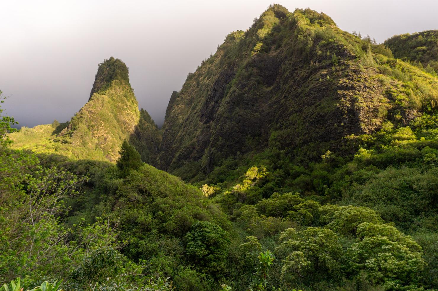
Sights: "The Needle", Iao Valley
What to Bring: Water (>1L), Snack
A place of both natural beauty and historical significance, Iao Valley State Park is a popular destination for many who visit the island of Maui. While there is a lot to see in the grounds of the park, a little extra effort will give you a more immersive look at this beautiful area. From the back of the park, you can climb a wet and muddy ridge to a pleasant lookout for a wider perspective of this lush green valley. And as you take in those views, you can imagine the bloody Battle of Kepaniwai that took place in this valley, many centuries ago. It's hard not to feel a little sense of wonder when you set foot in this special piece of Maui.
My final day of my Maui Adventure was about to begin. After 2 full days of hiking and diving, I was definitely starting to feel a bit drained. But with only one day left, I was willing to push through the exhaustion to tackle a few more Maui trails. For my last day, I was hoping to hit 3 different hikes located in Central Maui: Iao Valley Tableland, the Makamakaole Stream AKA "13 Crossings" Hike, and the Wai'hee Ridge Trail. After breaking down my tent and packing up the car for the final time, I was on my way to hike number 1, Iao Valley.
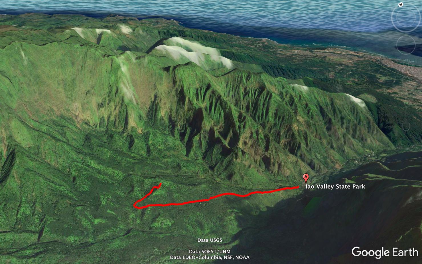
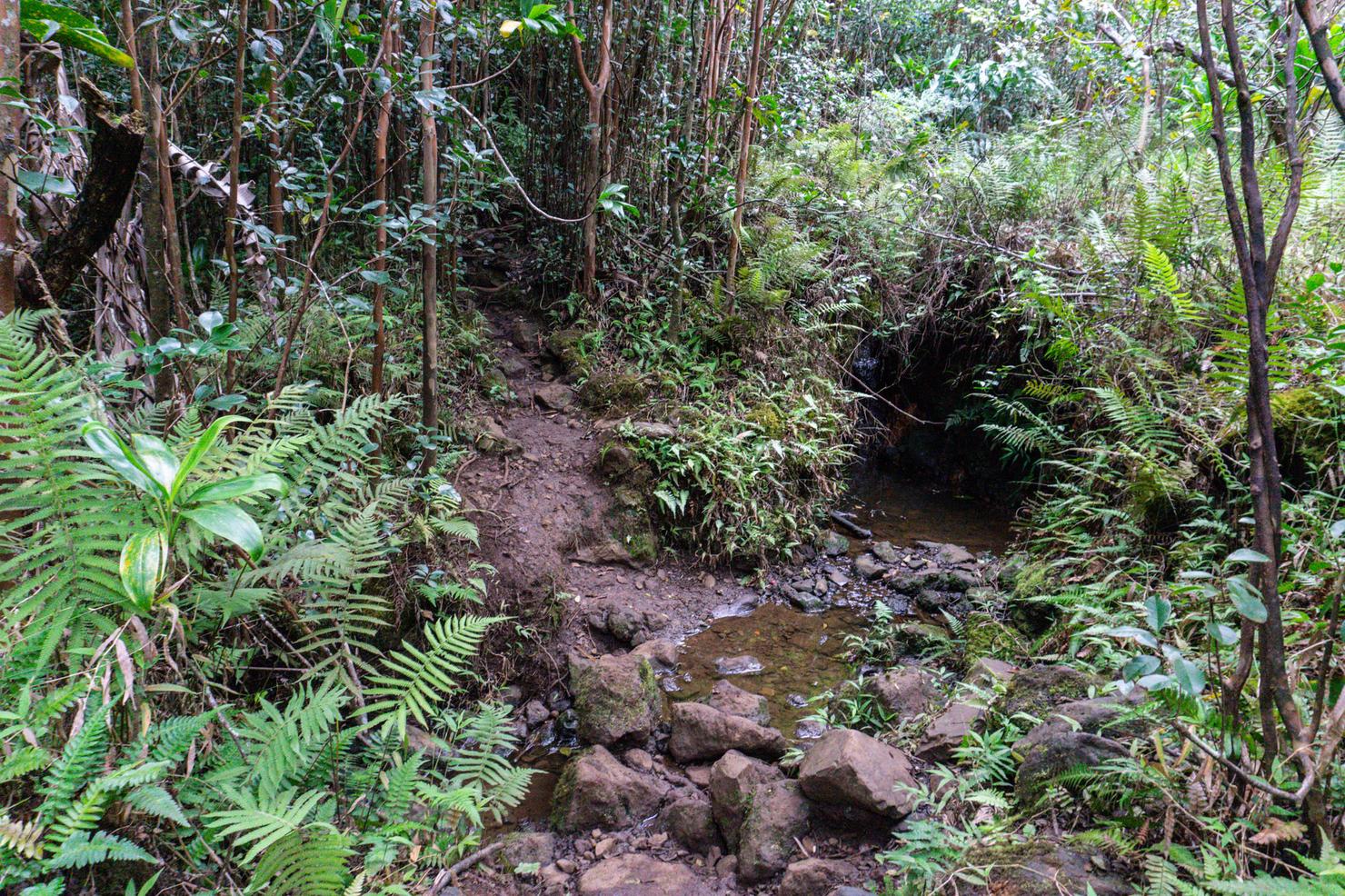
The trail we will do is often called Iao Tableland. It is a ridge the heads towards the back of Iao Valley, and then curls back to a flat lookout point, giving you expansive views. It is also possible to hike along some of the valley streams to some swimming holes. But with the Makamakaole Stream hike planned for later in the day, I was fine with sticking to the ridge.
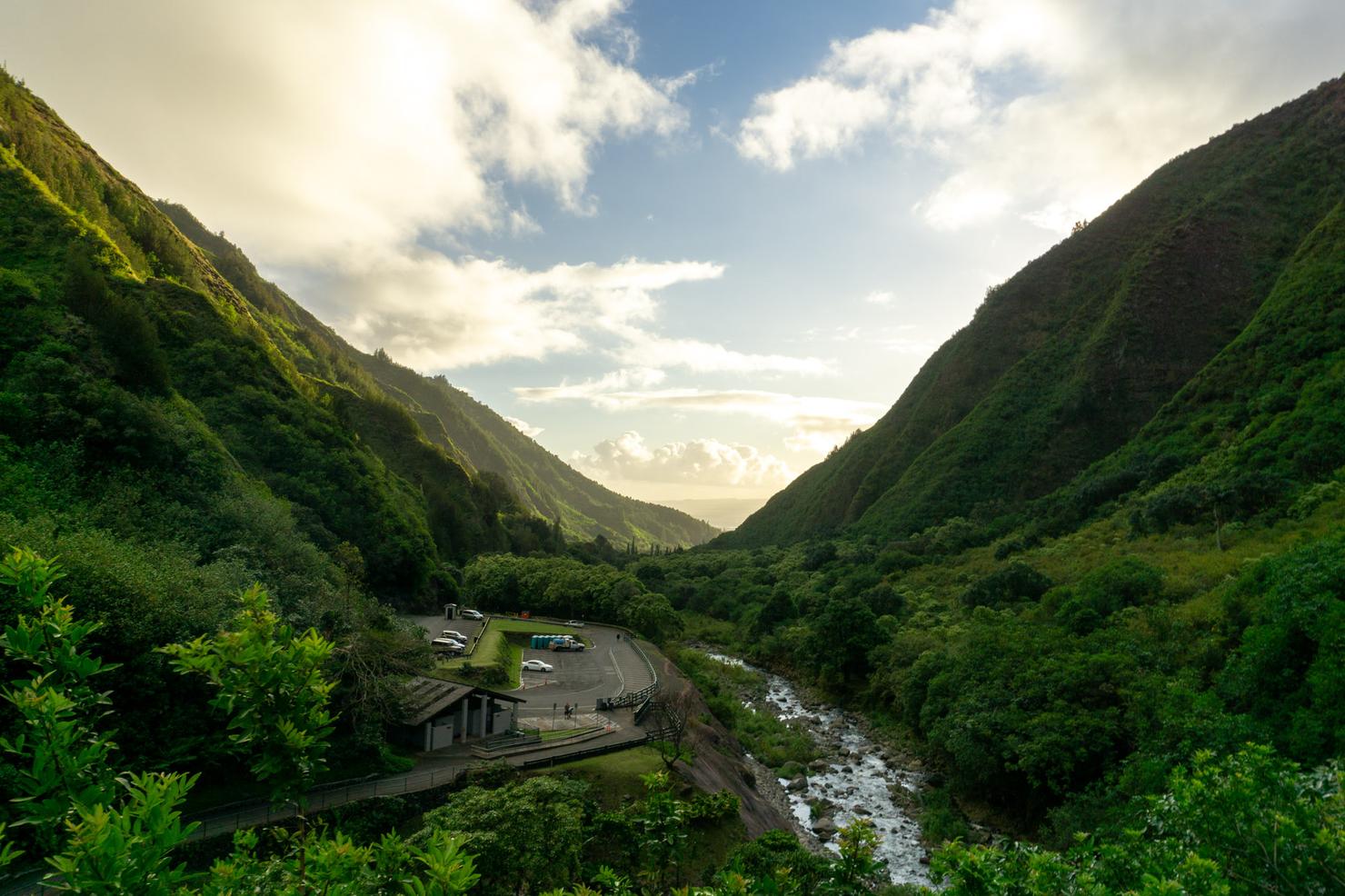
First things first: logistics. This trail starts at the back of Iao Valley State Park, so to get there you will need to pay the entrance fee ($5 per car, free for Hawaii residents). After entering the park, follow the path up to the top of the park where you arrive at a shelter with this great view of the"Needle".
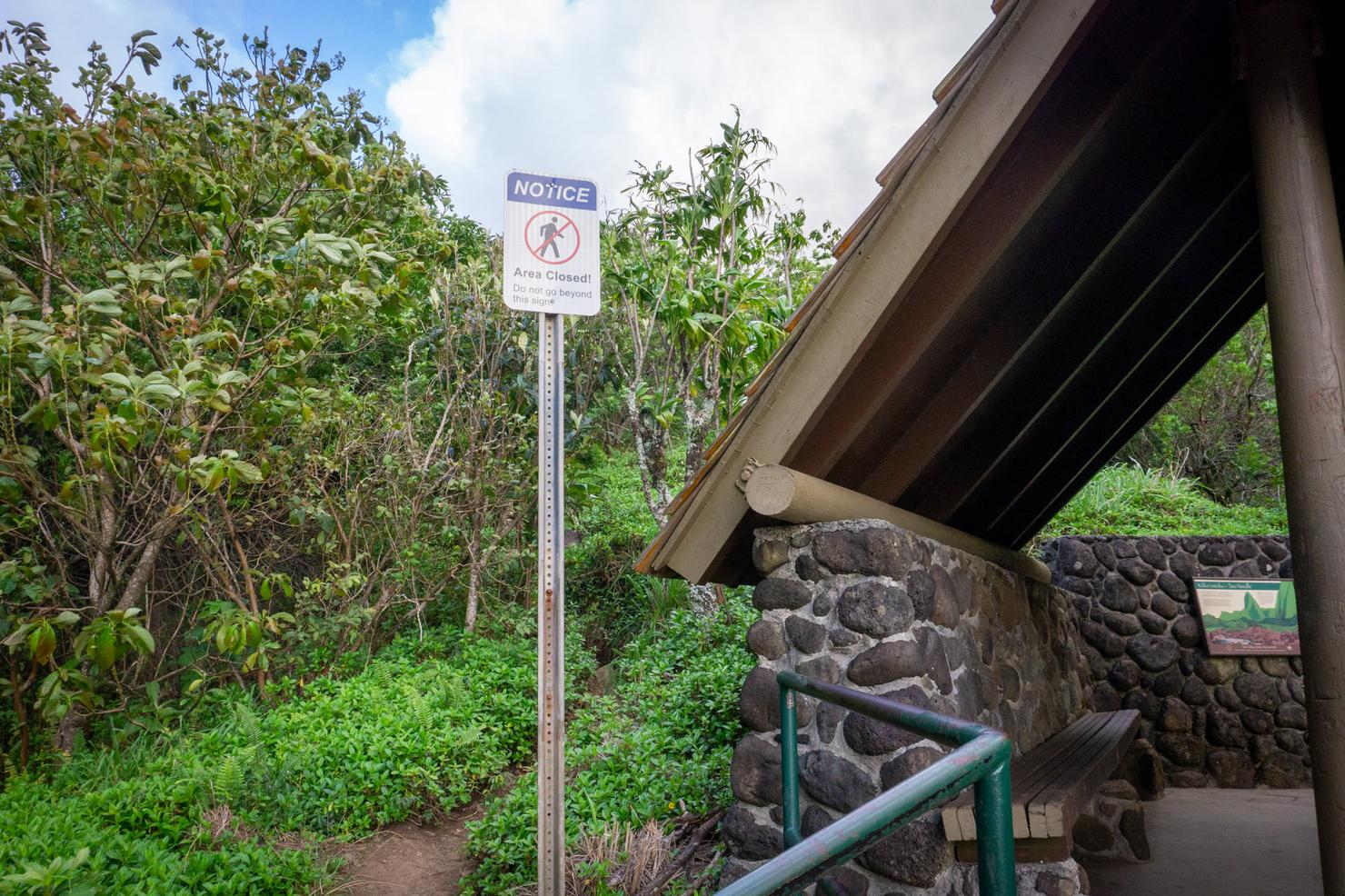
To the left of the shelter is a railing and an uninviting sign. To access the ridge, this is the way you must go.
And if you so choose to ignore that sign (accepting any risk or responsibility of doing so), you will begin your hike up the ridge. This is where the real fun begins.
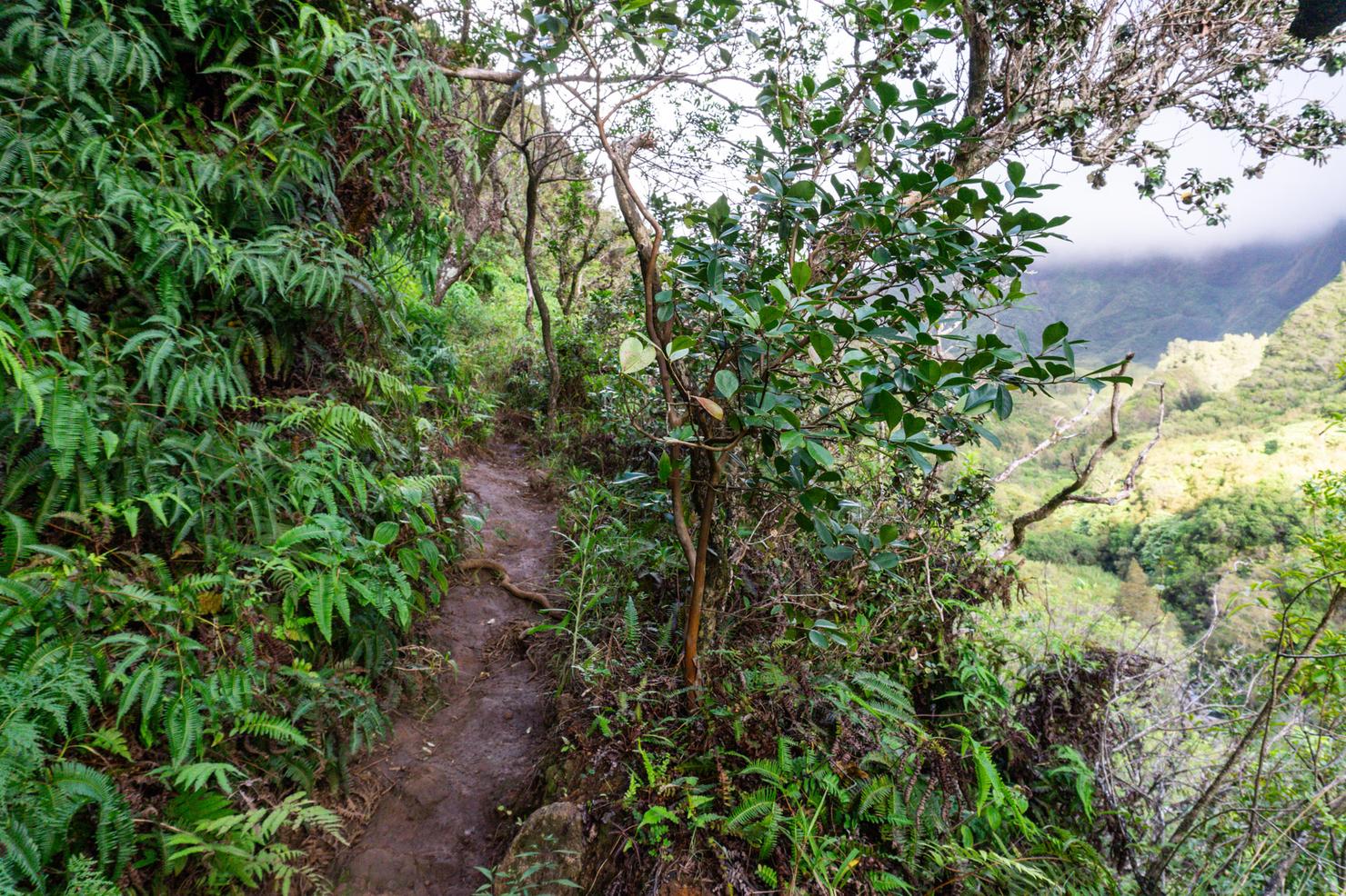
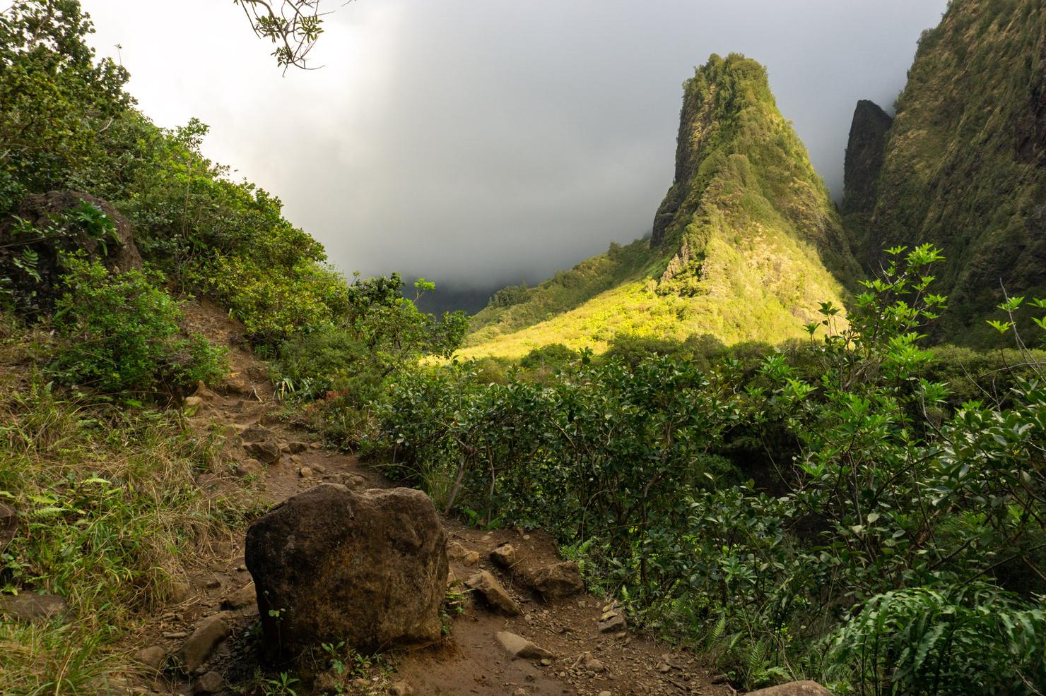
The ridge itself is your standard Hawaii ridge-- uneven footing, wet and slippery, and a solid dropoff on one side. The ridge starts out graded, with the crest located above and to the left of you.
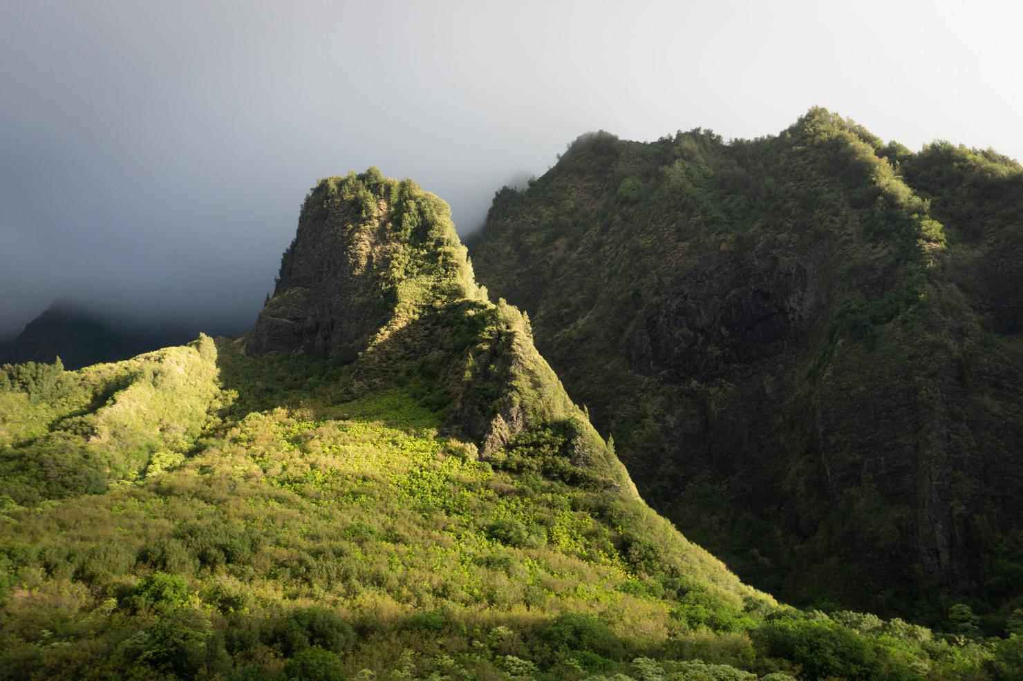
And as you make you your way along the ridge, you can fully enjoy those views to your right. This is a different perspective of the previously mentioned Needle. Other than the fact that it is known as the phallic stone of the ocean god, it actually has historical significance. Iao valley was home to the Battle of Kepaniwai where King Kamehameha, who is credited with uniting the Hawaiian Islands, battled Maui Chiefs in his quest to conquer Maui. The Maui Chiefs and army attempted to use the Needle as a hideout from King Kamehameha's Army and a bitter battle ensued. King Kamehameha's use of western weapons (cannons), helped break the stalemate and caused significant bloodshed (Kepaniwai translates to "damming of the waters," because the dead bodies were said to have literally been blocking stream flows). Although Maui was not official conquered until 1793, this battle is considered one of the bloodiest in Hawaiian history.
Now that you've had your history lesson, it's back to the trail. The only complication on this ridge is that there are a few forks along the way. I followed my gut and chose to take the right forks. This put me on the right grade of the ridge. It is possible, it doesn't actually matter, but I didn't try all the options so I can't say for certain.
At some point you will need to climb up to the crest of the ridge. I chose to do it on this short and steep scramble (again it is possible the graded portion will naturally lead you to the crest).
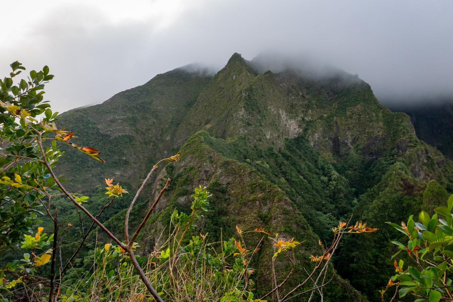
Once you're up on top of the ridge, you can get even more expansive views of the valley and the surrounding mountain range. That's one sexy looking ridgeline. Think it's hikeable?
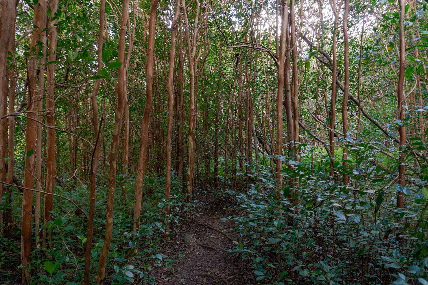
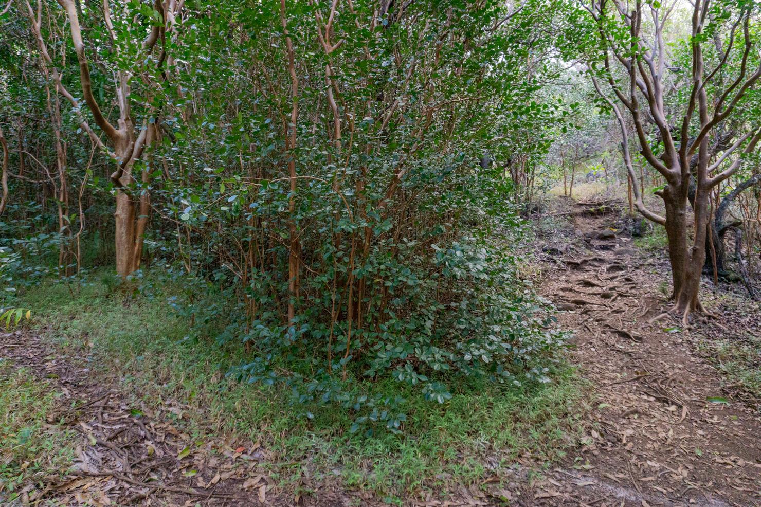
You will know you are on the correct path when the trail flattens out and you become surrounded by trees. Welcome to part 2 of the hike, the wet and muddy section.
Because that's exactly what this is-- being flat and shaded there is little opportunity for the trail to dry out. I'd wager that even in drier times, there's always some amount of mud up here. And that's assuming there ever are drier times. This valley is actually the second wettest in all of Hawaii receiving, on average, an inch of rain per day. (If you were wondering, the wettest spot is Wai'ale'ale Valley on Kaua'i, unofficially the wettest spot on Earth).
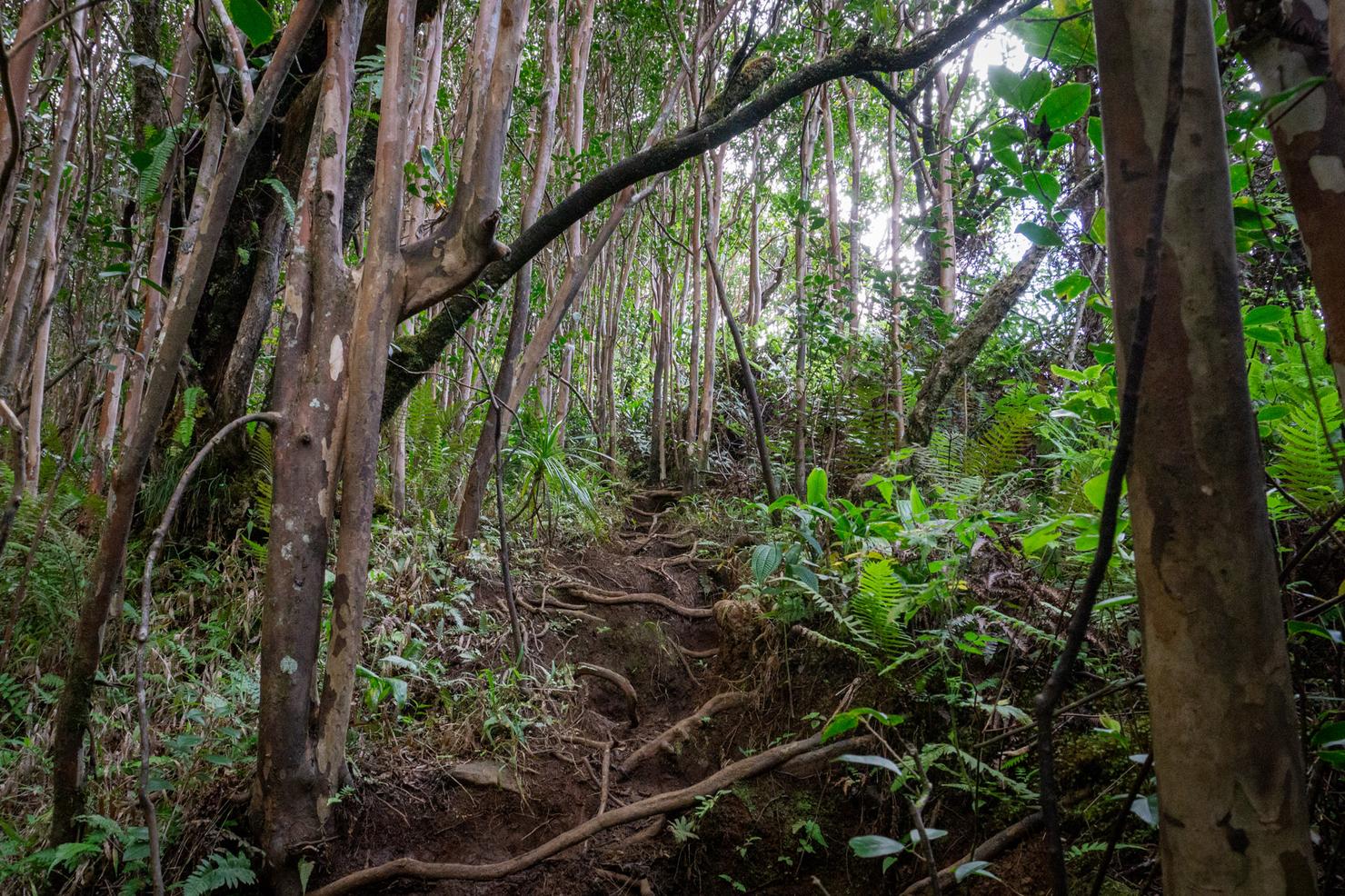
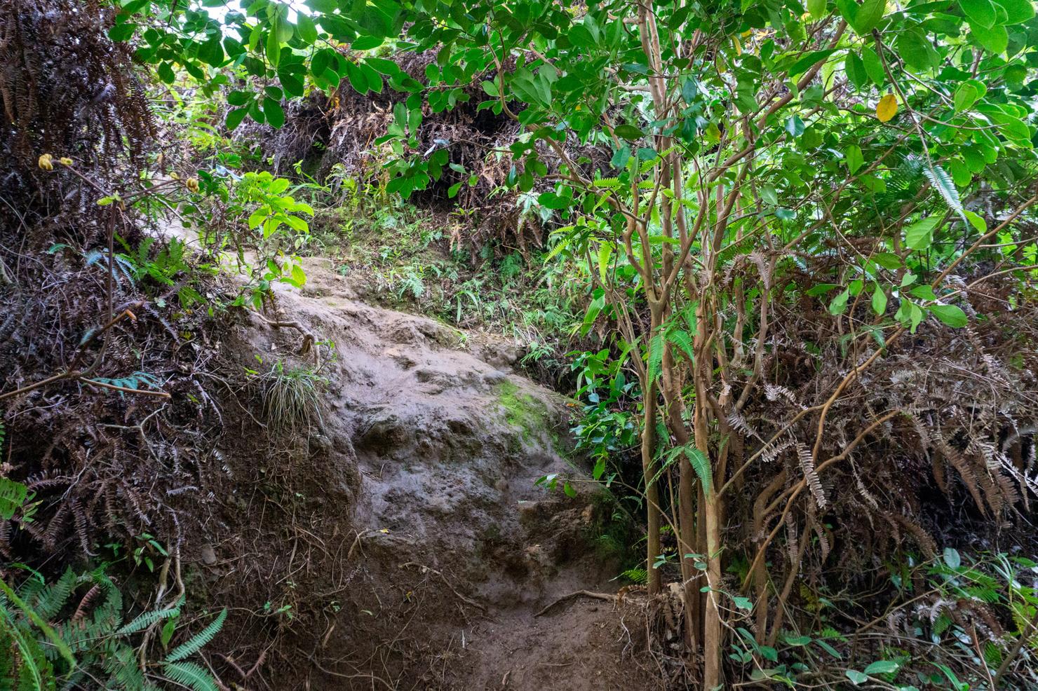
But with some finesse, you can hopefully avoid getting totally caked and make it to part 3 of the hike, the final push. Here you will be required to scramble up this steep and muddy rooted section of trail. If your heart rate settled back down, it's sure to spike during this little climb.
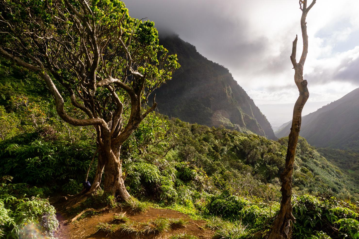
But within minutes, you will arrive at the lookout, marked by this sweet tree. Now it's time for a snack, a rest, and some views.
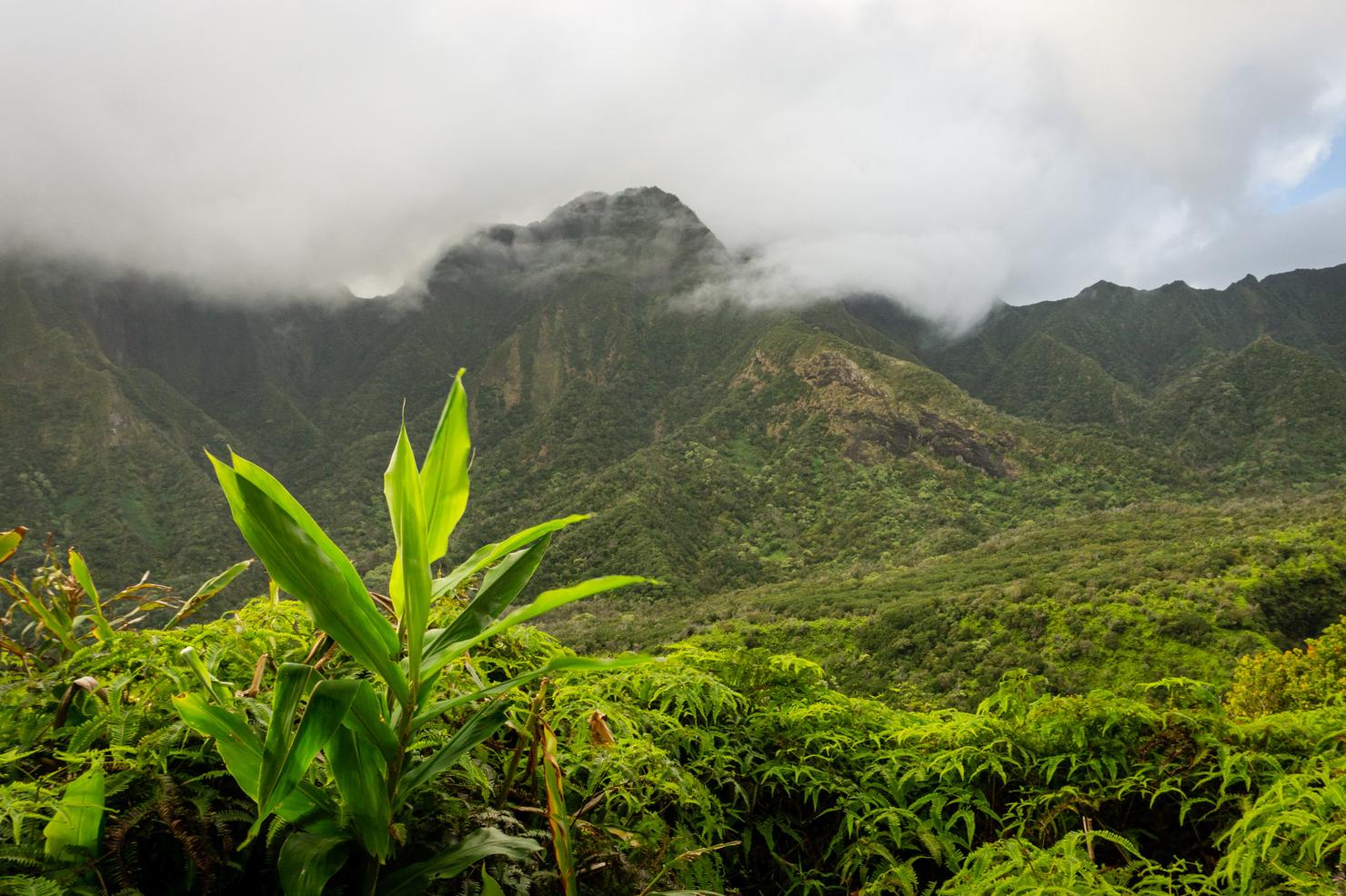
If you wander around the lookout, you can get many different perspectives of the valley. It will depend on how much it has been raining, but you can very likely spot a few waterfalls if you look closely at some of the ridges. Simply magical.
A nice casual ridge and a bit of history to start the day. Next, we're going to ramp it up a bit, with a few stream crossings (13 to be exact) and a bit of waterfall climbing along the Makamakaole Stream Trail. Stay tuned! 🤙
- This article about some of the area's history