Difficulty: INTERMEDIATE
Time: 4-6 HOURS
Distance: 5,.5 MILES
Elevation Gain: 2200 FEET
Foot Traffic: LOW
Challenges: Overgrown, Some narrow and steep sections with dropoffs, Potentially muddy
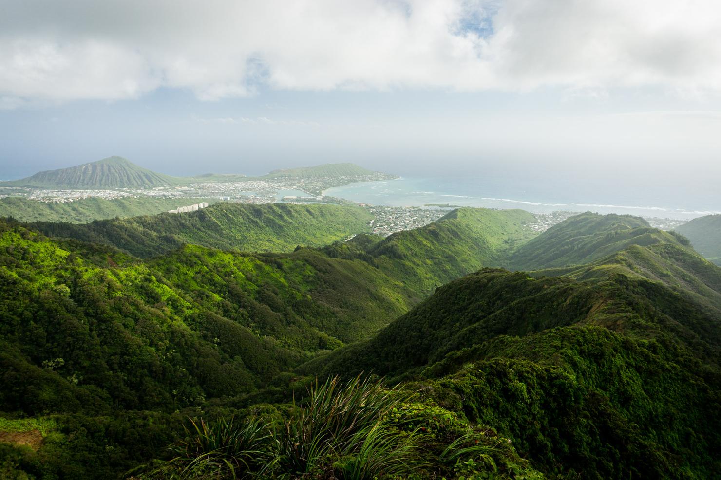
Sights: Windward and Leeward Side, Koko Crater, Honolulu
What to Bring: Long Pants, Water (>2L), Sunscreen, Snack/Lunch
Located near Honolulu, this trek is best completed as a loop, connecting the Kulepeamoa Ridge to Hawaii Loa Ridge via the Ko'olau Summit Trail. This loop is characteristic of most Oahu ridges--steep and narrow sections, challenging scrambles, probably a bit of mud, and of course epic views. While this hike probably won't make it most people's radar, those that do make the effort are sure to get a sense of satisfaction when it's all said and done.
After all the hiking I've done, I am somewhat surprised there are still ridges I haven't hiked. And yet there are, so I continue try and explore them all (or at least as many as I can). Finishing out 2019 strong, I got some motivation to do a Christmas Eve hike and knock another one off my list. We're off to Kulepeamoa!
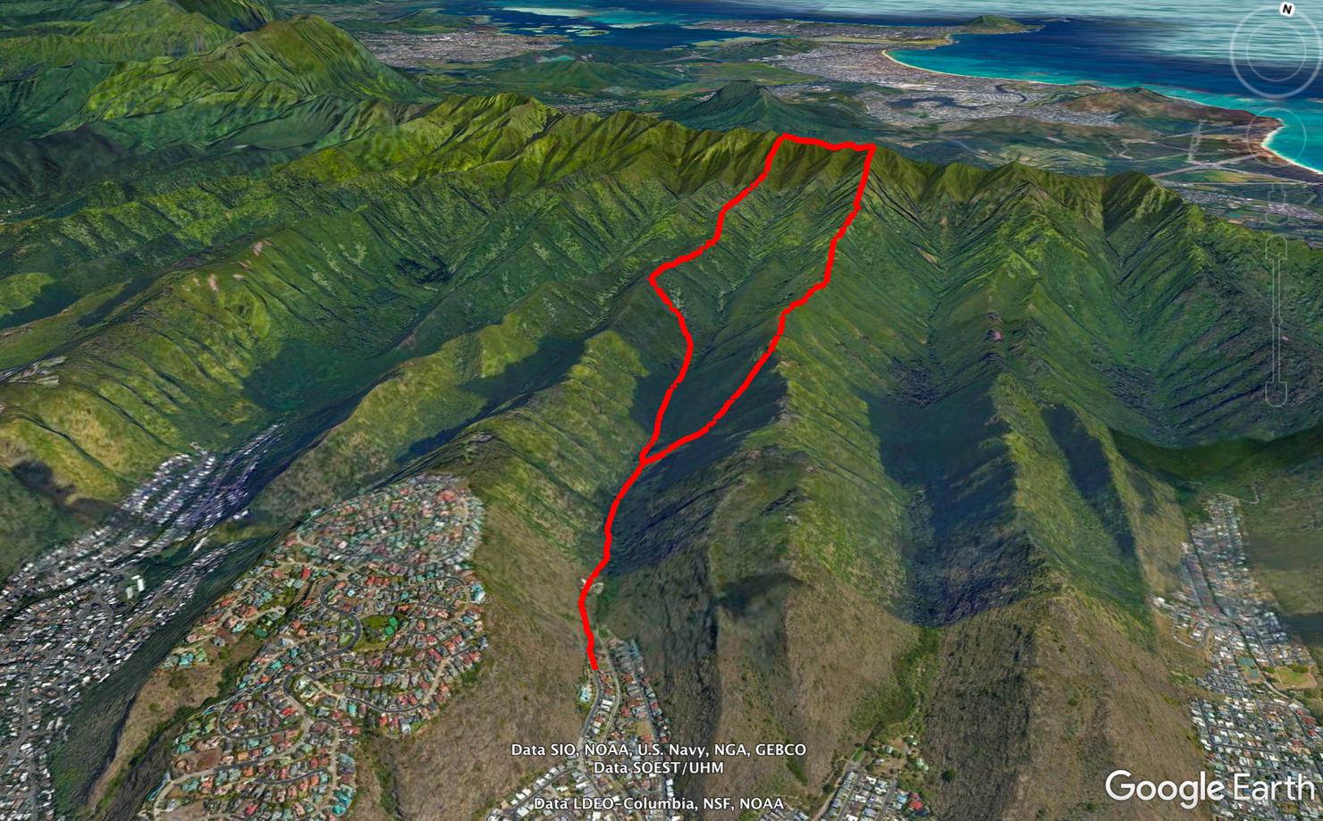
The Kulepeamoa Loop hike is quite similar to the nearby Wailupe Loop. You go up one ridge, traverse the Ko'olau Summit Trail (KST), and descend an adjacent ridge. I did this route in the counterclockwise direction, meaning I would ascend Kulepeamoa Ridge and descend Hawaii Loa Ridge, before taking a side trail from Hawaii Loa back to the starting point.
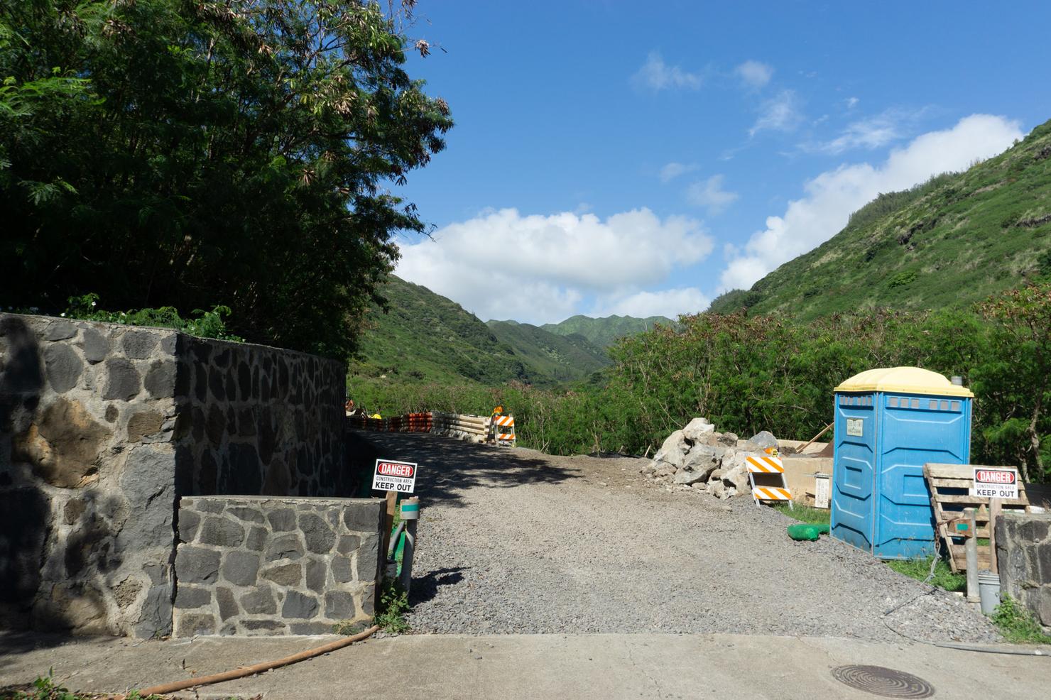
The trailhead is located at the end of Anolani Street, where there is plenty of street parking. You will have to walk through this small construction zone in order to get to the trailhead. No workers present today, but this is something to be mindful of depending on when you go.
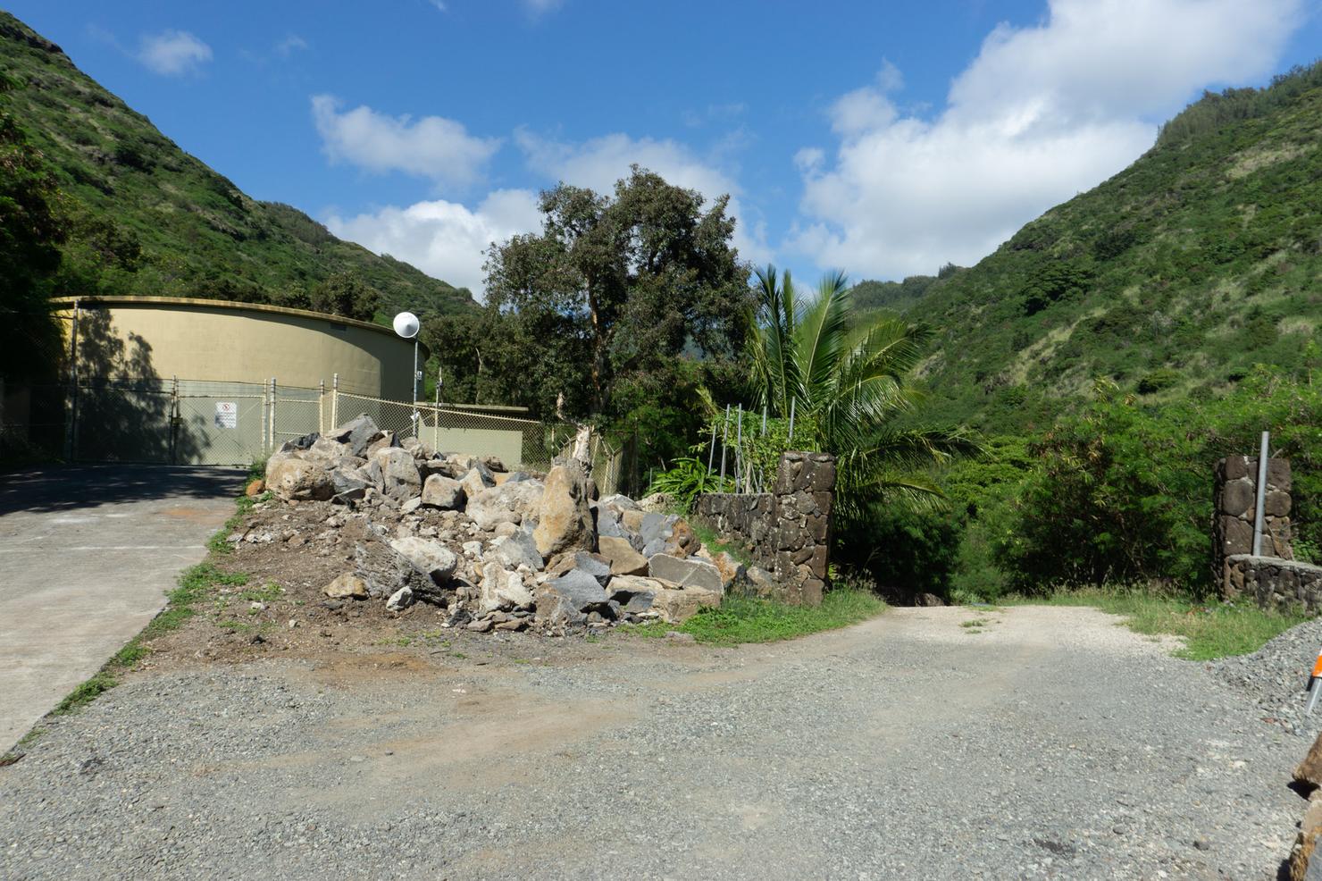
At the end of the road there is a slight fork in the trail. We need to go in between that fenced government structure on the left and the wall to get to the trail.
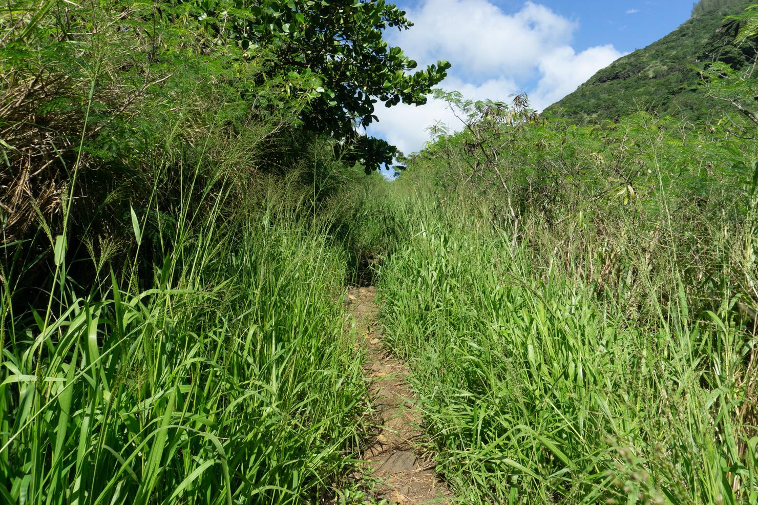
After which you will come across a bit of tall grass.
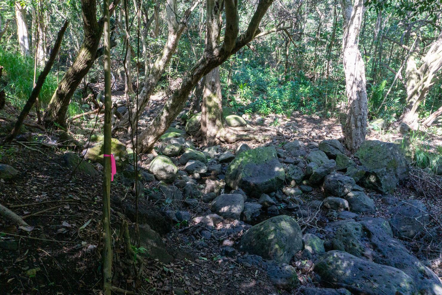
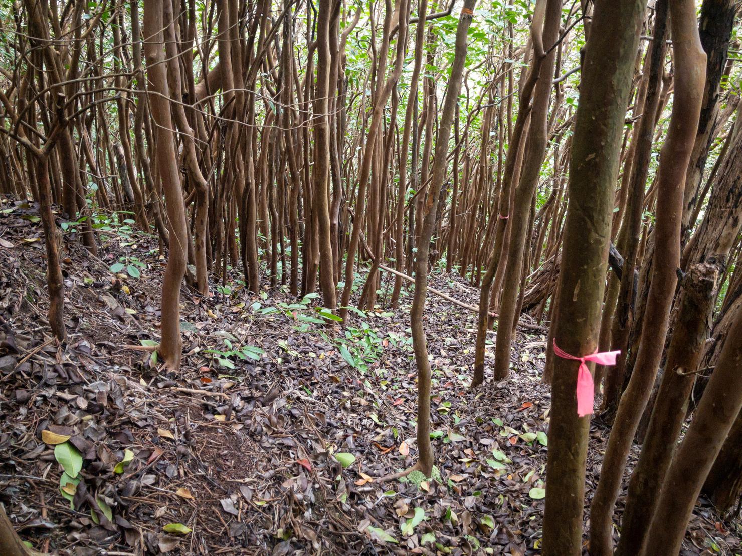
And then the ribbons start to appear. This trail is well marked, so it was pretty easy to stay on the path. After crossing this dry stream bed, continue following the trail markers to the left.
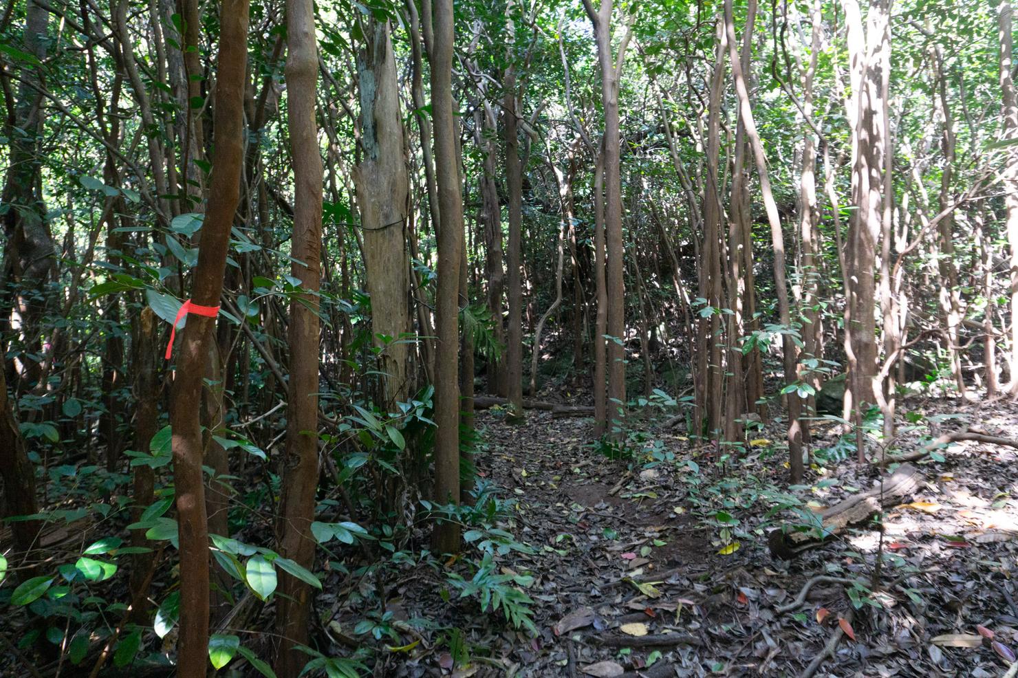
Mmm smells like nature!
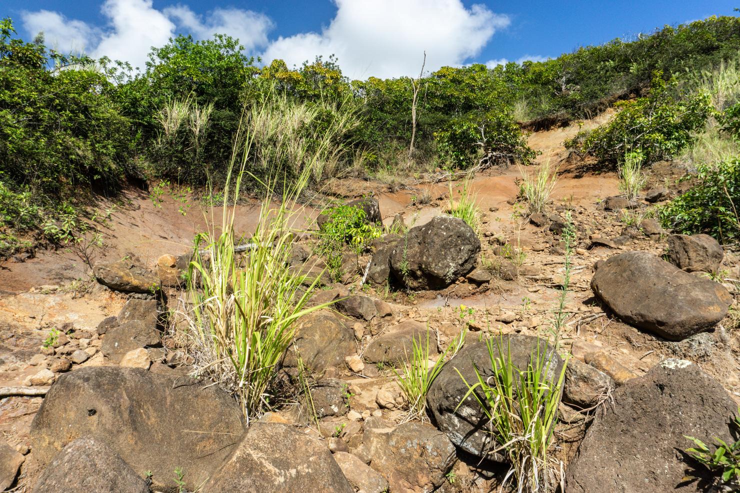
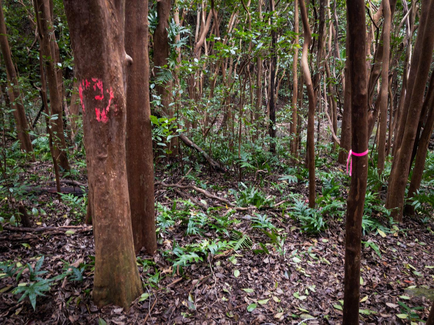
About 15 minutes into the hike, you will break out of the trees and arrive at this open dirt section. This is an important landmark. There are two sets of markers from here that marks a split in the trail. If you veer directly right (from this picture) to that set of ribbons, you will be heading towards Kulepeamoa Ridge. If you go up and to the left, you will be following the path to Hawaii Loa.
I had already planned on doing Kulepeamoa first, so I followed the right fork. I figured, if I didn't feel like doing the full loop, at least I would get to experience a new ridge.
This is when the hike kicks up a notch, because you start gaining some elevation. A bit of scrambling is always a good way to get the heart pumping.
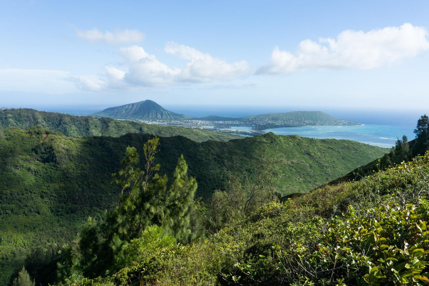
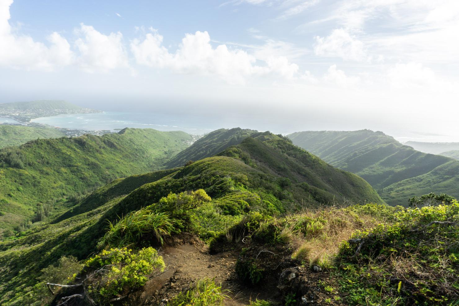
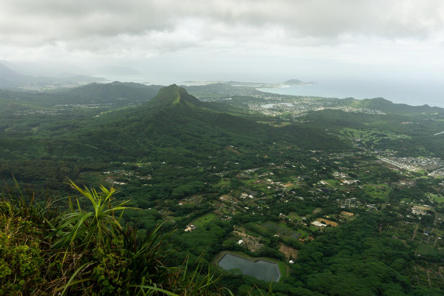
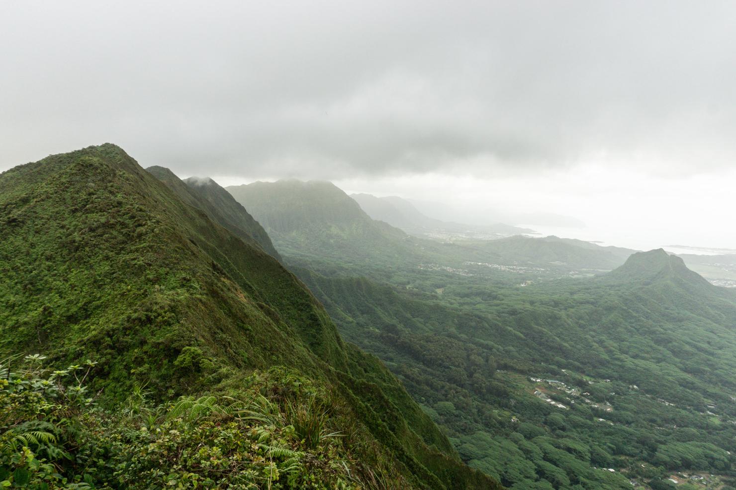
The good news is it doesn't take too long to get some views. In the distance you can see the iconic Koko Crater, one of Oahu's volcanic tuff cone and home to the popular "Stairmaster from Hell." It's looking pretty green these days. Gotta love that rainy season.
The ridge alternates between shaded sections...
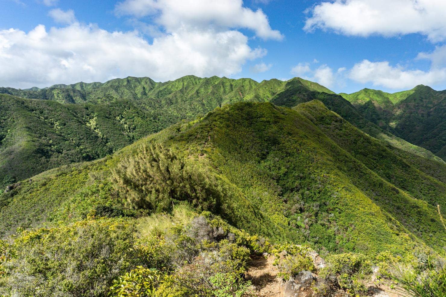
..and open ridge. It's nice as it gives you some variety. Those jagged peaks in the distance are part of the KST, which we will be hiking in order to connect to Hawaii Loa. It's looking pretty clear today, which is a good sign. Hopefully we will get some good views.
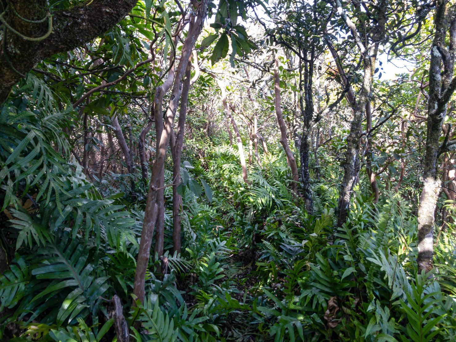
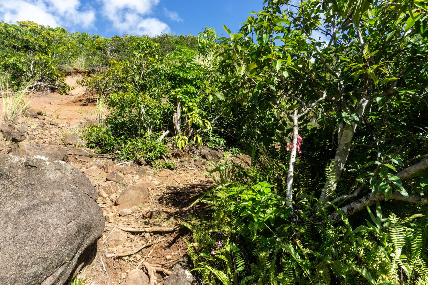
The trail does get more overgrown, so I highly recommend bringing pants along. Those low ferns can really tear up the legs.
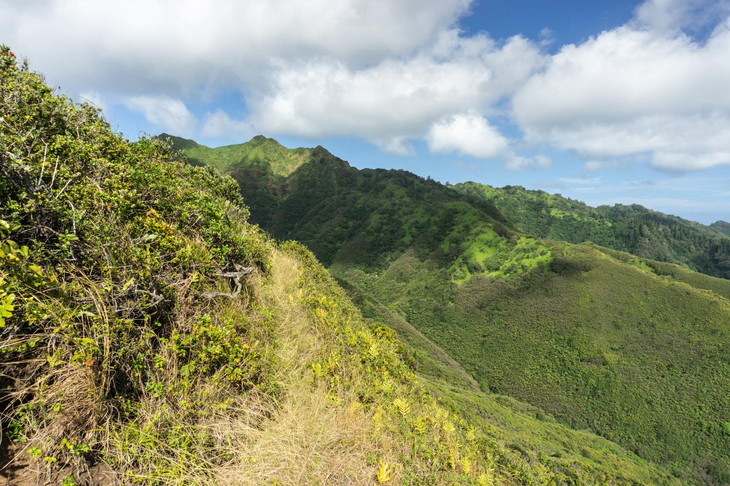
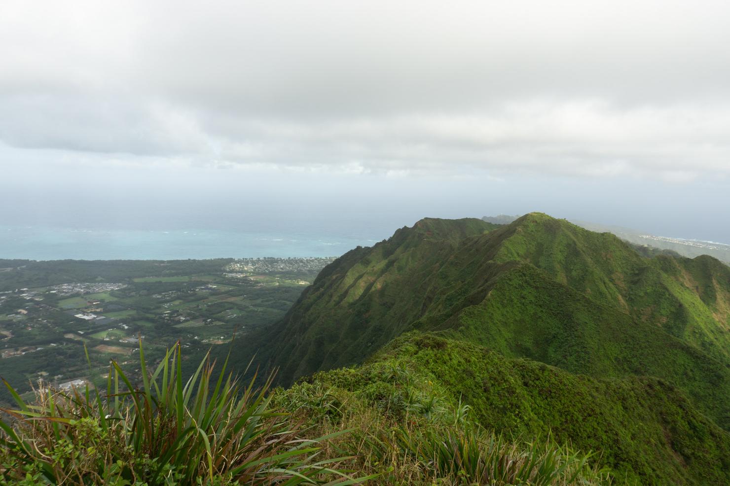
The trail does have a few sections that narrow a bit, which is why I consider this hike slightly more difficult than the more popular nearby ridges (Kuli'ou'ou, Wiliwilinui, or Hawaii Loa). In this section section, you are on a narrow grass section with a nice dropoff.
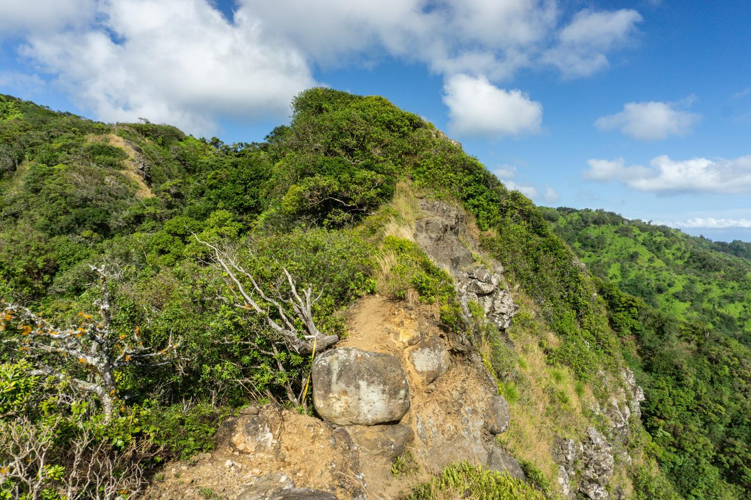
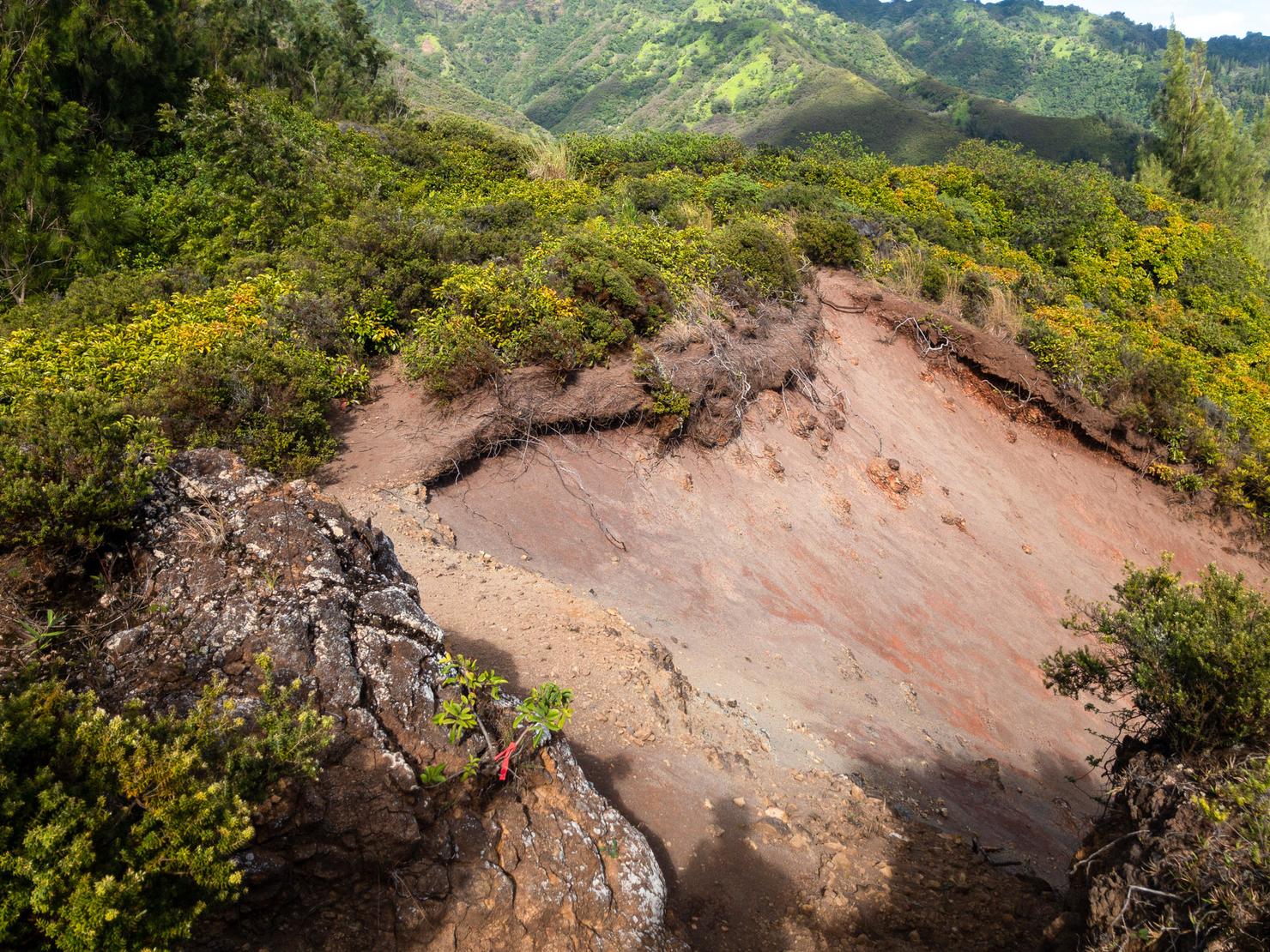
And here, you have to navigate around some boulders on an eroded section of ridge.
But overall, it's a relatively standard Ko'olau finger ridge.
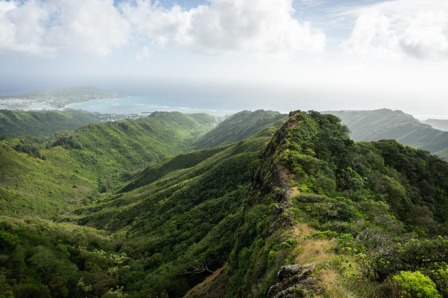
This was one of my favorite shots of the ridge. It is nice and narrow, looking back towards the ocean with the neighboring ridges in the background. I really wish there was a person in the shot for some perspective. But today was a solo journey, so my imagination will have to suffice.
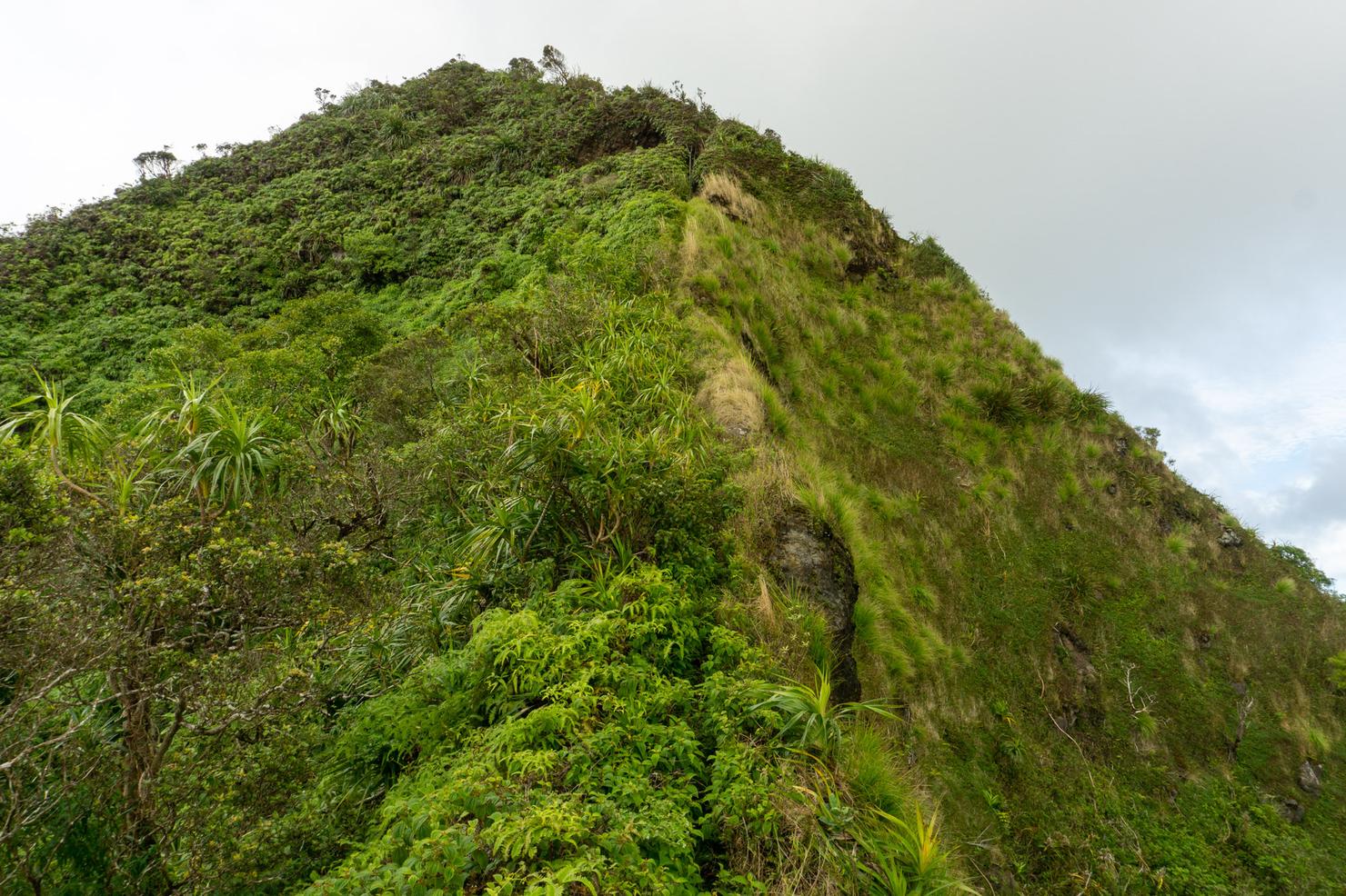
Almost 2 hours in, I arrived at what I consider the last and probably biggest obstacle of the entire hike. It's a steep and grassy scramble, that hovers very close to a sharp dropoff. There is a rope tied off that provides some much appreciated assistance. Relative to some other scrambles, it's nothing crazy other than its proximity to the edge. But I could see how descending it would feel a bit more precarious.
Phew! After that scramble, I was gassed. I don't know what it was, but this entire hike was a physical struggle for me. Sometimes you just have those days I suppose. (Or maybe it's all the christmas cookies and egg nog....). Regardless, I took a little break to soak in the views.
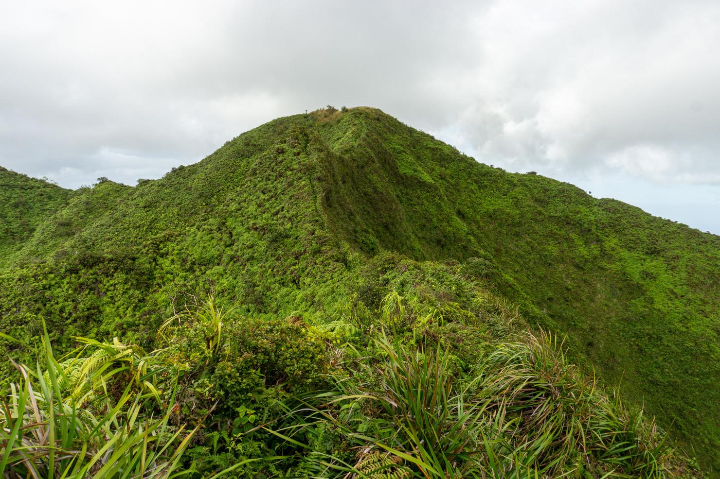
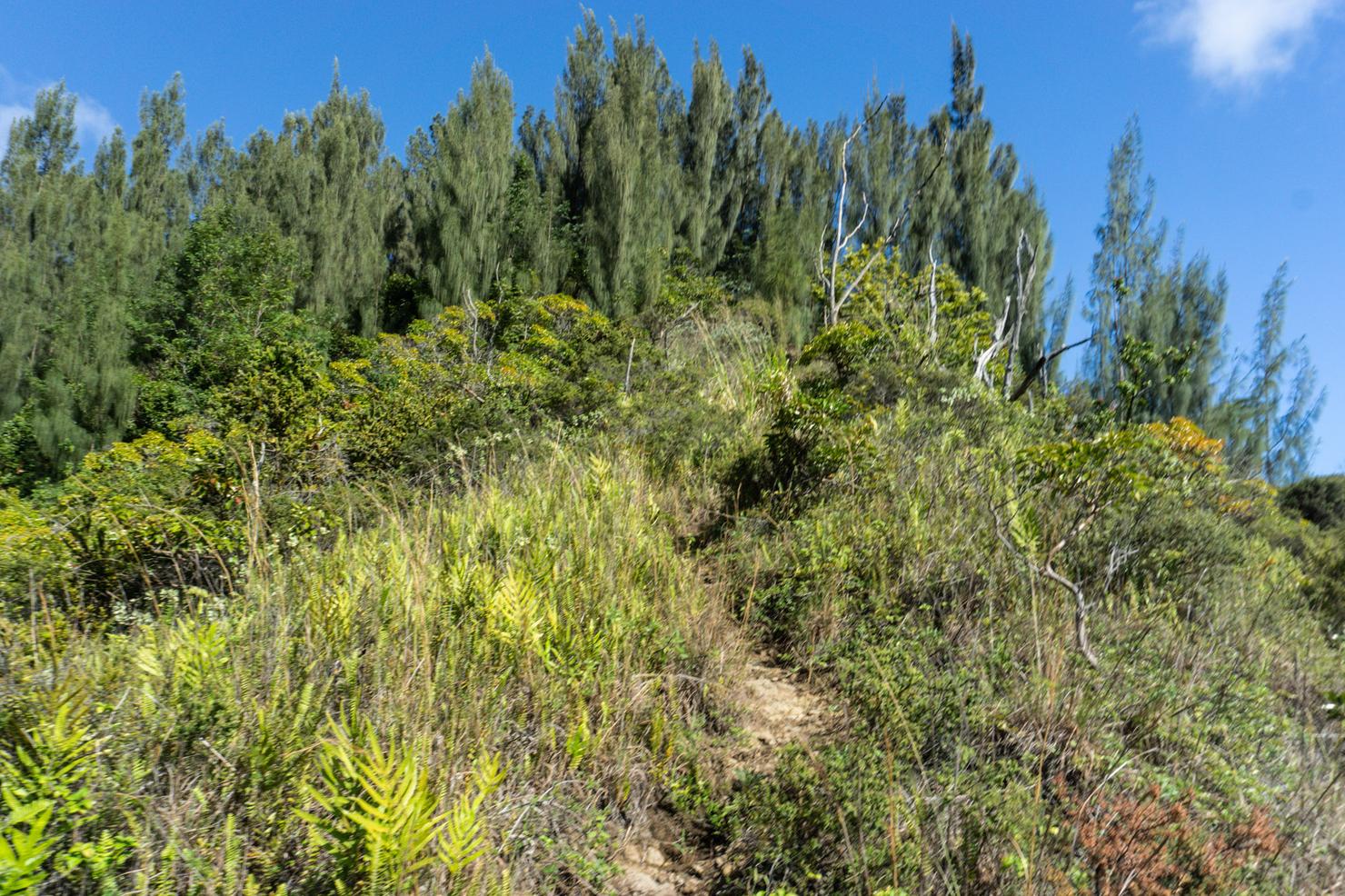
Because we still aren't quite at the summit. After the rope section, we still had another 15-20 minutes before reaching the summit.
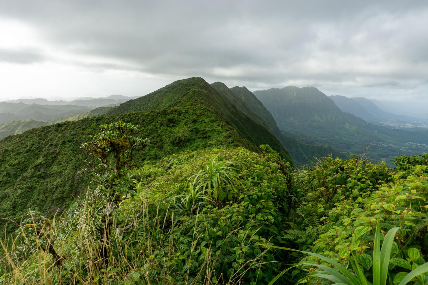
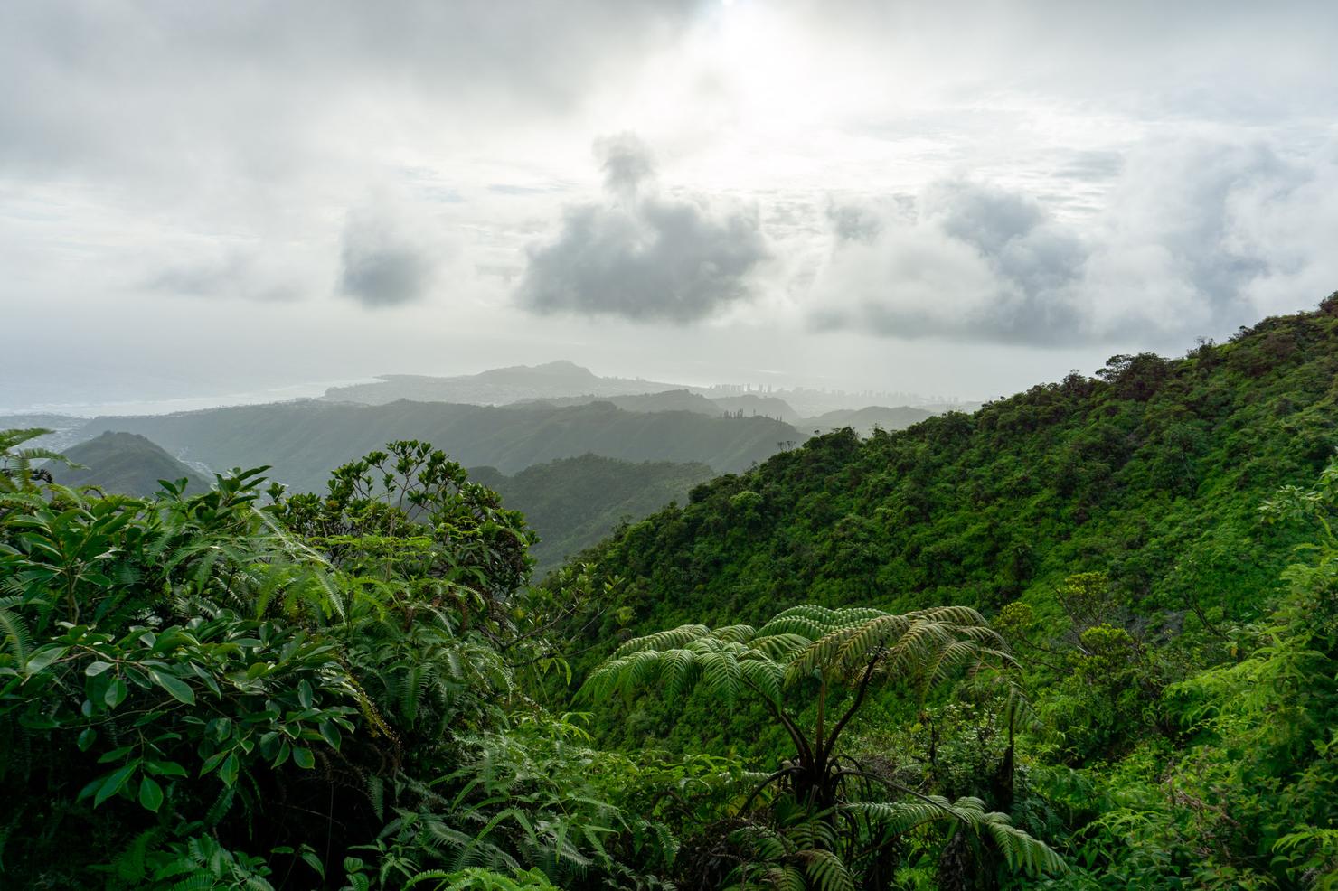
Finally! Roughly 2.5 hours to reach the summit. Not perfect on top of the KST (it rarely is), but not too shabby either. A solid look towards all the notable windward landmarks.
And a look down towards the south shore.
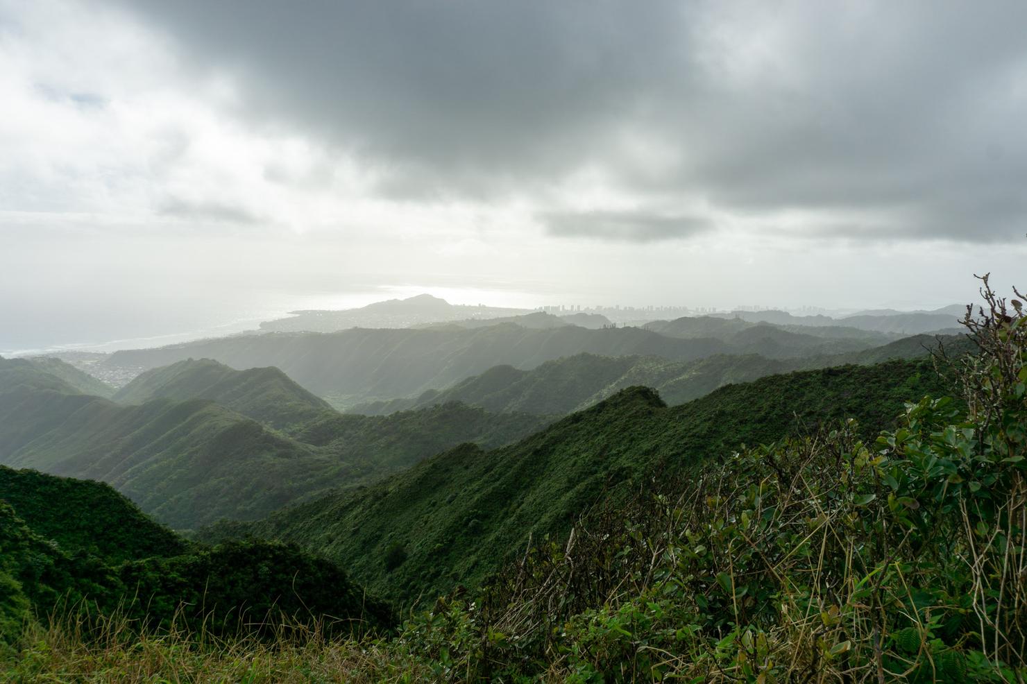
And then a look towards Honolulu, obscured by that late afternoon haze. I sat on the summit for a few minutes, letting my body briefly recover as the strong wind cooled me off. Sadly, no drone flight today...
Which is probably a good thing, because I needed to get going. If I wanted to complete the full loop before sunset, I couldn't waste too much time. Heading left, we will connect to Hawaii Loa via the Ko'olau Crest or the Ko'olau Summit Trail (KST). KST hiking is dangerous, as you are on a raw, muddy, grassy ridge with steep dropoffs, sometimes on both sides. In a relative sense, this section of the KST was pretty tame, only one narrowish section and a small grass scramble. But the KST is still the KST, so you should always hike cautiously.
It took about 25 minutes for me to connect the two ridges. Being so close together, the perspective is only slightly different at the Hawaii Loa summit. The backside of Three Peaks is still visible.
And good old Honolulu still shrouded in a haze.
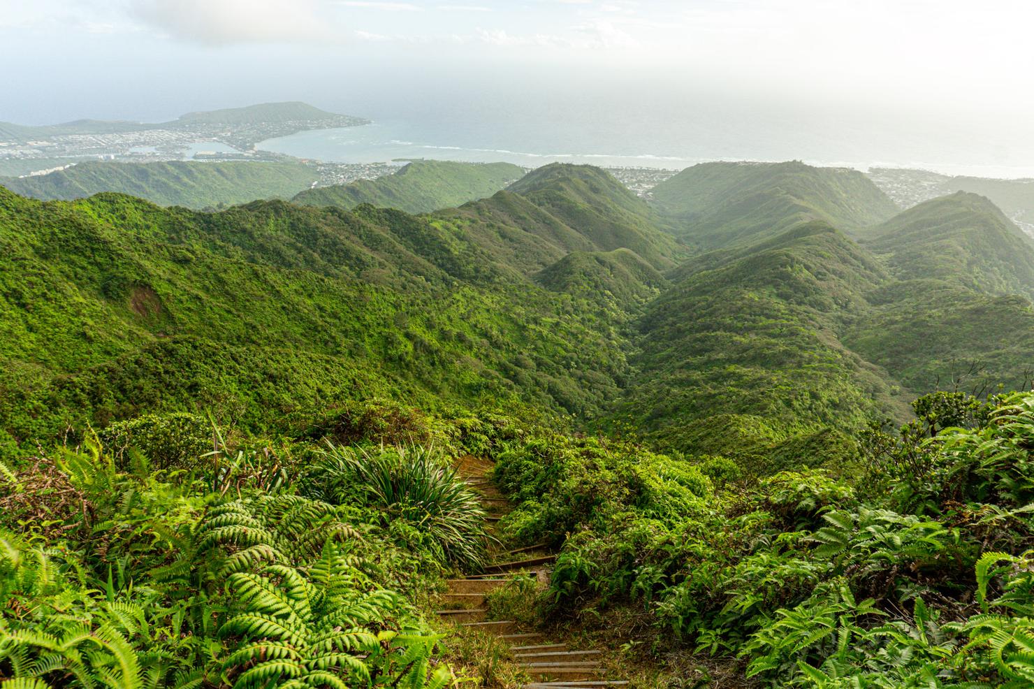
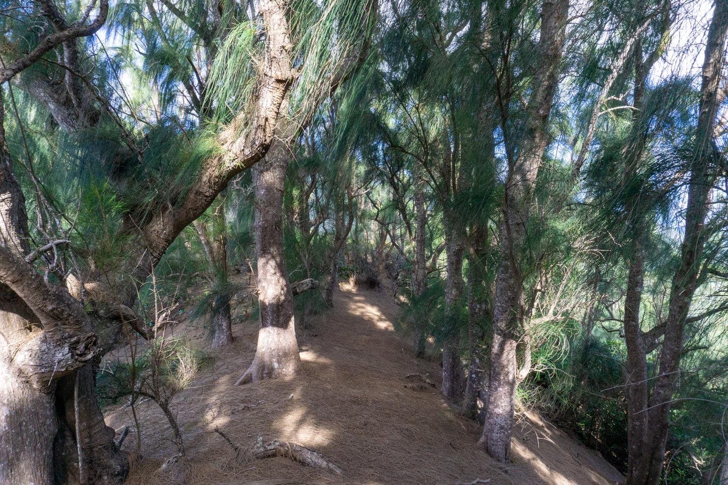
It's time to descend Hawaii Loa. As you can see, this trail already has a different feel than Kulepeamoa. It has some stairs before getting to a nice clean ridge, not at all overgrown. Hiking this ridge by itself is popular, but unfortunately there is restricted parking, so sometimes it's not always accessible. That's why it's nice to have some alternatives like Kulepeamoa!
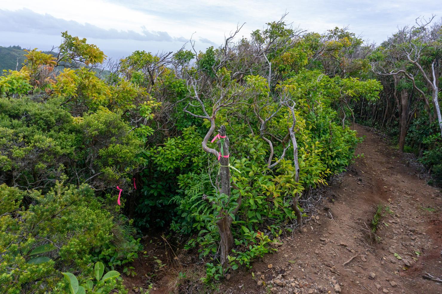
About 45 minutes after starting the descent, I arrived at the fork that would lead us back down to the valley. It's littered with ribbons so it is easy to spot.
From here just follow the ribbons down to the valley. The trail is slightly steep with some leafy footing, but there's tons of trees for you to use as balance. It's actually quite fun jetting down the trail, using the trees to control your momentum. For some reason, I always visualize that I'm skiing.
Once you get back down to the base of the valley, follow the trail right in the makai (toward the ocean) direction. The trail seemed to zigzag quite a bit, and there were a few instances where I wondered if I was on the right path.
But eventually, I popped back out at the dirt section and knew I was a mere 15 minutes from my car.
Not a bad way to spend a Christmas Eve before a Christmas Day cookie baking party with some friends. Hikes, cookies, and quality time with friends--that's what I call a recipe for a perfect holiday.