Difficulty: INTERMEDIATE-ADVANCED
Time: 1-2 DAYS
Distance: 18+ MILES
Elevation Gain: 7000 FEET
Foot Traffic: LOW
Challenges: Endurance Challenge, Numerous River Crossings
Sights: Waimanu Valley, Waipi'o Valley, Wai'ilikahi Falls,
What to Bring: Full Backpacking Gear
This long hike, located on the North Shore of the Big Island is best experienced as a multi-day backpacking excursion-- the beauty of this Valley is just too incredible to experience in one day. Getting to this valley, however, is no easy feat. With a heavy pack on your back, you will be required to hike a long distance, deal with roller coaster elevation changes, and cross several streams to reach this destination. But every ounce of pain is worth the opportunity to get a glimpse of this magical place.
If you live in Hawaii and are into hiking or backpacking, you've probably heard of Waimanu Valley. Its reputation as an epic and beautiful backpacking adventure is only overshadowed by the more famous Napali Coast. Naturally, with my love of all things outdoors and hiking, Waimanu has been on my list. But with minimal backpacking experience, I don't know that I was ever motivated to follow through in planning the trip. It wasn't until my friend Carly decided she was going to do it on Memorial Day Weekend, that I realized this was my opportunity. With that, plans fell into place, and Carly, joined by two other friends Chris and Drew, found ourselves driving to the North Shore of Hawai'i, ready to tackle this epic trail.
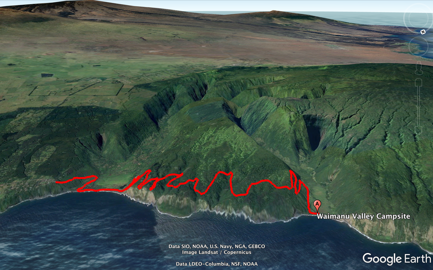
The hike looks something like this. You start in another picturesque valley, Waipi'o before you hike the 9 miles one way to Waimanu Valley. Along the way, you will deal with constant elevation changes, and numerous stream crossings all (likely) with a heavy pack on your back.
Day 1: Waipi'o to Waimanu Valley
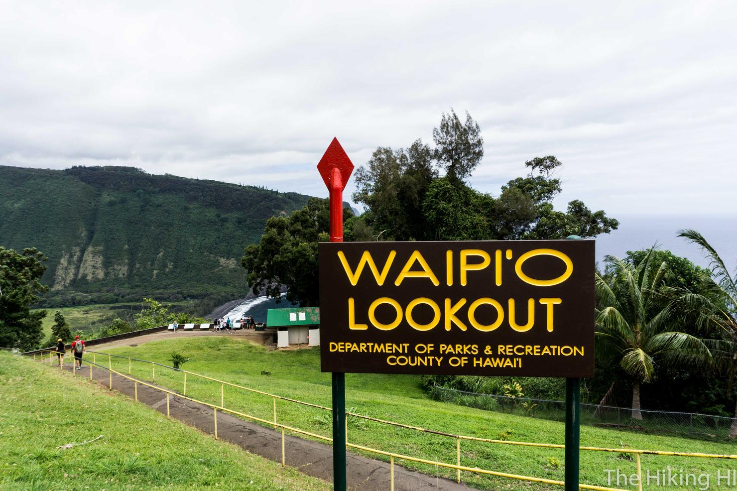
Our adventure begins where the hike begins, up at the Waipi'o Valley Lookout on the Kohala Coast. This lookout is a popular tourist destination because of it's stunning beauty... but more on that in a minute. The first challenge you will face is logistics. There's a couple options:
The best option, would be to have someone drop you off and pick you up. But unless you have friends on the Big Island (or have a way to quickly make friends), this is a less reliable method. Considering the Waipio Valley lookout is far from the major hubs (Kona, Hilo), it will be a challenge.
The second would be to use some form of paid transit. There is uber/cabs, but it would be very expensive. Not to mention, you will lose all cell service once you get within a few miles of the lookout. There is a bus system, but its closest dropoff is Honokaa. which is still about 9 miles from the lookout. You could probably hitchhike a ride up to the lookout from Honokaa (it's somewhat common), but that's not an option everyone will choose.
The last, which is what we did, would be to rent a car, drive, and leave it there while you backpacked. If you do choose this option, you will need to choose a place to park it. Based on our research, we knew that there was an art shop, Waip'io Valley Artworks, that we could park at, where they'd look after it for a few days... for a fee of $20 a day. The price is high, but it does give you some peace of mind that your car is safe. Unfortunately, that shop is still 3/4 of a mile walk to the lookout, so some members of your group (which happened to be Carly and Chris) would have to make that trek back to the lookout. Not terrible on the out, but it really sucks on the return trip.
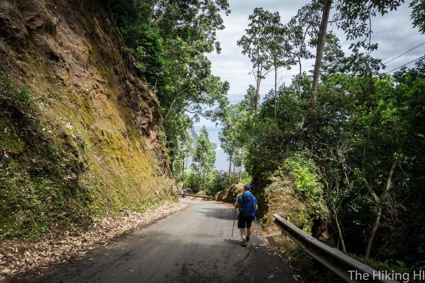
Because this is how you will have to end the hike, and today, where our hike begins--Waipi'o Valley Road. It is a narrow, steep and windy road that takes you from the lookout to the base of Waipi'o Valley. Supposedly, if this was actually classified as a road, it would be the steepest in the country. Up or down this road is tough. The down is harsh on the knees, especially with a heavy pack. And the up... well after hiking 18+ miles anything with incline is hard.
If you are lucky, however, you could hitch a ride to the base, or back up to the lookout as this road is drivable with the right type of vehicle. The catch is, there's no stopping on the road, so you need to hitch that ride before the car drives on the road. We didn't look for a ride down, but on the way back, Carly and I managed to snag a ride which was clutch (guess we looked less threatening than Drew or Chris... or more tired...)
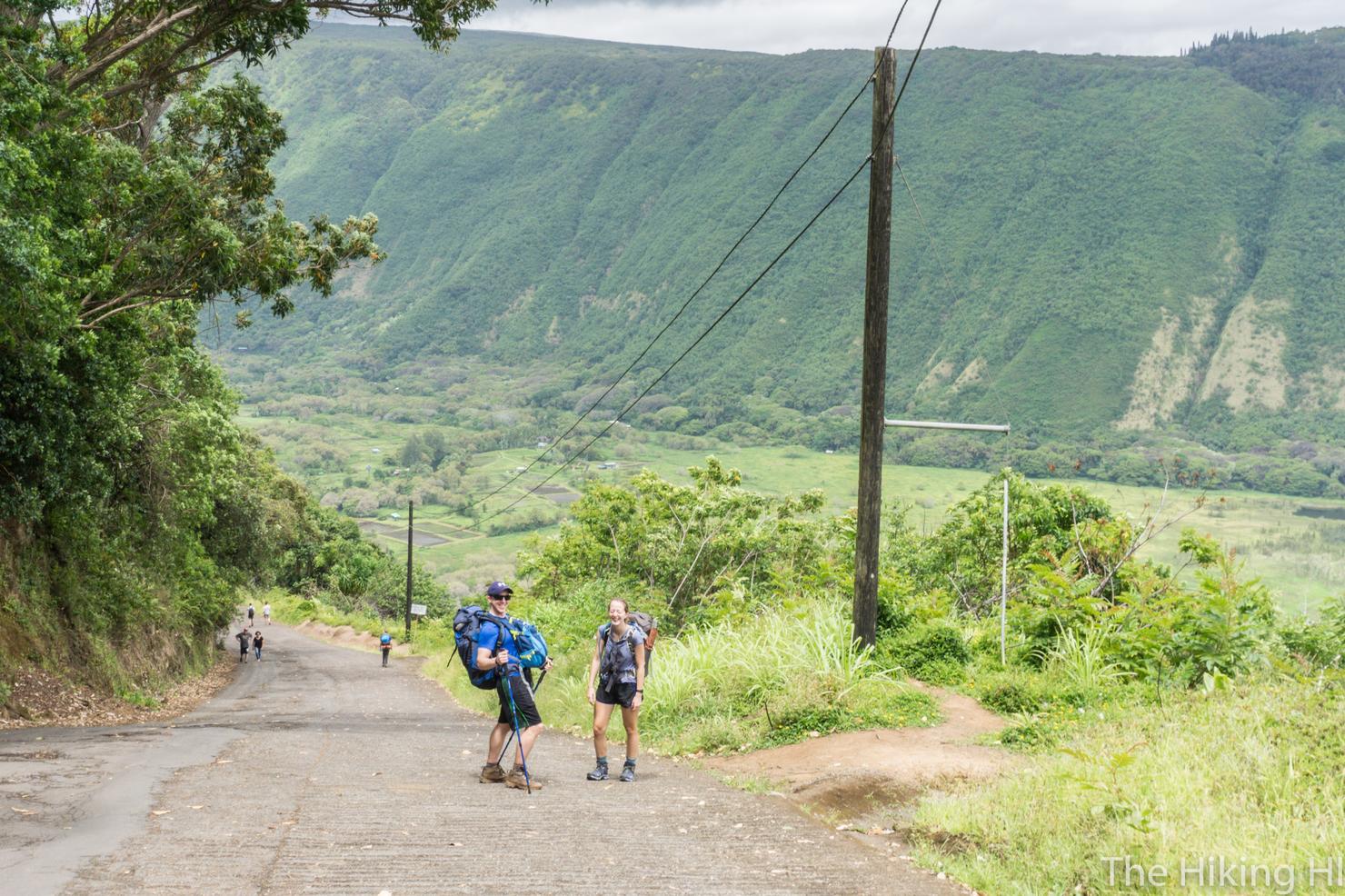
And so our adventure begins! Minutes into the trek, we're already having fun. But I think Carly and I we actually just making fun of Drew's Old Man trekking poles. But I'm sure I would have happily accepted those poles later into the hike. Chris had no patience for our joking, he was already jetting down the road.
As annoying as the road might be, it is very scenic. As a result, you will see a lot of other people making the journey (either on foot or by car), down and up. The majority of these people's destination will be Waipi'o Valley.
Once the sloped road ends, take a right at the fork and follow the dirt road towards the ocean. I loved the shot of the group all together in step. Our adventure to the mystical Waimanu Valley was just beginning...
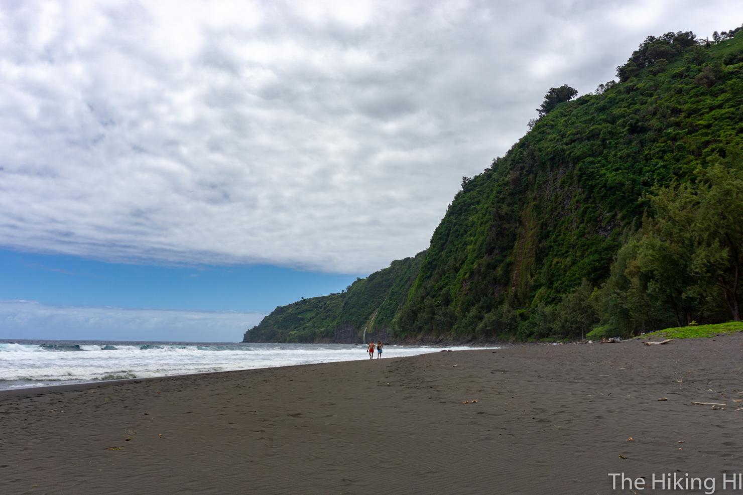
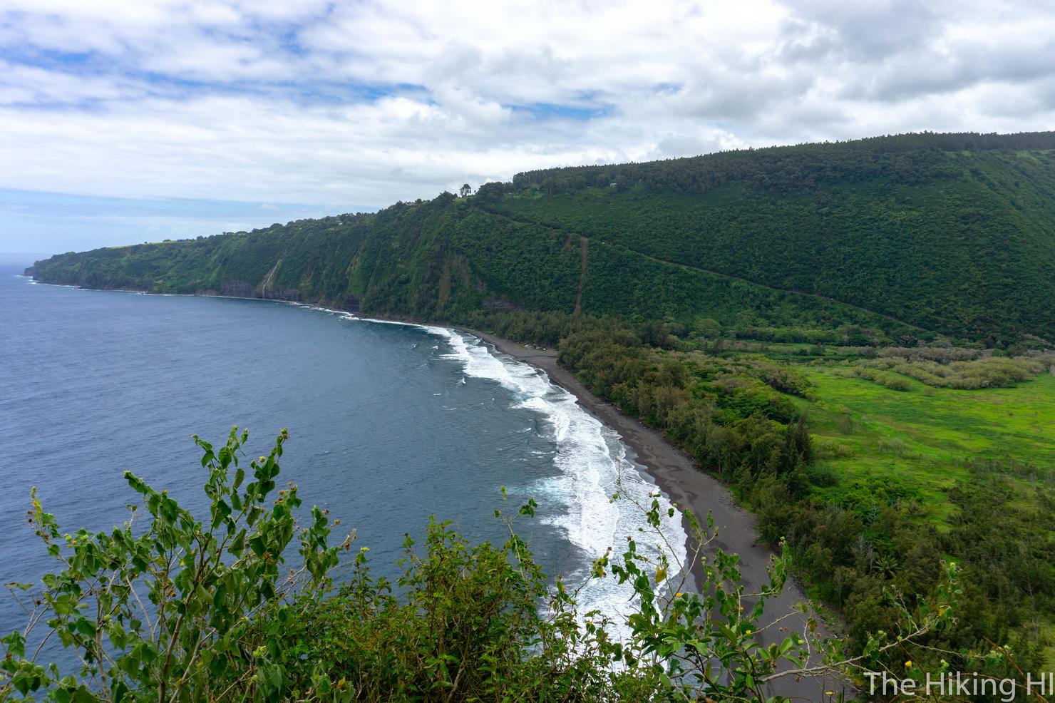
But Waipi'o Valley is no slouch itself. It also has that unique looking black sand beach surrounded by lush green sea cliffs. If you look closely, you can actually see a little waterfall above these people walking, which is Kaluahine Falls. Definitely an awesome place to spend a day.
But for our group, Waipi'o wouldn't quite cut it. We wanted Waimanu. But Waipi'o did provide us with our first major obstacle, a large stream crossing. This stream, Wailoa Stream, starts from deep within the valley and flows all the way to the ocean. And there's no way around it, you gotta get your feet wet. The strength of the flow, will really depend on how much it has rained recently.
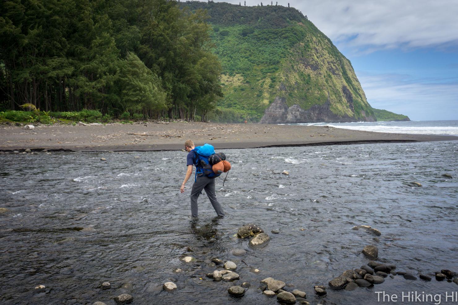
We took a few different crossing routes. Chris crossed a bit farther away from the ocean, where it was more shallow, but rockier. Good balance was key for avoiding a faceplant.
Carly, Drew and I took the route closer to the ocean. It was less rocky, but deeper. Carly and I had brought some dive booties, and swapped them out for our hiking boots to give us good grip, but not soaking our hiking boots. Highly recommend. With the group all safely across, it was time to continue.
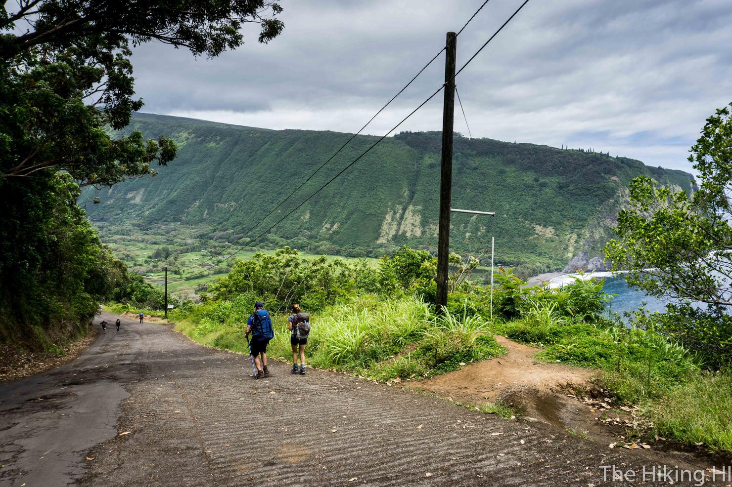
The path is easy, just head towards the cliff on the other side of the valley. We decided to head straight for the trees, and take the trail to reach the cliff vice walking along the beach. Any little bit to save our legs.
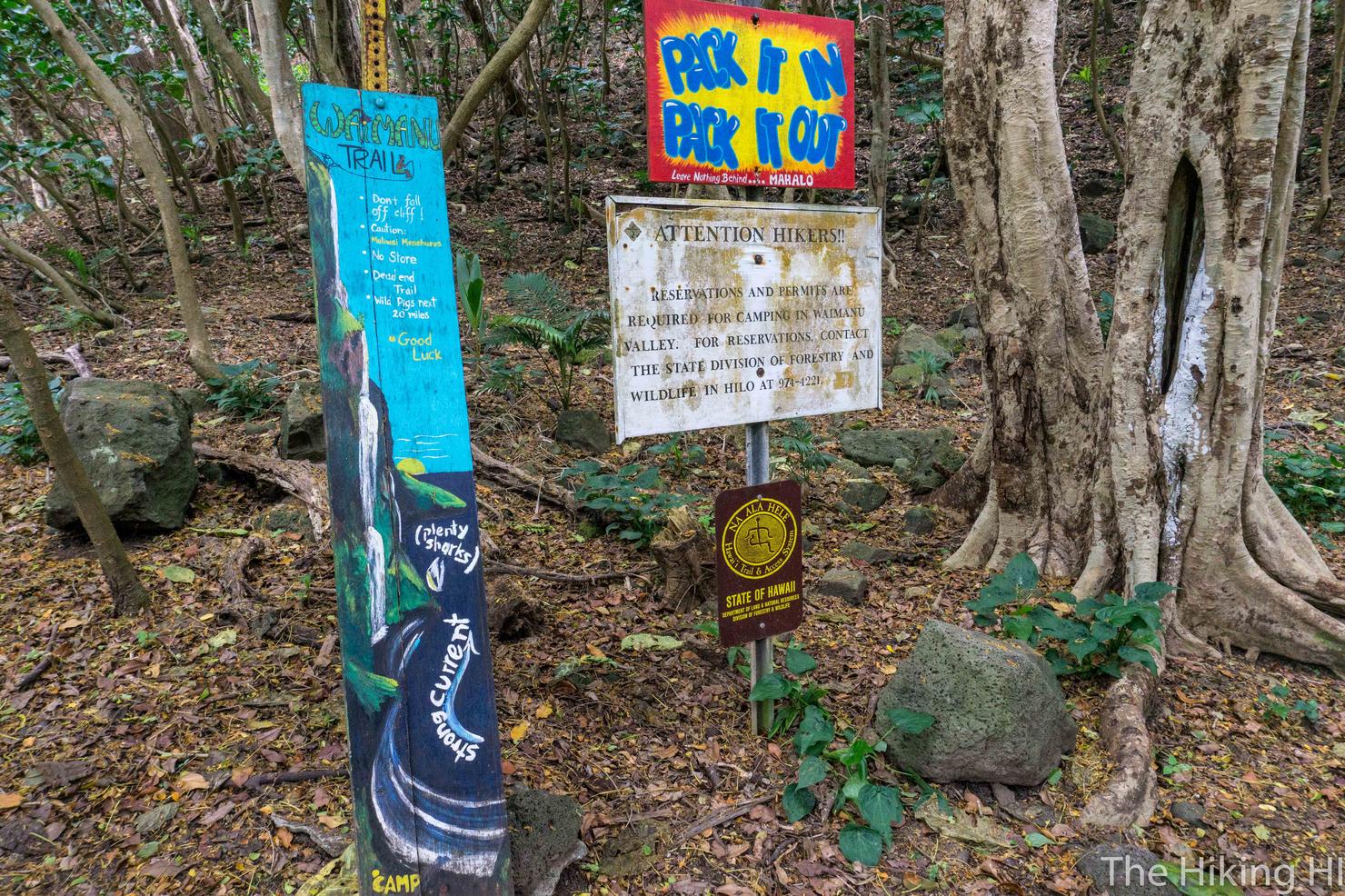
Once we had crossed the remainder of the valley, we reached these signs. The official Muliwai Trail and the "Z" trail begin here.
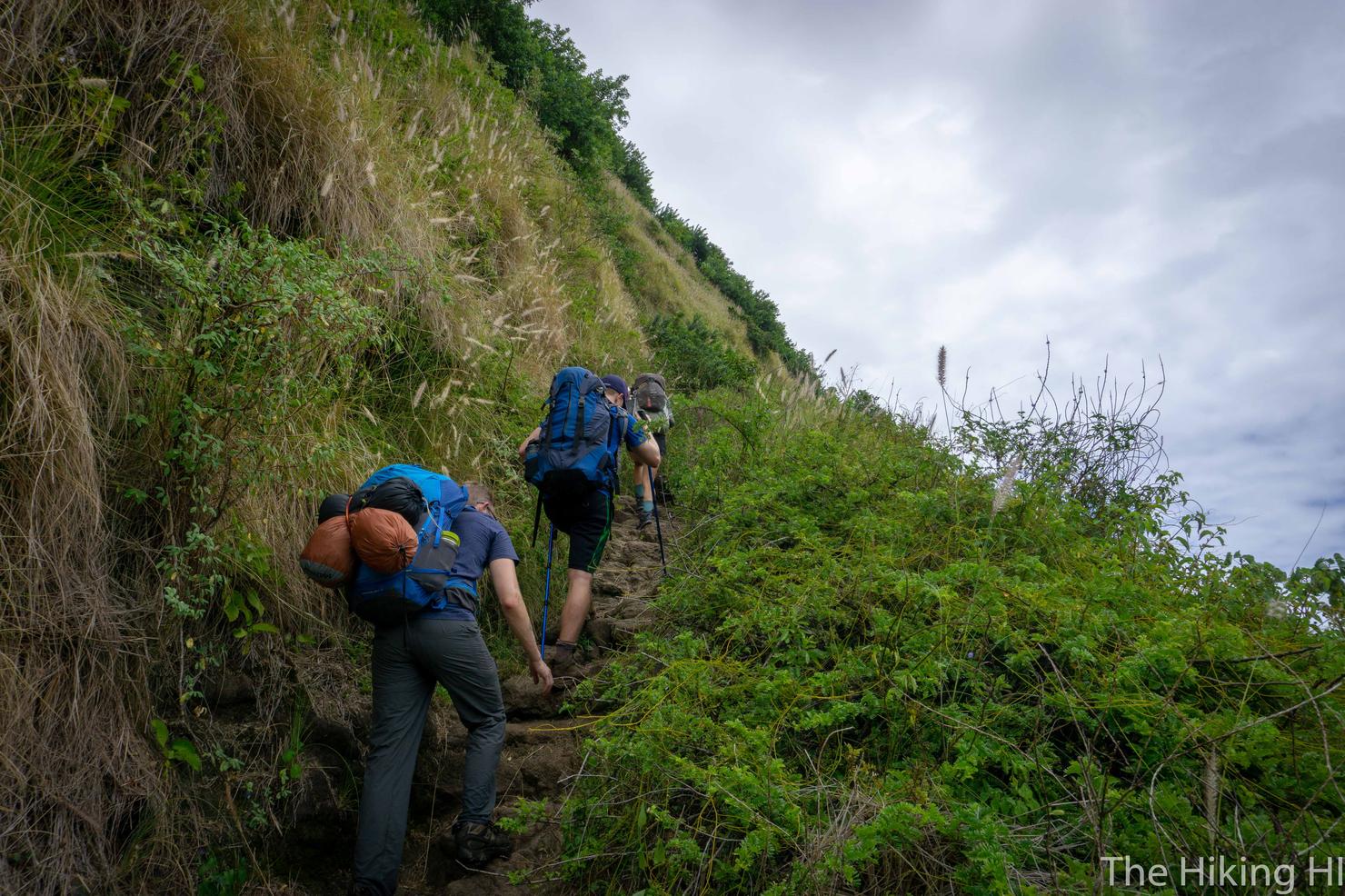
AKA the fun begins here! It's called the Z trail because the way the cutout of the ridge looks from Waipi'o Valley. Really it's just a series of switchbacks that takes you up roughly 1200 feet. With heavy packs, it's a doozy! Can't make fun of Drew for his poles anymore.
But the way to break up the ascent is to take view breaks. This ridge gives you a totally different perspective of Waipi'o Valley. It's hard to see, but there's actually a waterfall back there, Hi'ilawe Falls, which is supposed to be the largest in all of Hawaii.
Another shot higher up. I love how you can see the cut out of Waipi'o Valley Road in the ridge. It may be 2 days away, but I was already dreading the hike back up that thing.
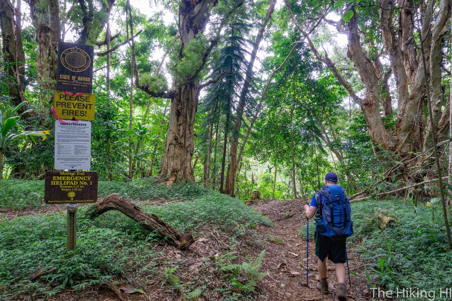
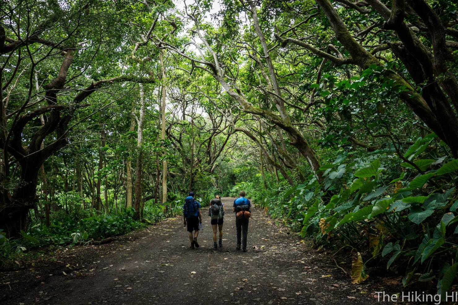
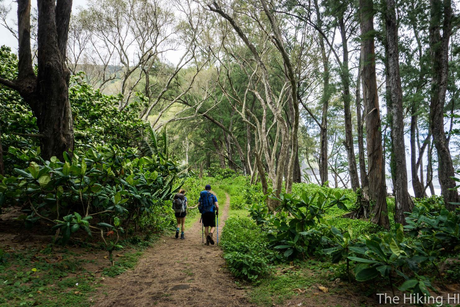
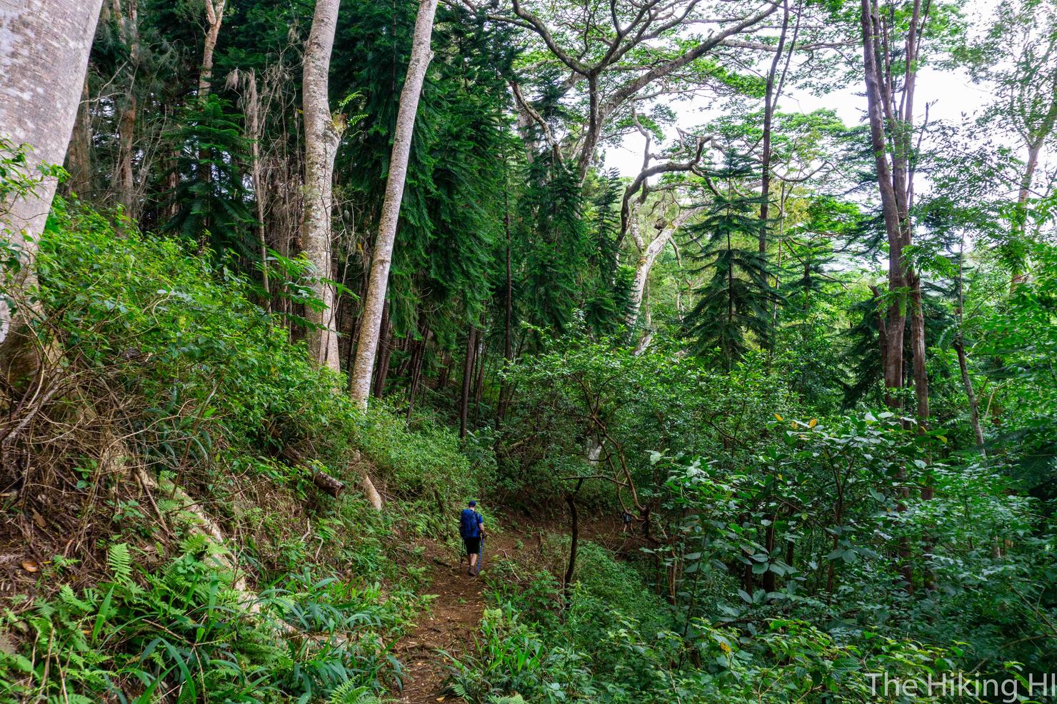
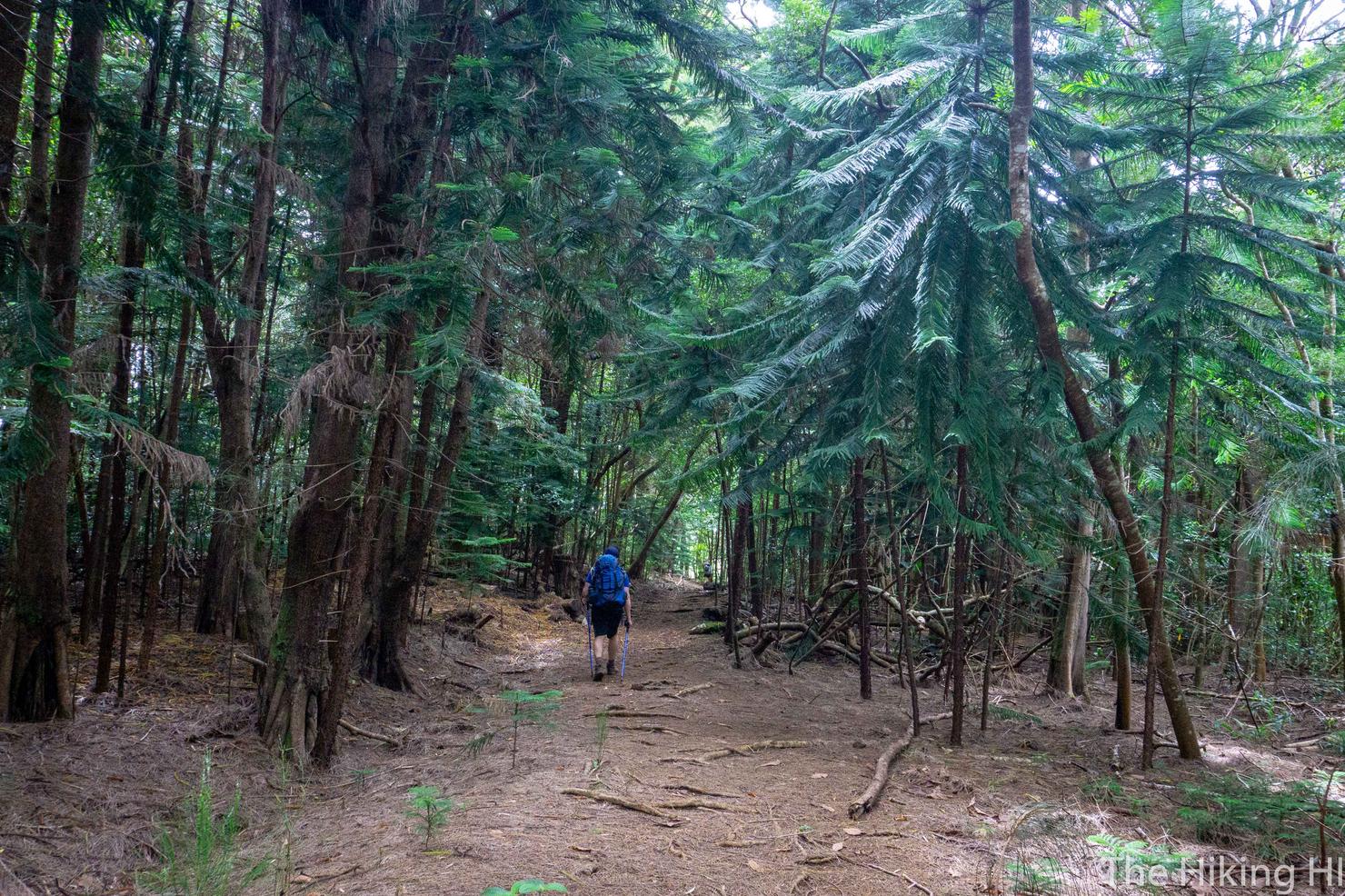
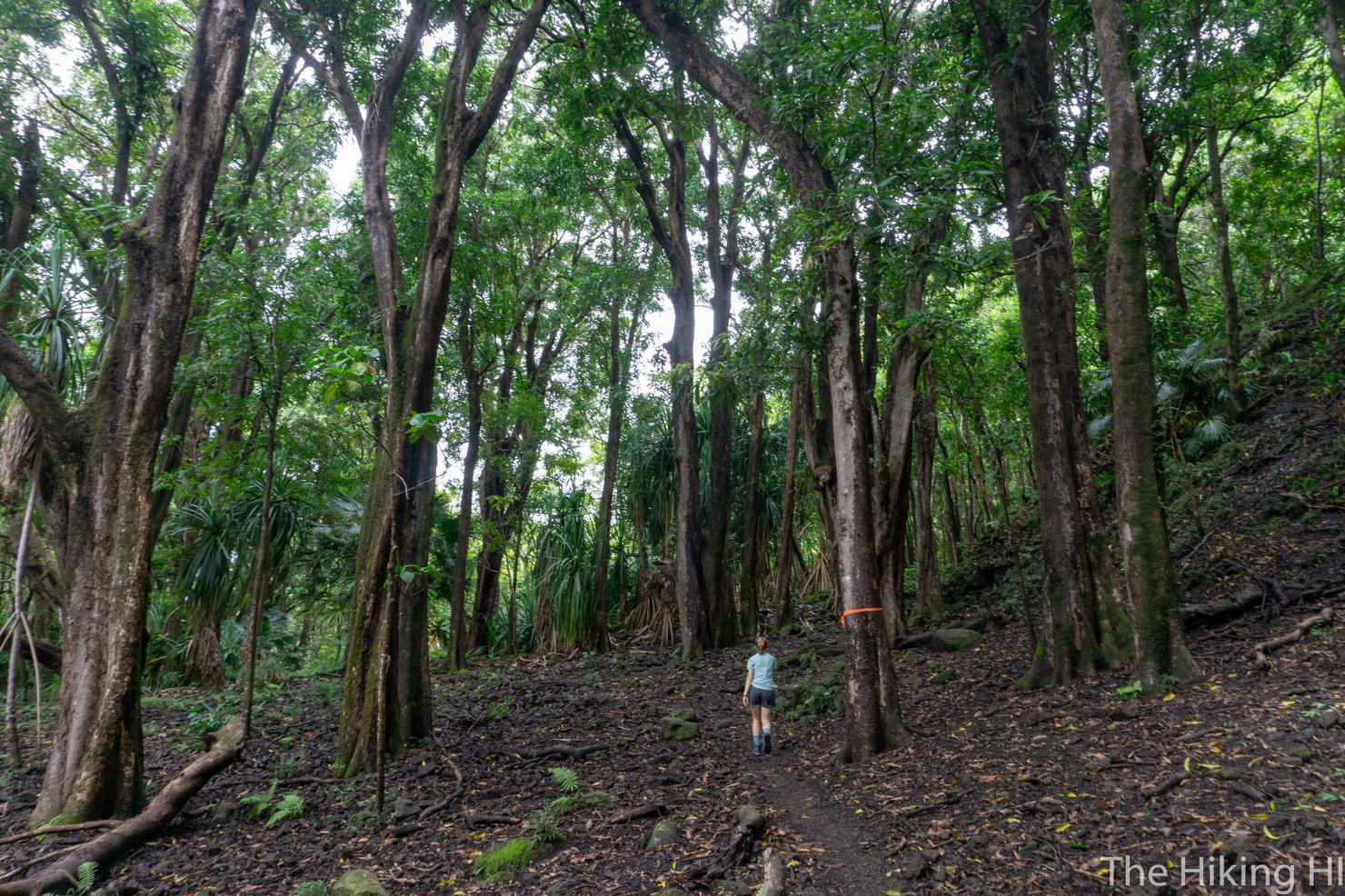
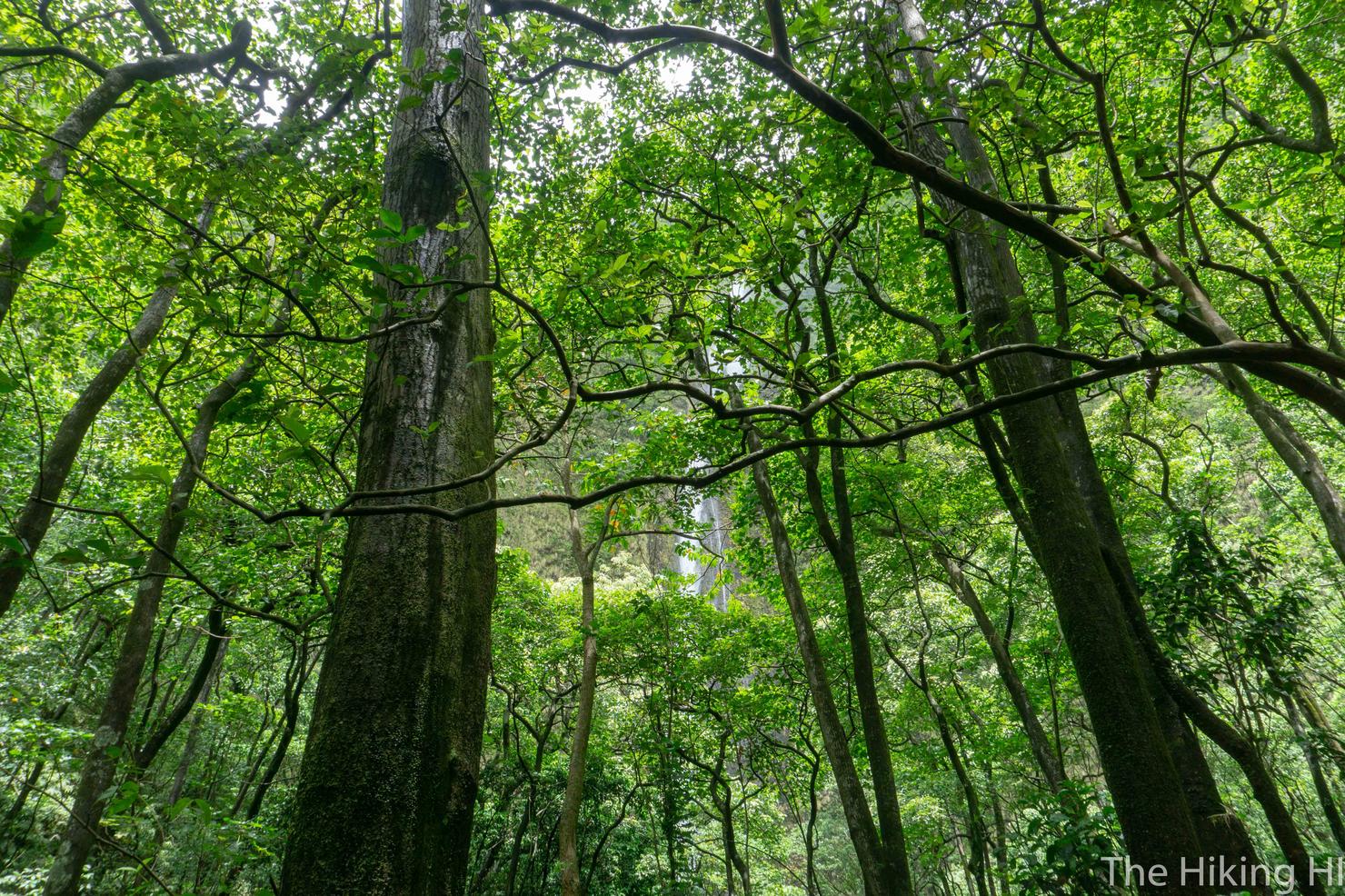
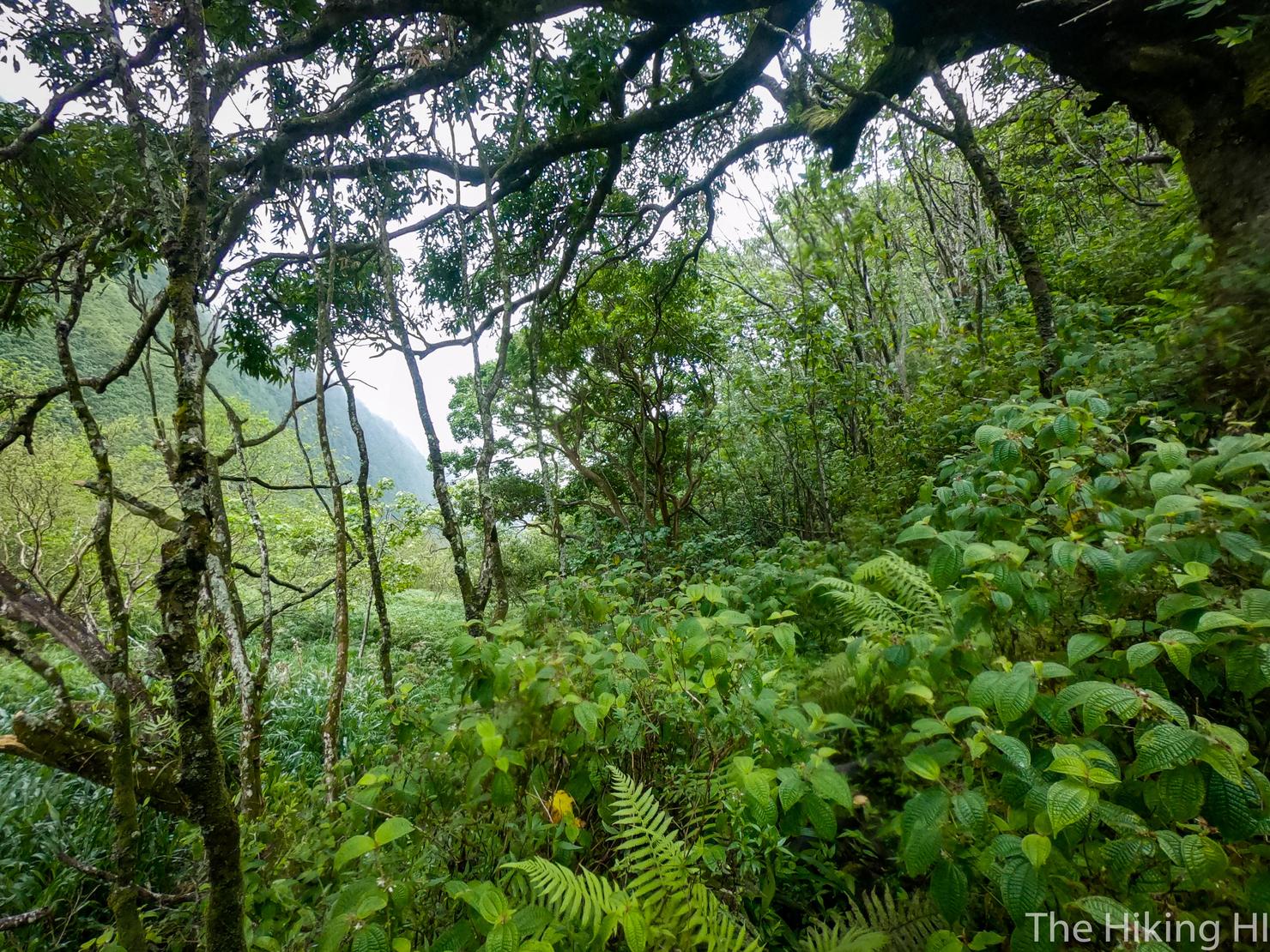
It took us about around 45 mins to reach the top of the Z trail and then it was into the trees. This is what you will be surrounded by for the majority of the hike, dense green foliage. While it's not the expansive open views I'm used to seeing, I loved it. It gave this hike a totally different feel than many on Oahu. One big perk of going on a maintained hike-- there are actually signs. You can see the sign to the left tells us how far we have to go (a mere 6.25 miles).
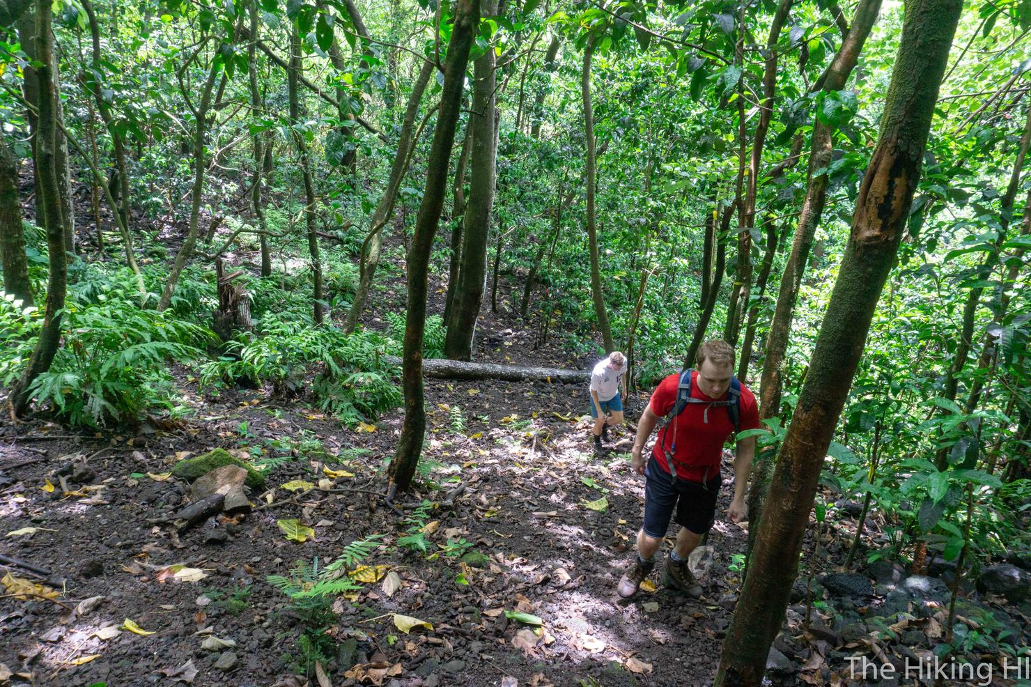
The majority of this hike will involve weaving in and out of river valleys (I think 12 in total). This means that you will descend a little bit, cross a river, and then ascend. The first couple were exciting, but the farther we got into the hike, the more we were counting down the crossings. I really hope the info was right and the number was only 12!
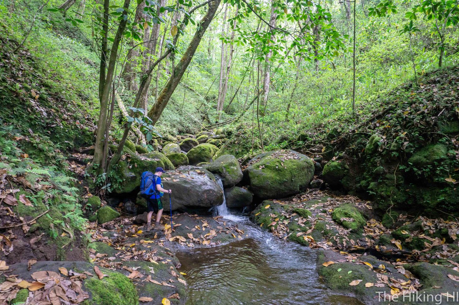
Overall these "stream crossings" were not too bad. Most of them were nearly dry, so navigating them without getting your shoes wet wasn't too challenging. I'm sure the condition depends on how much it has rained recently, but we had lucked out. This was one of the slightly more challenging crossings, because there was some water and the rocks were slippery. Right after taking this picture, one of Drew's poles slipped out from under him and he fell right on his butt. After stifling our laughter, we made sure he was ok. All good!
Which is good news, because we still got a bit to go. As the hike carried on, we all started to spread out, going at our own pace. It helped me become a bit more present with my surrounds. The diverse variety of trees, the freshness of the air, and the pleasant sounds of the birds and light breeze (and just the occasional helicopter), made this place feel truly remote. This is the sensation I envision when I think of a backpacking trip.
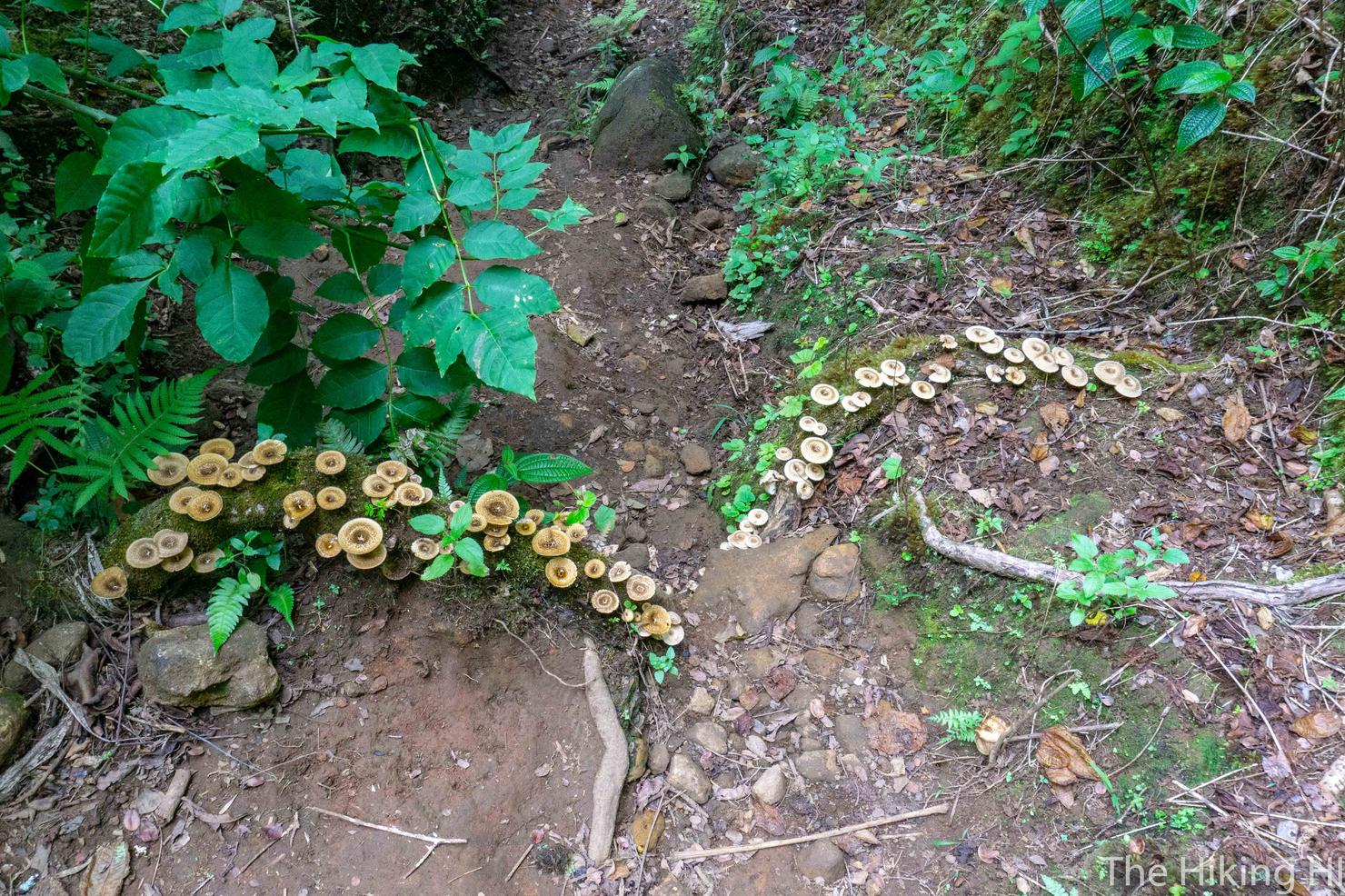
And like any adventure, there's always a few interesting gems to find. Not actually sure what these caps were, but their appearance on the moss covered root was captivating.
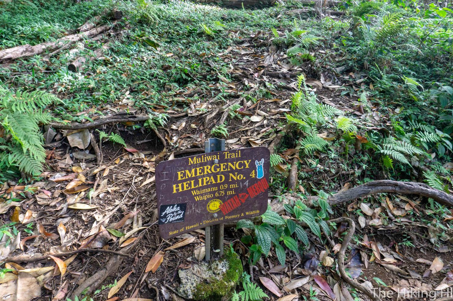
After 5 hours of hiking, we found the 4th and final trail marker/helipad. Less than a mile to go! This sign was encouragement, because at this point, the legs, shoulders, and hips were all burning. Cannot wait to take this pack off!
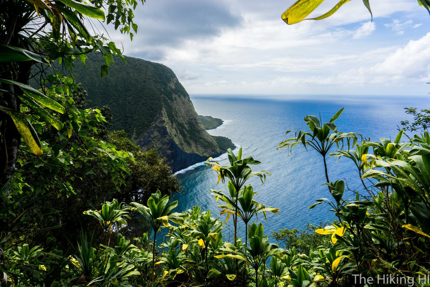
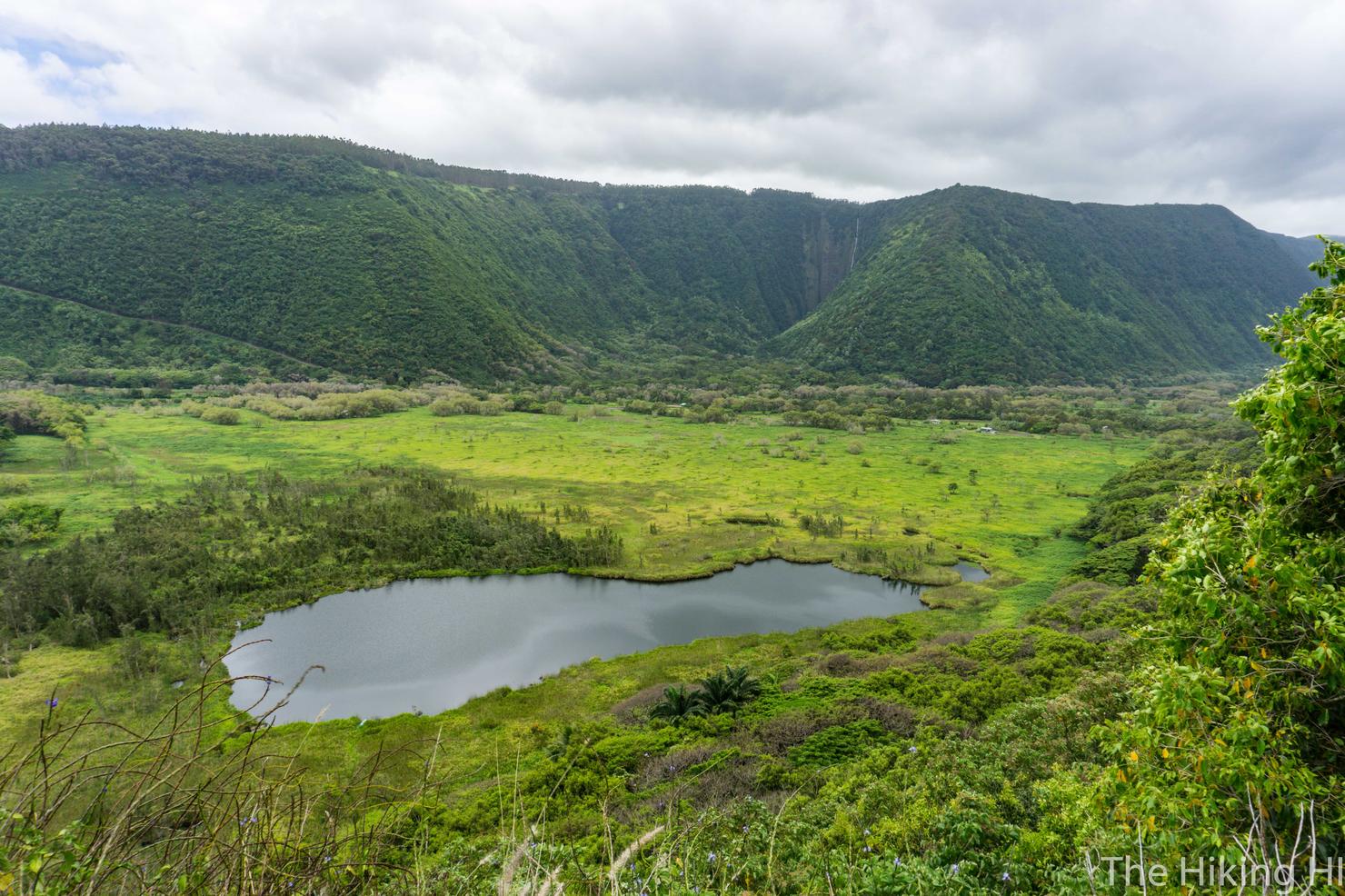
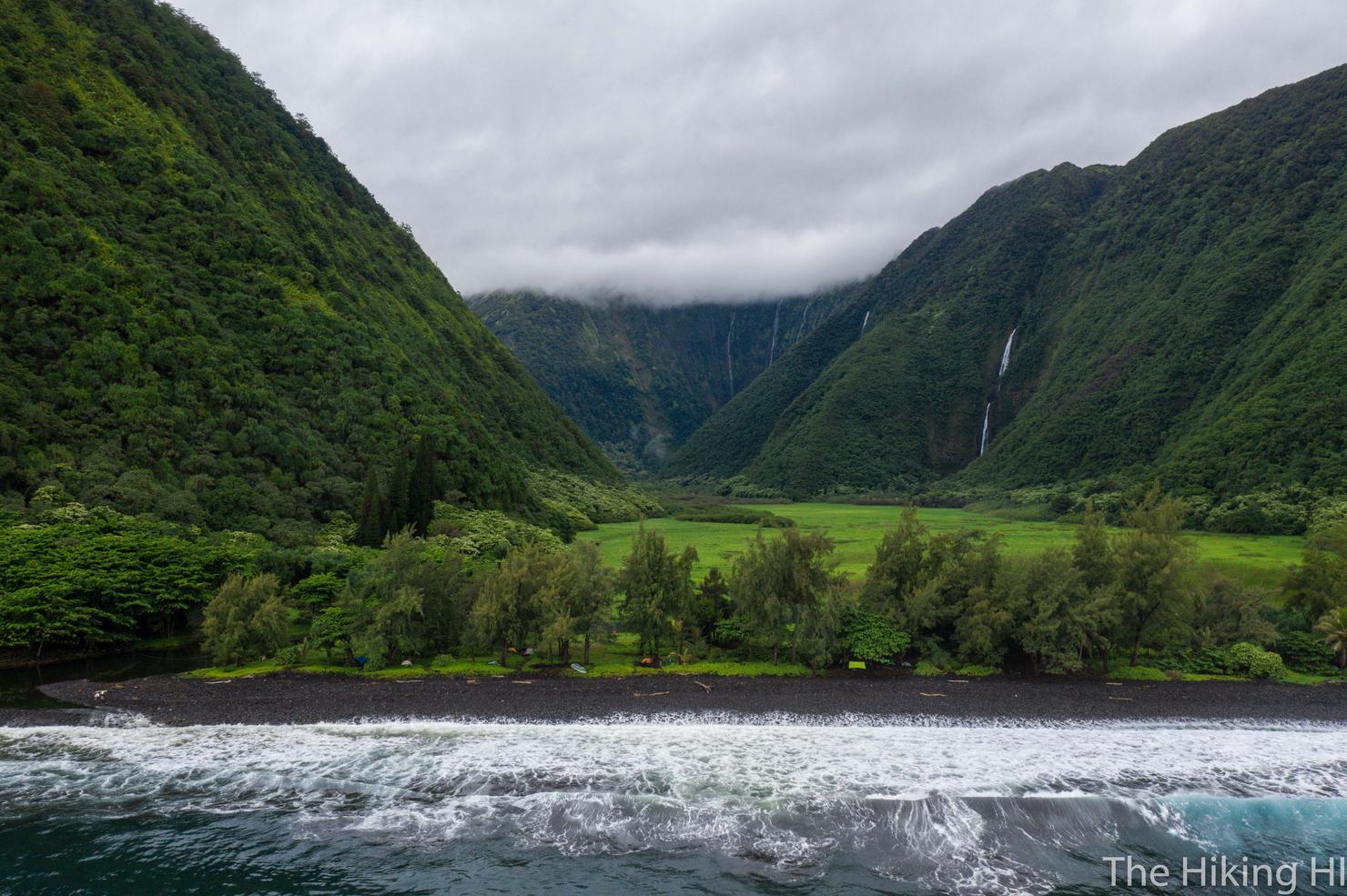
And soon, we got our first glimpse of Waimanu valley. In a lot ways, it looks like Waipio Valley. But from what I'd seen, there's a lot more magic to this valley. But first we need to get there!
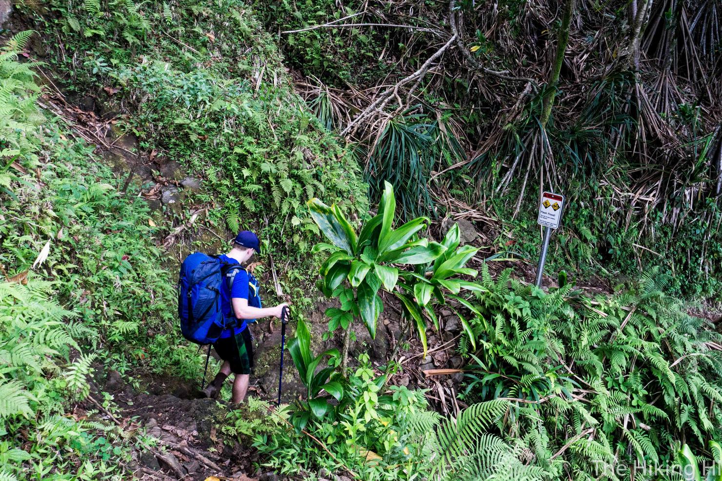
This last stretch of the trail is a descent along a series of switchbacks into the valley. It's tough! Not only are you tired, but the trail can get kind of steep, so it's pretty harsh on the knees. Also, there are sections, like this one, where the trail is eroded and the footing is uneven. Don't lose focus just yet!
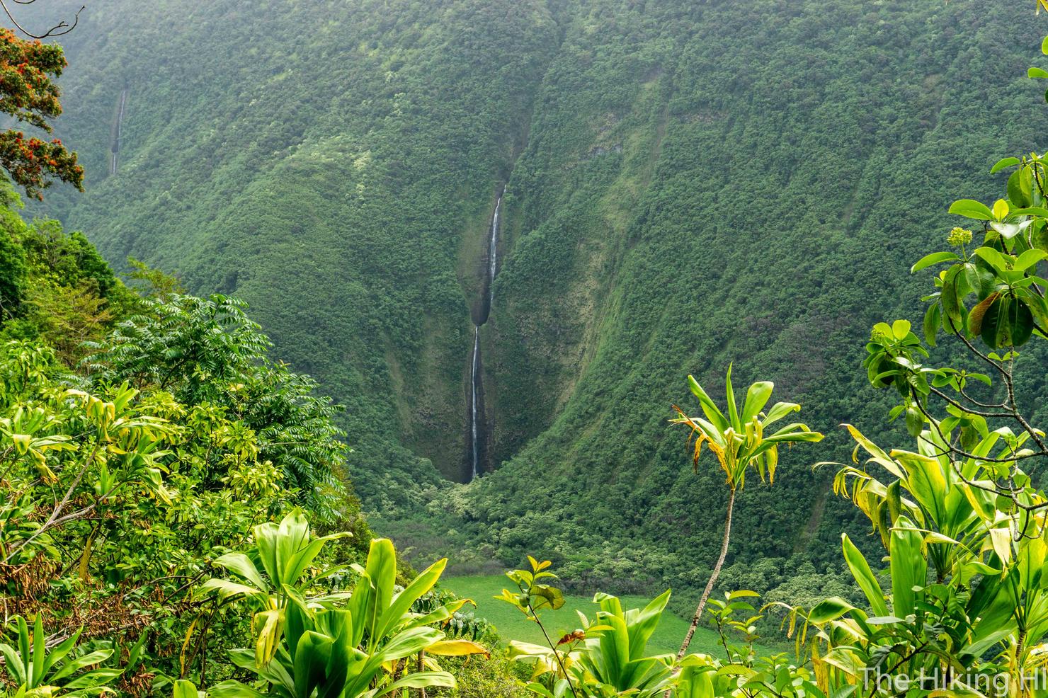
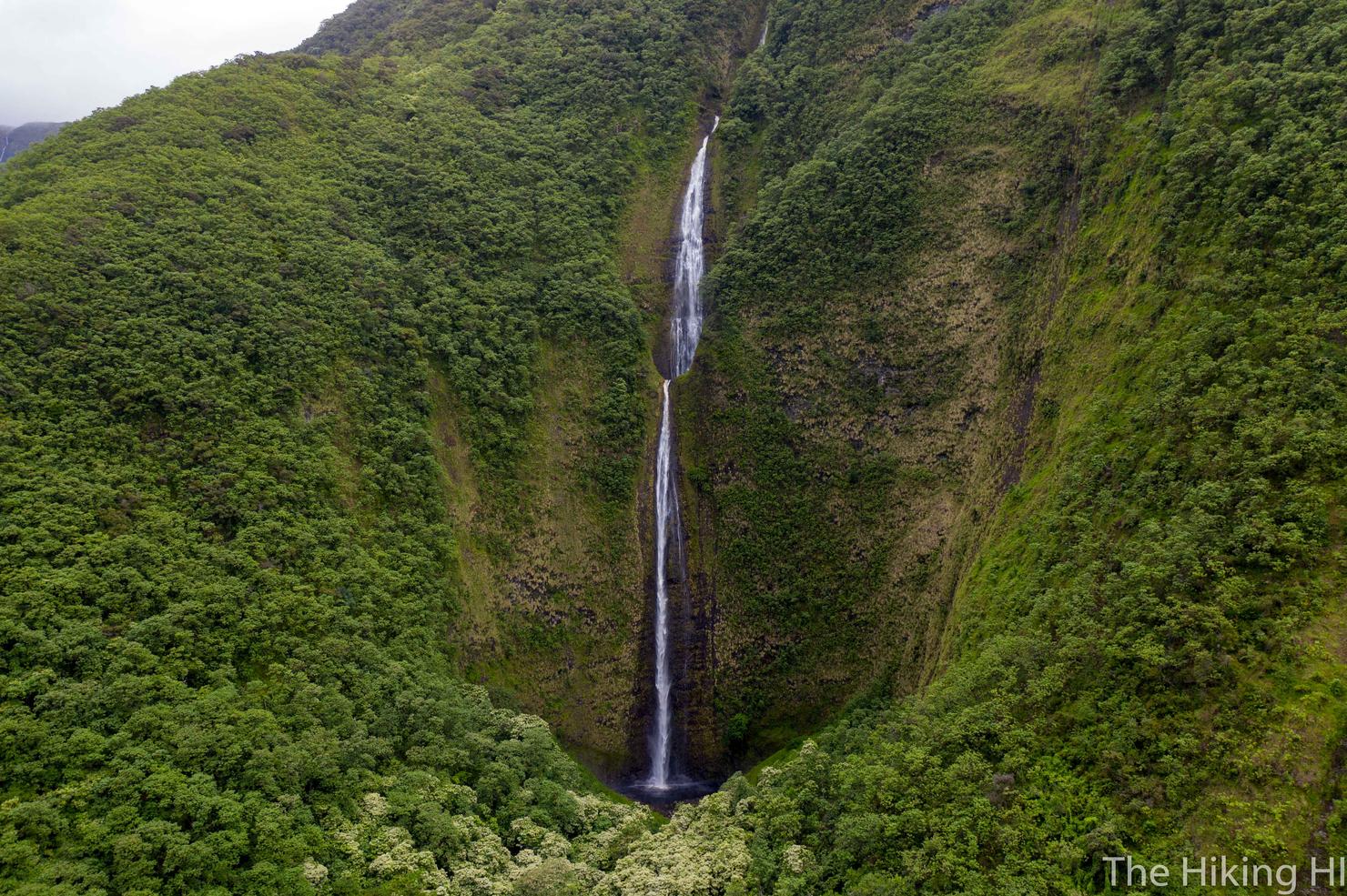
No one said getting here is easy, but that first glimpse of Wai'ilikahi Falls is all I needed to know this trek would be worth it. A massive and multi-tiered beauty!
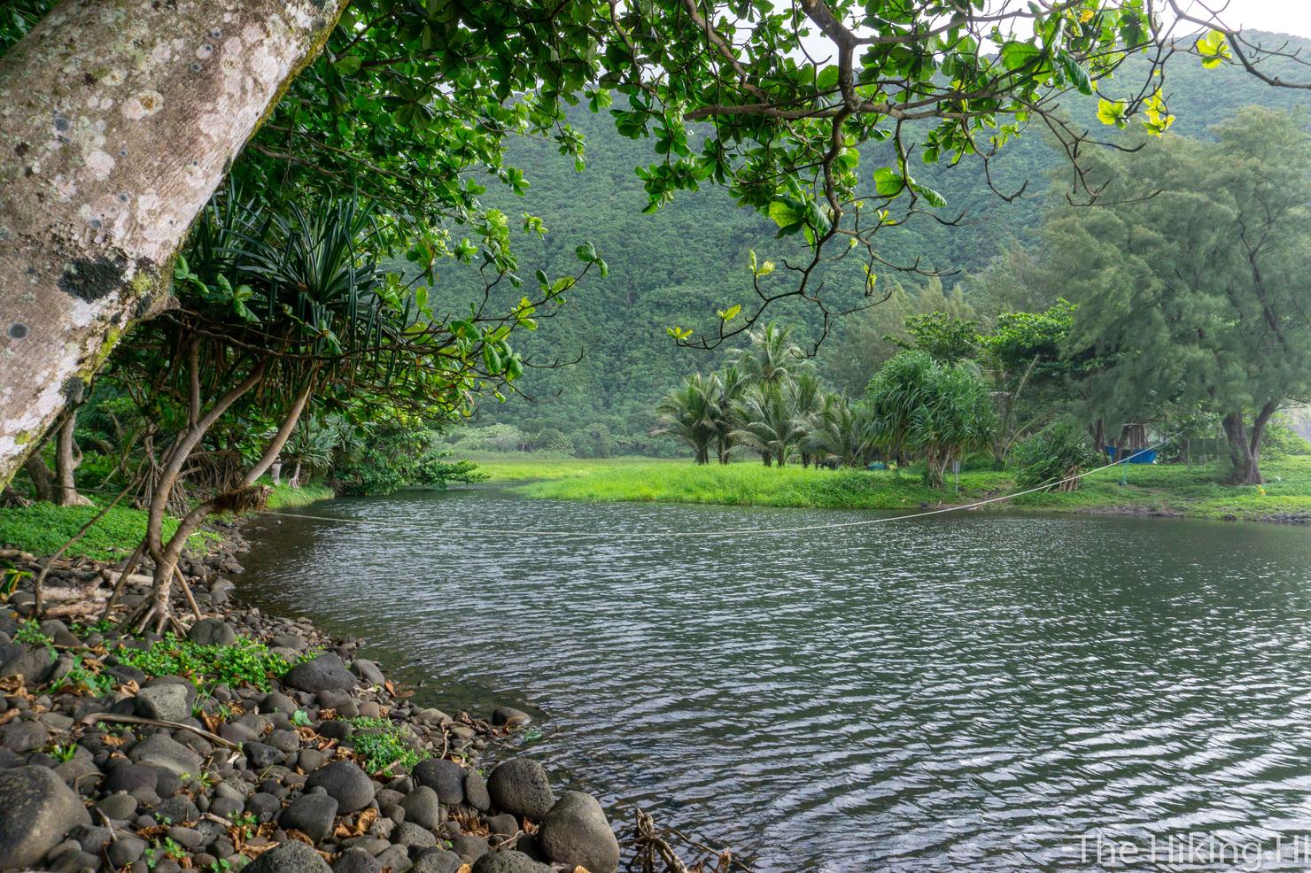
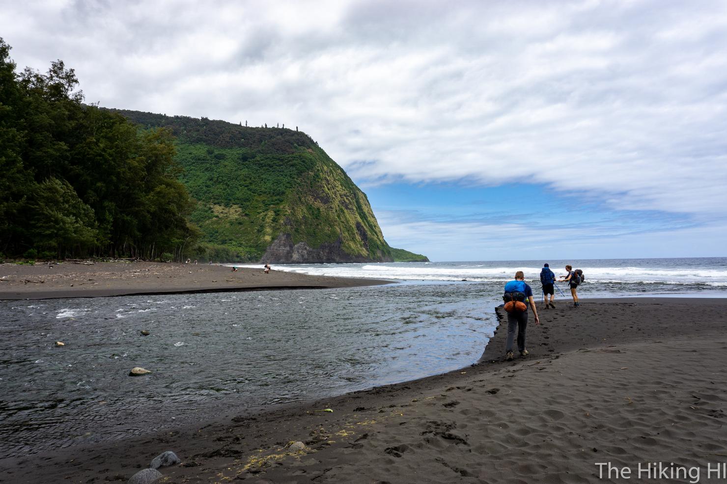
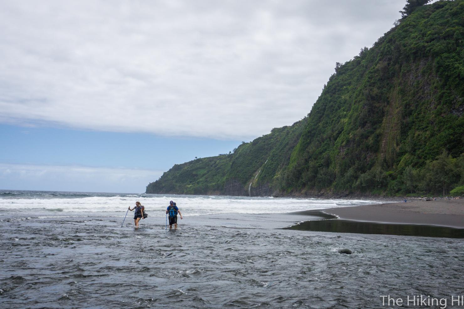
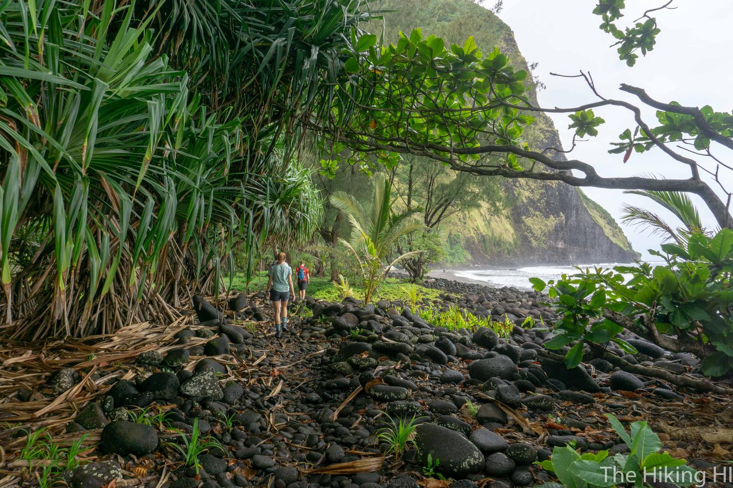
After descending the rest of the switchbacks, we made our way towards the ocean, leading us to our final obstacle-- another large river crossing. If you can tell, there's a rope tied across this section, indicating this would be a place to cross. However, if you were to cross to here, beware, IT IS DEEP. We saw a couple guys swimming around here later, and it gets near chest deep in the center. Not ideal when you're carrying a pack.
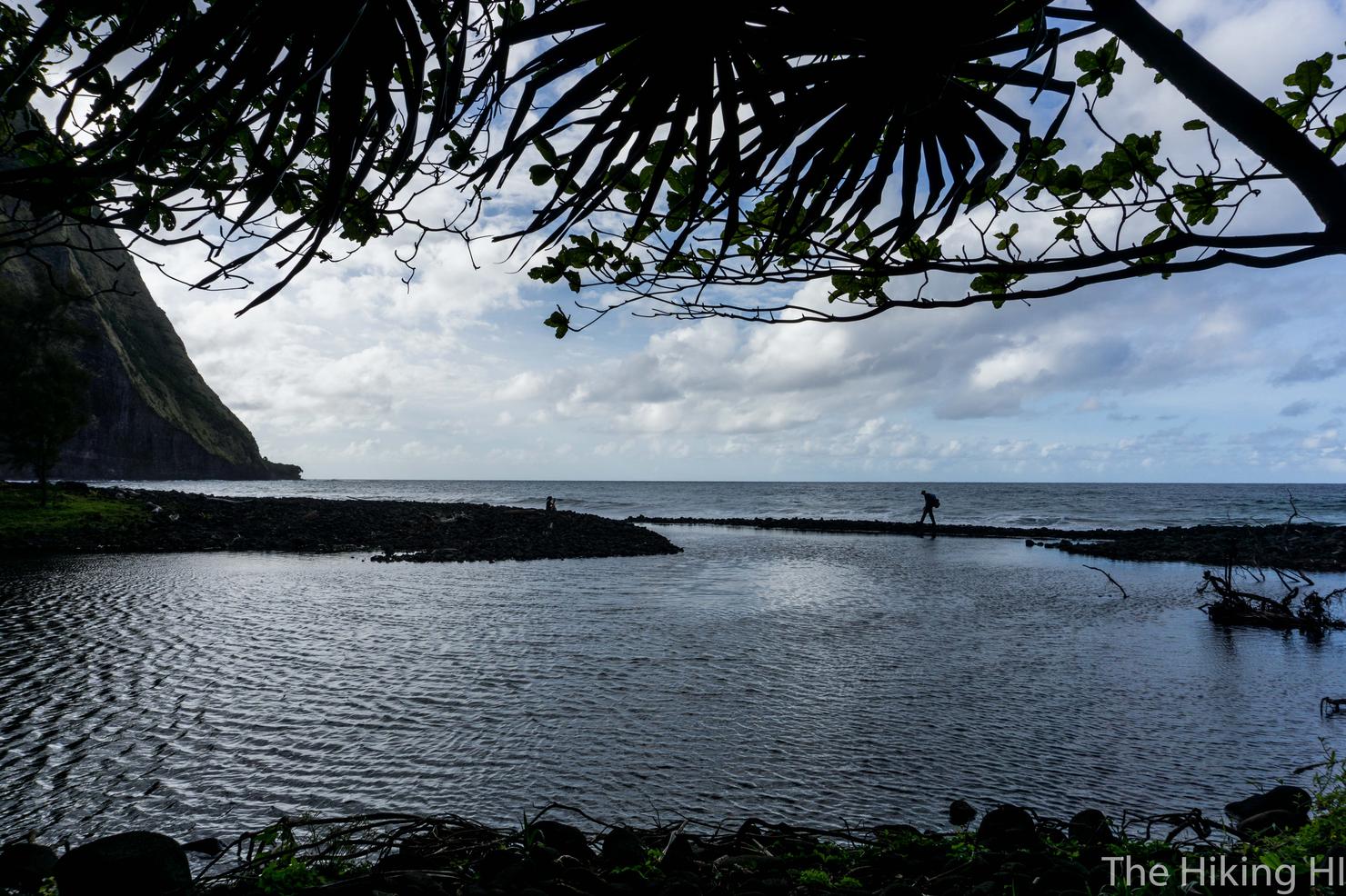
Instead, our group decided to cross closer to the ocean. there's a long rock jetty that parallels the ocean (where Chris is walking on the right) before you have to cross a section of water, roughly 5 meters across (where Carly is sitting). The only challenge about crossing here, is the footing is very uneven, and the current is pretty strong. The opening narrows near the ocean, creating a jet-like effect. Luckily, our group had descent balance, so nobody got their gear wet at the very end. (Pro Tip: Come back here for a swim after dropping your gear. The cold water couple with the strong flow feels amazing on your muscles).
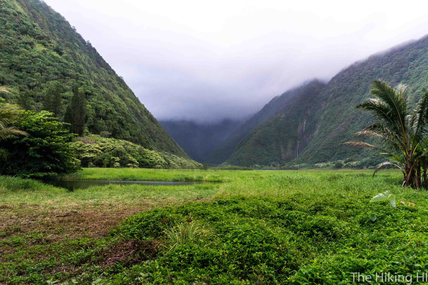
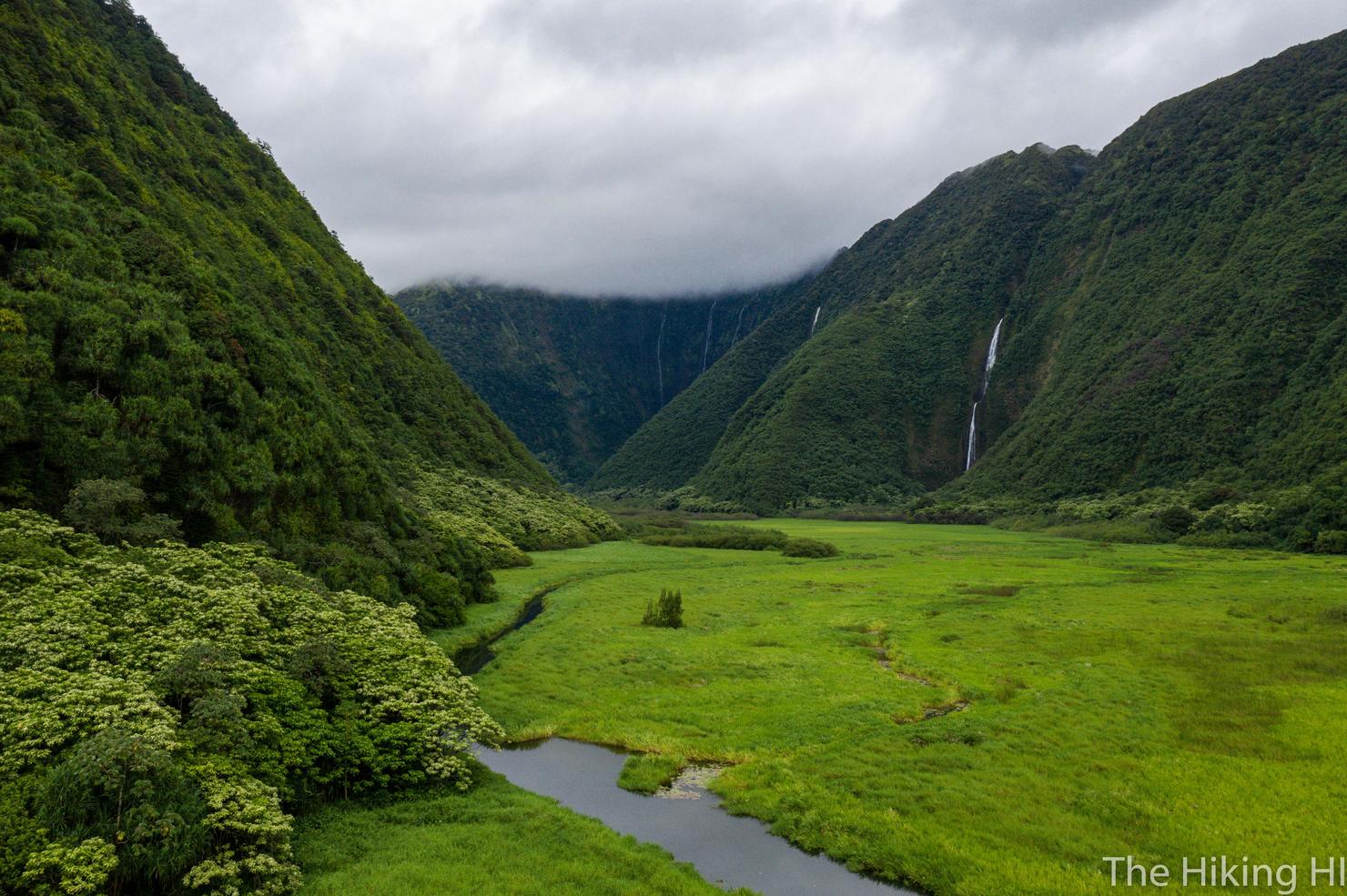
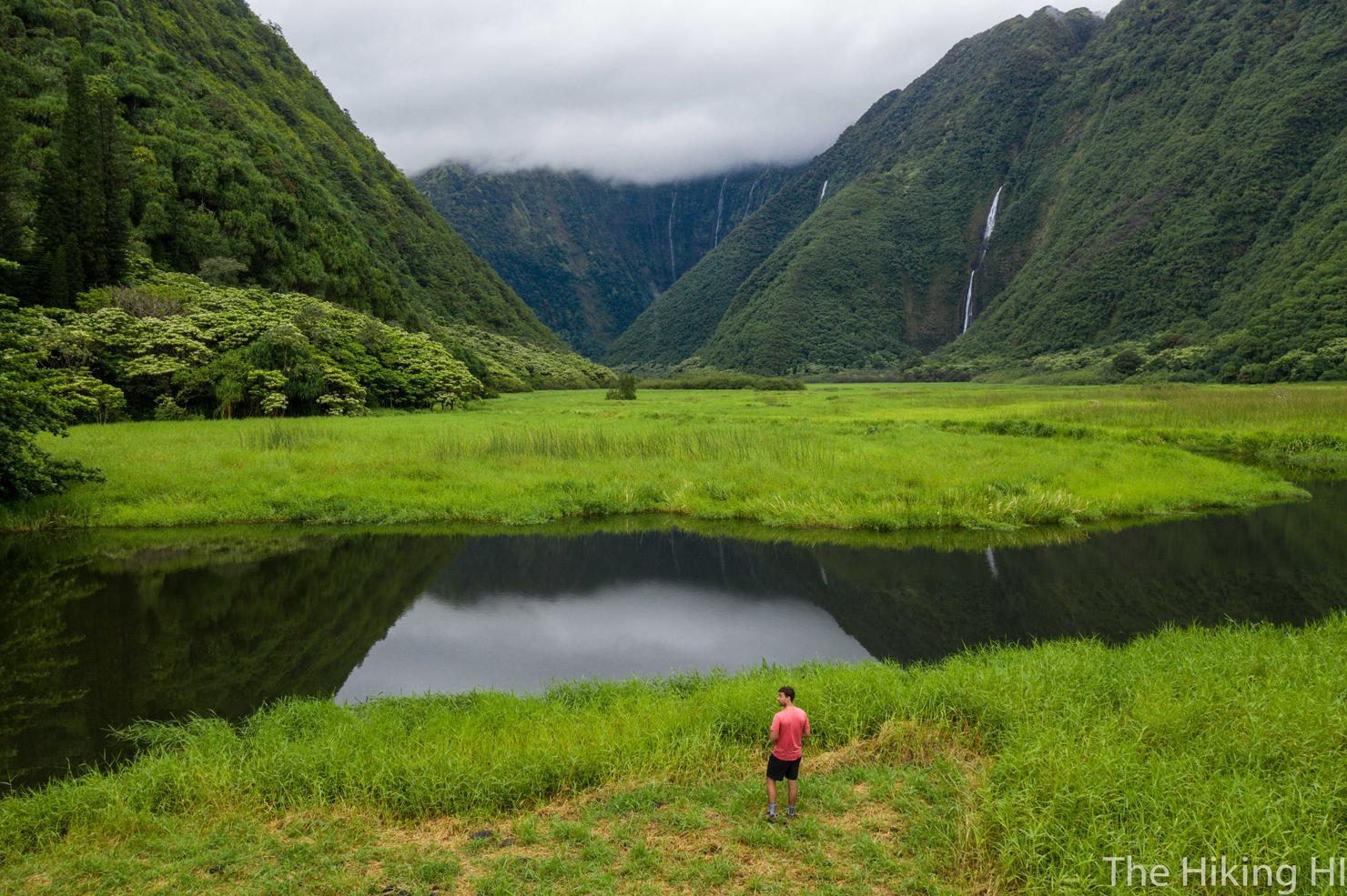
And there she is, Waimanu Valley! It had taken us over 6 hours to reach this spot. The views into the valley weren't totally clear, as the clouds were hanging low and the light was fading, but it was still beautiful. And to think the only way to experience this perspective is that hike we just did. Makes it even better.
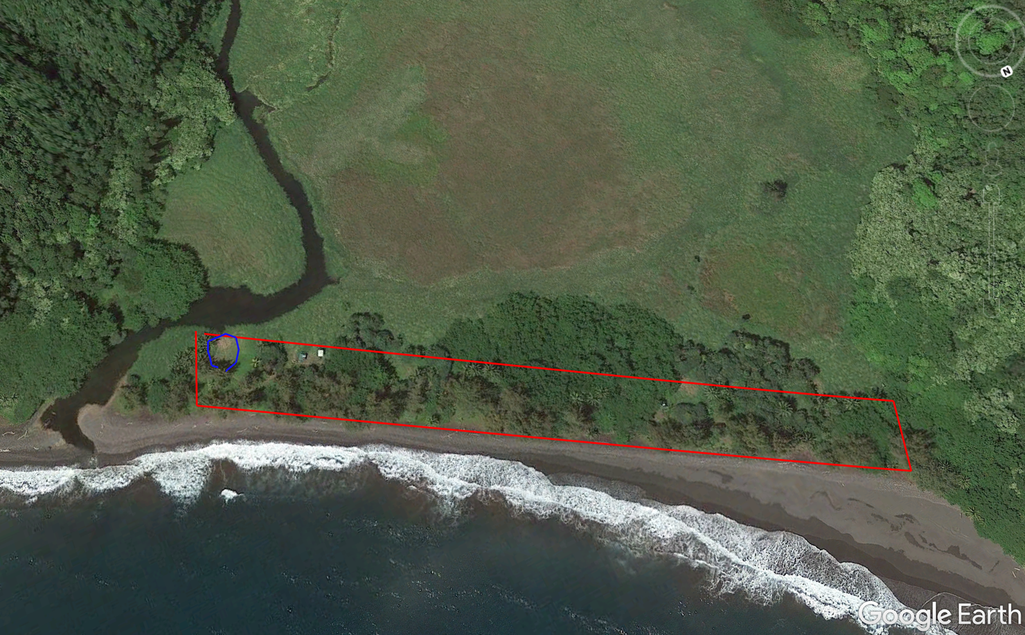
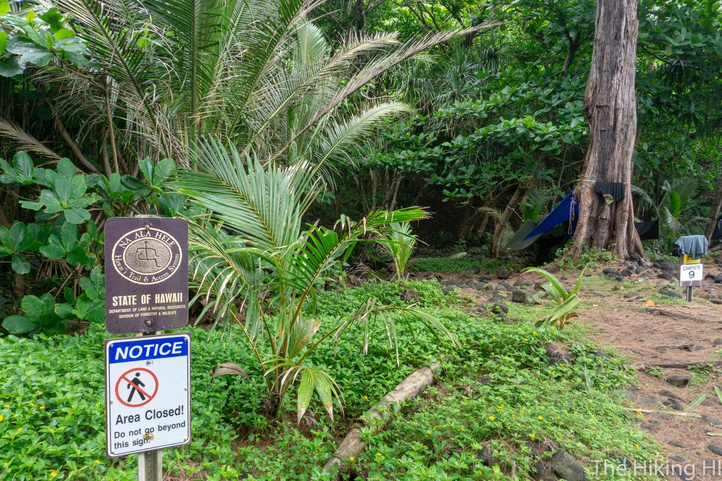
But before we got too mesmerized by the valley, we had to set up camp. Permits are required to camp here, and you can reserve them up to 30 days in advance for a fee of $12 or $18 per night (cheaper for residents). If memory serves, our campsite was #5, which was about a 30 second walk from the above photo. The higher the numbers go, the farther down the beach (to the right) you will be located. The prime real estate is campsite >#2, which is located just to the left of the above photo, and circled (very poorly) in blue. Despite Carly getting on the website a few minutes after being able to reserve it, #2 had already been snagged. Oh well, our spot was plenty good
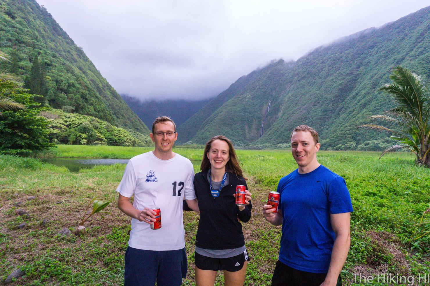
After setting up camp, we rewarded ourselves with a little adult beverage. Yes, we did just hike 9 miles with a beer so what? We even used that little pool we crossed to chill them a bit. That one beer sure created quite the buzz.
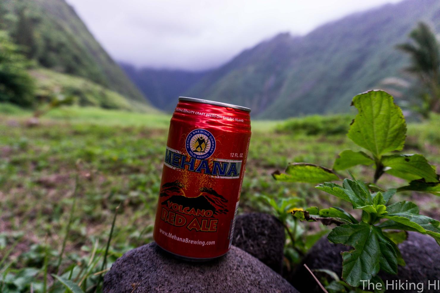
Beer and nature, two of my favorite things in one! And a little bit of free advertising for Mehana Brewing (I'll take my compensation in the form of more beer, thanks).
As the sun slowly dipped below the horizon, we made ourselves a little dinner and chatted about our journey. But it didn't take long before our tired bodies told us it was time for bed. Good thing too, because we had another adventure in store tomorrow.
Day 2: Waimanu Valley to Wai'ilikahi Falls (and a little droning)
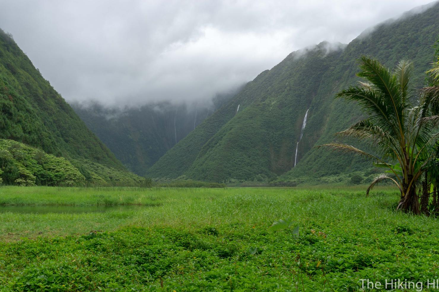
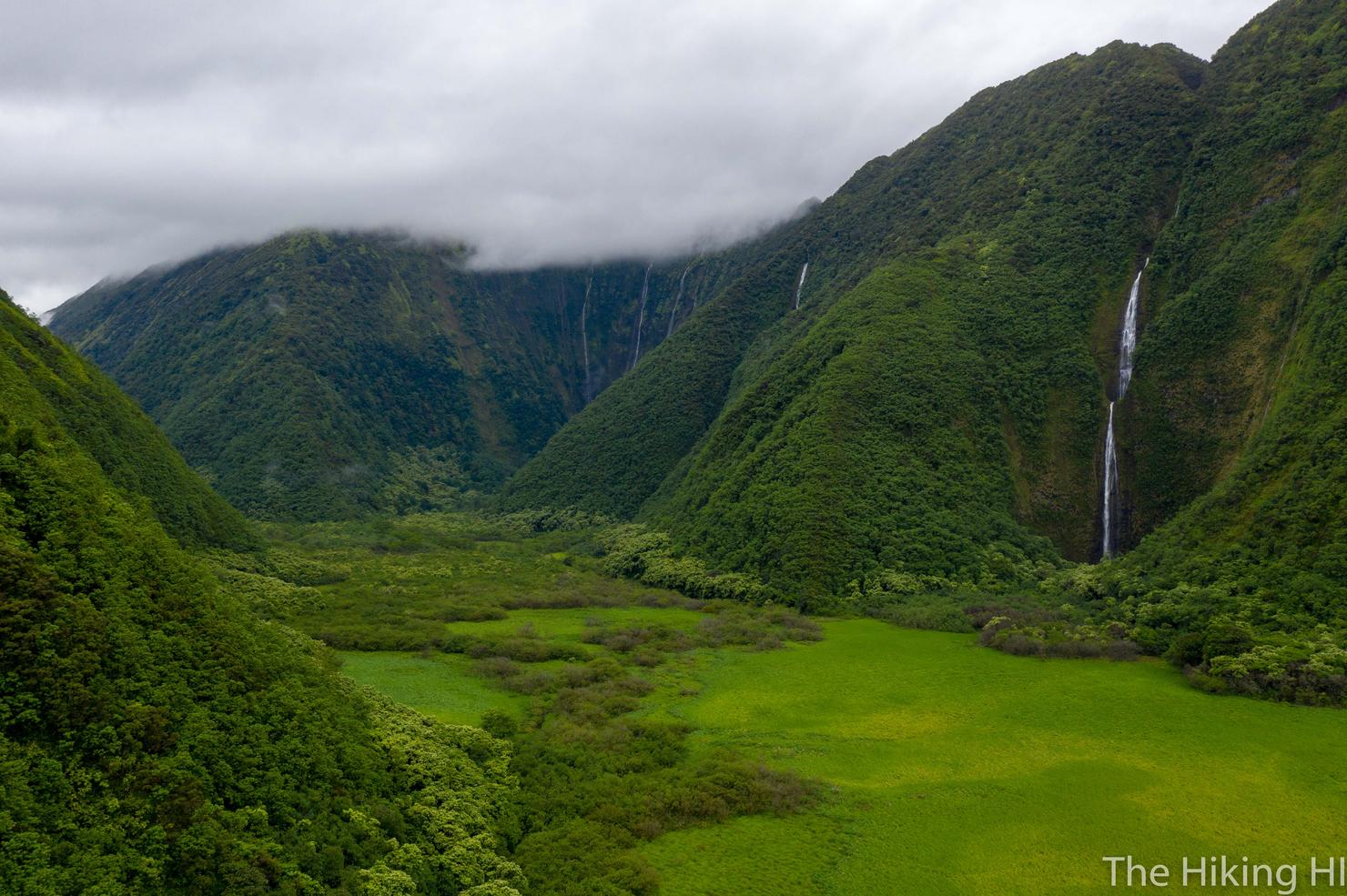
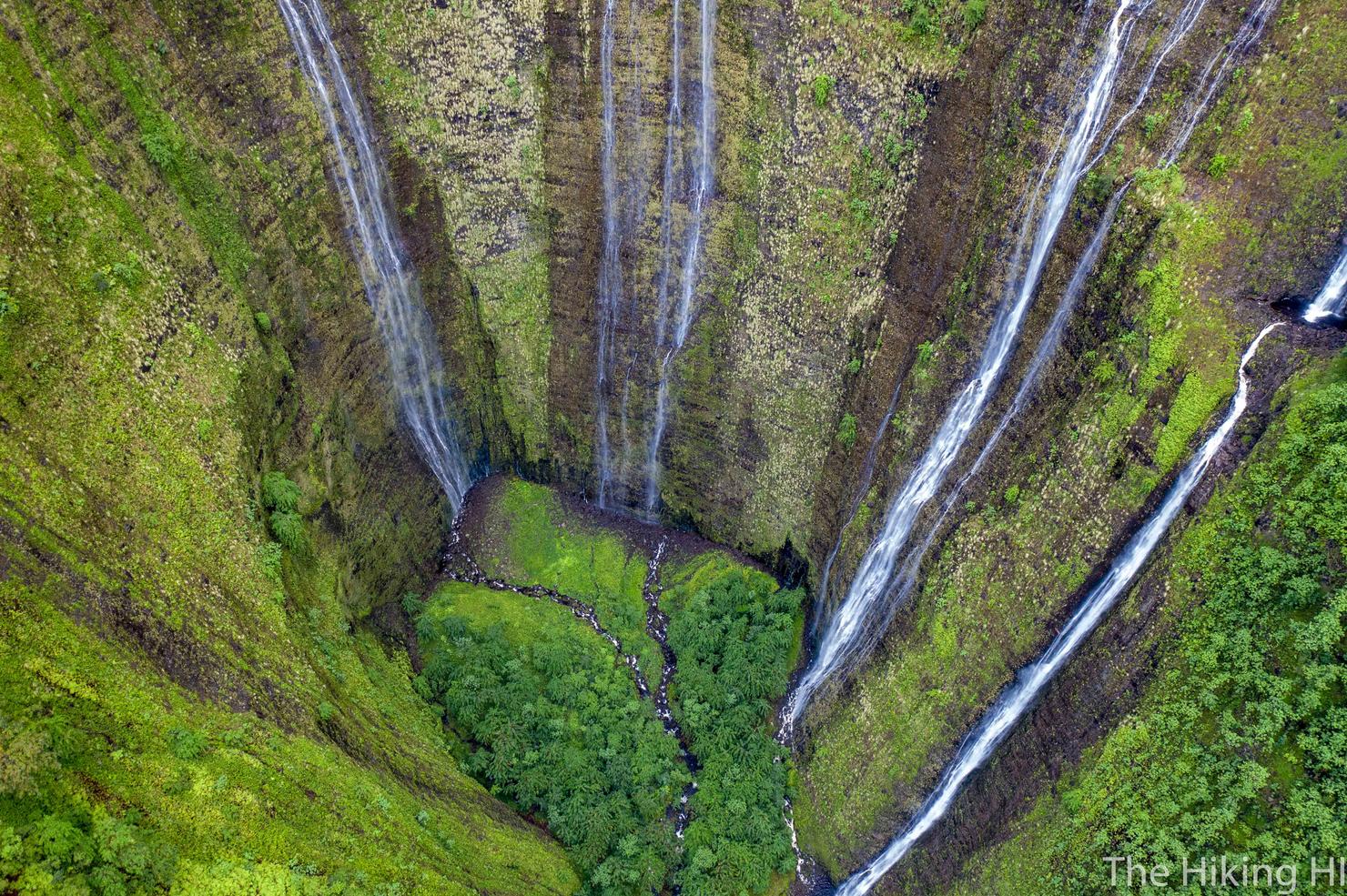
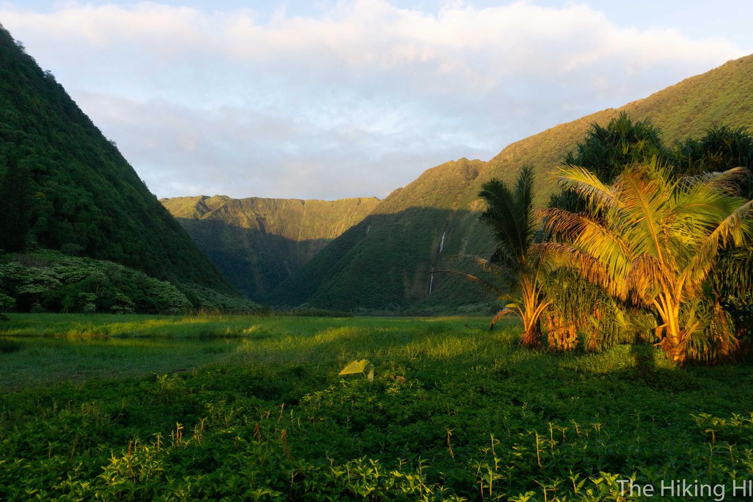
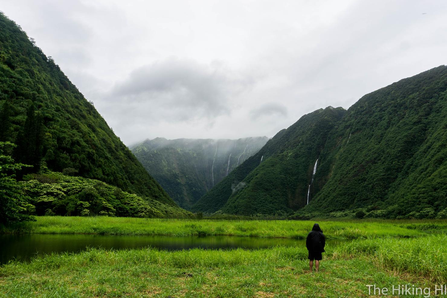
Throughout the night a sporadic rain storm woke me up several times. Despite some slight worry that our planned activities for the next day would be affected, the storm subsided. And instead, we woke up to this--an almost clear view of the valley and numerous waterfalls flowing from the valley walls.
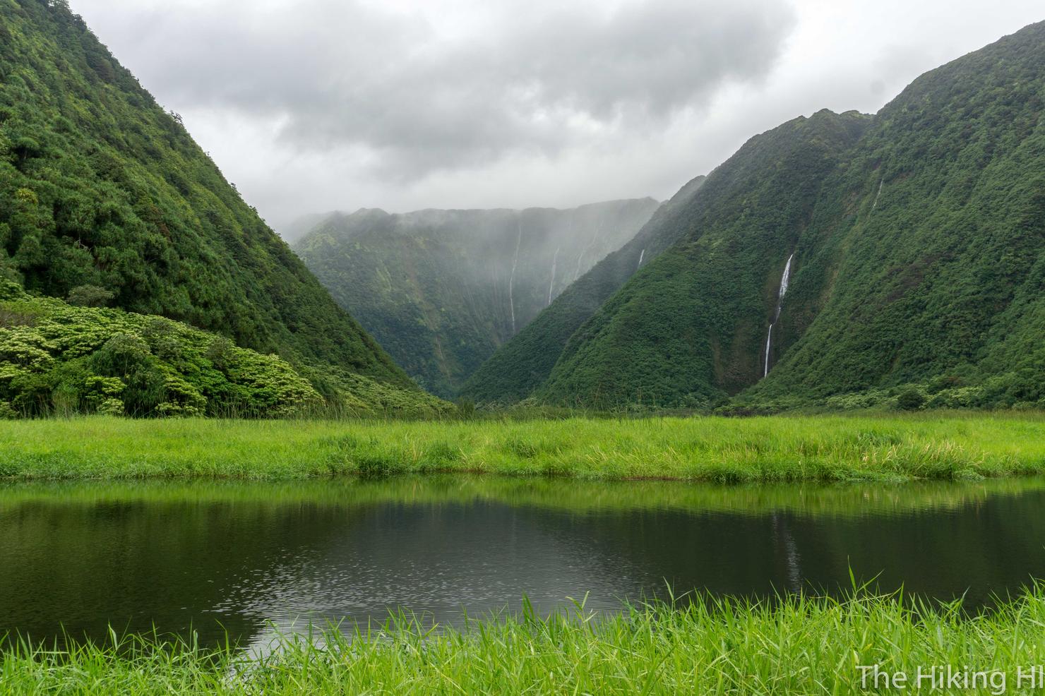
I was completely mesmerized. This was one of those beautiful images I'd seen of this place, but here I was experiencing it in real life. Even looking at this picture as I write this doesn't fully capture it. It was one of those things, you just have to experience in person.
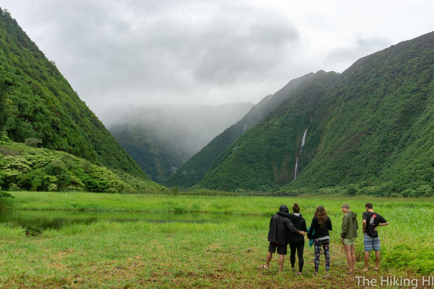
But I did think this shot of this random other group of people attempts captures the mood. You just can't look away. It's surreal. I spent nearly an hour drinking my coffee, snapping random pictures, and just staring. Of all the high points on this adventure (of which there were many), this was probably the most memorable.
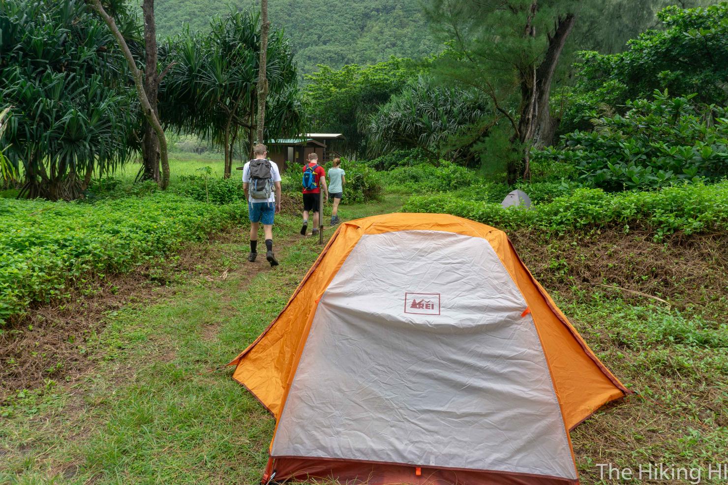
But eventually I did have to tear myself away. We had things to do, mainly hiking to Wai'ilikahi Falls, that large waterfall we'd been staring at from a far. The hike is roughly 3 miles round trip from the beginning of the campsites with 200 feet of elevation gain. It's not overly challenging, just some uneven footing and mud. To get there, you follow the trail through the campsites. This is a shot of part of our campsite and my newly acquired REI Half Dome 2. Mahalo to my sister for bringing it to the island to give to me. I'm starting to feel like a real backpacker!
The trail through the campsites is quite pleasant as you hear the ocean waves crashing on the beach. What you do realize walking through here, is that the campgrounds are pretty big. It takes a almost 10 minutes to walk from one side to the other. Usually this wouldn't be a big deal, but with those tired legs, every extra effort feels like a lot.
One you reach the end of the campsites, follow the trail past this sign.
From here, you will begin to see a series of ribbons. This is the path to the falls. The trail is very well marked, so you shouldn't have too much trouble. We did end up veering off the path once or twice, but that's the norm for most of my adventures.
A side note on this area, a few minutes after leaving the campsite and starting this trail, you will see a pseudo-stream off to your right. If you follow it uphill to its source, you will find a nice flowing mini waterfall with a couple PVC pipes on the ground. We got some info from other campers and they said this place could be used as a watering hole, without having to filter the water. While I'm still new to what is or isn't safe, Chris convinced the group that the water should be fine and we drank it for the remainder of our adventure. I will say that Carly got sick a few days later, but Chris, Drew, and I were all fine. So I guess whether that water is safe remains a mystery...
Anyway, back to hiking. One of those incline sections. I can just feel the soreness Drew and Chris are experiencing in this picture.
But don't worry, we are almost there! We got our first glimpse of the waterfall through the trees.
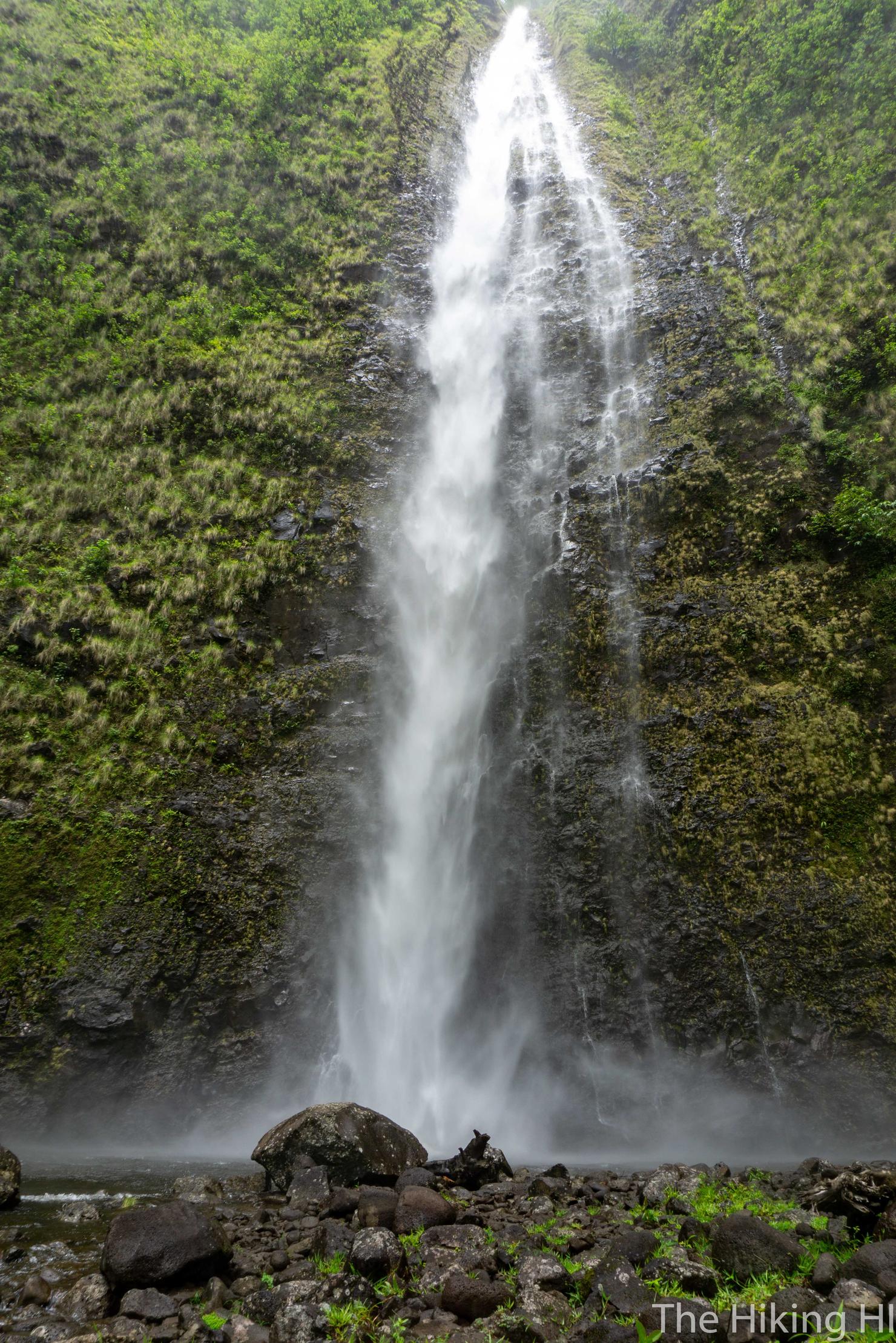
And there it is. It may be hard to tell from this shot, but this thing was RAGING. By far the most powerful waterfall I've been to in Hawaii. I'm not sure if it was caused by the recent rain or if it is normally like this, but it was impressive. You feel the force of the water from way back.
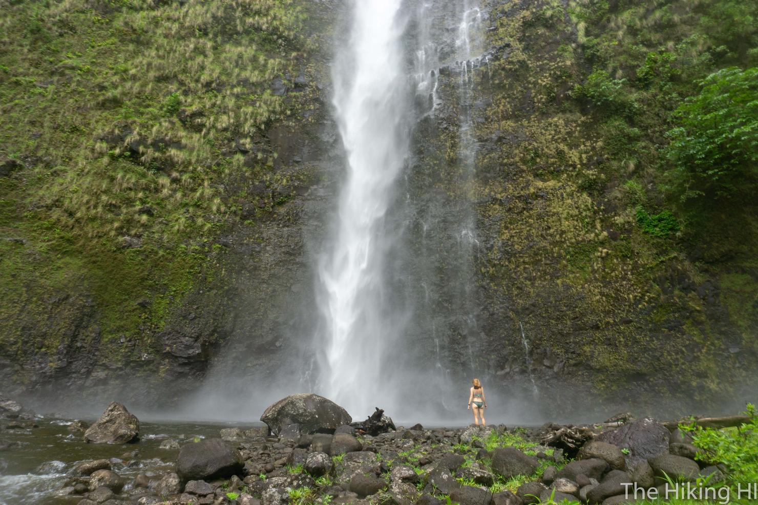
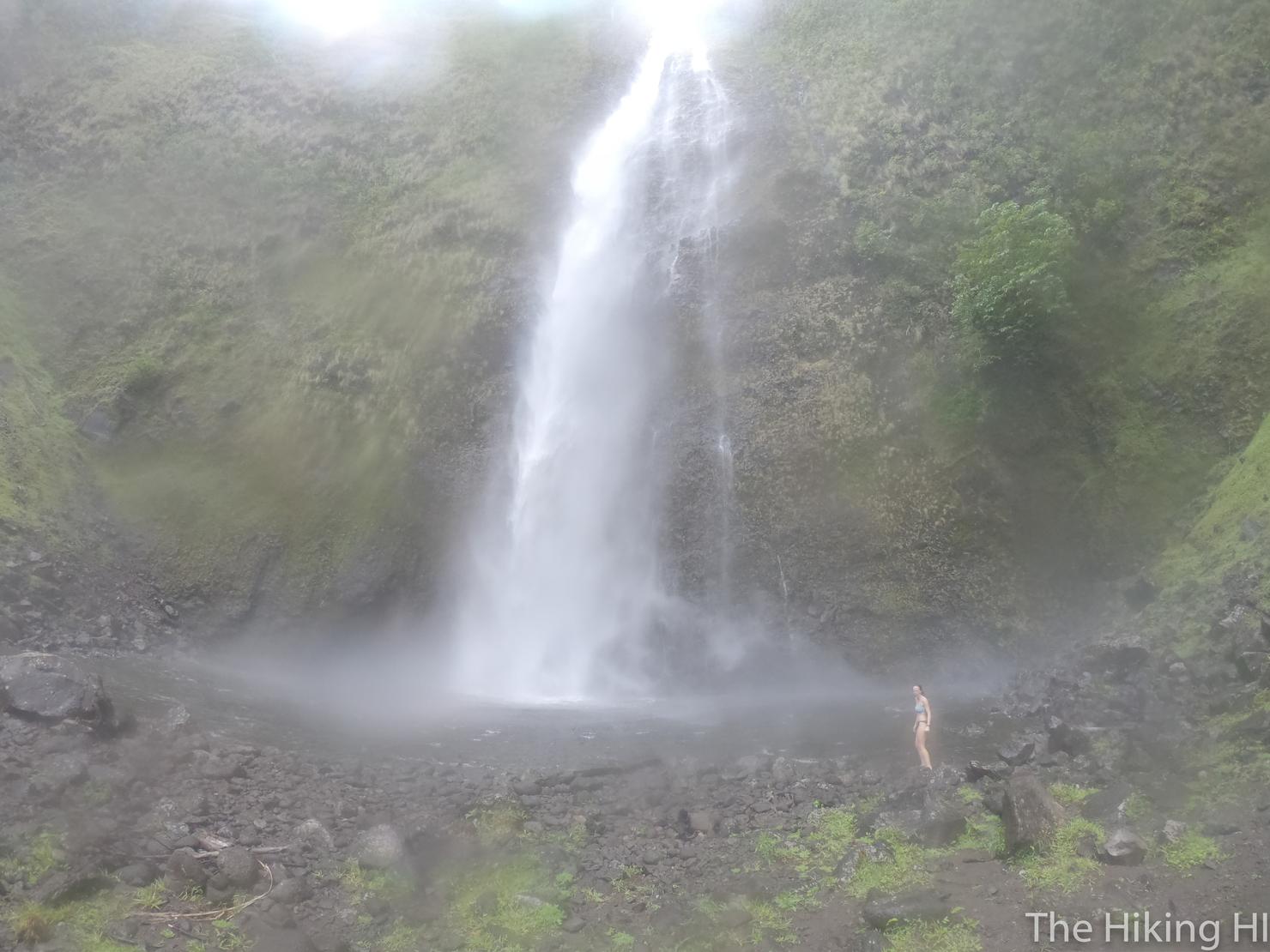
But that didn't stop us from going in for a closer look anyway. This is only about half of the visible part of the waterfall, but it gives some perspective of it's size.
And this is what most of my pics looked like. The constant spray would wet my lens in seconds.
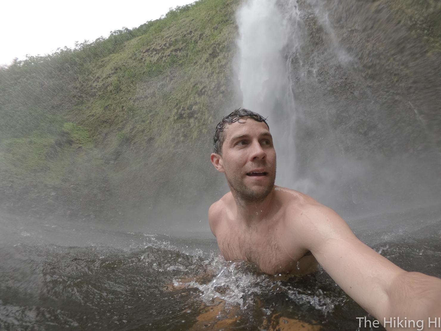
But I was able to squeeze off one quick selfie, before the spray and force of the falls pushed me away. After a bit of time, the group decided we had enough of the falls. It wasn't quite the relaxing experience we had been hoping for, although still very cool. Chris, Carly, and Drew began their trek back. I decided to continue deeper in the valley. From what I had read, there were three other waterfalls you could experience if you continued along the valley wall.
I quickly realized I wasn't prepared for this trek--mainly mentally. The trail was not really marked, so it was full of bushwacking and getting turned around. I did manage to make it to the second waterfall, Kaka’auki Falls, after about an hour of hiking. While pleasant, it was very small compared to Wai'ilikahi. Here I made the call that I just didn't have it in me to see all four. I decided to make my way back to camp.
Instead, I decided I would experience the falls with a little bit of technology-- the old drone.
And what a place it was to fly!
This shot helps see all the different waterfalls. First on the right is Wai'ilikahi. The second, which you can barely see the top of, is Kaka’auki. Supposedly, there are two other named falls, Lahomene and Waihulu, but you can't see them in this picture.
Hey, we were here earlier!
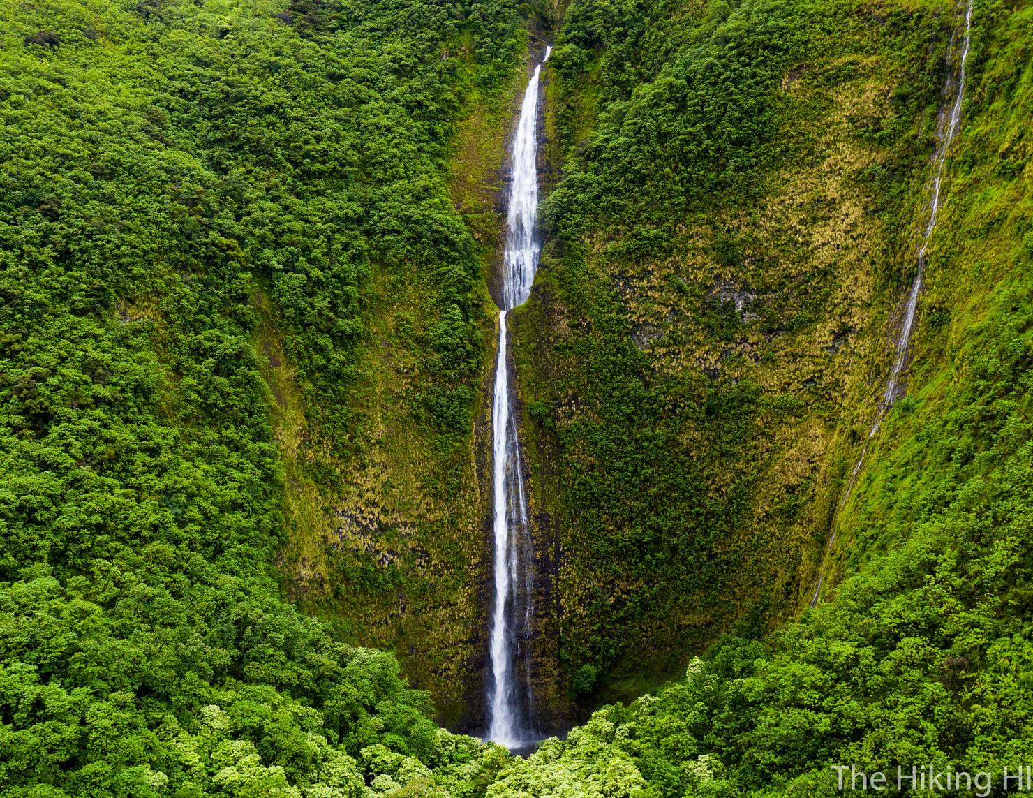
Looks just as impressive from the sky.
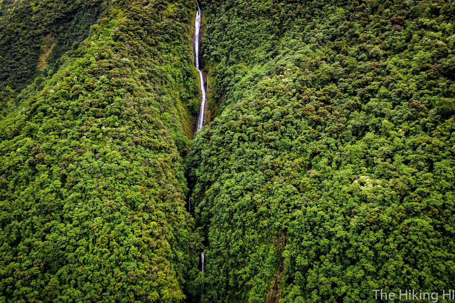
Now we're flying over Kaka’auki. I would never have known from the ground the tiered nature of that waterfall. It made me appreciate the trek to it just a bit more.
The money shot. Looking down into the back wall of Waimanu. With my drone yelling at me saying it barely had enough battery to get back, I could only look down for a few seconds before retreating out of the valley. Probably the riskiest flight I've done to date, but man was that worth it.
Just one more shot hovering off the beach. What a place.
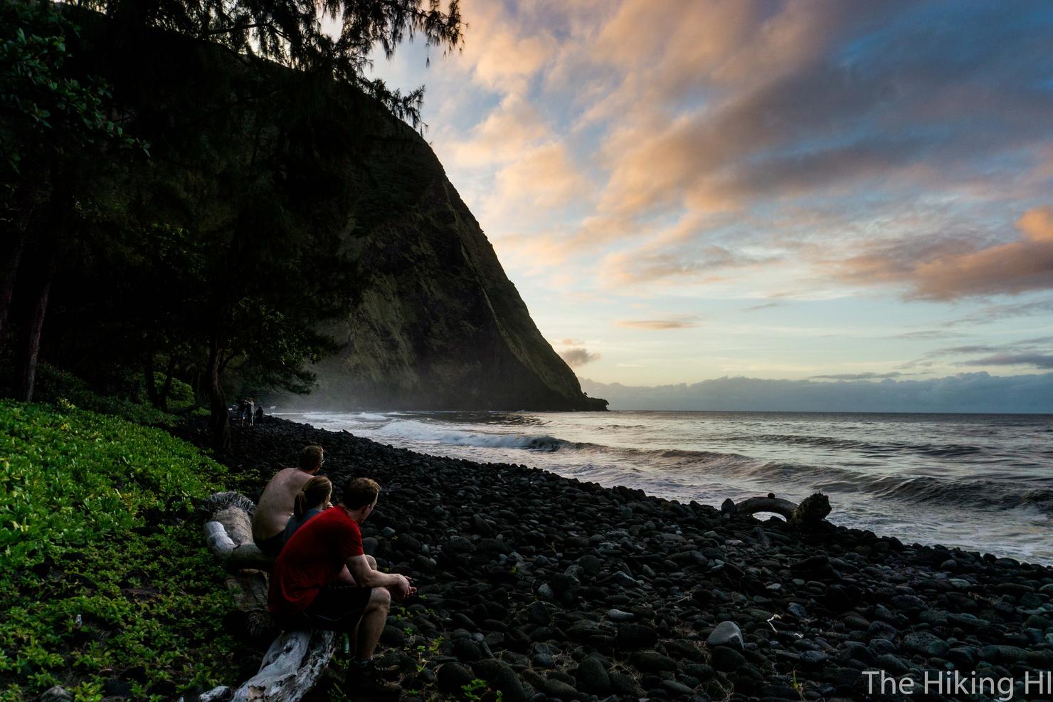
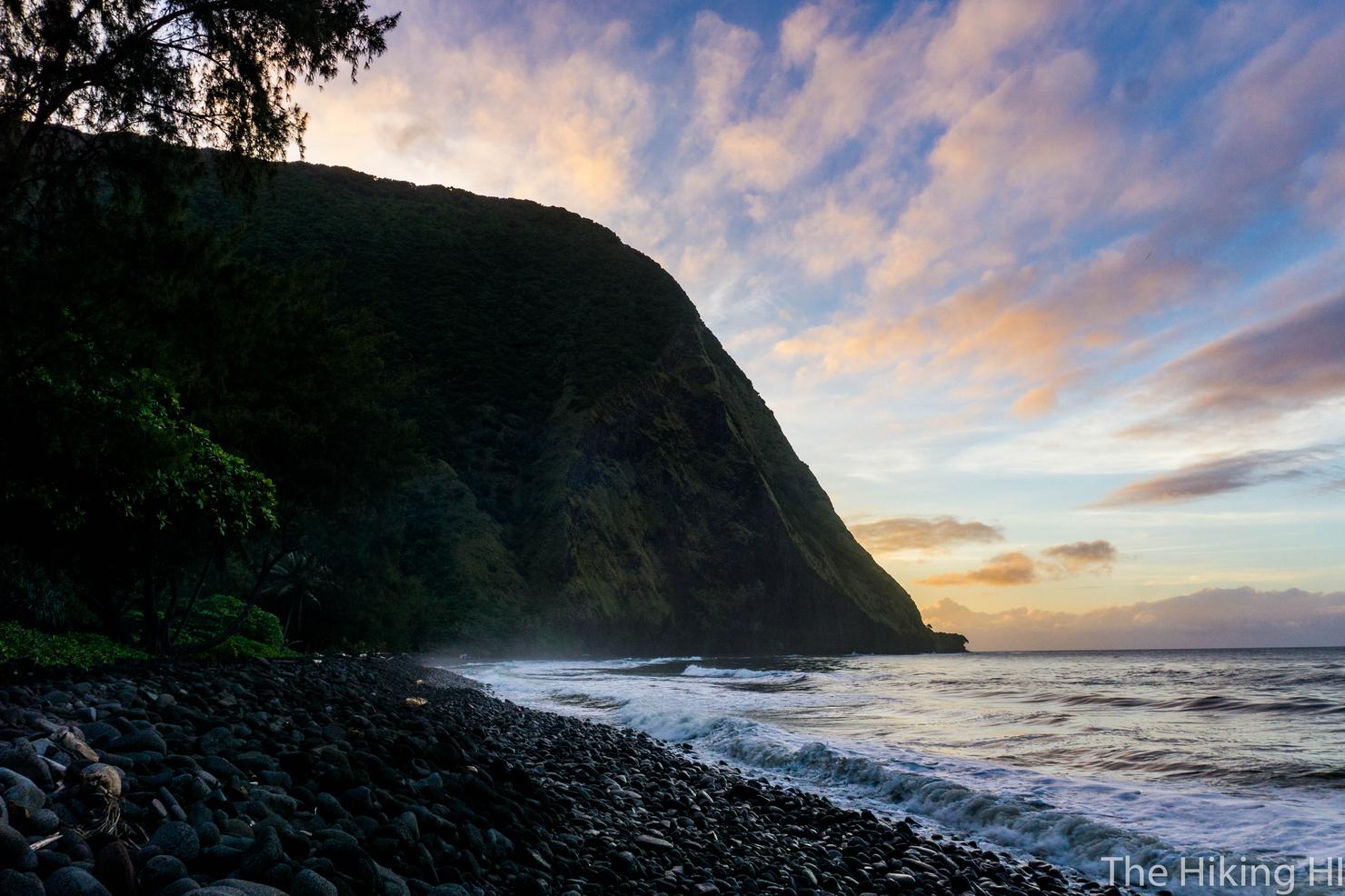
After landing my drone, I joined the rest of the crew who were hanging out by the ocean, watching the sun go down. Not much was said. We were just soaking it all in, watching the colors change and listening to the waves rushing over the rocky beach. This was our second and final night in Waimanu. Tomorrow, the long journey back, and the transition back to reality awaited us.
Day 3: Back to Waipi'o Valley
We woke up before daybreak to pack up before our trek out. With an evening flight back to Oahu, we wanted to make sure we had enough time to get out of the valley and just maybe stop at Big Island Brewhaus on the way to the airport (yea we clearly like beer). But I packed up with enough time to enjoy the sun peaking through the clouds as it broke over the horizon.
And of course a little bit more time to experience that valley lookout one more time.
It took us almost 7 hours to make it back to Waipi'o Lookout (don't worry, we had enough time for beer). While our bodies were aching, our minds were refreshed. The magic of Waimanu is real. The surreal beauty and the effort it takes to experience it, made this an adventure for the books. But now all I can think is, what's next?