Difficulty: INTERMEDIATE-ADVANCED
Time: 5-7 HOURS
Distance: 9 MILES
Elevation Gain: 2000 FEET
Foot Traffic: LOW
Challenges: Somewhat Overgrown, Narrow Ridges, Potentially Muddy
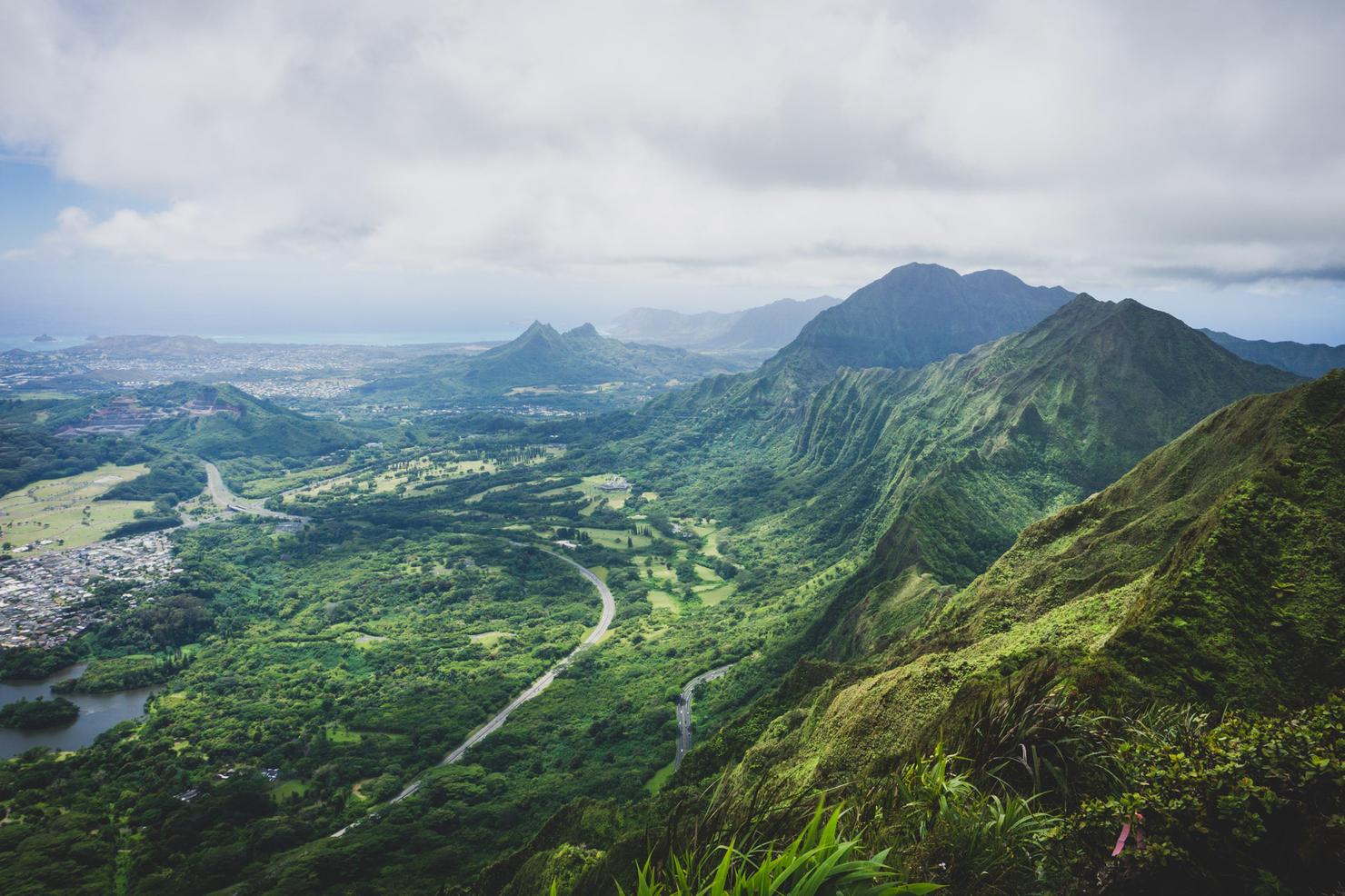
Sights: Windward Side, Waianae Range, Honolulu
What to Bring: Water (>2L), Snack, Sunscreen, Long Pants
A conveniently located hike near Honolulu, this ridge is a great option for those looking for a low traffic challenging hike, but still with epic views. The ridge can be travelled from two locations-- Moanalua Valley or the Tripler Medical Base. The long ascent to the KST is a tough one, but the open nature of this ridge will give you good views most of the way. One you reach the summit (and if the conditions allow), you will get gorgeous 360 views of both the Windward and Leeward sides of the island. And for those looking for a bit extra, you can even take this ridge to connect with the Haiku Stairs!
Summer time had gotten started with a bang with a fun island hopping trip with the fam. Several new hikes and adventures had concluded with an epic backpacking trip to Waimanu Valley. All that adventure had left me feeling a bit burned out. But several weeks later, after the grind of work had hit, I was already itching for another new adventure. So on a Sunday Morning I found myself driving to Tripler to tackle yet another new Ko'olau ridge.
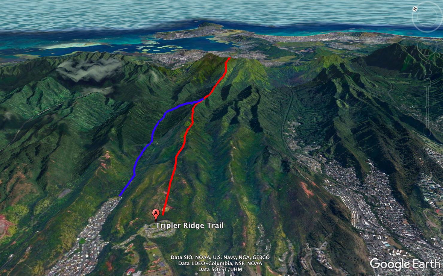
If you've hiked a KST finger ridge, you know the deal, a long gradual ascent to the summit. The catch about this ridge, is there's two ways to access it. You can start in a neighborhood behind Tripler Military Hospital (where red begins), which means you will need some method of getting on the installation. Or you can begin in Moanalua Valley (marked in blue) and connect to Tripler from a side trail.
Today, I would be taking the path from behind Tripler. By the numbers, this is probably a bit easier, since it starts about 500 feet higher in elevation than Moanalua Valley.
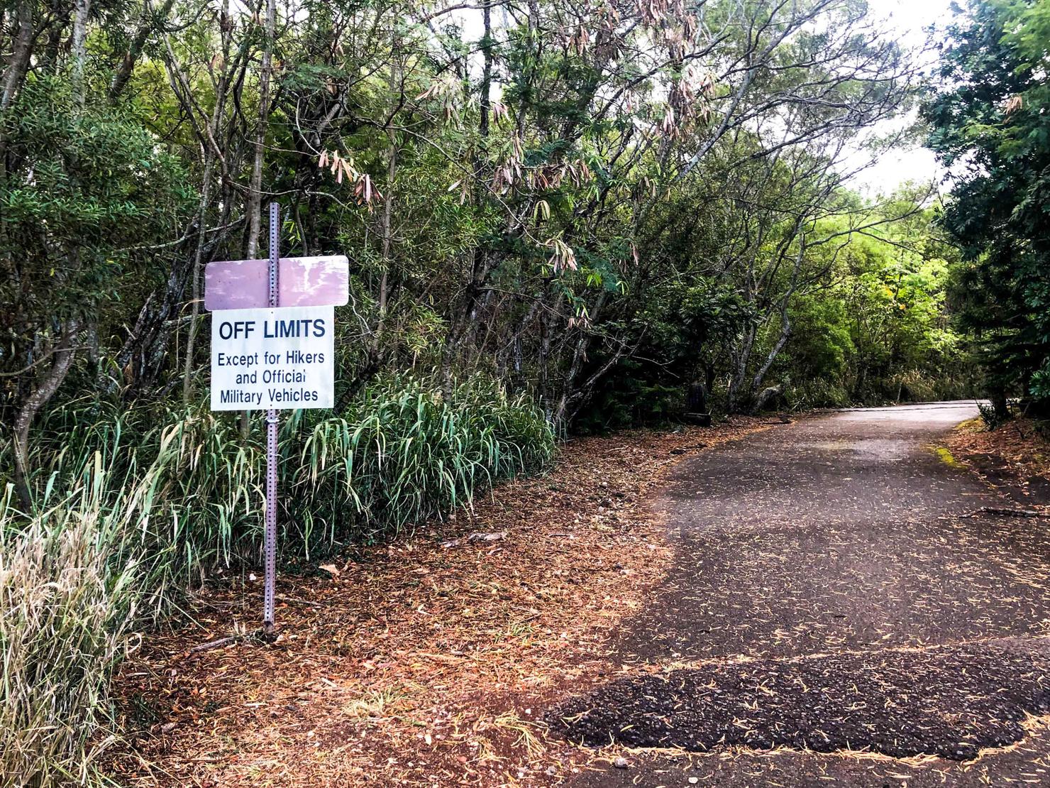
The hike starts on Reasoner Road. Off the side of the road you will see this sign, which marks the start of the hike. It seems as though there were plenty of street parking stalls by the trailhead, so parking shouldn't be much of an issue.
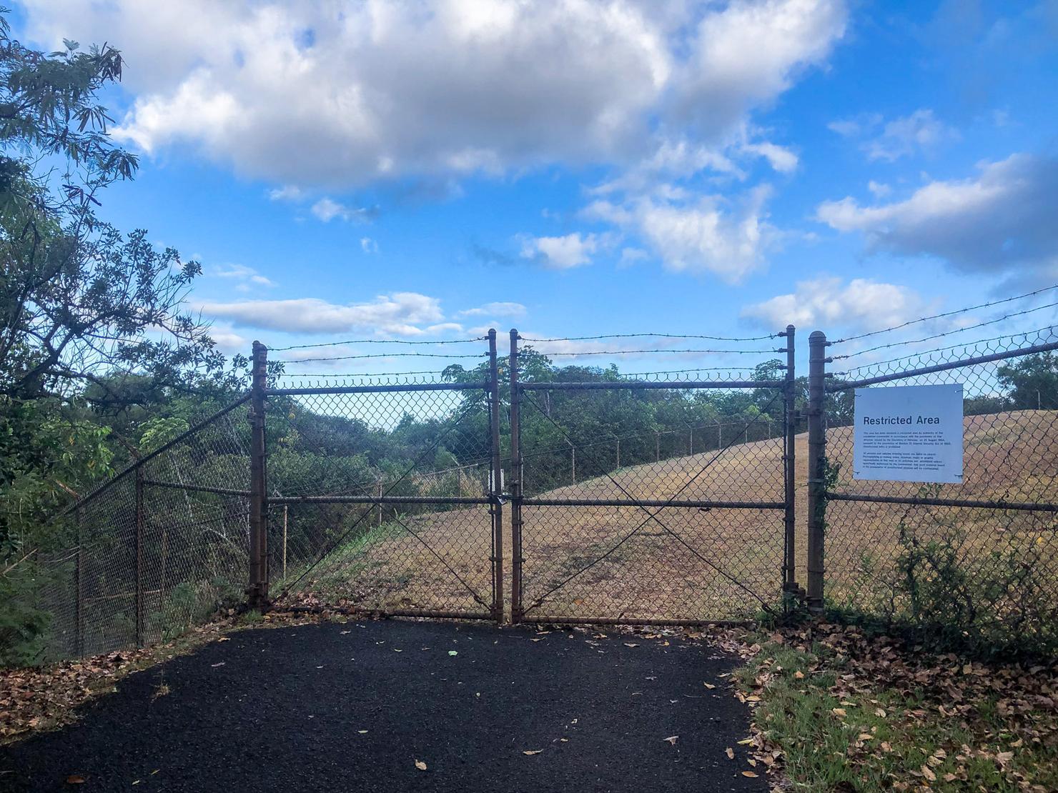
If you simply follow the road like I did, you will run into this restricted area fence. Oh no, where to go?
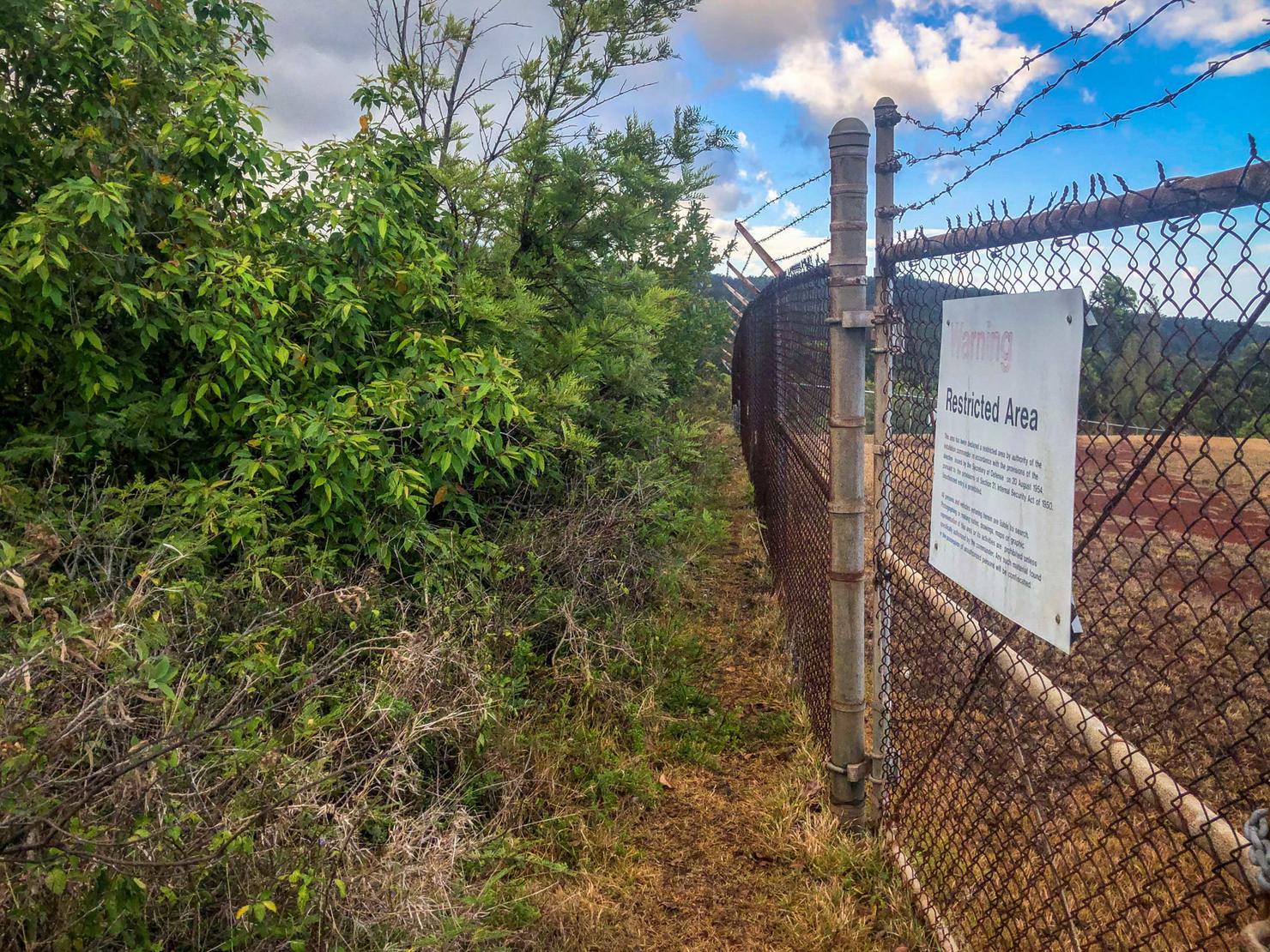
Don't worry, there's a path around the fence on the left.
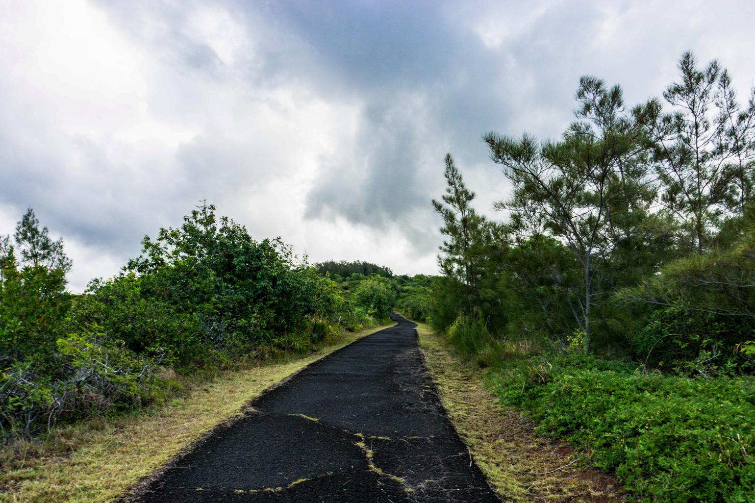
Which will then spit you out onto this road. I noticed on my way back that it did look as though there's a more direct path that would get you to this road, without having to contour the fence. But I must of missed it, probably as a result of skipping my usual morning coffee (Pro Tip: Most Hawaii hikes don't have bathrooms, so pregaming with Coffee can have unpleasant consequences...). Pretty negligible to the hike, but I thought it worth pointing out.
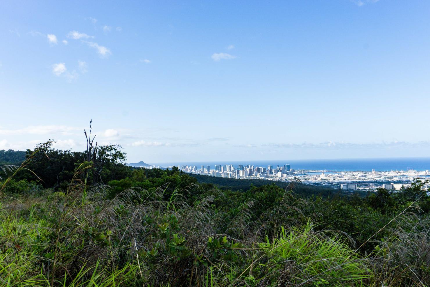
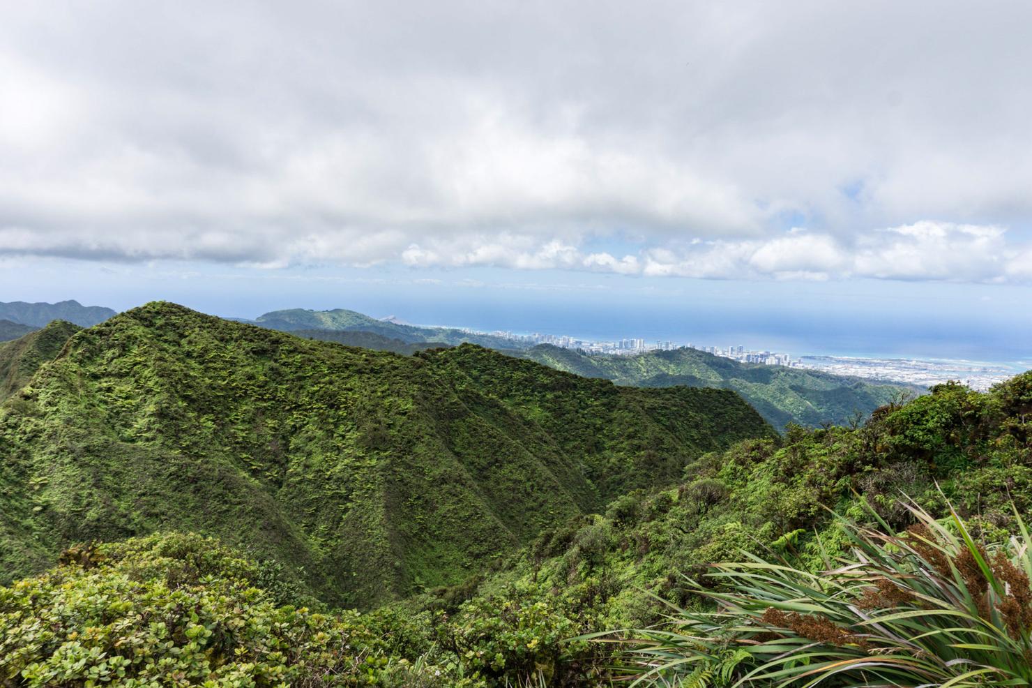
And away we go! Some solid views right off the bat. To the right we can see Diamond Head and good old Honolulu (AKA "Town") peaking over the adjacent ridge.
And to the left, the Waianae Range, the other mountain range on Oahu's West Side.
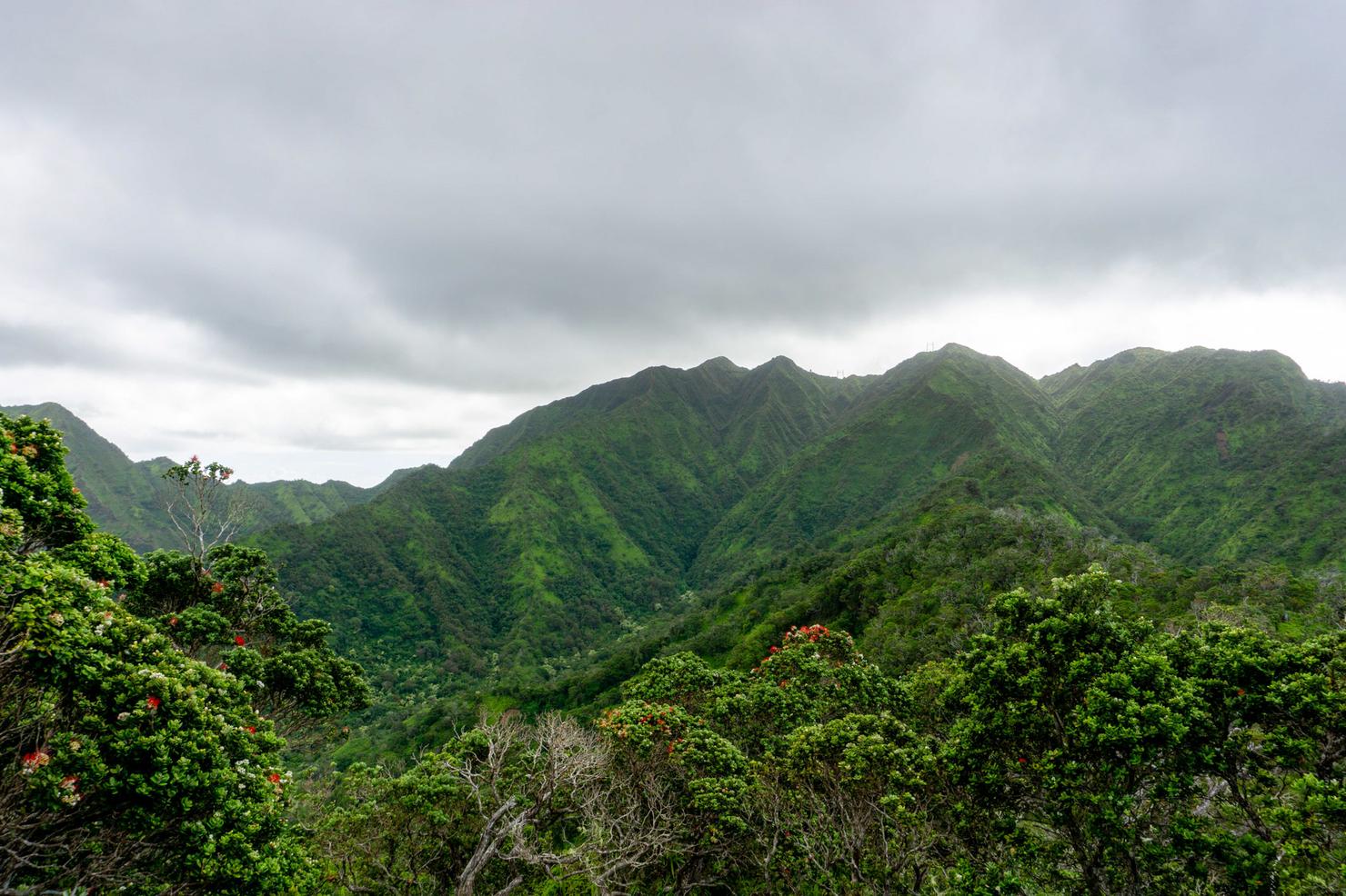
Looks a bit different than the greener Ko'olau Range, which is what we are currently hiking. That greenness comes from all the rain this part of the island sees. But that greenness generally comes with it's other companion, mud. Lucky for me, Oahu's been pretty dry as of late, so I had a nice clean(ish) trek to the summit.
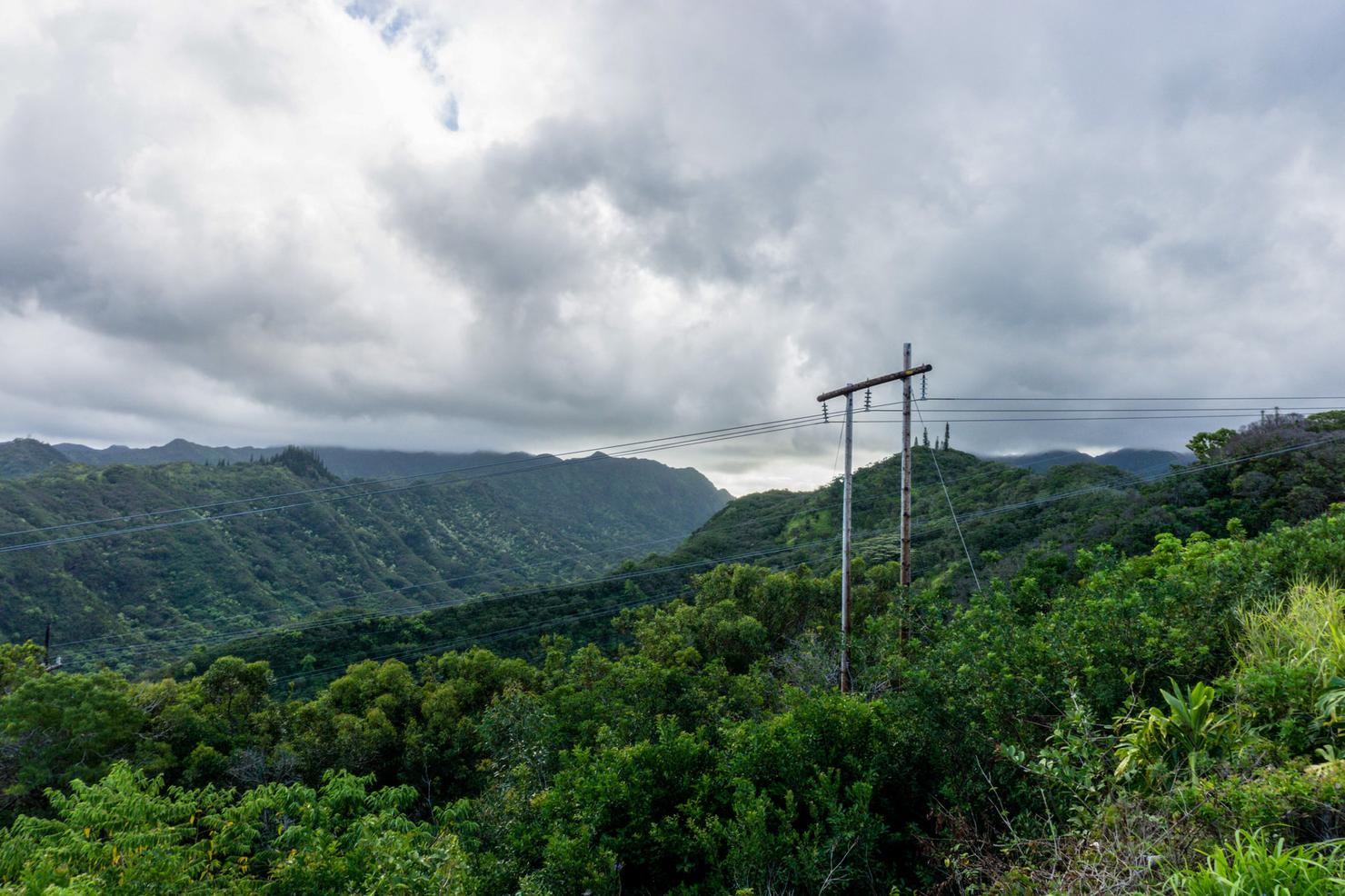
Our first "obstacle" of the hike-- navigating under these electrical poles. Don't worry there's plenty of space to pass (this isn't a Tough Mudder), but something about hearing the buzz of electricity always makes me uncomfortable. Is the fear of getting electrocuted irrational? If so, I suppose I'm irrational...
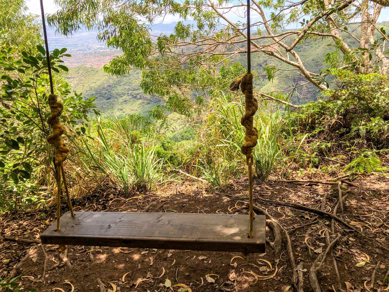
Early on in the hike you will run across this nice little swing. A great spot for a little break to take in the partial views.
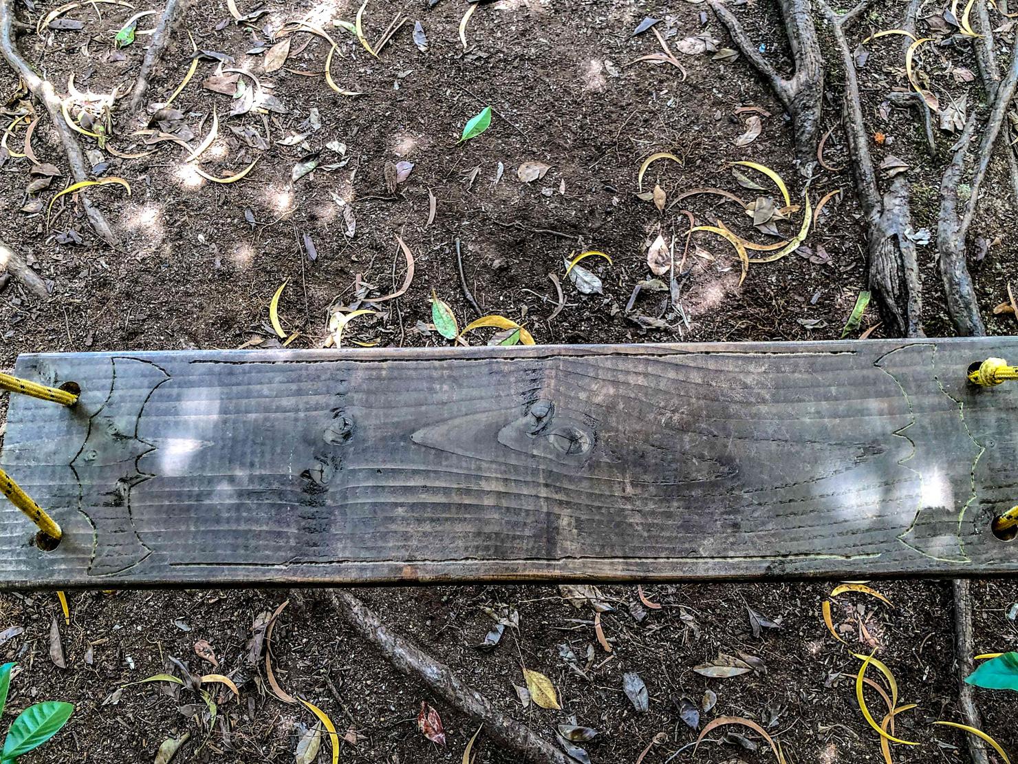
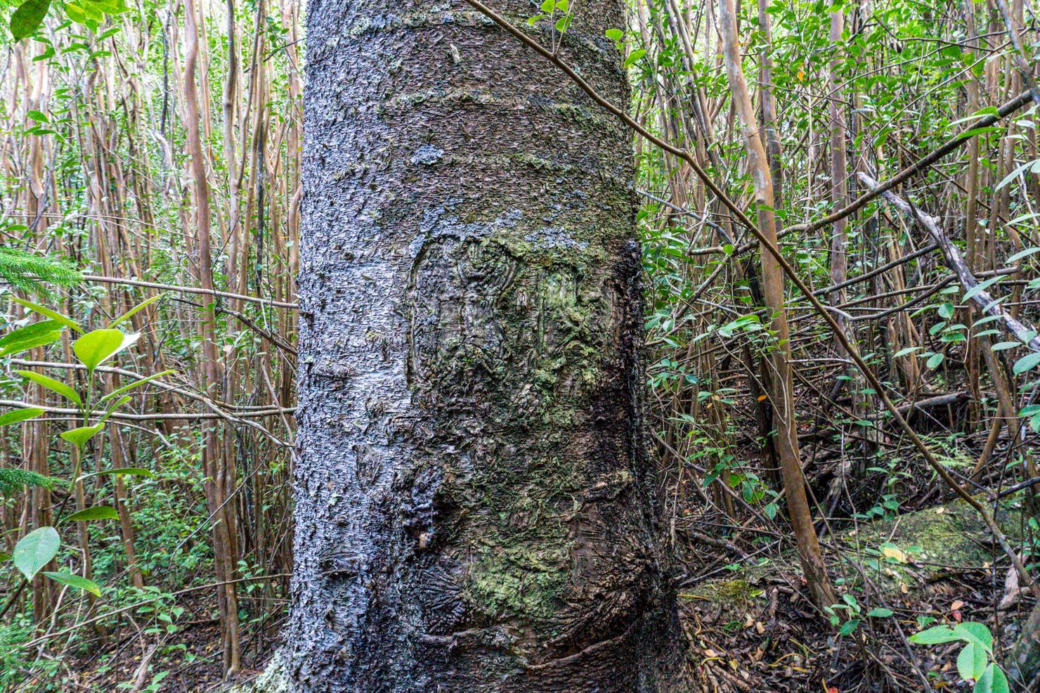
If you look closely, you will see a nicely carved bat symbol on the swing. I didn't realize Batman visited the island, but I suppose even superheroes need a vacation sometimes...
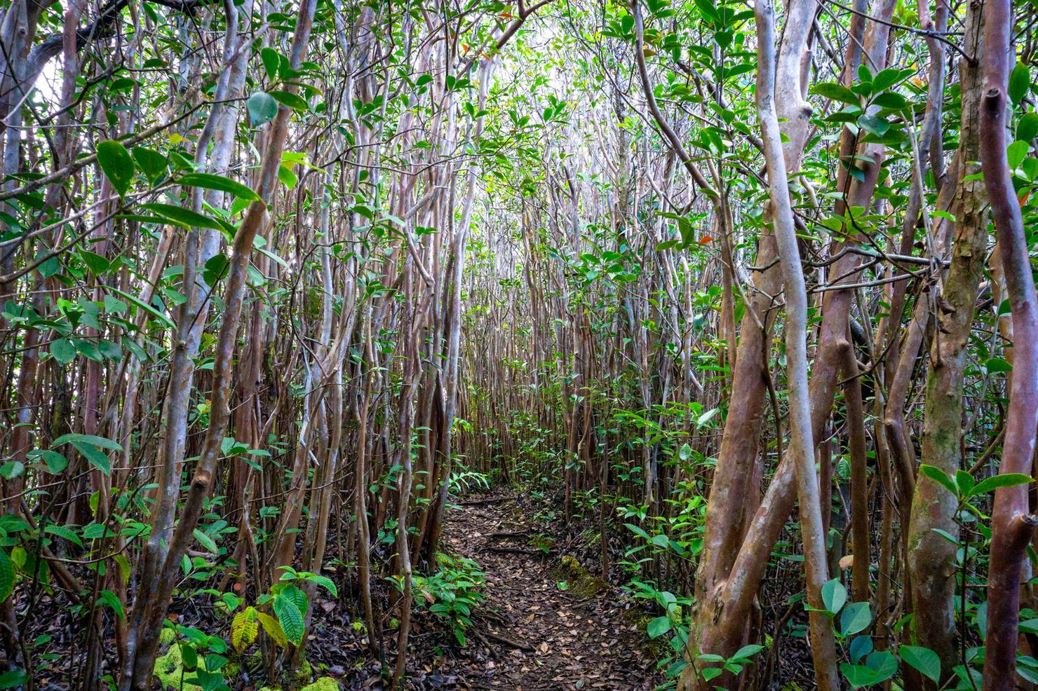
And back to the hike. Some of the foliage is quite pleasant to look at on this trail such as these trees with there long smooth trunks.
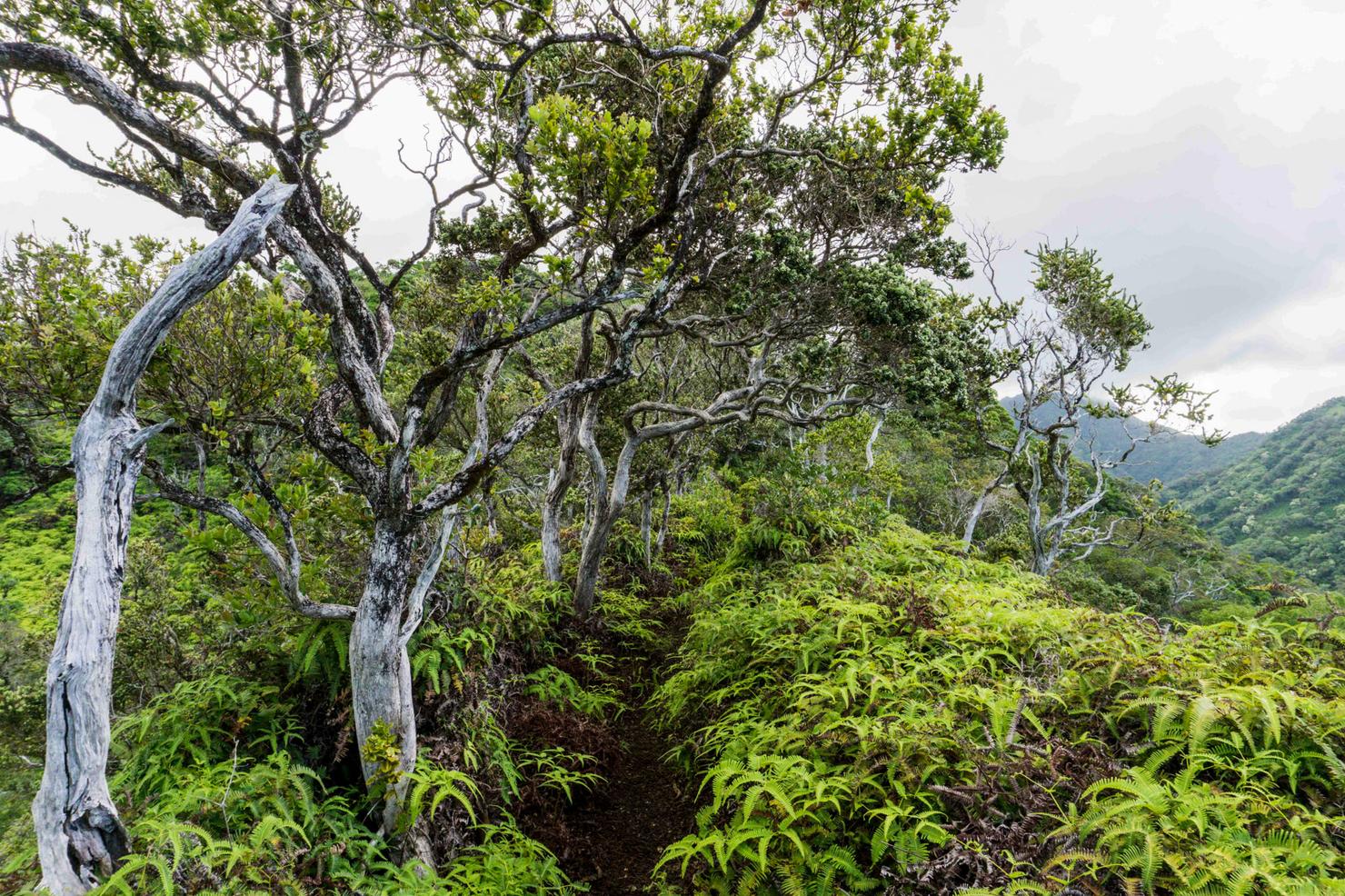
And then this massive pine tree which almost felt out of place on the ridge. It was the only one of its kind and rose high above the other trees. It kind of felt like it was the guardian tree, protecting its smaller relatives.
Then there was some not so great foliage, like these uluhe ferns. These things are all over Hawaii ridges and can really tear up your legs. They won't bother you much at first, but after several hours rubbing against them, you will be full of cuts. Overall, this ridge wasn't as bad as some, but I'd recommend pants.
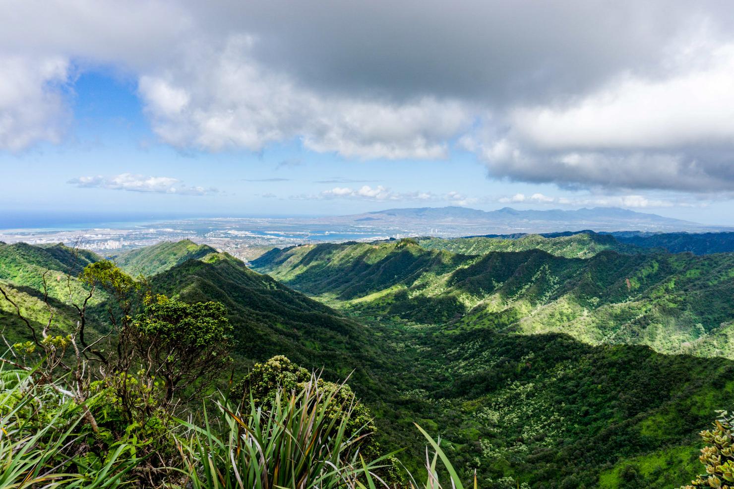
After about 45 minutes of hiking I found this nice open patch on the ridge that gave a preview of what's to come. Since you can actually see the peaks of the KST, that means there's a chance we will get some views. But with the Ko'olaus, you never know until you get there as the cloud cover can change quick. Just gotta keep hiking and hope for the best.
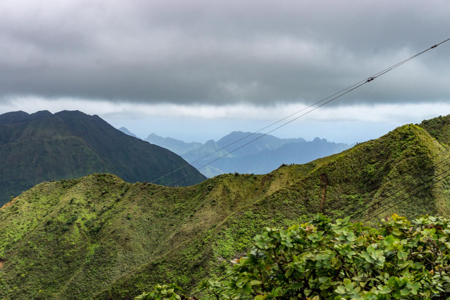
Getting closer! This picture shows the three adjacent ridges in this area that get you to a similar spot on the KST. On the right is Bowman Trail, another low traffic ridge. The middle is Tripler and the left is Moanalua Middle AKA "Backside to Stairway." Similar end game, but each with their own nuanced personality.
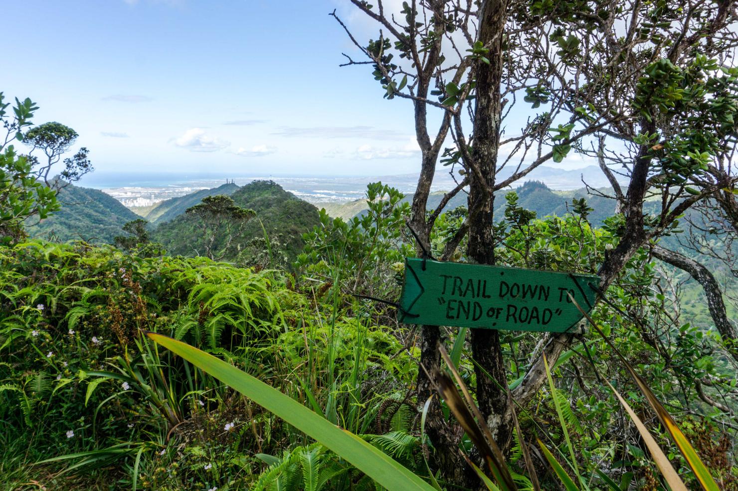
2 hours up the ridge, I stumbled upon this sign. The Trail Down to "End of Road." What does that mean? Although I have not done it, I would guess this is one of the ridges that funnels back down to Moanalua Valley. I'll have to do some more exploring to find out for sure.
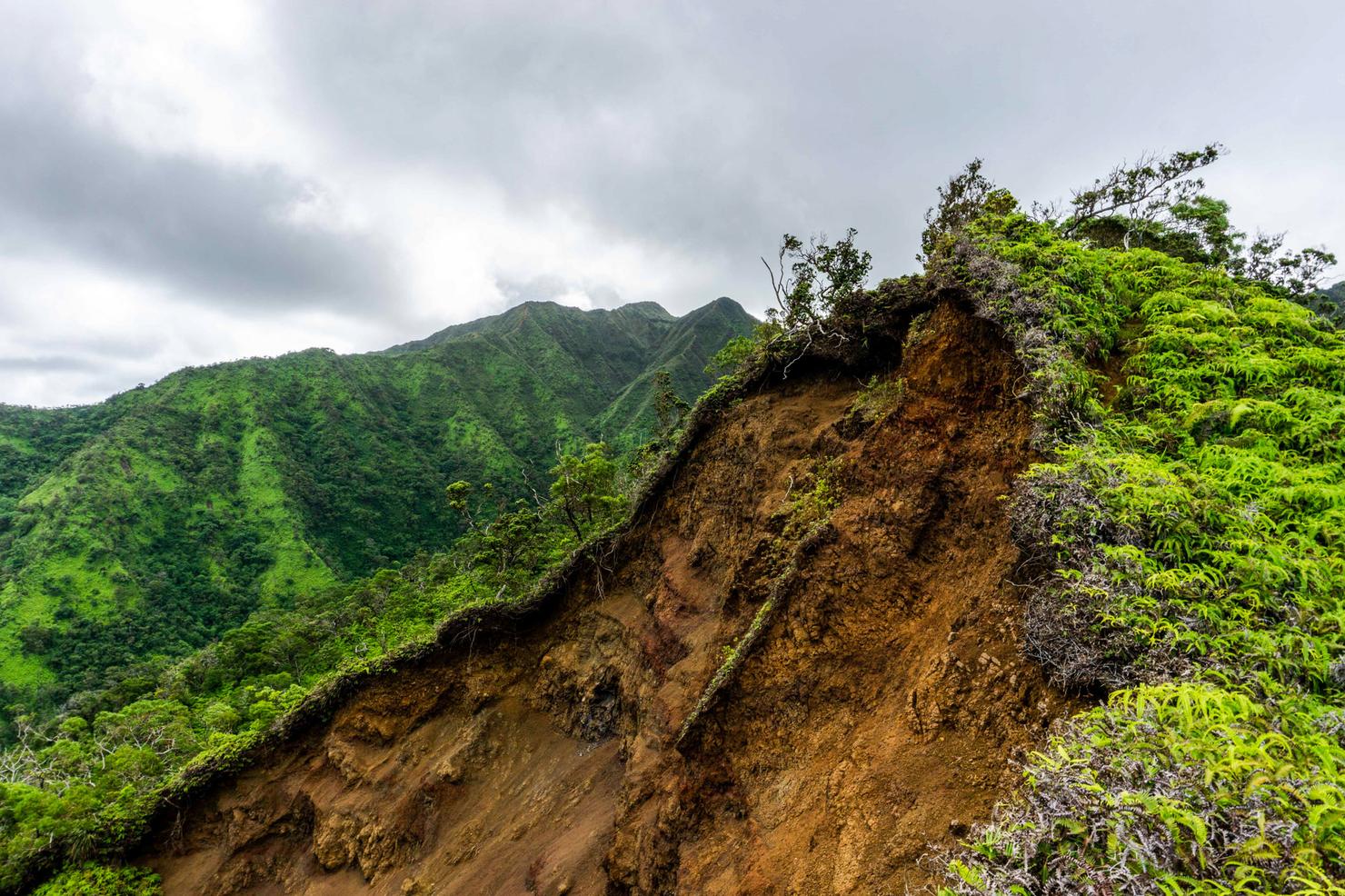
While this hike wasn't hair raising, it's still a KST ridge, which means there are still some obstacles. This eroded section of the ridge provides a reminder that mother nature is one powerful force.
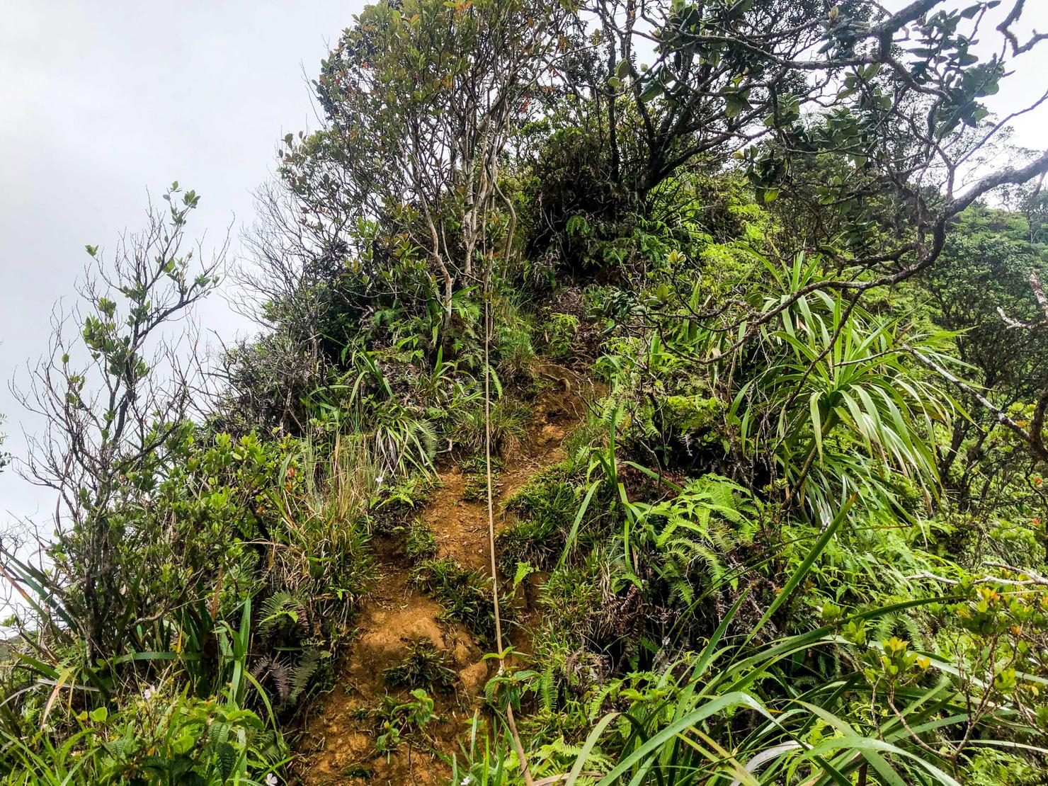
And there were a few steep scrambles along the way. Luckily there were some ropes laid out for assistance.
Up and up we go!
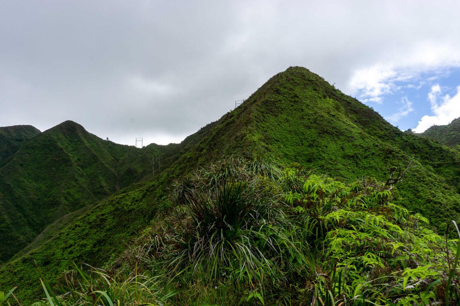
The final push... kind of. There's a few false peaks near the summit. So just be prepared for a couple disappointments.
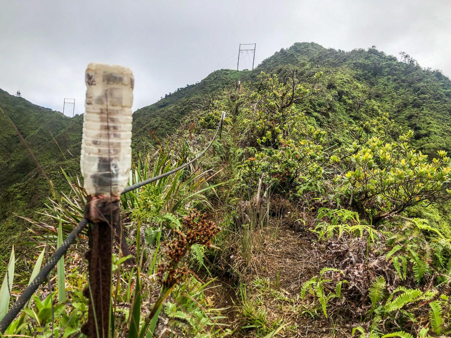
As I neared the summit I stumbled across this contraption. Basically a lot of metal stakes in the ground with rope tied between them, creating a "railing". I've never seen this in Hawaii, but I kind of liked the concept. Gives you a sense of comfort as you climb these skinny ridges. But still not sure I'd be relying on them too heavily...
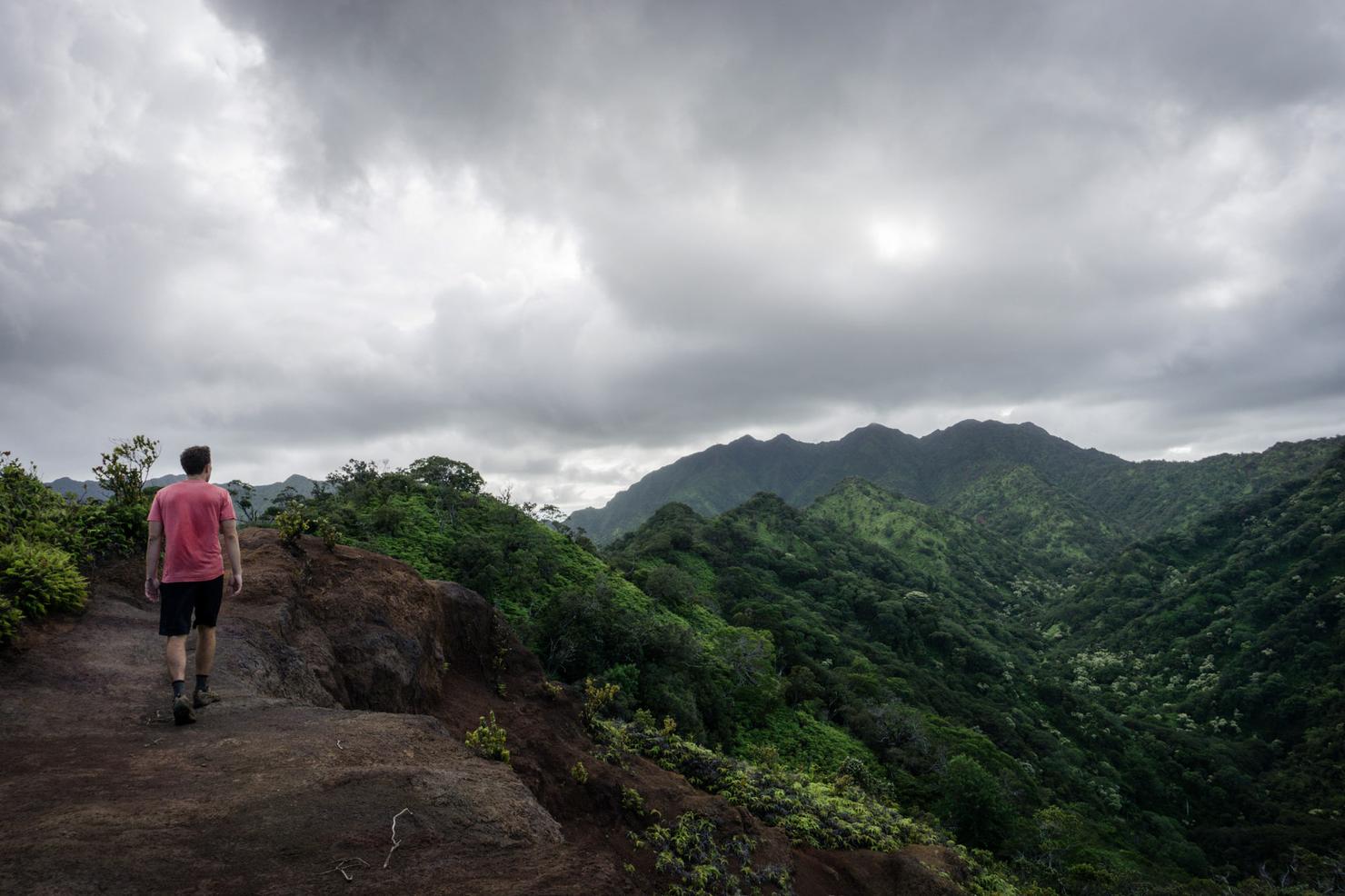
And we made it! About 2 hours 45 mins later, we've reached the summit of Tripler Ridge. The clouds were even nice to us as they didn't block all the good Windward views.
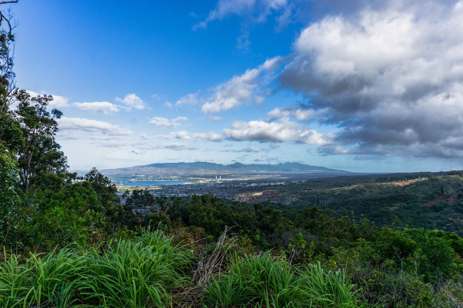
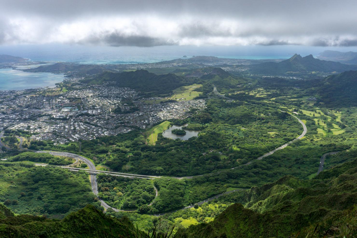
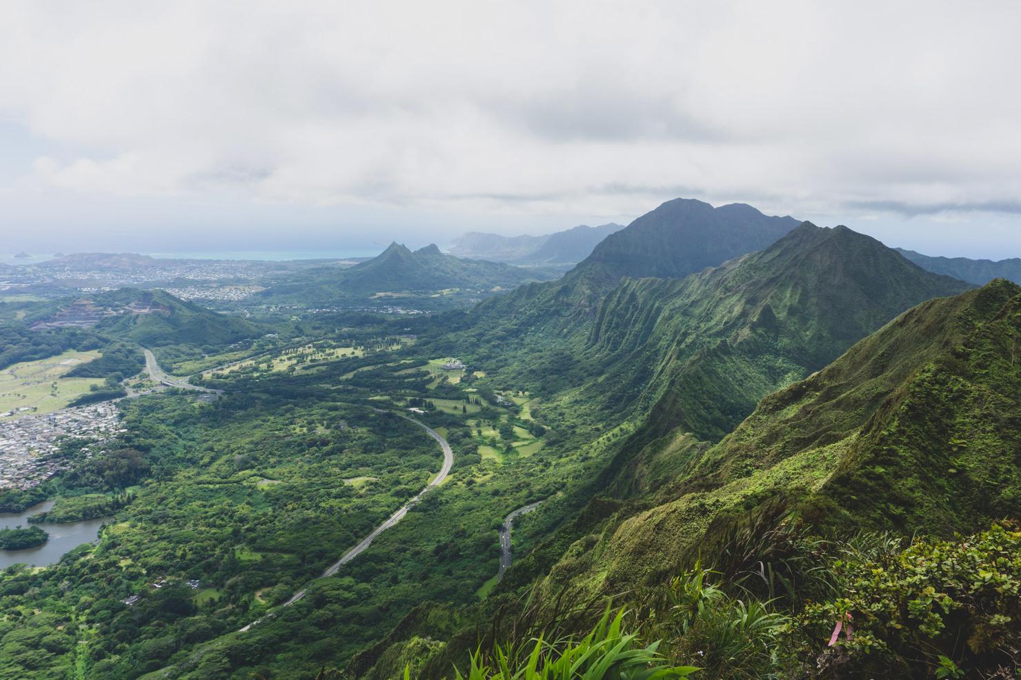
360 degrees of beautiful Hawaii views. Looking south we get some different views of Honolulu.
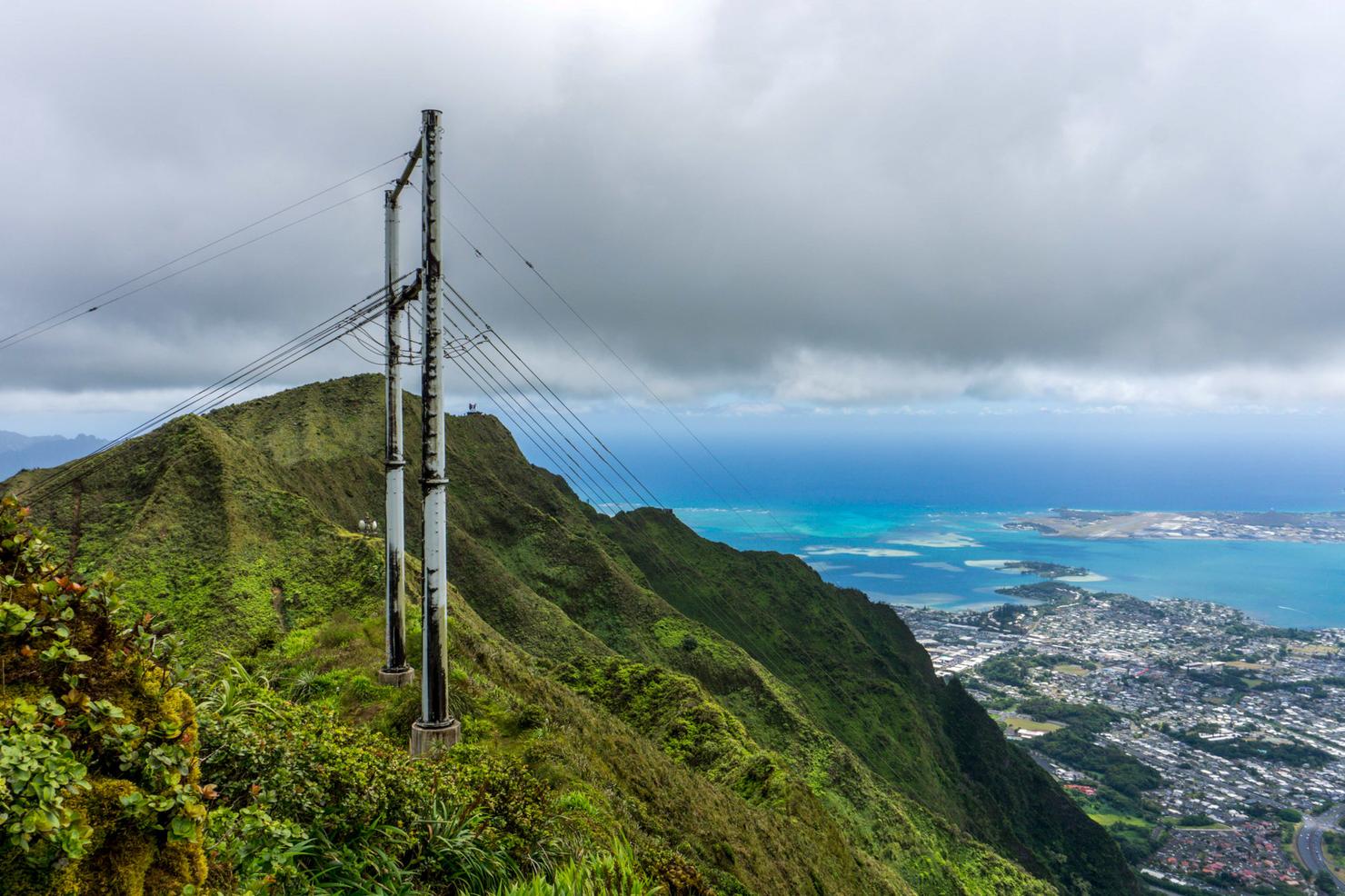
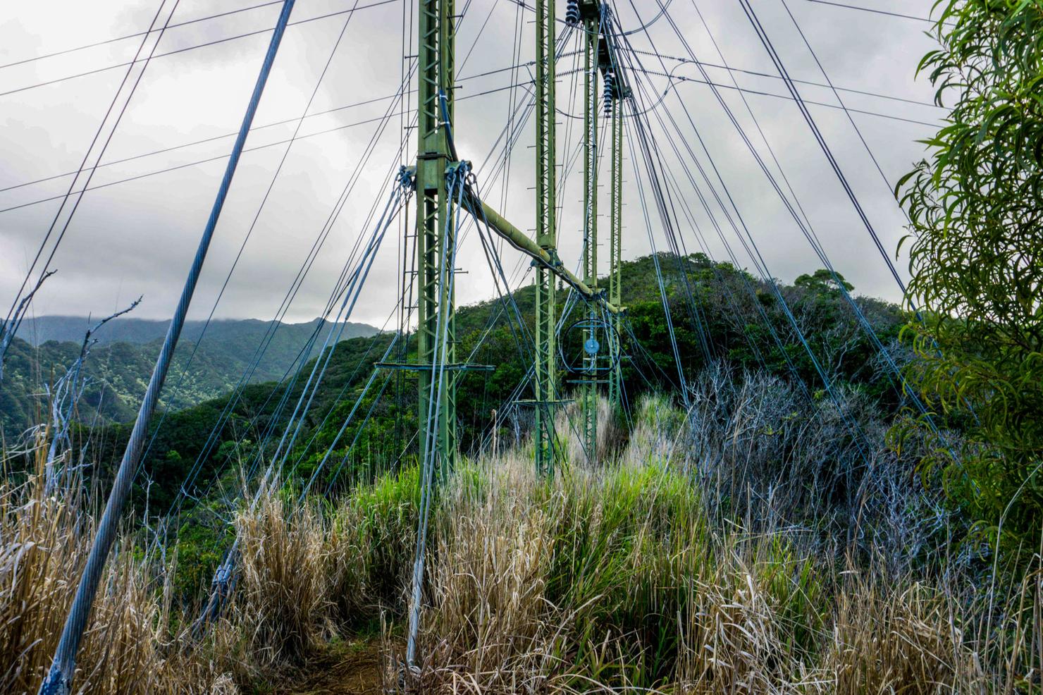
And North we see a couple of structures along the ridge. These are actually transmitter stations that were used by the U.S. Navy to send signals to ships throughout the Pacific. That far structure just underneath the wires on the right side marks the top of the Haiku Stairs. Remember Moanalua Middle Ridge?
Well there she is right there. It's hard to see in this photo, but that ridge is FULL of people. Probably at least 20 in this picture, which is a lot for a difficult hike like Moanalua Middle. But it's not surprising as it's the easiest "legal" way to reach the stairs and nowadays and it's no secret how to do it. It would be very possible to connect Tripler to the stairs, but it's on the lengthier side. Not everyone wants to spend an entire day in the mountains.
And for me, a trek to the stairs just wasn't in the cards. I was very much enjoying being alone on this summit, staring down the breathtaking Ko'olaus. It took many generations for mother nature to form this spectacle, with all its shapes, dips, peaks, and curves. And every time I stand atop this range, I am equally humbled and in awe. And it's this feeling that will always keep me coming back.