Difficulty: INTERMEDIATE-ADVANCED
Time: 4-5 HOURS
Distance: 5 MILES
Elevation Gain: 2000 FEET
Foot Traffic: LOW
Challenges: Narrow Ridges, Mostly Shadeless, Steep Climbs
Sights: Honolulu, Windward Side, Koko Head
What to Bring: Water (>1.5L), Sunscreen, Snack
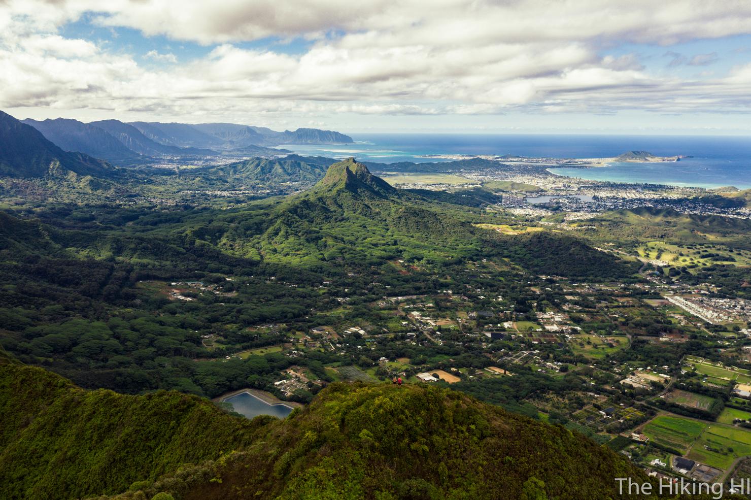
A alternative to the popular Kuli'ou'ou Ridge, this route offers all the same beauty, without all the crowds. Hike up Western Kuli'ou'ou Ridge on your way to the Ko'olau Summit Trail (KST), taking in the scenery of Koko Head and the surrounding Hawaii Kai Area. A few narrow ridges and climbs later, you will be standing on the peak of Pu'u O Kona, where you will be surrounded by all the views of the Windward Side of the island. Those looking for more adventure, can even connect this ridge to Kuli'ou'ou Ridge via the KST. There's really a lot to love about this hike.
With work ramping up and a half marathon training program underway, I've had some trouble finding my way into the mountains recently. More so, I've had trouble finding new quick fix hikes--those hikes that don't require a full day's effort and logistical challenges (such as my recent adventure to Stairway to Hell), but still get me on the trail. I decided I just needed to commit to going hiking and that the joy and discovery would follow. Having never done Pu'u O Kona in reverse, I figured, why not?
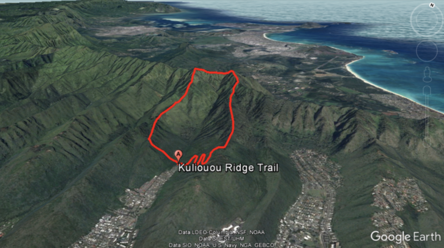
This hike can be an out and back or a loop. You start out going up to the left (West Kuli'ou'ou) until you reach the peak of Pu'u O Kona. You then have the option to connect via the KST to Kuli'ou'ou.
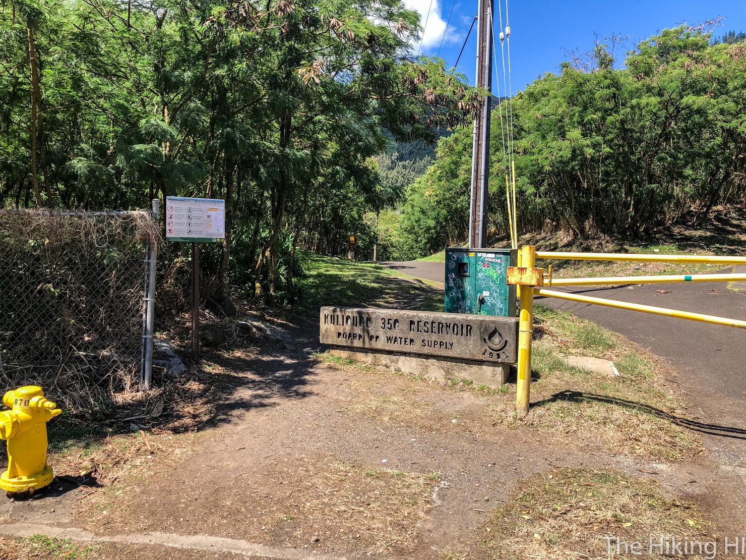
The hike begins in the same place as Kuli'ou'ou on Kalaau Road. With the exception of the cul-de-sac, you can park anywhere along this road. I will say it gets pretty crowded, so if you want to get close to the trailhead, I recommend getting here early.
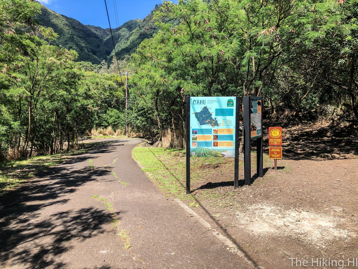
There is a split early on you should be aware of. That right fork will take you up to the official Kuli'ou'ou trail, but we are going to continue following this road until it ends. At the end of the road, you will run into a fenced in structure. Just to the right, you will see an opening in the trees. This is the path to the ridge.
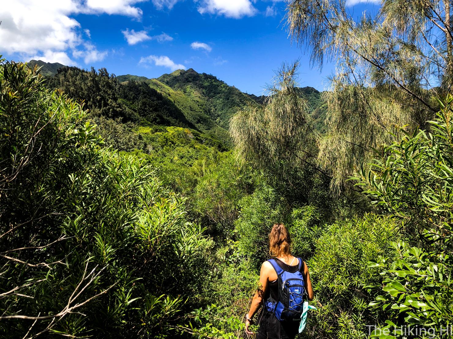
The ascent is a nice little kick in the butt to bring on the sweat, but it only takes about 20 minutes to reach the ridge. From here, head right along the ridge. It begins with some shade and the trees.
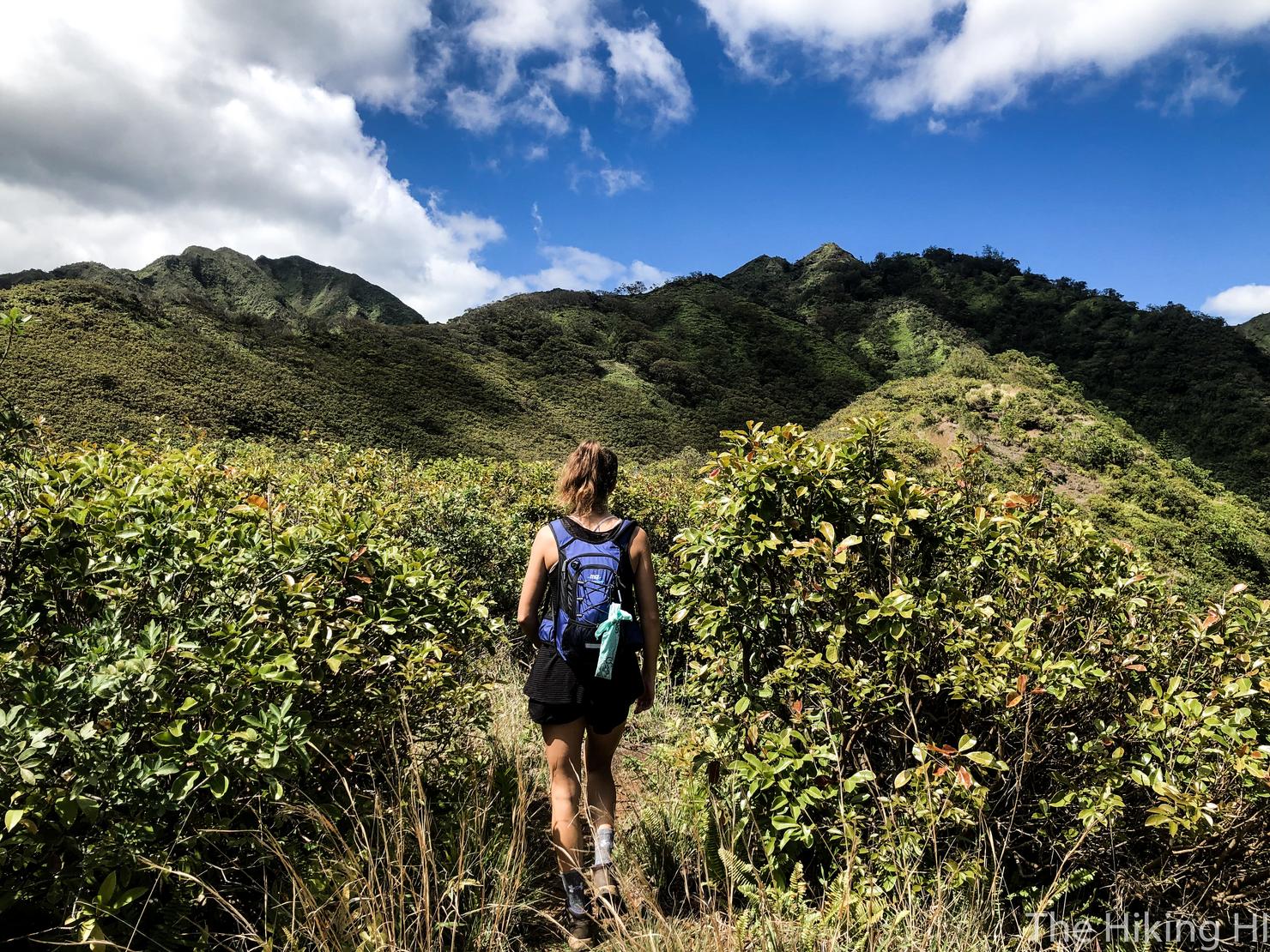
But soon the ridge will open up giving you that nice Hawaii sunlight.
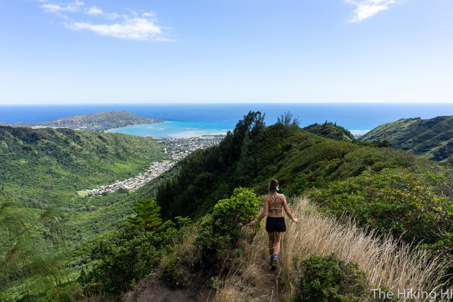
But that also means views! Which means time to play around on the ridge and take some photos!
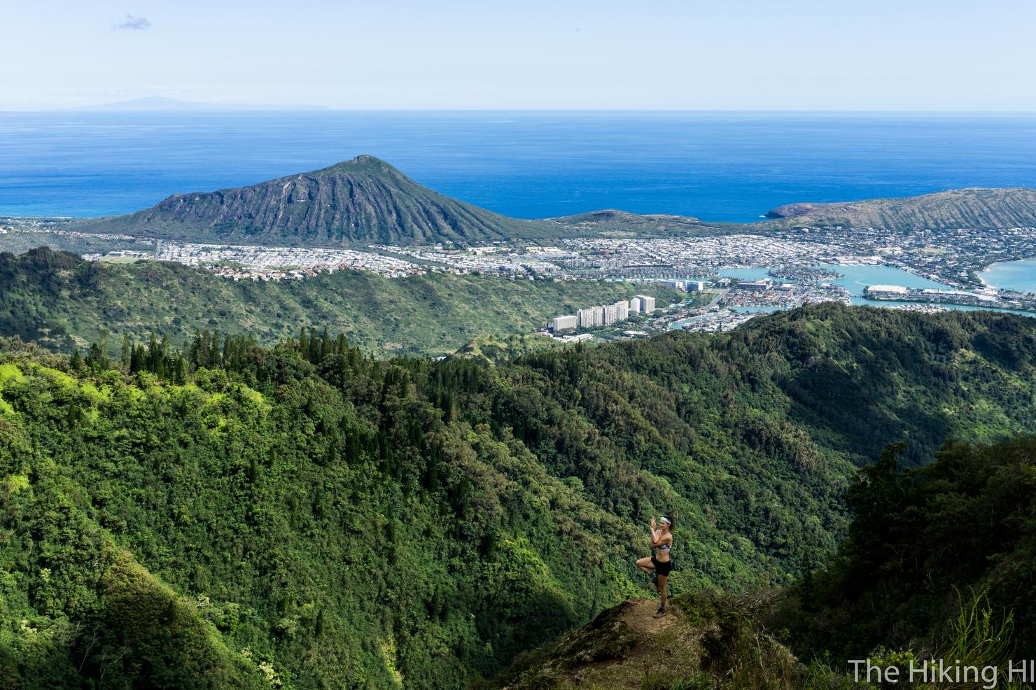
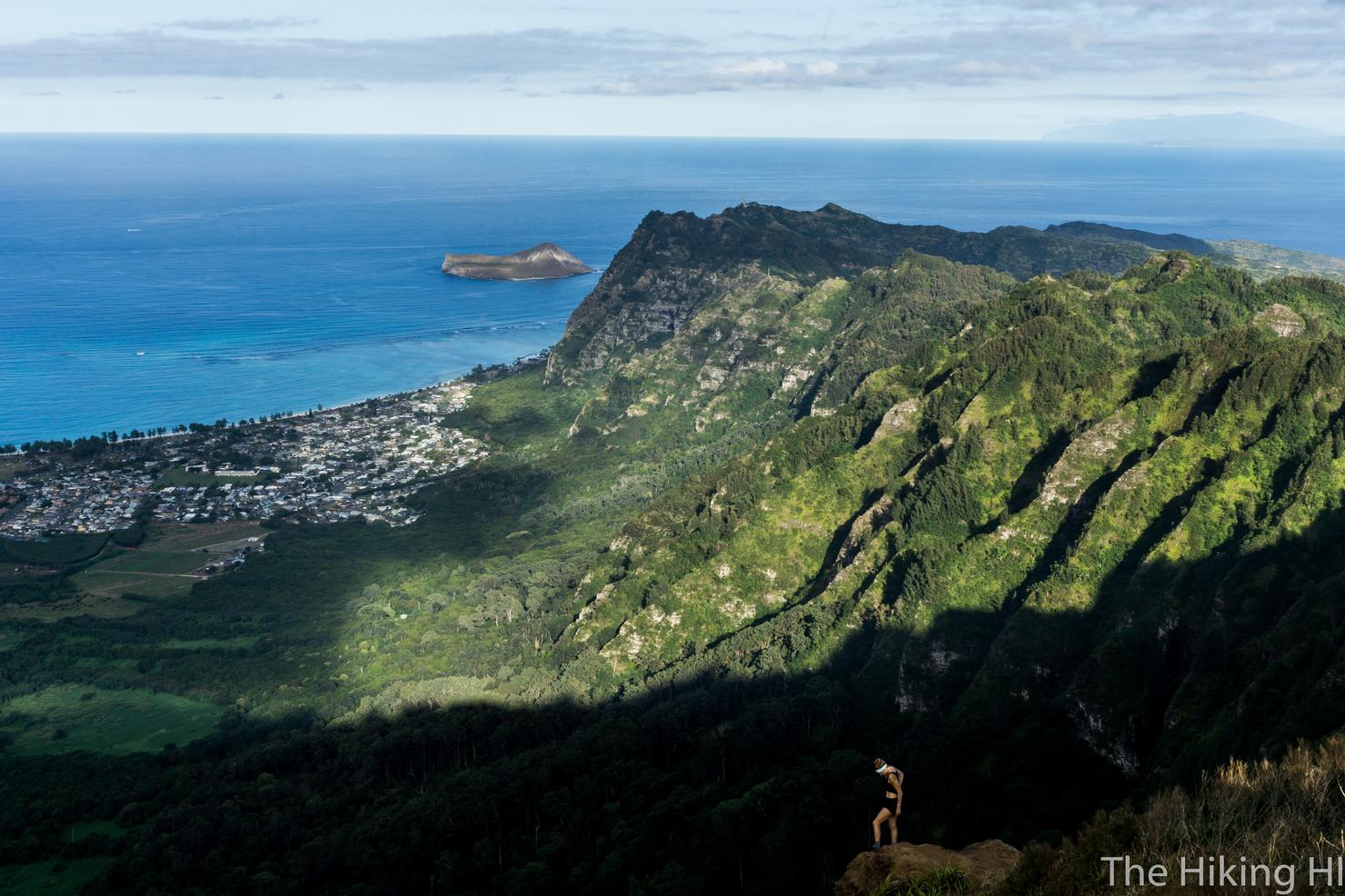
And maybe even a little cliffside yoga. My hiking companion Indre striking a beautiful pose (tree pose?). Also featured in this picture is Koko Crater and just barely in the background you can see the island of Molokai. On the clearest of days, you can see Maui and Lanai from this point. Pretty amazing.
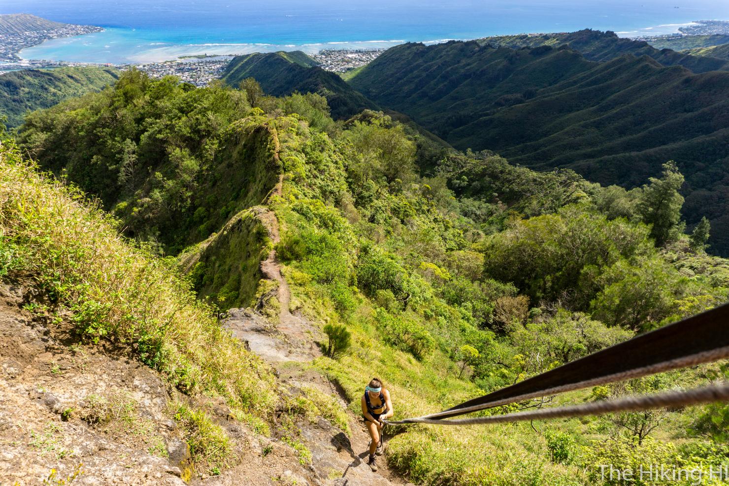
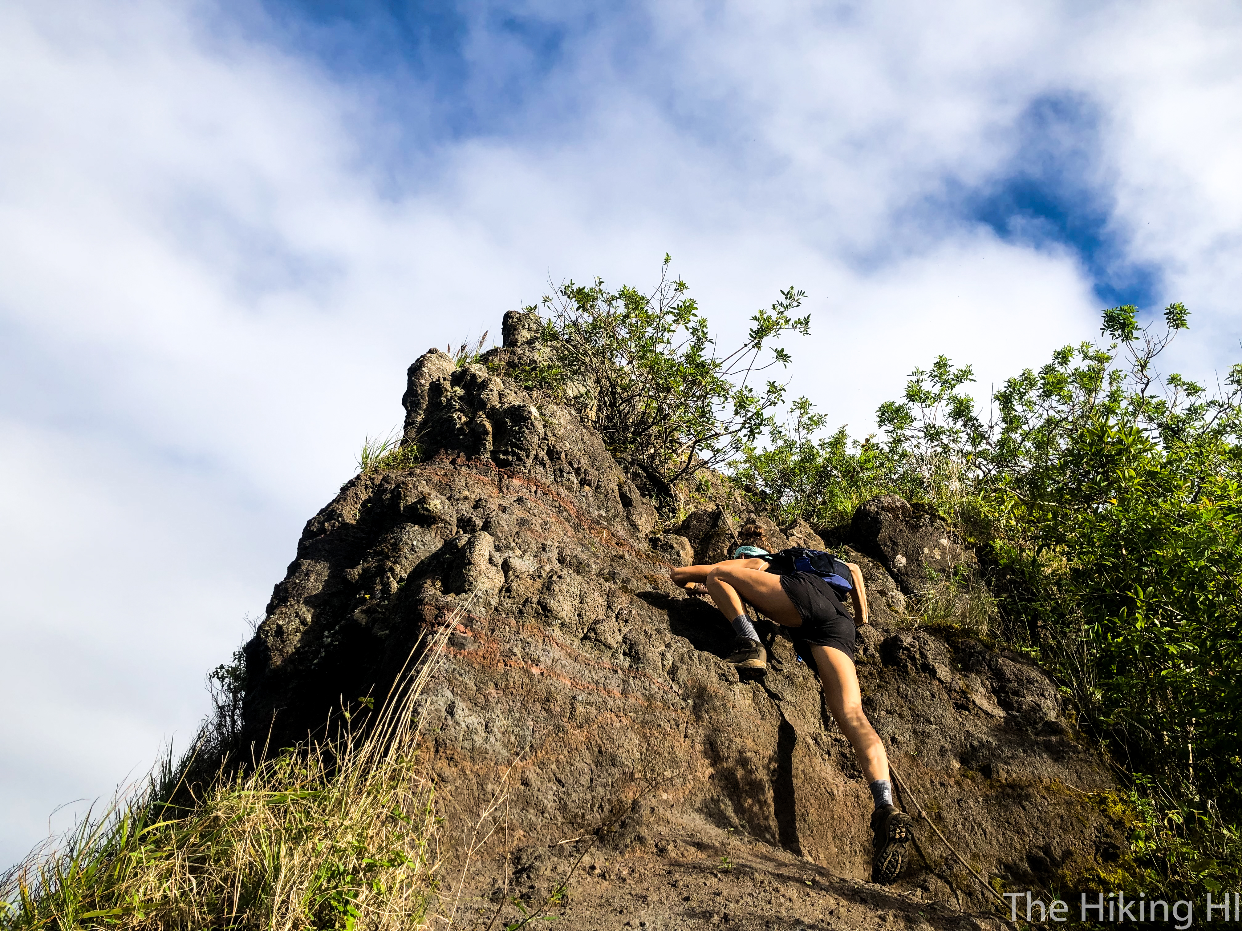
But it's not all fun and yoga poses on this hike, we had some climbing to do. Luckily, there's a couple of ropes for assistance in some of the steeper sections.
And it does get a little narrow on the way up.
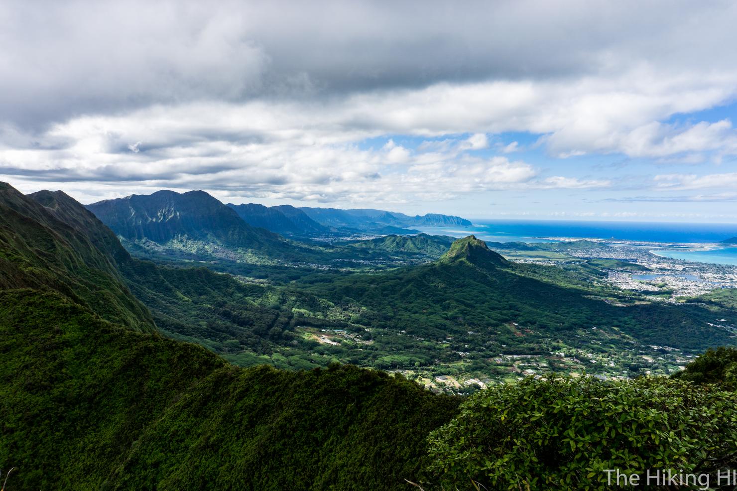
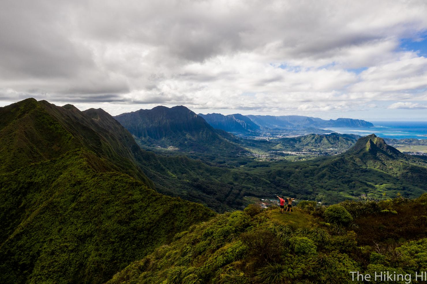
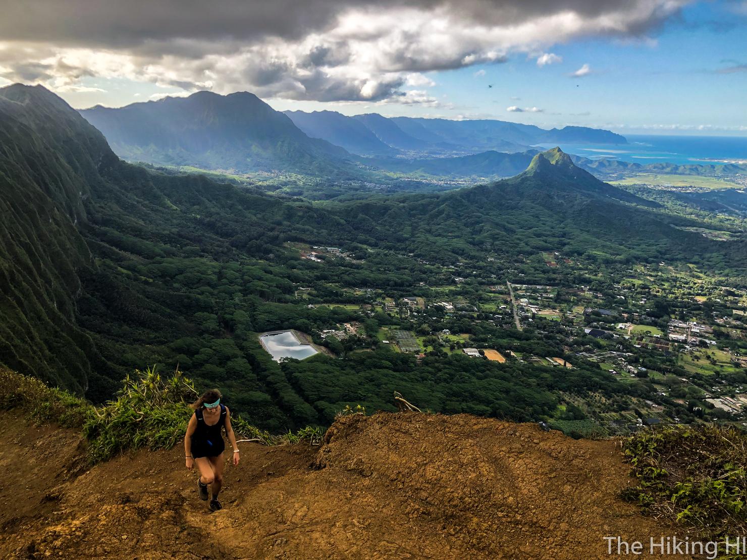
But after about 2 hours we made it! Well sort of... there's a flat clearing a few minutes before the official summit of Pu'u O Kona. But this is a good spot to stop, have a snack, and of course take some photos. We're currently looking towards the windward side of the island. Down the left side is the Ko'olau Range as it extends all the way to the North shore of the island. In front of us is the backside of Three Peaks, and the surrounding town of Kailua.
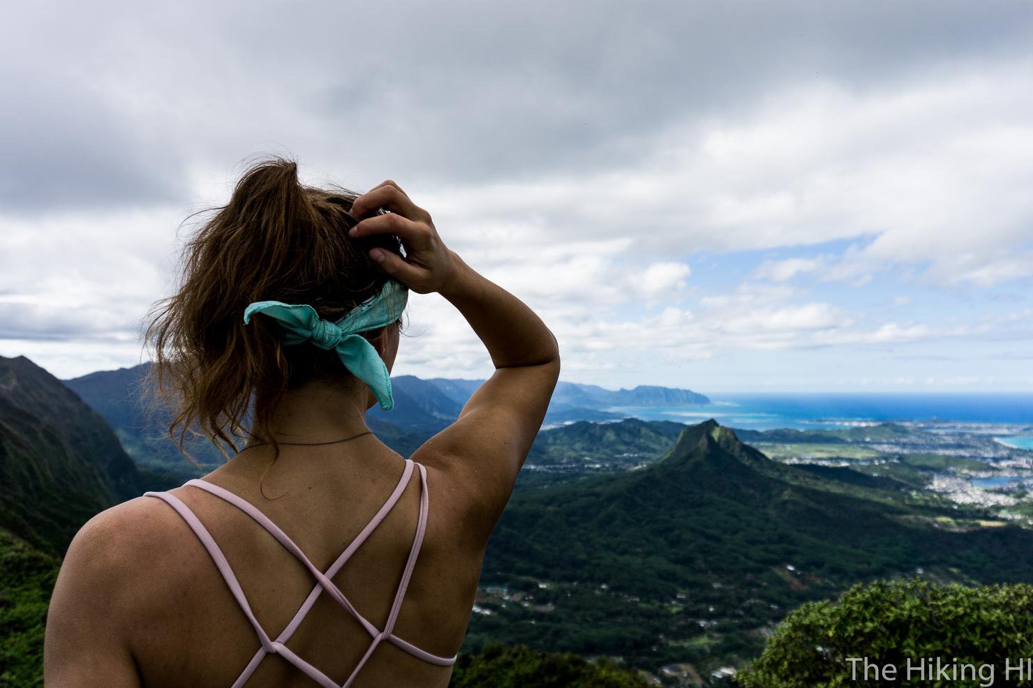
Model shot. Staged or Candid?
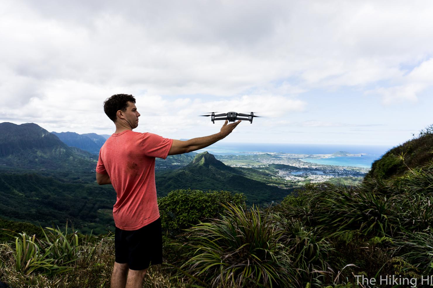
This spot was also a great place to launch the drone. I used to think I looked so cool launching this thing, but this shot makes me look like I'm scared of it. To be fair, it did attack me once...
But I will accept looking that way if it takes shots like this. Drones always put into perspective how small we are compared to our natural landscape.
And here we are at the "official" summit. We couldn't have asked for a nicer day.
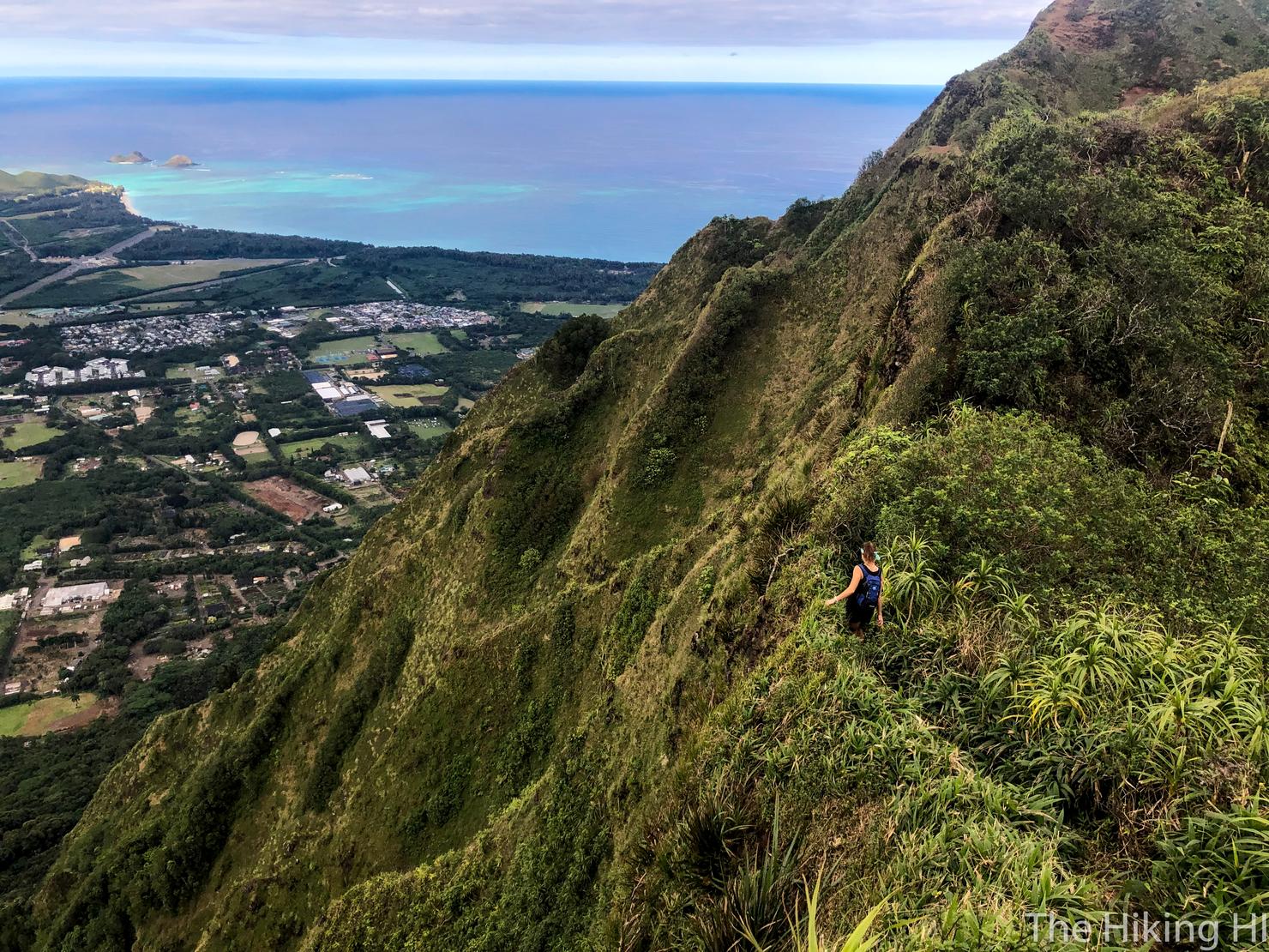
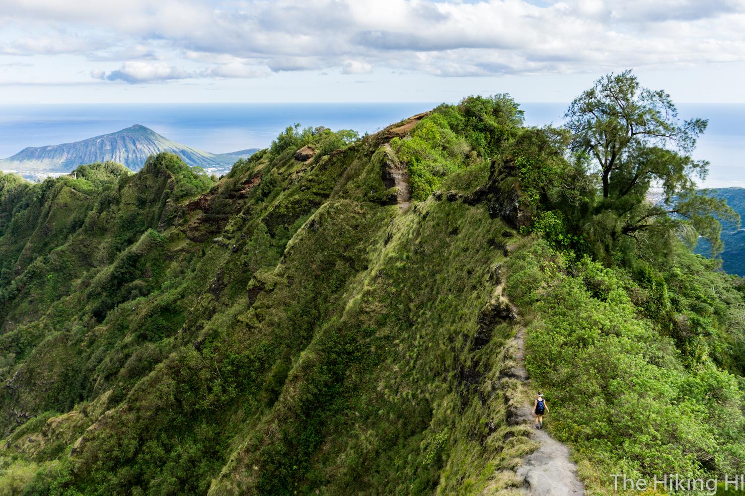
And we decided to keep the day going, by continuing on to Kuli'ou'ou Ridge. To get there, we head right along the KST. If you can't tell from this shot, KST traverse hiking can be a bit sketchy. It's typically overgrown and has some narrow sections. But overall, this portion of the KST is pretty tame.
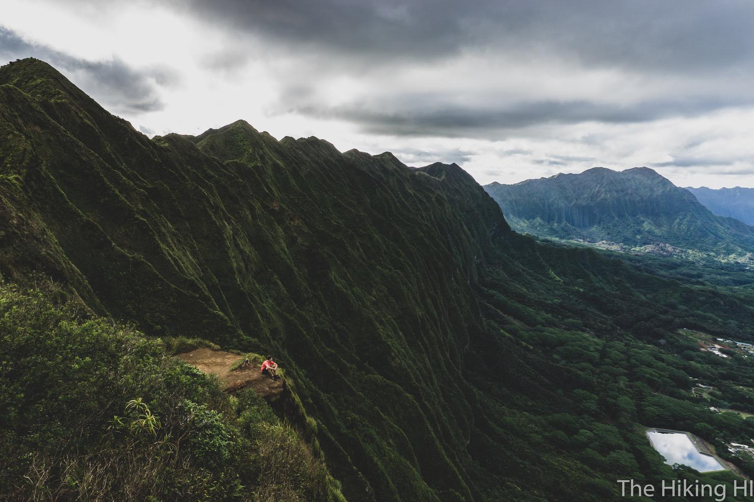
And trekking along it gives you the opportunity for this epic spot. The only thing that would make this better would be a cup of coffee (or maybe a beer).
Stunning!
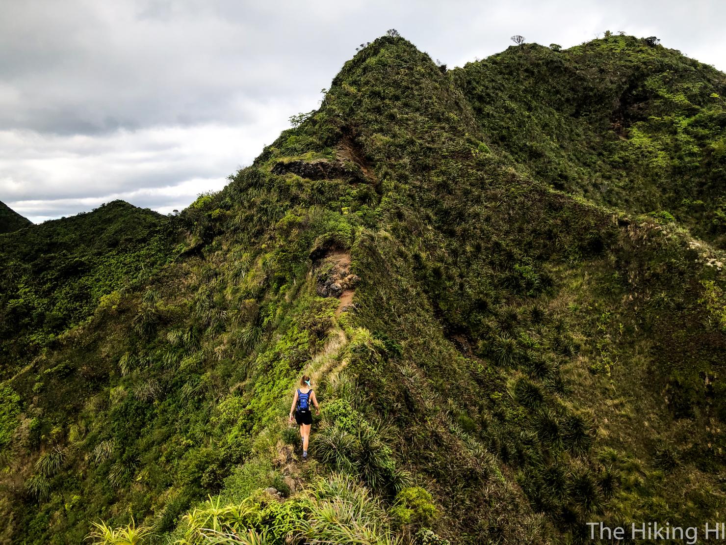
One last climb on the way to Kuli'ou'ou.
And one more narrow ridge.
And maybe one more quick photo shoot.
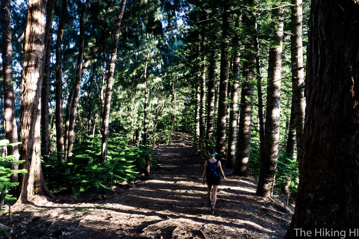
Before a trek back down through the trees to our car. Kuli'ou'ou is an old friend of mine. But experiencing it in a new way, with new company, is just a different method to fully experience its beauty.