Difficulty: BEGINNER-INTERMEDIATE
Time: 4-6 HOURS
Distance: 9 MILES
Elevation Gain: 600 FEET
Foot Traffic: LOW
Challenges: Logistics, Muddy, Lengthy, Overgrown
Sights: Windward Side, Ko'olau Range, Waterfalls
What to Bring: Water (>1L), Snack, Shoes to get Muddy
Not to be confused with the Maunawili Falls Trail, this hike is a point to point hike that starts off the Pali Highway and contours along the base of the Ko'olau Mountain Range all the way to Waimanalo. As you weave in and out of the valleys, you will get an amazing view of the windward side and its landmarks as well as an awesome look of the Ko'olau ridges, towering just above you. If it's been raining heavily, you can even see a few waterfalls along the trail. While not very challenging, this trail is a great way to get a unique and beautiful perspective of this part of Oahu.
Like many people on Oahu, when I hear Maunawili, I assume people are talking about Maunawili Falls, the popular waterfall hike located in Kailua. It wasn't until I bought The Hiker's Guide to Oahu, that I learned there was a trail called Maunawili Trail, a hike completely different than the falls trail. It is a foothill located right next to the Ko'olau Mountain Range, that goes all the way from the Pali Highway to Waimanalo. Unfortunately, it is a 9 mile hike one way, so without a second car and a buddy, it would be quite the challenge to complete this lengthy trail. Luckily I made a new hiking friend, Indre, who was willing to lend a car and deal with this logistical challenge and hike with me. Once the weekend rolled around and the weather was clear, we were off.
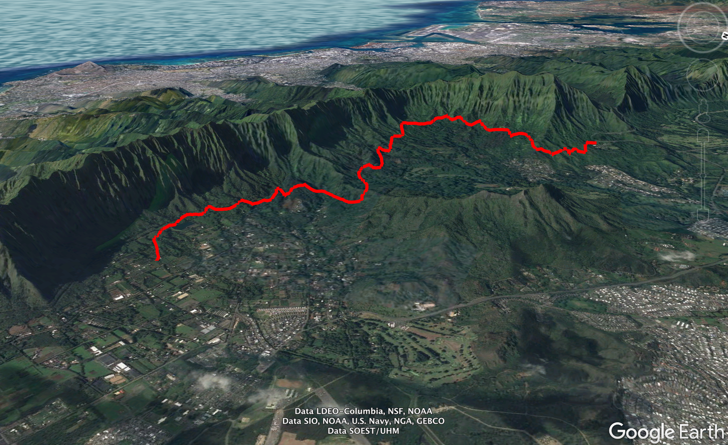
This drawing captures the lateral distance covered by this hike. I suppose you could make it an out and back, but that would be one long day. You also could take the reverse route we did, starting in Waimanalo and ending at the Pali. However, that would make the hike harder overall, since the Pali Highway is located above Waimanalo, i.e. more elevation gain. But the choice is up to you.
TheHikingHI editors have chosen this tour as one of our top recommendations for travelers looking for a memorable hiking experience.
The Manoa Falls Guided Hike takes you on a sightseeing adventure to one of the crown jewels of Oahu - Manoa Falls. It's led by expert guides who share their knowledge on the plant and wildlife you encounter.
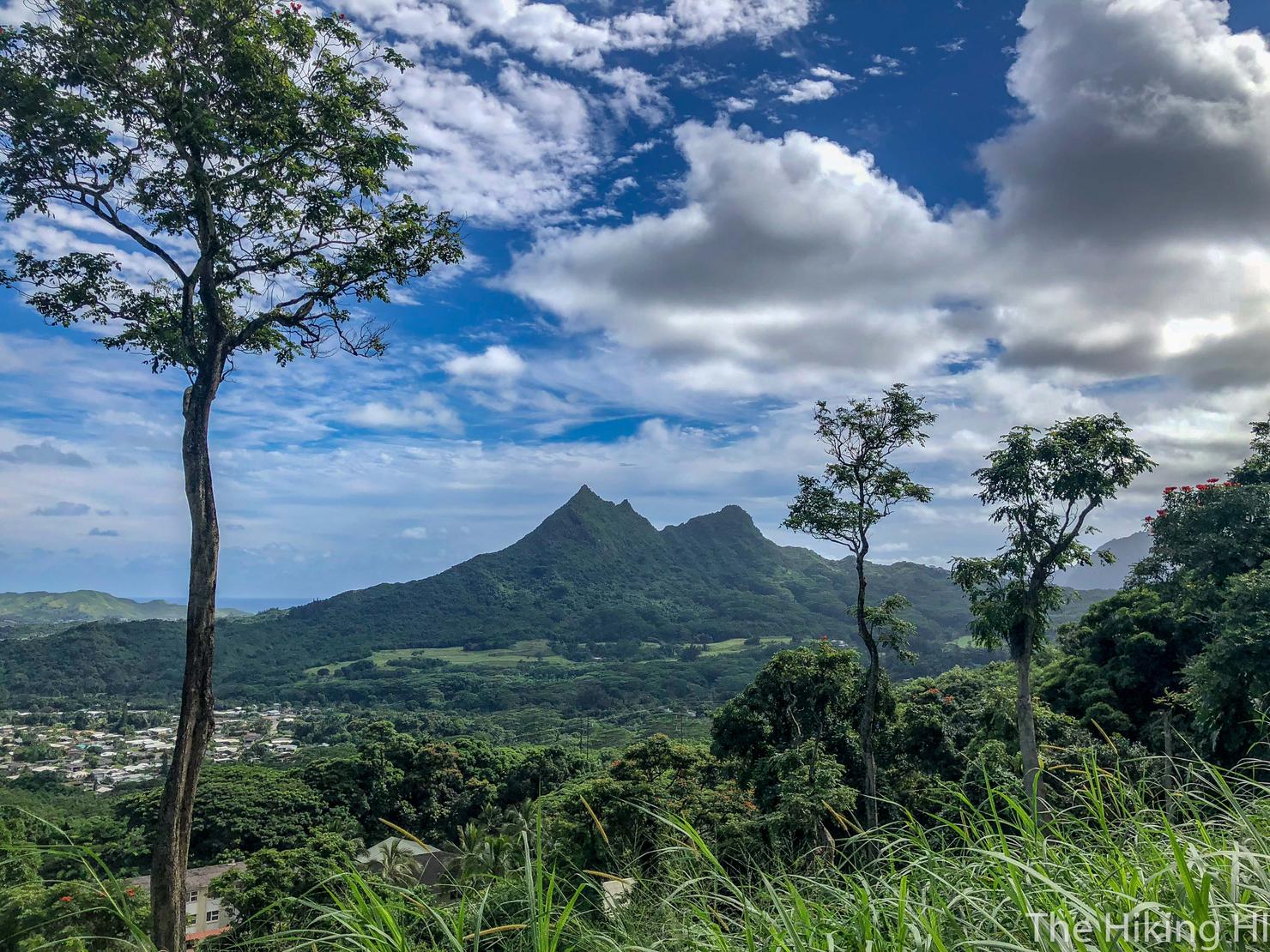
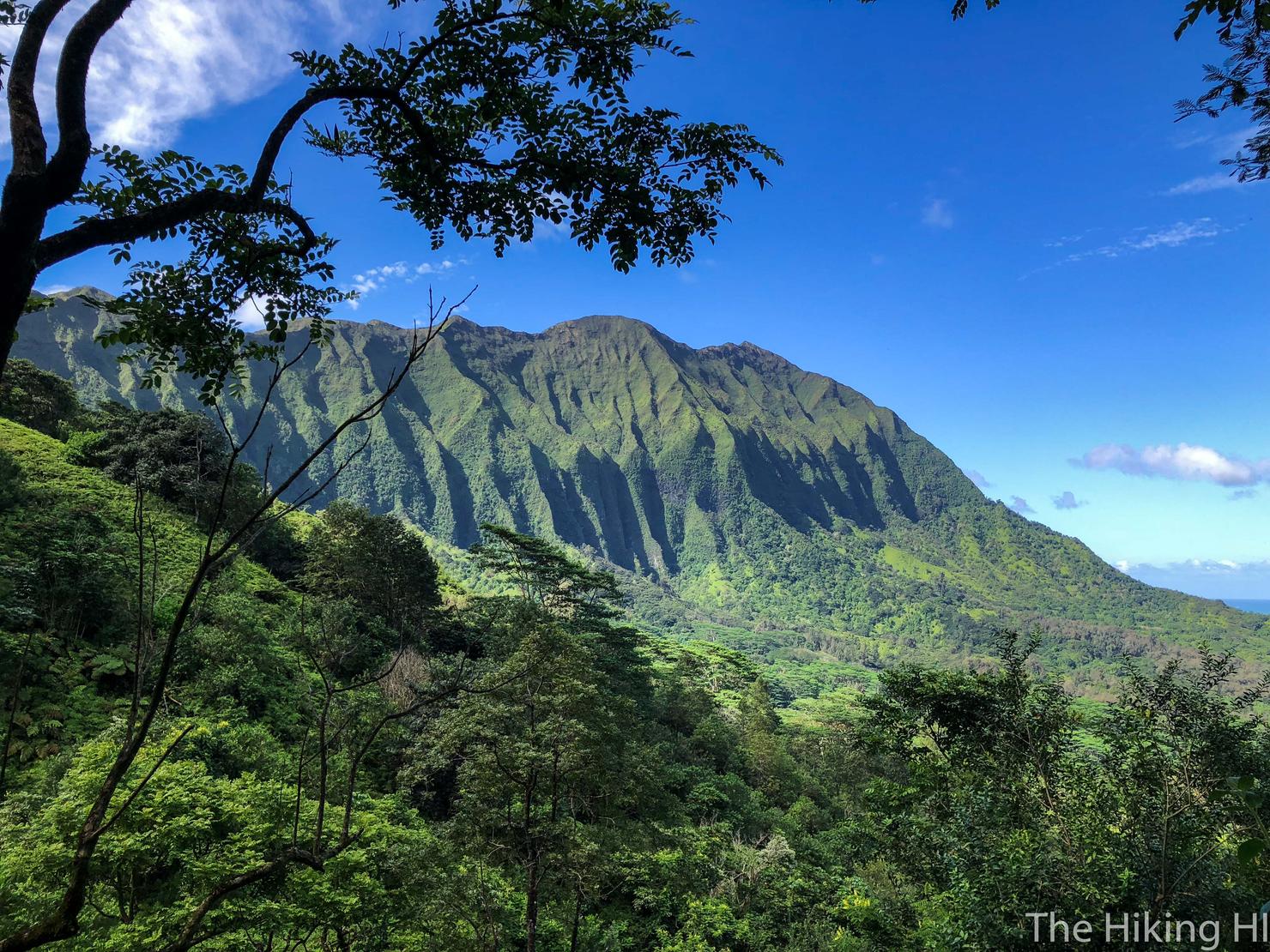
👉 Book This TourWe will cover this in the Waimanalo bound direction, the easier of the two. The trailhead is in a unique location just off the Pali Highway. In the Kailua bound direction of the Pali, there is a lookout point located at a hairpin turn, just before the Pali intersects with the Kamehameha Highway. You will likely see cars parked at this lookout. This is where the trail starts. If you climb up on the wall, you can get this great view of Three Peaks. This landmark, as you will find out, is more or less the centerpiece of this hike.
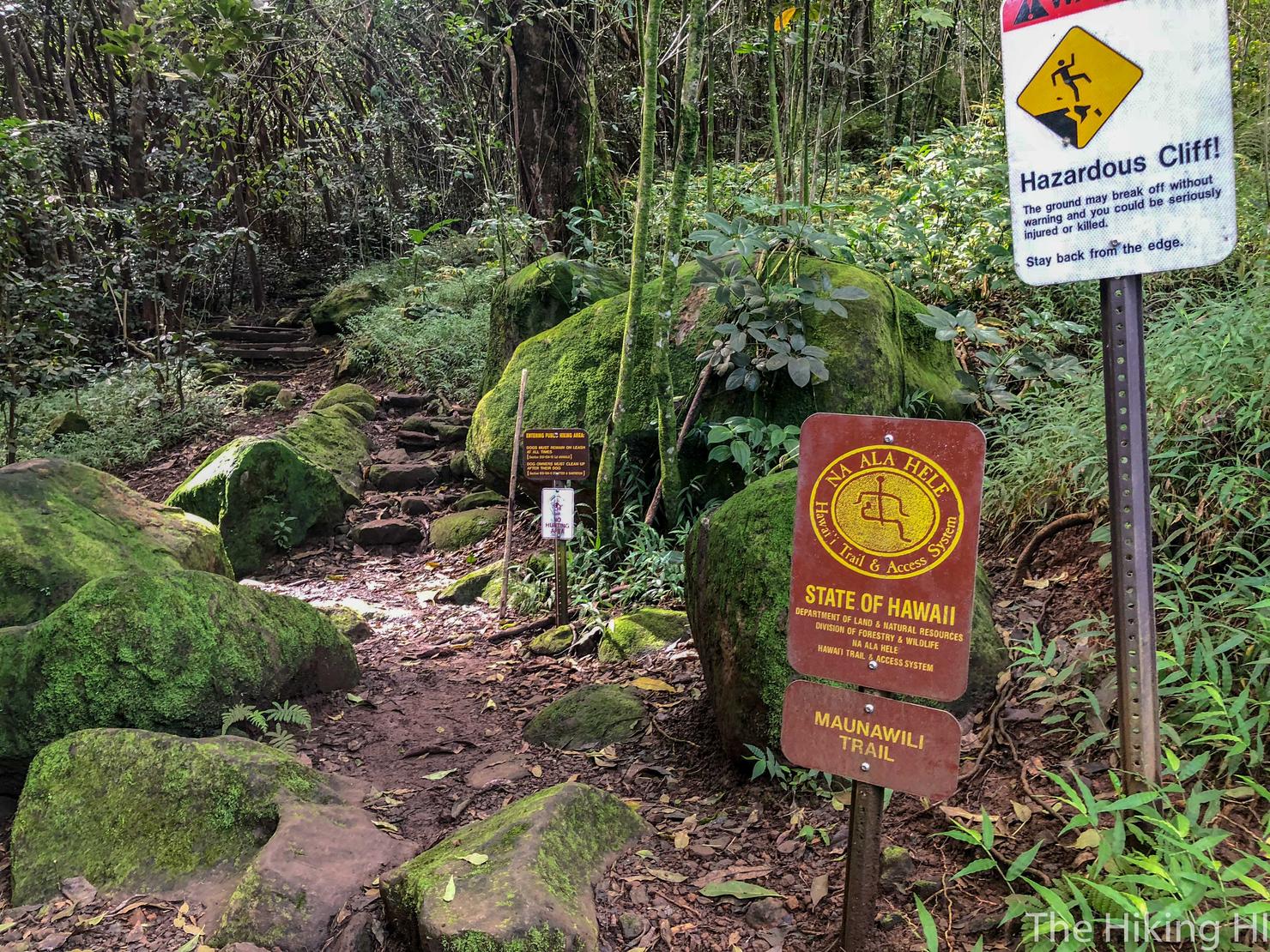
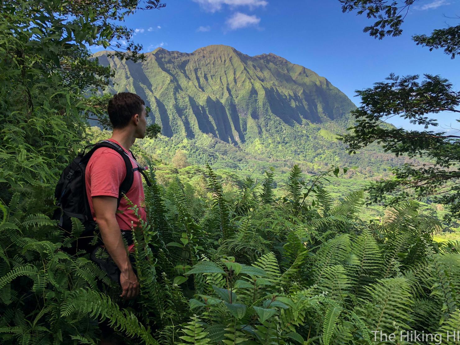
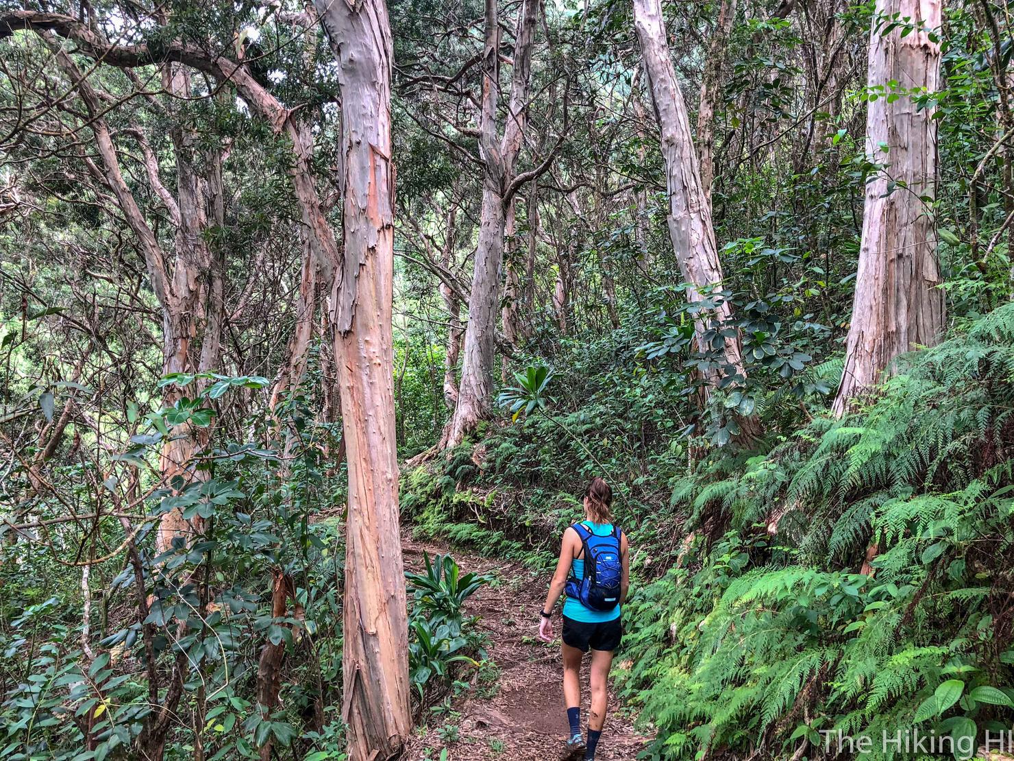
If you walk back up to the parking lot entrance, you will see a sign with an arrow and a break in the trees. Walk in a short ways and you will arrive at the trailhead. My instant feeling after walking on the trail was how lush and wild it felt. It really separates you from all the noise and clutter of everyday life.
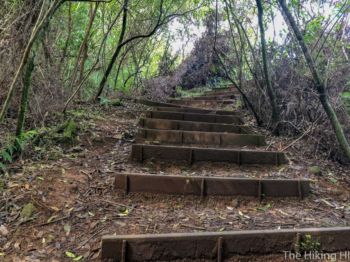
Shorty after the start you will see a set of stairs leading up to the right. This is NOT the way to continue the trail. If I had to guess, this would lead you back to Old Pali Road and subsequently the Pali Lookout. Maunawili Trail has several potential starting locations, one on the Pali Highway (where we started), the Pali Lookout, Waimanalo (where we will end), and Maunawili Falls Trail. Today we are taking the more traditional route... or at least the one described by Stuart Ball.
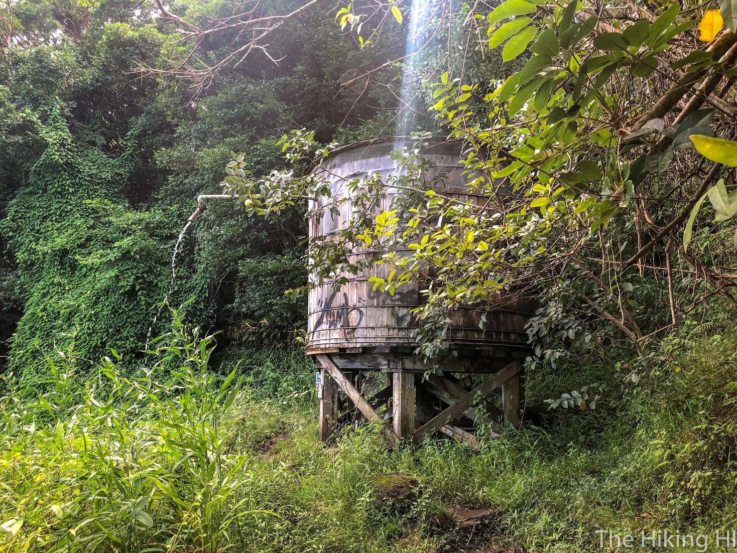
10 minutes in, you will come across this water tower. I can't advise drinking the overflow. As a sign indicates, the quality is not tested.
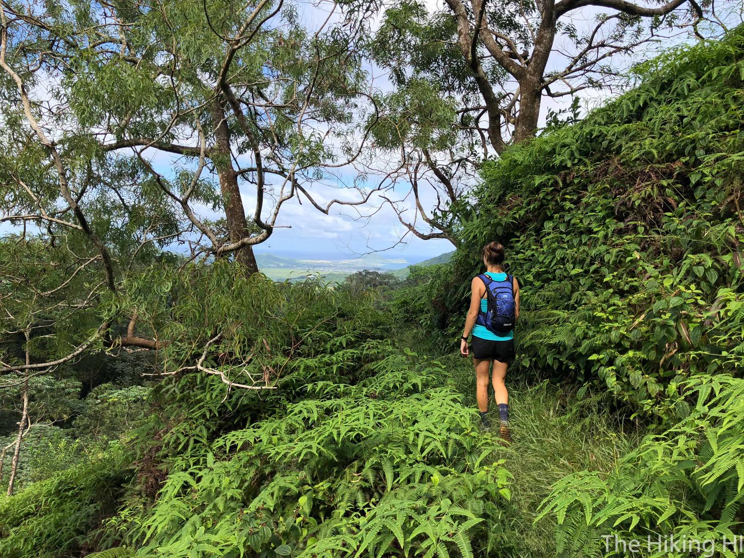
But the tower does give you a great vantage point of the windward side. These periodic lookouts define the flow of this hike. You enter the trees for a bit as you weave in towards the mountains, and then you weave back out getting an awesome view.
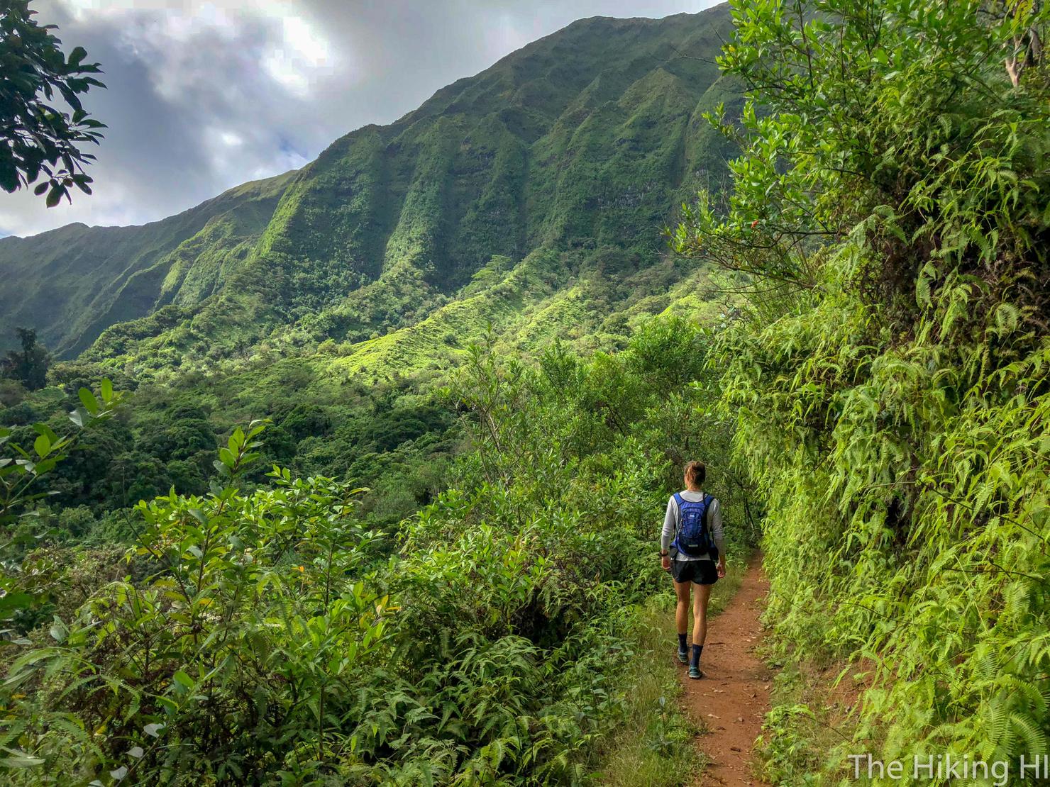
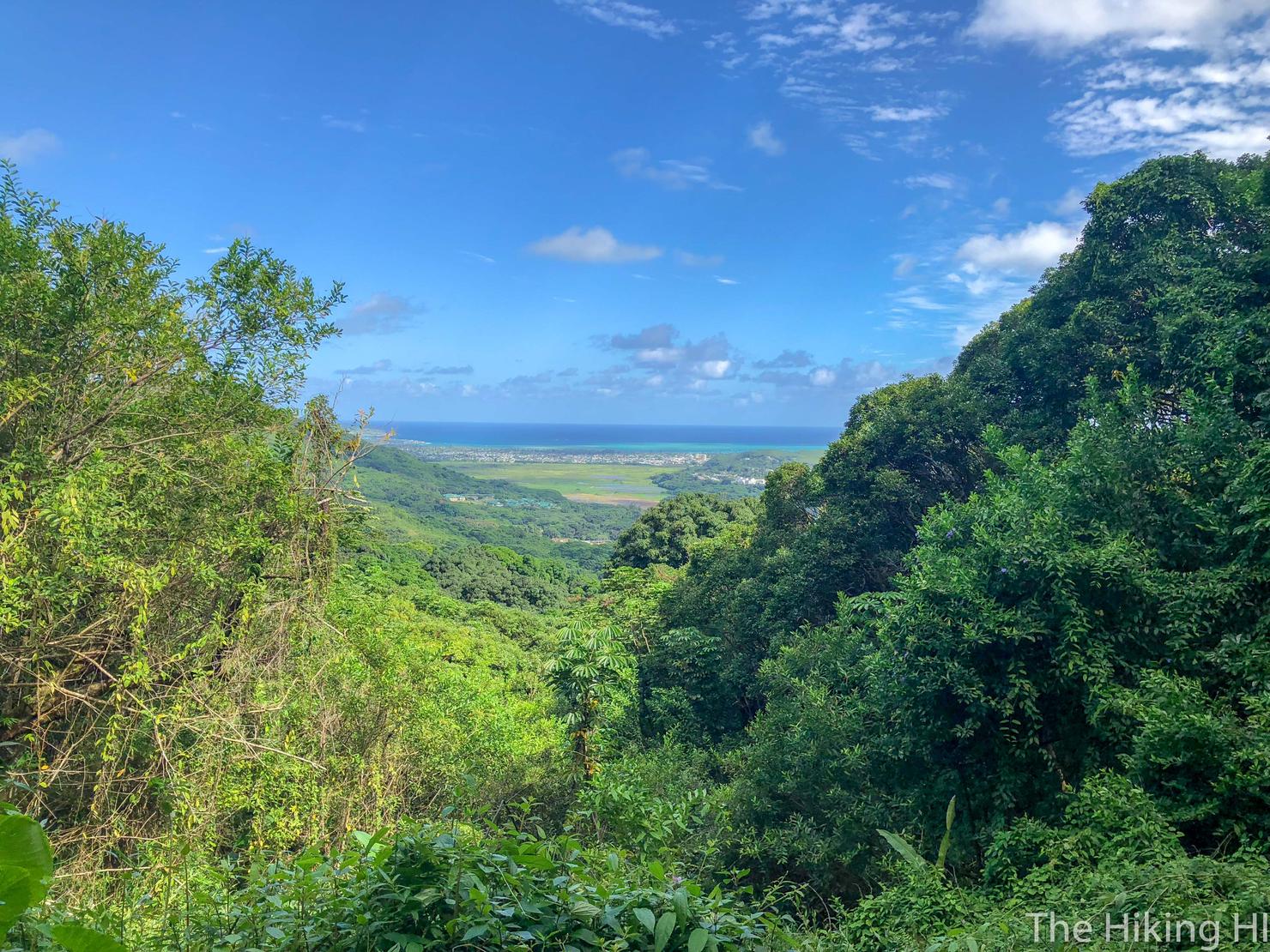
The views go both ways too. Take a look at the massive Ko'olau ridges, towering above you. Amazing!
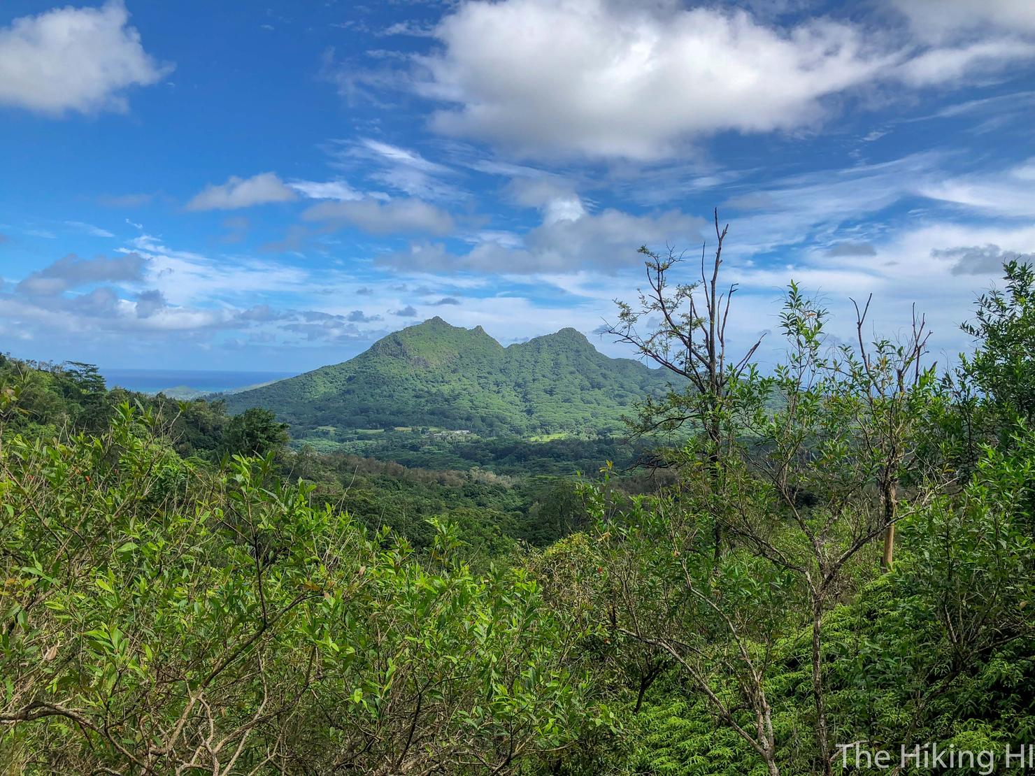
And if you like looking at Three Peaks (which if you read this blog you know I do), then this is the hike for you. Three Peaks is the focal point of the lookouts, with its perspective changing the farther you go on the trail.
Maunawili actually has some good connectors to a few other trails. Here is the connection to Piliwale Ridge, a treacherous ridge that gives you the ability to reach Konahuinui 1 (K1), the highest peak in the Ko'olaus (more info here).
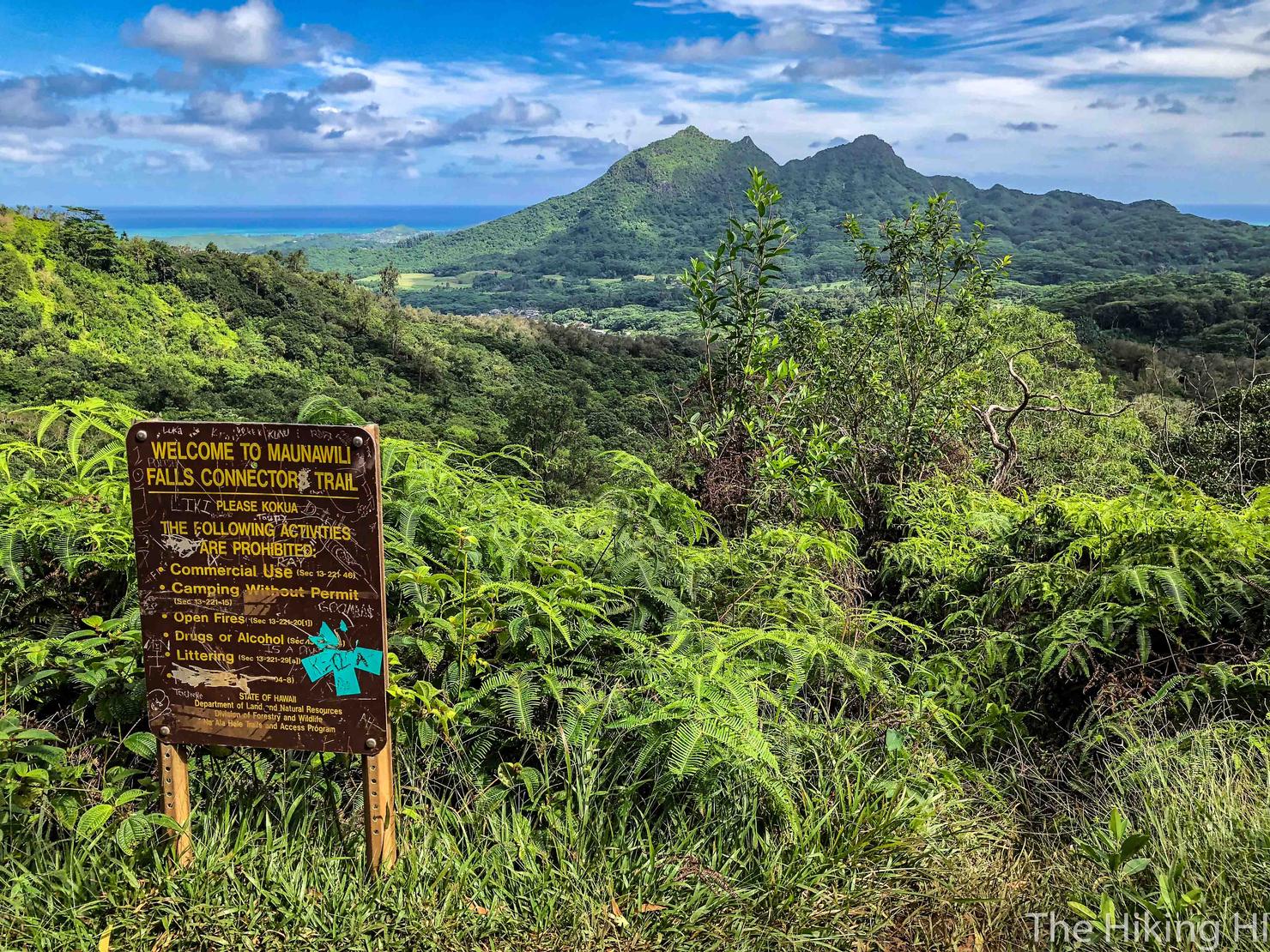
And of course, there is a the connector to the Maunawili Falls trail. It was a little over 2 miles and took us just over an hour to reach it. Although we didn't do the connector, I think this would make a great alternative to reach the Falls and would serve as a solid half-day hike. Plus, look at that view!
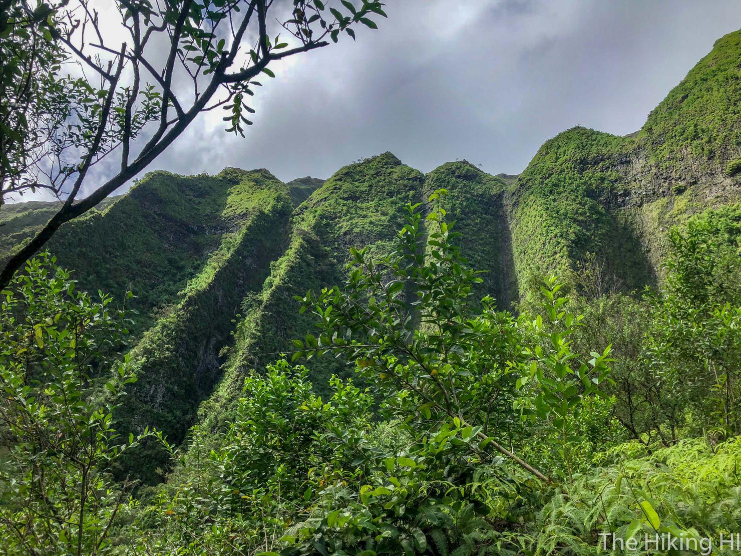
But the highlight for me on this hike was simply looking up at these Ko'olau Ridges in awe. That beautiful green, those prominent and sharp ridges--it's just mesmerizing. You can even see evidence where waterfalls have formed during heavy rains.
As the lighting changed with the lowering sun, the details of those ridges became more and more pronounced.
As for the difficulty of this hike, it's manageable, just long. There's very little elevation gain (in this direction) and the terrain is only somewhat muddy and overgrown.
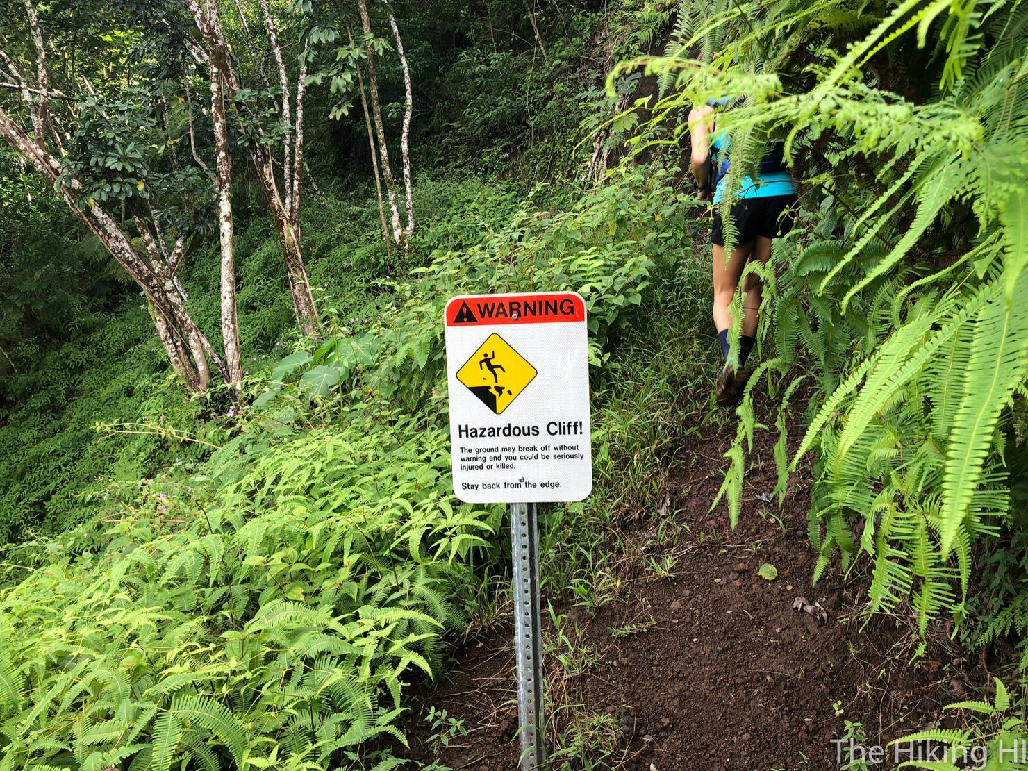
This sign is misleading, there is just one section where the trail gets skinny but it is only on one side. It's nothing compared to any ungraded Ko'olau ridge.
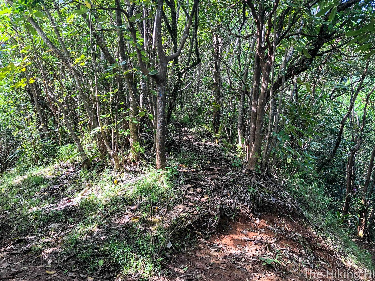
As we entered the last part of the trail, we left the views behind and entered the trees. But the trees have their own beautiful appeal.
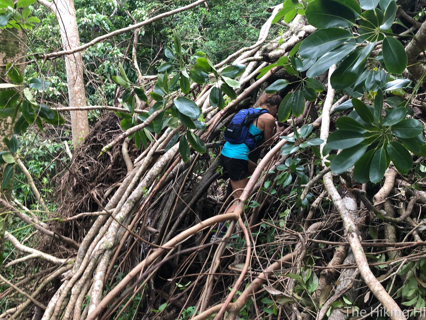
We also had to climb through a few trees. This was the biggest obstacle on the entire trail. This fallen tree completely blocked the path so the only way past was to squeeze through the branches. Despite the discomfort, I enjoyed this, the challenge makes the hike more exciting!
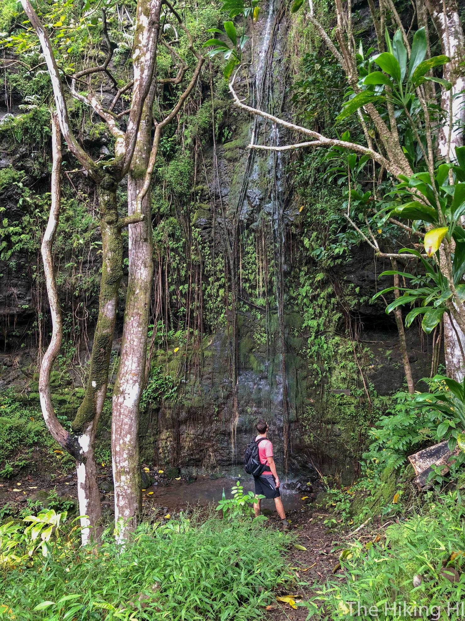
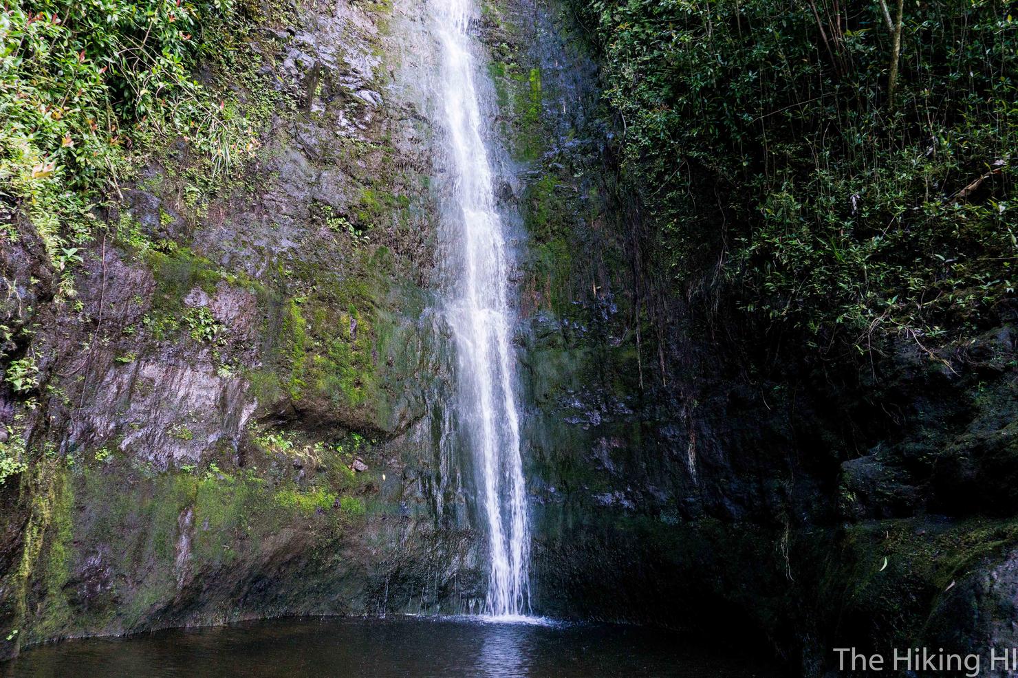
There is even a waterfall along the path. It was a light trickle when we were there, but I could imagine this would be pretty solid after heavy rain.
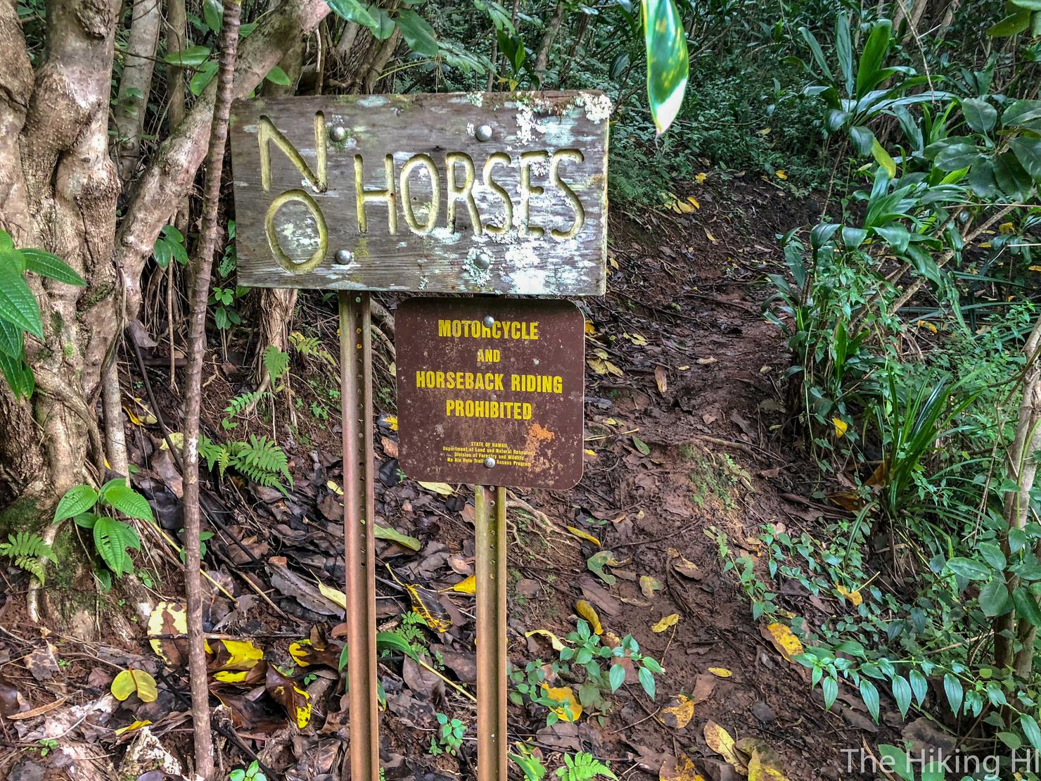
Eventually you reach a section of the trail littered with some signs. This first sign is a new one for me. So horses, if you are reading this, I am sorry but you are prohibited from this trail (but props for learning how to read!)
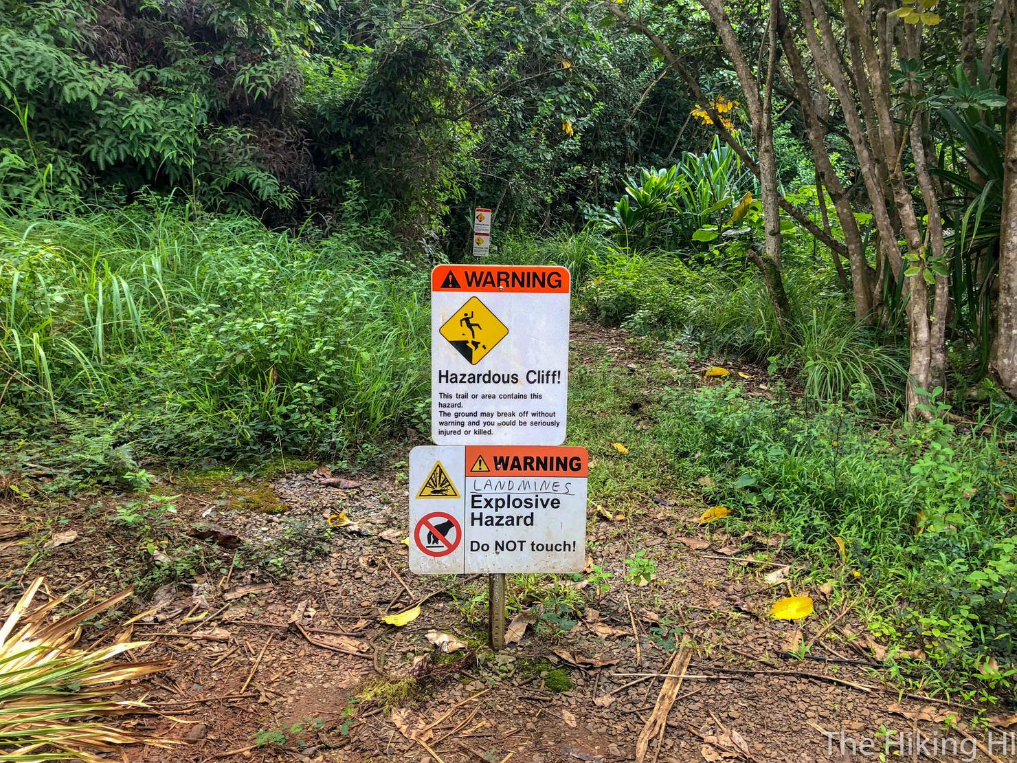
You will also see this somewhat intimidating explosives sign. There are a number of these throughout the island and I'll be honest I've never seen a landmine. But I suppose you never know...
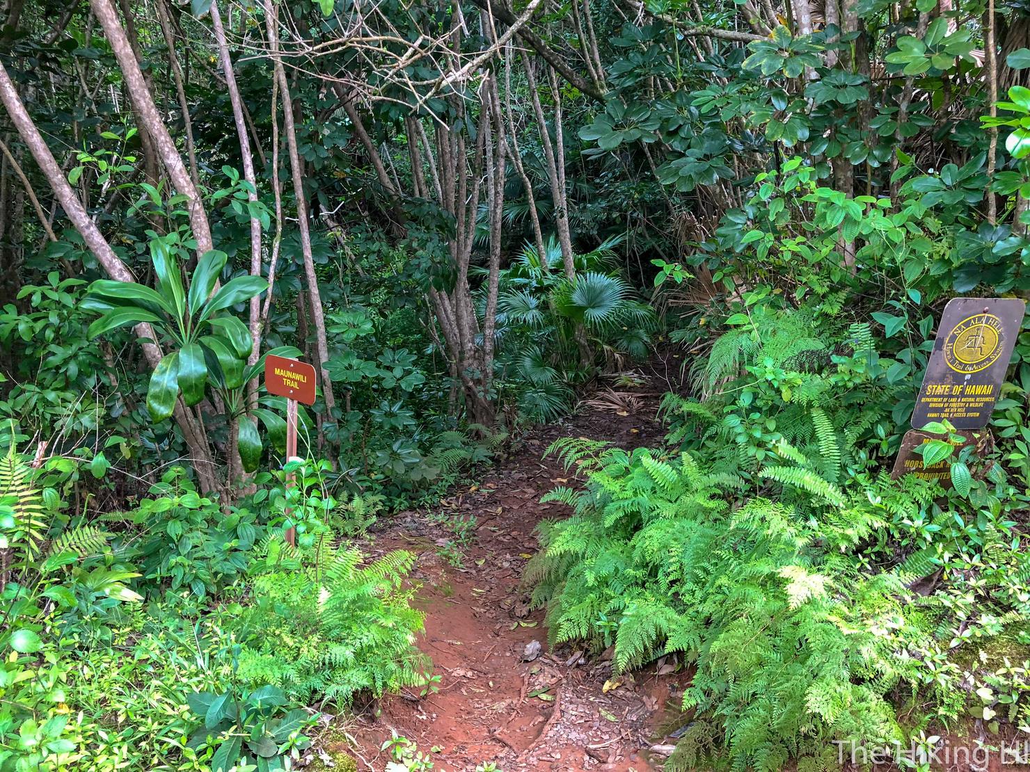
But the most important sign to look for is the one that will take you to where you (hopefully) parked your car. It is an obvious fork, but you should follow the right path (pictured above). From here you will follow some gentle switchbacks down to your car.
This hike was very different than most Oahu hikes. Instead of being high up one of the many Ko'olau ridges, I was staring up at them from ground level, admiring their grandeur. This hike gave me a totally different perspective of this beautiful part of the island. And everything is about perspective.