Difficulty: INTERMEDIATE-ADVANCED
Time: 7-9 HOURS
Distance: 15 MILES
Elevation Gain: 1700 FEET
Foot Traffic: LOW
Challenges: Endurance Challenge, Somewhat muddy and overgrown
Sights: Waimano Valley, Windward Side (if you're lucky)
What to Bring: Water (>2L), Lunch, Sunscreen
What to Bring: Water (>2L), Lunch, Sunscreen
A lengthy hike located in central Oahu, this trail takes you from Pearl City all the way to the Ko'olau Summit Trail by means of a 15 mile graded ridge. On the way, you will pass some tunnels (previously used for irrigation), get a beautiful view of Waimano Valley, and even see a little waterfall. While this long hike isn't for everyone, those that want some solitude and a challenge will receive great satisfaction upon its completion.
As I continue marking hikes off my Oahu bucket list, I realized something. The days of those 2-3 hour hikes with low energy expenditure and amazing views are over. Now many of the hikes that remain are full days of bushwacking and stomping through mud all to reach a peak that is likely covered in clouds. But for me, that reality isn't disheartening, it's encouraging. Knowing I will be traveling along a hike that so few others will experience, often in complete solitude, is a very satisfying experience. That in mind, I set off for the 15 mile Waimano Ridge Trail.
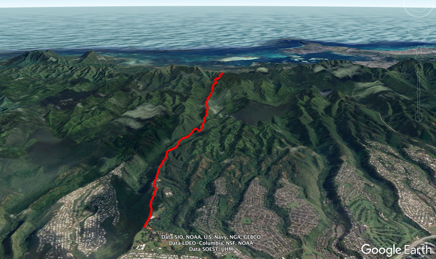
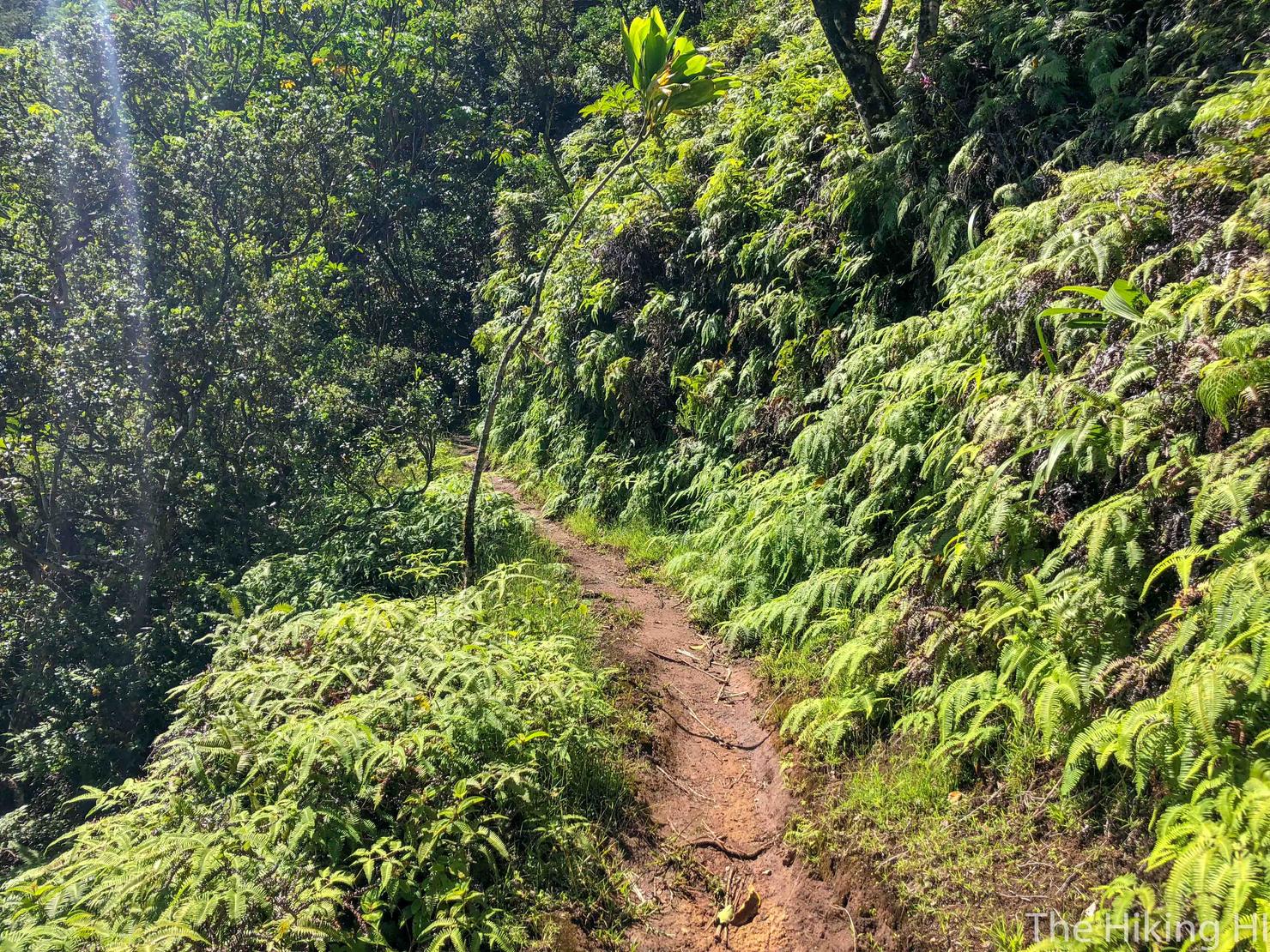
15 miles out and back. Yep it's long, but the distance is deceiving. The ridge is a slow steady incline and less muddy and overgrown than many of the Ko'olau ridges, so it is manageable.
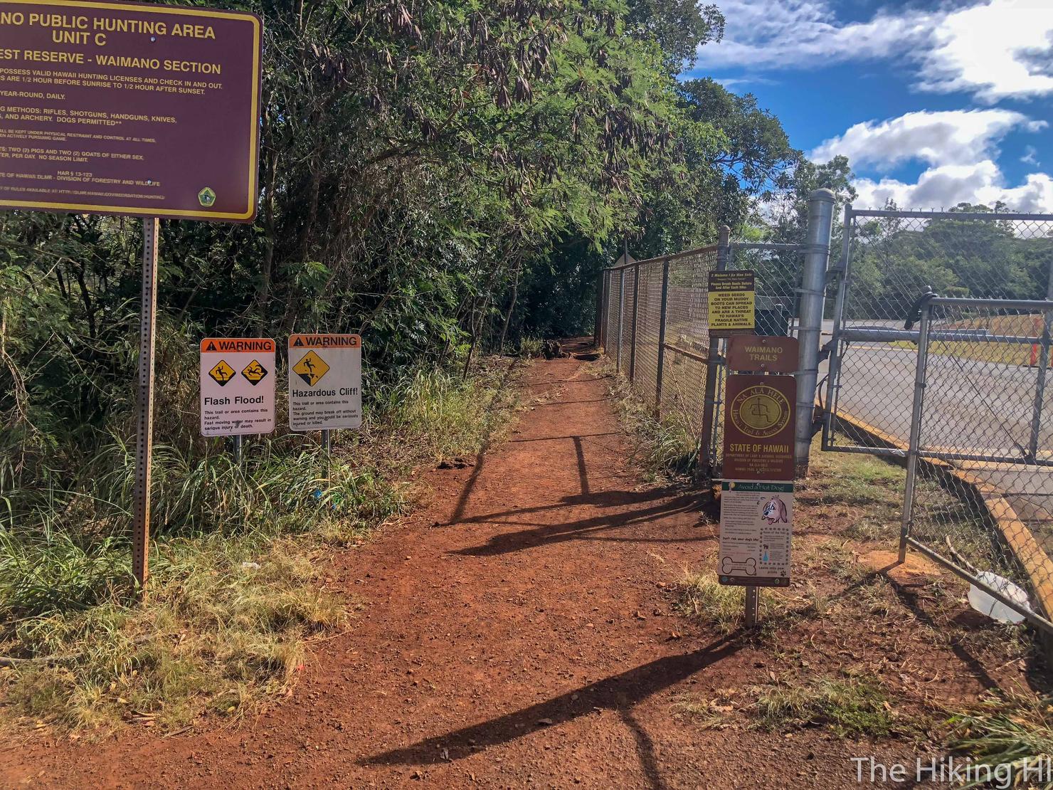
The trailhead is located at the end of Waimano Home Road. The road ends at this fenced in government facility, but there is a dirt lot on the left side of the road, just before the fence where you can park. From there, the trailhead is located to the left of the fence.
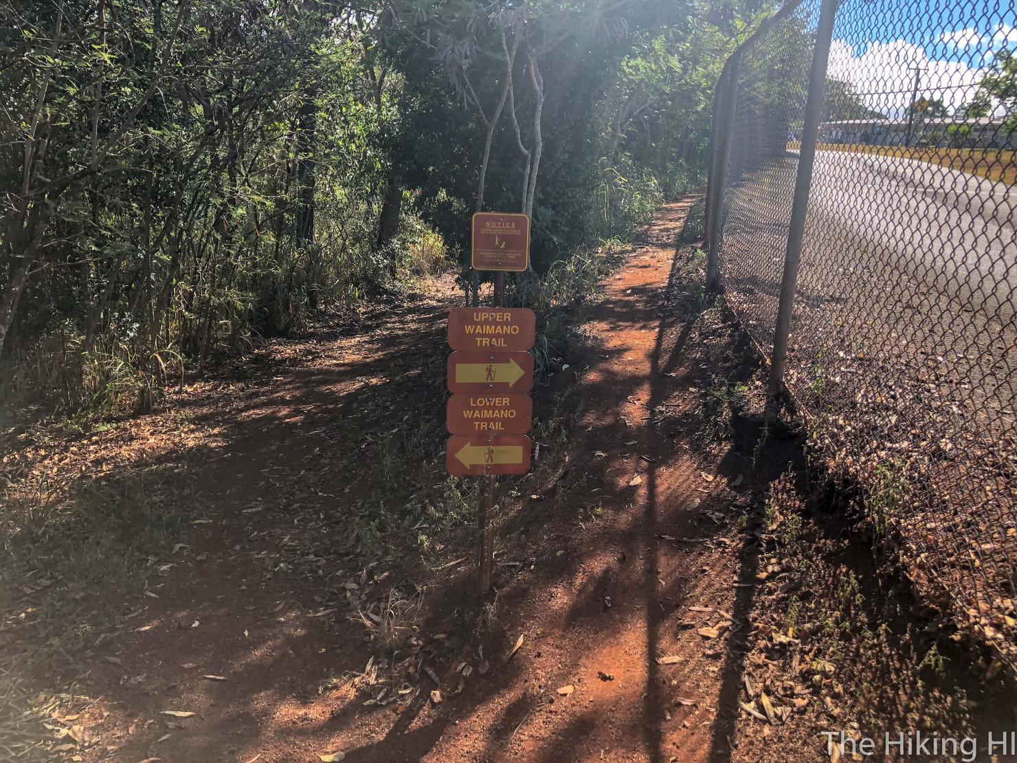
Lower or Upper? It makes no difference since they end up meeting back up, but I hike like I strive to live my life, taking the high road!
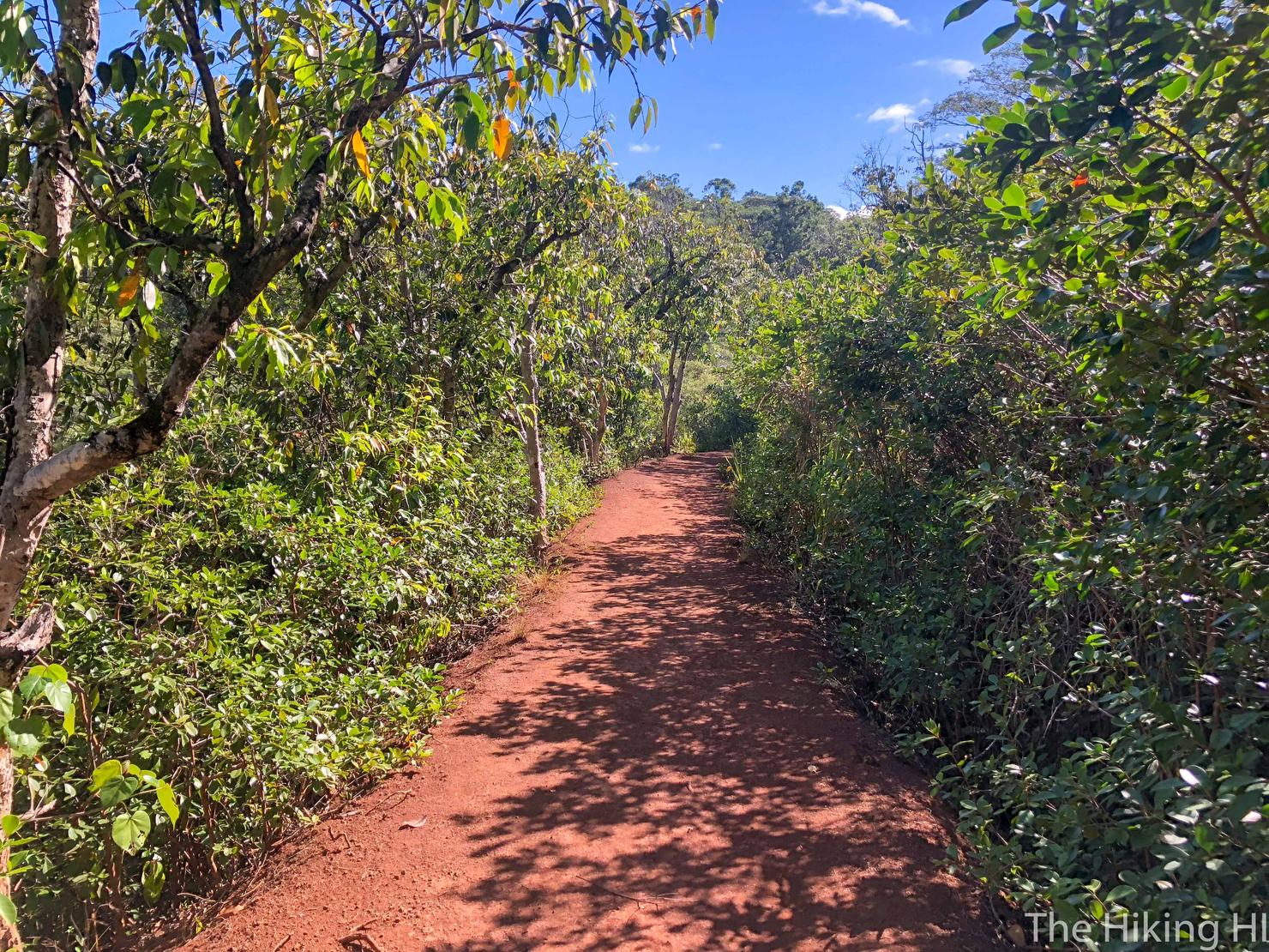
On the trail again.
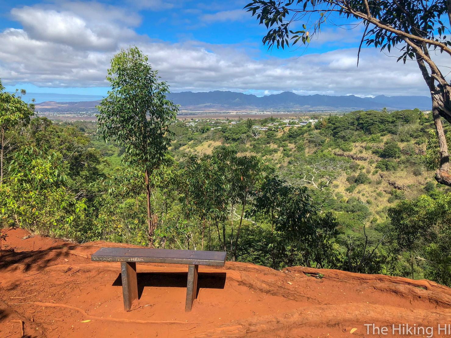
Not too long into the hike you will come across this beautiful lookout of the valley and the Waianae range in the distance.
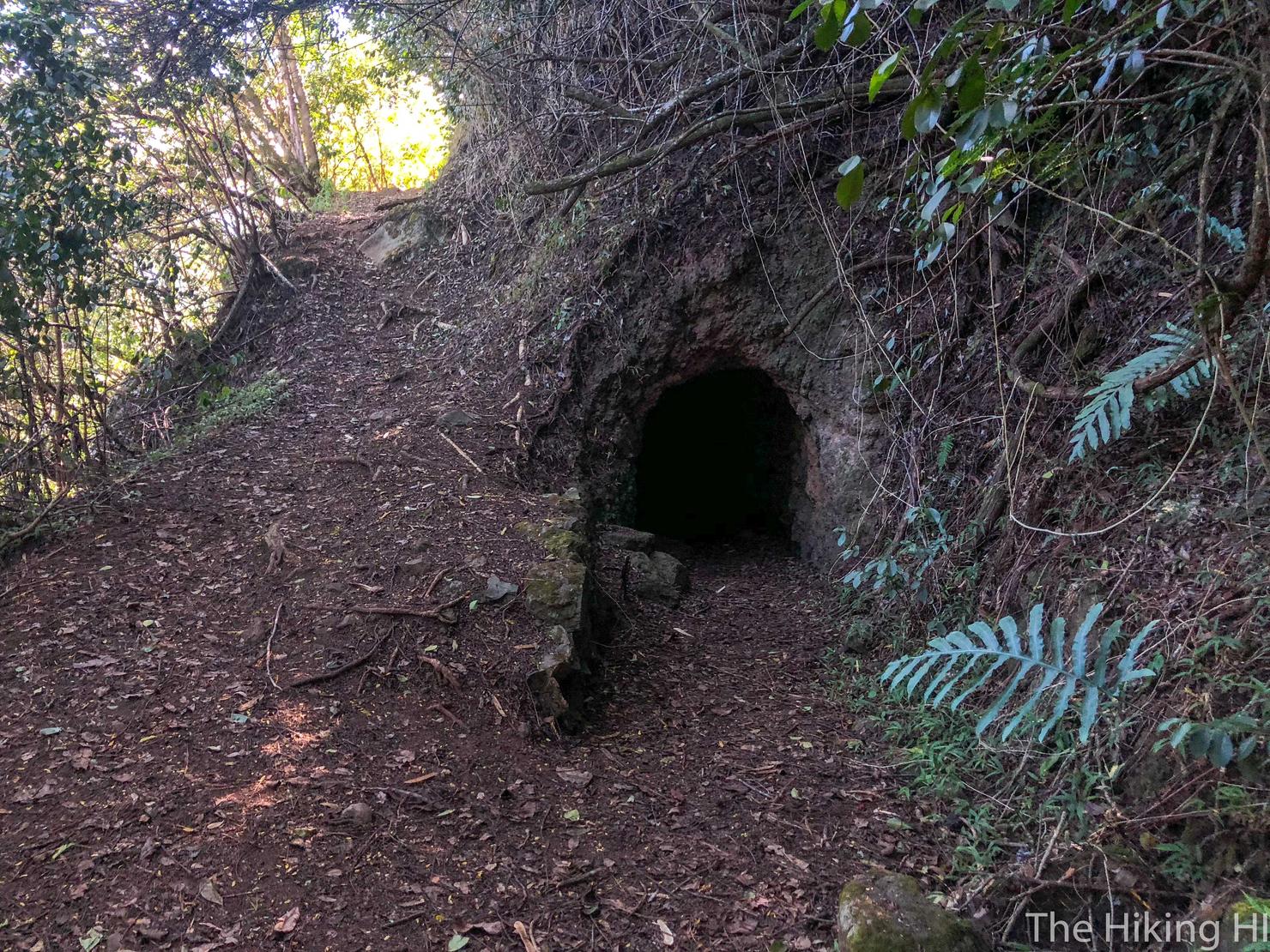
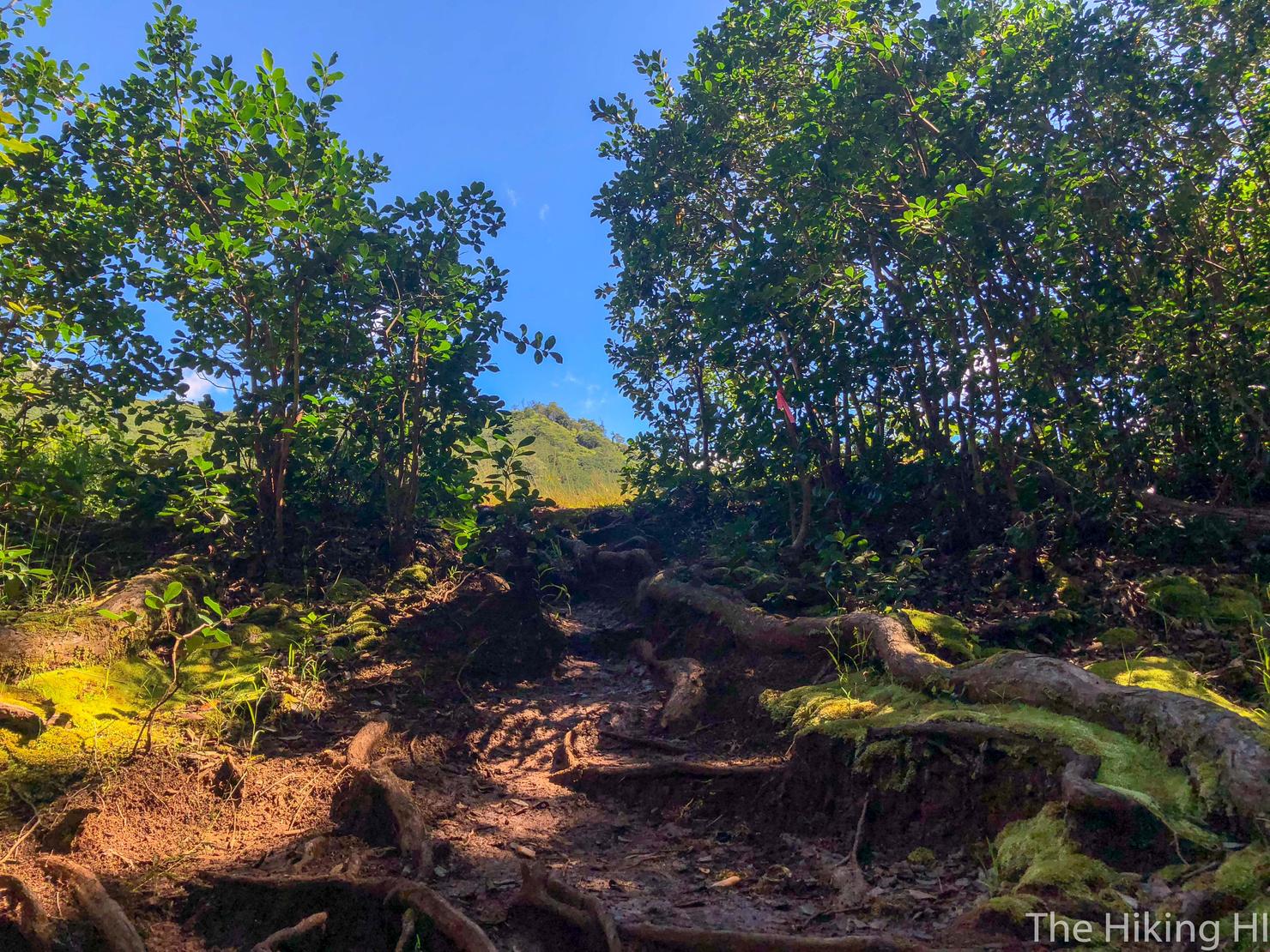
A unique aspect of the early parts of the hike are the many tunnels (previously used for irrigation) located off the side of the trail. You can actually walk (or crouch) through these, as I did when I hiked here almost a year ago. They are cool (and a little eerie) to walk through, but they can be a bit muddy inside. Since I was on a mission to get to the summit, I decided to by pass them. using the trails to the left.
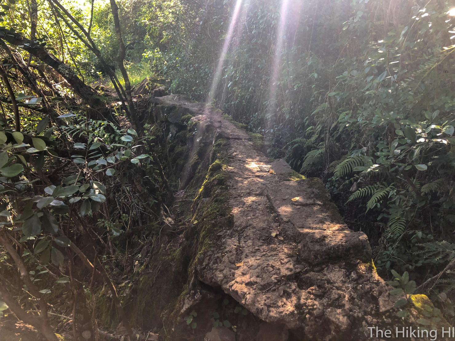
I had to take a picture of the sunbursts coming through the trees illuminating this rock wall.
You get a few lookouts of the valley during this early portion. See that peak in the clouds way back there, that's how far we have to go (Cue Moana theme song?).
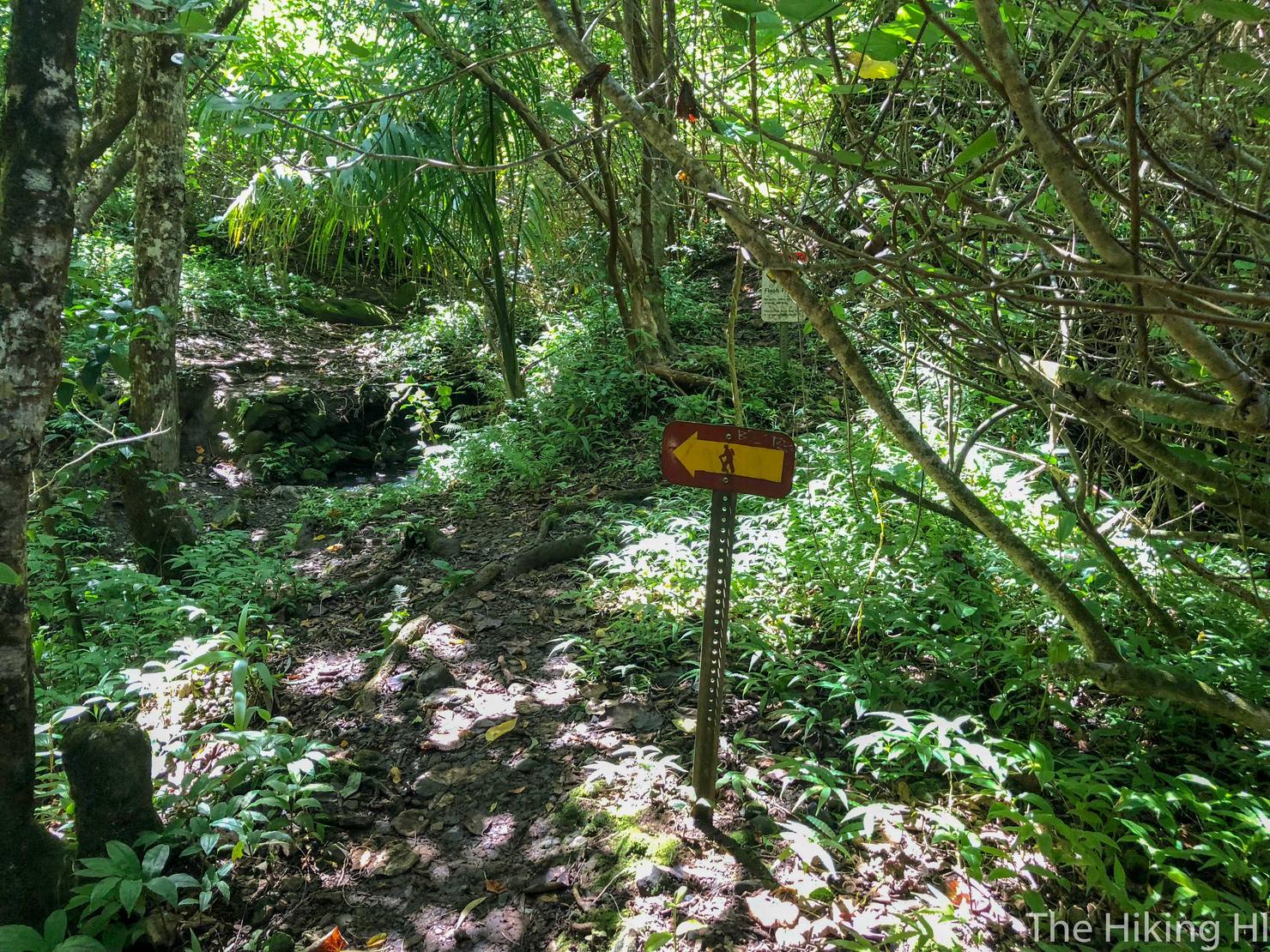
The first part of this trail is very well marked so you shouldn't have too much trouble. Just follow the pink ribbons and these signs.
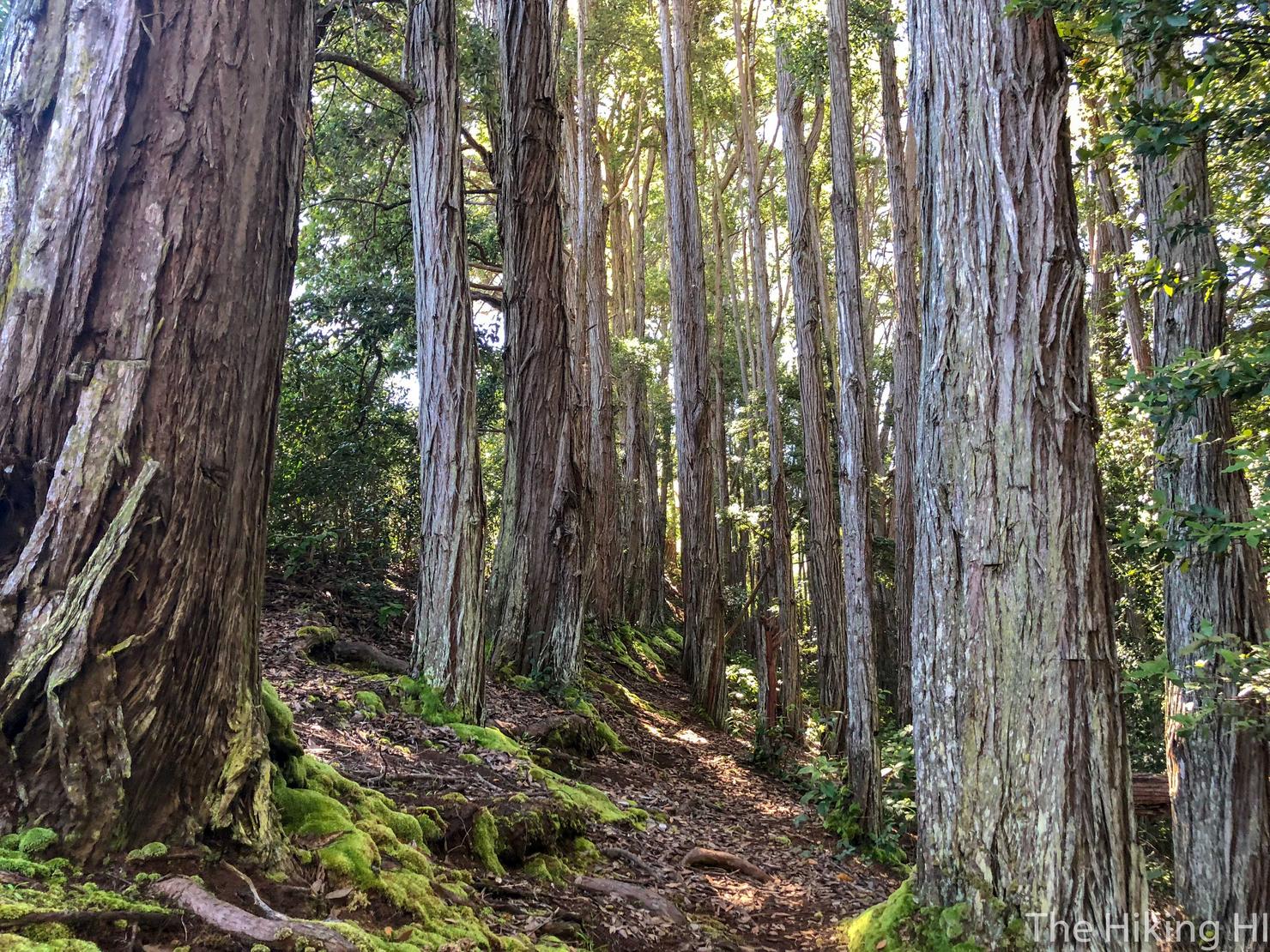
Eventually you will enter this forest of these beautiful and massive trees. I felt so small in their presence.
On the left side you will see a small little trail that goes uphill. Go this way.
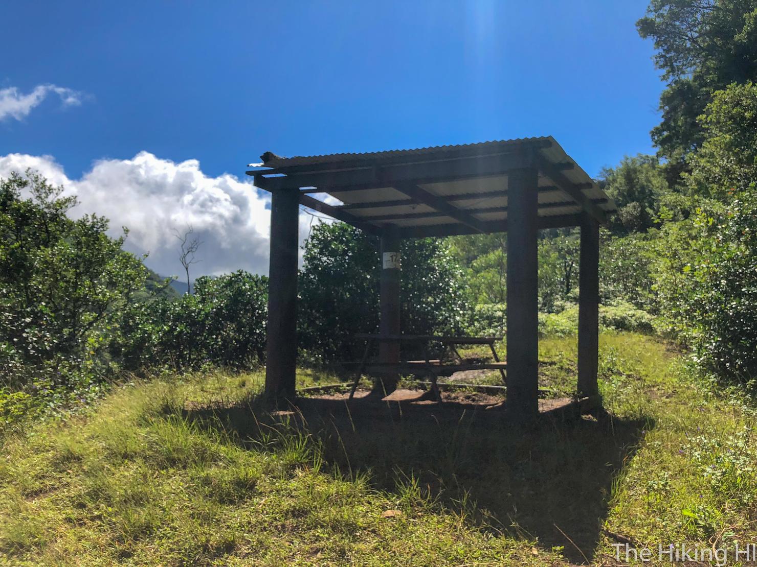
And it will lead you to this lookout point. Last time I was here, this served as my turnaround point.
But if you want to continue, the path to do so is just before that pavilion on the left. It goes downhill and is marked by pink ribbons.
As you begin this section, you may start thinking, why is this trail going downhill? Am I going the right way? At least those were the thoughts that came to as me as I started this section.
And the answers are yes and yes, the trail does go downhill, and it is in fact the correct trail.
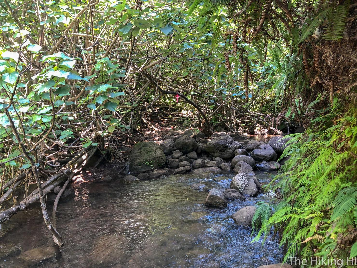
This trail goes downhill far enough that you will actually return to the valley floor, where you will be forced to make this small stream crossing. I recommend taking off your shoes and socks for this portion. There weren't many good rocks to hop on and it's better than having your shoes sopping for the remainder of the hike.
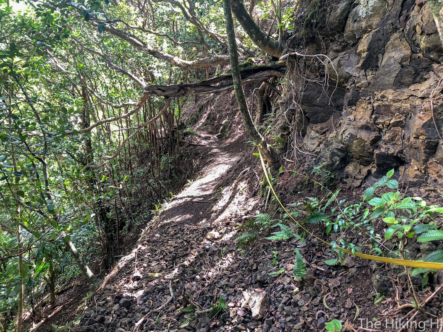
After that stream crossing, you will continue the long gradual ascent to the summit.
It was about this time where I realized this hike was very different than I had anticipated. I was expecting this to feel like Manana or Aiea Ridge Trail, a long ungraded ridge full of ups and downs until you finally reach the KST.
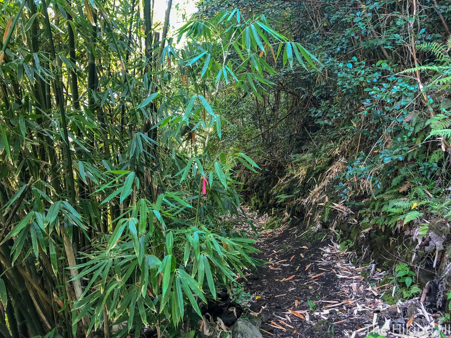
Instead what you get is a graded ridge, meaning the trail is not at the crest of the ridge, but cut into the side of the ridge. It reminded me of the Kalawahine Trail another graded ridge near the Tantalus area. This type of ridge gave the hike a totally different feel than your typical Ko'olau ridge.
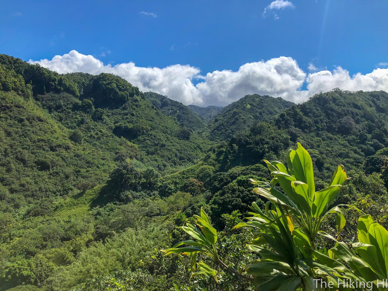
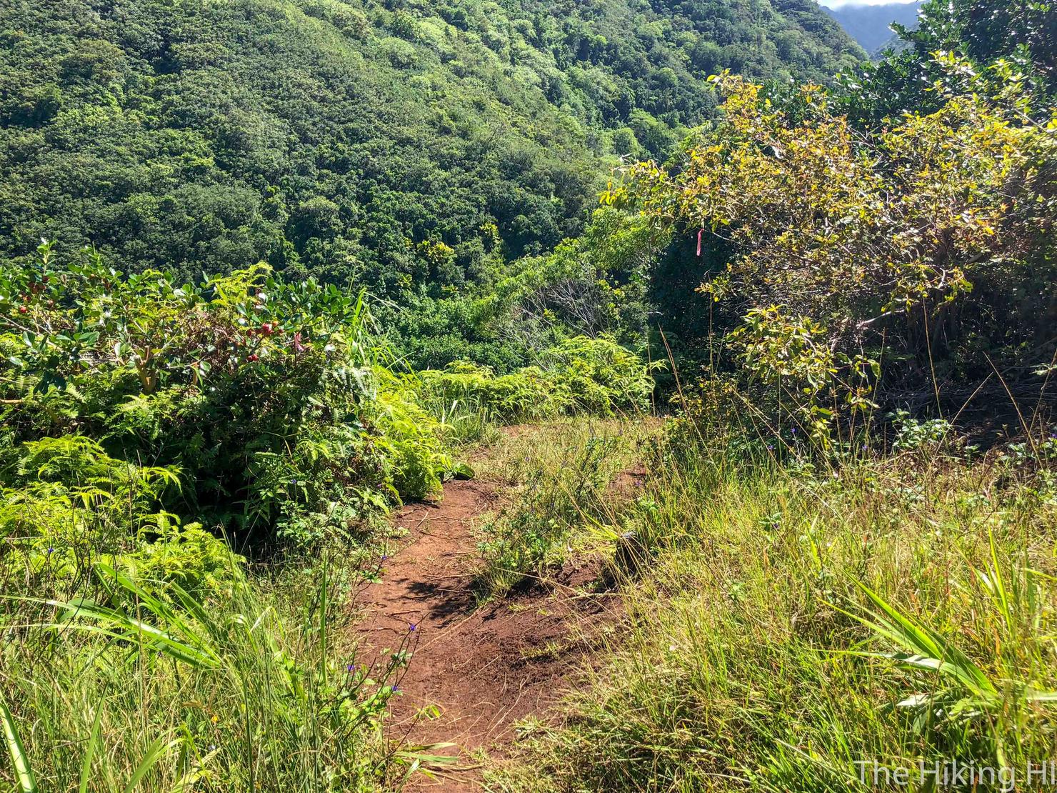
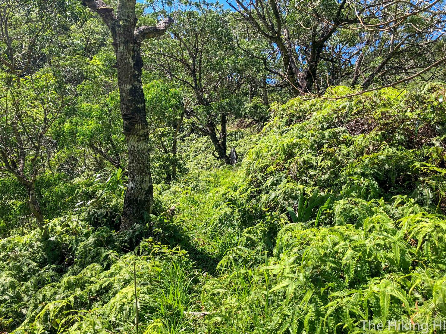
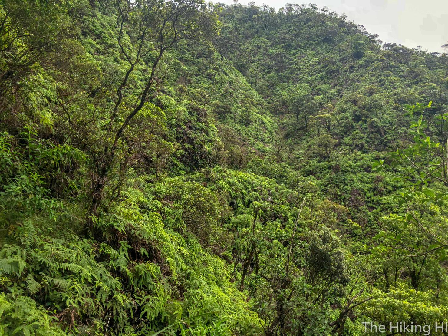
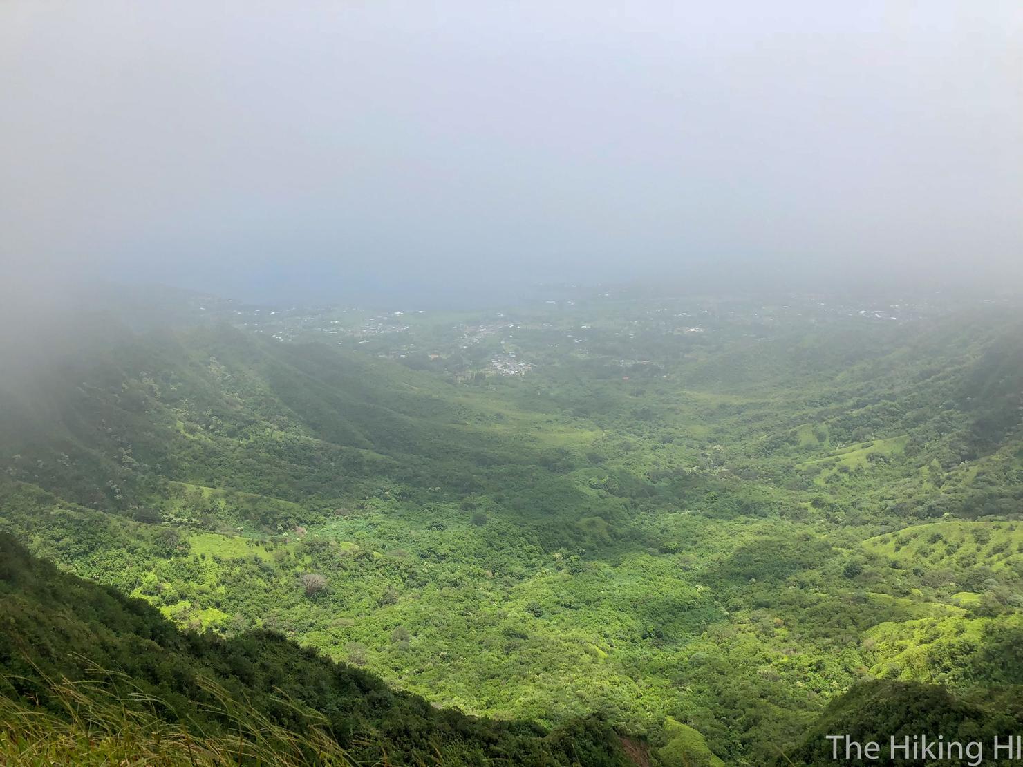
And it wasn't without its views either. The trail will give you a variety of perspectives of the valley looking back towards Pearl City.
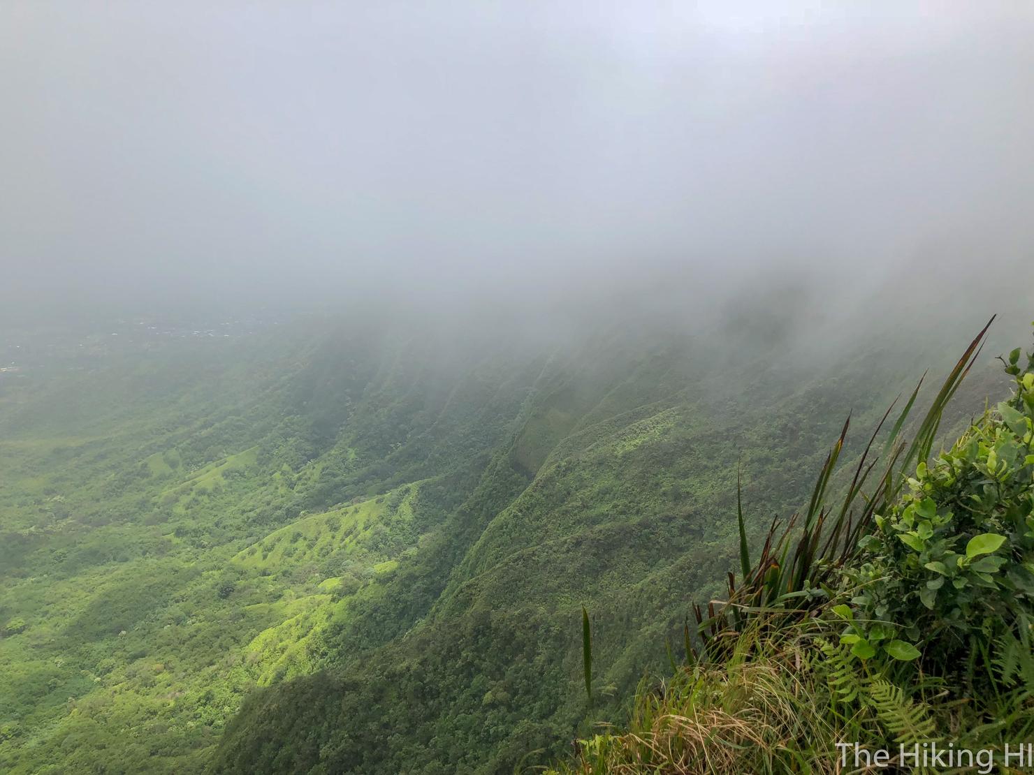
As I continued getting closer and closer to the summit, I sensed the clouds beginning to slowly creep in around me, threatening to block my views.
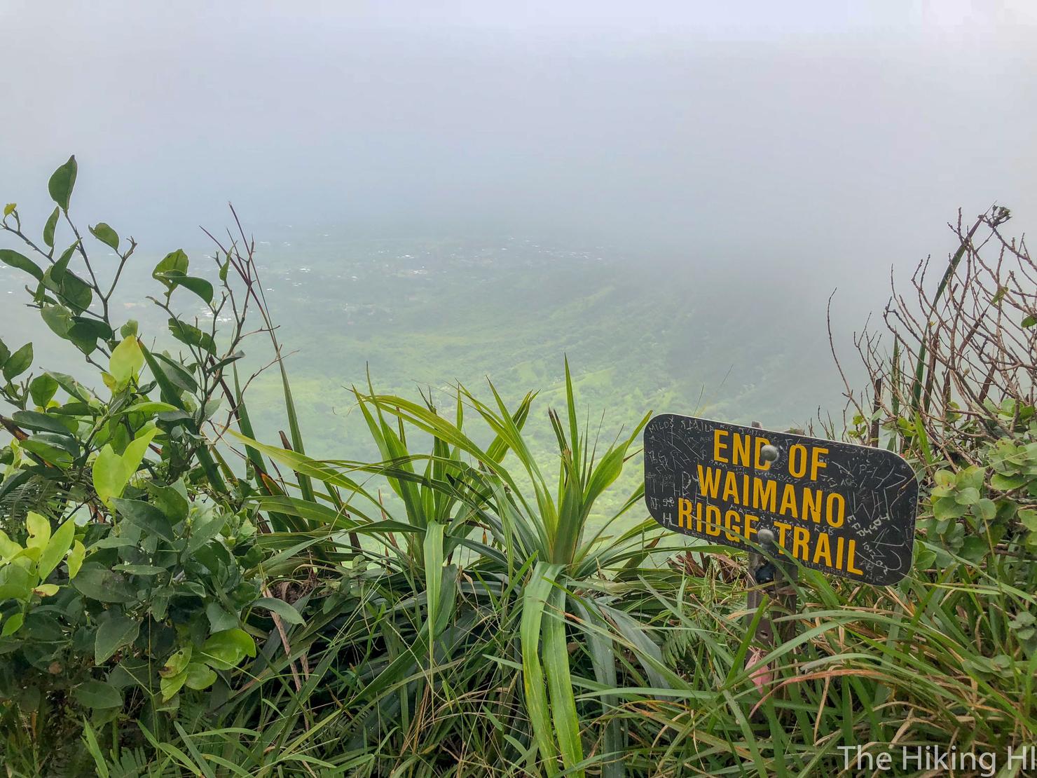
After 3.5 hours, I finally made it, the end of Waimano Ridge Trail. Now for those views...
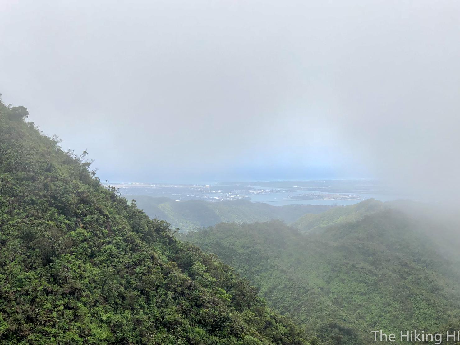
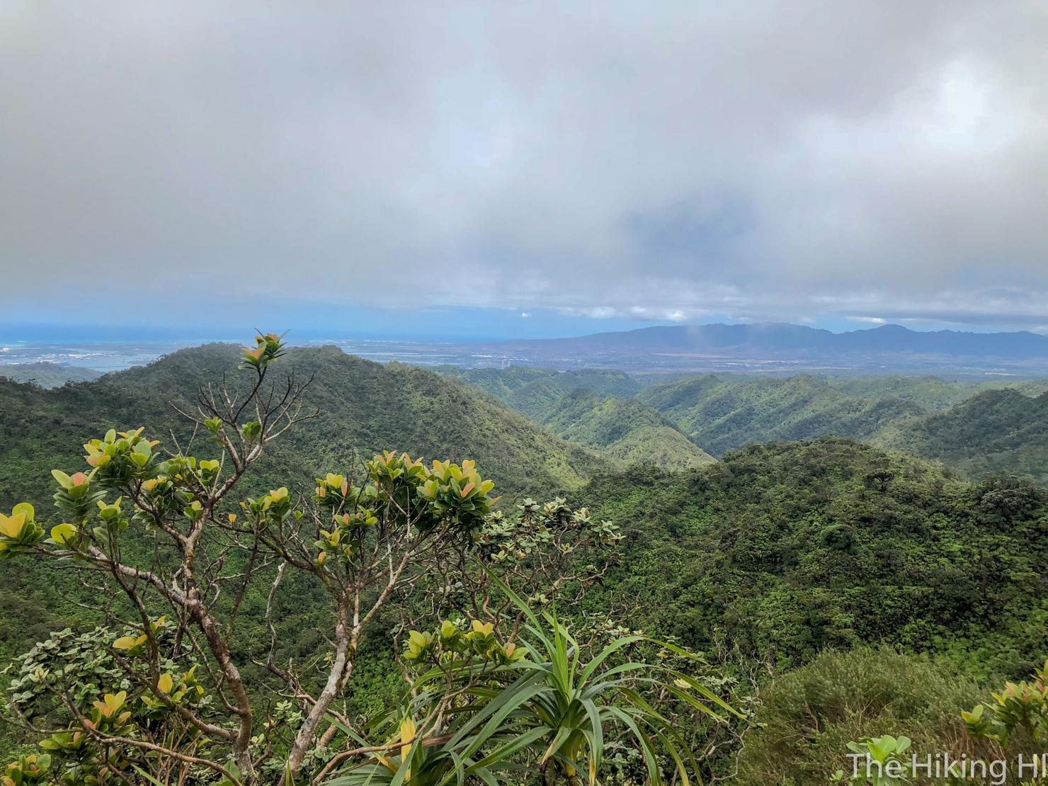
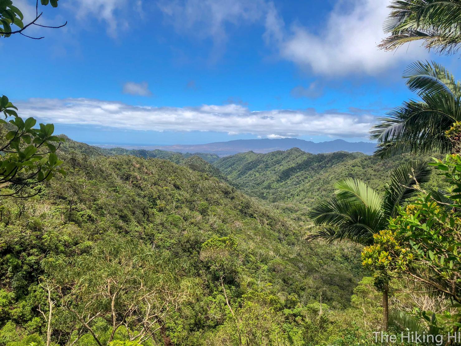
The views weren't perfect, but you could actually see to the ocean, which is a good day in the Ko'olau Range. Often you are completely surrounded by the clouds, unable to see anything. We are currently looking out towards the Windward side, near Kaneohe.
There was also enough visibility to see those crazy dropoffs of the KST. Eventually, I plan on connecting some of these ridges. But one step at a time...
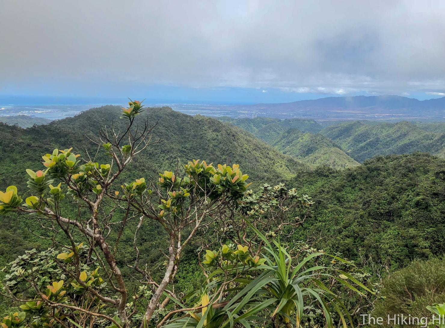
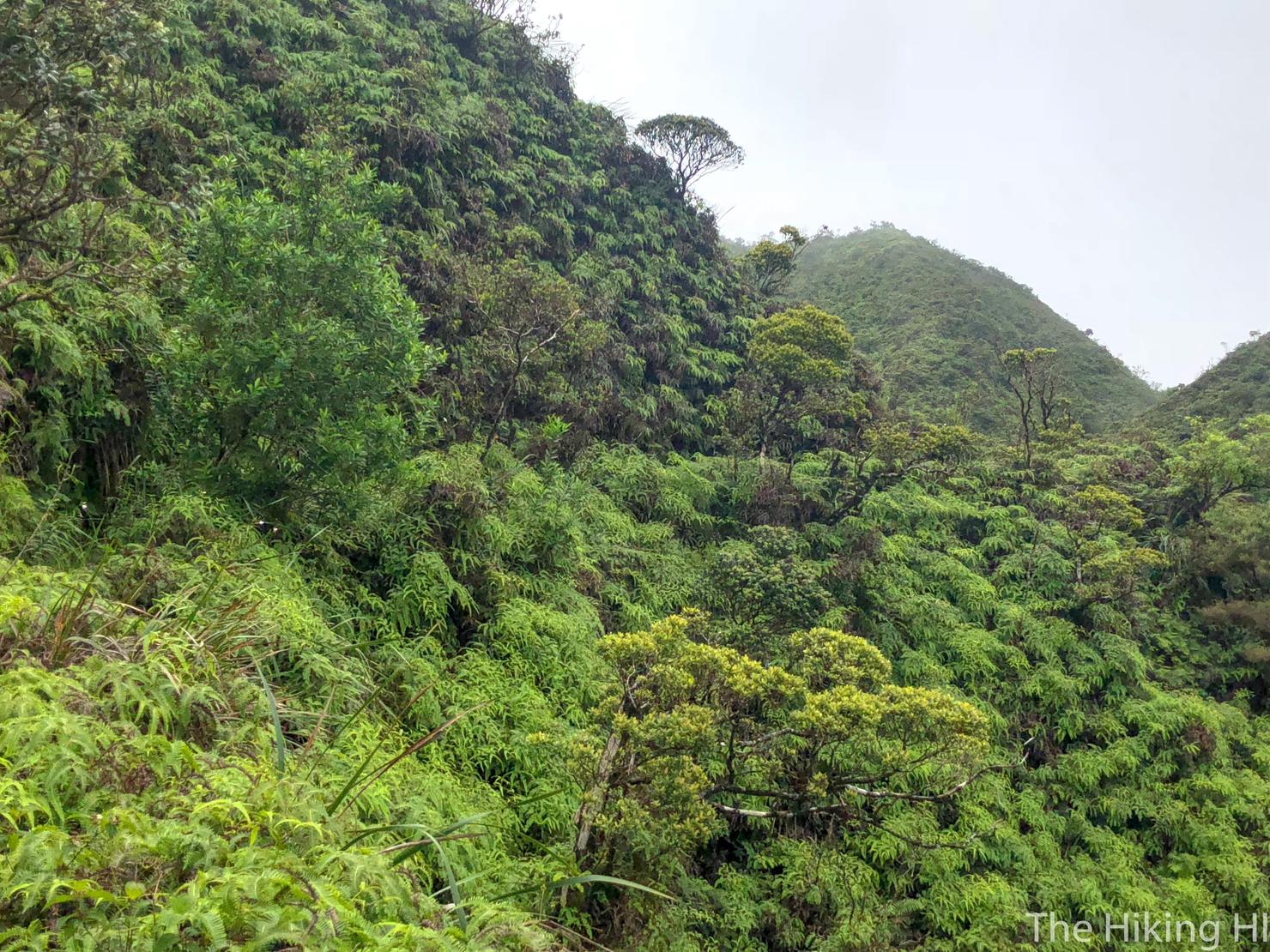
One more shot of this valley before the clouds completely sock me in.
And now it's time for that 7.5 mile trek back. No matter how many miles, or how "mediocre" the views, I find something to enjoy on each and every hike on this island. Maybe it's just a mindset. But until I lose that sense of wonder, I will keep on hiking.