Difficulty: INTERMEDIATE
Time: 5-6 HOURS
Distance: 9 MILES
Elevation Gain: 1400 FEET
Foot Traffic: LOW
Challenges: Stream Crossings, Muddy, Steep(ish) Ascent
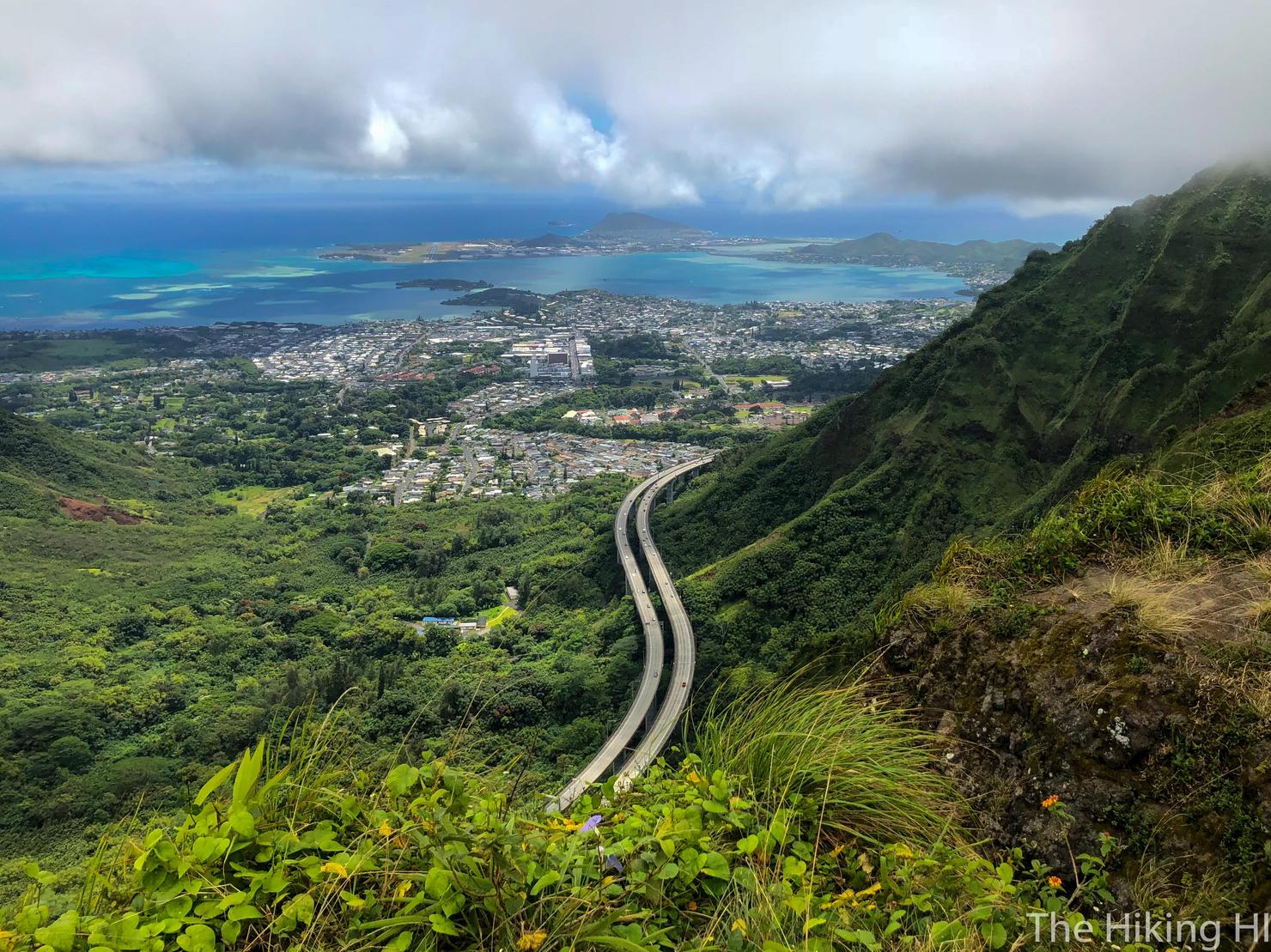
Sights: Moanalua Valley, H3 Highway, Windward Side, Waterfall (if raining)
What to Bring: Water, Lunch, Shoes with Good Grip
Sometimes called the Kamananui or Moanalua Valley hike, this combination valley/ridge hike is a great way to experience a pleasant walk in the woods, while also getting some amazing Windward views. The hike consists of three parts. It begins along a maintained path, called the Kamananui Valley Road, where you can enjoy the shade and read about the rich history of the area provided by several information posts. Then, you will split off on to the Kulana'ahane trail where you will be required to make several stream crossings in order to progress deeper into the valley. Finally, you will make a short, but steep ascent to the Ko'olau Summit Trail where you will be rewarded with amazing views of both Moanalua Valley and the Windward Side.
And we are back! After two and a half months on the mainland for work, it was time to come back to the Aloha State. The mainland was fun no doubt, I got to reconnect with old friends and even did some hiking in West Virginia, but I was ready to get back to the island. There were a few stresses I brought back with me-- a new position at work and having to move out of my house, but I still needed to celebrate being back. What better way to celebrate than with a hike! Having had the Kulana'ahane Trail on my list for a while because of its unique perspective of the windward side, I decided this would be the trail to conquer.
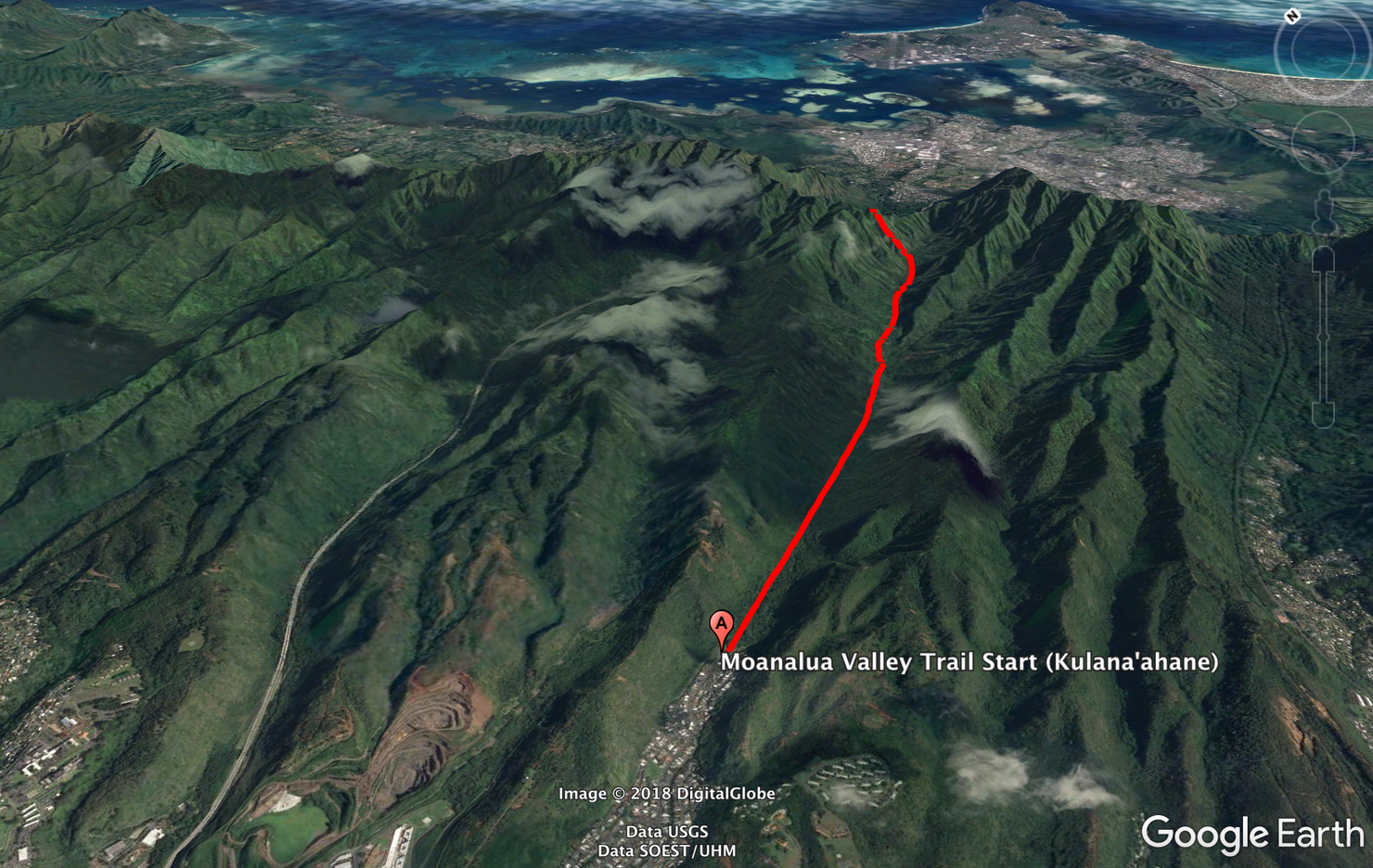
The hike consists of 3 parts. The first part goes along the partially paved Kamanui Valley Trail. You will then split off on to the Kulana'ahane Trail where you will begin your many stream crossings. Finally you will make a short, but steep ascent to the Ko'olau Summit Trail.
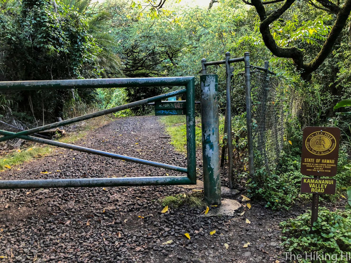
The trailhead starts at the end of Ala Aolani St. There a parking lot in Moanalua Valley Community Park at the end of Ala Aolani, but there is limited space. The gate to the park is also only open between 7am and 7pm. If you can't park in the lot, simply park somewhere on Ala Aolani (although make sure you look for the few no parking sections). There is a short uphill road that stems from the back of the parking lot that leads here, the trailhead. That gate is normally closed, so you might have to squeeze through it, but don't worry, this hike is perfectly legal!
Ah, it's so nice to be back in Hawaiian nature. Even on a humid summer morning, the shade provided by these large trees coupled with a gentle breeze made it very pleasant.
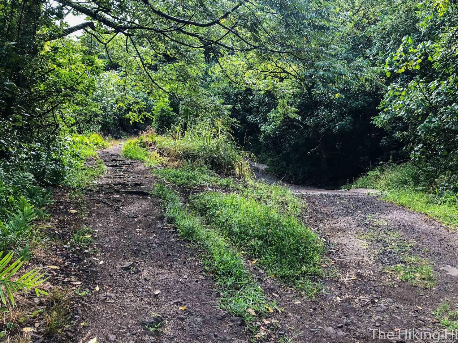
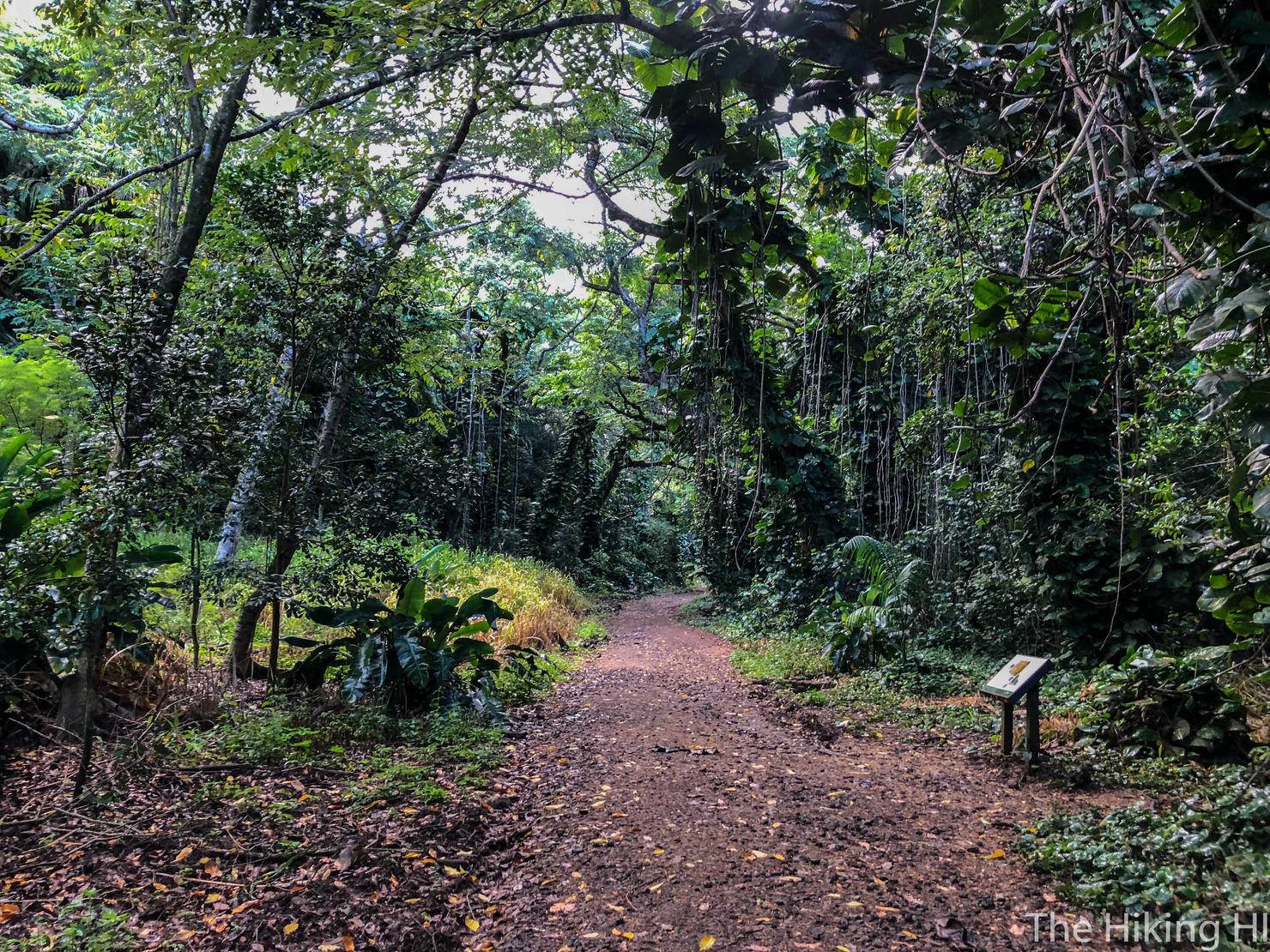
The initial trail is primarily a wide dirt path. There will be several splits in the road like this one, but they reconnect a few hundred yards later. My guess is that the low road has the potential to be covered by water since this area is known for flash floods. However, on a dry day like mine, you can choose which path to take.
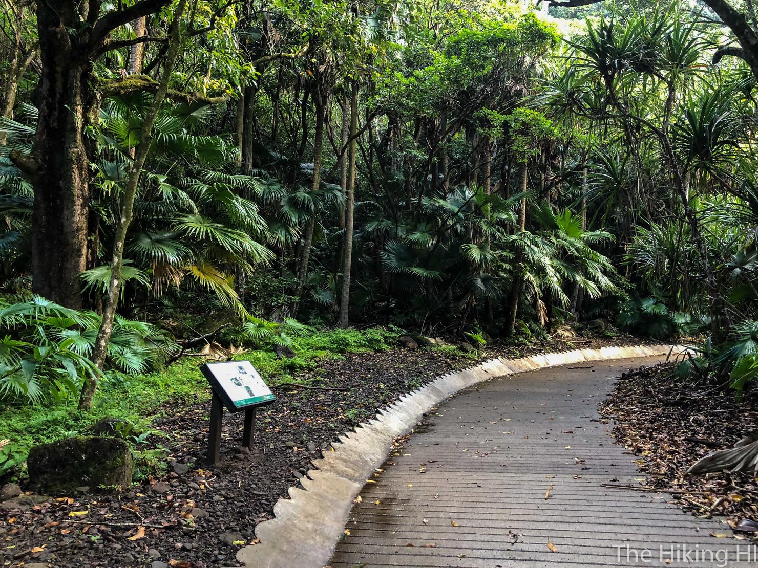
The dirt trail actually changes into a legitimate boardwalk for a short while. On the left you can see one of the many information posts found on this trail. If you really just want to be outside and take in some history, this is a great place to do it.
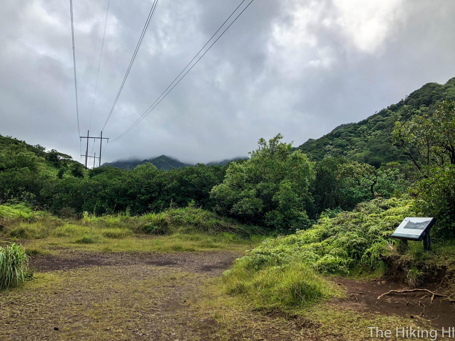
After 40ish minutes, the trail leads to this clearing. To continue, follow the trail as it loops to the right just beyond that information post.
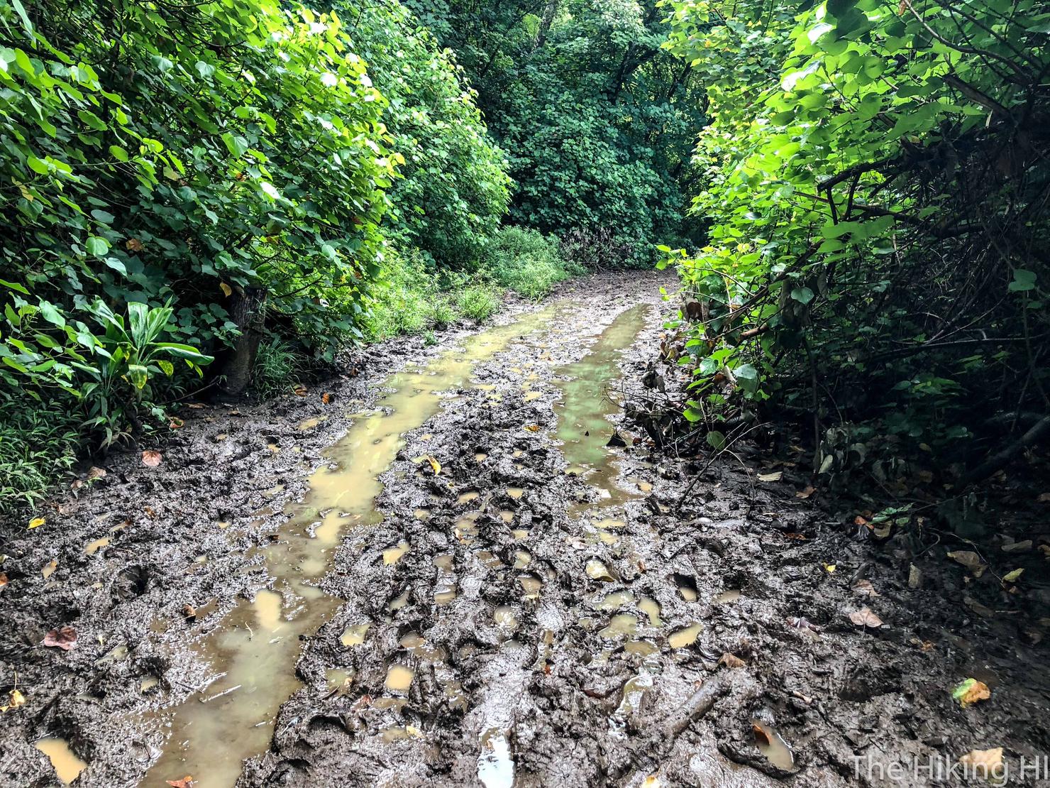
MUD! I've been on this trail three times before, and even on a dry day like this one, this section is always insanely muddy. Pro tip, to the left of the trail, there is a detour that goes through the trees that will allow you to avoid this mess. The detour is still somewhat muddy, but at least your shoes won't be sopping.
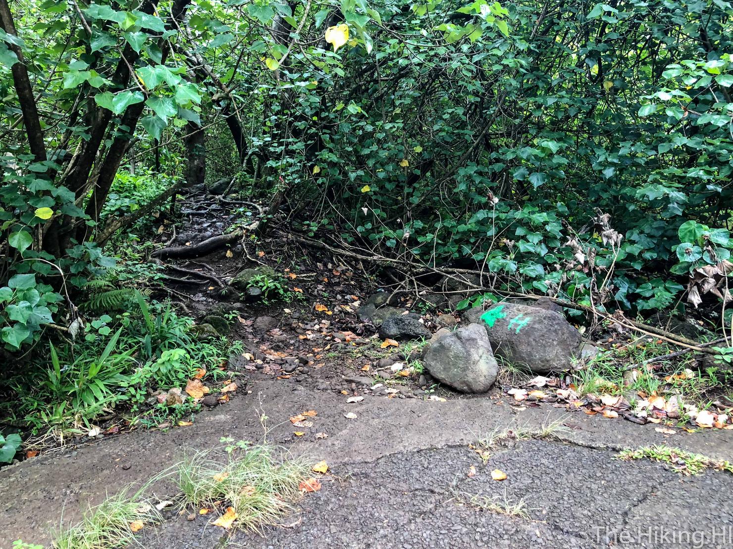
A few minutes after the mud, the road will end and you will be forced to turn left into the trees.
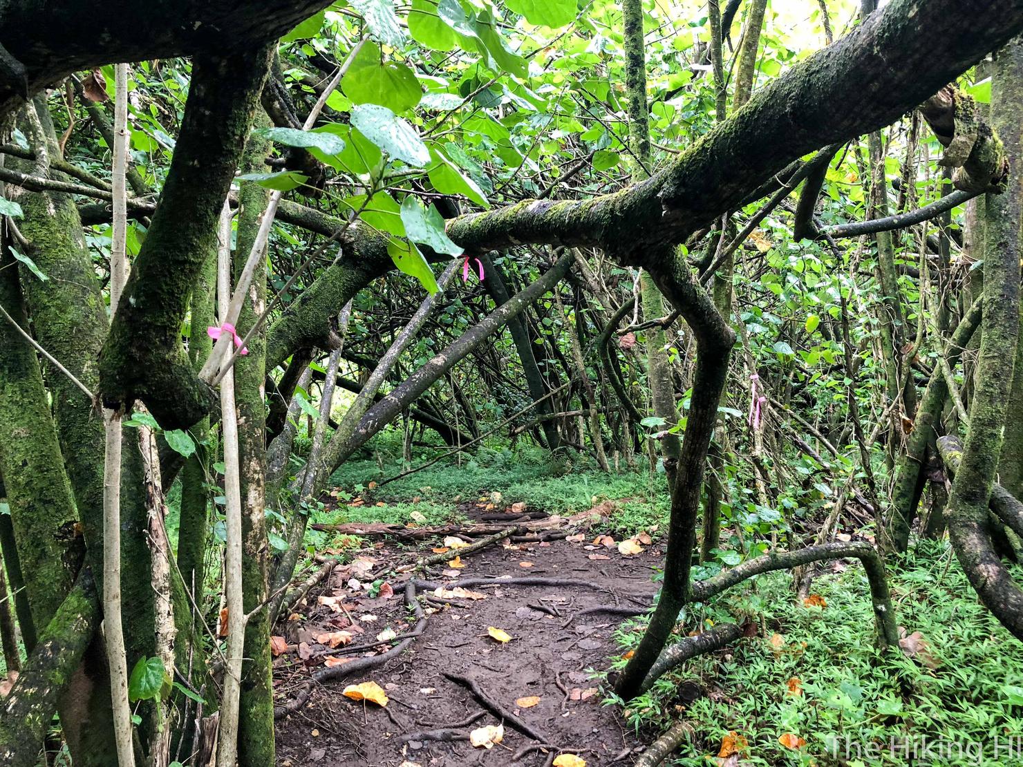
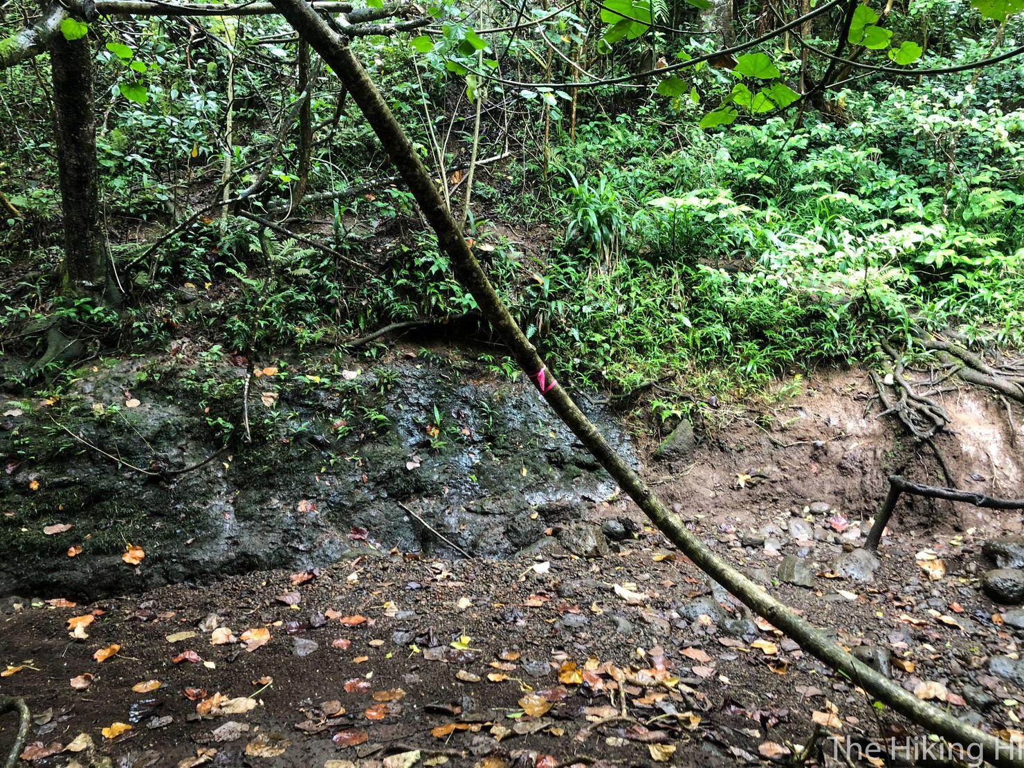
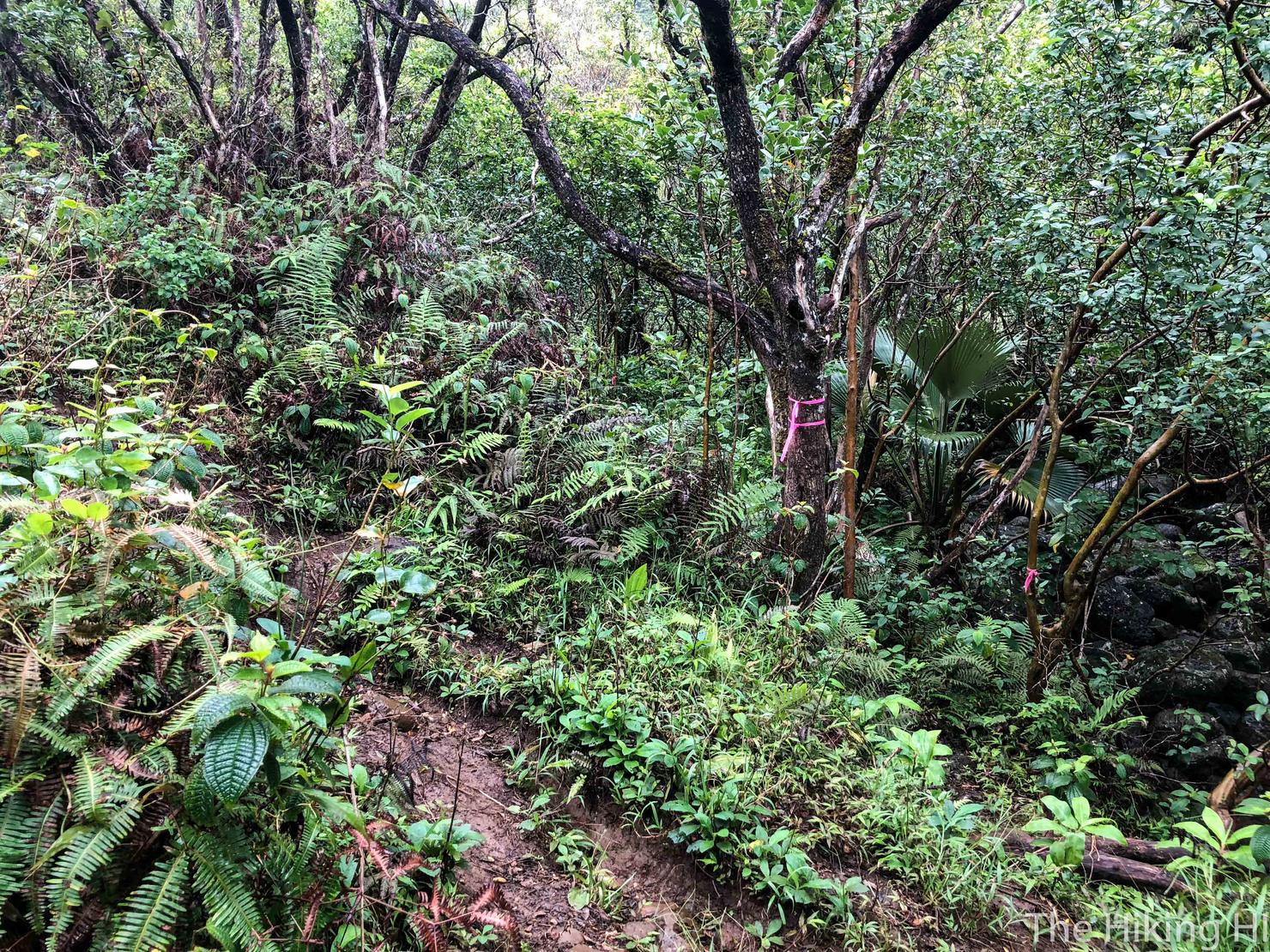
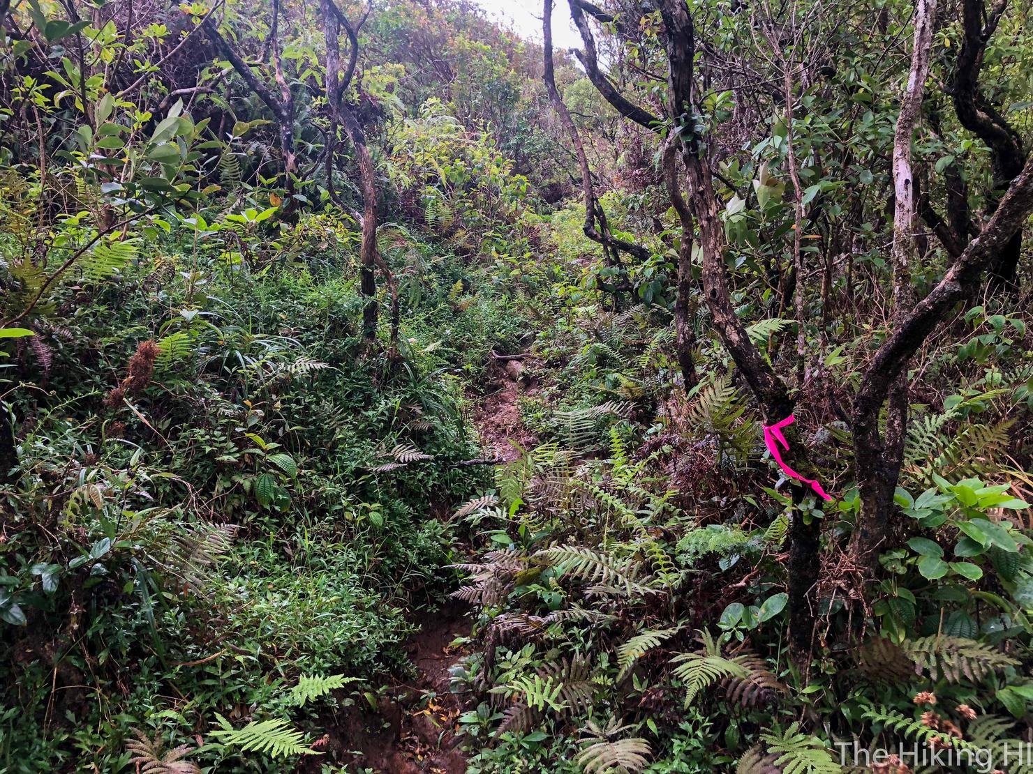
This is when you should pay attention, because shortly after that turn, you will come across this fork. It should be fairly obvious as there are several pink markers tied to different branches. GO RIGHT at the fork. I made the unfortunate mistake of going left, which led to a domino effect of wrong turns, which led to me climbing halfway up a steep and muddy ridge. I was actually able to get back on the correct path, but bottom line, make it easy on yourself and go right.
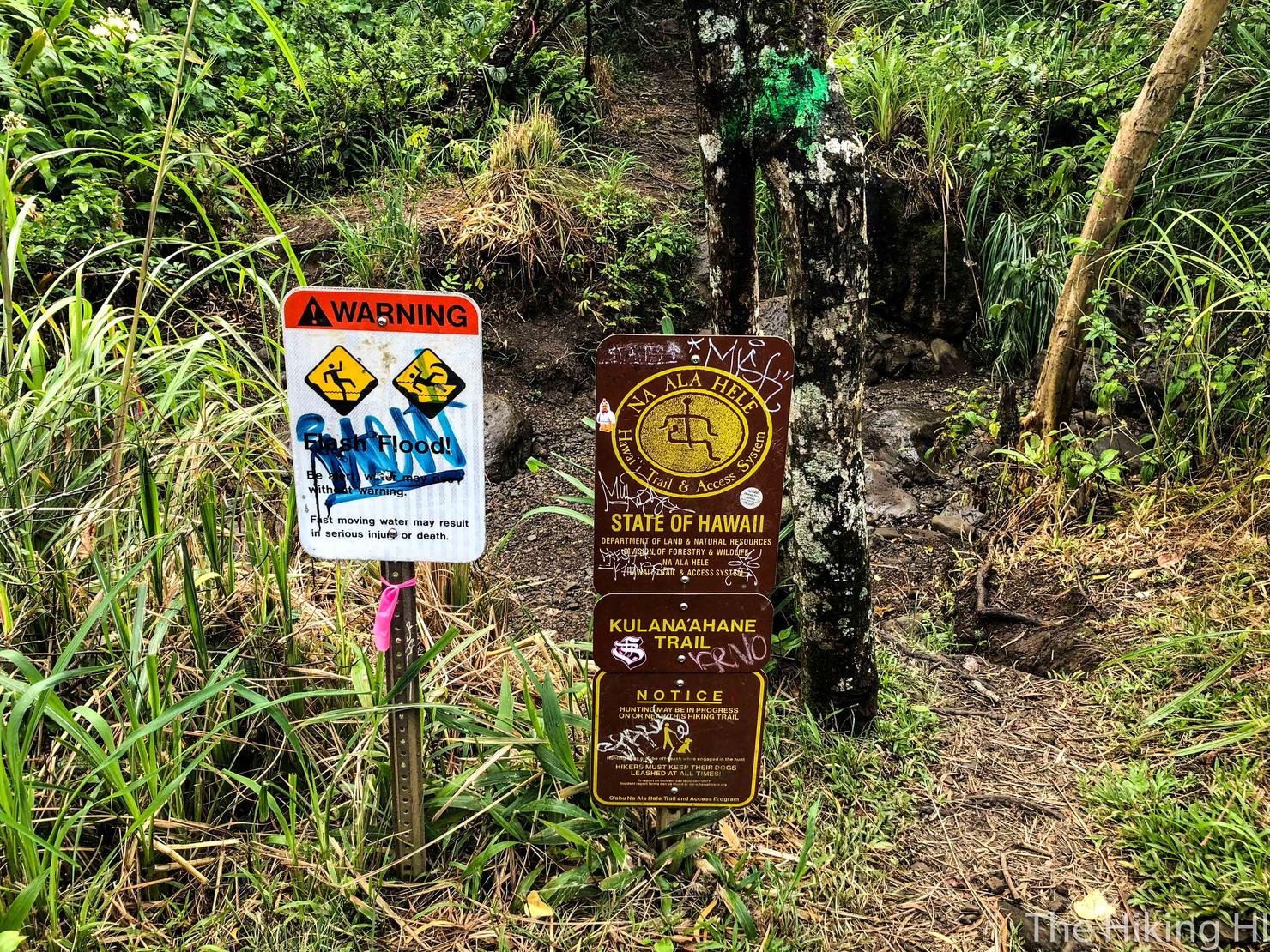
Not too long after that fork, you will arrive at the split off to the Kulana'ahane Trail. To continue, you will need to go past this sign and cross this (potentially) dry stream bed. If you didn't make this turn, you would continue on to Moanalua Middle Ridge, an advanced ridge hike often called "the back way to Stairway to Heaven", because it would lead you to the famous Haiku Stairs. I actually passed three separate groups on Kulana'ahane, all of whom were attempting to reach the Haiku Stairs, but had unintentionally made the turn here. I was happy to lend them all a hand and try to direct them to Moanalua Middle. I wonder if they ever made it?
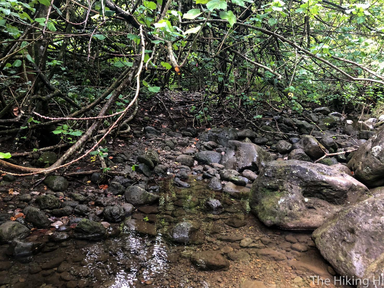
Oh well, can't do much about it now, back to hiking. Here's is the first of your many "stream crossings." It's in quotes, because it really depends on the time of year you go (and how much it has been raining). Since I was hiking in the dry summer months, the streams weren't flowing. However, if I wanted to cross without getting my shoes wet, I did have to do some rock hopping, which can be just as treacherous. Most of the rocks were still wet, so you still need to be careful while crossing.
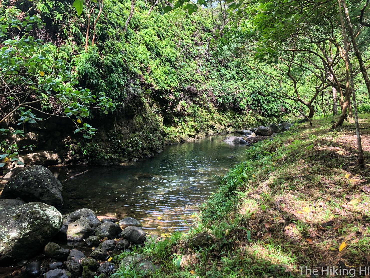
I liked the looks of this area of the trail. The water was pretty deep here, and would make a great place for a swim. But alas, I had no swimsuit. Not that that would have stopped me, I was just very focused on summiting.
The Kulana'ahane trail is easy to follow. Just follow the beaten down path and the markers. This was maybe one place you could take a wrong turn. The trail T's at what appears to be a dry stream bed. It looks as though there is a path leading uphill on the other side. However, the correct path is to go RIGHT along the wide path.
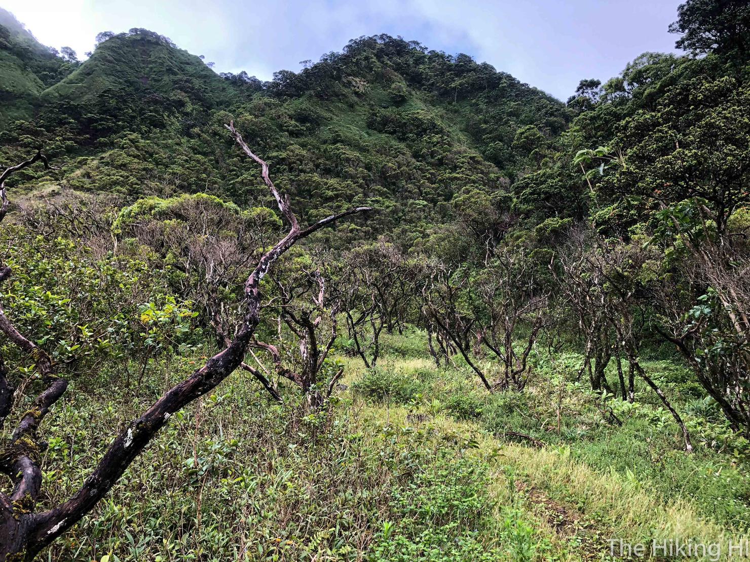
There's a moment where you break out of the woods to this field of leafless trees. It was a nice break to the scenery.
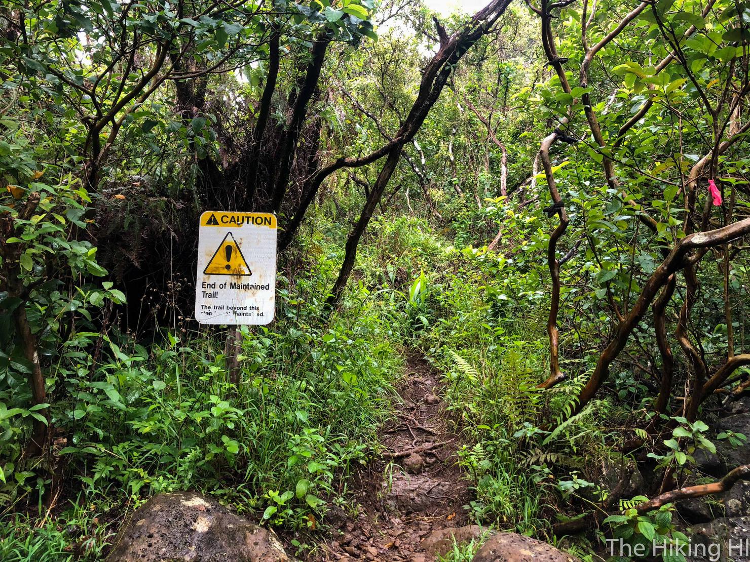
After a little over 2 hours of trekking through the trees, I reached this sign marking the end of the maintained trail. This signifies the final stage of this hike, the ascent to the Ko'olau Summit Trail and the H3/Windward Overlook.
Very shortly after that sign, you will reach a fork. To head up to the overlook, you need to go LEFT and UPHILL.
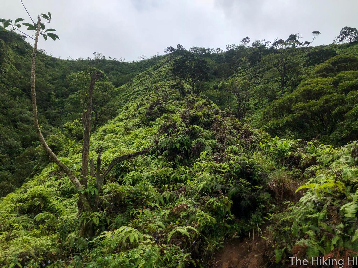
And this is when the intensity vamps up on this hike. Up until now you were actually gaining elevation, but at such a gradual pace it wasn't noticeable. Your only real challenge was ensuring you didn't break your face while crossing the streams. Now, with less than a mile to go, you have to gain hundreds of feet in elevation on a muddy slope. Needless to say, your body will get jolted awake during this section.
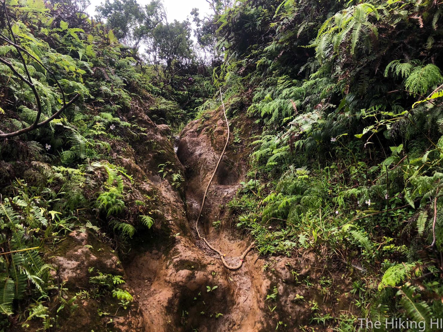
The ascent, while muddy and steep, is manageable. There are some ropes along the way to help you out. If you happen to have microspikes, they would be very useful for this portion of the hike (unfortunately, I forgot mine at home).
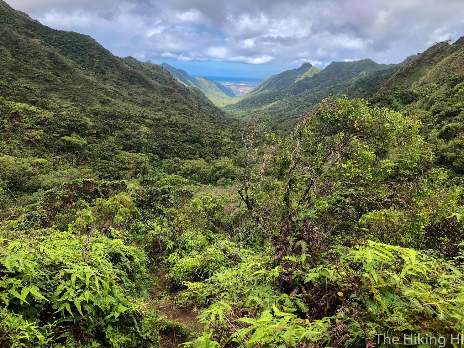
And to make it even more tolerable, once you gain a little bit of elevation, you get a great view looking all the way back through the valley. We've already hiked all that! Crazy right?
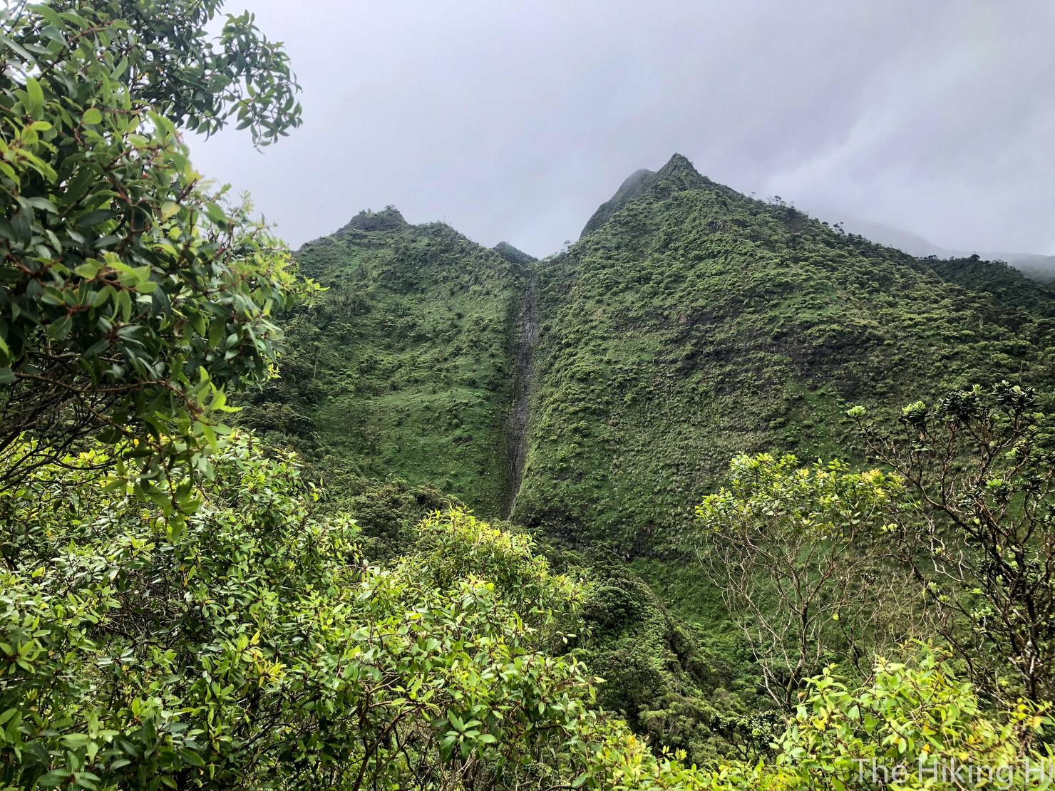
As you continue to gain elevation, look to your right. See that discoloration in the ridge? That is a waterfall. It's not flowing today, but when it rains I imagine it's amazing. That is probably one of the most magical aspects of this island. Get enough rain and the Ko'olau ridges turn on like a faucet, with numerous waterfalls popping up all over. One of the best places to view this phenomenon is while driving on the H3 Highway right before you go through the tunnel.
Which is exactly where we are going! Not for the waterfalls, but we will still get a great view. Just one final push up this slope...
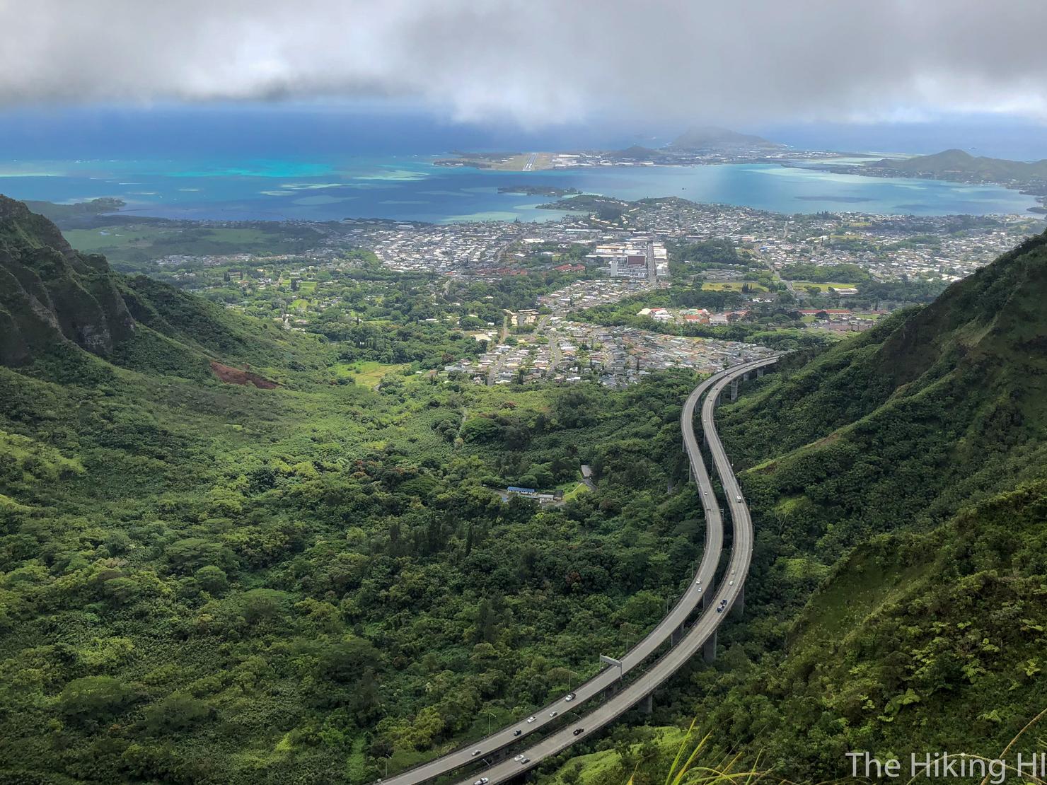
And we made it! It was a bit cloudy and windy, but not bad enough that I couldn't enjoy the view. That is the H3 Highway, my commute to work over the past 2 years. Looking farther, you get a view of Kaneohe Bay of "K-Bay" with it's beautiful color variations thanks to the sandbars. Imagine after a long day at the office, driving back home, you pop out of the tunnel and WHAM, that's the view you get to see. Why am I moving to Honolulu again?
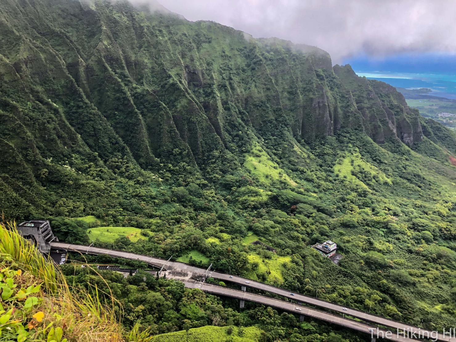
Speaking of that tunnel, there is the entrance. It's a pretty remarkable (and expensive) piece of infrastructure built into these massive mountains.
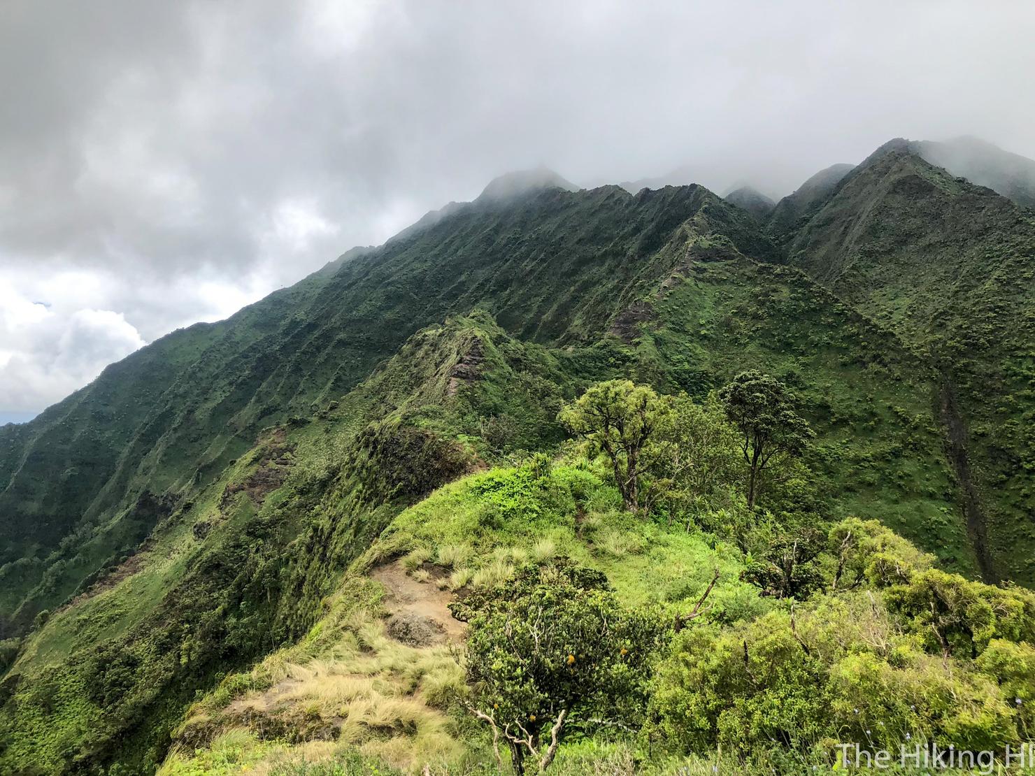
If you look to your right, you will see the Moanalua Saddle, one of the many notoriously treacherous portions of the KST. It is feasible to take that ridge to the Haiku Stairs and back down Moanalua Middle Ridge all in one day. But that would be a LONG day (probably 12 hours or so).
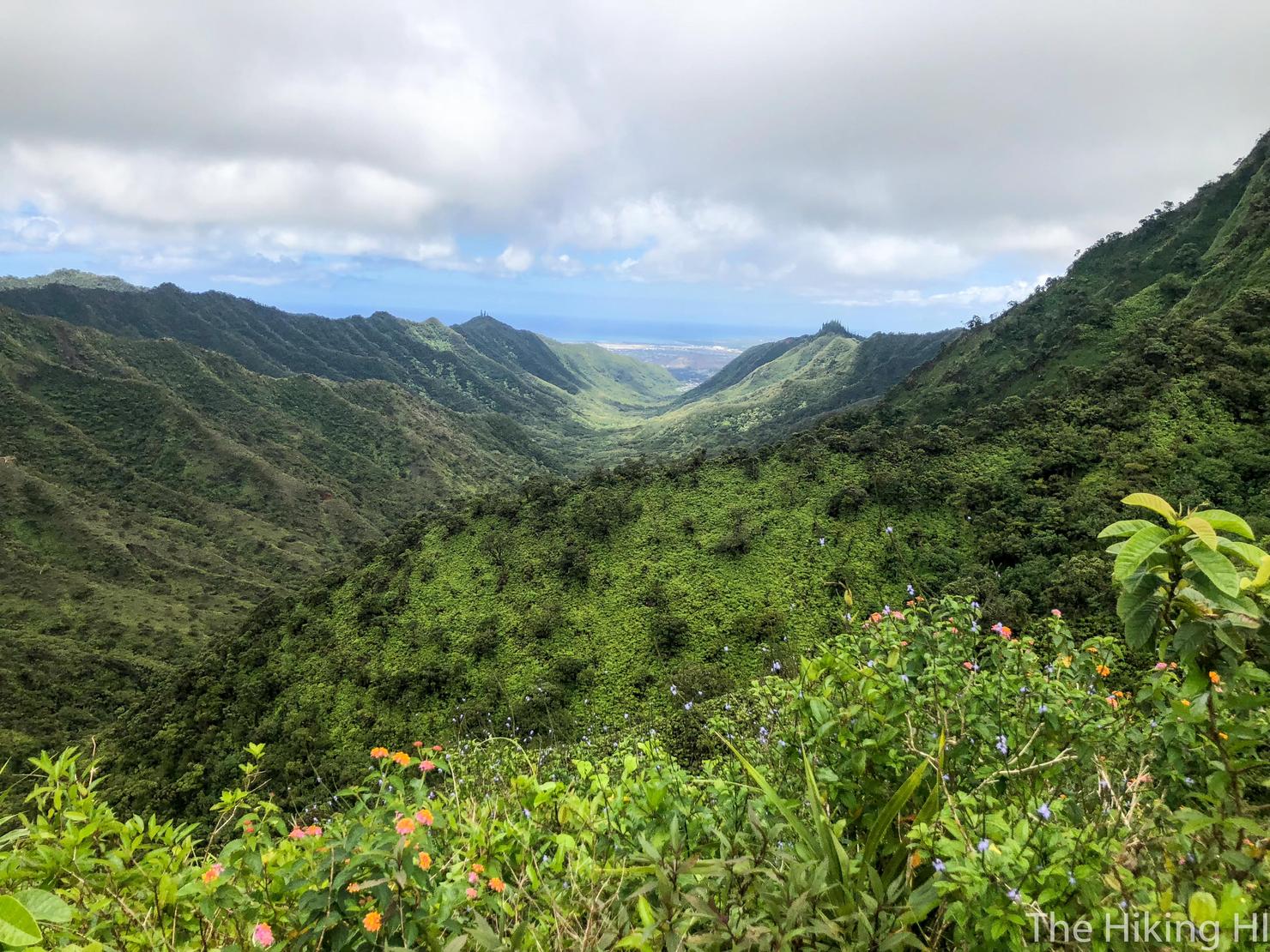
And looking back leeward, you can see everything we've accomplished today (as well as the amount of hiking we have left).
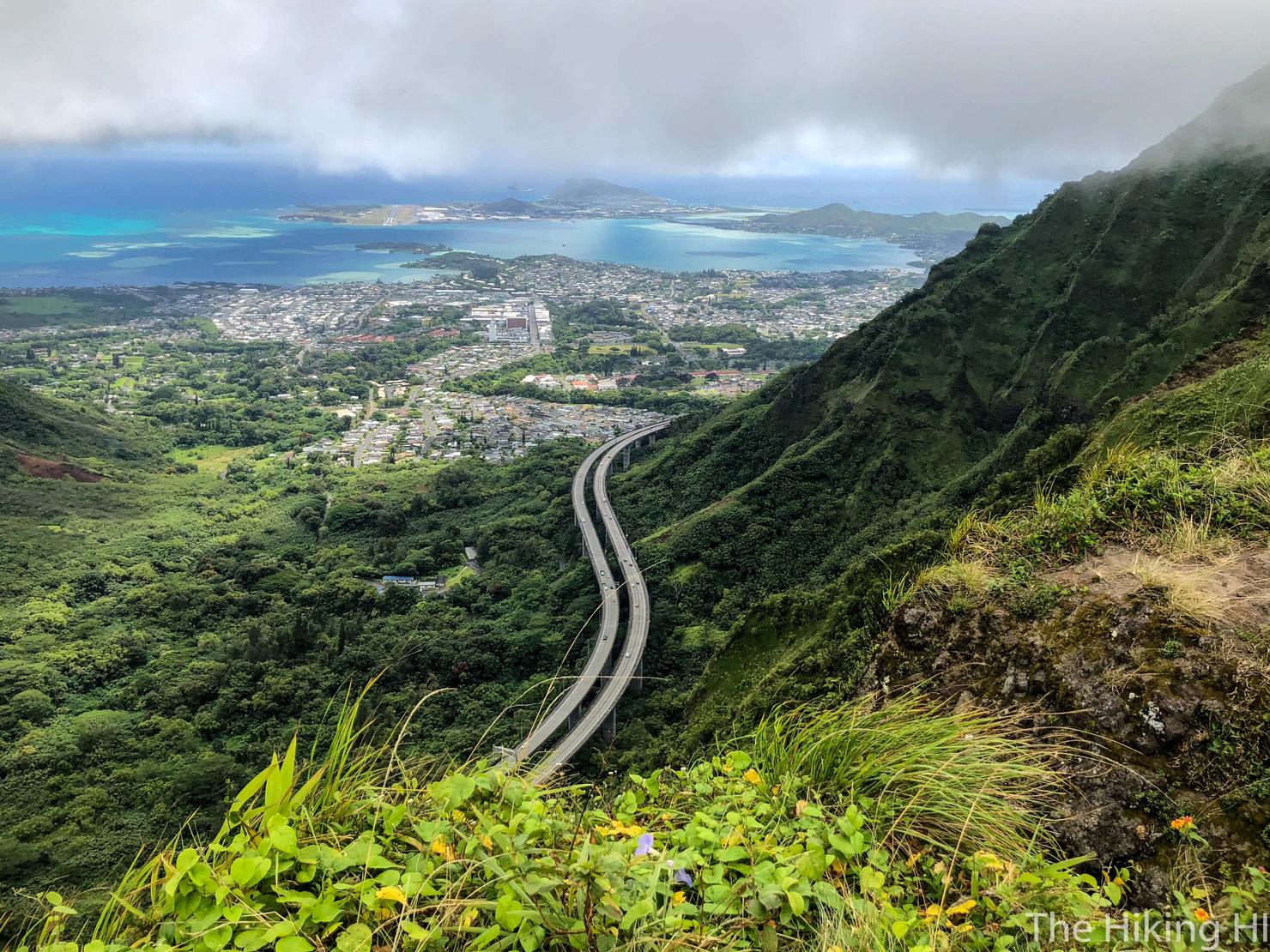
One more shot of the windward side. I sure will miss this commute everyday. I guess that's just one more reason to return to this beautiful ridgeline.