Difficulty: INTERMEDIATE
Time: 3-5 HOURS
Distance: 5 MILES
Elevation Gain: 1500 FEET
Foot Traffic: LOW
Challenges: Some narrow ridges, Steep uphills, Minor rock scrambling
Sights: Honolulu, Diamond Head, Ka'au Crater, Windward Side
What to Bring: Water, Snack, Shoes with good grip, Sunscreen
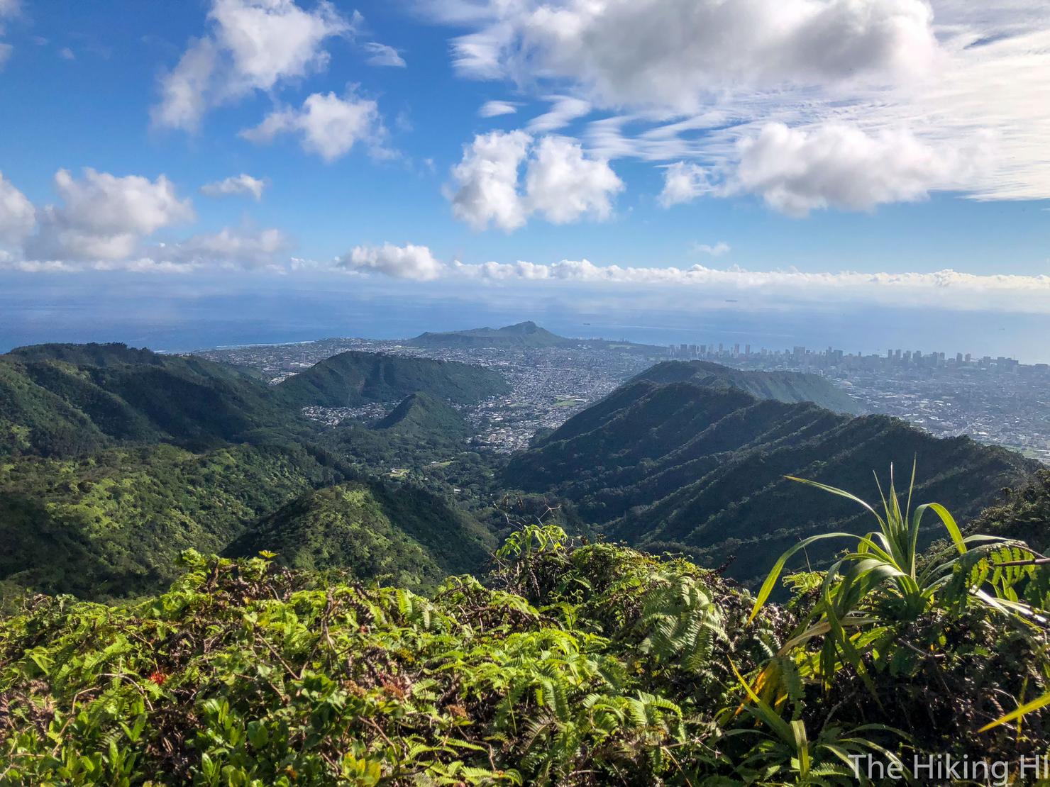
This is one of two popular routes to reach the Ko'olau peak of Awaawaloa, more commonly called Mount Olympus. The hike involves some minor rock scrambling, narrow ridges, and a few steep uphills coupled with a long 5 mile climb. But once you make it to the summit, you will be greeted with spectacular views of both the windward and leeward sides of the island.
It was a pleasant sunny Sunday on the island of Oahu. I had managed to make the most of my rainy Saturday, adventuring to the beautiful Waipuilani Falls. Today, my friend Peter and I had hoped to knock out a hike together, celebrating my last weekend on the island before returning to the mainland for a few months. Unfortunately, he had gotten caught up at work, so I was left staring out the window, contemplating what to do with this beautiful day. I no doubt had to hike, but where? After perusing AllTrails, I decided to revisit a peak I had been to several times, Mount Olympus, known for its amazing views,. This time, however, I would take a different path to reach this peak, via Wa'ahila Ridge Trail.
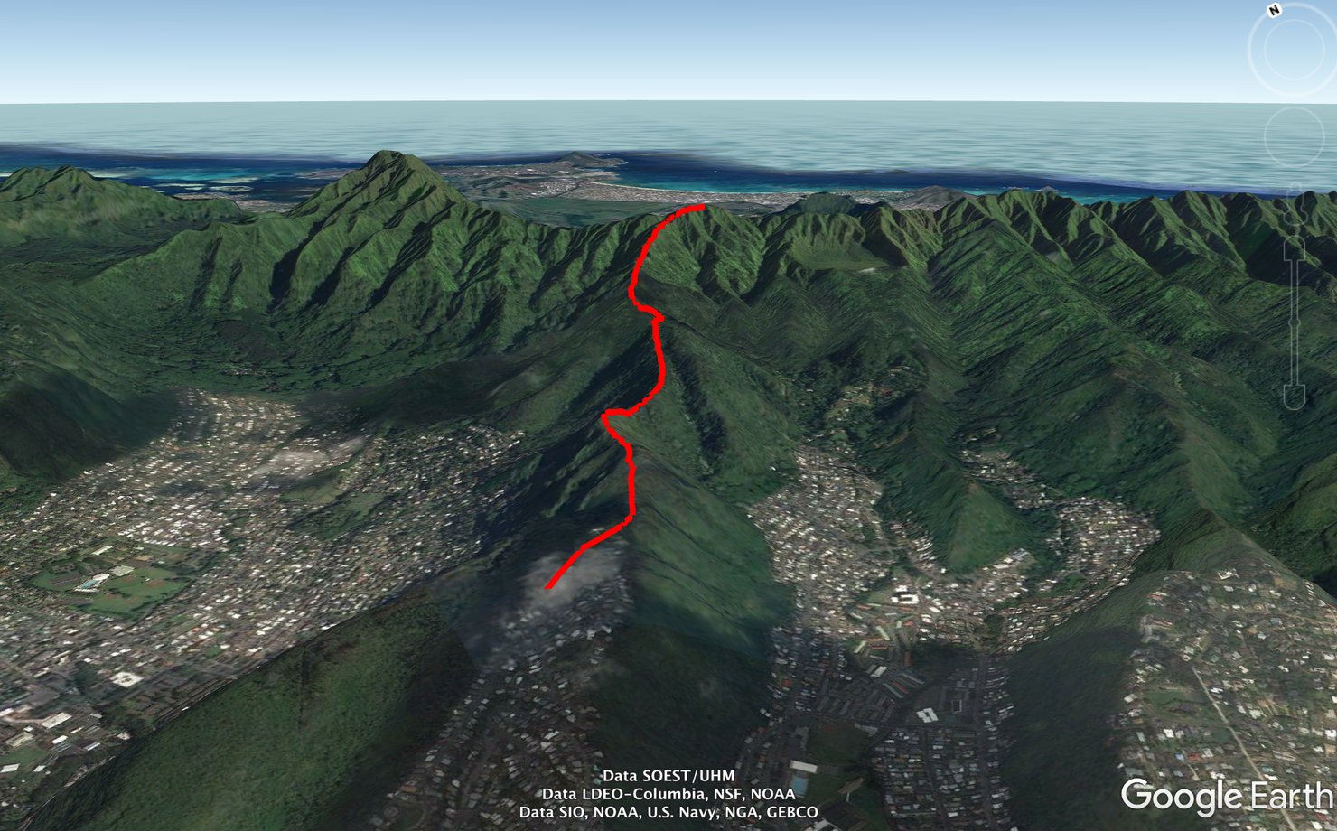
Like most ridge hikes that lead to the Ko'olau Summit Trail (KST), this is a long gradual uphill along one of the Ko'olau finger ridges. I guess one potential benefit to starting here vice the alternate route via the Kolowalu trail, is that you begin 500 feet higher in elevation. However, that 500 feet isn't really noticeable. This hike is a workout regardless.
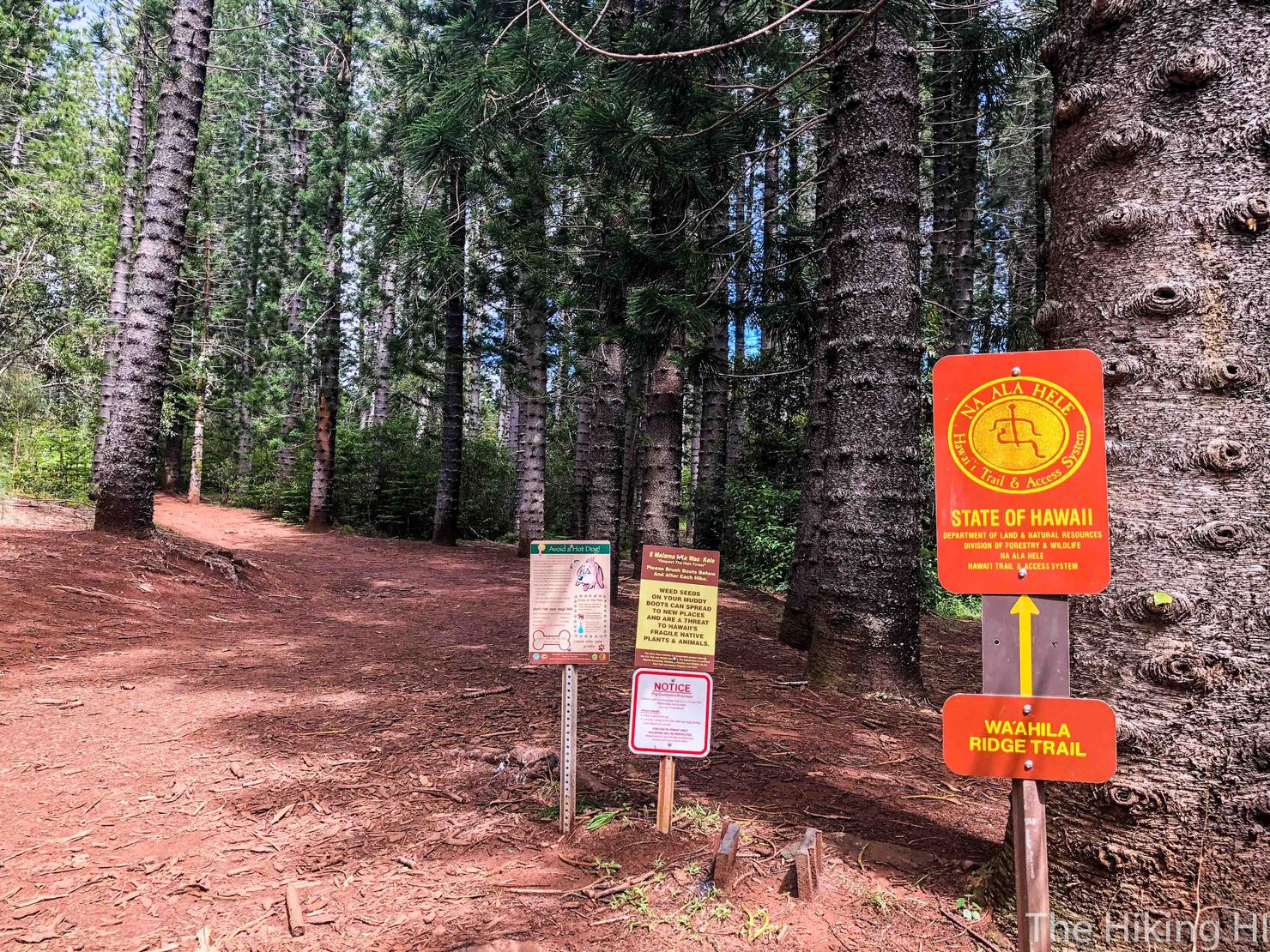
Wa'ahila Ridge trailhead is located in Wa'ahila Ridge State Recreation Area (go figure). This park is legit, with parking spaces, bathrooms, picnic tables and all. If you don't know, this is quite a rarity for Oahu hiking. Most hikes start at some random point in a residential neighborhood or on the side of the highway. I instantly began to compare this hike to the Kolowalu route, seeing which route I prefer to take to Olympus. So right now, that is advantage Wa'ahila!
I came across what felt like a fork almost immediately. Some people may not even notice it and naturally go the correct way. But if you do notice it, go left.
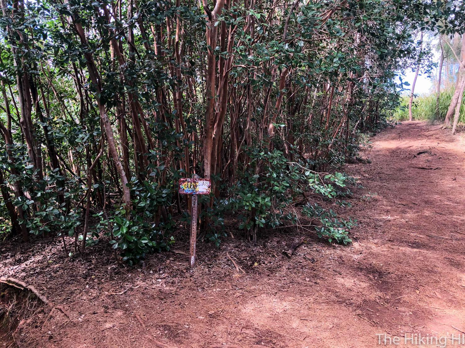
And shortly after, you will notice another fork, marked by this sign. Head left.
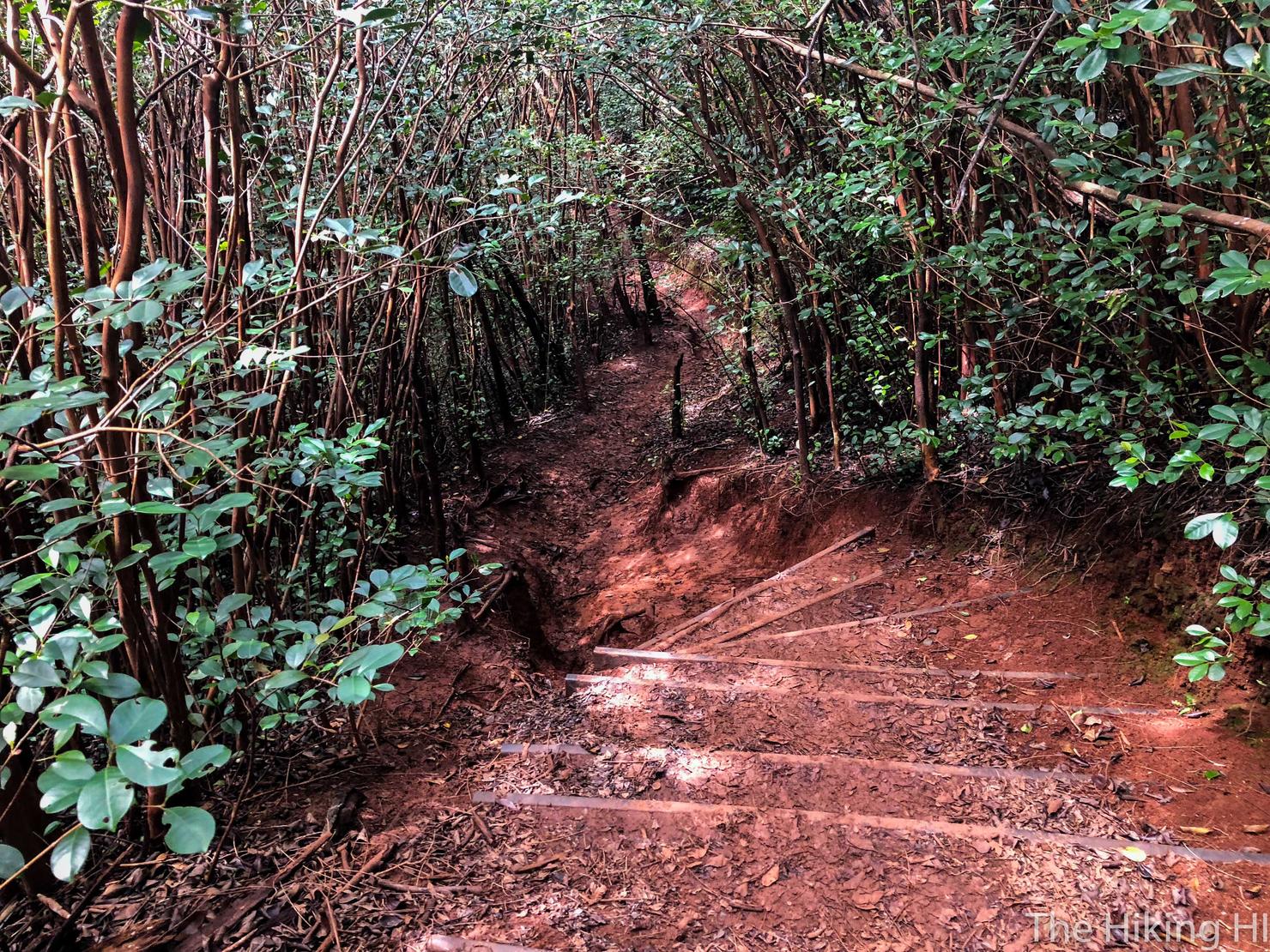
And you will arrive at some stairs that will take you downhill.
Only to go back uphill.
Only to go back downhill... You get the picture, there is some up and down here. This part even required a bit of rock scrambling, requiring you to use your hands for balance, but it makes it more fun. Kolowalu on the other hand, is a constant uphill.
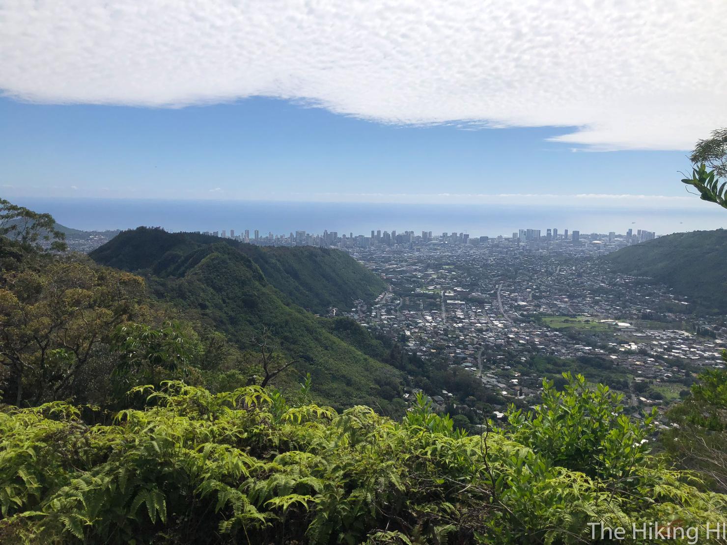
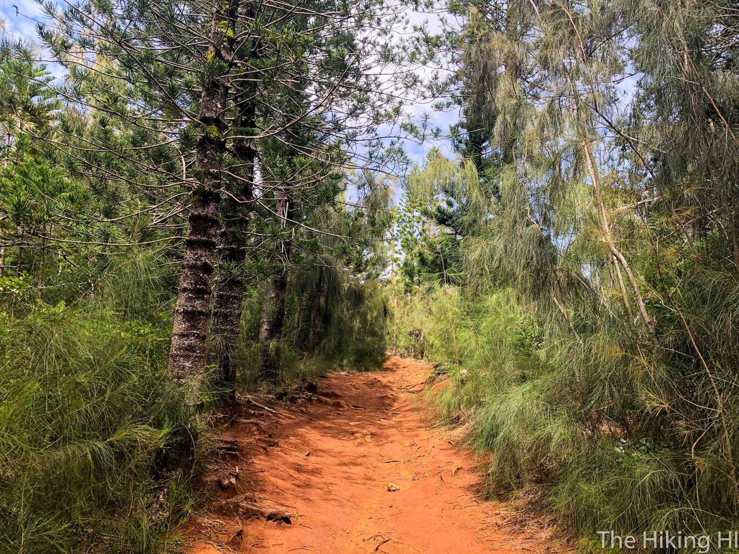
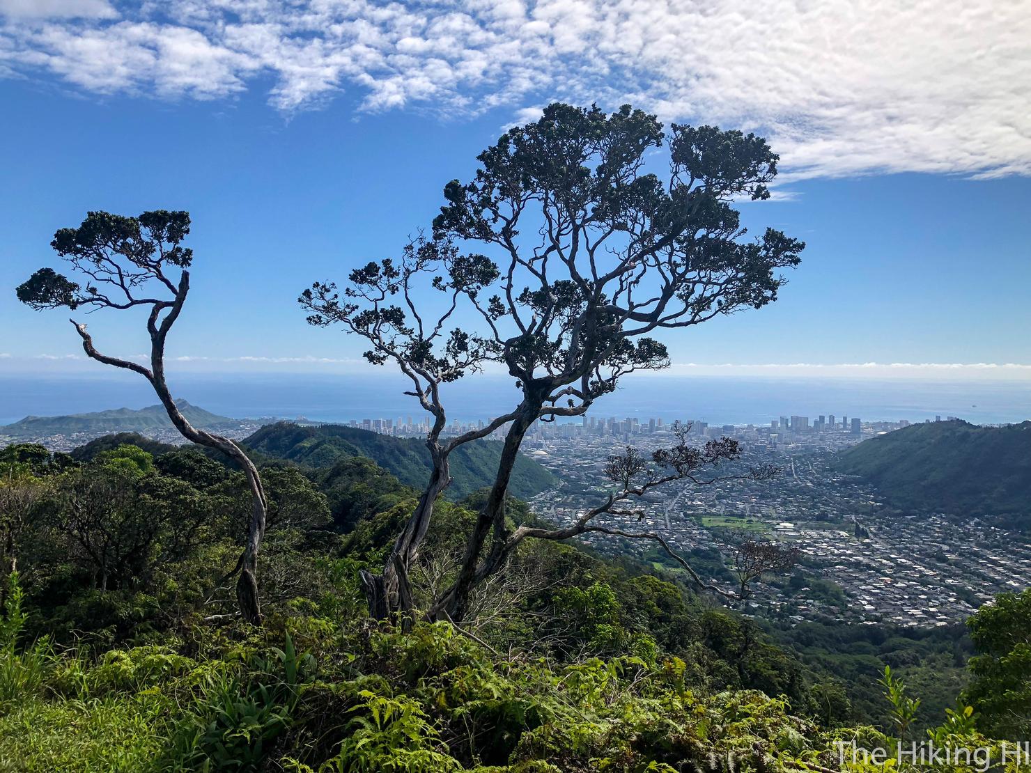
Periodically, the trees will break to give you some views. Looking left we get a solid view of Honolulu. The clouds were really interesting today, like a collection of flattened marshmellows. I'm sure there's a technical name for them...
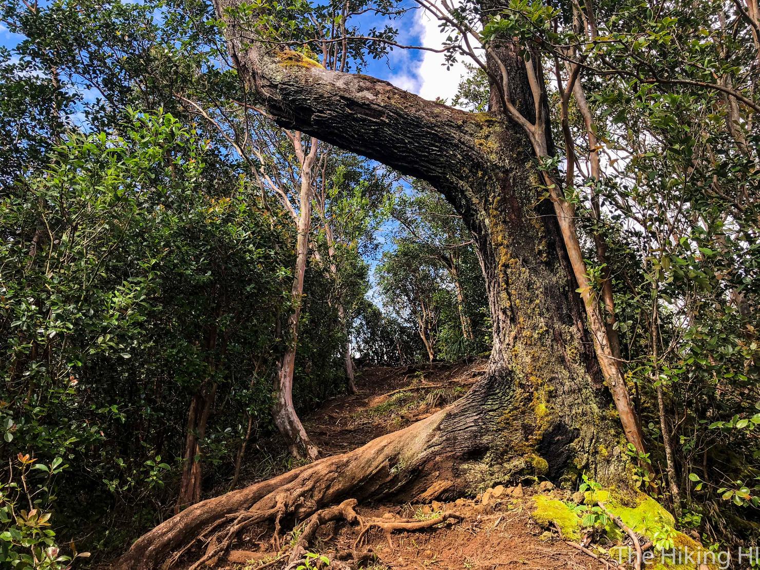
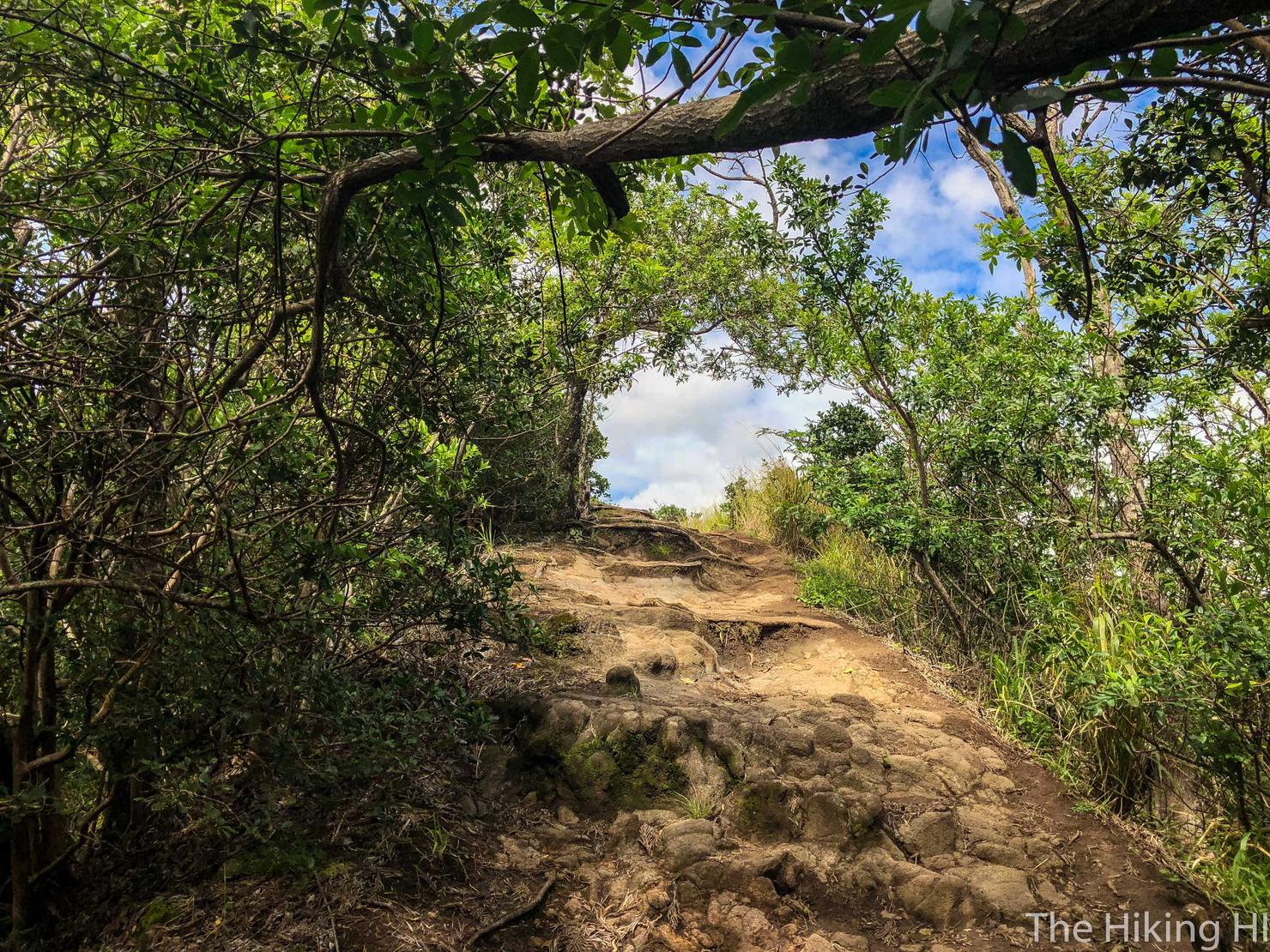
I thought this tree hanging over the trail looked rather interesting as well. It also serves as a good landmark.
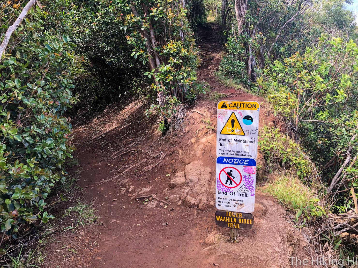
Because a few moments later is our turn to the upper part of the ridge, marked by this sign. That left fork is the Kolowalu trail, so from now on, the hikes are the same. We will head right to go up the ridge.
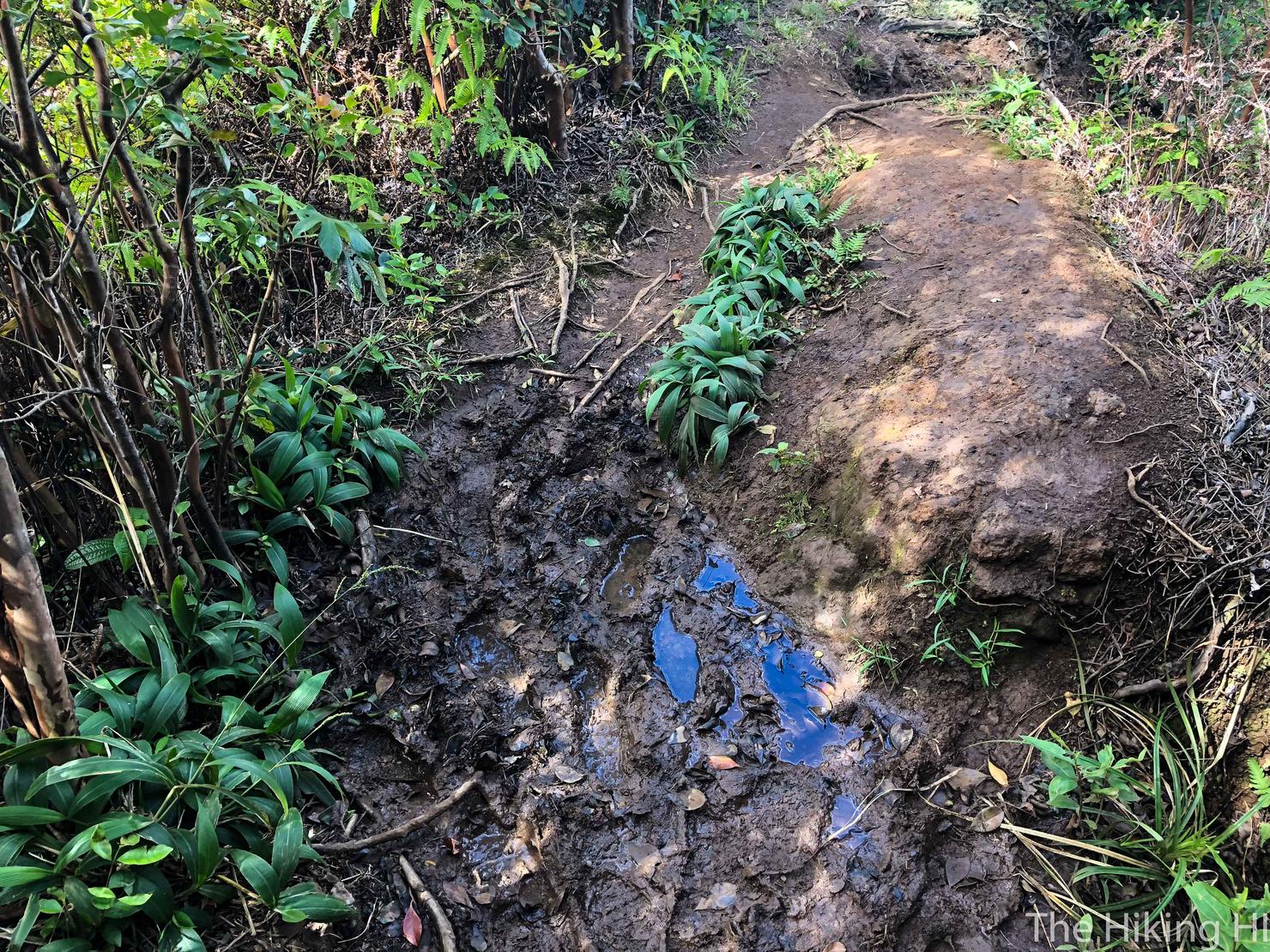
Did I mention this hike gets muddy? Because it definitely does if it's been raining consistently. Not a problem, just circumvent these puddles and try not to slip...
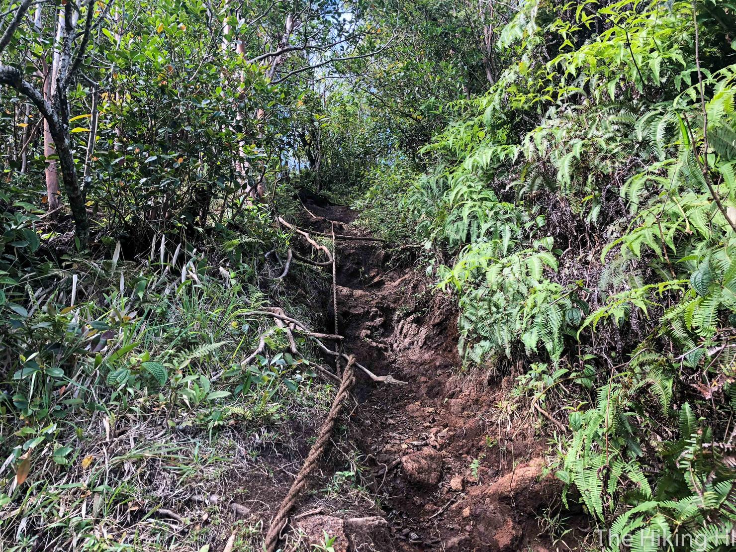
Once you get to the upper ridge portion, you will find some ropes periodically to help you up the steeper ascents.
There's a nice flat clearing during the ascent, marked by this tree. I think if someone climbed the tree and sat on it, it could make for a great photo.
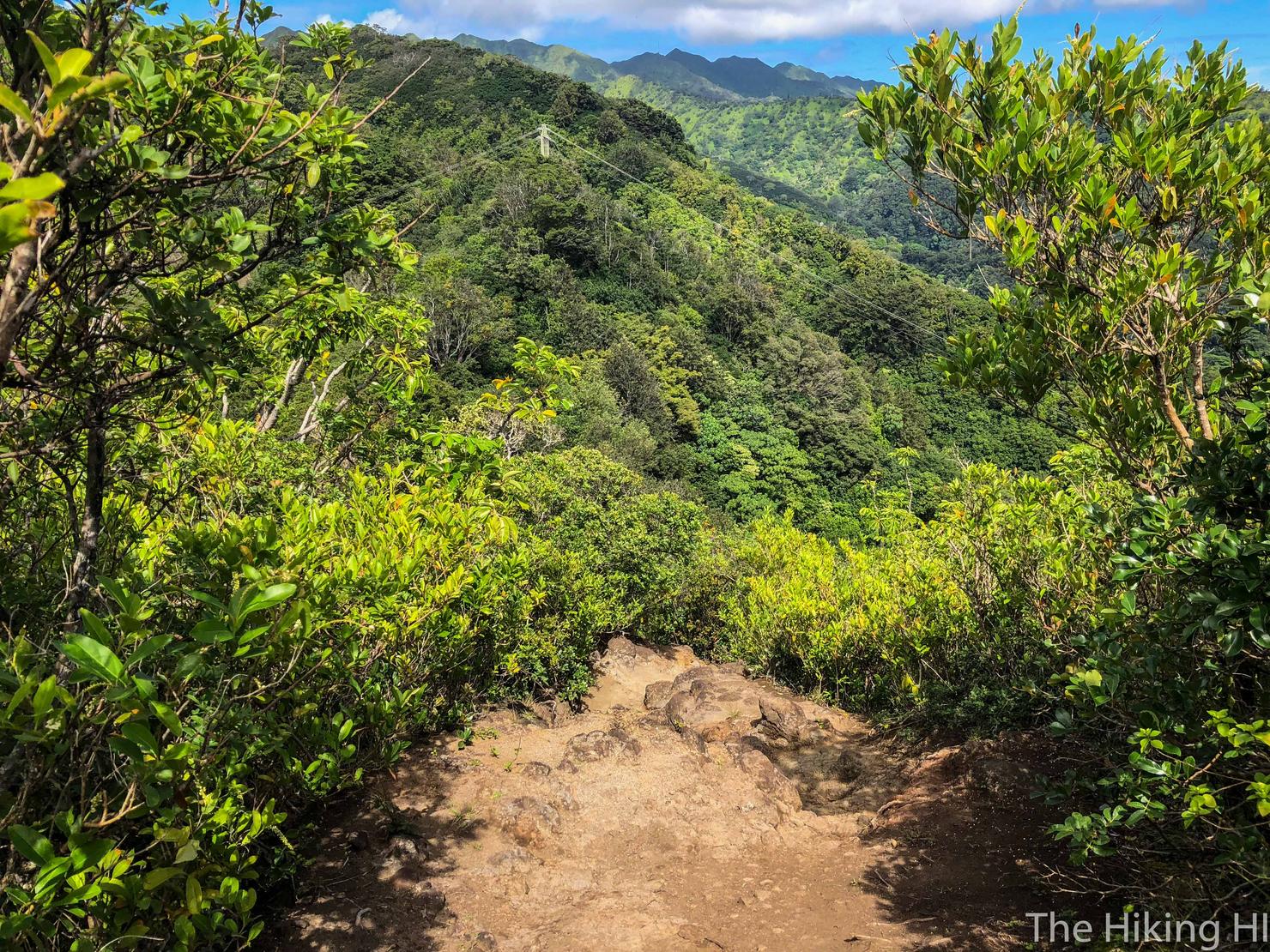
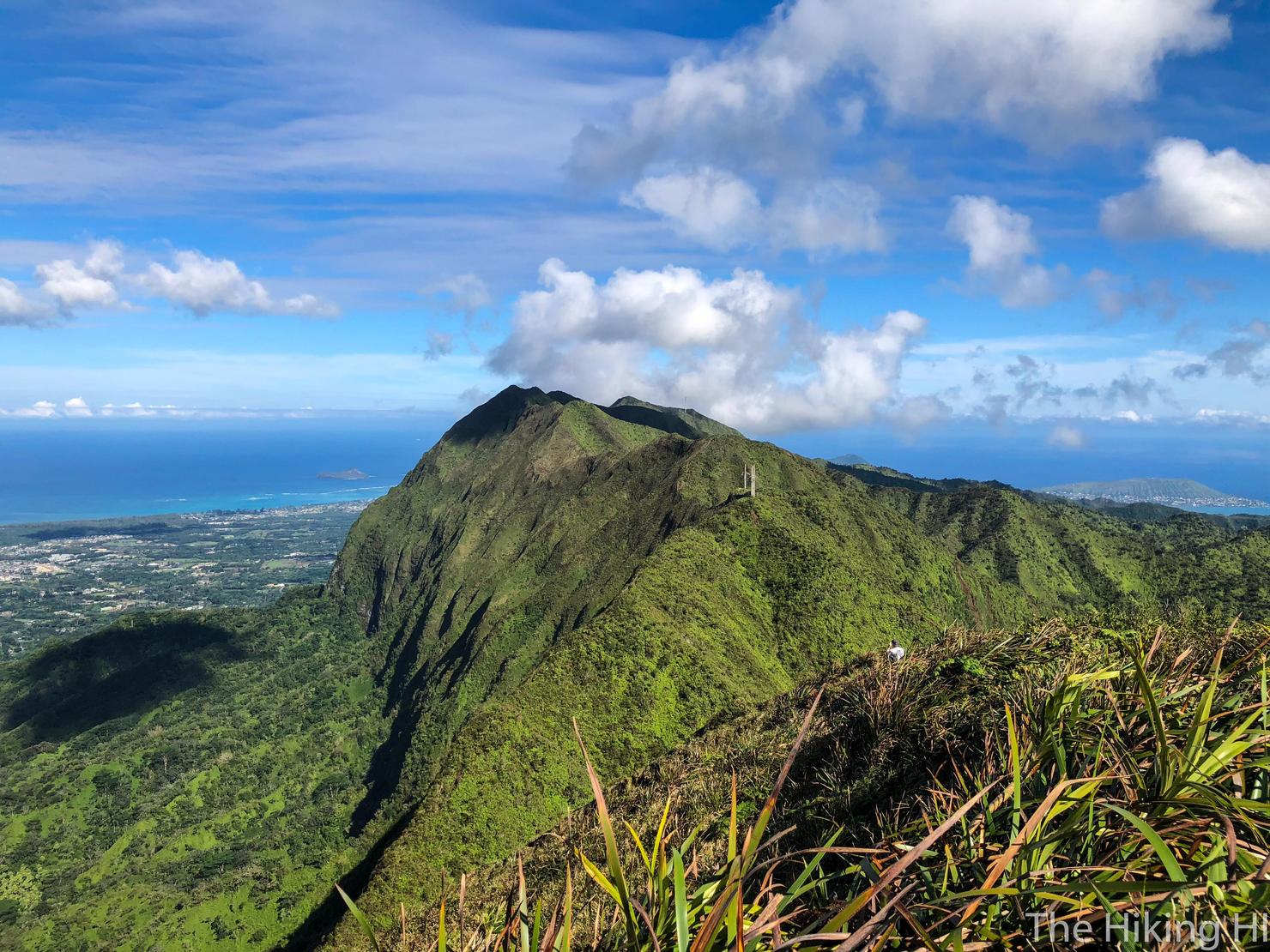
We've still got a ways to go. That peak on the right is Olympus.
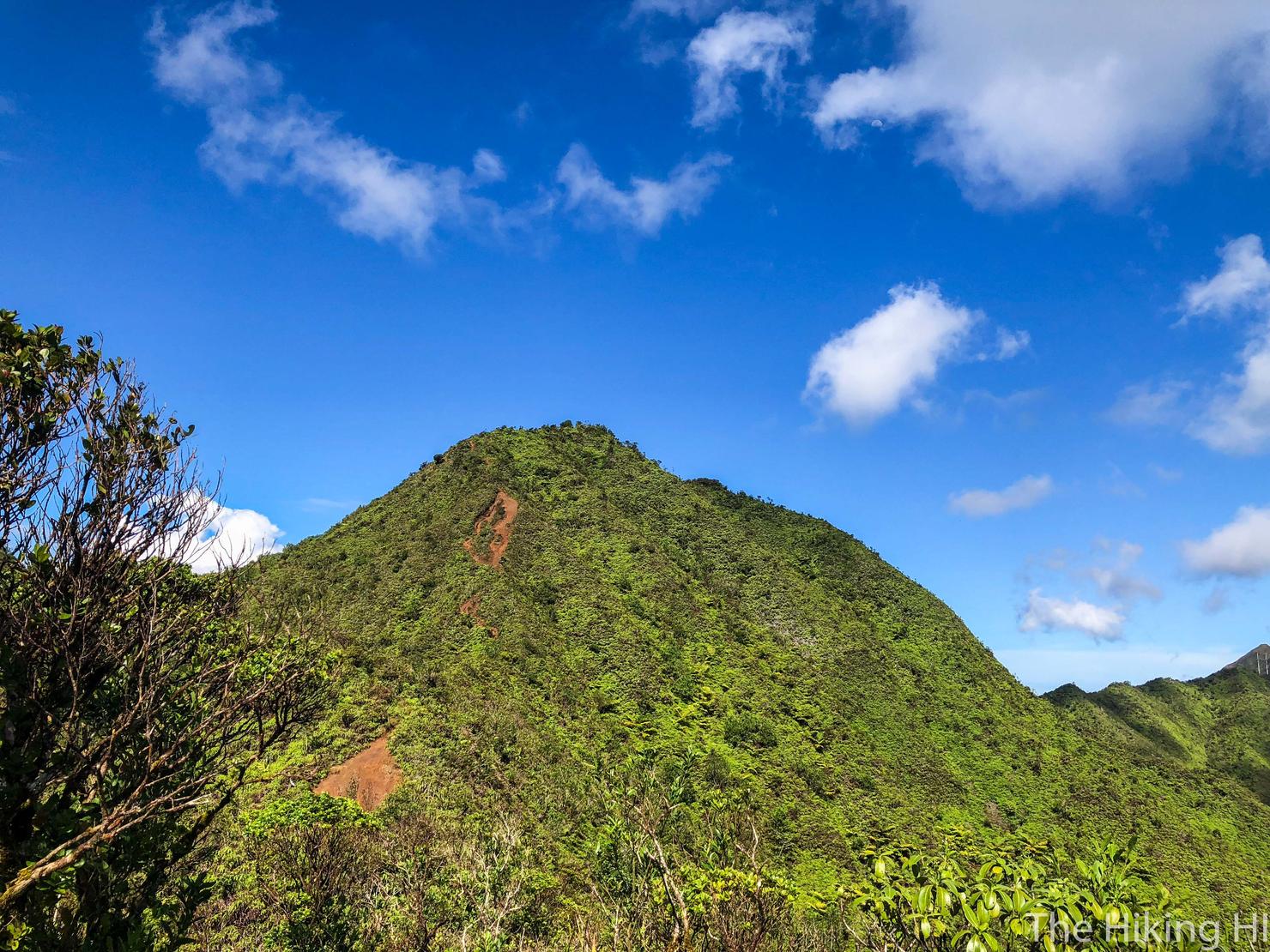
Fast forward thirty minutes. We are close now, this is the last big ascent.
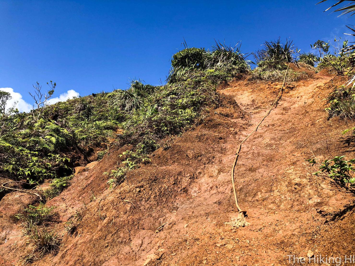
But it is a steep one. There are two paths to get up, both with rope assistance. The difficulty varies based on how wet it is. However, if you use the ropes wisely, it should be manageable. The ropes are much more necessary during the descent.

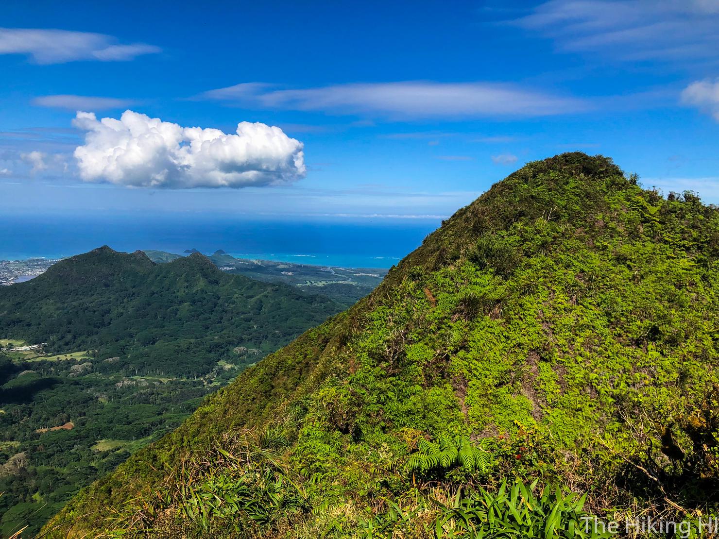
And shortly after the ascent, you will be rewarded with your first view of the Windward Side! This is why I find hikes to the KST so satisfying. After several hours of effort you get treated with an awesome perspective of a completely different side of the island.
The official Olympus summit is a bit further, down and up this short saddle.
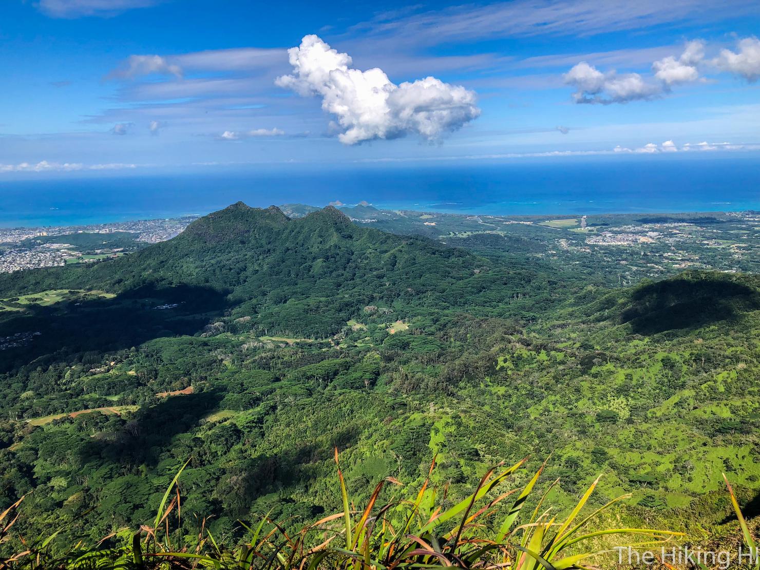
And we made it! More windward views, starring Three Peaks.
And looking southward along the KST. If you were to continue along this trail, you take it all the way to Makapu'u, the most southern point on the island. Maybe someday we will give that route a go.
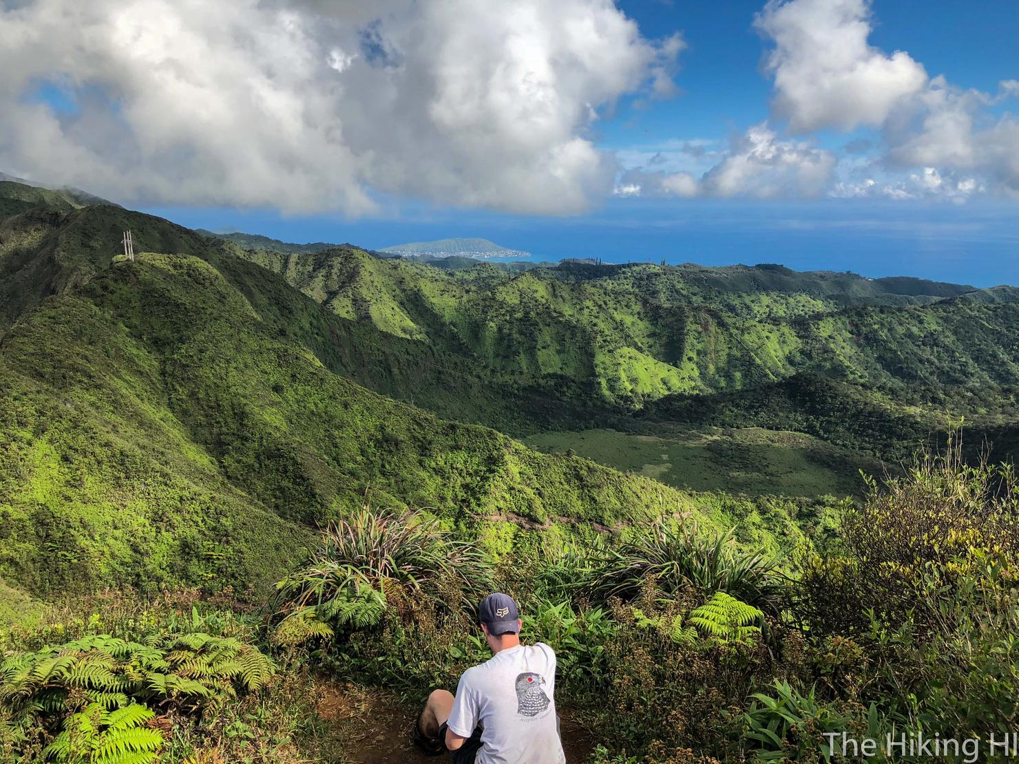
If you continue a bit further, you can get a nice perspective of Ka'au Crater, another great ridge hike to the KST that includes some waterfalls. This guy was flying his drone around, getting some good footage. I've noticed an uptick of the number of drones buzzing around these ridges (typically I am one of those guys). I suppose you could be annoyed by this new technology, but I don't think it's going anywhere anytime soon. Welcome to the new age, to the new age...
A final shot looking back at what we accomplished. My goal at the beginning of the hike was to figure out whether Wa'ahila or Kolowalu was the "best" route to Olympus. But once I reached the summit, that comparison no longer mattered. I was just happy to be here, in a present state of mind, as I soaked in this endless beauty.