Difficulty: INTERMEDIATE-ADVANCED
Time: 5-7 HOURS
Distance: 10 MILES
Elevation Gain: 1800 FEET
Foot Traffic: LOW
Challenges: Muddy, Exposed, Long Distance, Slightly Overgrown, Some Narrow and Eroded Portions
Sights: H3 Highway, Waianae Range, Honolulu, Windward Side, KST
What to Bring: Water (>2L), Snack/Lunch, Sunscreen, Shoes with Good Grip, Long Pants
Despite its distance, this is one of the more manageable Ko'olau finger ridges if you catch it on a dry day. The hike begins from the popular Aiea Loop trailhead before it splits off to the unmaintained ridge portion of the hike. The ridge starts as a long, gradual ascent that parallels the H3 Highway before it veers deeper into the valley. You will be forced to deal with some narrow ridges and mud, all while traversing more than 10 miles. However, if you push through these obstacles, you will reach the Aiea Summit on the Ko'olau Summit Trail (KST) and be rewarded with some spectacular views of the central and windward parts of Oahu.
Despite my love of all things hiking, I find my own mind getting the better of me sometimes. When I wake up on a weekend with plans to hike and see a dark and overcast sky, I sometimes ask, should I even bother? If I can't experience those amazing views at the summit (and subsequently an awesome photo), should I even spend all that time and exert all that effort. I know this sounds like First World Hawaii Problems, but it is a conversation I have with myself.
This Sunday was one of those days. I looked at the sky and saw nothing but gray clouds as far as the eye could see. My body was telling me I needed to get outside, since I had spent all of yesterday watching College Basketball. But my mind was telling me why bother, the views will suck. I decided to ignore my mind, grabbed my backpack, got in the car, and started driving, with no particular destination in mind. As I made my way along the H3 Highway, I spotted a lookout that spans off the Aiea Loop Trail, a hike I had recently done. Remembering I had discovered the fork for the Aiea Ridge Trail and how I had desperately wanted to explore it, I decided this would be my destination.
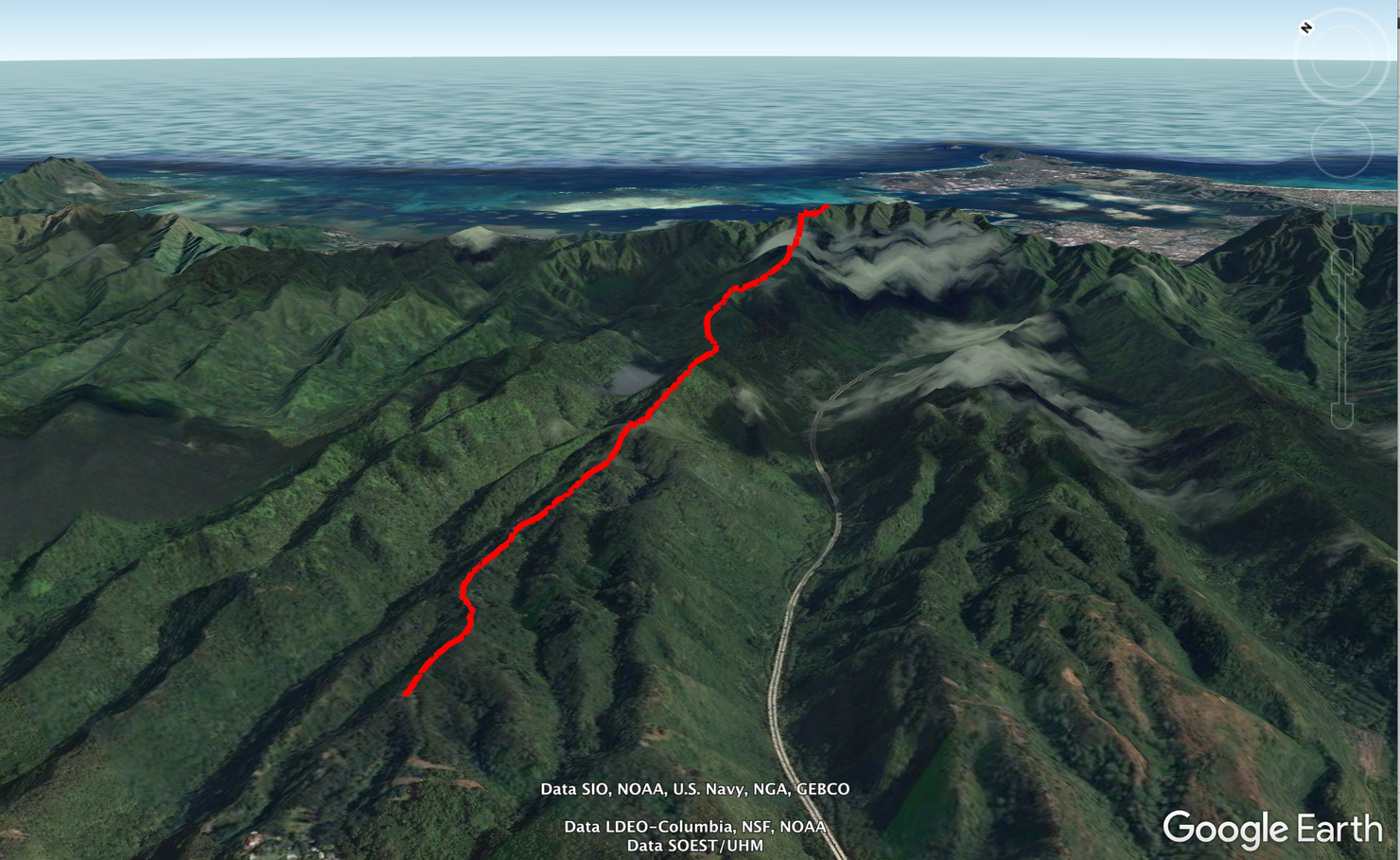
The hike is simple, but you cover a lot of distance. It's an out and back from Aiea all the way to the Ko'olau Summit Trail.
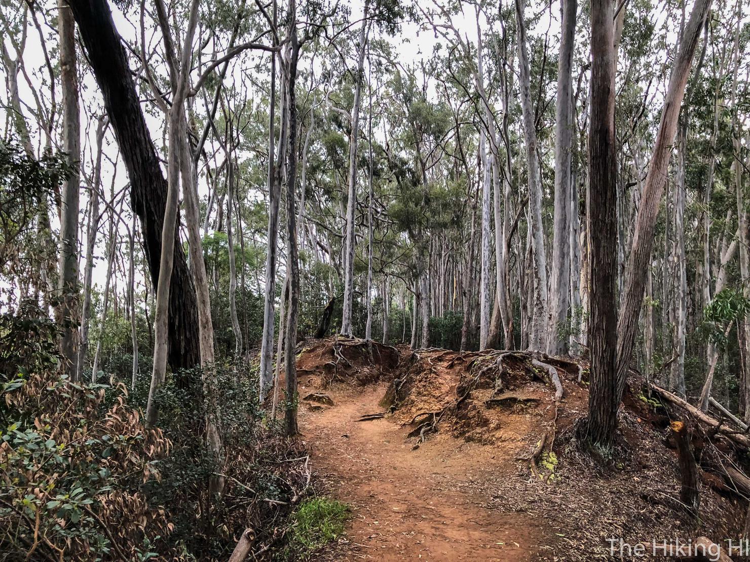
Let's get started. We begin along the Aiea Loop Trail, located in Keaiwa Heiau State Recreation Area. Aiea Loop is a great foothill hike that contours through a beautiful forest-like landscape. Every time I come here and see this trail, a wave of calm rushes over me. I could already tell I had made a good decision to ignore my negative thoughts and to simply get outside.
After around 30 minutes on Aiea Loop trail, you will see a relatively obvious opening on the left side of the trail that heads uphill. The opening is located on this hairpin turn. This is the path to Aiea Ridge.
A different perspective of the junction.
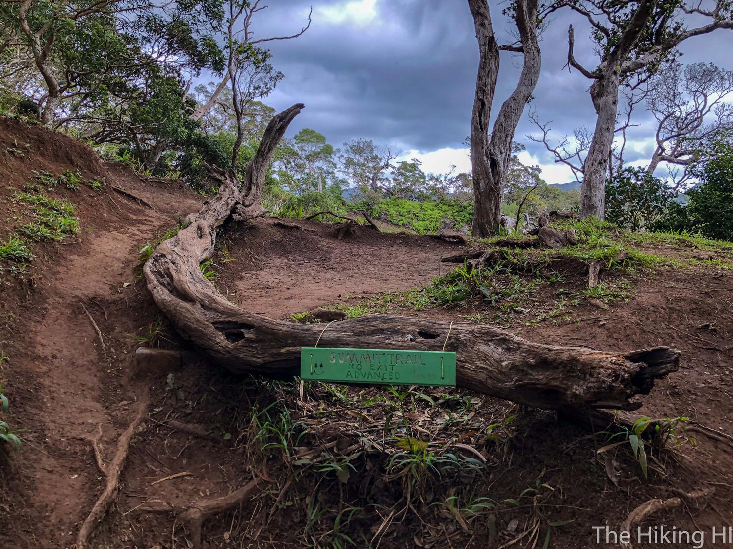
You will find the trailhead sign at the top of the little incline. You can't see it in the photo, but there is writing on the sign that says 9.4 miles from this point. (Update: Last time I trekked up this ridge, this sign no longer existed). When I had checked AllTrails, the track reported this hike to be 6 miles round trip. Turns out AllTrails was wrong. Fortunately, I had 2.5L of water, a granola bar, and nowhere to be, so I was willing to give this lengthy ridge a go.
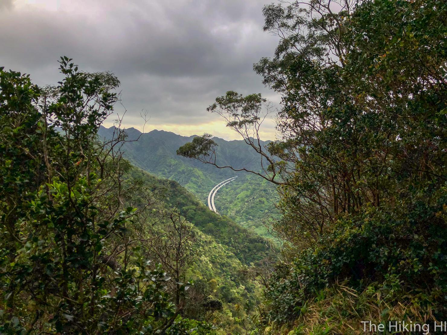
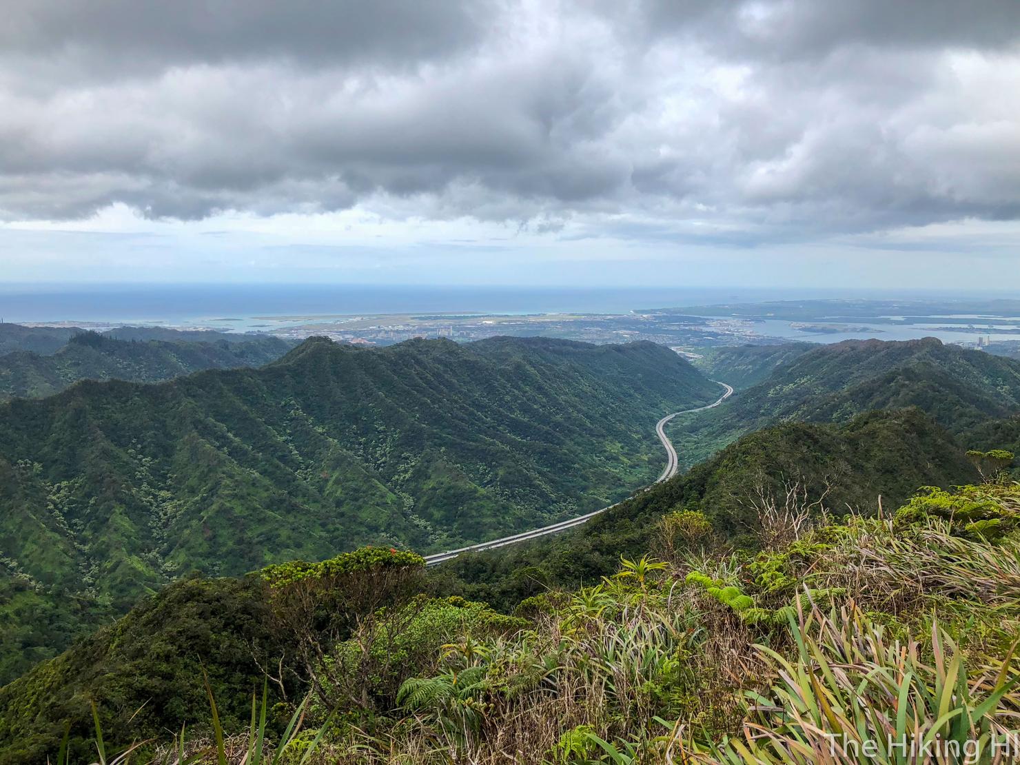
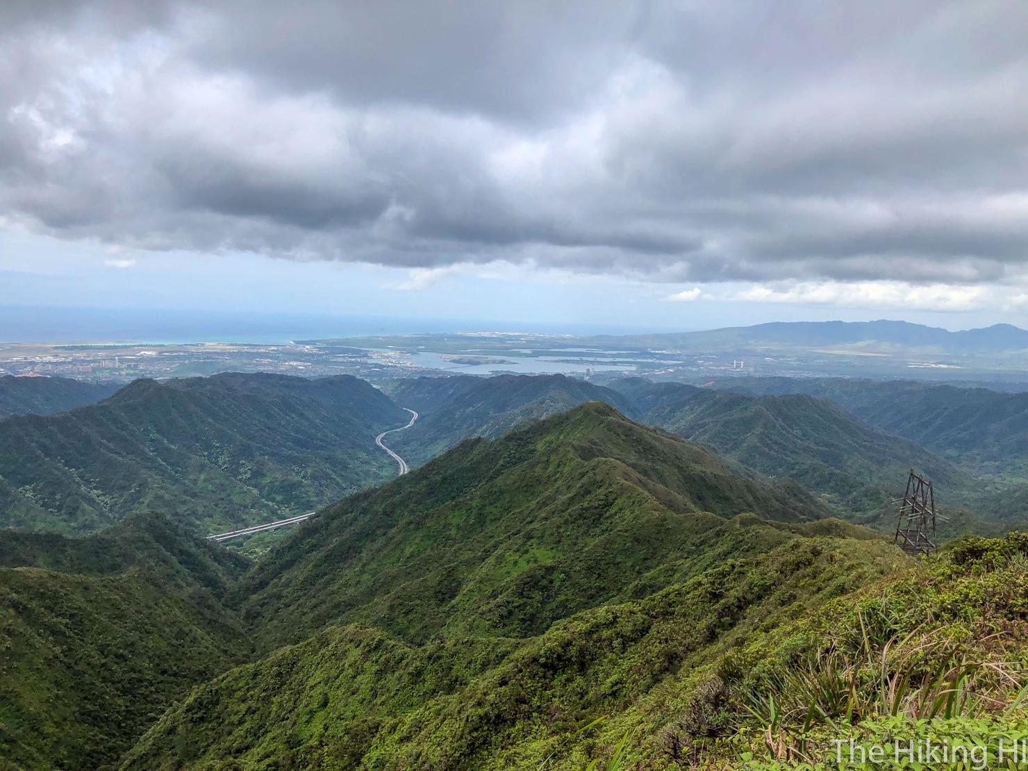
Shortly after you start hiking on the ridge, you will get a glimpse of the H3 Highway, home to my daily commute to work. It really is one of the most scenic drives I've ever experienced, and I am lucky enough to experience every day.
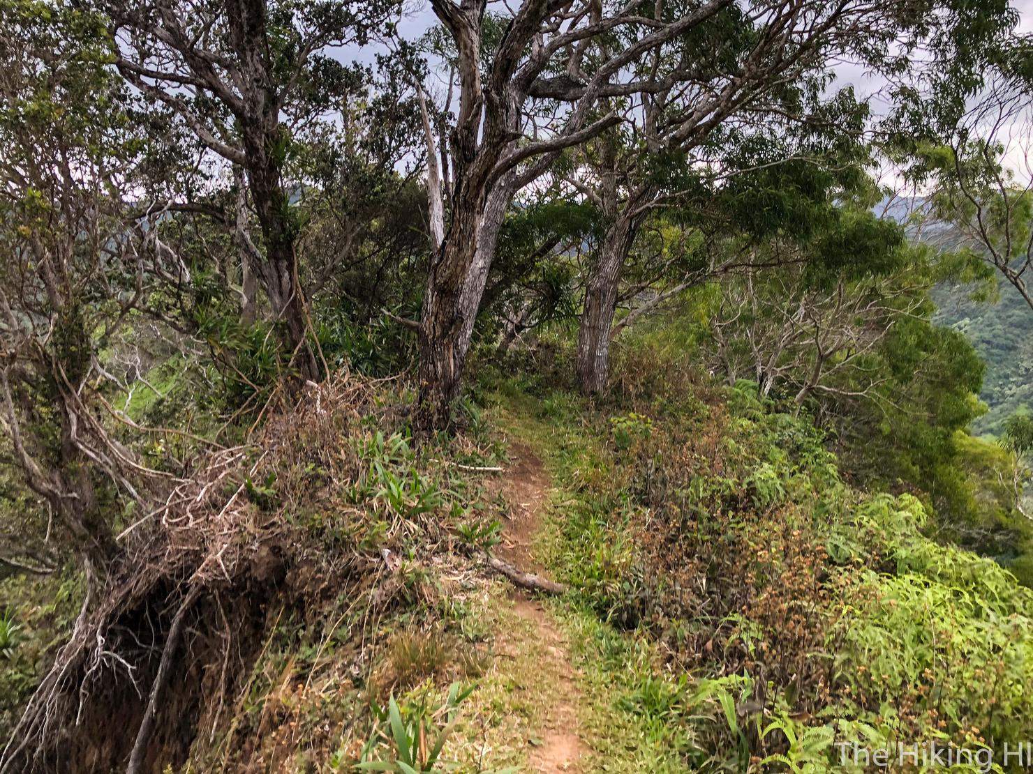
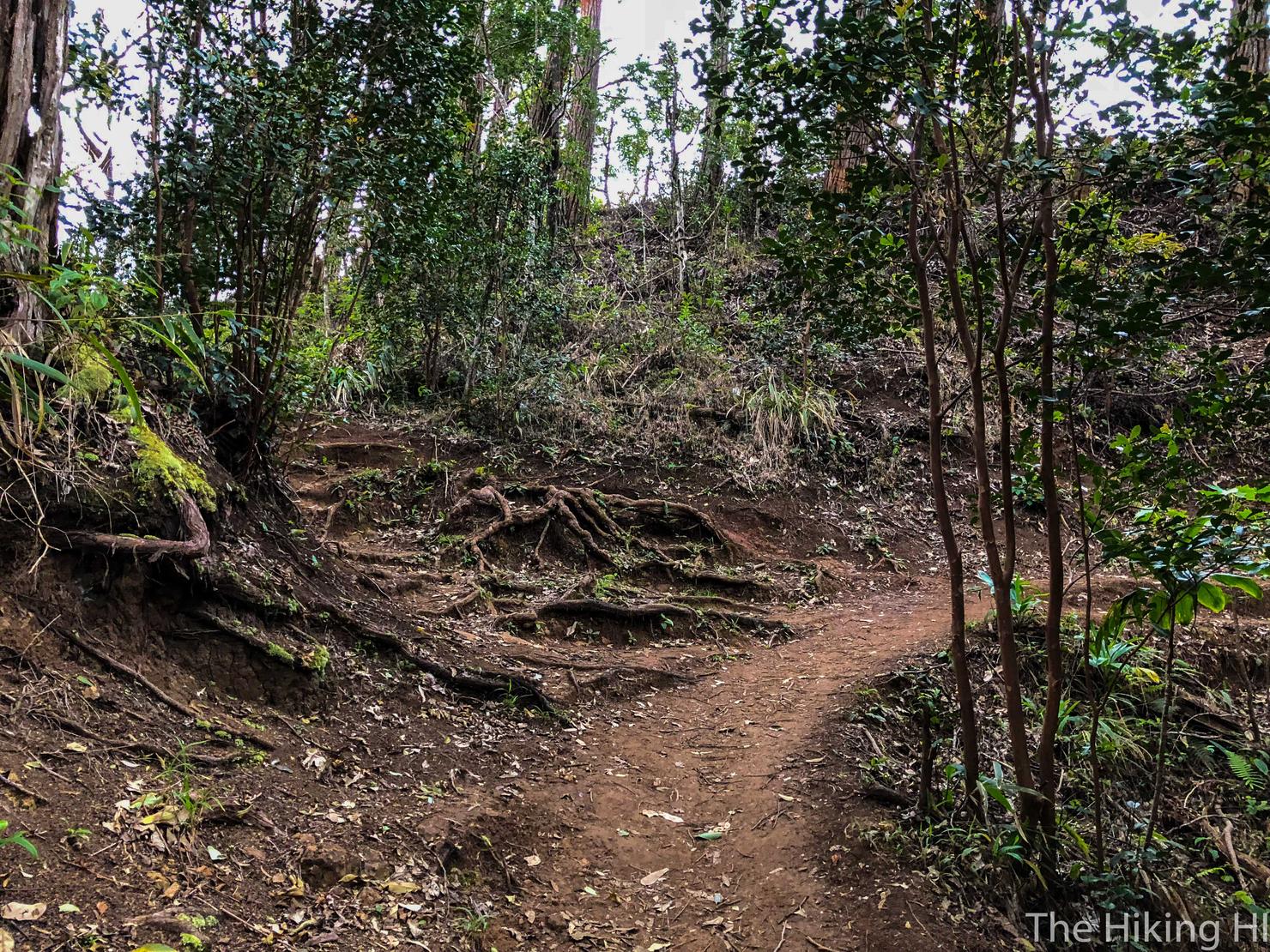
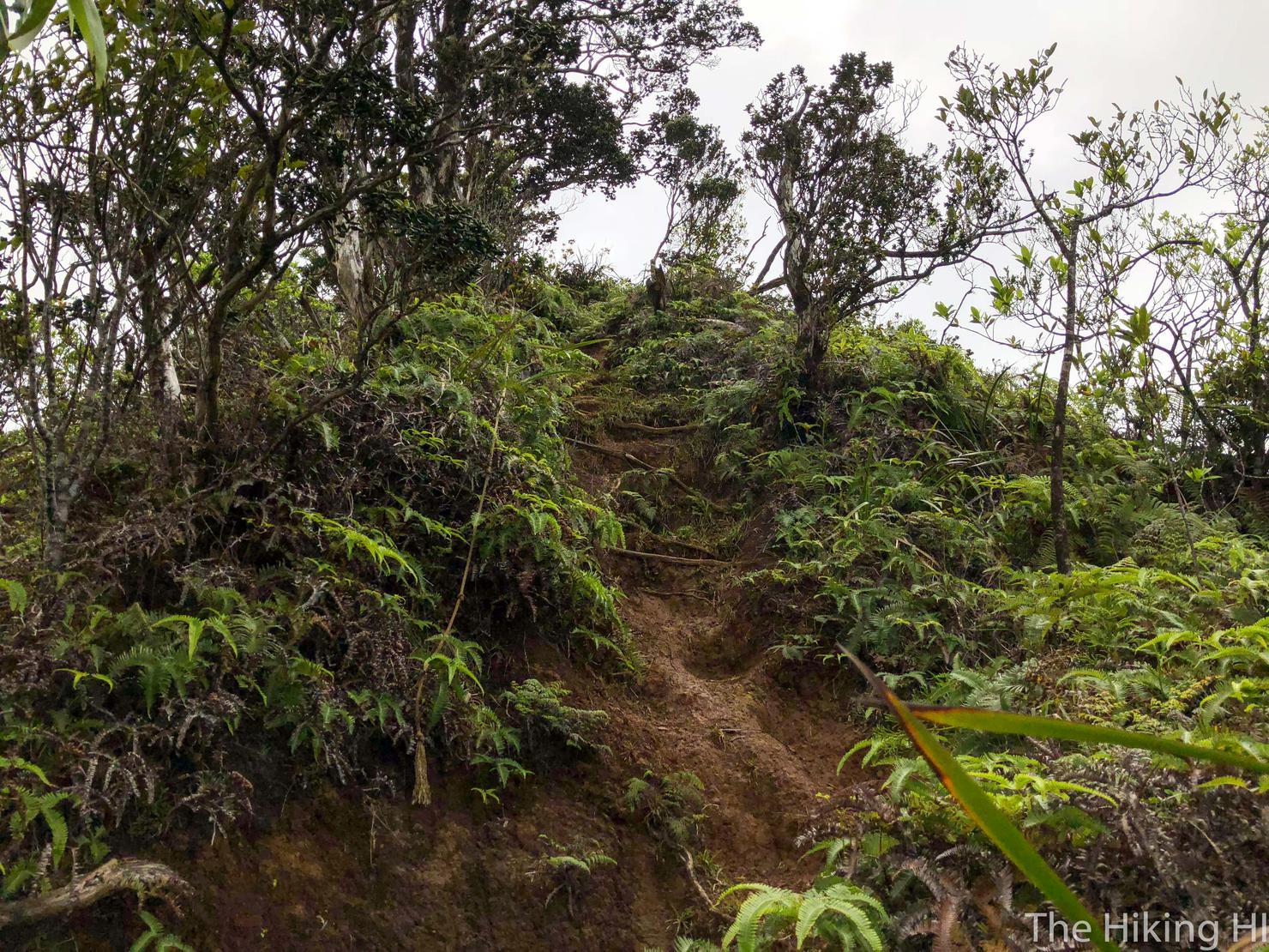
The ridge begins in the shade as the trail weaves in and out of the top part of the tree line.
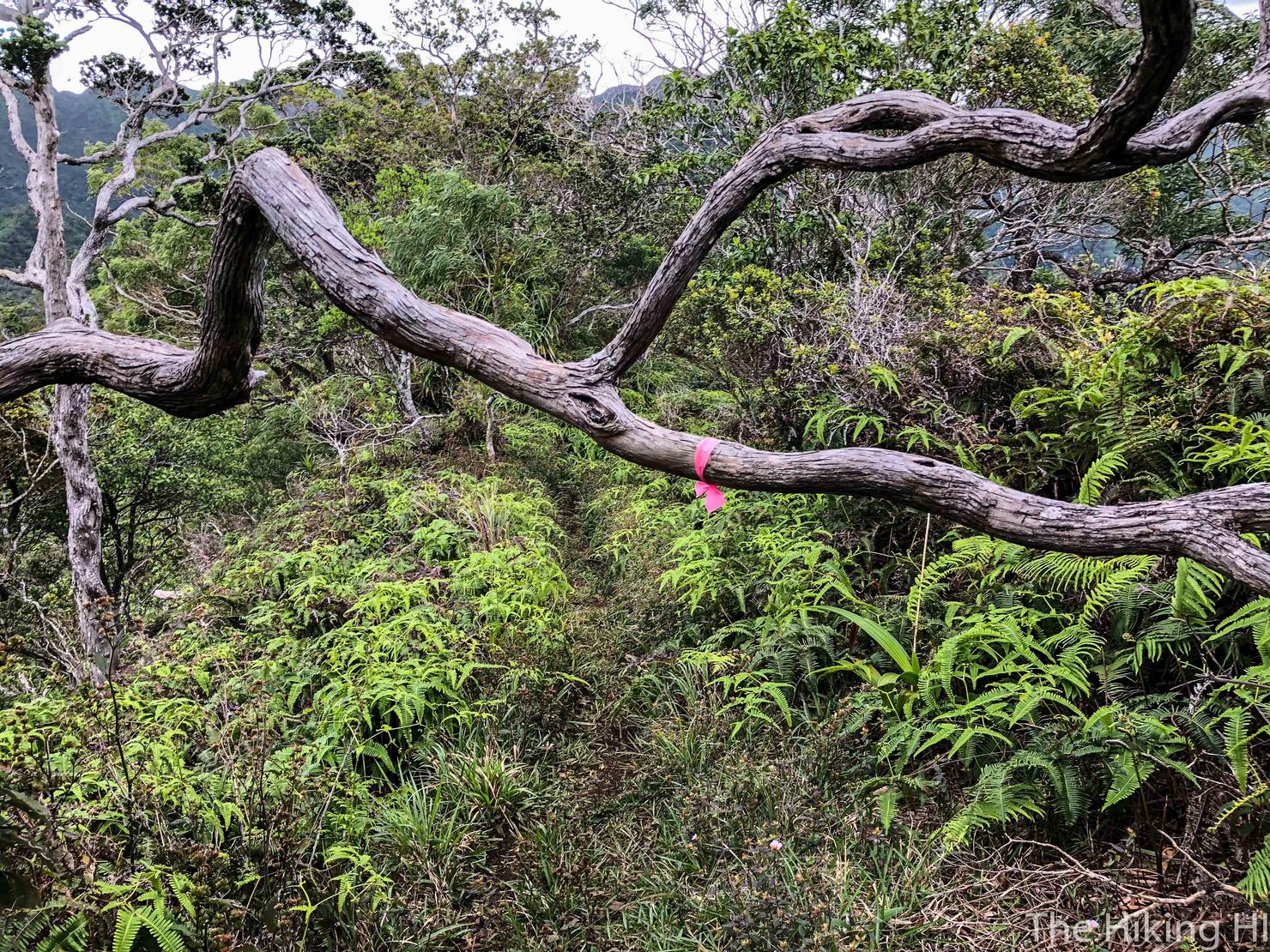
It is marked sparsely, but you won't get lost. There's only one way to go.
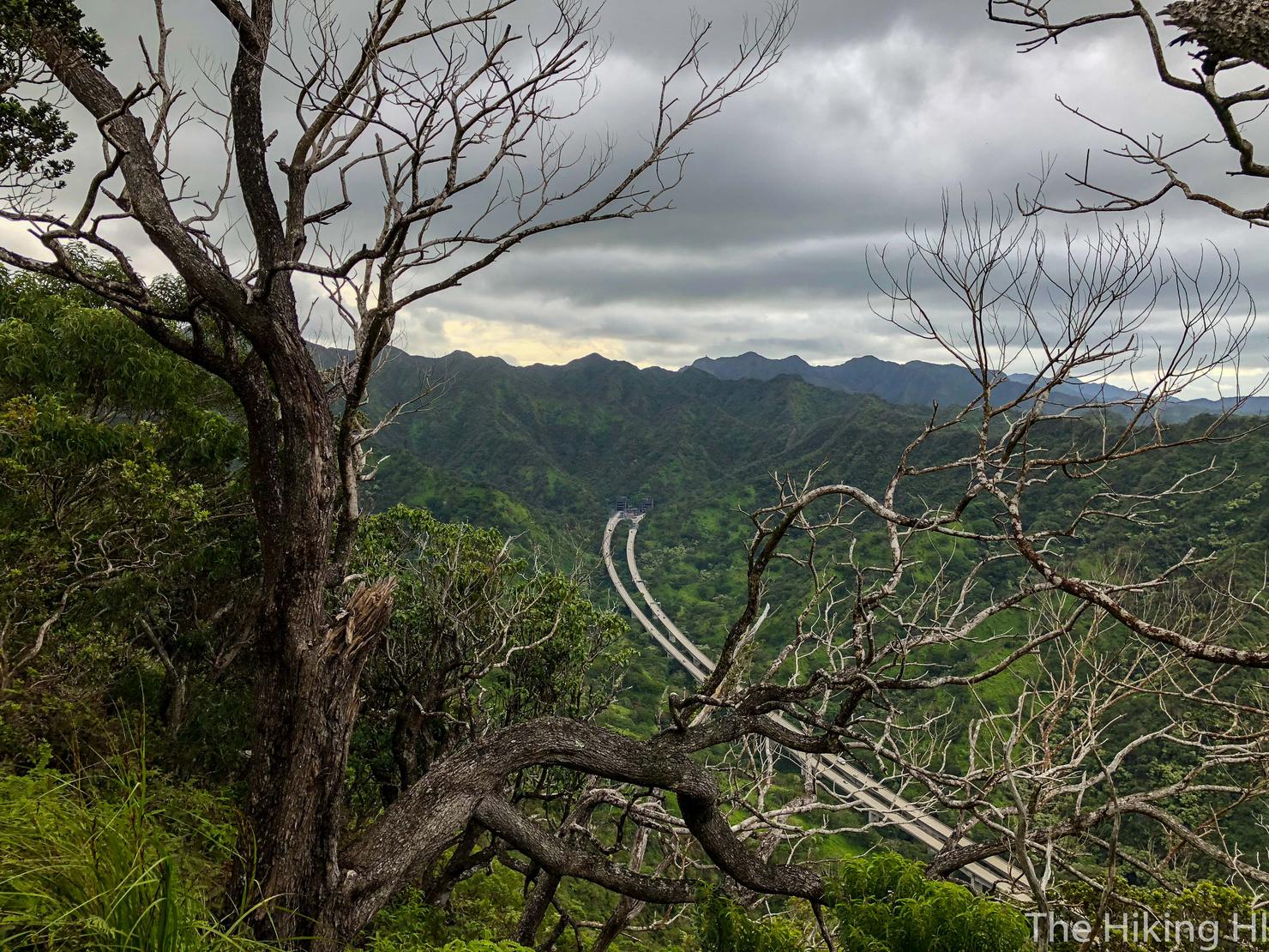
Initially, you will be hiking parallel to the H3 Highway, watching the cars whiz by. Sometimes during my commute, I fantasize about being up here on these ridges instead of working. I wonder if anyone down there is doing that today?
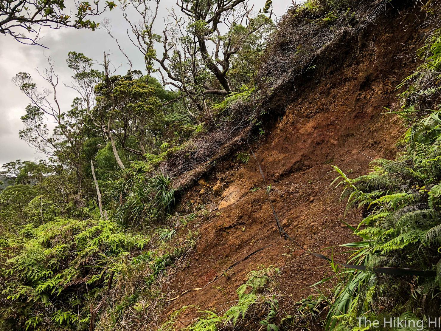
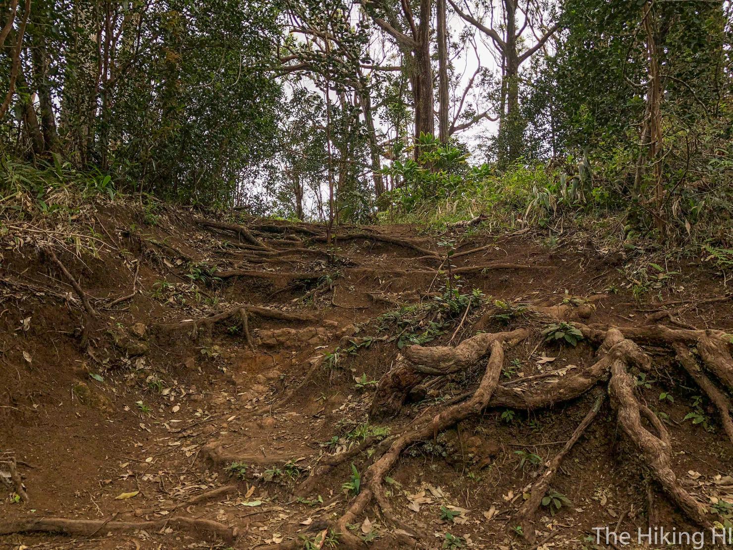
For an Oahu ridge hike, this trail is relatively nonthreatening. There were a few tricky sections, such as this eroded section. Luckily there is this nicely placed rope to help you out.
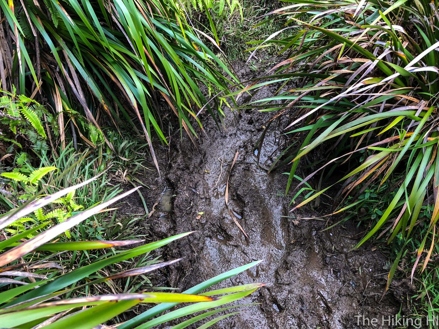
There is also a good bit of mud. Don't expect your shoes to be clean when you finish up.

And there were a few times the trail gets a bit narrow. There is brush on both sides of you which should at least partially calms the nerves.
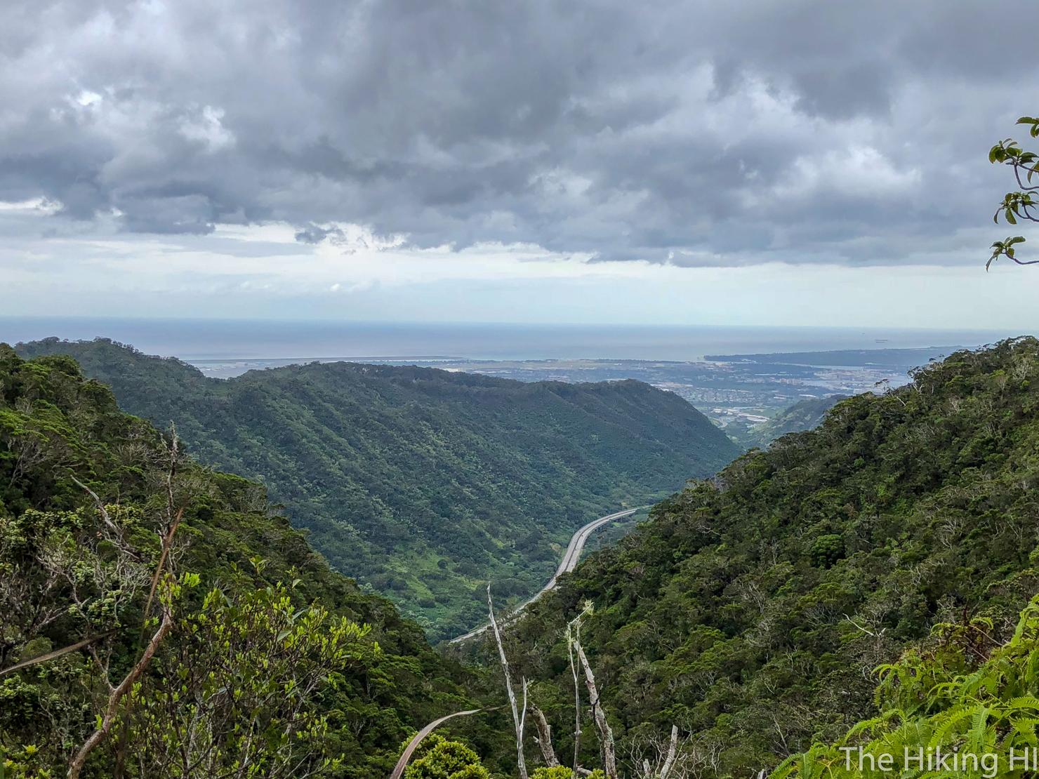
So just make sure you have solid footing when you turn around to take in the view. I just love the perspective of the highway weaving through these green Ko'olau ridges.
Here's a nice uphill portion. Overall, this trail didn't rollercoaster that much. It was a relatively steady ascent to the summit. Part of me thinks my recent ridge hikes at Hawaii Loa and Wiliwilinui were tougher in that regards, with constant ups and downs. Those hikes, however, were not 11 miles...
But hey we gotta keep going up if we want to get these views!
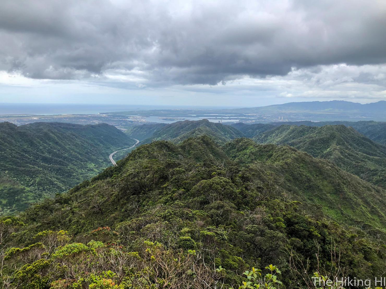
You can even see a bit of Honolulu peaking over those distant ridges.
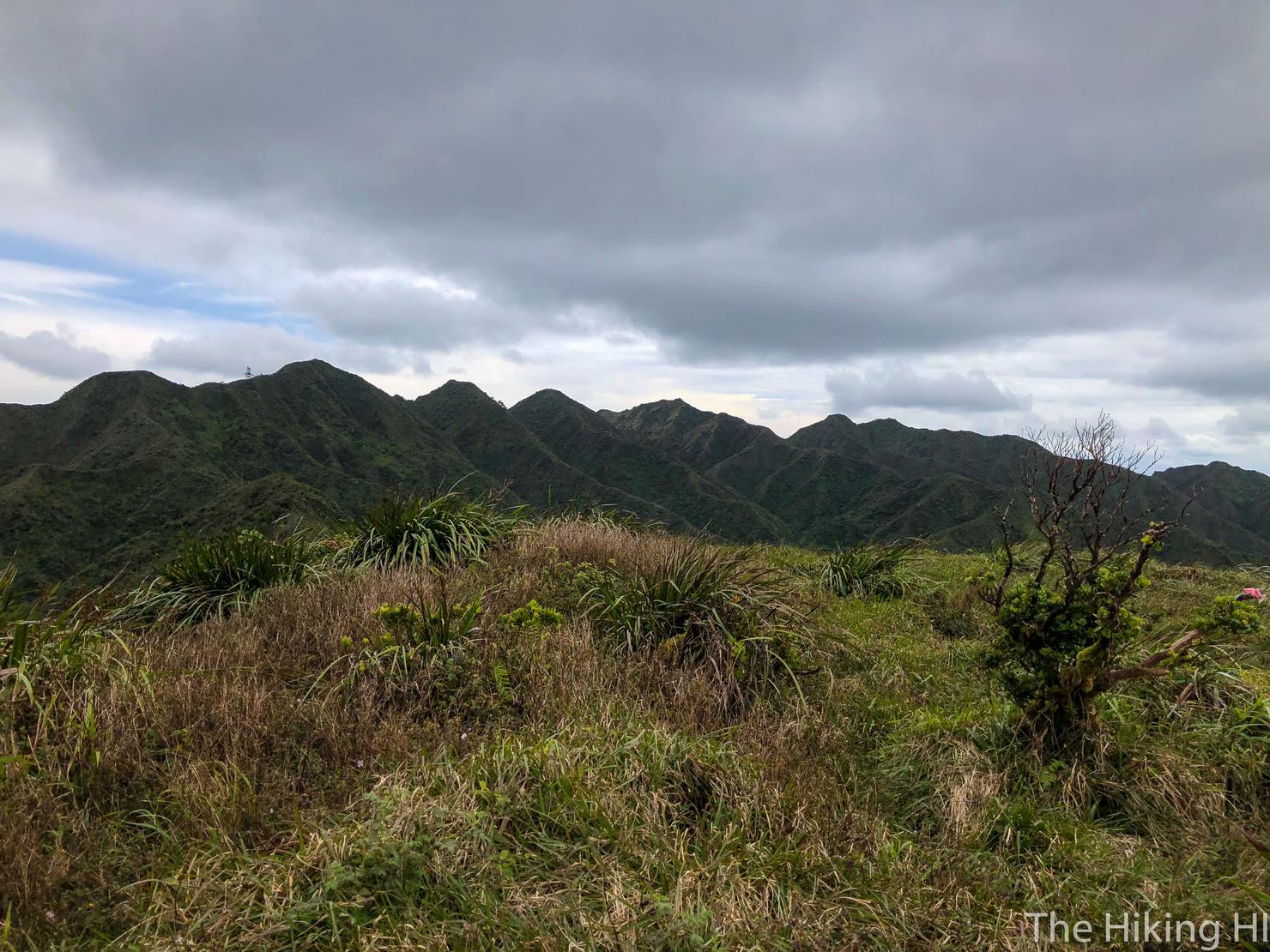
Right around the 2 hour mark I reached a flat grassy peak. I believe this to be Pu'u Kaiwipo'o, a false peak of the Aeia Summit. It's a great spot for a little water break.
And of course a great spot for photos if you're into that sort of thing.
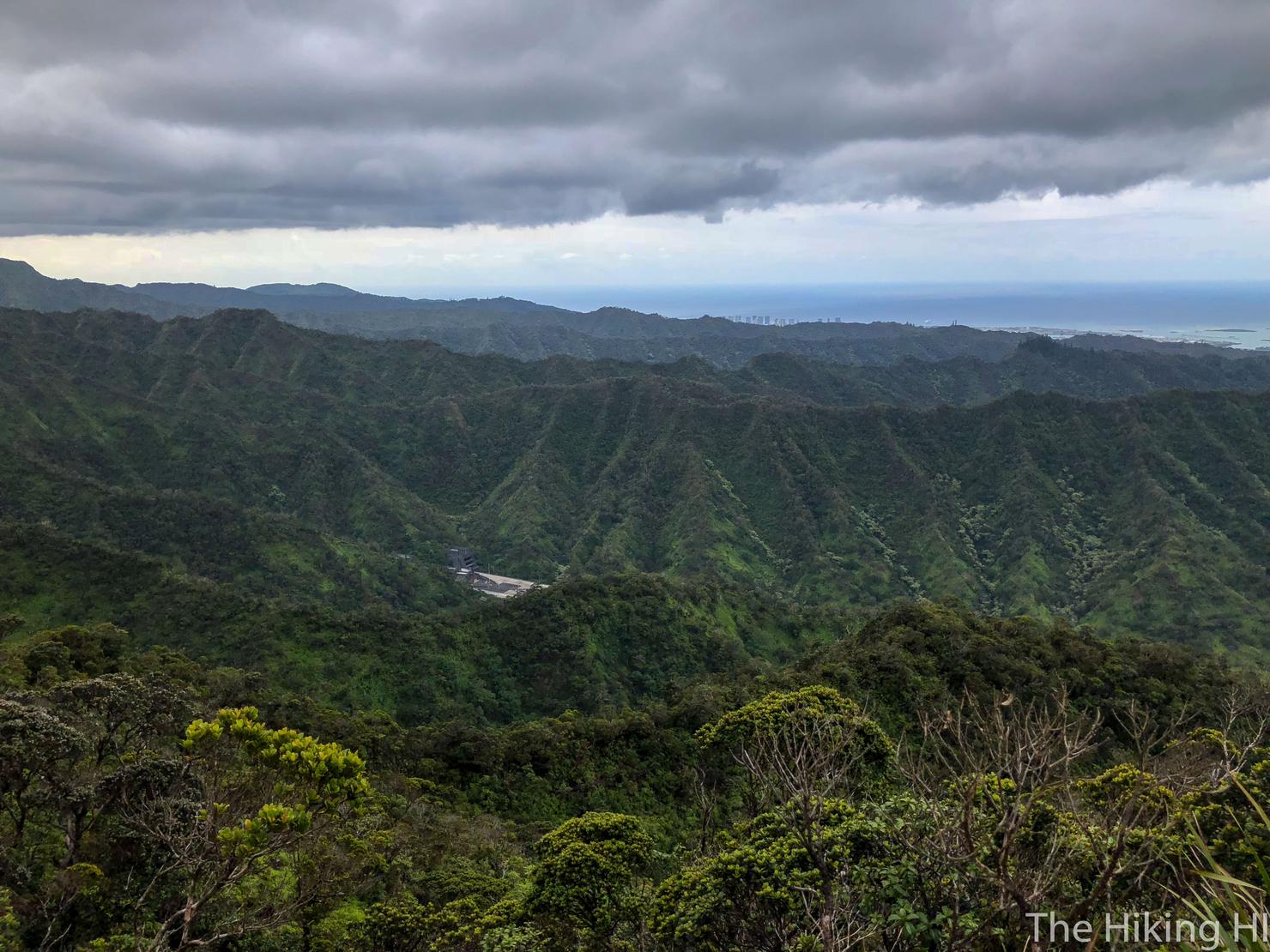
I could see a power line structure in the distance. That has to be the summit... right?
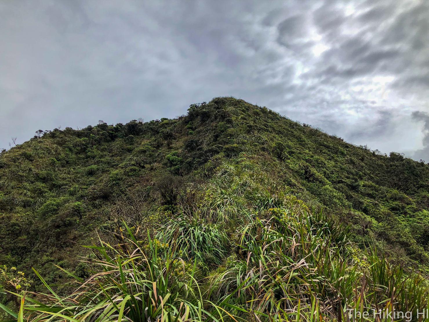
After a bit more slogging along, I had one final ascent...
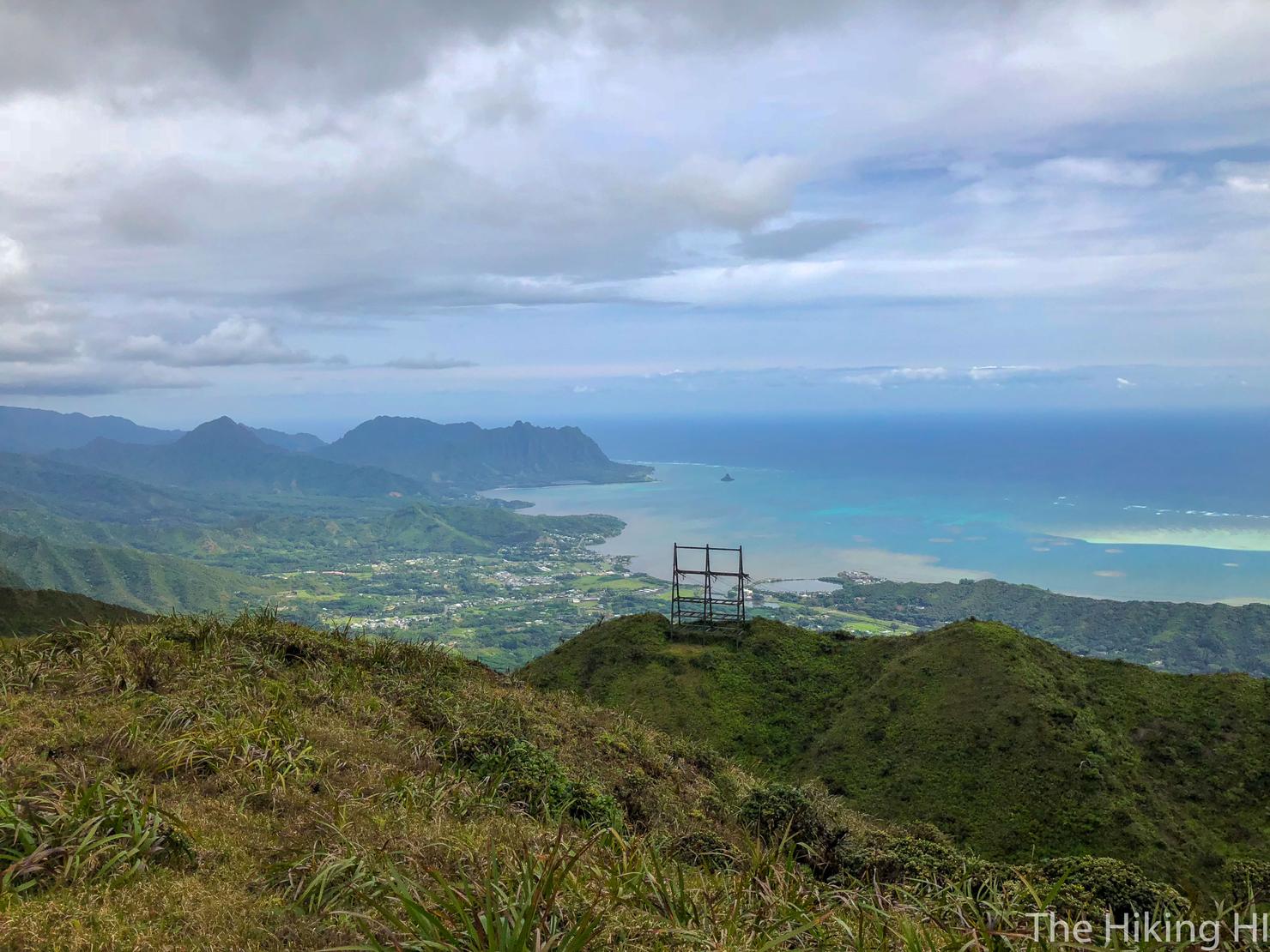
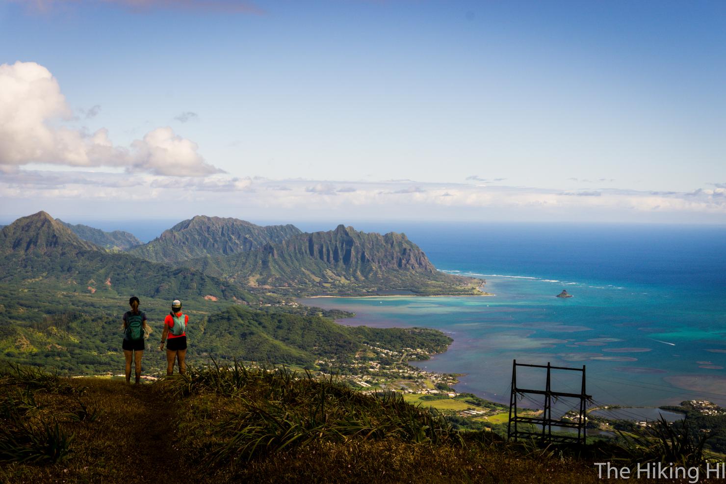
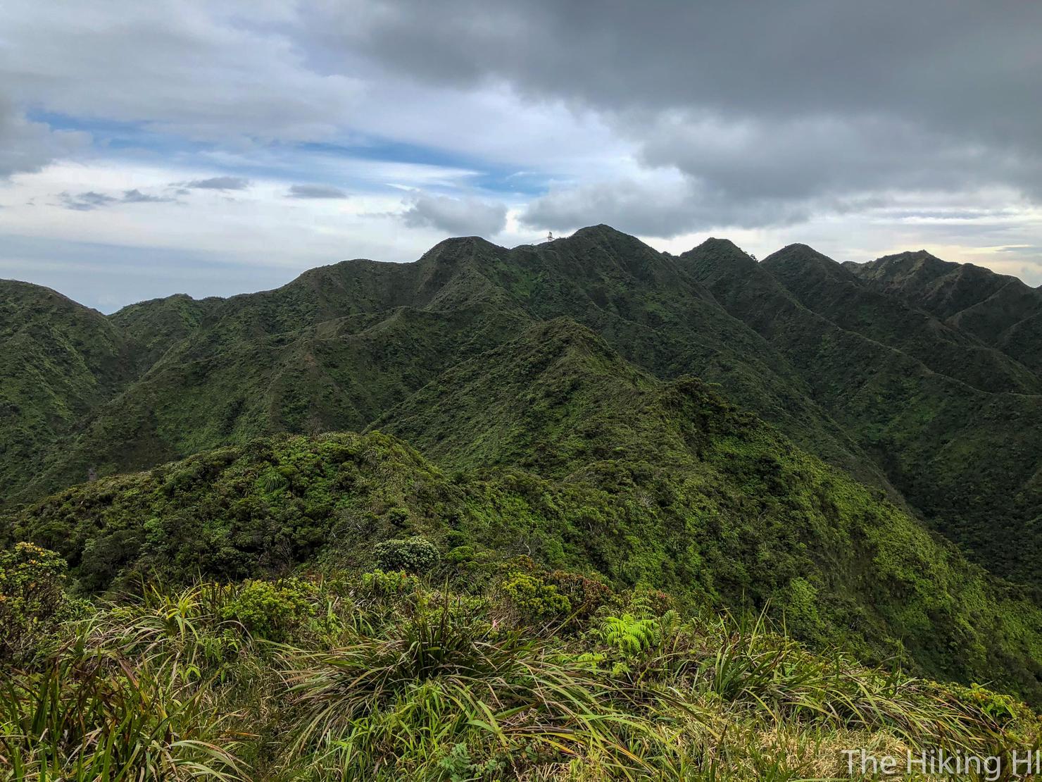
And we reached... another false peak! This large flat peak did not connect to the KST and therefore was not the official summit. Luckily, the beautiful colors of the windward side had come into view, so I was able to momentarily forget the fact that I hadn't officially summited.
A recent photo (3/3/19) I took of this location while using Aiea ridge to crossover to an adjacent summit. Too beautiful not to include.
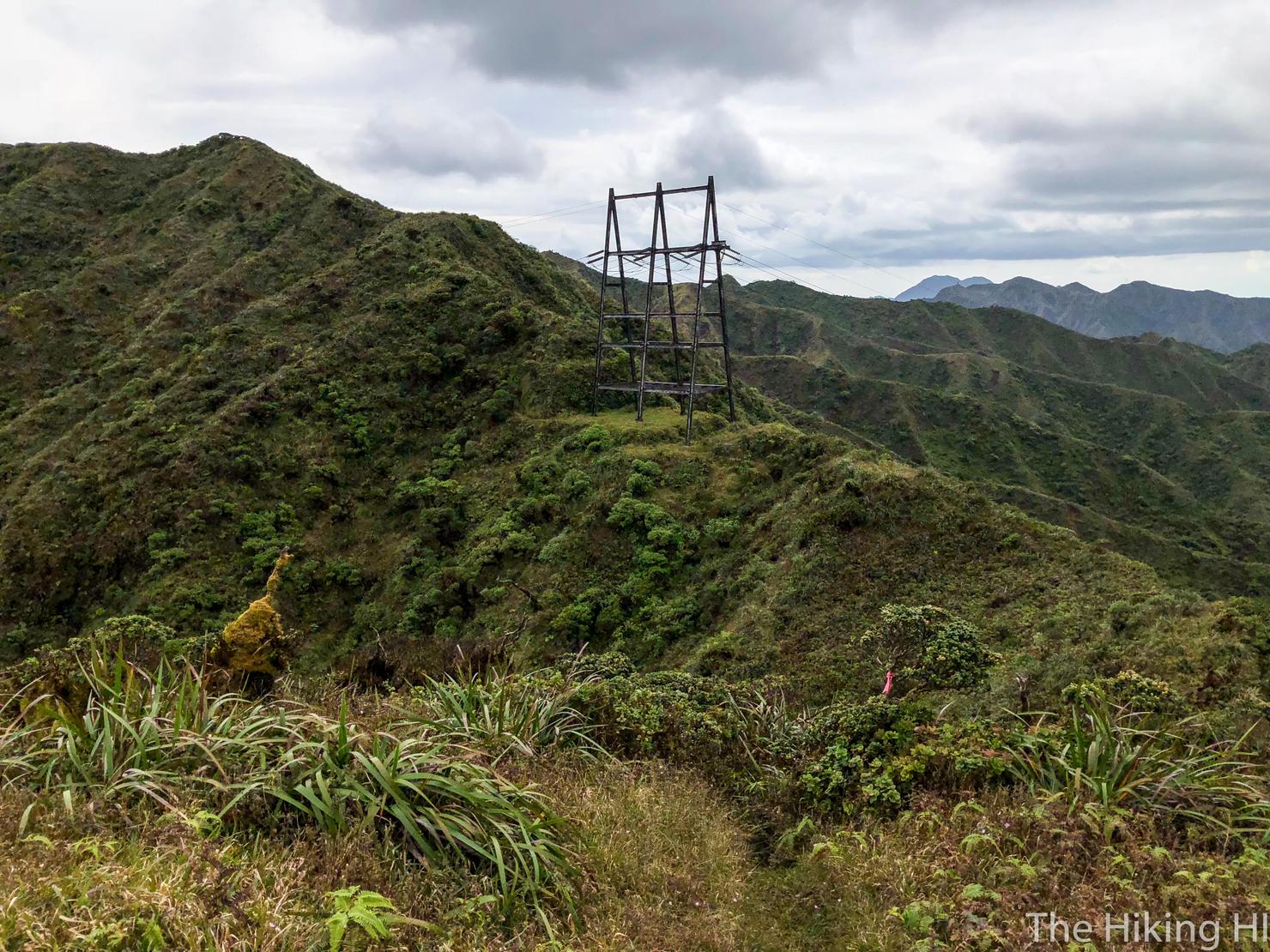
To get to the summit, facing makai (towards the ocean), look right. You will see the powerline structure and some trail markers. Head that way.
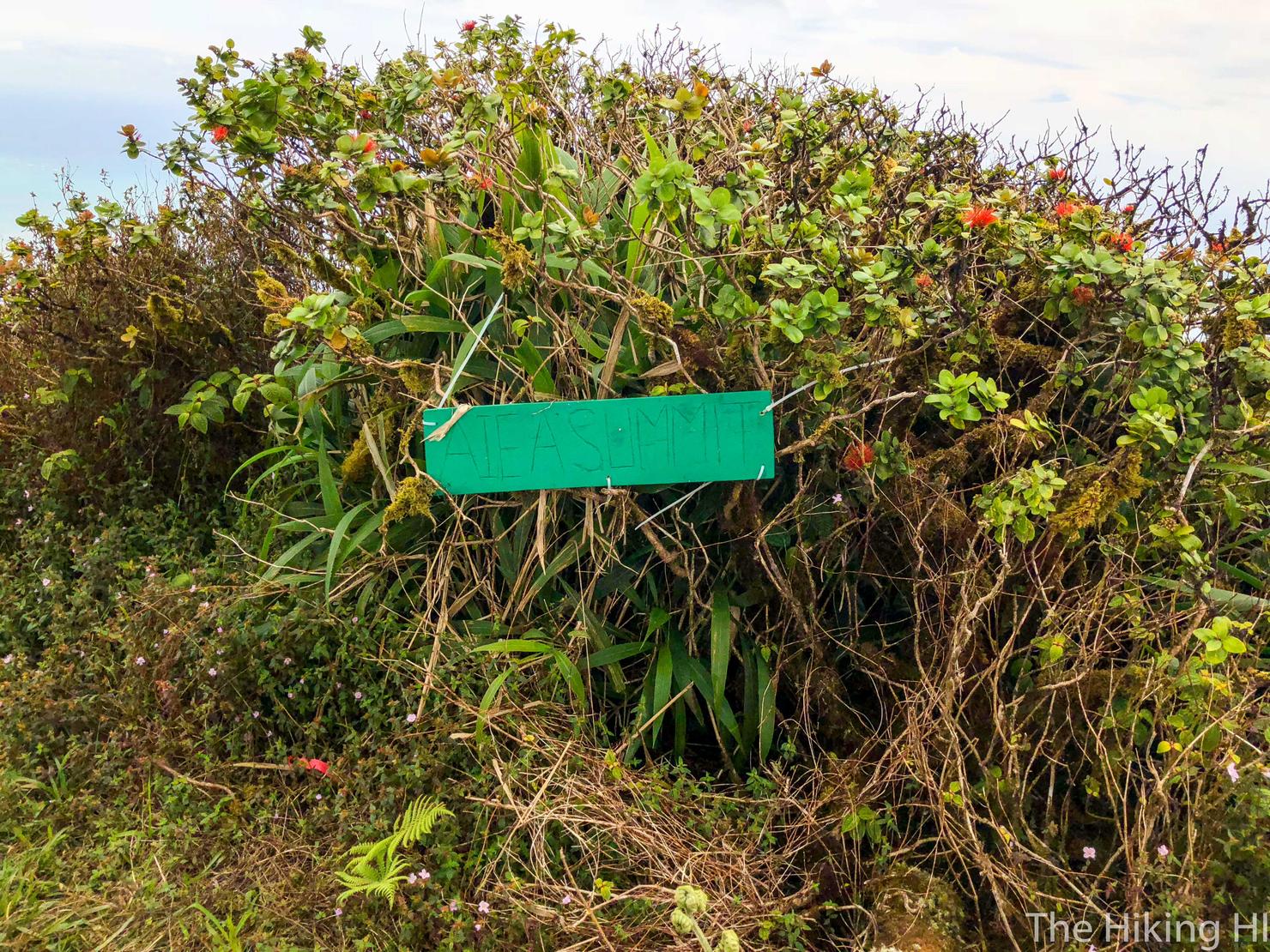
And after another 10 minutes of climbing, we reached the official Aiea Summit! This took me about an hour from the Pu'u Kaiwipo'o.
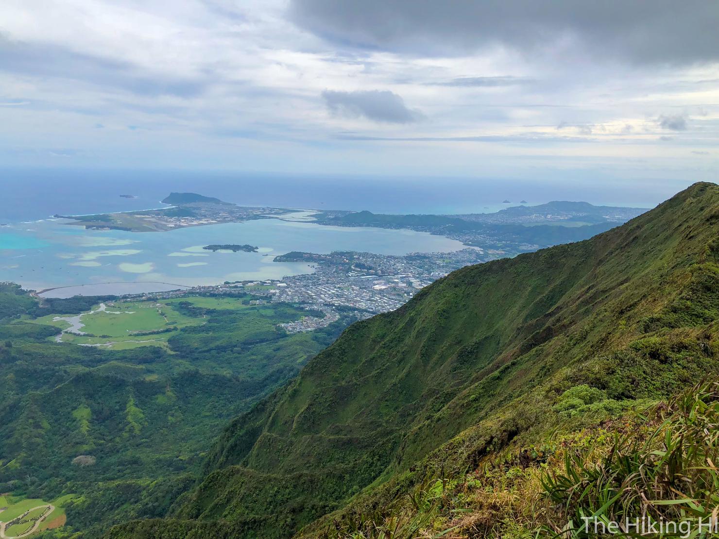
Now it's time for a summit photo montage. Here we are looking south towards the Kailua and Kaneohe area.
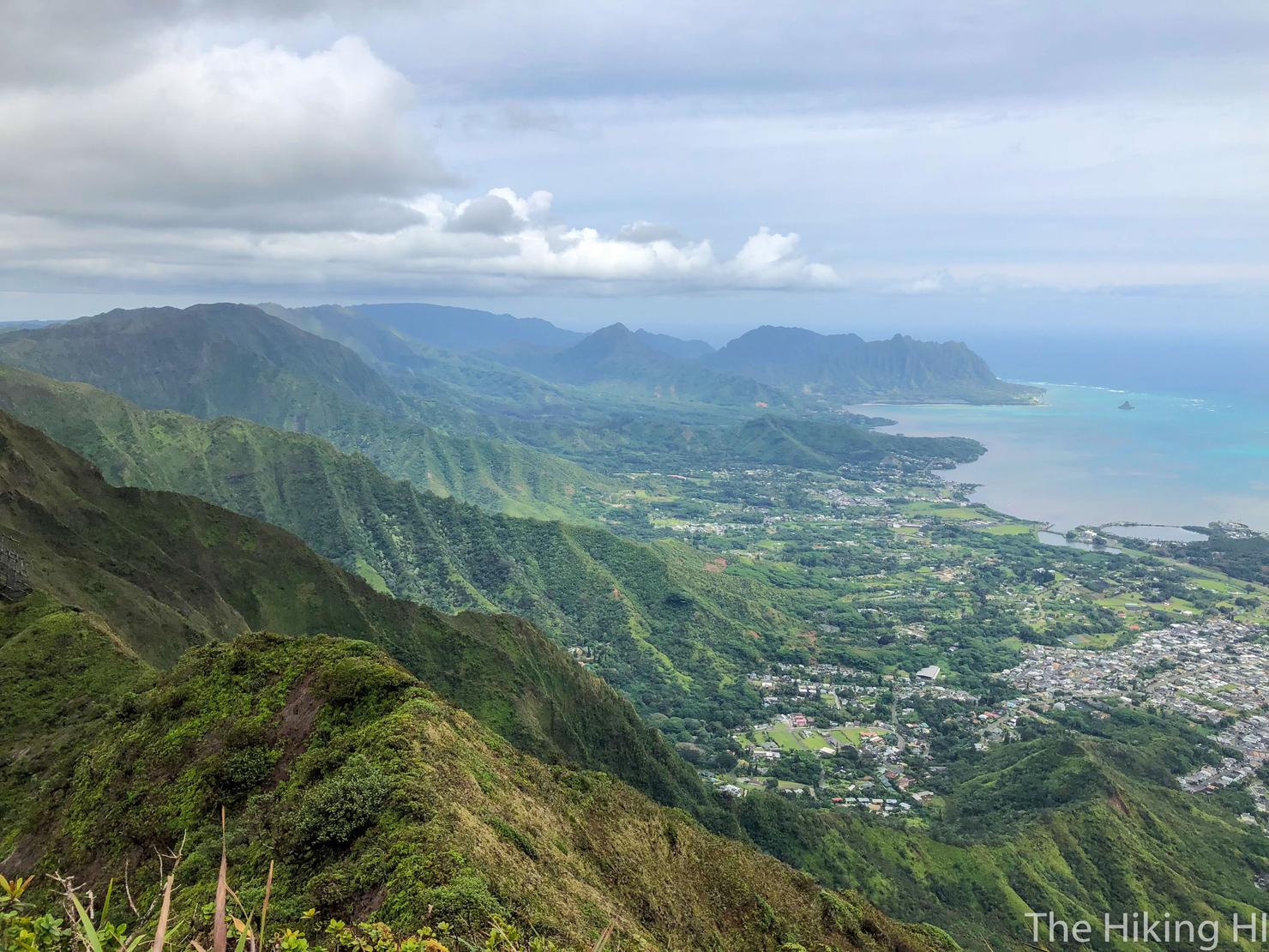
And North where you can see many of the Ko'olau finger ridges.
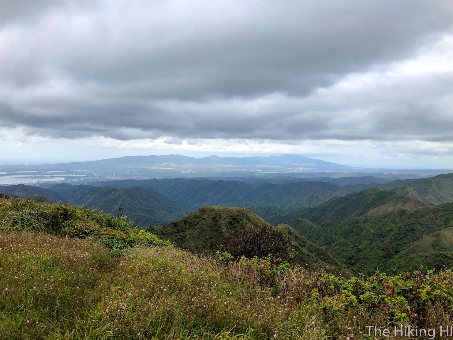
And another towards the center and west side of the island.
And one last photo of what we accomplished.
As I stood staring at these beautiful ridges, and the Waianae Range in the distance, I couldn't help but laugh at myself. Just a few hours ago, I had almost convinced myself that it wouldn't be worth it to hike today. Sure, there were some clouds in the sky. Sure, the scenery wasn't as beautiful as it could have been. And sure, this photo won't get a bunch of likes on Instagram. But what is it that really matters and brings us satisfaction? For me, it is getting outside and appreciating the natural beauty that is Hawaii. Sometimes, there are obstacles to achieve this satisfaction. And sometimes, that obstacle is simply my own mind. And that obstacle can be the most challenging of them all.