Difficulty: BEGINNER
Time: 1-2 HOURS
Distance: 2.5 MILES
Elevation Gain: 300 FEET
Foot Traffic: MODERATE
Challenges: Muddy
Sights: Bamboo Forest, Tantalus Lookout
What to Bring: Water
The Mauka Trail System is the best maintained and the only true series of interconnected trails on the island of Oahu. It's trails take you around the Tantalus/Roundtop area, Manoa, and towards the Pali. This post covers the Moleka to Ualaka'a Trail located in Tantalus.
Last weekend, tragedy struck. While taking out the trash, I accidentally ran over my pinky toe with a full trash can. IT HURT. I was barely able to walk on it for two days and the toe turned a nice shade of purple. Needless to say, I was worried I had broken it. Well, the only thing I could do about this clutzy injury was stay off it and hope for the best.
By Friday, the swelling had subsided and I was (almost) able to walk like a normal human again. Having had no form of cardio throughout the week, I was itching to be outdoors and get some exercise. After getting off work at a reasonable time, I decided to visit some different hiking territory, Tantalus and the Mauka Trail System. I had been here once before, when taking the Kalawahine Trail to K2. Today I would explore some of the less strenuous trails in the system, specifically Moleka to Ualaka'a.
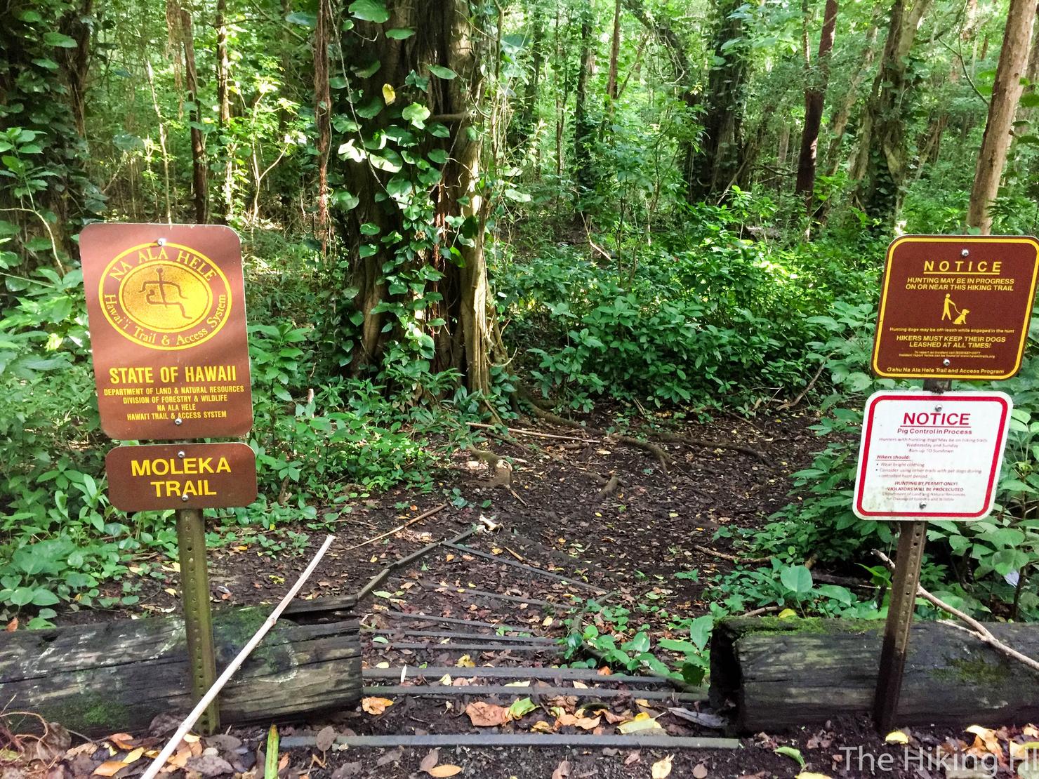
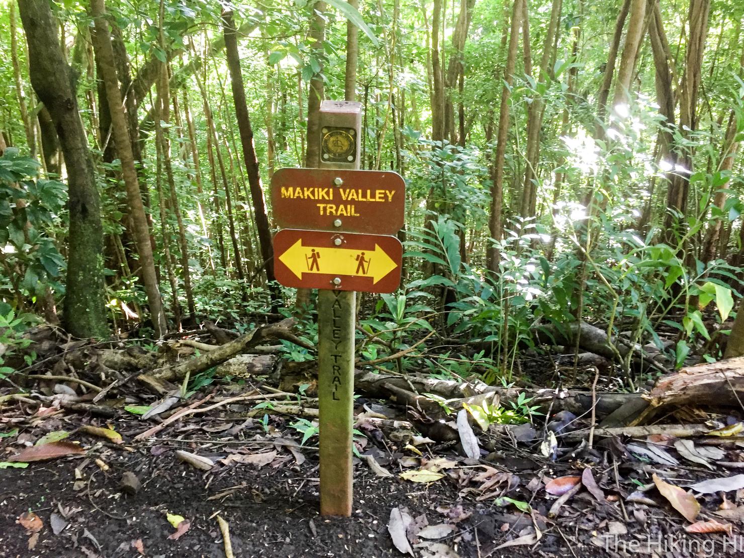
After driving up the roundabout road to Tantalus/Roundtop, I stumbled on the Moleka Trail. This trail system is actually well marked and mapped (check out map here) and there are many different routes you can take. My goal was to make it to the Ualaka'a State Wayside Park where there is an incredible lookout of Honolulu.
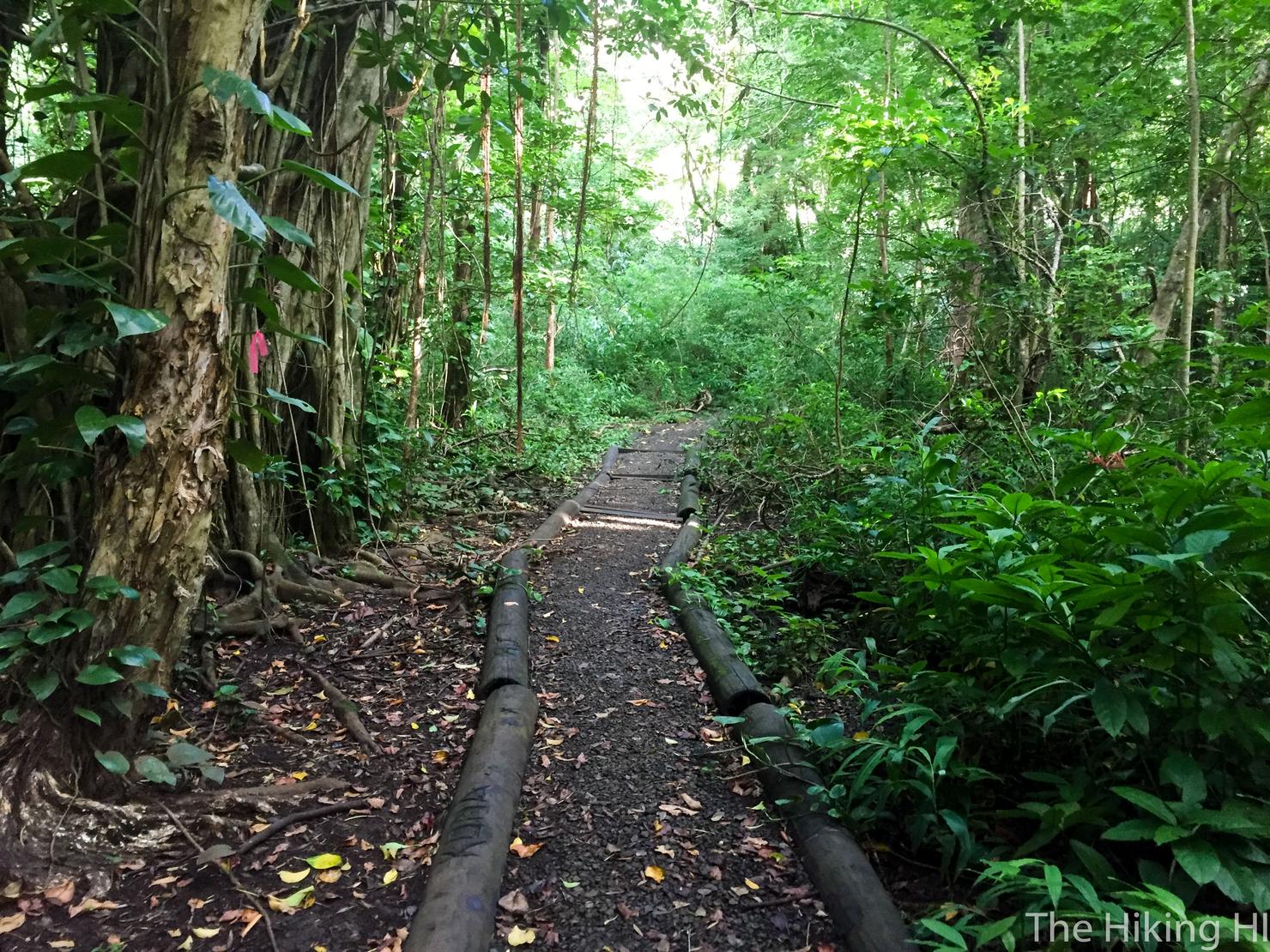
This really is a change of pace from the open Hawaii ridge hikes I typically do. Not only is it a shaded walk in the woods, but the path is nicely paved and very wide. No bushwacking or trailblazing required!
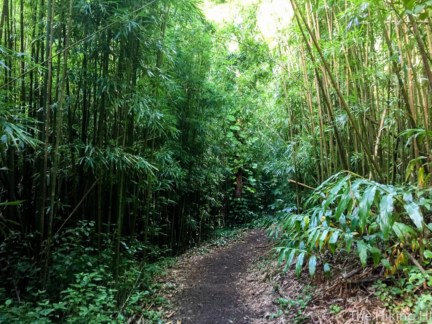
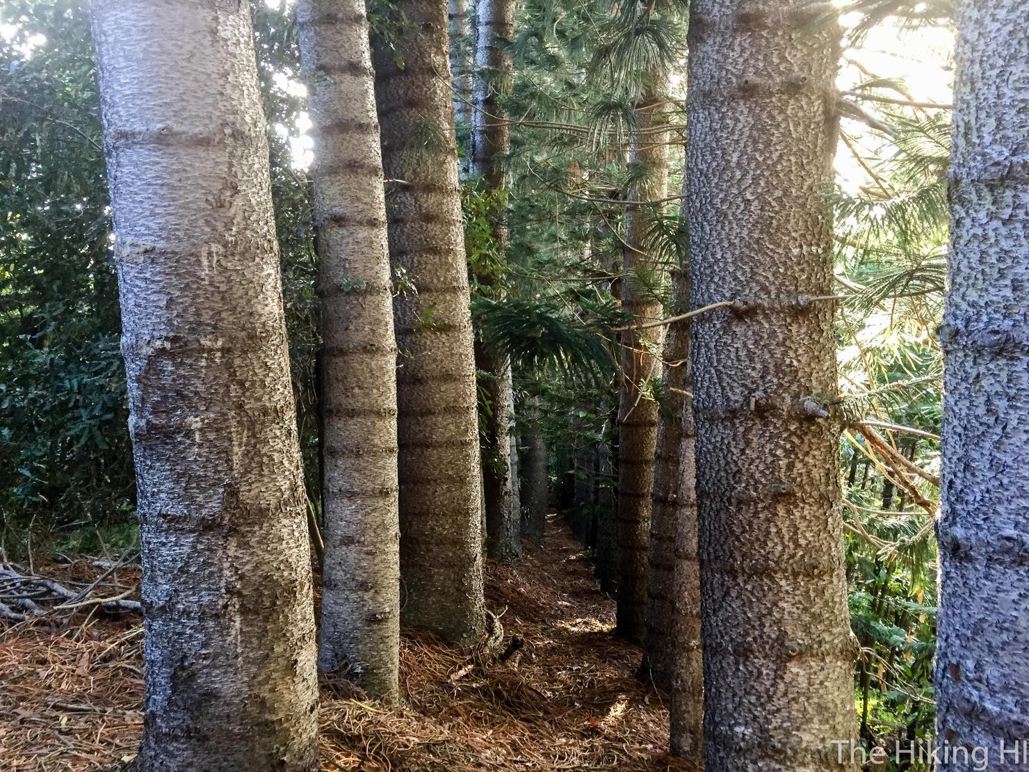
You will even get a pleasant walk through a beautiful bamboo forest.
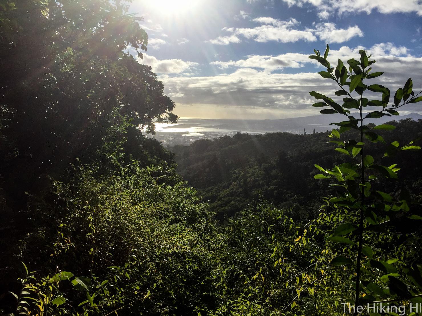
The trail has a few openings where you can get glimpses of the surrounding valley and beyond. Here you can see Pearl Harbor and towards the western side of the island.
We've reached a fork! We are going right. If you can read a map, you shouldn't have a problem navigating your way around this trail system. Of course, I have met plenty of people who are navigationally challenged, but hey, there's nothing wrong with getting lost in the woods! Well, assuming you find your way back eventually...
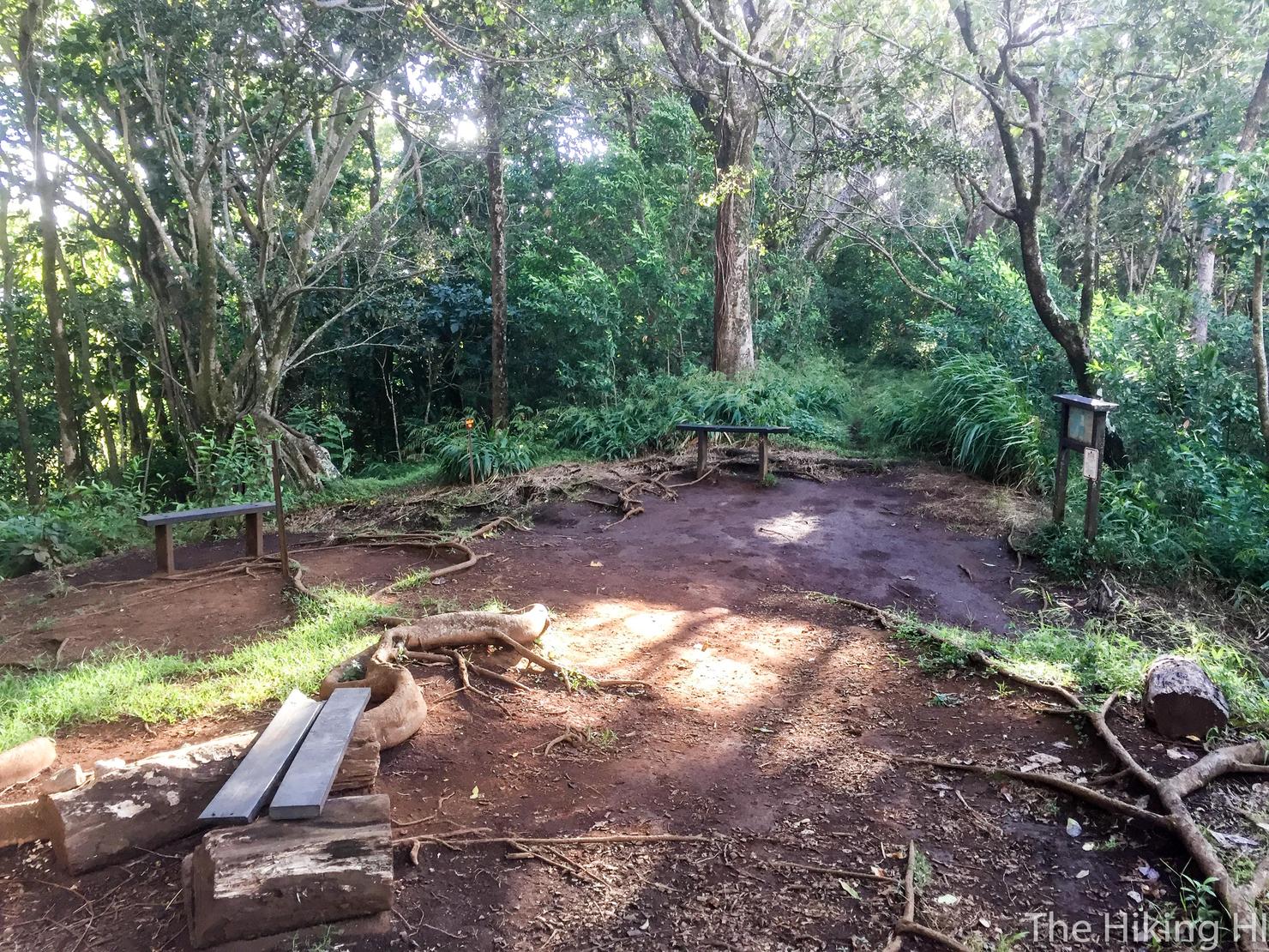
Eventually you reach this massive intersection where several different trails stem off. I really did like the layout of this system. There were so many different paths I could choose from. It was like one of those choose your own adventure books I used to read as a kid.
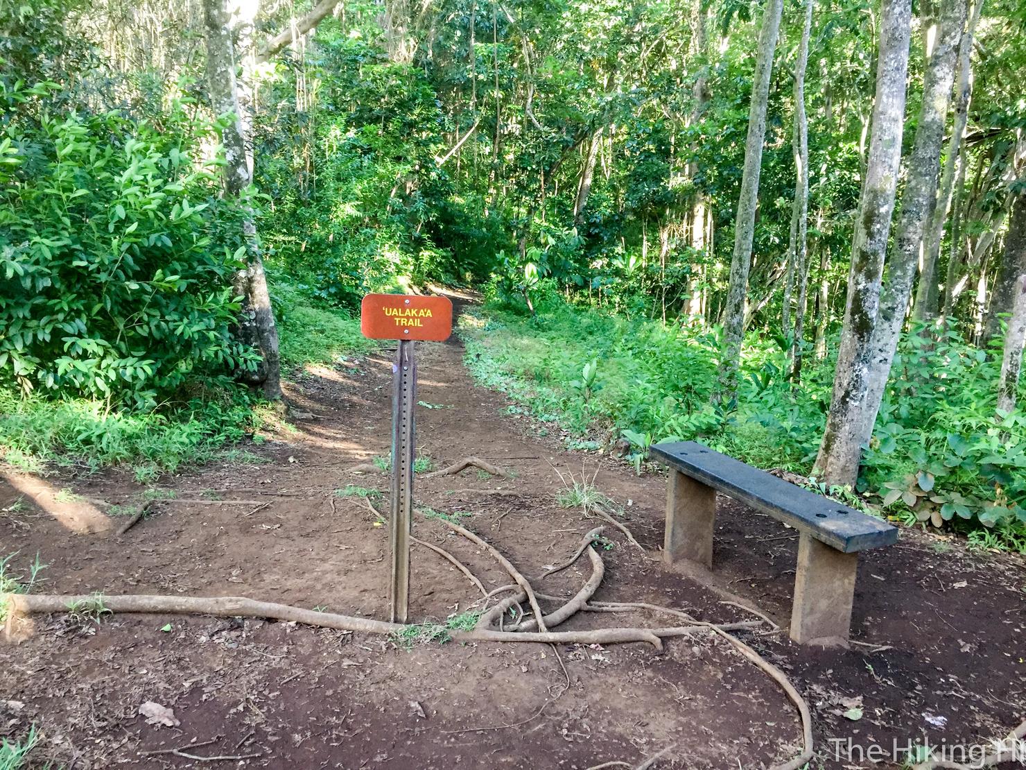
But I already had a destination in mind, so we will stick to the plan. To get to Ualaka'a Park, we will, rather obviously, take the fork to the Ualaka'a Trail.
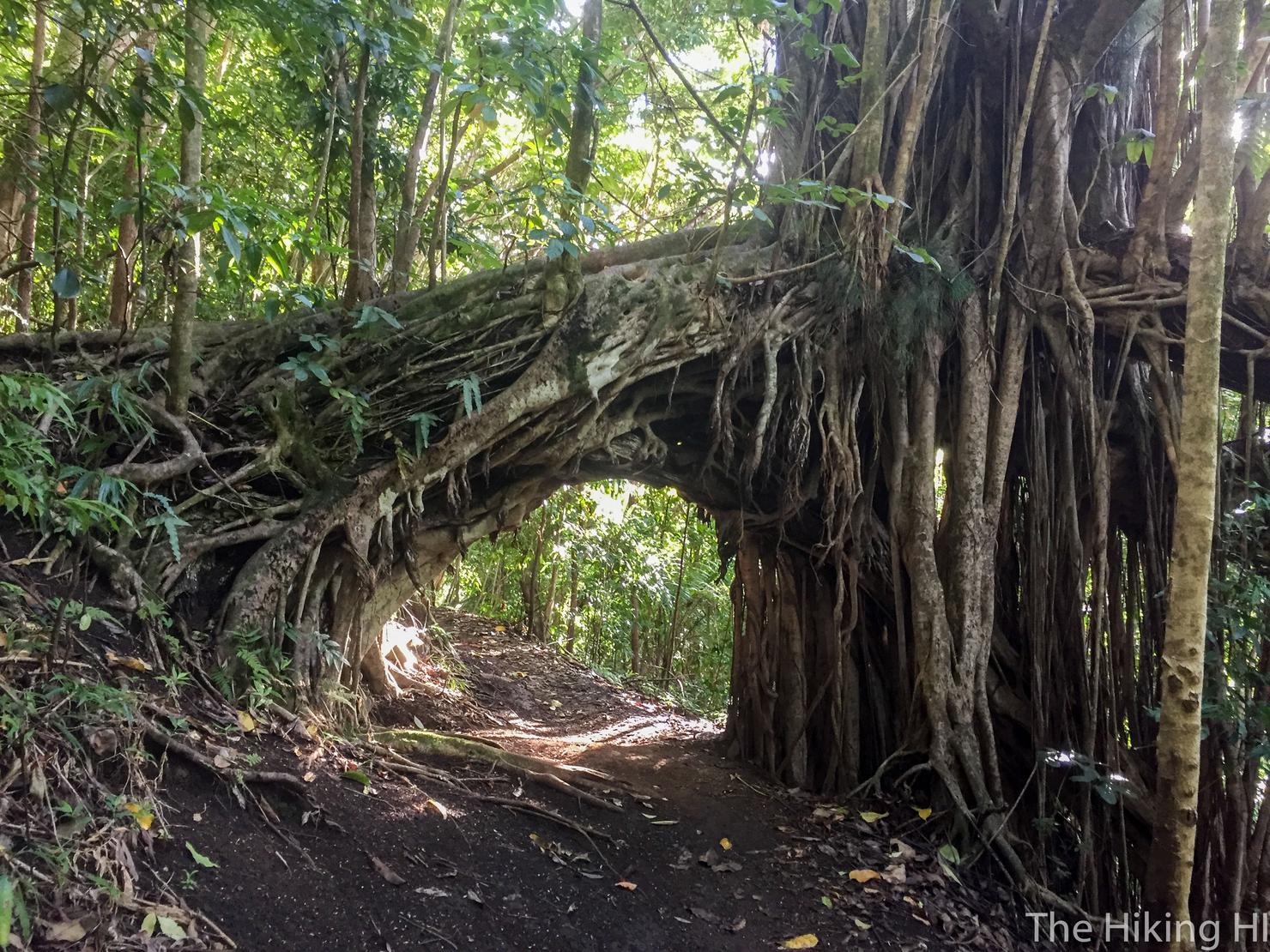
Some of the surrounding foliage was really cool to look out. There were a couple of these natural tree arches along the path.
Some more awesome trees. I've seen these before on Oahu, most notably during my hike to Pu'u O' Kona via Kuli'ou'ou Ridge. Something about their size and those unique notches up the trunk makes them feel so... majestic.

After about 45 minutes of hiking I had reached the park. To get to the lookout point and picnic area, you follow the road up a pretty large hill. I didn't actually hike up the hill. I hiked back the way I came and drove up it. I'll blame the (possibly) broken toe for my laziness.
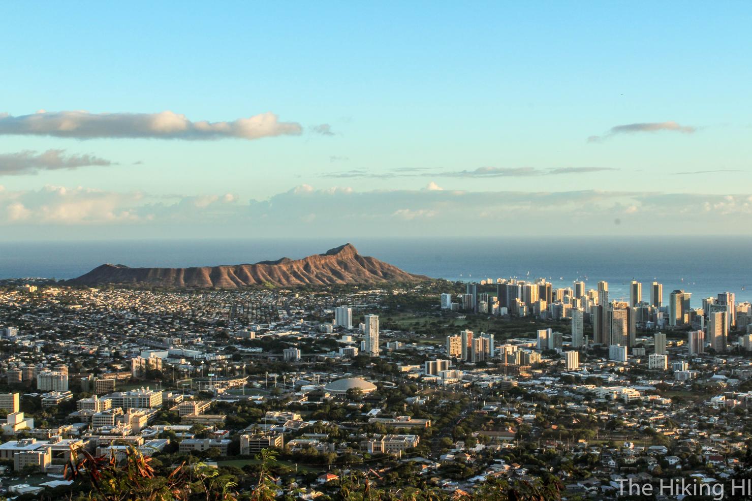
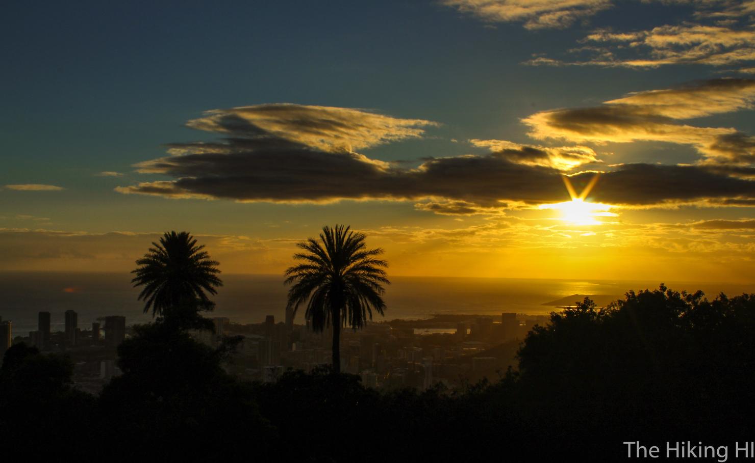
Regardless of how you get up there, I definitely recommend going to the lookout, because this is the kind of view you will get. Amazing! A crystal clear view of Diamond Head and Honolulu. There really isn't a better vantage point on the entire island.

Also, it's an amazing spot for a sunset. Closing out my Friday and bringing on the weekend with a sunset like this, that is what I call a good Aloha Friday.
- The official map of the Mauka Trail System