Difficulty: ADVANCED
Time: 7+ HOURS
Distance: 12 MILES
Elevation Gain: 4500 FEET
Foot Traffic: LOW
Challenges: Altitude Sickness, Endurance Challenge, Possible Freezing Temperatures
Sights: Mauna Loa, Lake Waiau, Observatory, Mauna Kea Summit
What to Bring: Good Hiking Shoes, Lots of Water, Lunch, Cold Weather Gear, Sunscreen, Aspirin
The tallest peak in all of Hawaii and the tallest sea mountain in the world, hiking to the summit of Mauna Kea is no easy task. You start at the visitor center at 9,200 feet before completing a near 12 mile round trip to the summit at 13,808 feet. You are battling difficult elements, with potential freezing temperatures and the threat of altitude sickness, as you trudge up the old volcano. But if you are persistent, you will have accomplished something you can always be proud of.
Ever since I learned you can hike Mauna Kea, the highest peak in all of Hawaii and the tallest sea mountain in the world (33,000 feet from the ocean floor), I knew it had to be on my Hawaii bucket list. Sure, you are only actually hiking up 4500 feet in elevation from the visitor center to the summit of around 13,800 feet. But considering you begin the day at sea level and most people simply drive to the summit, you are in an elite minority. So when I found myself on the Big Island a second time, I knew I had to set aside a day for this epic journey.
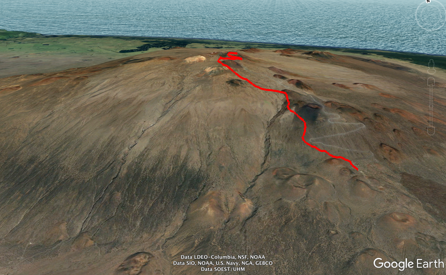
Here's a sketch of the hike. It actually looks pretty insignificant here. But let me tell you, it is anything but.
Our journey begins at 9,200 feet at the Visitor Center. I arrived circa 7 am. I wanted to give my body about an hour to acclimate before I began the climb. Altitude sickness is a real threat on this hike. There's not many places in the world where you can start at sea level and reach near 14,000 feet within hours. This hike has other challenges too, such as freezing temperatures in conjunction with the fact that it's about a 12 mile hike. This is why it's recommended to start the hike as early as possible since it takes most people around 8 hours to finish.
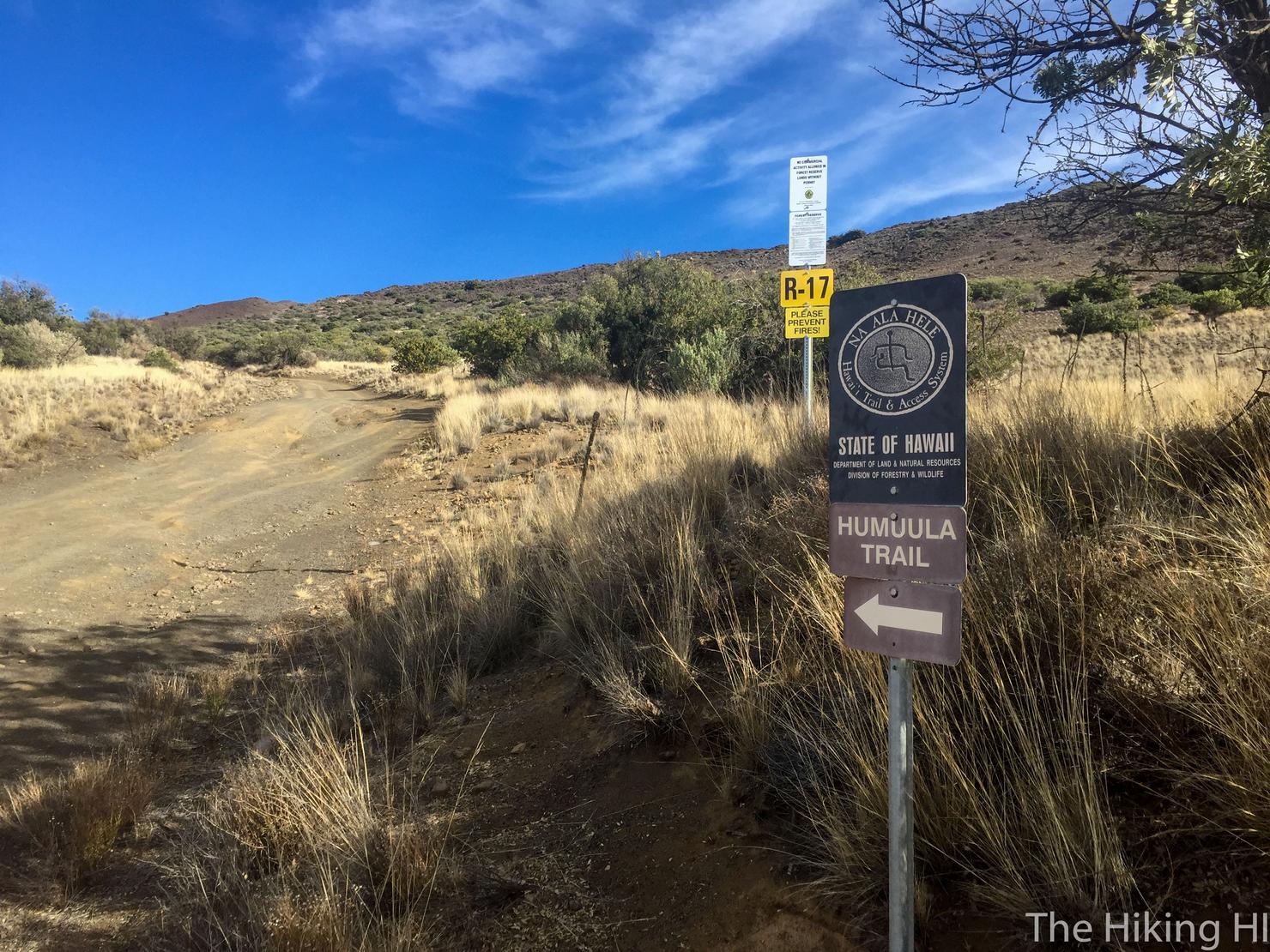
After signing in at the Visitor's Center (all hikers are required to for tracking purposes) I was off. The summit trail is called the Humuula Trail and actually begins a couple hundred yards up the road from the Visitor Center. The seemingly obvious path across the street is NOT the summit trail. I learned that the hard way...
Now that we're on the right trail, let's begin the hike!
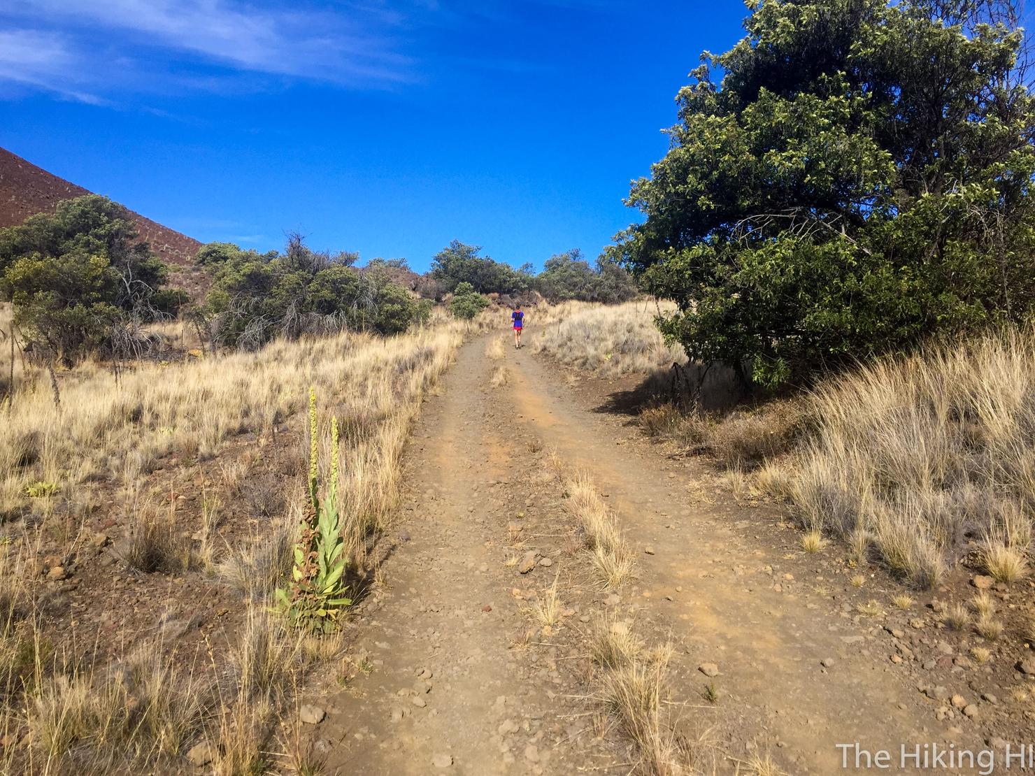
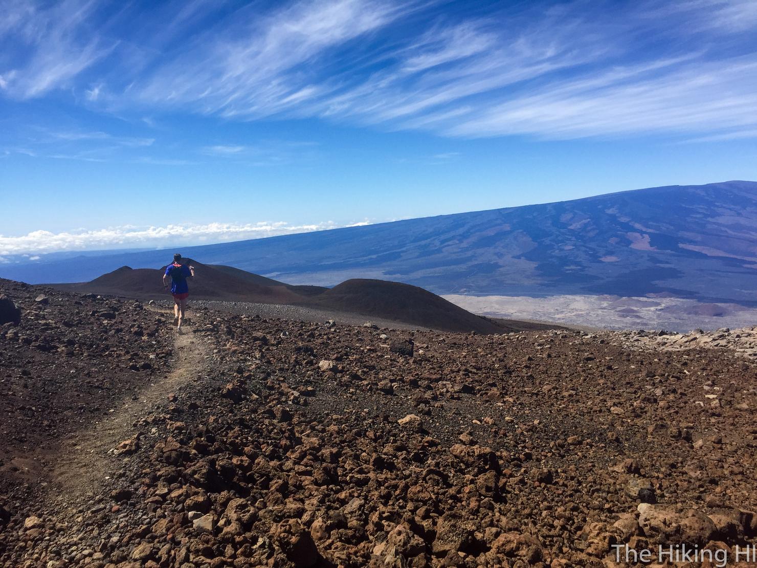
The very beginning is a nice gradual incline. Depending on how the altitude affects you, you may or may not think this is difficult. I was doing alright at this point, but I could definitely feel the altitude. Clearly this guy in front of me was not affected as he was RUNNING up the mountain. There are crazy people in this world I tell ya.
But don't worry the inclines quickly get more intense. You will be breathing hard soon enough, regardless if the altitude affects you.
So when you start breathing hard or start feeling the altitude, just turn around and remind yourself, you are already above the clouds! Just take in the beauty of this incredible landscape and be happy with the accomplishment of being here. If you make it up, you do. If not, it's all about the experience.
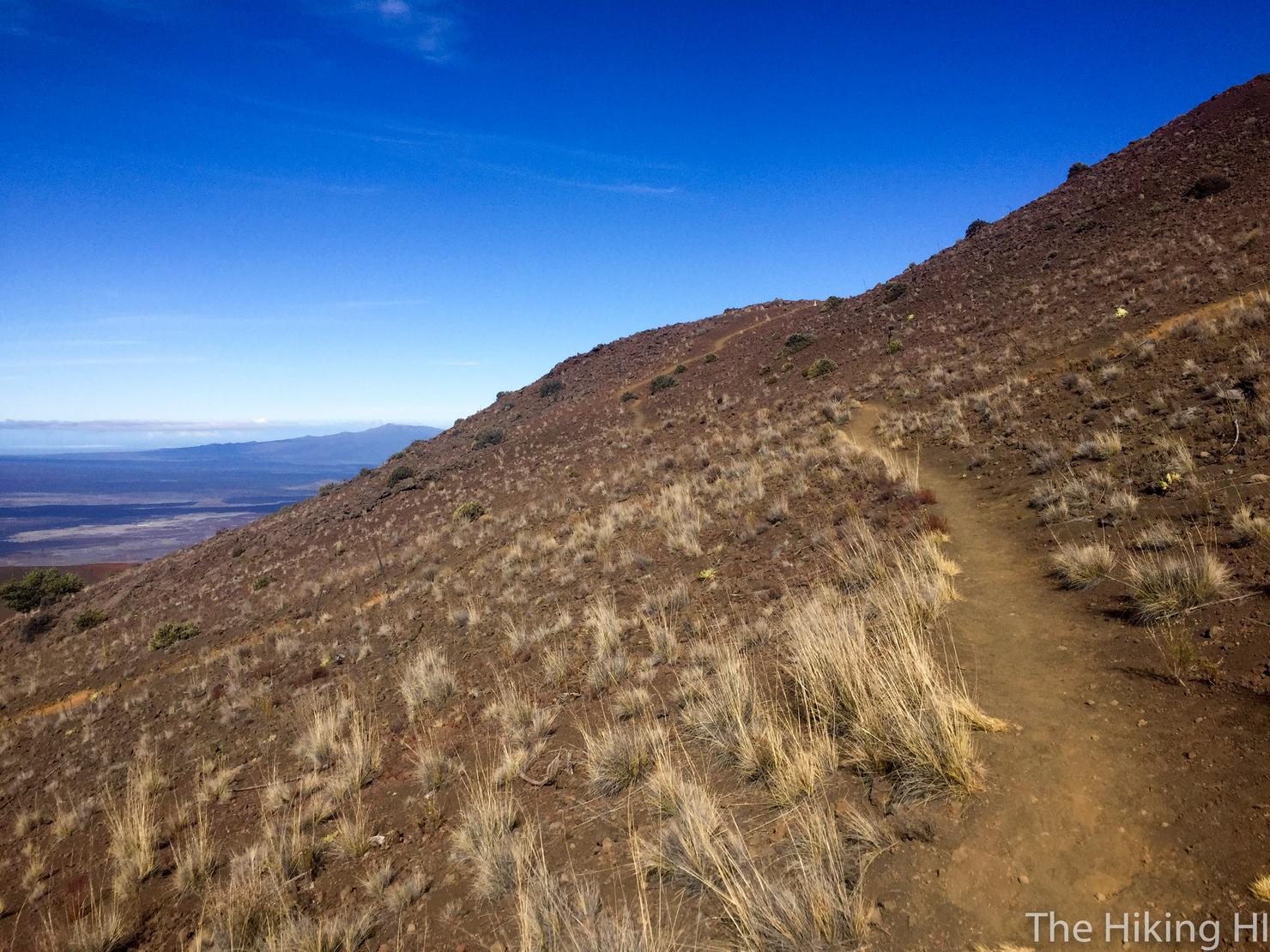
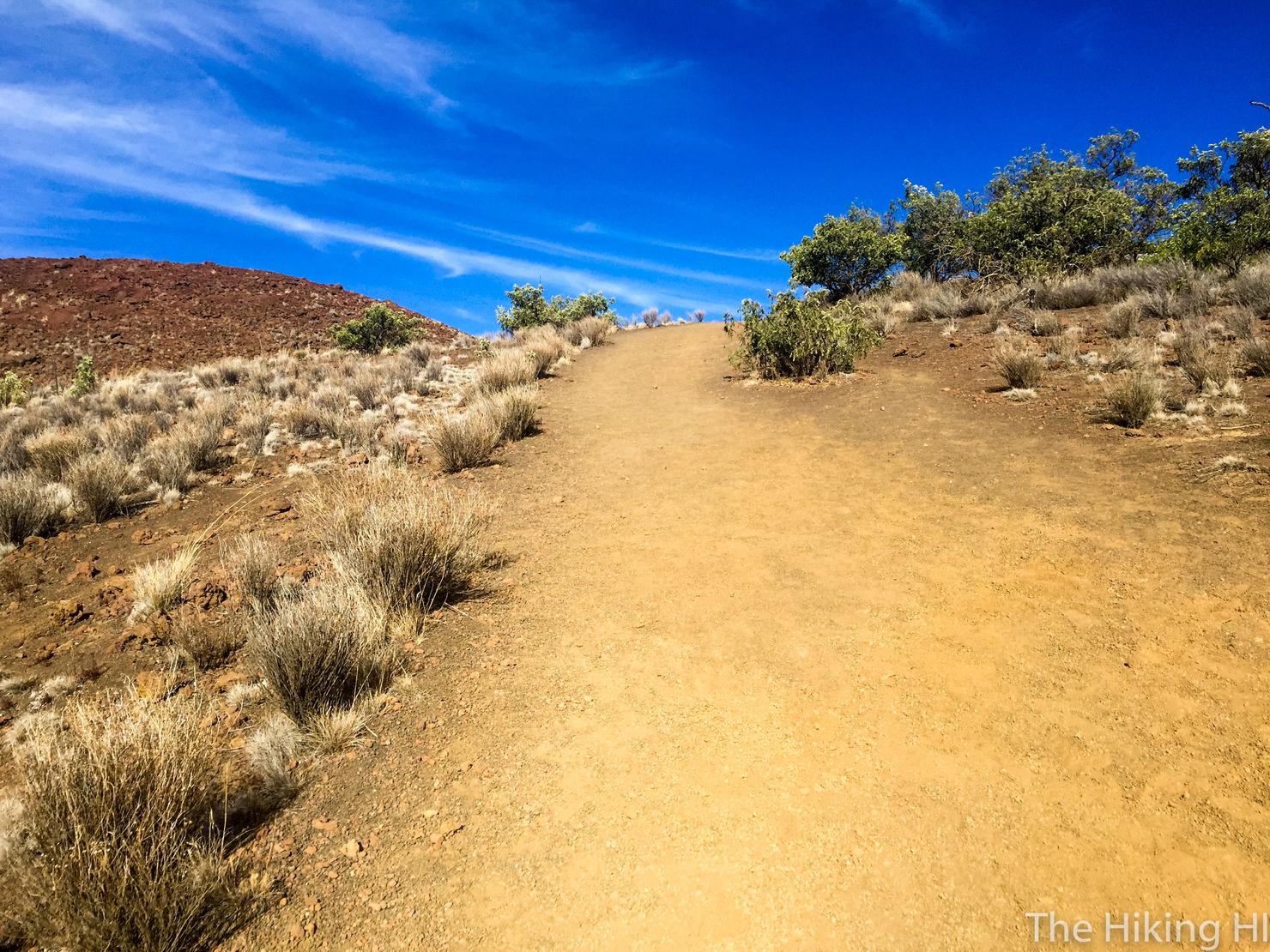
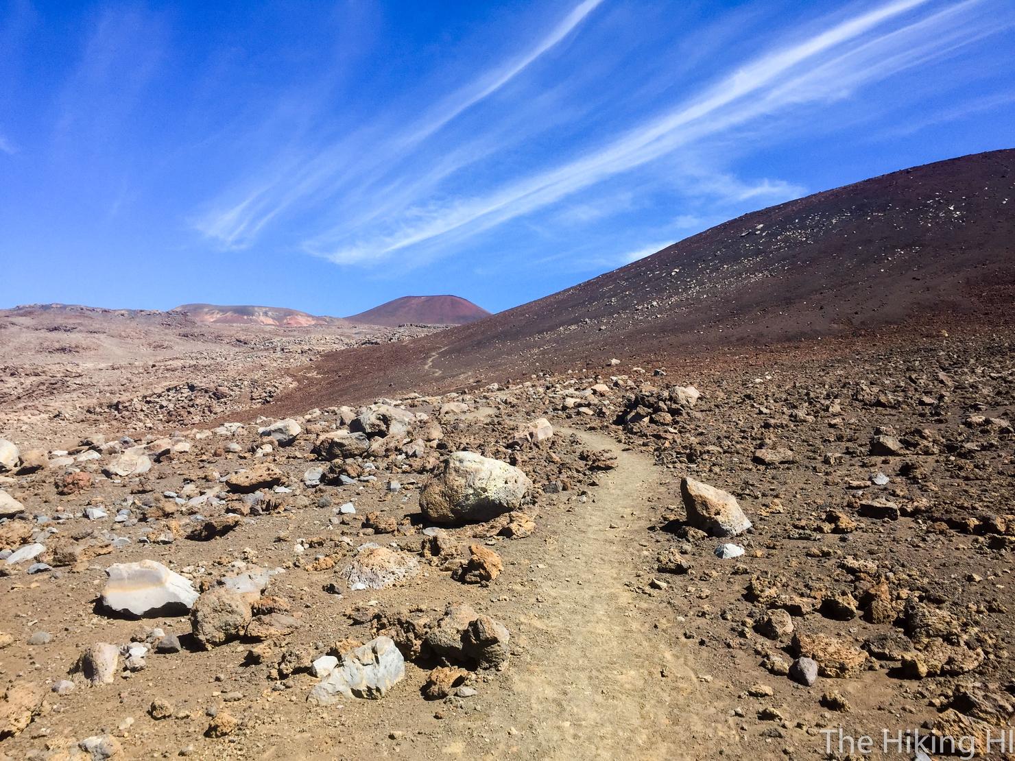
But for those committed to summiting, just keep moving. The few level sections like this one felt heavenly on the body.
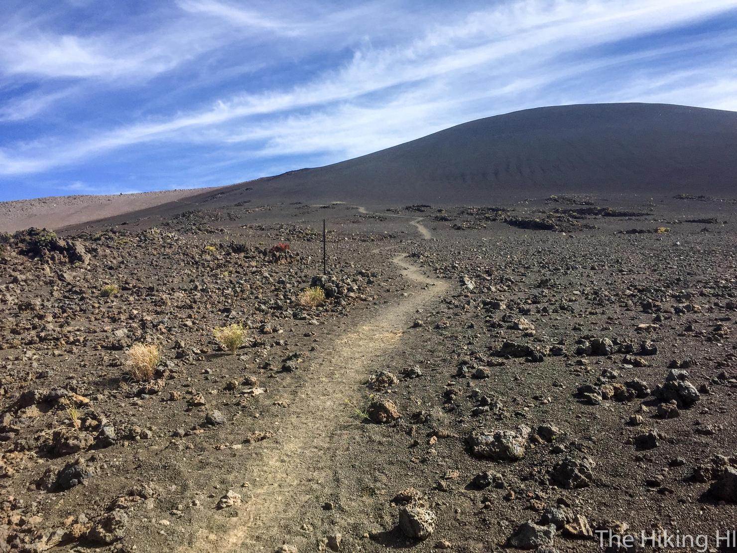
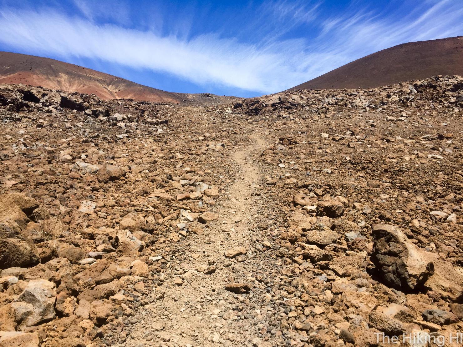
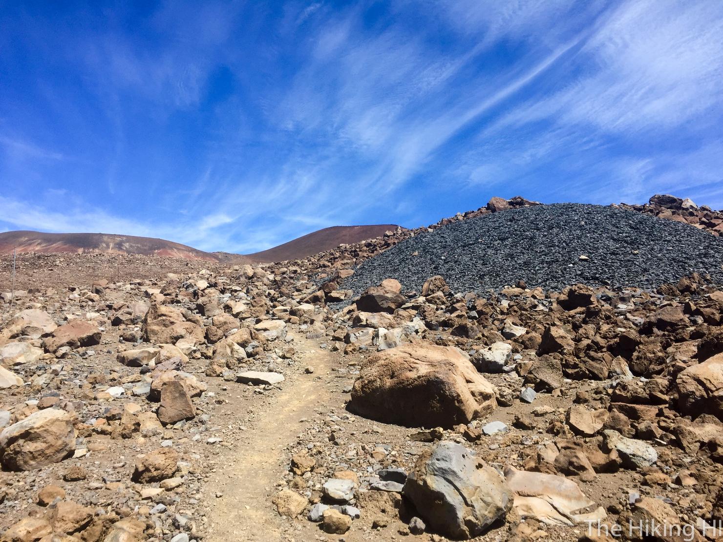
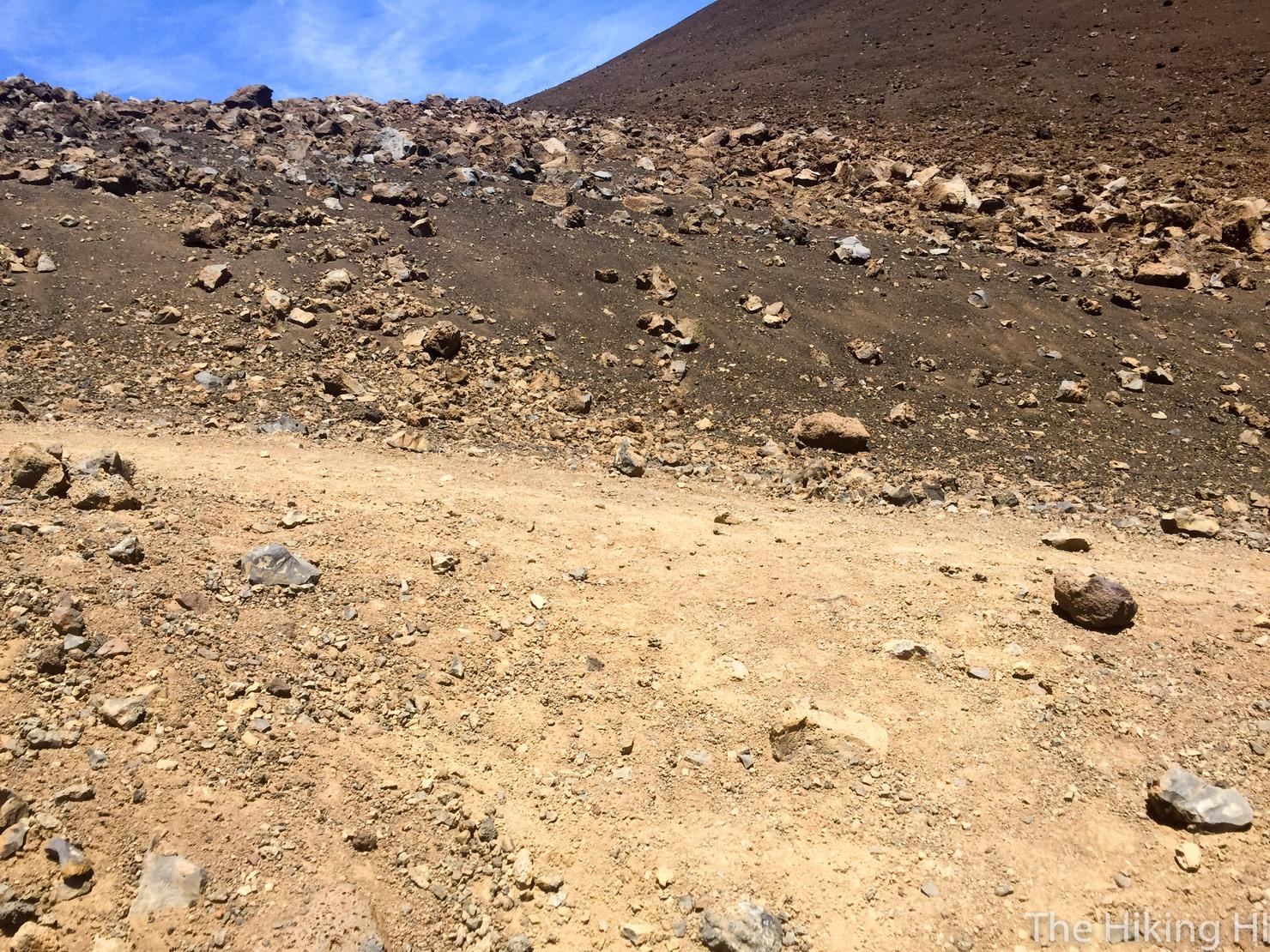
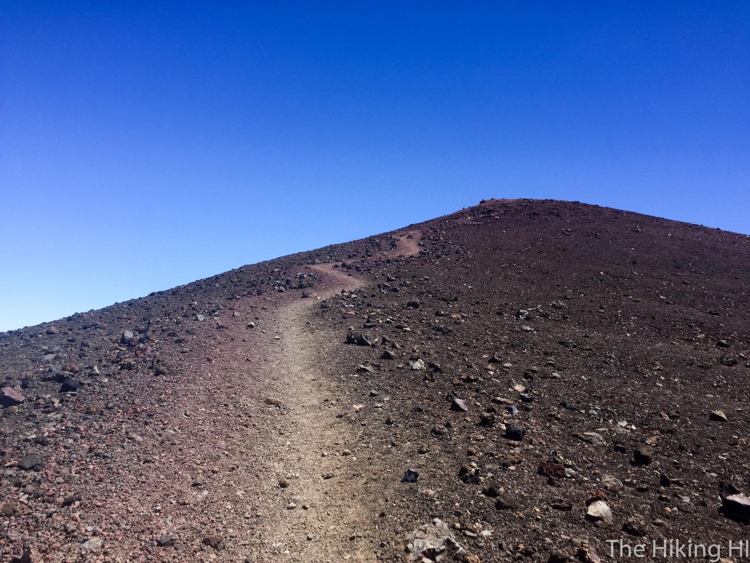
The summit trail is very obvious, so it shouldn't be too much of a challenge to follow. There's also those posts along the trail to indicate the direction you should head. For the most part the trail is a beaten down dirt path.
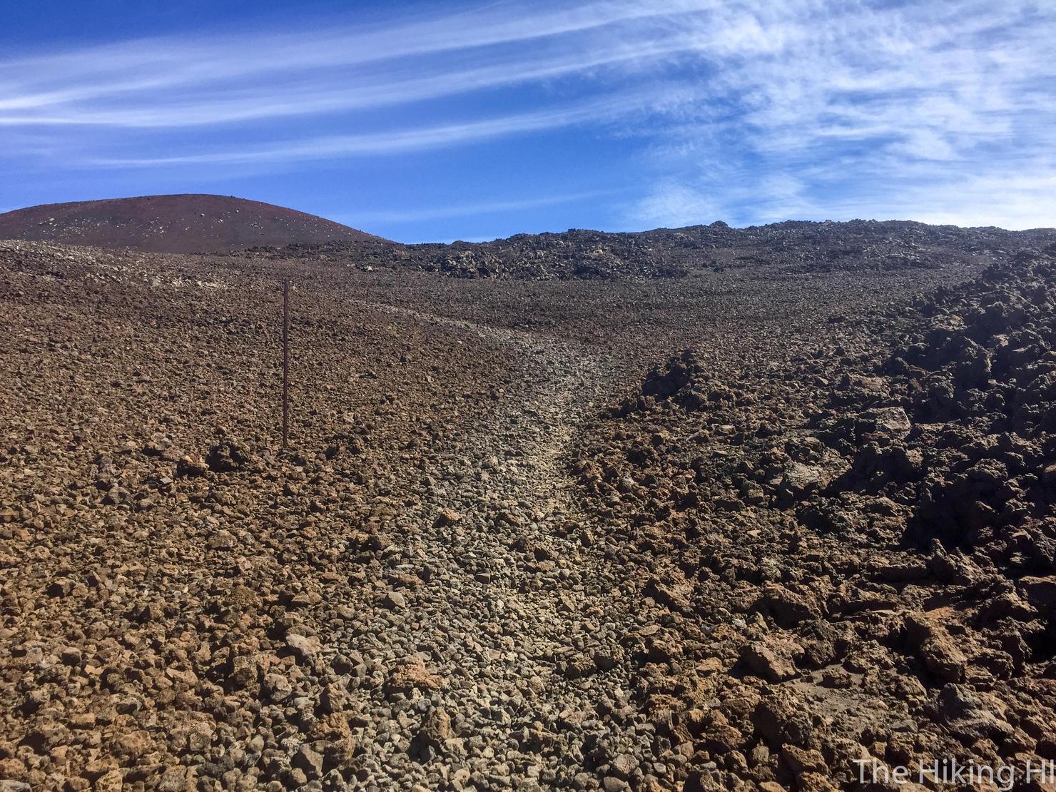
But every so often it will get rocky. I didn't notice the nature of the trail on the way up as I was simply focused on moving forward. On the way down, however, I found these sections to be a bit trickier. Since I was already exhausted, I lost my footing a few times. No faceplants, but it is something to be aware of on the descent.
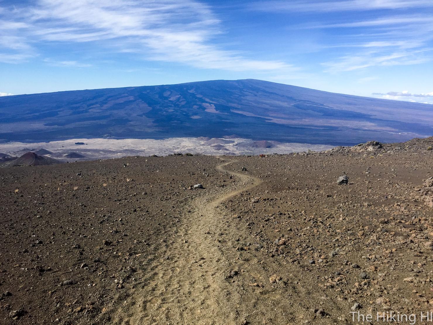
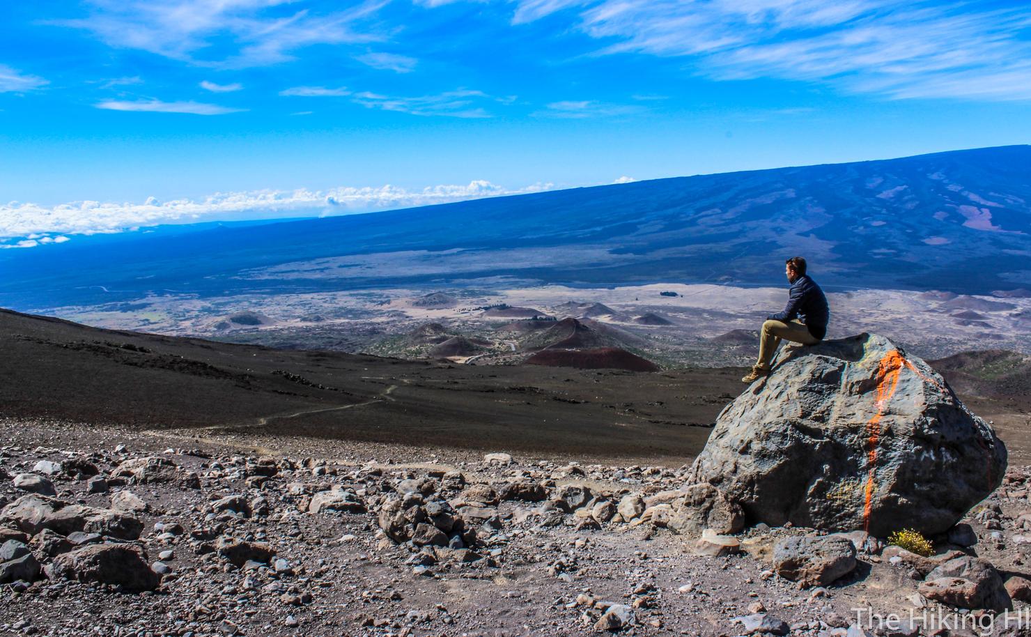
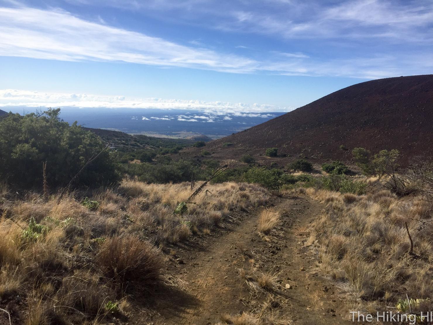
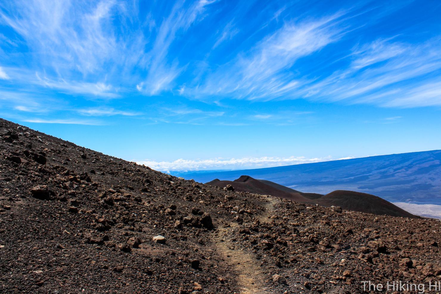
During the ascent, you will see a large and long peak behind you. That is Mauna Loa, the second highest peak in Hawaii at 13,678 Feet. That is another hikeable peak, but it is an even longer 13+ mile journey. From what I've read, it can feel more difficult than Mauna Kea since you begin the hike at 11,000 feet and have less time to acclimate.
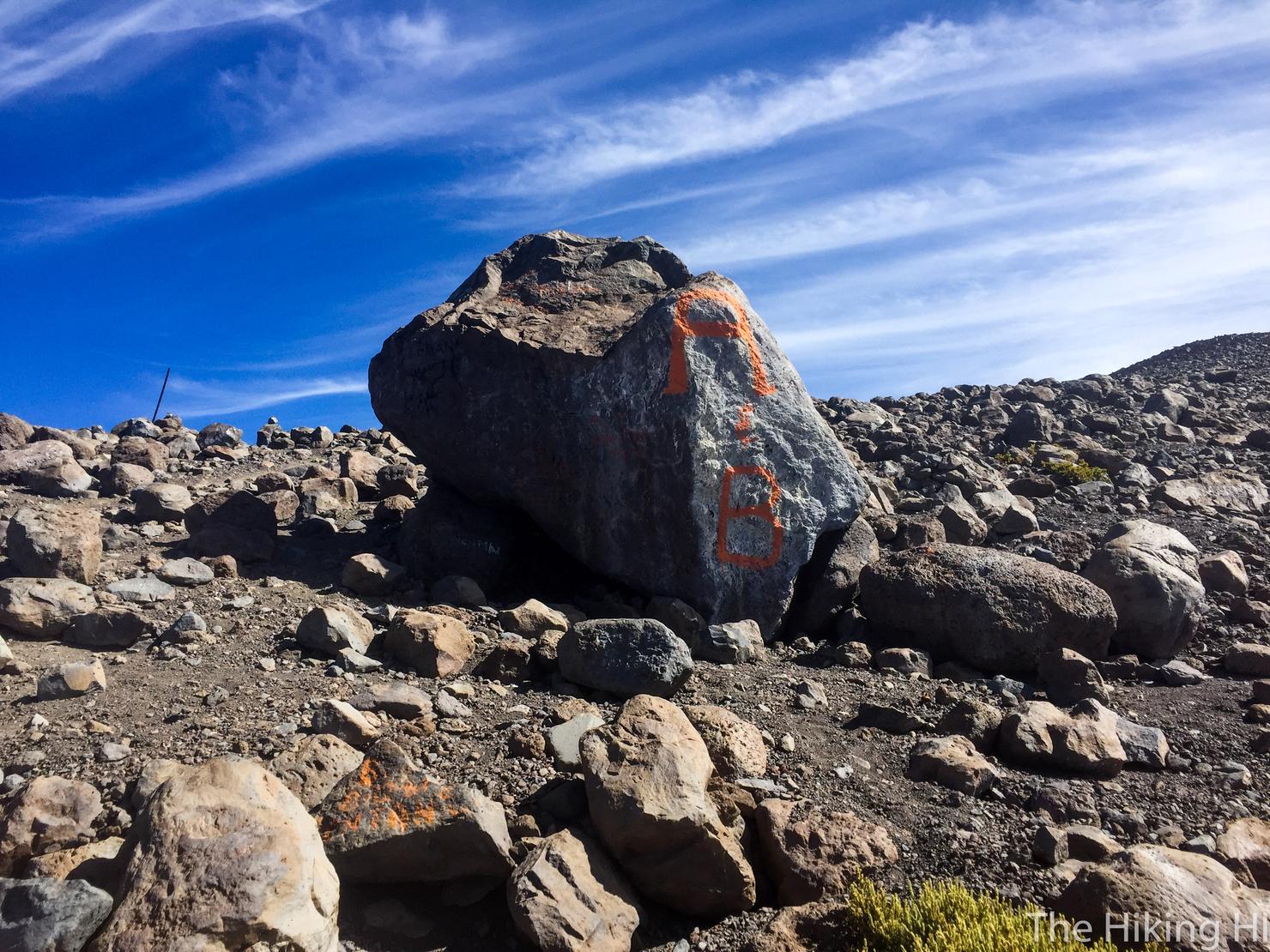
After an hour and half of hiking, I reached this painted rock. I checked my altitude, right around 11,000 feet. This felt like a perfect spot for a snack, water, and acclimation break.
And of course a photo break. This is one of my favorite photos I've taken. I feel it really captures the awe I felt for this incredible environment. You'll also notice I'm wearing a jacket now. I was only wearing a long sleeve at the start of the hike but as I gained elevation, it started getting a bit chilly. It also began to get a lot windier. My tripod actually fell over when I was trying to shoot one of these pictures.
Alright let's continue. I actually didn't realize how much the altitude was affecting me until that break. Before I had stopped, I was pretty winded and was feeling a constant pressure in my head. After, I felt rejuvenated and was ready to tackle the next 2,800 feet.
But the altitude crept back in soon enough. I won't lie, there were a few times when doubt entered my head whether I would finish this thing. Sometimes when you're up on a mountain all alone, motivating yourself is a real challenge. But then, you see a guy run by you in short shorts who already summited and you realize, alright maybe I can do this. As much as I hate to admit it, ego is a real motivator.
Another way I took my mind off the struggle was to simply be present with these amazing surroundings. Similar to my hike through Haleakala Crater on Maui, this hike feels other worldly. Also, the clouds were beautiful. Maybe these were cirrus or possibly altostratus (sorry I'm not a Nepholologist). Name aside, these fragile looking clouds were captivating.
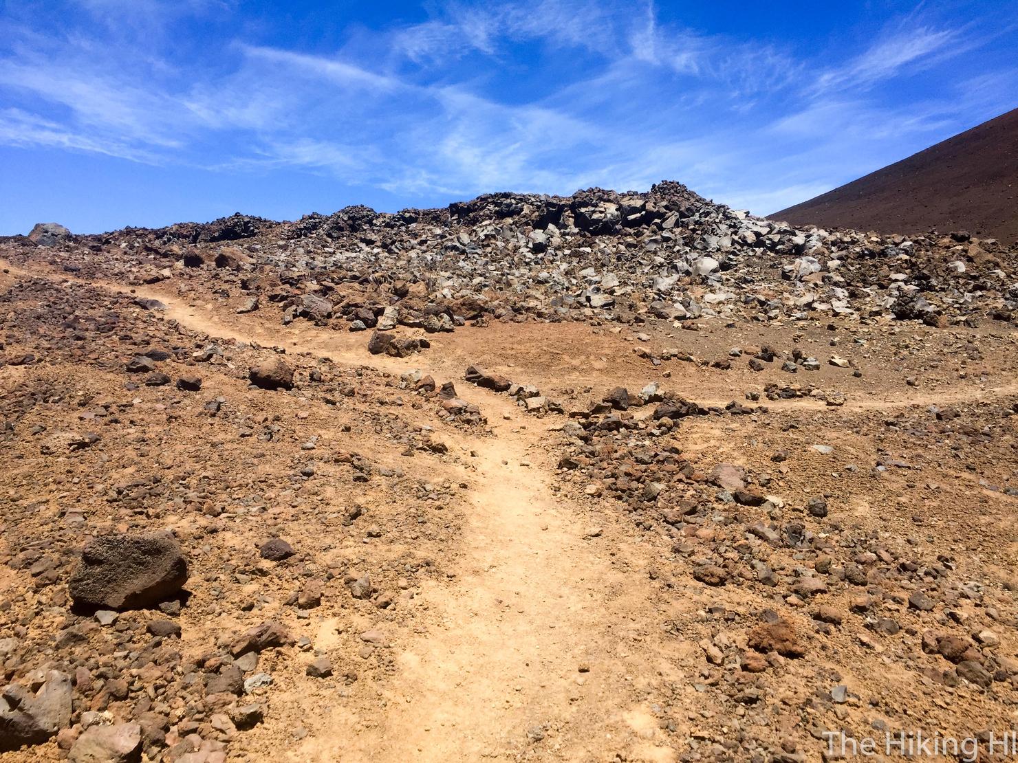
I noticed this large pile of fine black rocks and checked my elevation. Right around 12,000 feet. Progress was being made.
That view though...Amazing!
After another hour or so from the 12,000 foot point, I reached this fork in the road (sorry the picture doesn't fully capture it). In order to continue on the summit trail, go LEFT. If you head right, it will simply take you back to the road. Oh yea, you do know you can drive to the summit right? Too late now, we're already almost at 13,000 feet.
Shortly after that first fork, you will come to another fork. The turn here was a little less obvious. The right path looked like it continued to the summit, but the left one looked intriguing as well. I went left...
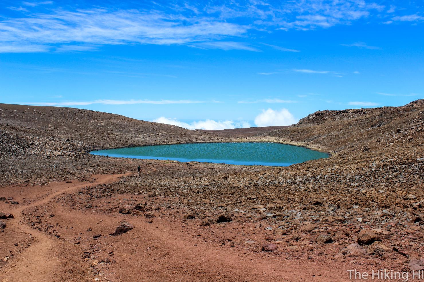
And I'm glad I did because it led me to this, Lake Waiau. It was only about a 5 minute walk from that fork, which was actually quite the struggle for me given how I was feeling. But man, was it worth it! There were a lot of amazing things on this hike, but this was probably the most mesmerizing. This is a beautiful blue/green lake completely above the clouds at roughly 13,000 feet. It is also the highest lake in the Pacific Rim. It really was magical.
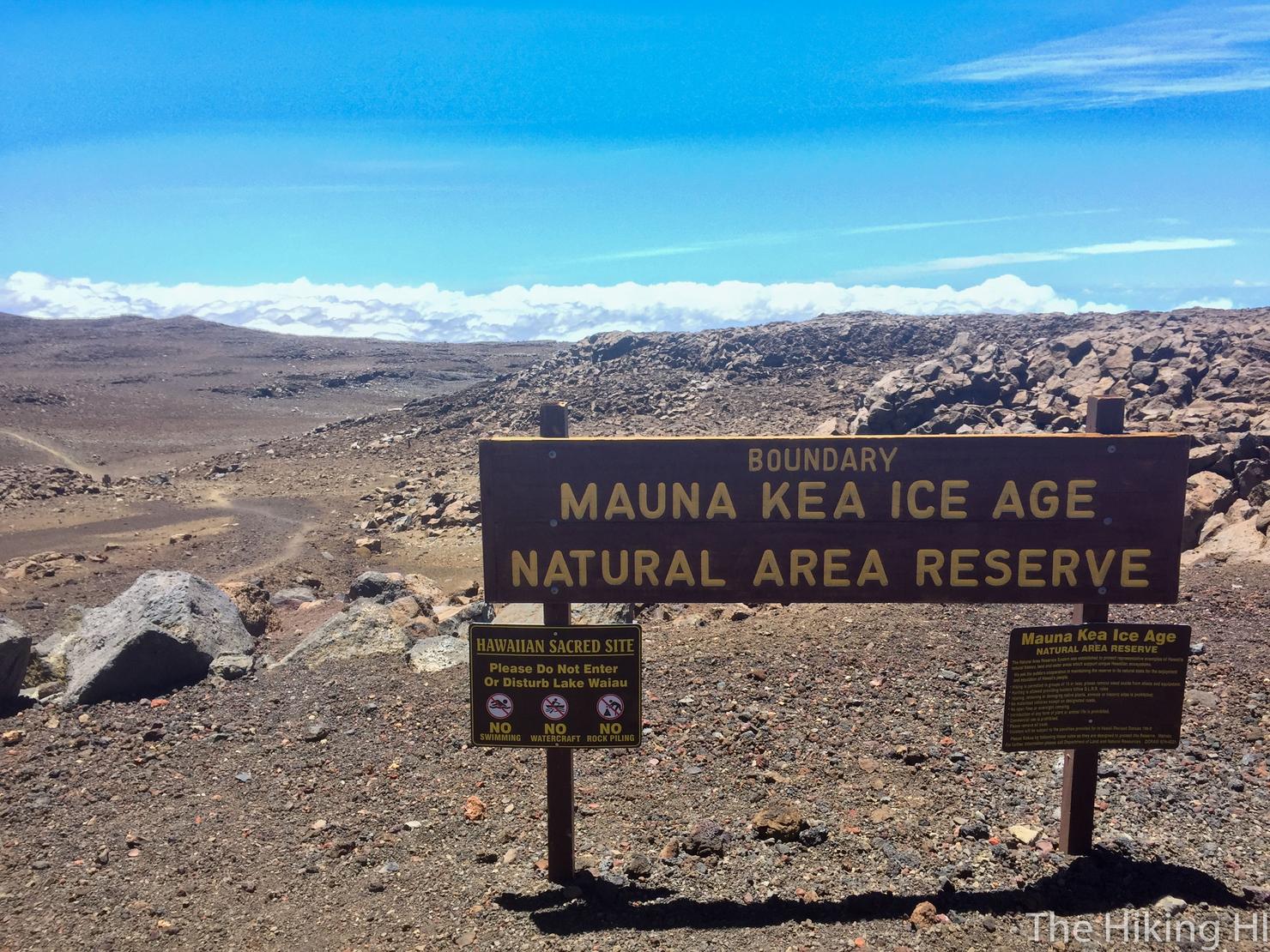
After taking in the beauty of that lake, I decided to continue to the summit for the final push. I went back to the second fork and took a RIGHT this time. After about 30 minutes, the trail ended at the road where you can find this sign.
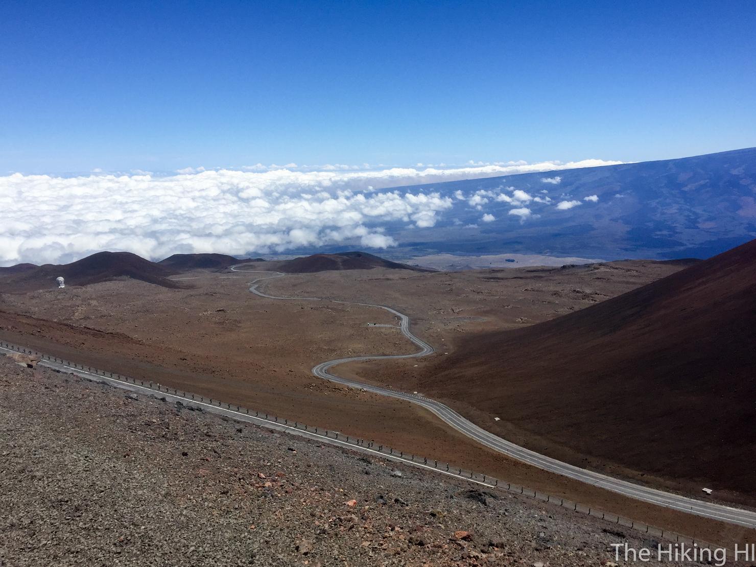
From here, you simply hike along the road to reach the summit. It is still several hundred feet in elevation and switches back a few times to get there. Watching the cars effortlessly zoom by you is somewhat discouraging. I was half tempted to hitch a ride. However, I made it this far, I might as well stick it out to the end.
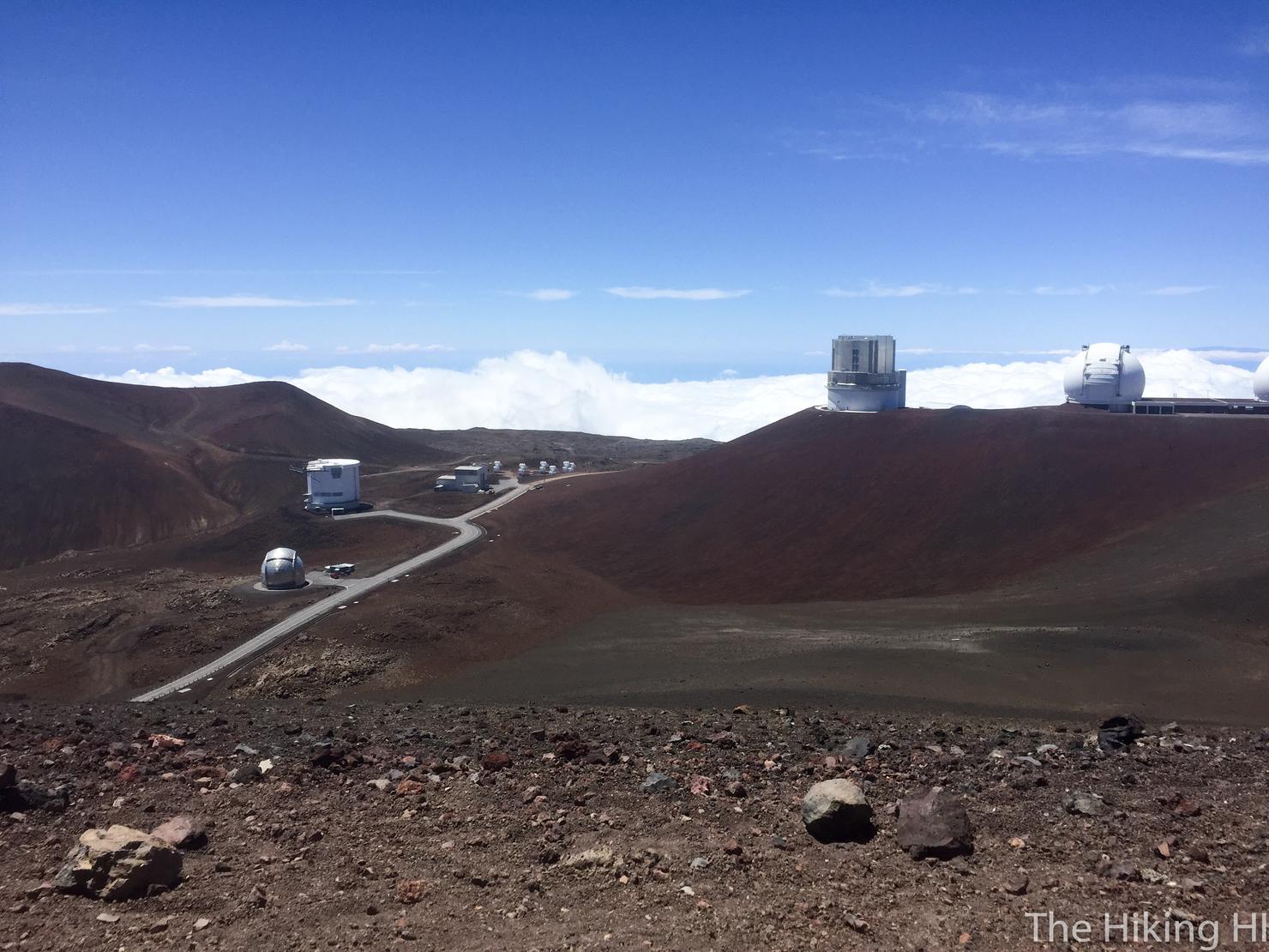
The road will eventually end at a bunch of buildings and a dirt area that serves as a parking lot (you will likely see cars parked there). Just beyond the parking lot you will get this view. Many of these structures are observatories. There's 13 observatories up here, some funded by as many as 11 different countries. The stargazing is some of the best in the world. You should check out this website which gives the upcoming special observatory nights.
However, that lookout area isn't the official summit. On the opposite side of the road, you will see a little path that leads to this. This is what I believe is the official summit. There was a sign at the beginning of this path that made it seem like you weren't supposed to hike up here. However, I saw other people doing it and we all know I'm not one to follow rules when it comes to hiking...

And we're here 13,808 feet at the top of all of Hawaii! I tried to take in the moment the best I could, but it was very challenging. There was a cold wind whipping me pretty good and the altitude had really taken its toll. This was one of those adventures where the satisfaction of what I'd just achieved didn't hit me until afterwards.
This was definitely one of the most difficult hikes I have ever done. Going from sea level to near 14,000 feet was a real challenge for my body. It took me about 5.5 hours to summit with a 2.5 hour return trip. The altitude definitely got me as I felt pretty bad for the next 12 hours or so. Luckily the minor altitude sickness was temporary. The memory and sense of accomplishment I feel for having done that thing will last a lifetime. I would do it again in a heartbeat.
Check out my video of this epic journey!
Have you ventured to the top of Hawaii? Share your story below!