Difficulty: BEGINNER-INTERMEDIATE
Time: 2-3 HOURS
Distance: 4 MILES
Elevation Gain: NEGLIGIBLE
Foot Traffic: LOW
Challenges: Sharp Rock, Shadeless, Powerful Waves Near Rocks
Sights: Lava Fields, Tidepools, Rock Bridges, Mauna Kea
What to Bring: Water, Sunscreen, Snack, Sturdy Shoes, Swimsuit
This out and back near Kailua-Kona, Hawaii is a beautiful hike that takes place entirely along the coast.You start at Kiholo Bay and head south where you will traverse lava rock, black sand beaches, and sea cliffs in order to reach the turnaround at Mano Point. Mano Point is a very secluded spot of the island where you will have miles of lava field on one side and the endless pacific ocean on the other. This isn't your traditional hike up a mountain, but it is a great adventure nonetheless.
After spending the first half of the day up hiking the Pololu Valley Trail near Kohala, I began making my way back to Kona, where I was staying for this trip. I decided I had time for one more afternoon hike before I would call it a day. Last time I visited the island, I did a hike along the Kona coast by heading north fom Kiholo Bay to Keawaki Bay. It was a long hike, around 8 miles round trip, but it offered some amazing sights, with lava fields, tide pools, and rock bridges. On this trip I decided to return to Kiholo Point but instead, I would head south for a much shorter hike to Mano Point. While it offered a lot of similar views as before, it was still a new and different experience altogether.
A shot of the hike. Mano Point is an unofficial point, marked by an aquatic sign. You really can hike as far along the coast as you see fit. When I hike, I always like to have a goal and turnaround point because otherwise, I may never stop hiking.
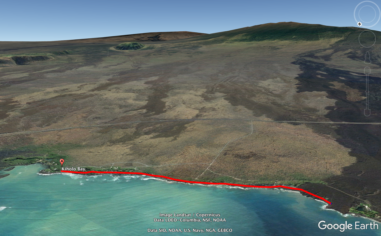
The entrance to Kiholo Bay is located on an unnamed road just off the Queen Ka'ahumana Highway. A precaution, the road that leads here is not paved and very bumpy and dirty. You don't need 4WD or anything (I made it in a Mustang the first time) but you will definitely need to drive cautiously.
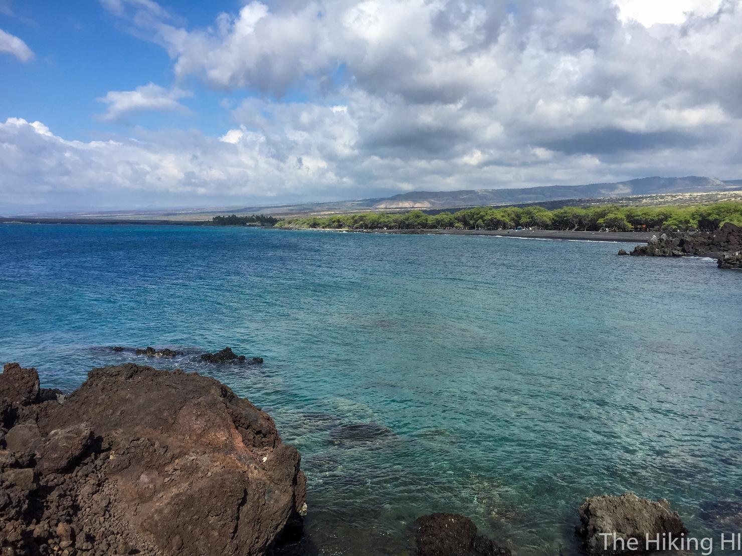
Ah nothing like the smell of salt and a nice ocean breeze! This shot is looking north. If you head this way, you can get to Keawaiki Bay (what I did last time).
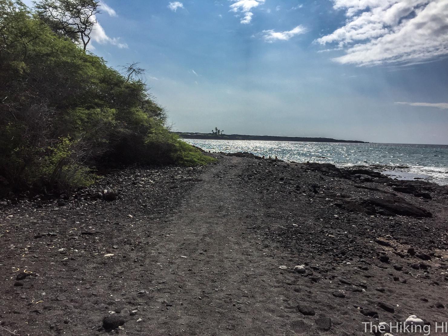
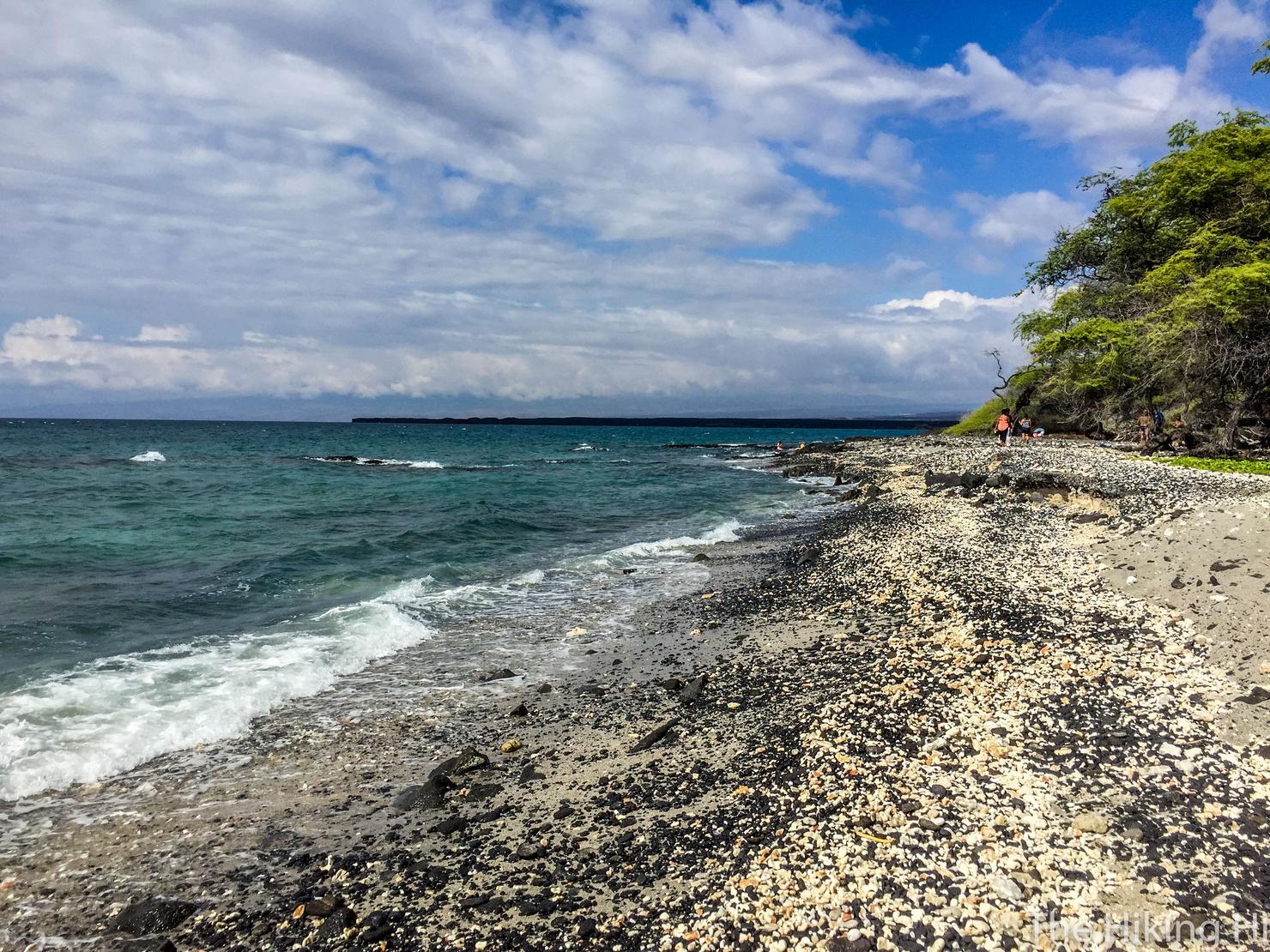
But this time we're heading south. As you can see, a lot of this hike will take place on a black sand beach.
After you make some progress, turn around and if it's clear enough, you can see Mauna Kea (that long ridge in the background) When I was hiking in this area last time, it was December, and I was amazed to see snow on the top of Mauna Kea. How many places can you an ocean and snow all in one shot?
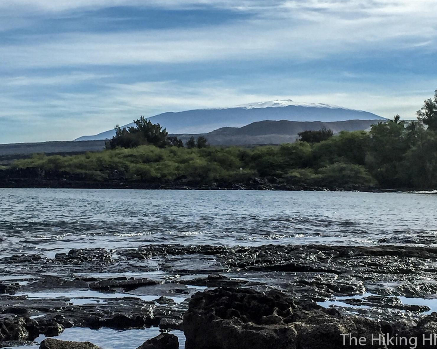
Oh hey! There's that picture. Gotta love data storage.
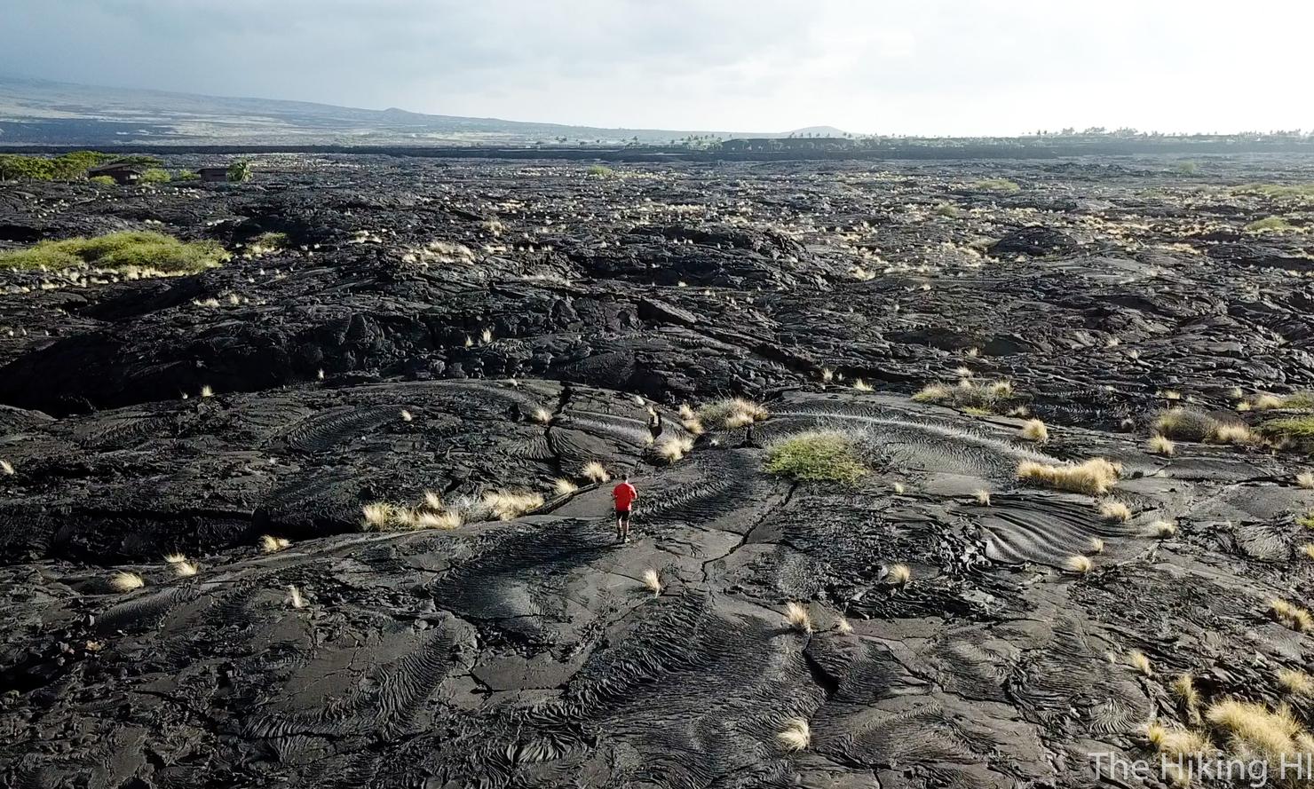
Anyway back to 2017. A lot of the early part of your hike will be through this lava rock. There's an obvious path, but that doesn't mean it's an easy path. There's plenty of uneven footing and a lot of sharp rocks. This is why some sturdy shoes are a good idea.
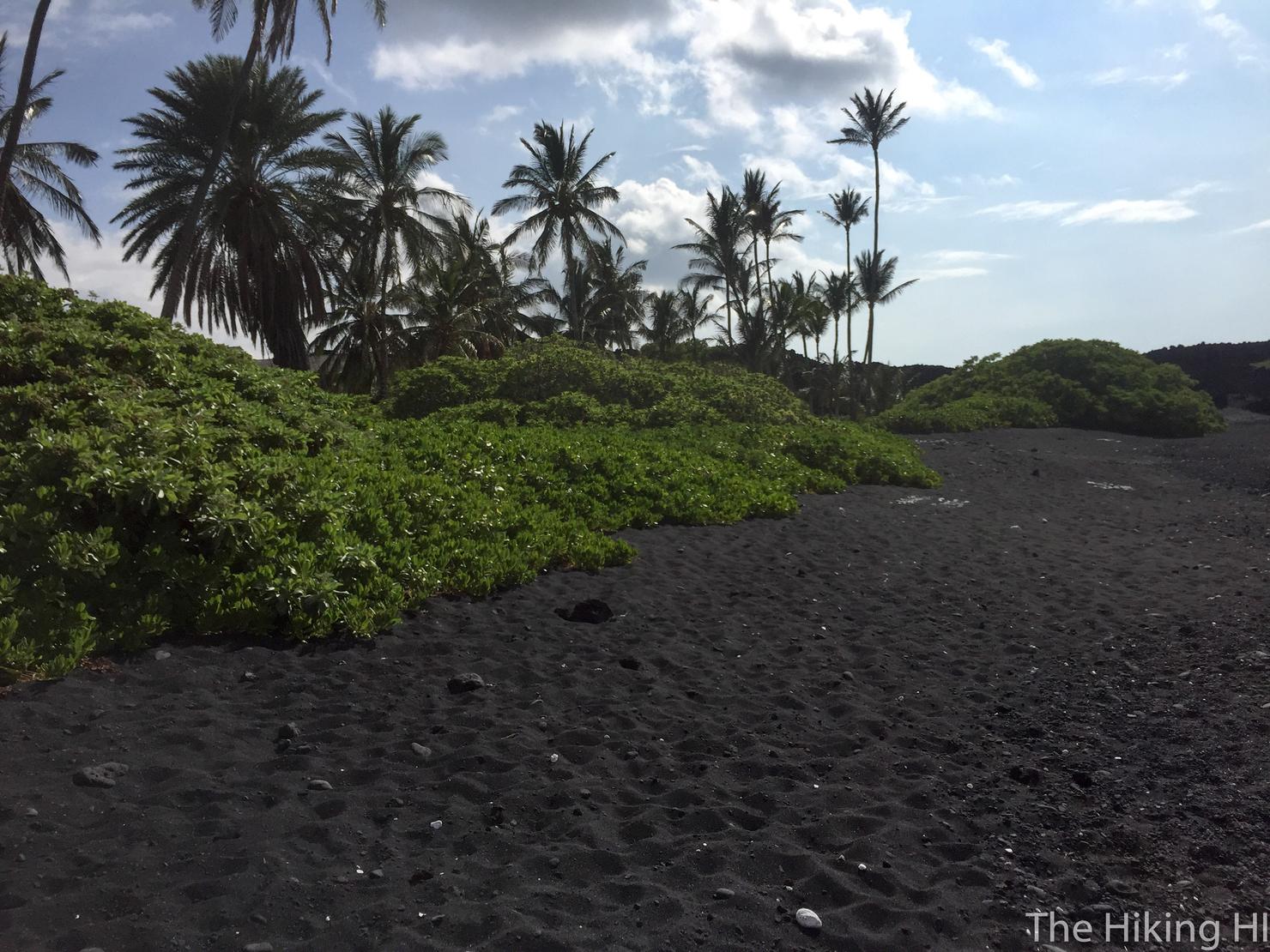
There's a break in the lava rock at this beautiful black sand beach. There's actually a house located just behind the foliage. Your own personal black sand beach? Only on the Big Island.
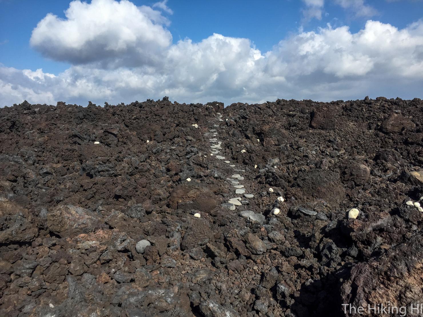
Back through the lava fields. Portions of this were lined with these white rocks. I don't know why but it really made the experience feel even more magical.
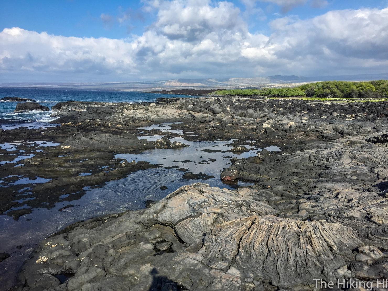
Eventually the rocks will end and you will reach these tidepools. This is a great place to just wander. There's plenty of interesting looking rocks, created from both the original lava flow and the waves.
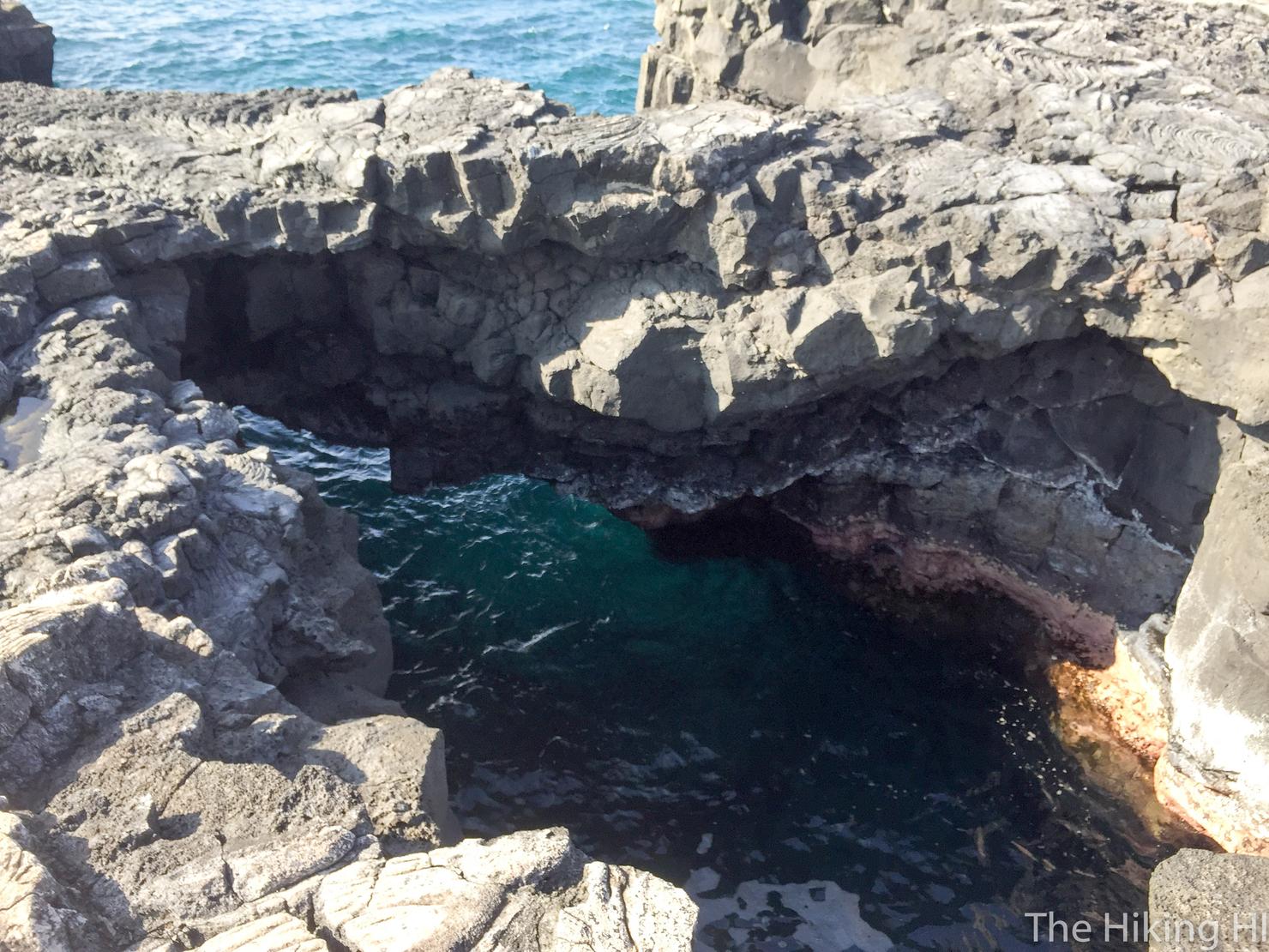
And there's even some rock bridges and tidepools. Careful, these things like to spit water at you every now and then.
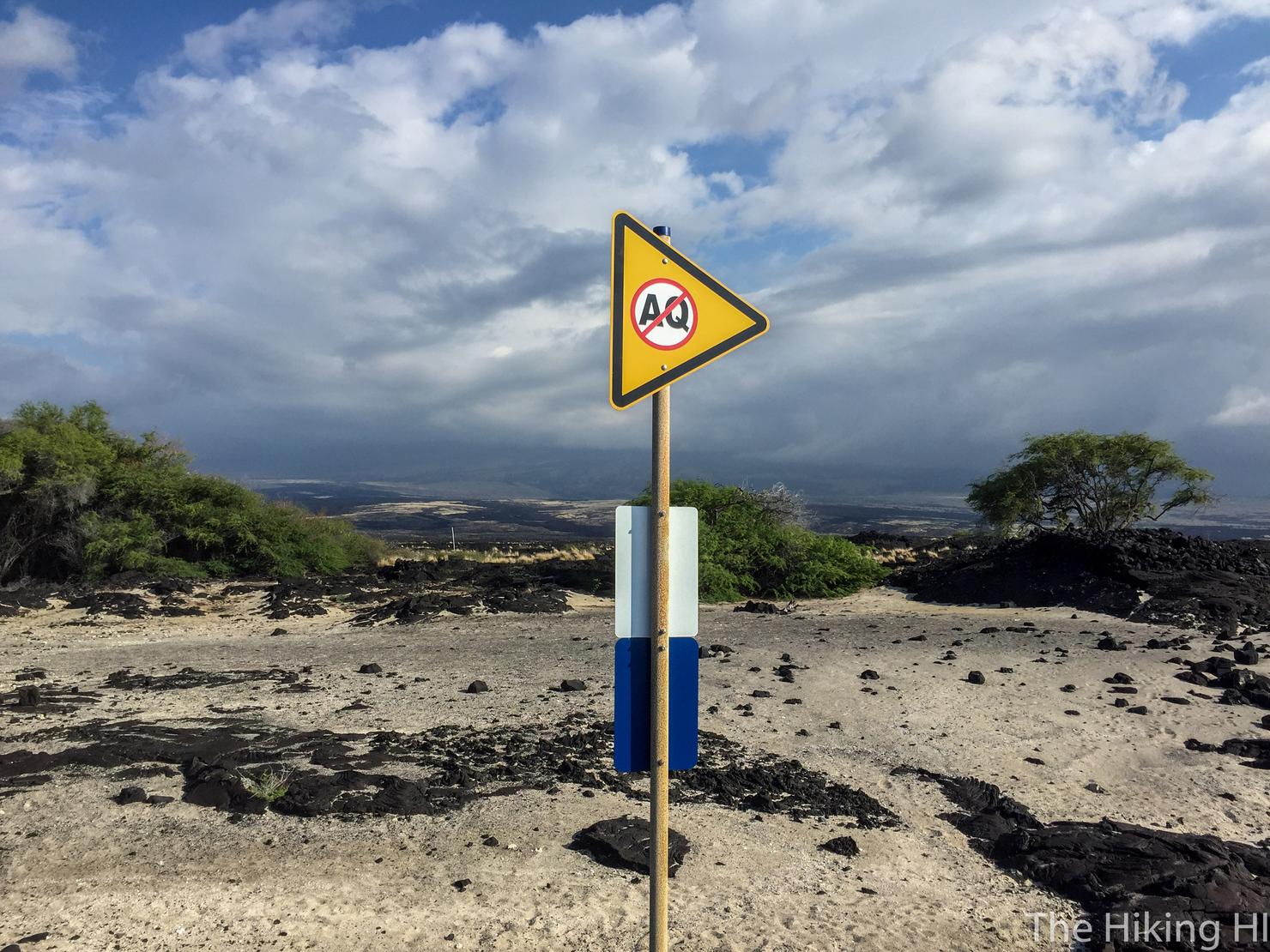
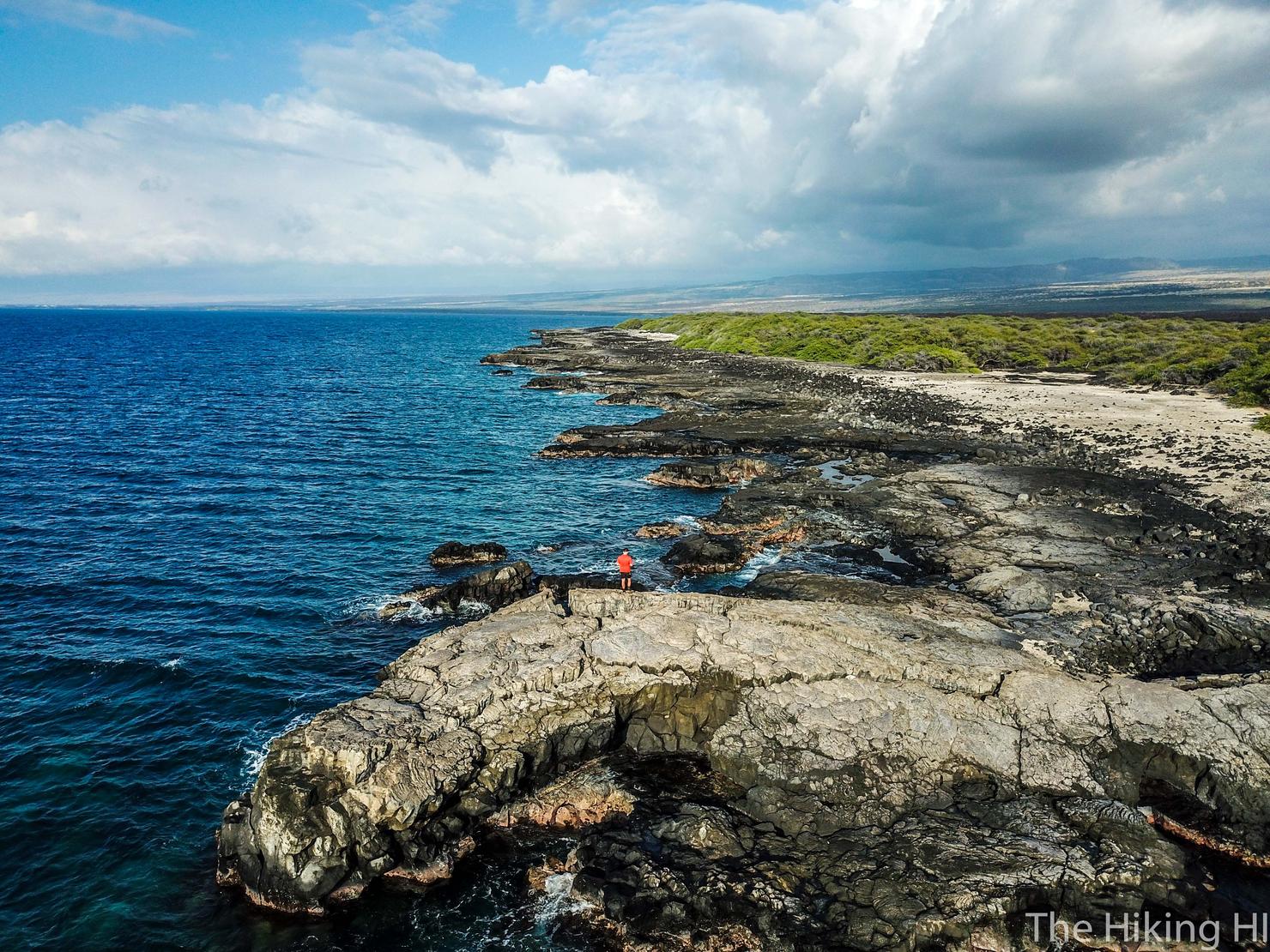
Mano Point, the unofficial turnaround point, is a bit difficult to find. The best way to tell is when the dense foliage to your left ends, you will see a rock with a huge fissure that juts out beyond the others. You will also this sign. This is Mano Point.
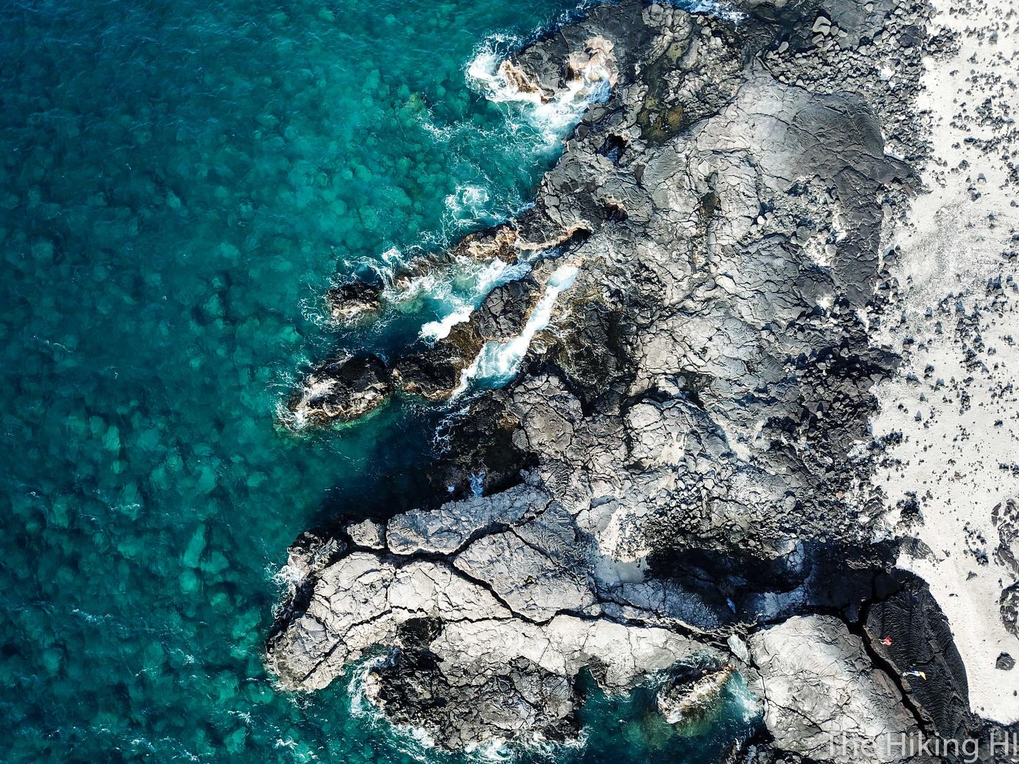
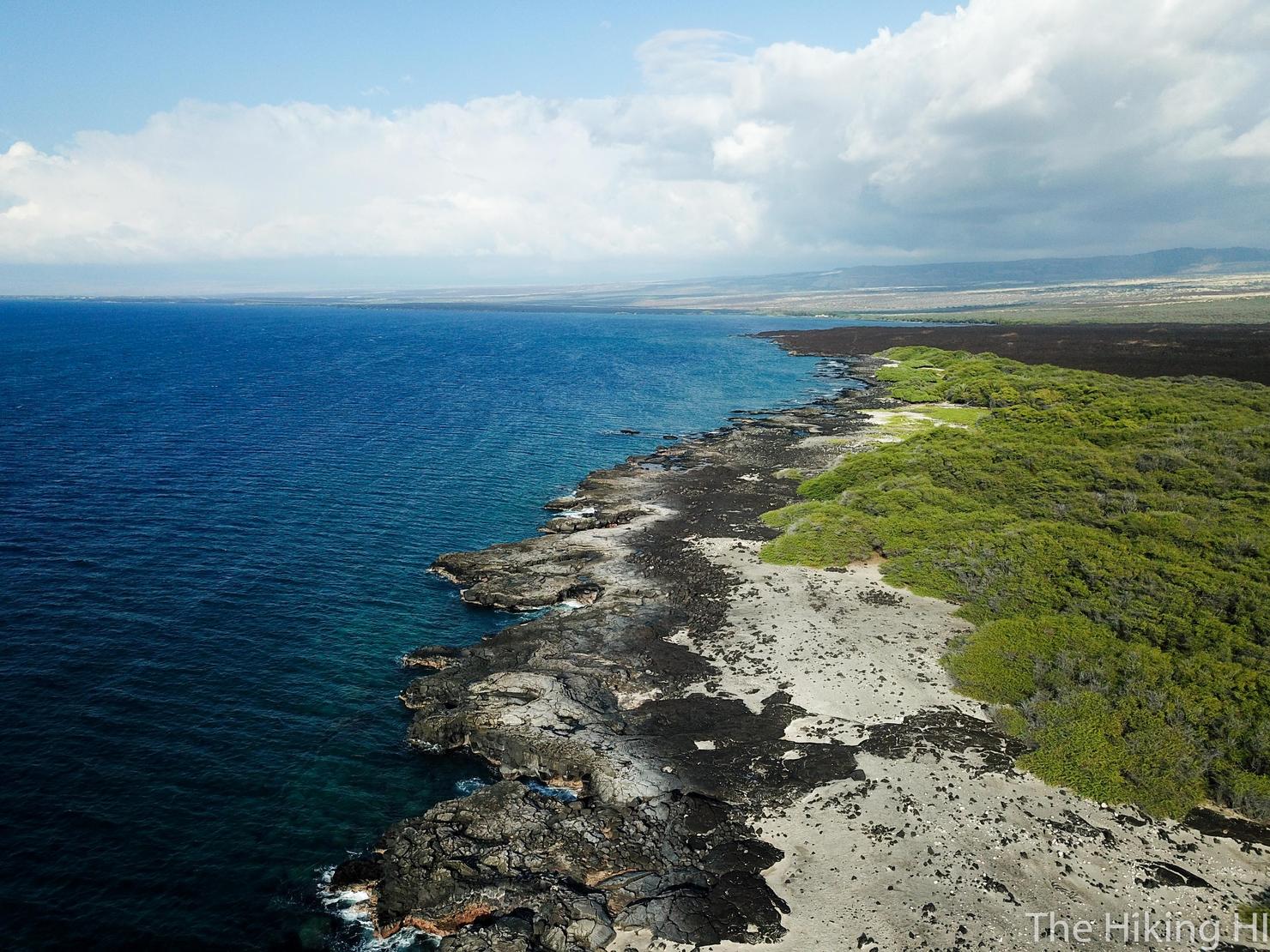
And if for some reason you had a drone, this is what Mano Point looks like from the sky. I think that large crack is awesome, it really adds to the volcanic nature of the place. Speaking of drones, let's fly around.
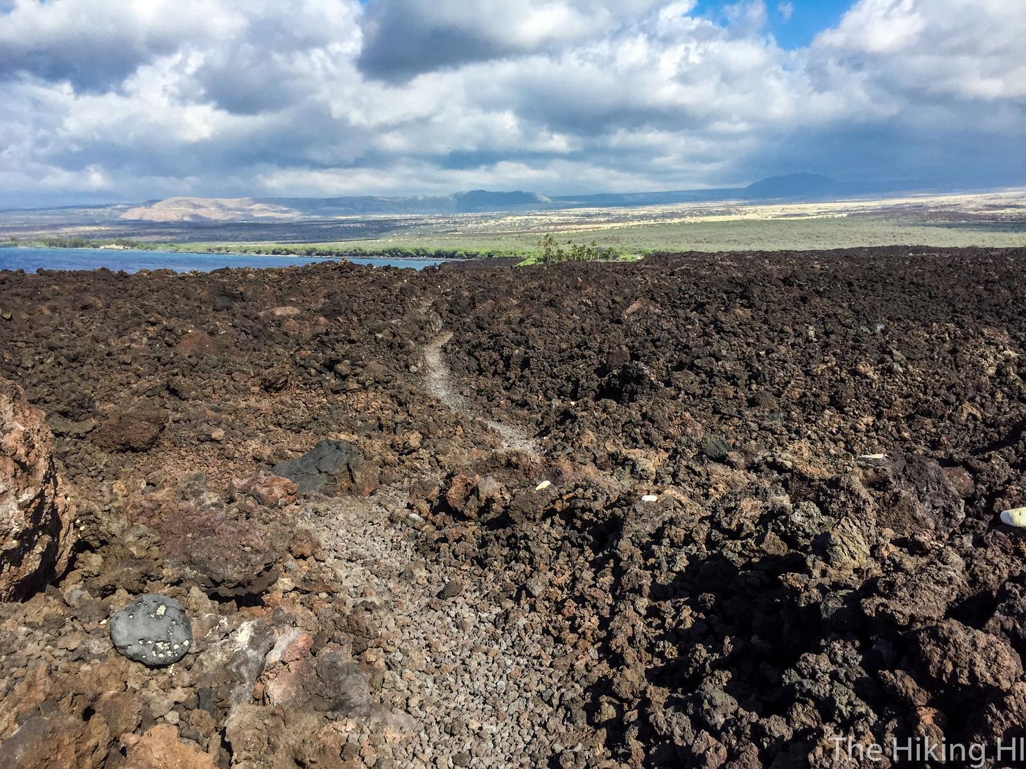
If you head inland, there is a vast lava field, with the much darker black lava rock. This landscape looks very similar to what you would see if you hiked to the active ocean lava flow at Kamakonu (read about my experience here). Here, you obviously won't see any actual lava...
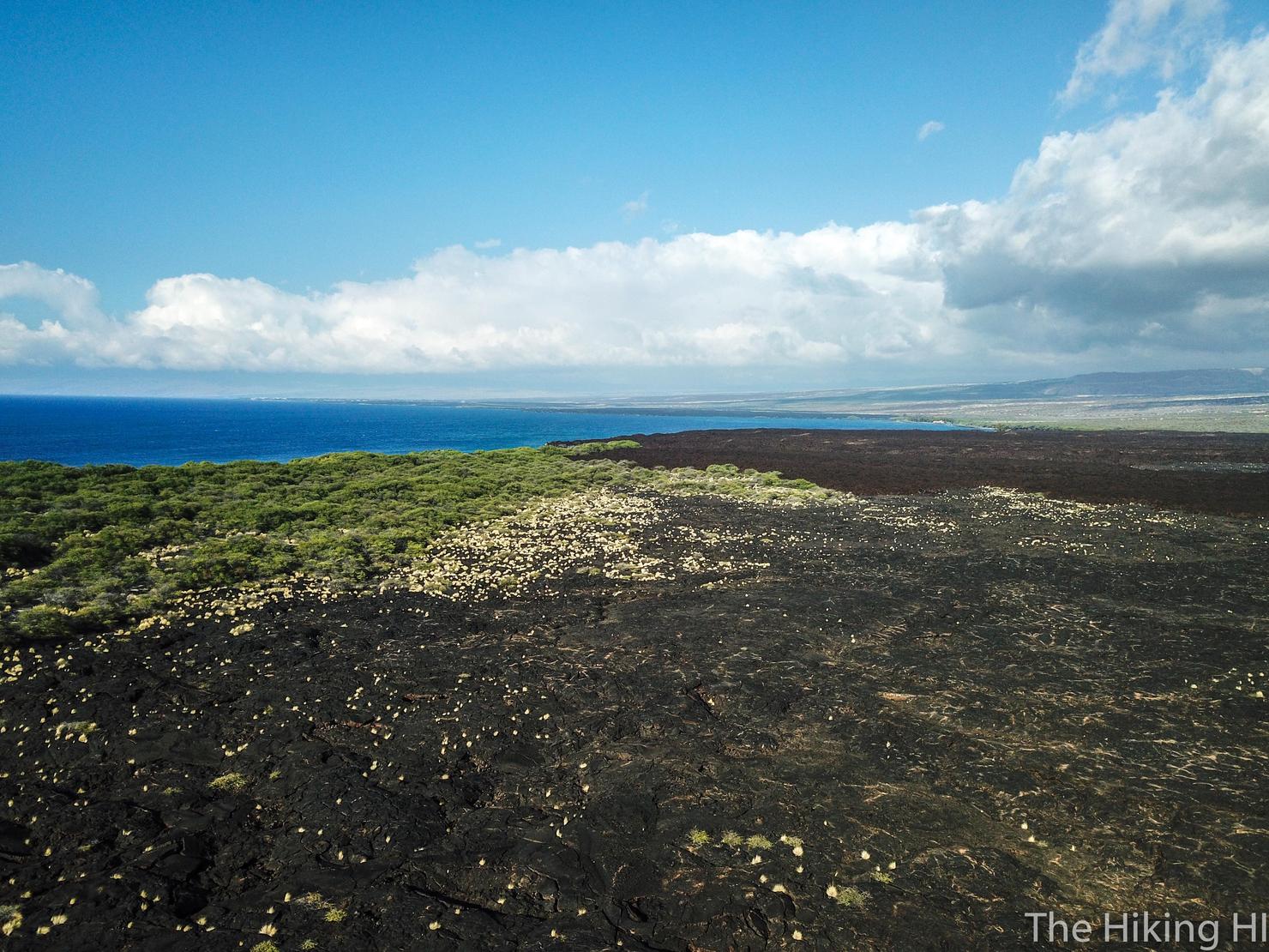
Looping around to the north we can see the dense foliage next to the lava fields with Mauna Kea in the back. I love the combination of the landscapes all together in one shot.
And a shot of the hike we just accomplished.
What an amazing place to explore and experience! It may not be a mountain, but I hope everyone can find some enjoyment and peace in unique locations like this.
Check out my video of this hike!