Difficulty: ADVANCED
Time: 5-7 HOURS
Distance: 4 MILES
Elevation Gain: 1900 FEET
Foot Traffic: LOW
Challenges: Steep climbs, Rock Scrambling on Narrow Ridges, Overgrown, Muddy
Sights: Ko'olau Mountain Range, Kahana Valley, Windward Coast
What to Bring: Lots of Water, Shoes to get muddy, Long sleeves/pants, Sunscreen, Snack/Lunch
Pu'u Manamana has a reputation for being one of the more dangerous hikes on Oahu. You are required to traverse some narrow ridges while scrambling up and over rock formations, all after being physically drained from a steep initial ascent. But that challenge is worth it because you will get some of the most amazing views of the Ko'olau Mountain Range, Kahana Valley, and the Windward Coast.
If you tell someone who knows a little about Oahu hiking that you've conquered Pu'u Manamana, you will instantly garner some respect. The hike is sometimes called "The Most Dangerous Hike on Oahu." While I don't necessarily agree with that nickname and think people might be confusing the Pu'u Manamana Turnover Trail with the sketchier True Manamana, this hike is certainly advanced. My hiking buddy, Peter and I had done this ridge awhile back via the Kahekili-Manamana loop in terrible conditions. For awhile, that had been the most challenging hike I had accomplished on this island. That was of course until I did Pu'u Kawiwi to Kamaile'unu Ridge, Peter and my crazy west side hike. Almost a year later, we decided to try the hike again via the Turnover Trail to see if it gave us that same sense of accomplishment as before. It did not disappoint.
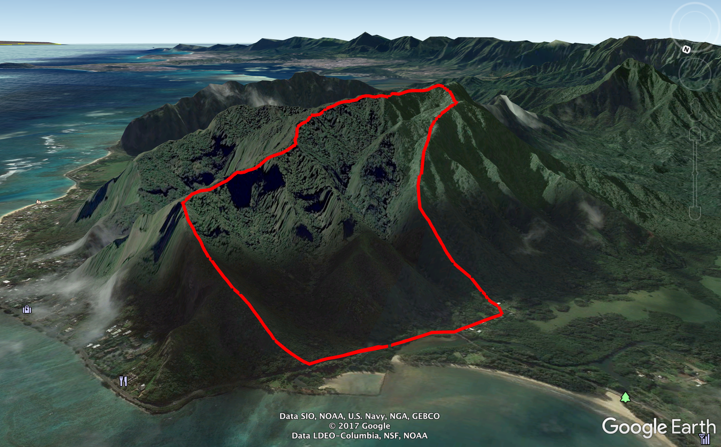
Here's a rough Google Earth sketch of the hike. You begin by heading up Crouching Lion, the ridge nearest the ocean before it becomes Pu'u Manamana. Once you reach the Turnover Trail Summit at the top, you will make your way back down Cemetery Ridge (named for the ancient cemetery at the bottom) where you will hit Trout Farm Road and can walk back to your car.
Our journey begins just above the beautiful Crouching Lion rock formation, a popular mini hike. It will take you about 15-20 minutes to get here from where you parked your car. Check out my previous post about Crouching Lion for more information on where to park and how to reach this ridge.
This is the first part of the hike, the ascent up this ridge.
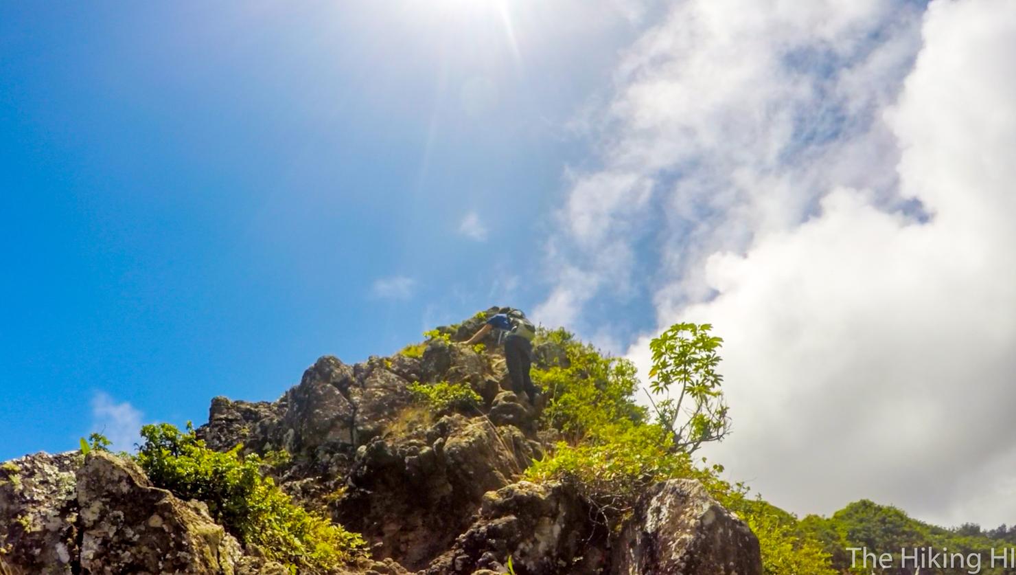
There is no warmup. The ascent hits you hard and fast, requiring you to hike/scramble up a steep and rocky ridge.
It may level off periodically, giving you a quick moment to catch your breath.
But then it's back at it for some more climbing. You will be using all parts of your body to get up this ridge. In case you can't tell from my glistening arm, you will be sweaty. This is the reason I recommend a good amount of water for this hike.
But with some persistence, you will reach the top of the ridge. There is still some elevation gain to come, but you just conquered a large percentage of it.
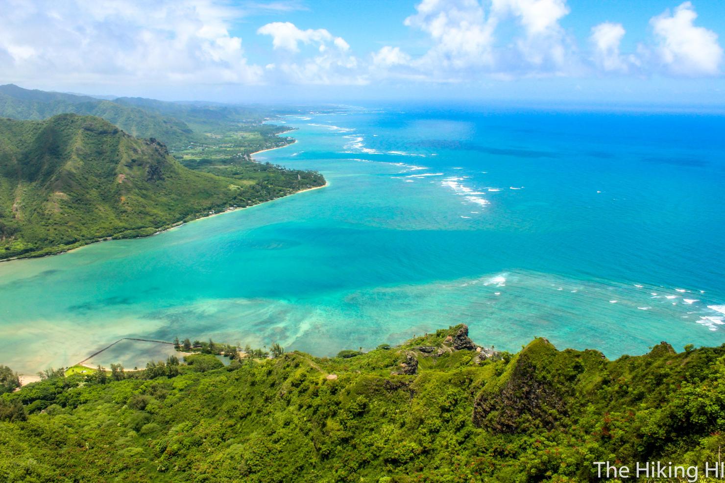
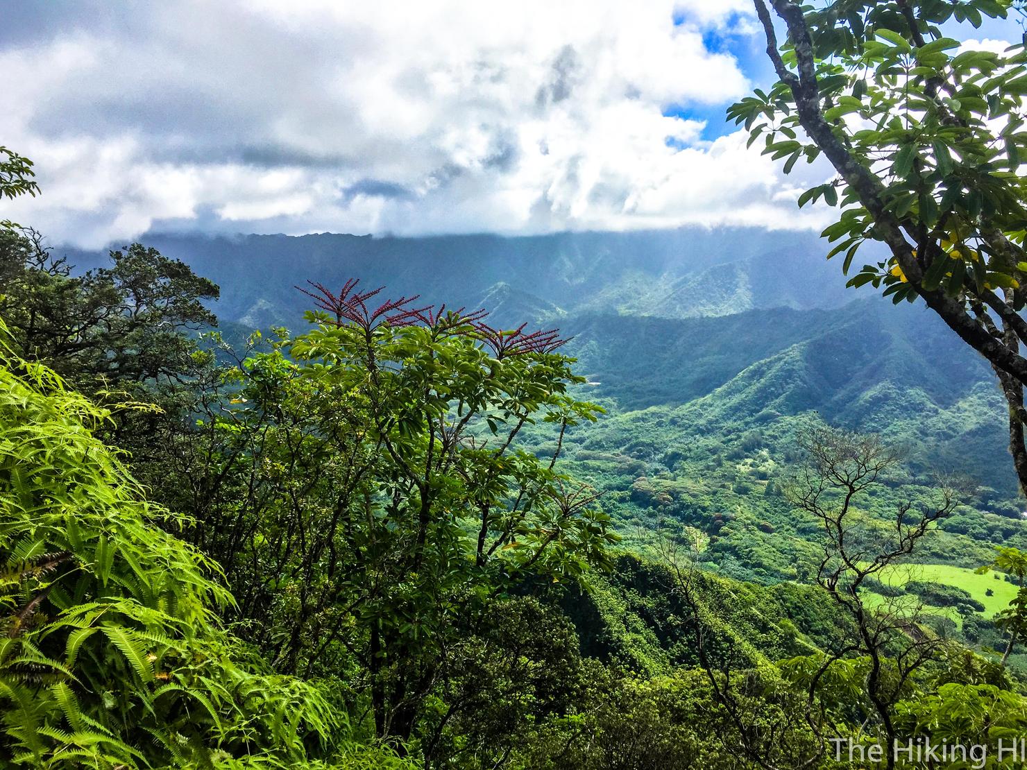
And really, you can't complain about the physical difficulty of this ridge, because look at that view you get the entire time! I'd argue that this ridge ascent is one of my favorites on Oahu because it's a physical challenge, but also incredibly beautiful.
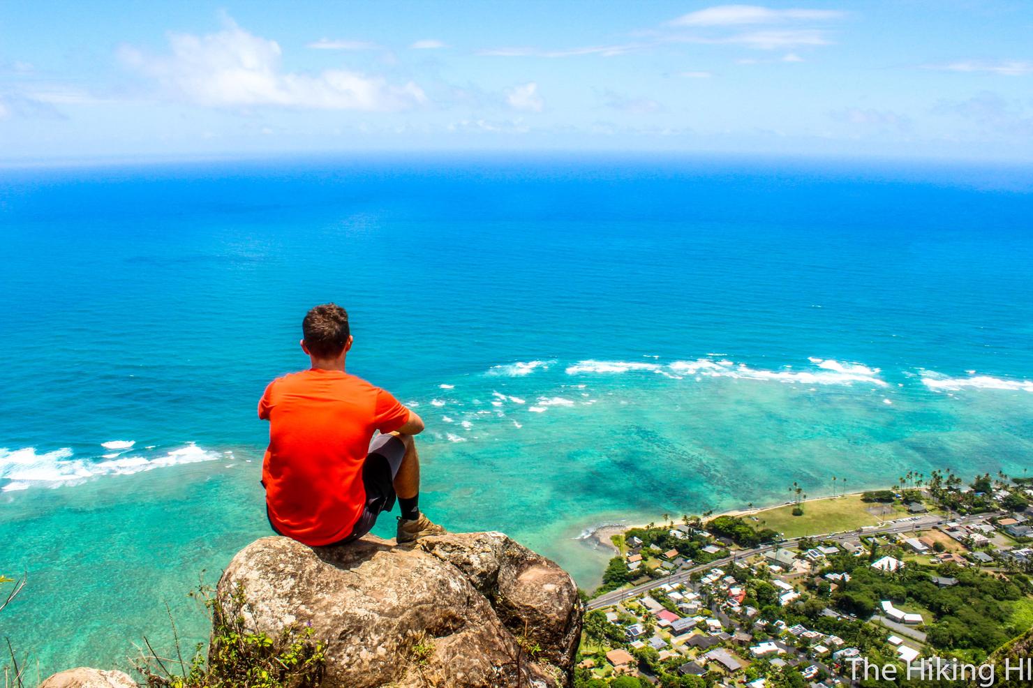
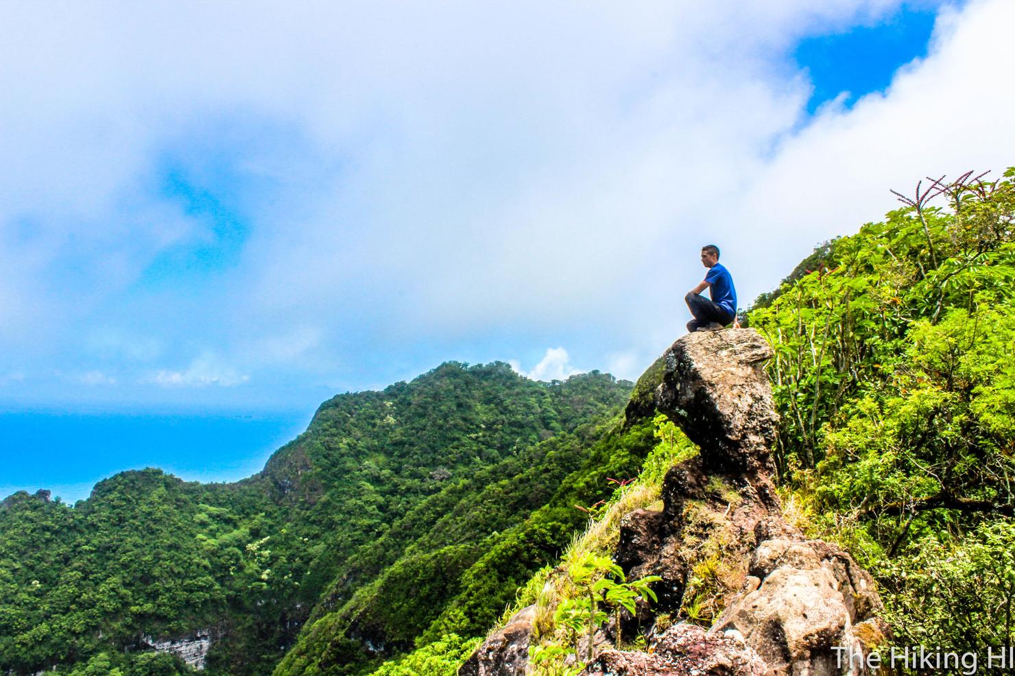
This is also a great spot for a nice break and/or a photo shoot. Here I am, doing a little pondering... pondering about how out of shape I've become at my ripe old age of 25.
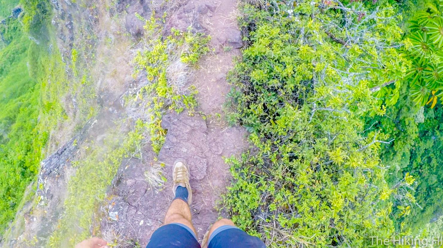
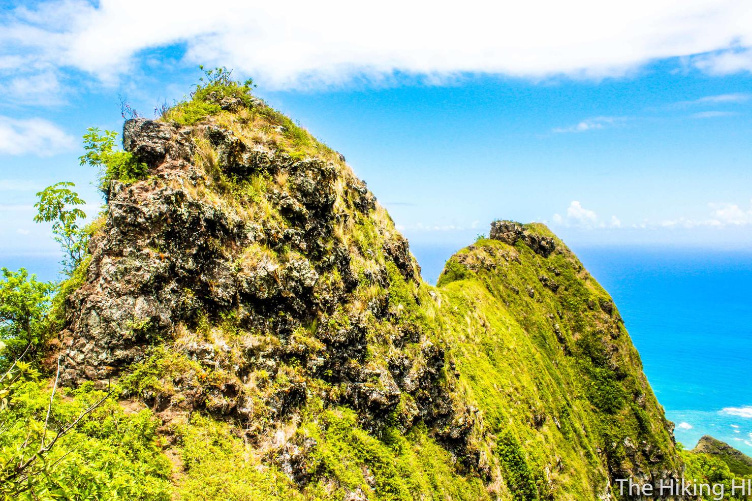
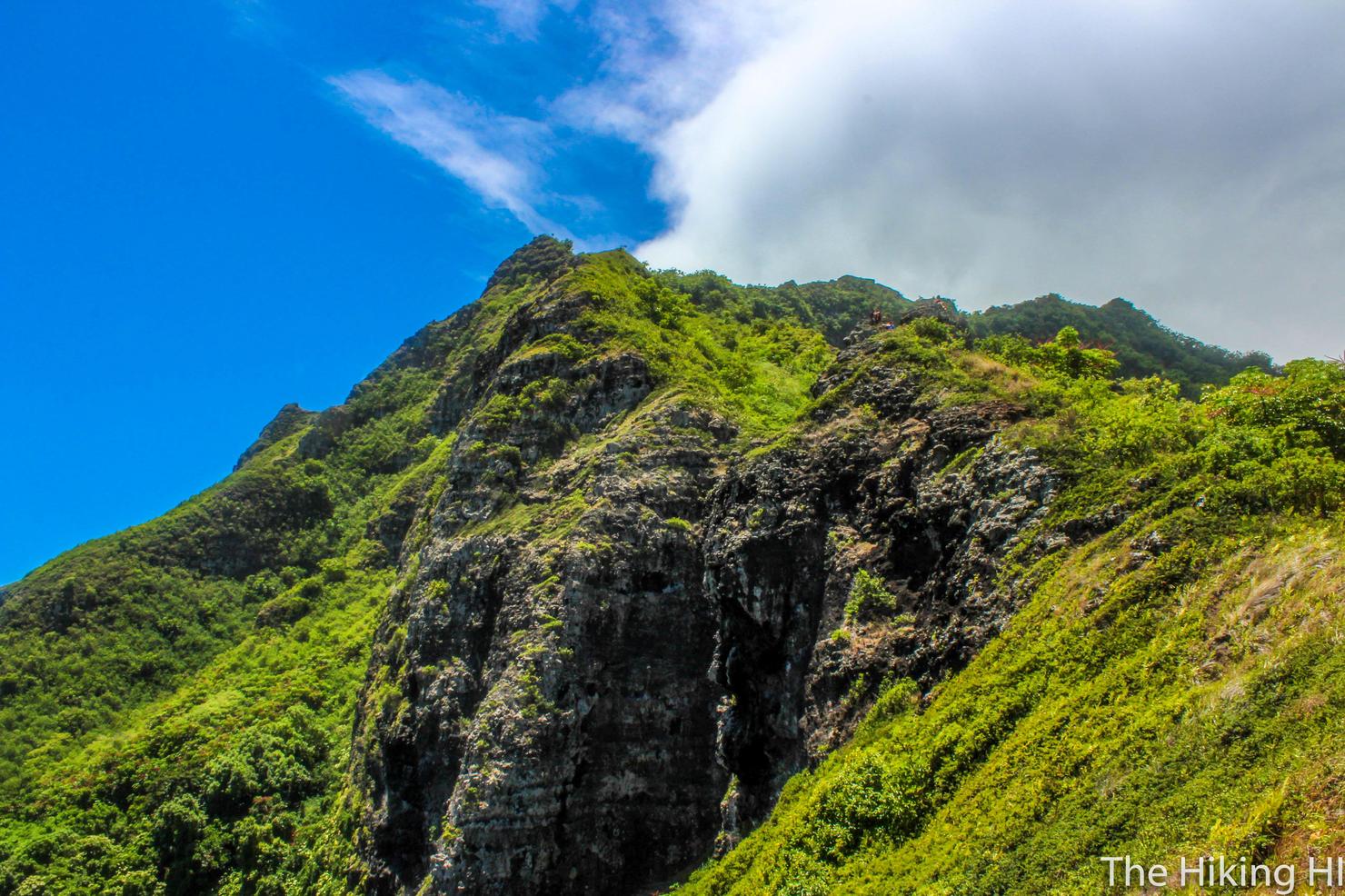
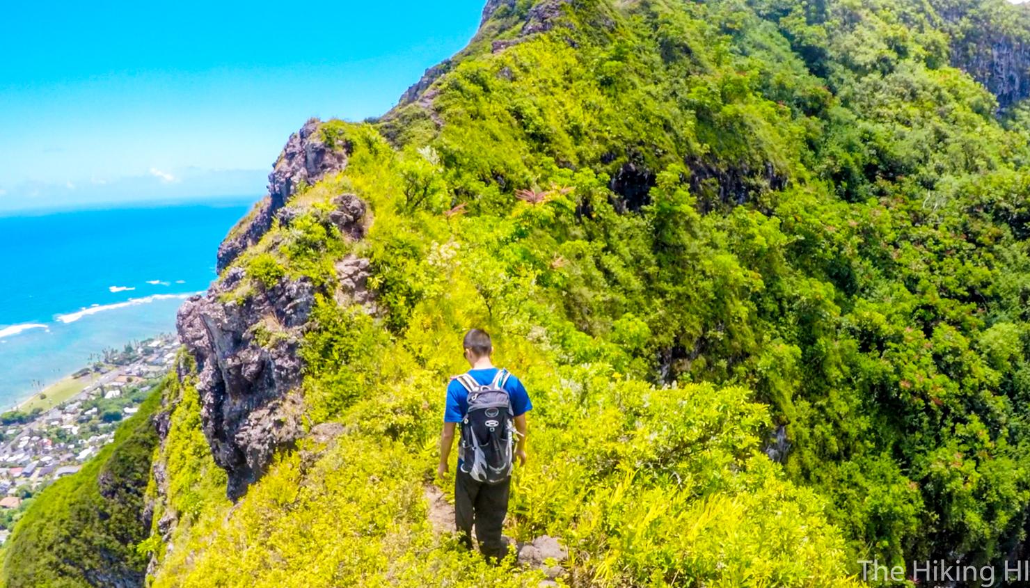
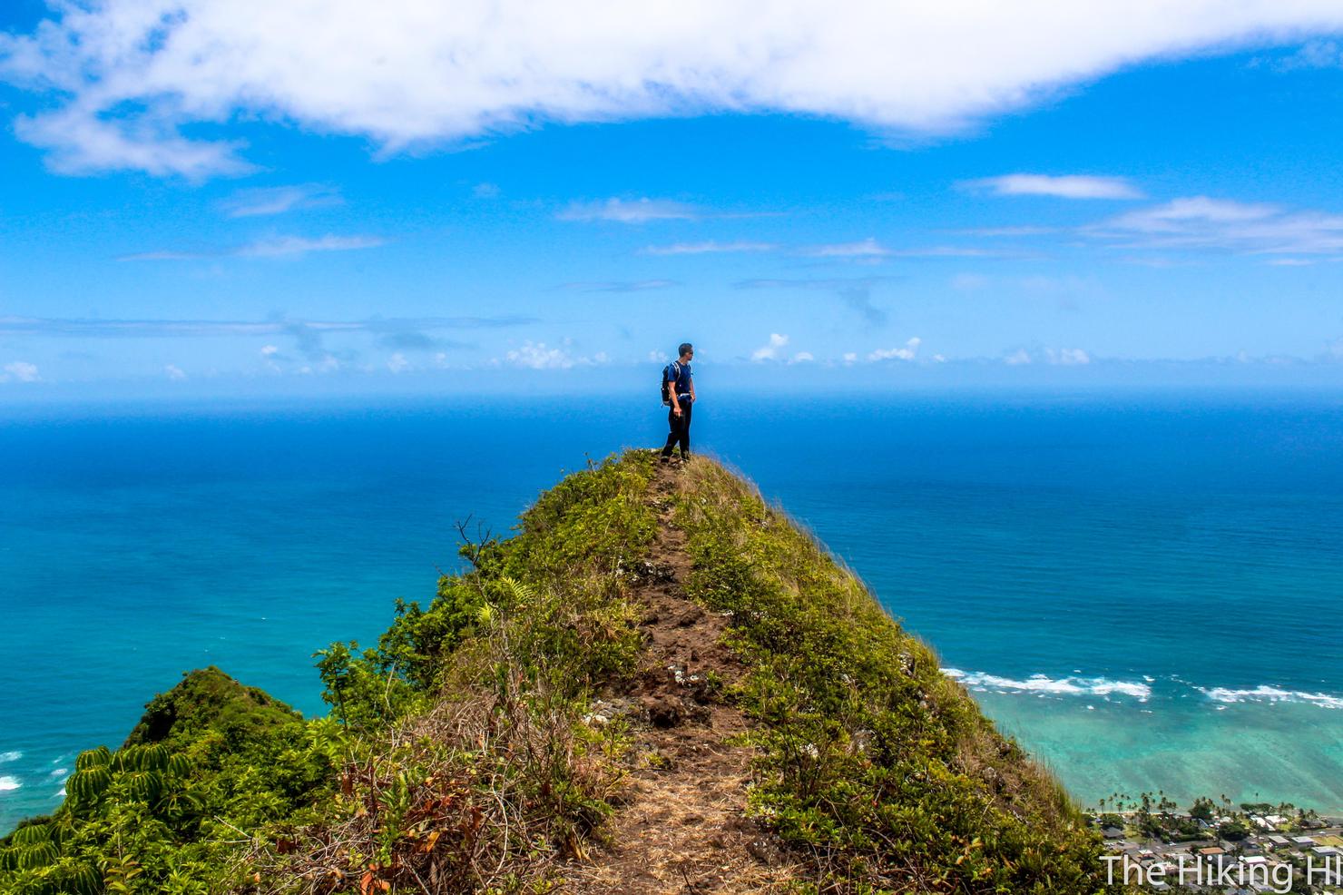
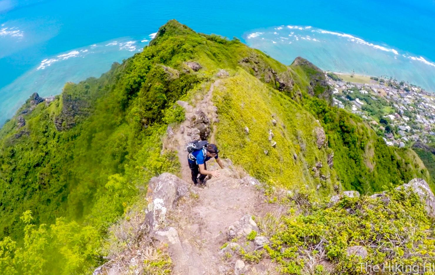
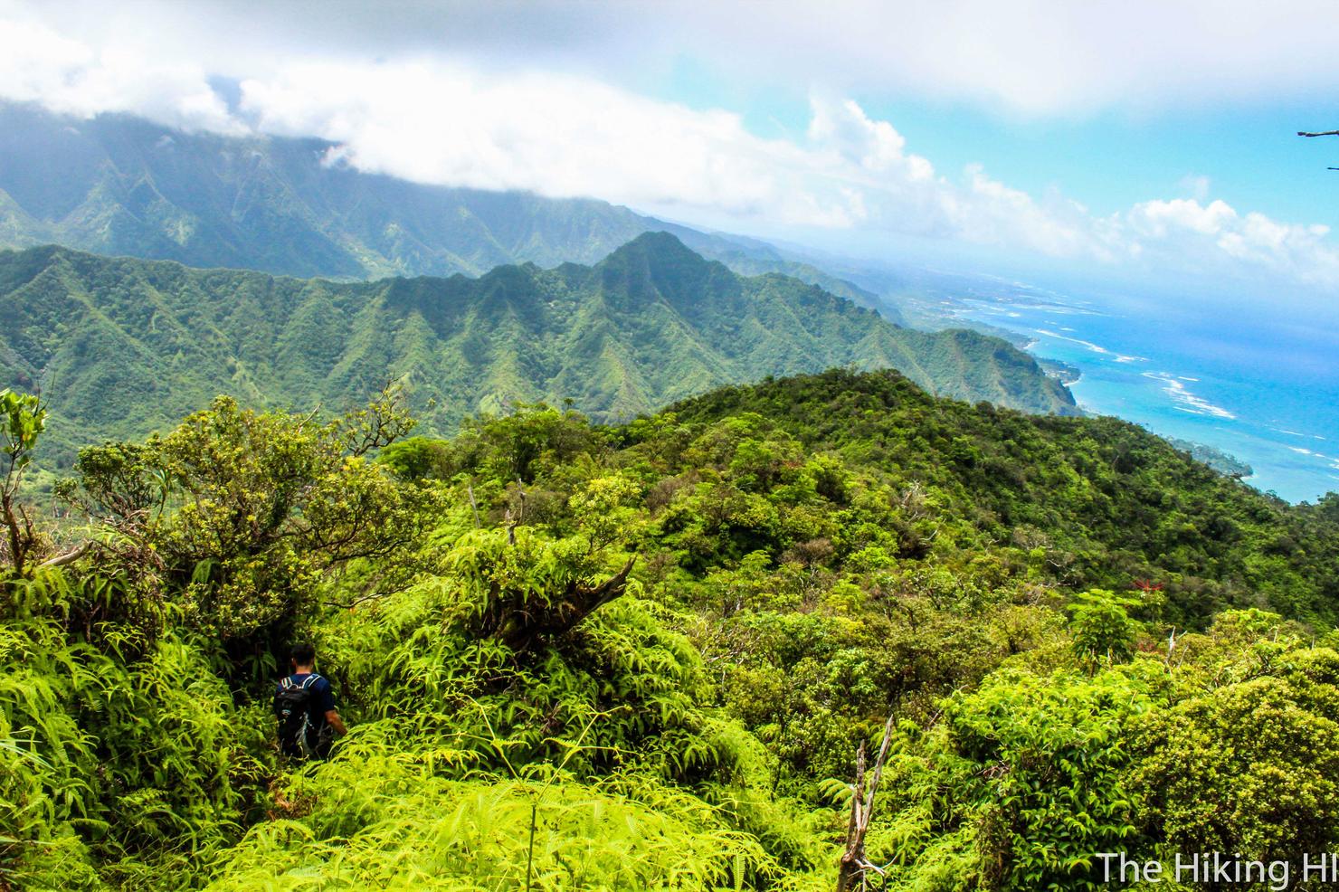
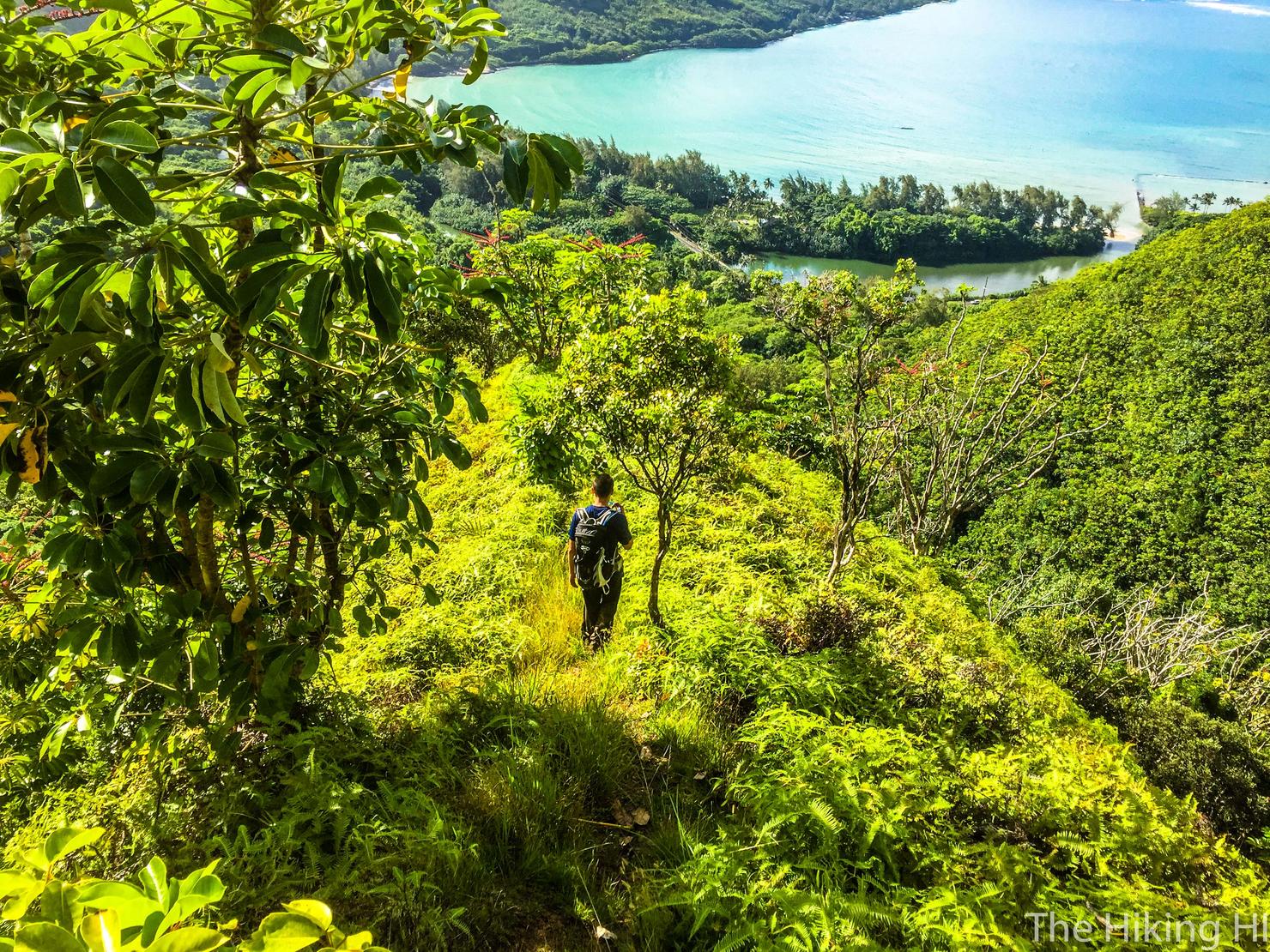
From that little peak, you will head inland, where the hike instantly becomes more challenging. It gets pretty narrow. Not skin crawling narrow, but narrow enough that you should pay attention to your feet.
This shot gives a good idea of the ridge. It's got sharp drop offs on both sides with rock scrambling in between. This is why this hike is advanced.
One last look at the beautiful ocean before conquering this narrow section.
Just keep scrambling.
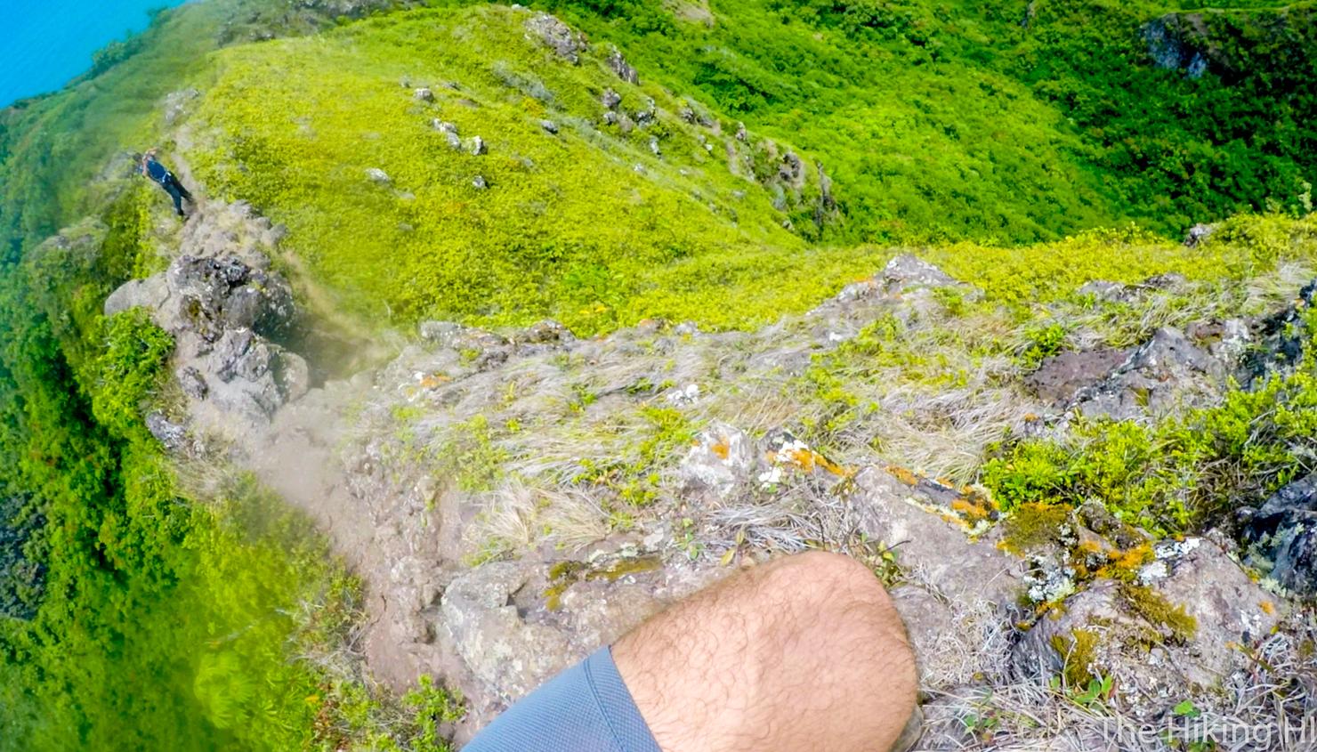
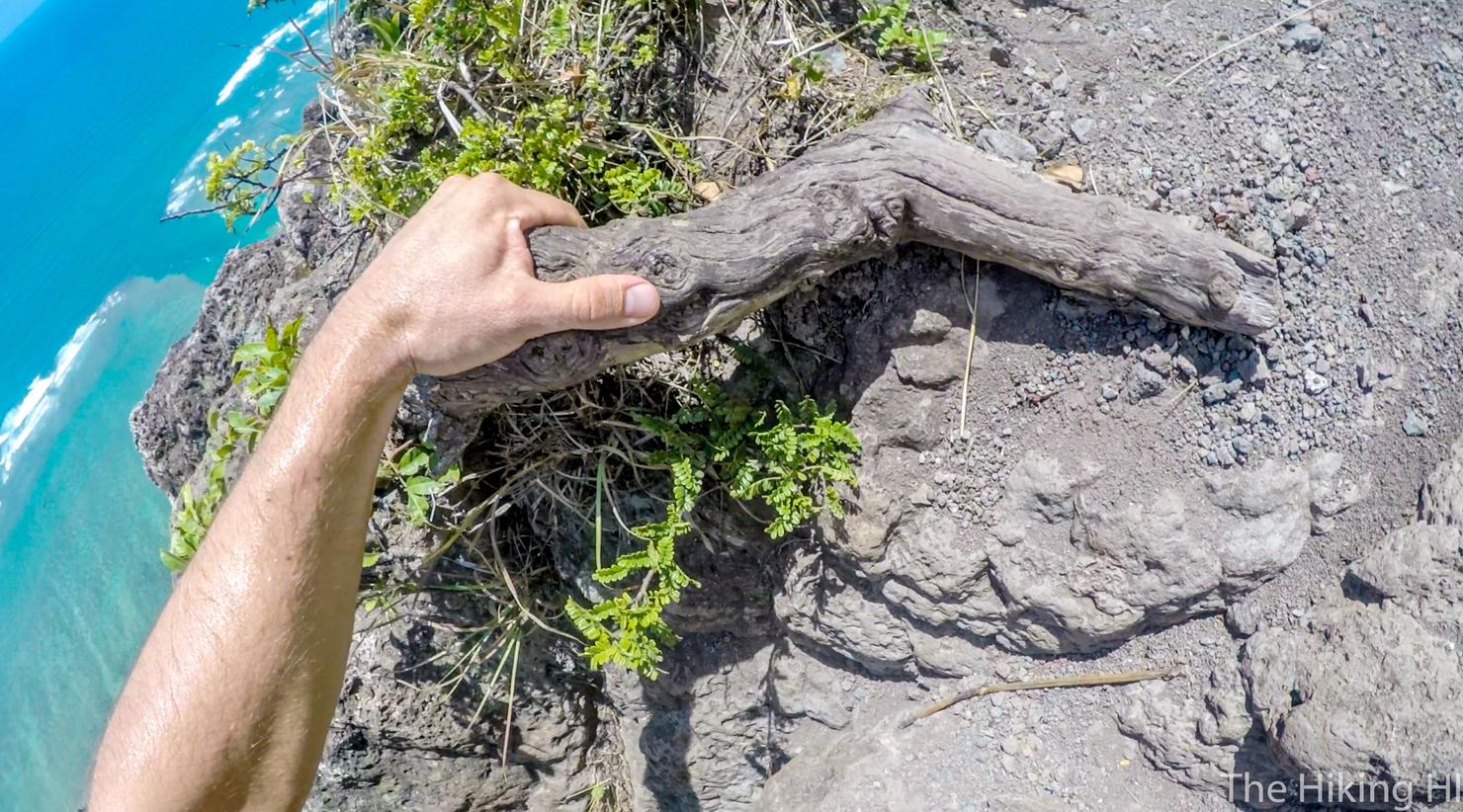
This portion could end badly if you aren't careful.
Just gotta make sure you take your time and place your hands and feet properly.
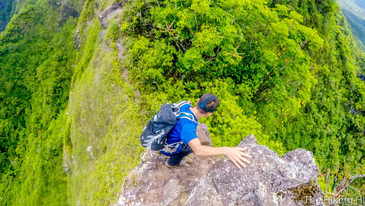
Eventually, you will reach this small section of ridge, where this rock is perfectly placed for photo opportunities. If I were to do this hike again, I would make it an out and back to this location. The enjoyment to effort ratio goes down significantly after this section, for two reasons...
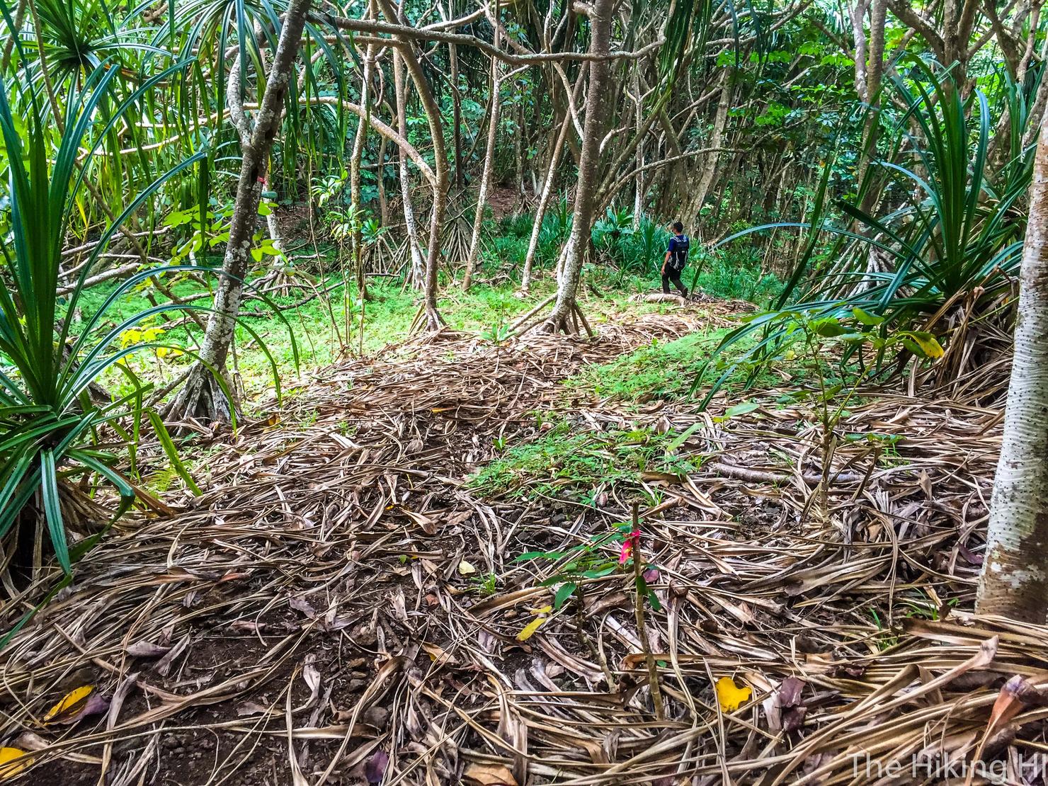
One, it is very overgrown. Long pants are definitely a good idea.
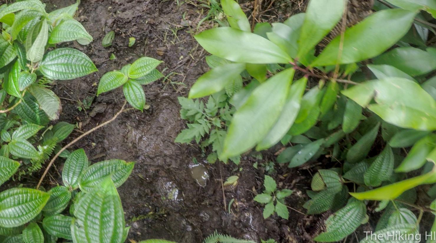
Two, it's very muddy. The first time I did this, I considered it the muddiest hike I'd done. After round 2, I think it remains number one (narrowly beating out Moanalua Ridge). It had been very dry the past few weeks, and there were still puddles that went over my ankles.
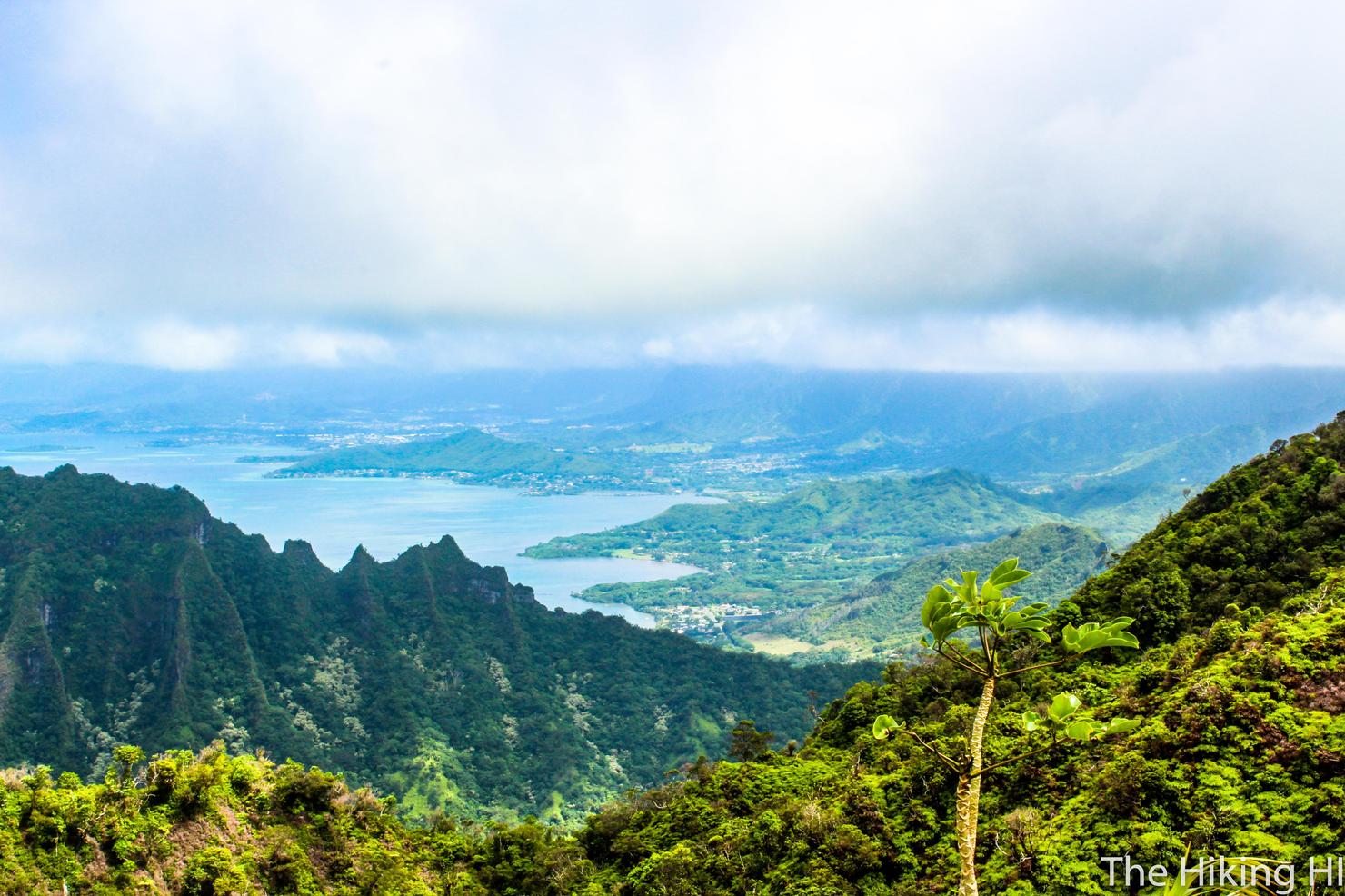
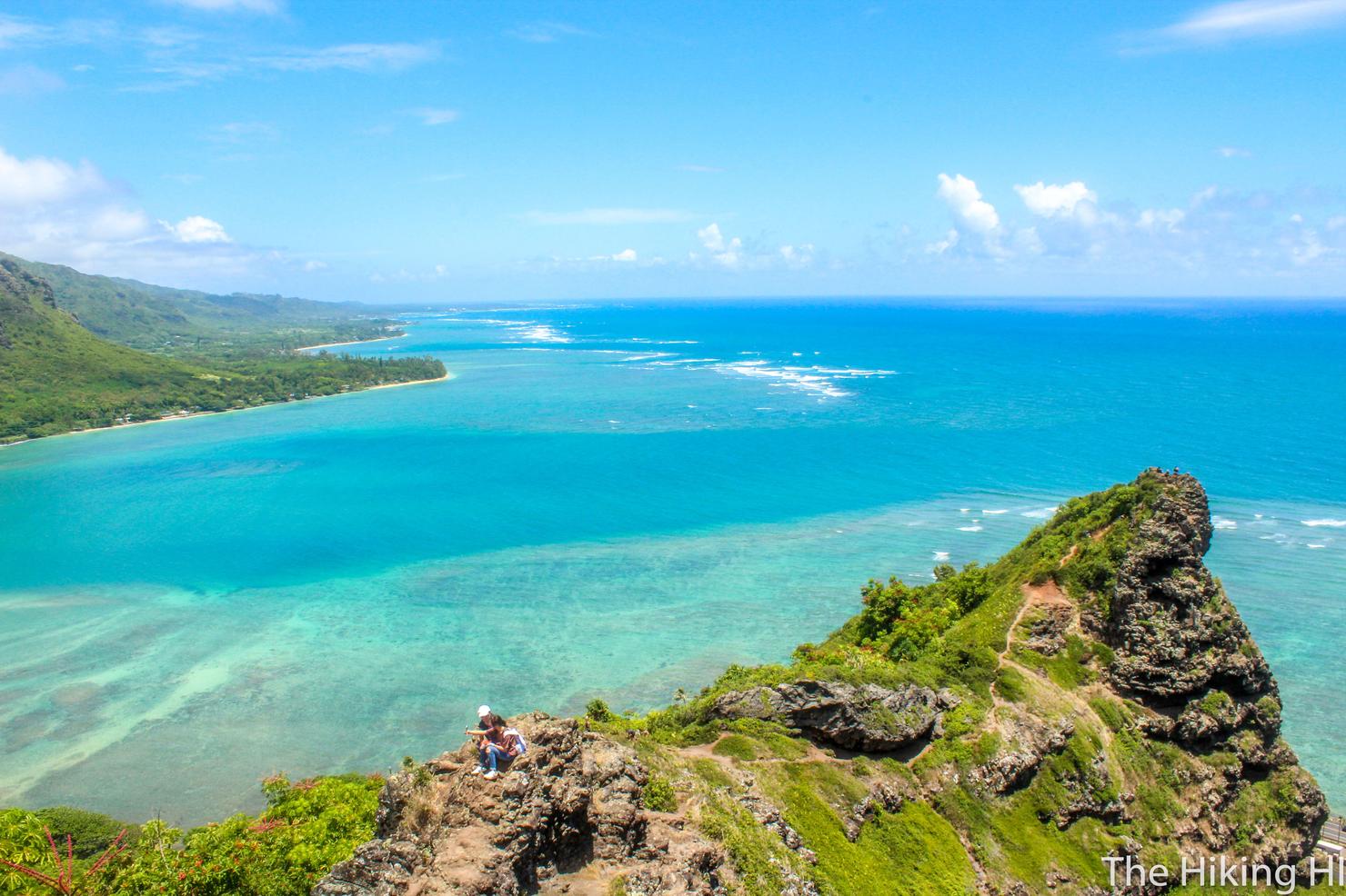
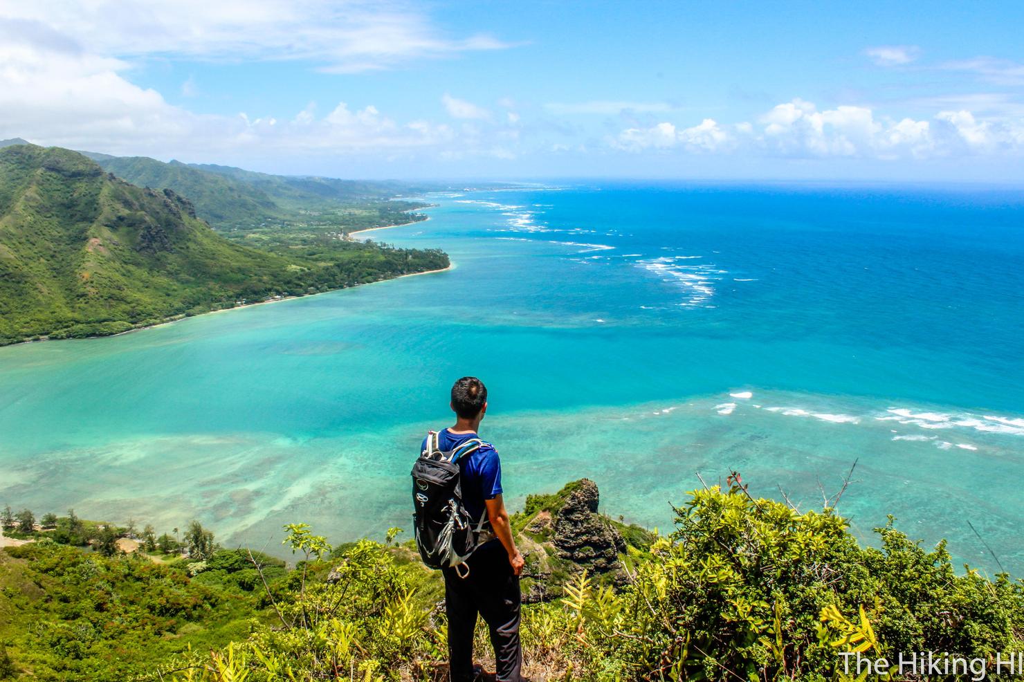
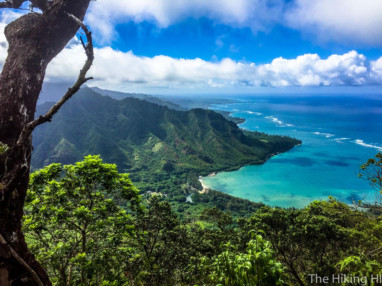
But if you do choose to summit, it will be worth it. You follow the muddy, overgrown trail until it T's (sorry forgot to take a picture). Take a LEFT (right will lead you to Cemetery Ridge) and you will be greeted with an open grassy area and this beautiful view of the windward coast.
If you look towards the center of the island, you will see another mound that connects to the Turnover Summit. That's the path to True Manamana, a much more intense version of this hike.
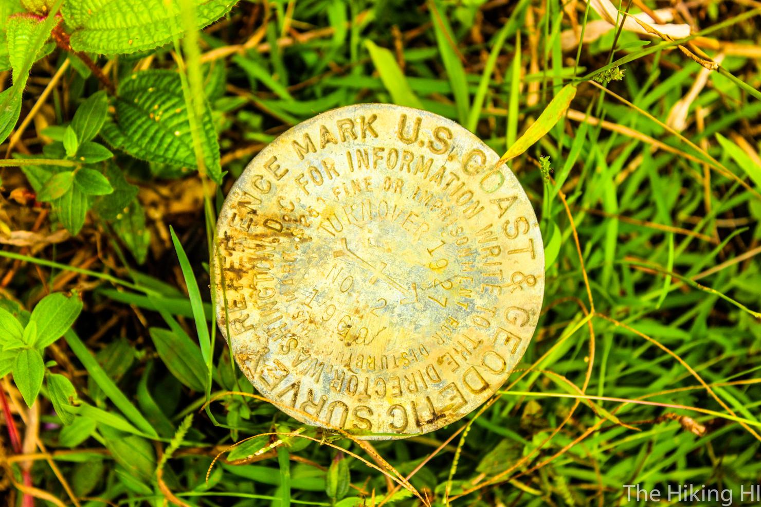
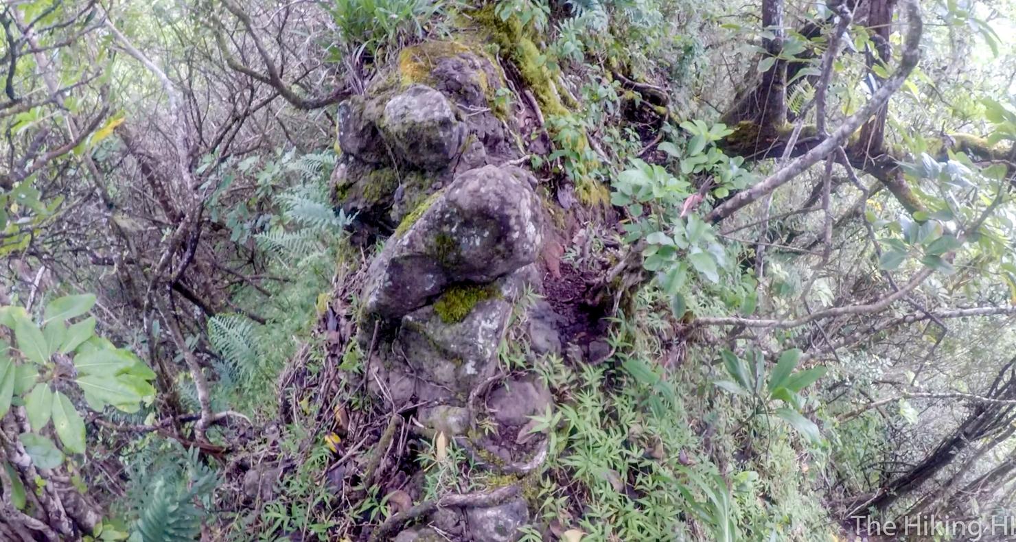
Somewhere on this grassy peak you will find this object. If you look closely you can see "Turnover" written on it. A rare occasion in Hawaii where the name of the hike can actually be found along the way.
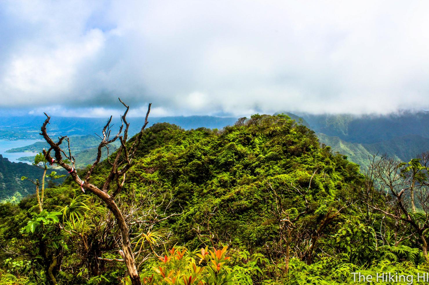
It's time to head back down Cemetary Ridge to make this a loop hike. In order to do this, you will head back the way you came when you turned to head to the summit. Keep going straight where the path T's so you are heading North down the ridge. You should be facing this beautiful view.
Cemetery Ridge is named for the ancient burial ground you will find at the bottom. It starts out as an overgrown and muddy descent.
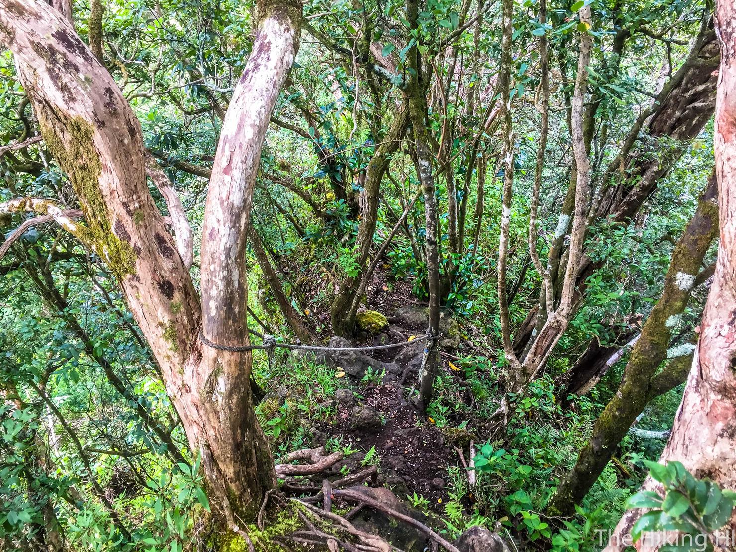
Eventually it will turn into this, a steep, narrow ridge composed of tree roots, grass, and dirt. I actually really liked this part of the hike. I've never hiked a ridge like that in all my Hawaii hiking. It was very unique.
Your views aren't impeded the entire time. You will get plenty of glimpses of the coast and Kahana Valley.
And eventually the ridge will open up even more for better views.
But then you will head back into the trees one last time. There's a good number of markers around here. We decided to follow them and it led us right back to the road.
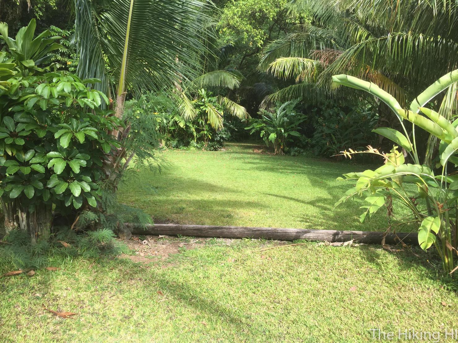
This is a shot from Trout Farm Road. The cemetery is located just beyond those trees (we passed them on the way down). You could access Cemetery Ridge from this opening if you so desired. Now it's time for the level and leisurely walk back to our cars.
My return to Manamana did not disappoint. Steep ascents, narrow ridges, rock scrambling, and incredible views make this a truly awesome hike if you're up to the challenge. I know I will be back.
Check out my video of this exciting hike!