Difficulty: INTERMEDIATE-ADVANCED
Time: 4+ HOURS RETURN (to Junction)
Distance: 5+ MILES
Elevation Gain: ~2000FT
Foot Traffic: LOW
Challenges: Overgrown, Muddy scrambles, Narrow Ridges
Sights: Ko'olaus, Falls, Sacred Falls?
What to Bring: Water (>2L), Long Sleeves and Pants, Lunch
A lesser known trail on windward Oahu, Papali Uka is an ungraded ridge that can serve as a gateway to some of the more unique elements of the Ko'olau Mountain Range. Overgrown, muddy, and generally just a tough slog, this trail isn't for your casual hiker. But for those looking for the ridge less traveled, and maybe to see a few hidden gems along the way, this may be the hike for you..
COVID got you down? Well you certainty aren't alone. After a month of the country enacting a lockdown, cases spiking throughout the country and the realization that we were probably in this "new normal," for the long haul my level of unease was high. And I had also made the commitment to leave my job in about a year with no real plan of what was next. Needless to say, I was a bit anxious.
But one thing that can bring back that balance-- the trails! After a quick scope of the weather, I decided to make my windward to return to the Ma'akua Trail and beyond to Papali Uka to see explore some new ridgeline (and maybe snag a few new drone shots).
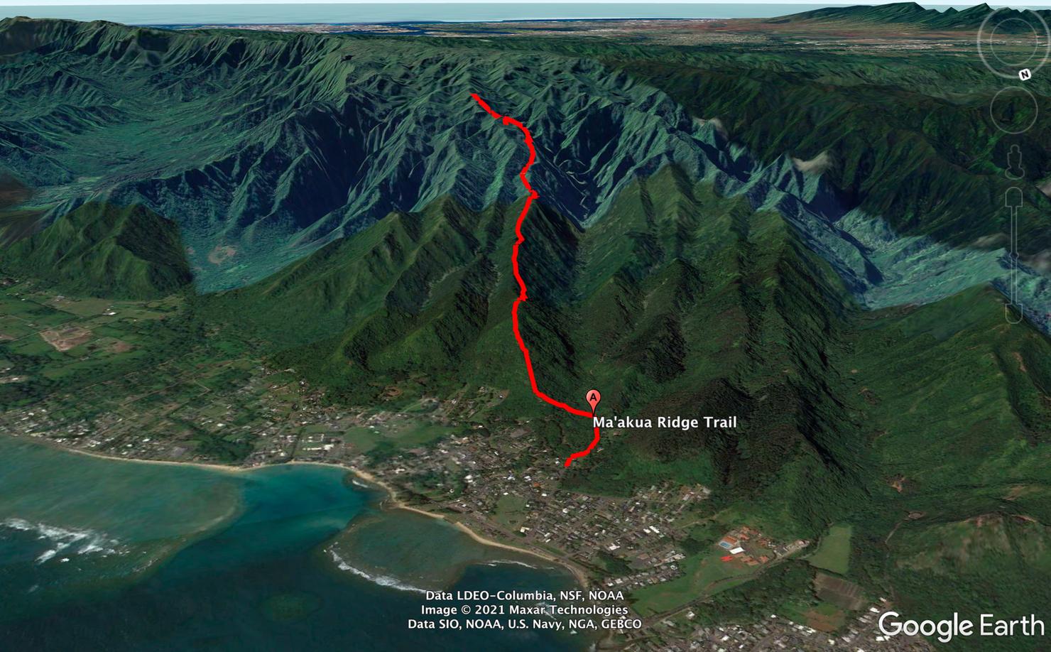
The trail I would follow is called Papali Uka. It's not a standalone trail you will find on AllTrails or a hiking guide. I had pieced it together through my own understanding of the ridges and a few Google Searches. This trail itself is more a gateway to other landmarks like "The Nipple" or the Old Castle Trail. And these aren't well-known landmarks. These are those spots that typically only those Oahu veteran hikers seek out. For me, I was simply looking something a little different (and maybe a good launch spot for my drone.)
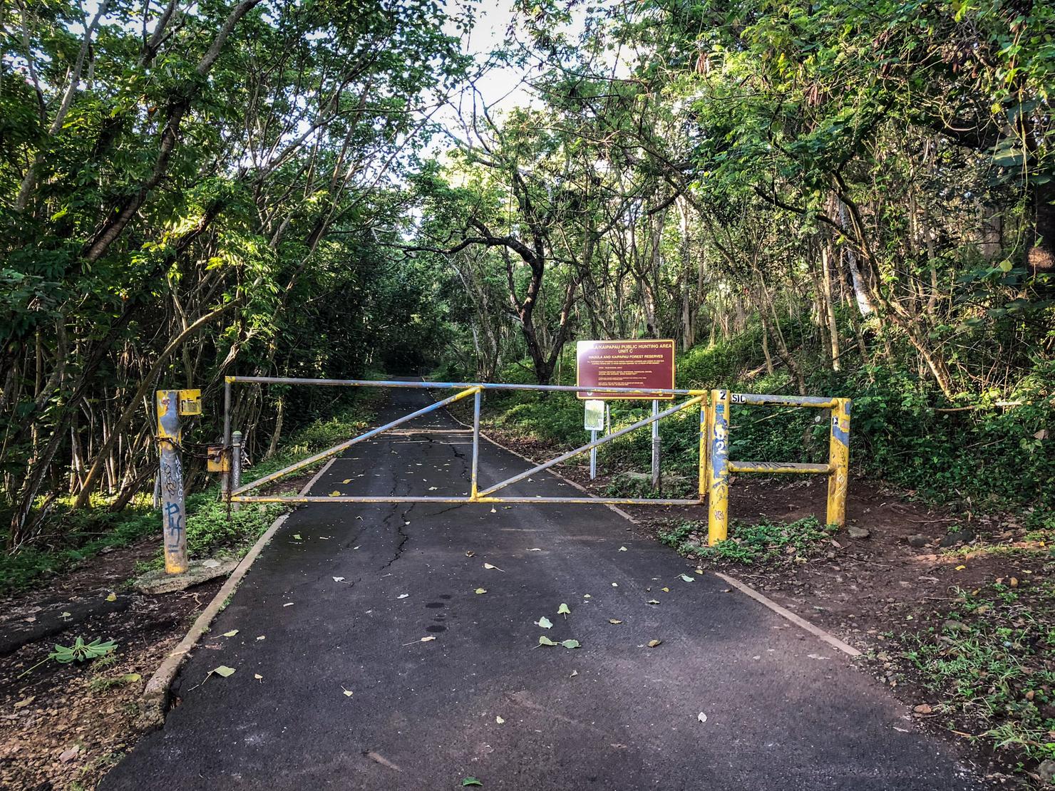
The trail follows the same beginnings as Ma'akua Ridge Trail, a beginner ridge that I hiked a few years ago. Find some nearby street parking (I parked a little farther away on Kawaipapa Street) before following Ma'akua Road until it hits this fence. Go around the fence and continue along the road.
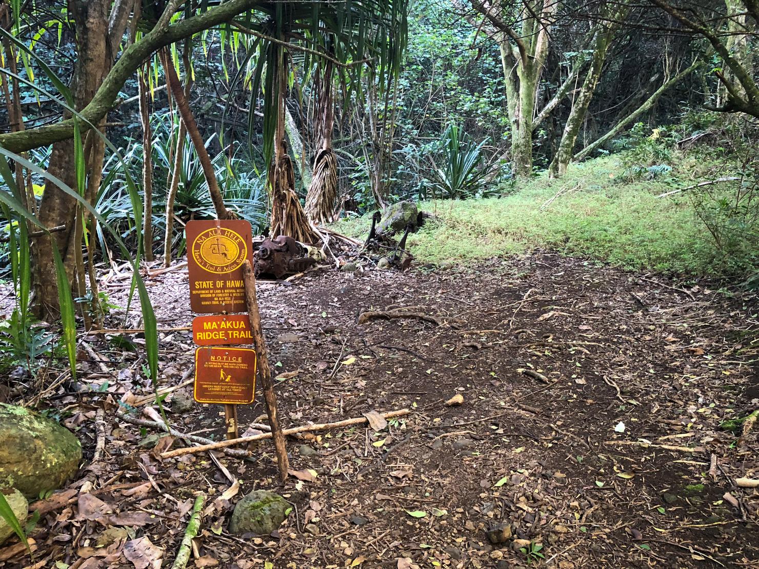
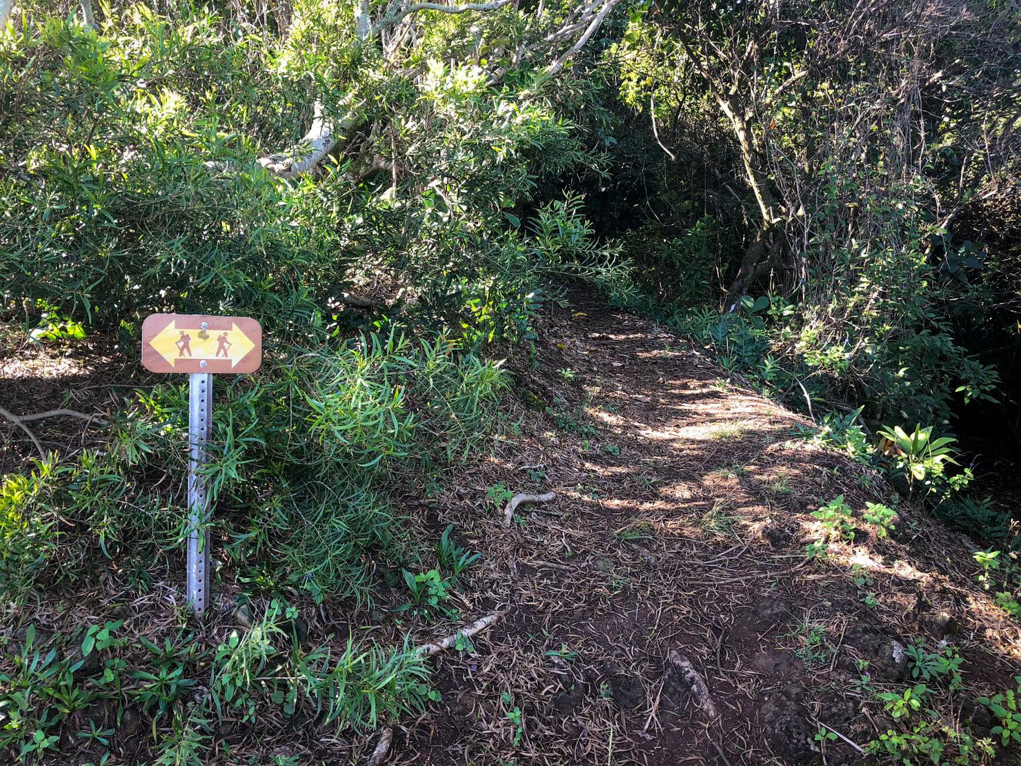
After following the road for a few minutes, you will come across the trailhead sign on your left.
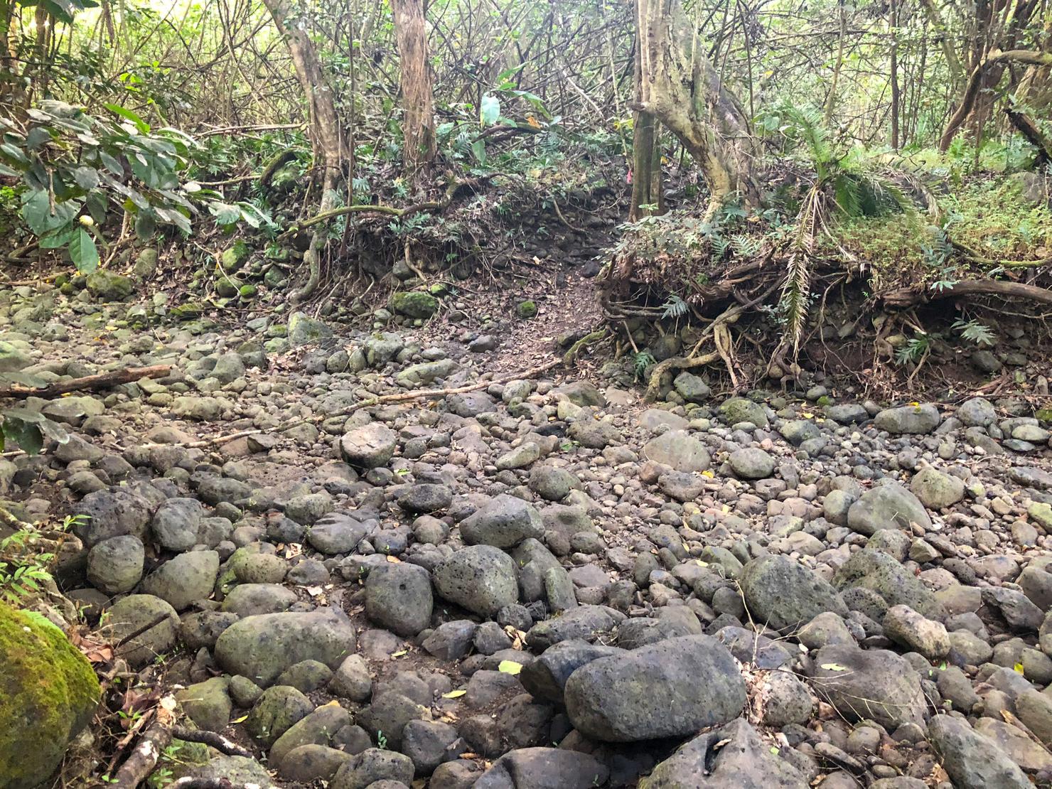
Follow the trail and cross this (likely) dry stream bed to the other side.
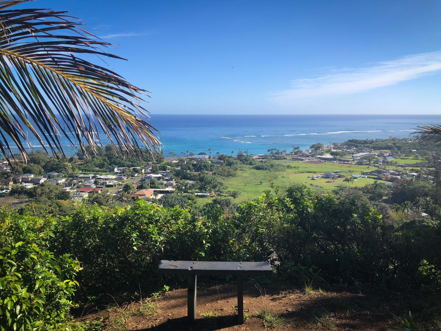
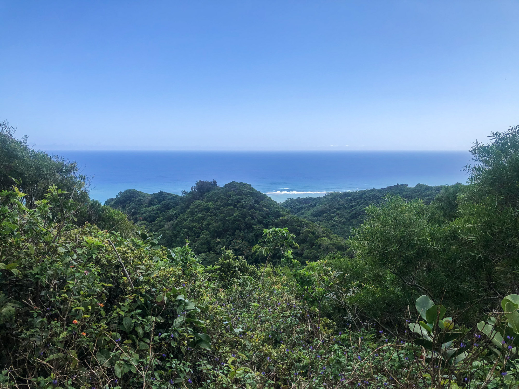
And soon enough you will hit this coastal lookout. Not bad for only small amount of effort.
But unlike my short, false alarm missile strike adventure last time, today's adventure will be a bit longer. We are headed up to the ridge line. Immediately behind you are three forks (the rightmost being the way you came). Take the center path for the most direct route to the ridge.
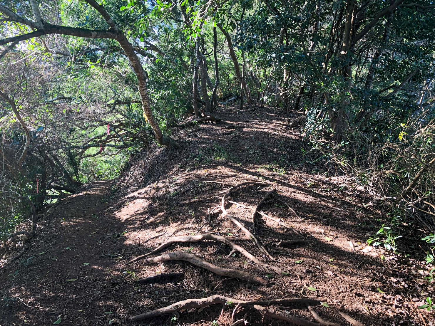
After hiking for a short while you will reach another fork. Take another right to begin the ridge ascent.
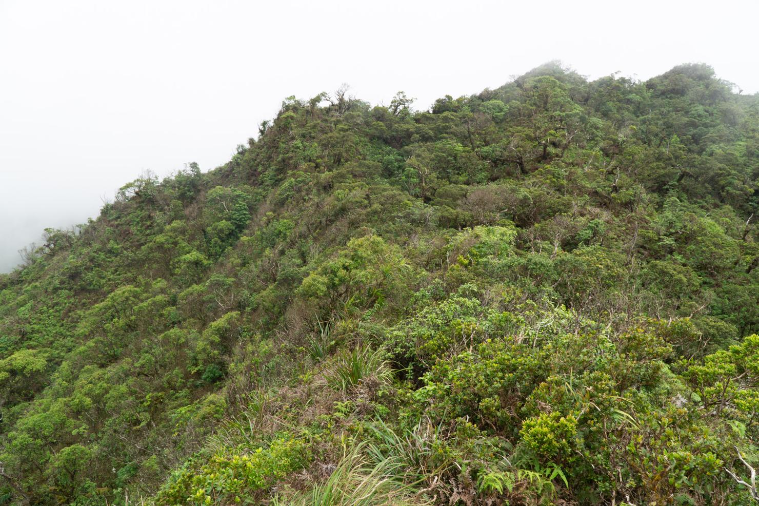
And... yep. This is a lot of what you can expect on this ridge. Overgrown and muddy. I did mention this one isn't for everyone right?
But like most Ko'olau hikes, you will find those occasional spots for views.
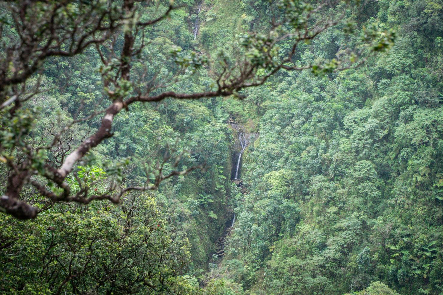
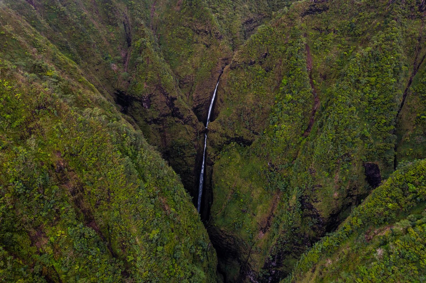
And this one even has a few gems, specifically waterfalls! These falls in view are part of the 7 Falls hike. I personally have made this adventure.
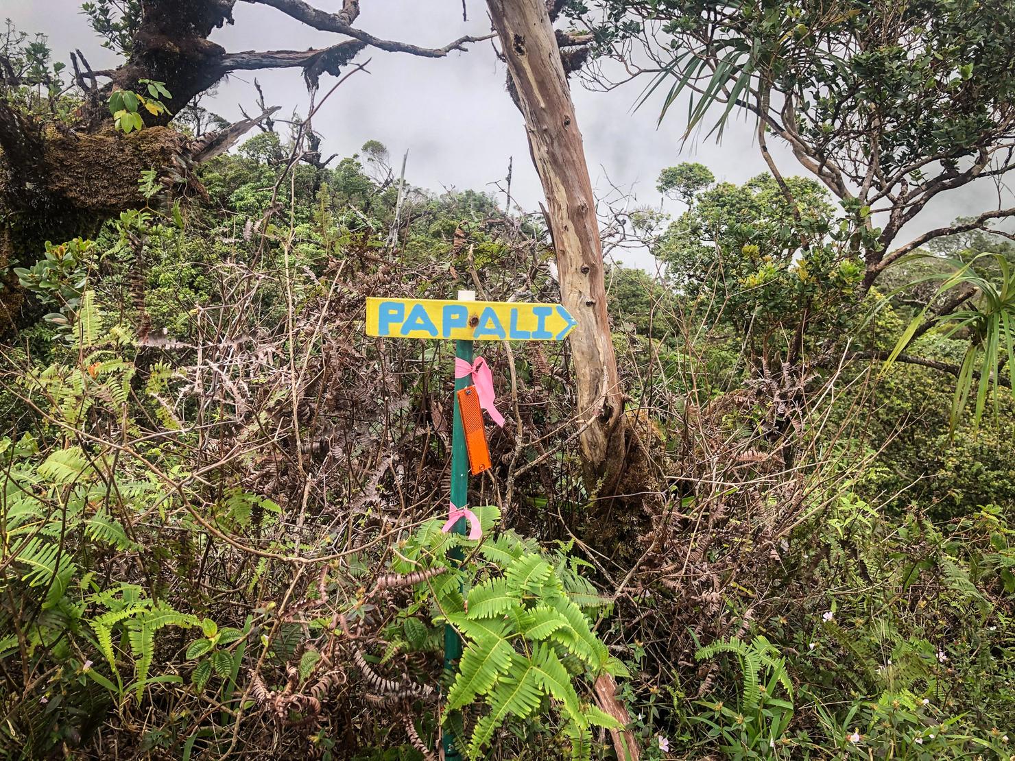
After a little over 2 hours of hiking, I reached the sign indicating I had reached the Papali Junction. For those seeking other routes (such as the Pu'u Waiahilahila), this would be a notable landmark.
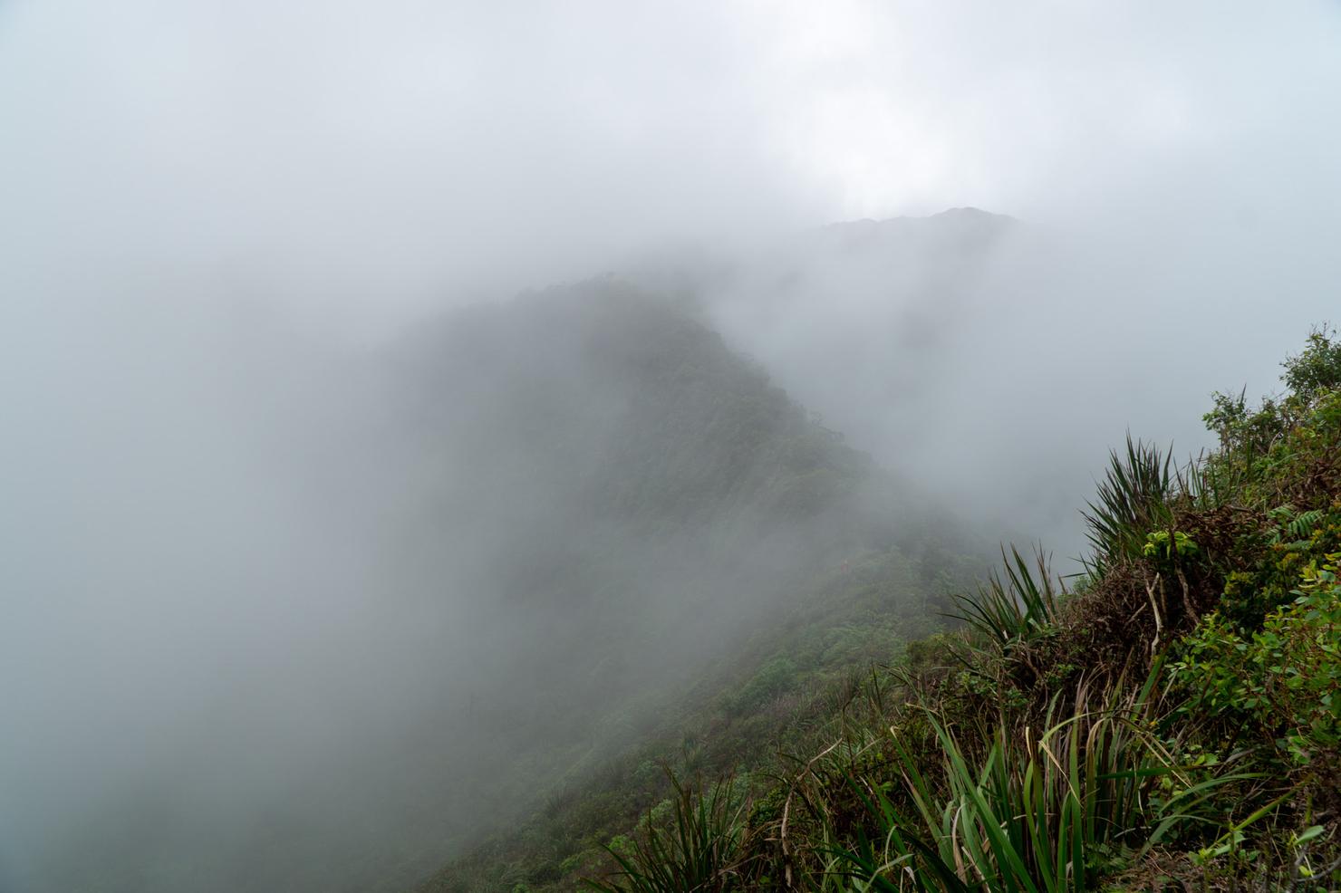
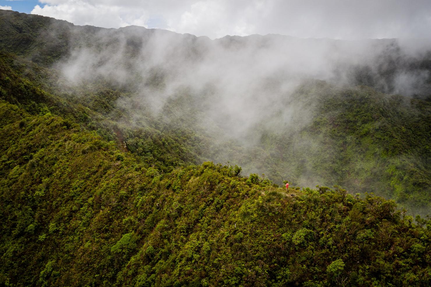
But we are continuing along Papali Uka. It was shortly after the junction that I came to this section. A skinny section with clouds obscuring the view. It looks somewhat ominous, but that sensation of hiking through the shrouded ridge was invigorating.
My attempt at capturing the action. Wonder what is beyond the clouds?
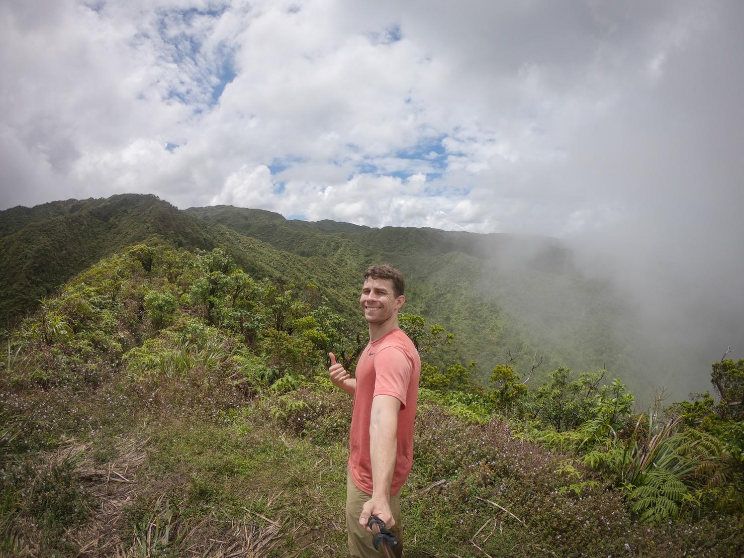
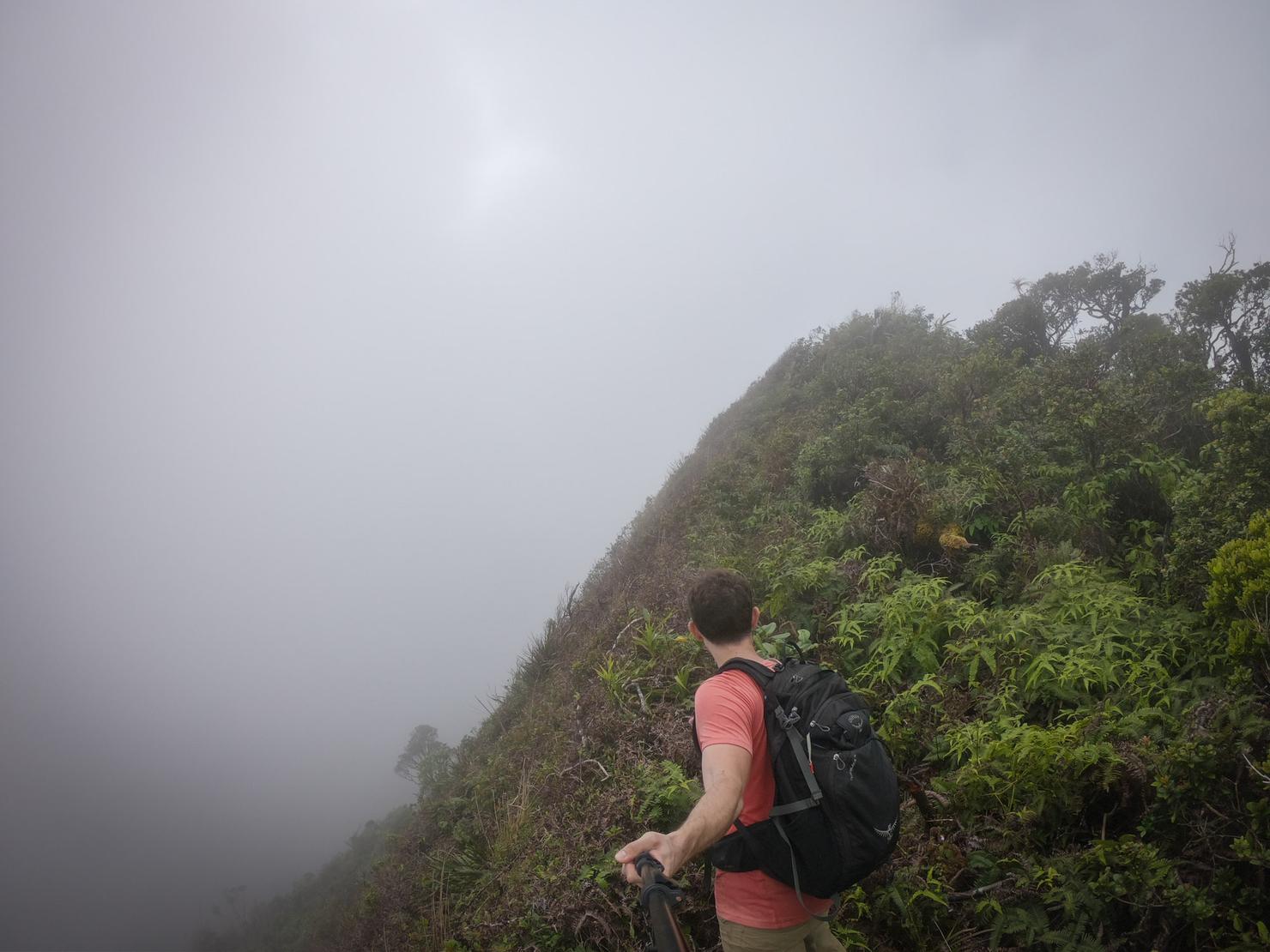
A lookout! Another 20 or so minutes, some of the clouds cleared just in time for me to reach this flat and open section of ridge. Having originally had the idea to see if I could snag a shot of Sacred Falls this seemed like a perfect spot for a drone launch (after a quick selfie of course)
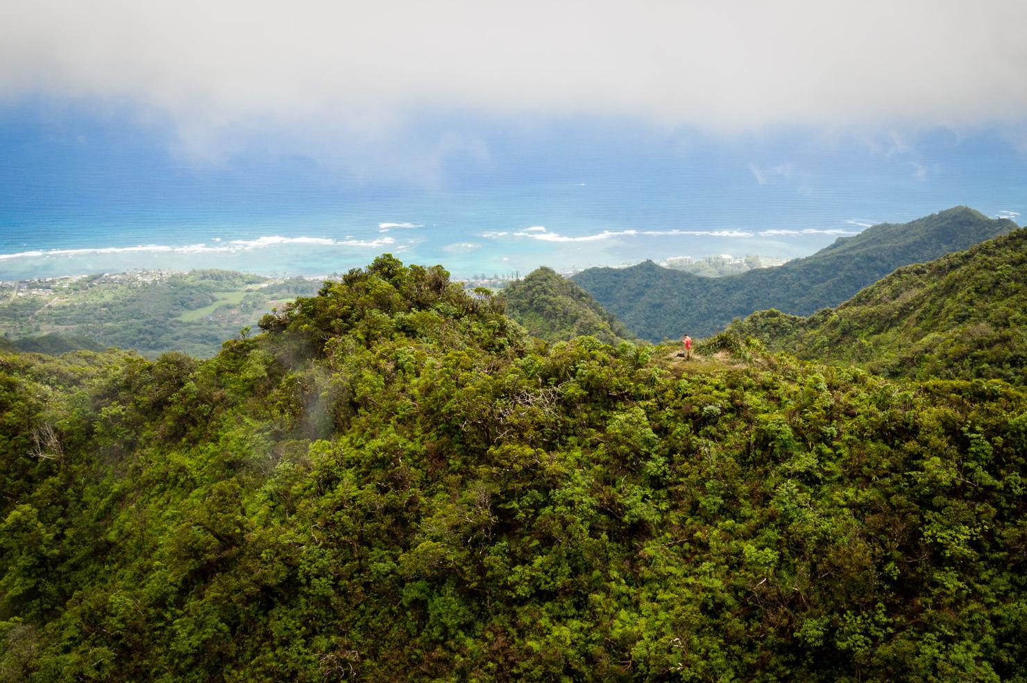
A shot for perspective. And now the flight over to Sacred Falls. With only a faint idea of where to go, I headed directly over the adjacent ridge hoping I'd catch a glimpse on my small Iphone screen. After clearing the ridge and making it above what looked like the adjacent valley, I gently pushed on the left stick as the drone rotated around...
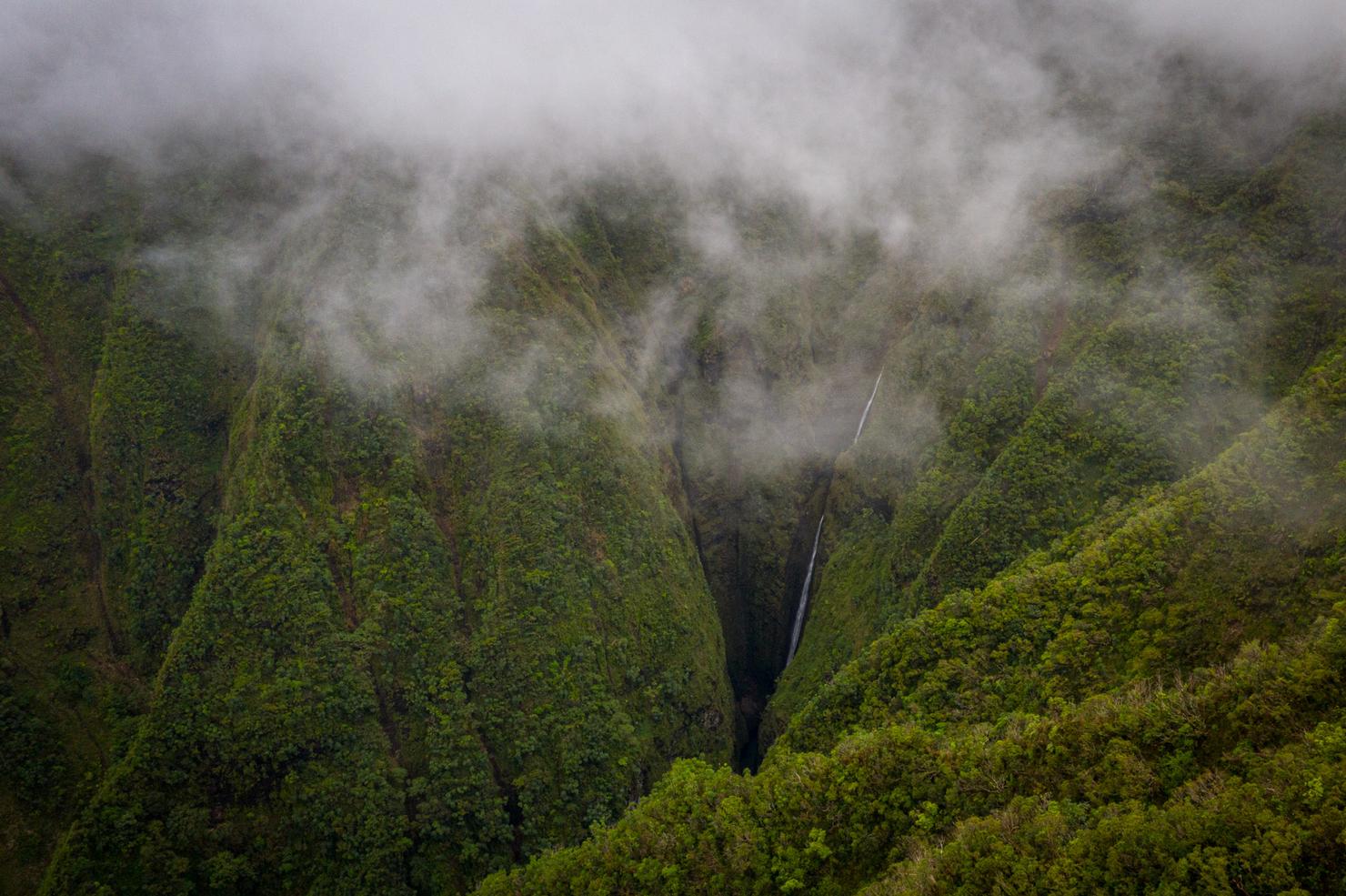
... and boom! There it was! Sacred Falls just barely visible below the low hanging clouds. Sure, I could have found a way to hike there, but today was a day to rely on some technology. I decided to descend a bit to see if I could get a closer shot.
And this was about as close as I could get before I got the always nerve-racking SIGNAL LOST notification on my controller. The mountains were interfering with the Wi-Fi signal. Let's hope that automatic return to home feature works.
Within a few seconds, the drone automatically ascended and I regained connection. Mahalo to that phenomenal DJI software! I decided to give the shot one more go from a slightly different angle and maybe avoid the interference. But as I began to descend the drone I got a new notification, LANDING. What??? No no no! I immediately pushed up on the left stick and the drone exited landing mode. Apparently the drone was sensing the clouds as solid ground and was trying to land on them. I took it as a sign that my little Sacred Falls drone adventure was done and it was time to land.
One last dronie. Sometimes I look at pictures like this and think, there's not much there. No eye watering colors of a tropical paradise that will get you all the likes on the instagram feed. But maybe that's precisely why I like it. It represents that sense of seclusion I felt, nothing but me, that little slice of green ridge and the clouds.