Difficulty: BEGINNER-INTERMEDIATE
Time: 1-2 HOURS
Distance: 2 MILES
Elevation Gain: 400 FEET
Foot Traffic: MODERATE
Challenges: Stream Crossings, Muddy and slippery, Flash Flooding
Sights: Bamboo Forest, Makamaka'ole Falls
What to Bring: Water (>1L), Snack, Water Shoes, Swimsuit and Towel
This short valley hike leads to the base of Makamaka'ole Falls within West Maui's Forest Perserve. While the hike is not too long, it can be challenging as you will be required to cross Makamaka'ole Stream multiple times (13 to be exact) to reach the falls. But after all that slipping and scrambling you can reward yourself with a refreshing dip at the base of the waterfall. For those looking for more of an adrenaline rush, you can climb the side of these waterfalls to discover the other tiers of this 260 foot beauty.
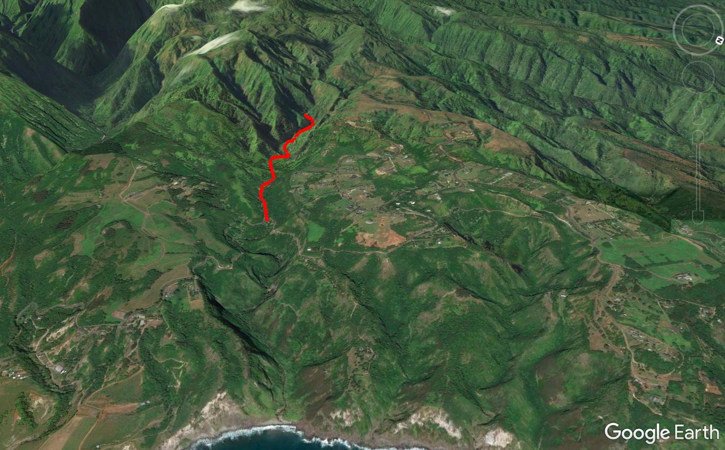
After coming off a morning hike at Iao Tableland, I planned on making my way counterclockwise around Western Maui, hitting this hike and the nearby Waihe'e Ridge trail, before catching my evening flight back to Oahu. I'd spent a lot time this island hop diving in the salty Pacific, so I was looking forward to getting a refreshing natural shower from a waterfall. The only obstacles between me and that sweet sweet flow were thirteen stream crossings. Let's hope this waterfall is flowing!
As with most waterfall/valley hikes, the trail follows the stream into the valley until you reach the base of the falls. There are a few tricks with this hike, however.
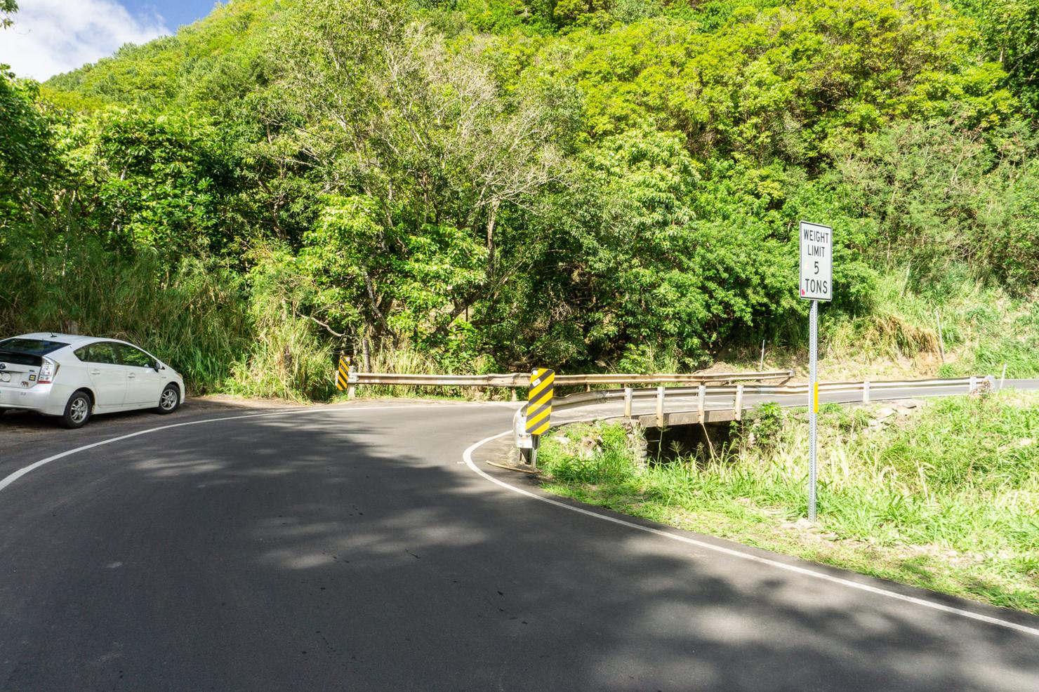
The first trick--getting to the trailhead. It is located on the southern side of the bridge that crosses Makamaka'ole Stream. The only place to park is on the shoulder off the Kahekili Highway. There's some space right by the trailhead, but you may have to park up the highway a little bit to find spots. Be careful--walking around here can be dangerous as the highway is narrow and the turns are somewhat obscured. The trail entrance is just in front of the Prius through an opening in the trees.
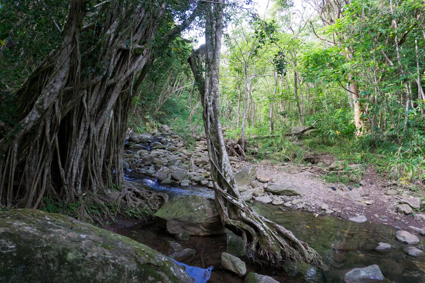
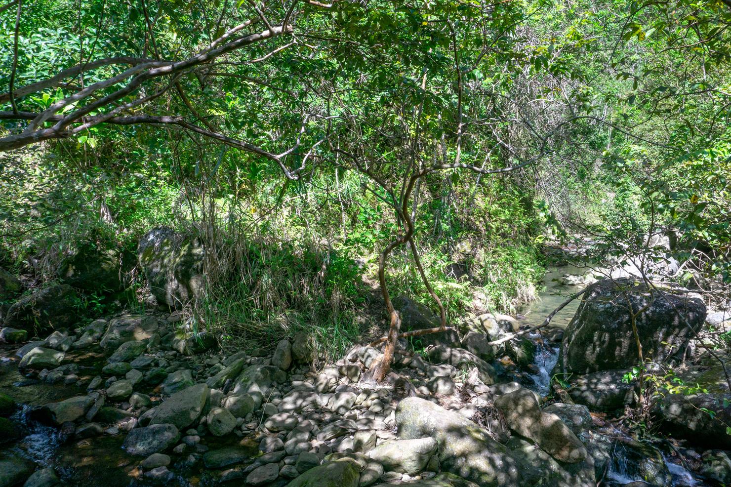
Shortly after entering the trees, you will reach stream level. This banyan tree marks the first crossing.
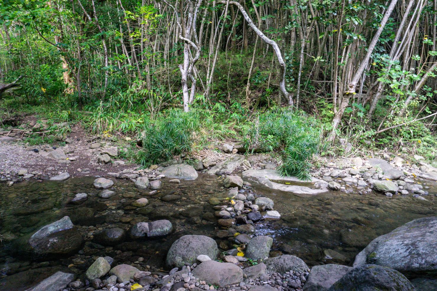
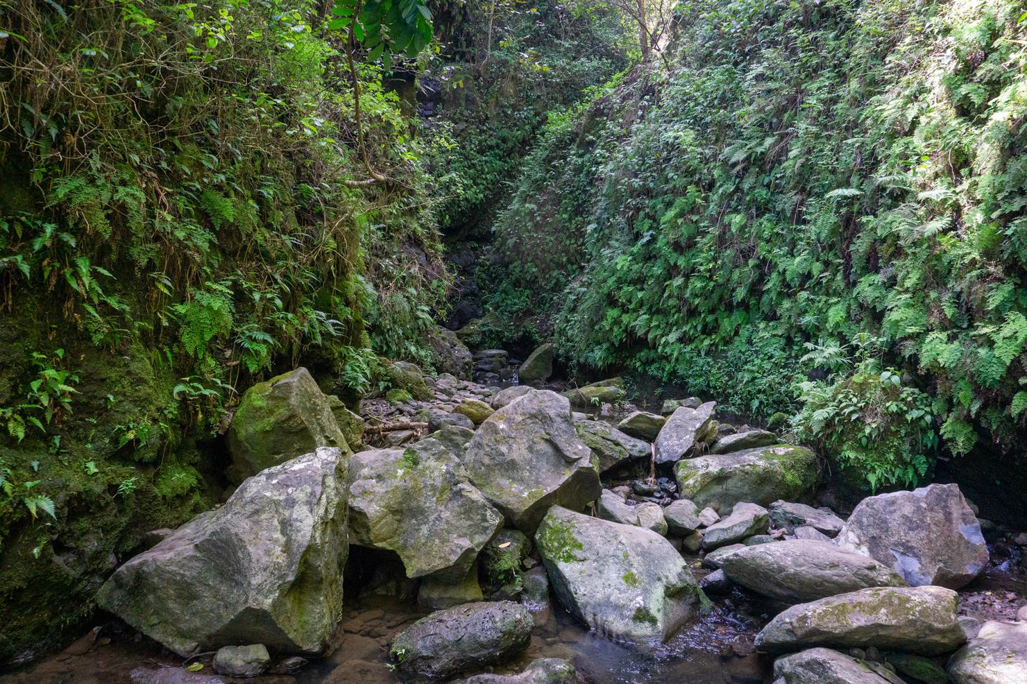
And this is the name of the game for most of the hike--cross a stream, don't slip, walk along the stream until you get to the next crossing. Repeat 12 times. I was there during what seemed to be a pretty dry time, so the crossings were tame. I was able to hop on dry rocks without getting my shoes wet. But like any valley hike, the conditions are dependent on recent weather. This area is prone to flash floods if the weather turns south and people have been rescued as a result of being trapped by the flood waters.
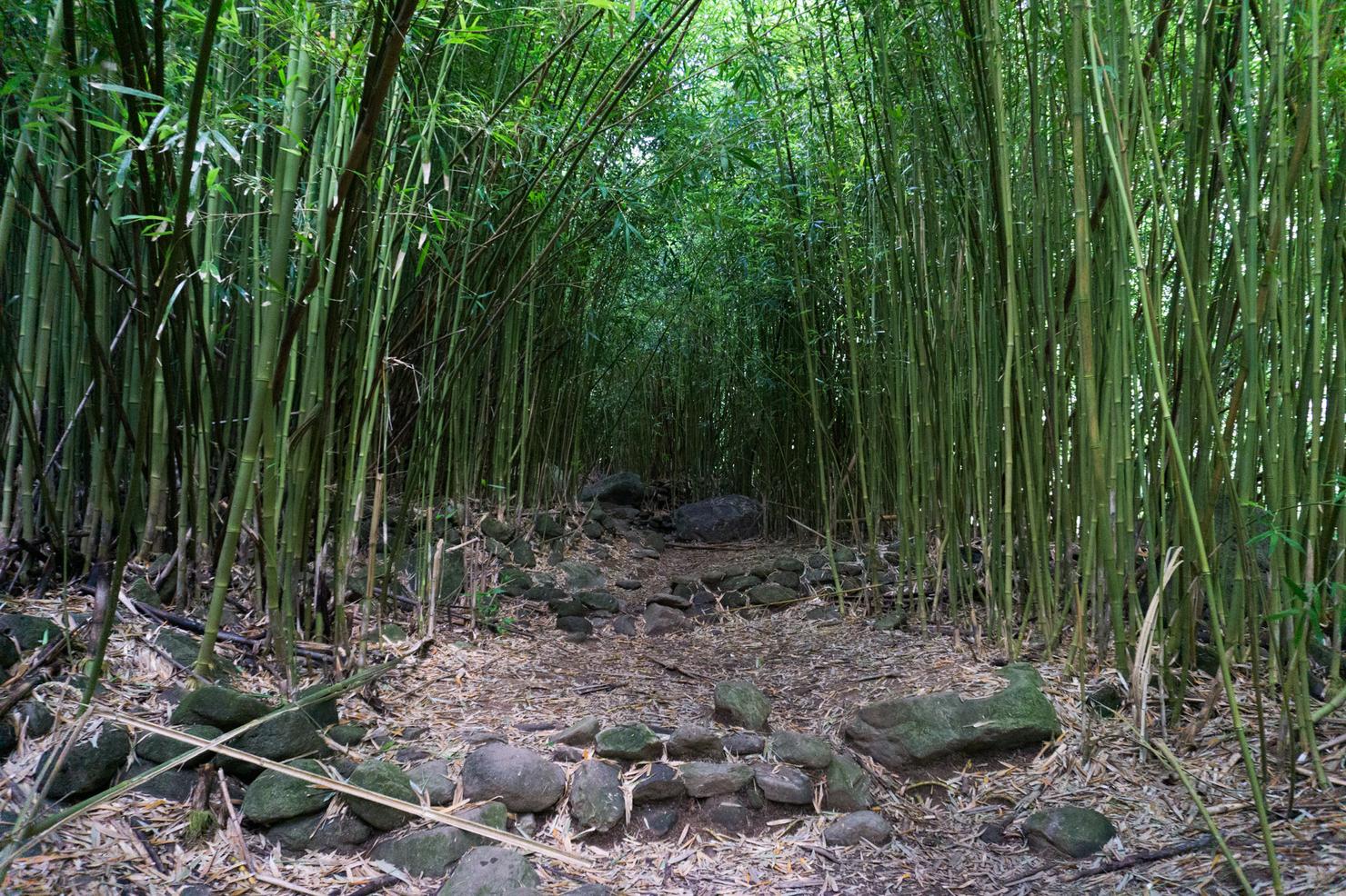
While much of the trail consists of trees and stream crossings, there are a few little gems along the way, such as the beautiful bamboo forest. While this bamboo forest is not as grand as the Pipiwai Trail's, it was impressive nonetheless. The stacked rocks coupled with those towering bamboo stalks made it feel like some sort of ancient pathway.
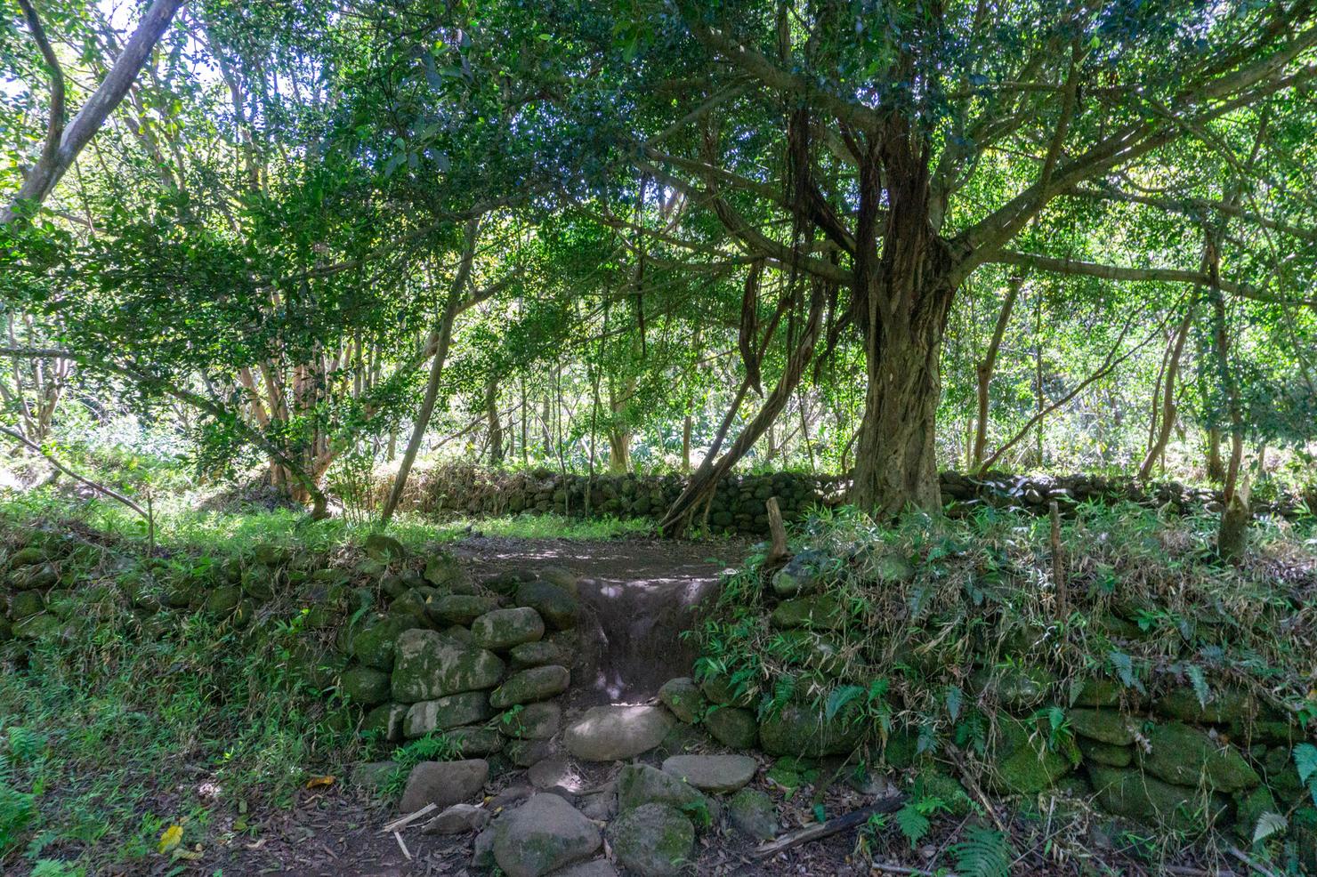
Soon after the forest, you will come across more deliberately stacked rocks. My assumption is that these are the remnants of an ancient Hawaiian temple (heiau), although I was unable to conclude from my Googling if that is the case. This area is also important as it marks a potential fork in the trail. The correct path is to the left, which will soon get you to another stream crossing. However, there does seem to be a path that leads right. Maybe it goes somewhere, but today we are going to stick to the main trail.
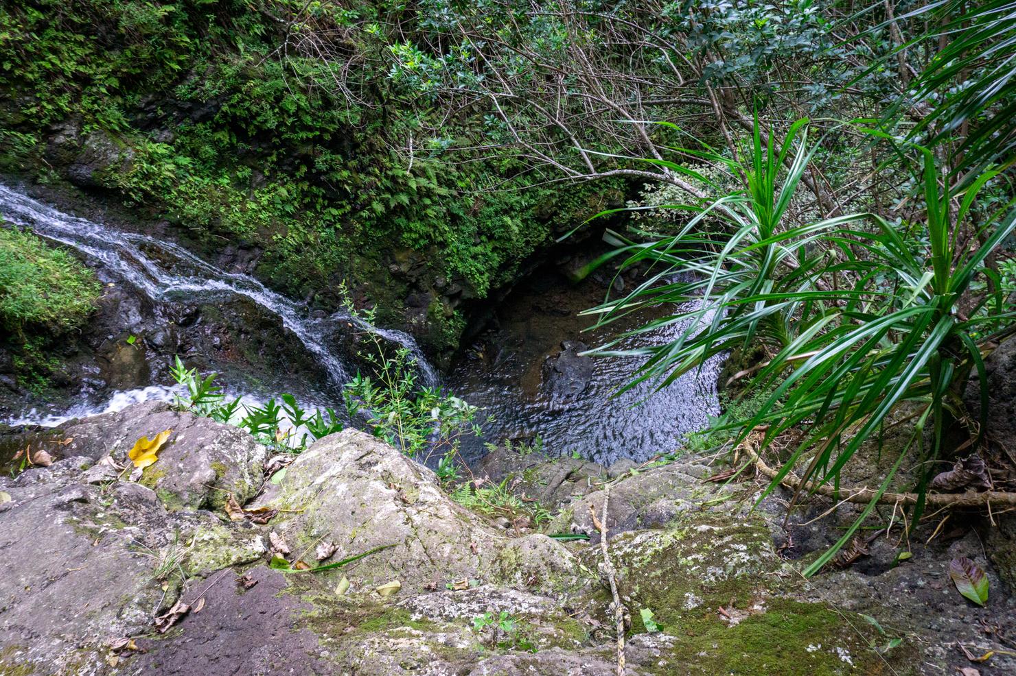
After about 30 minutes of hiking, I reached the 13th and final crossing (apologies for the poor photo). As soon as you cross the stream, you will arrive at a grassy impasse. From here, the path around the wall goes left or right. Both lead to a waterfall. We will go left first.
This path leads you to this grassy ravine. Remember the warning about flash flooding? This is probably the last place you want to be if such an event were to occur.
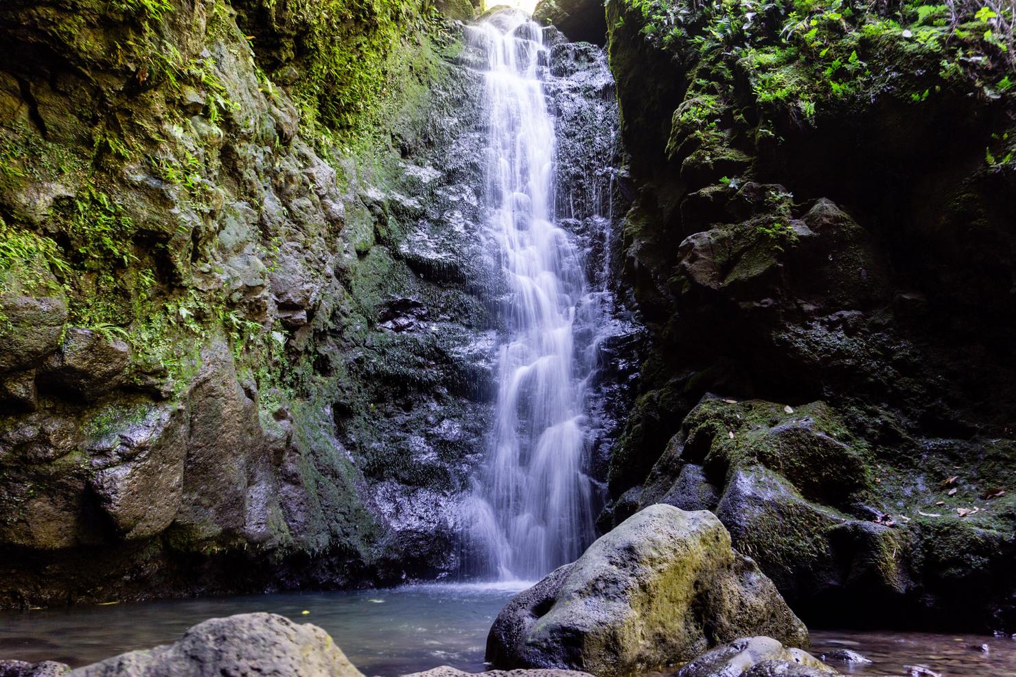
Aloha waterfall #1. The pool of this waterfall (on this day at least) wasn't quite deep enough to swim in. It did look like it was possible to climb up a grassy area to the right side of the falls, but I decided to forgo that adventure. After a few pics it was on to the next falls.
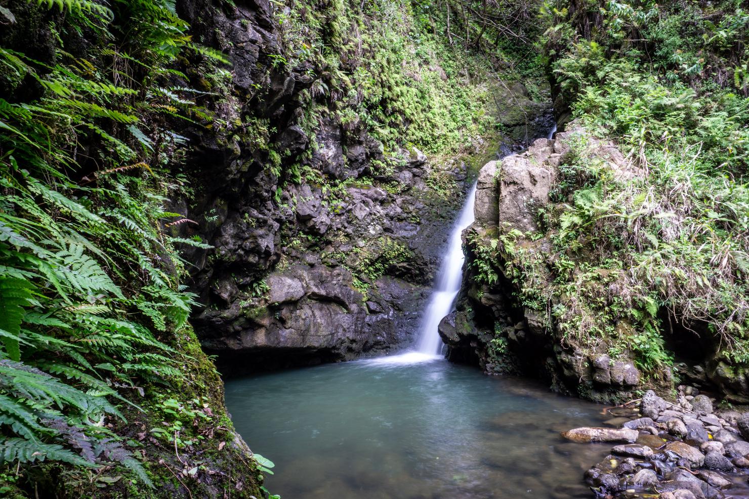
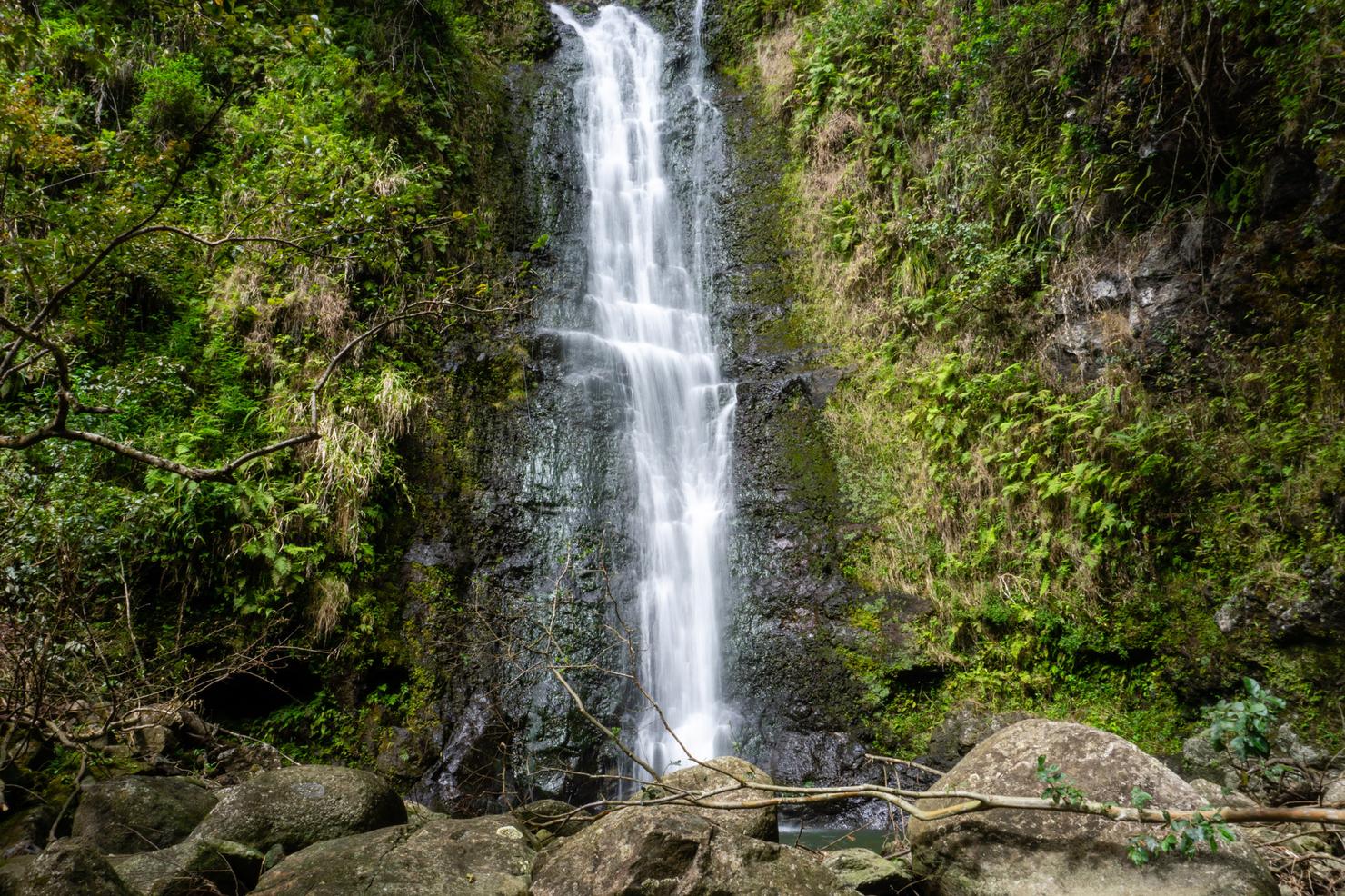
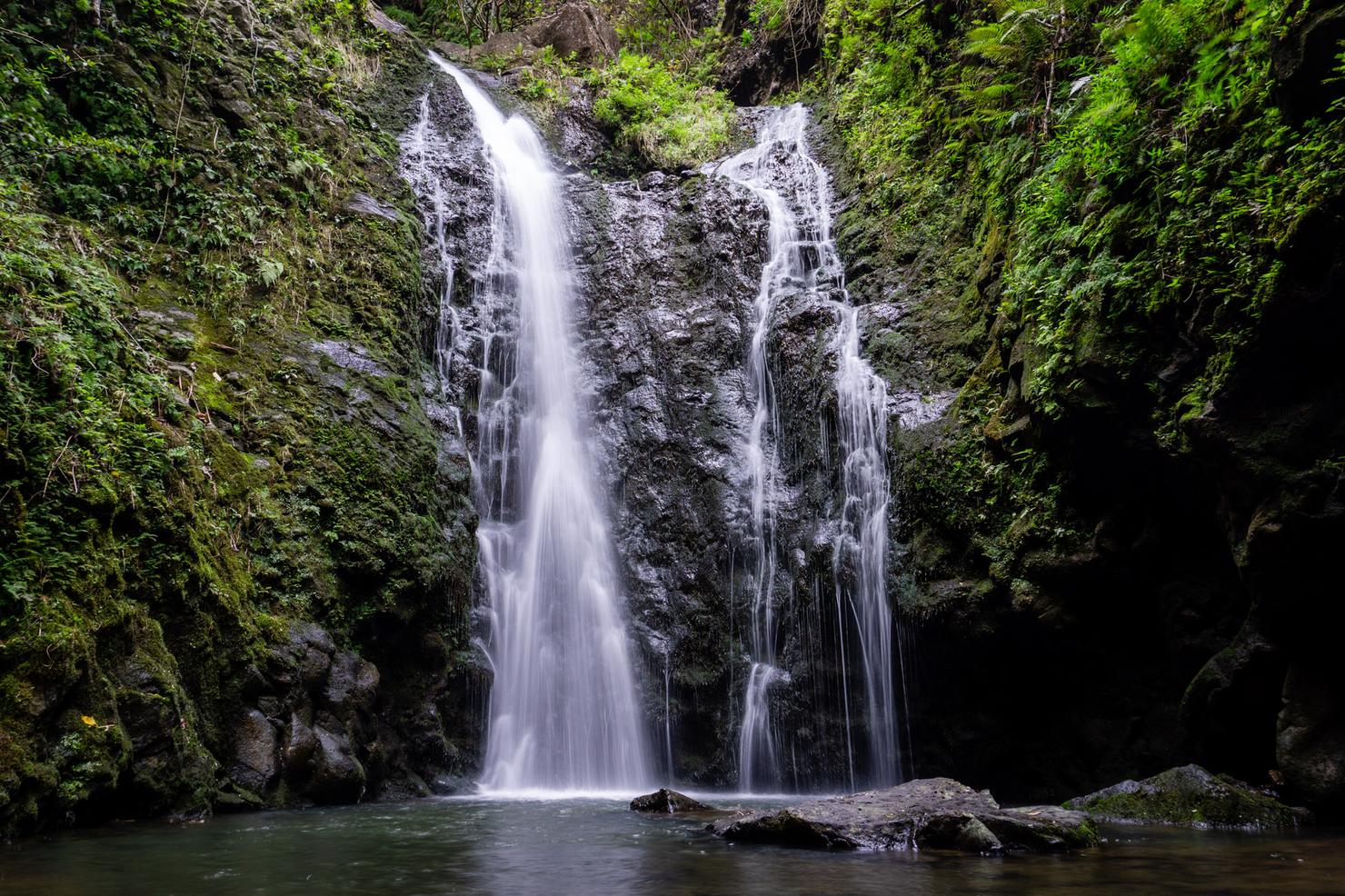
After backtracking out of the ravine and taking a RIGHT at the fork after the 13th crossing, I hiked another 0.1 miles to this pleasant little waterfall. This is the "main" falls. Even on this dry day, the pool at the base was deep enough for a swim. For most, this marks the turnaround point of the hike.
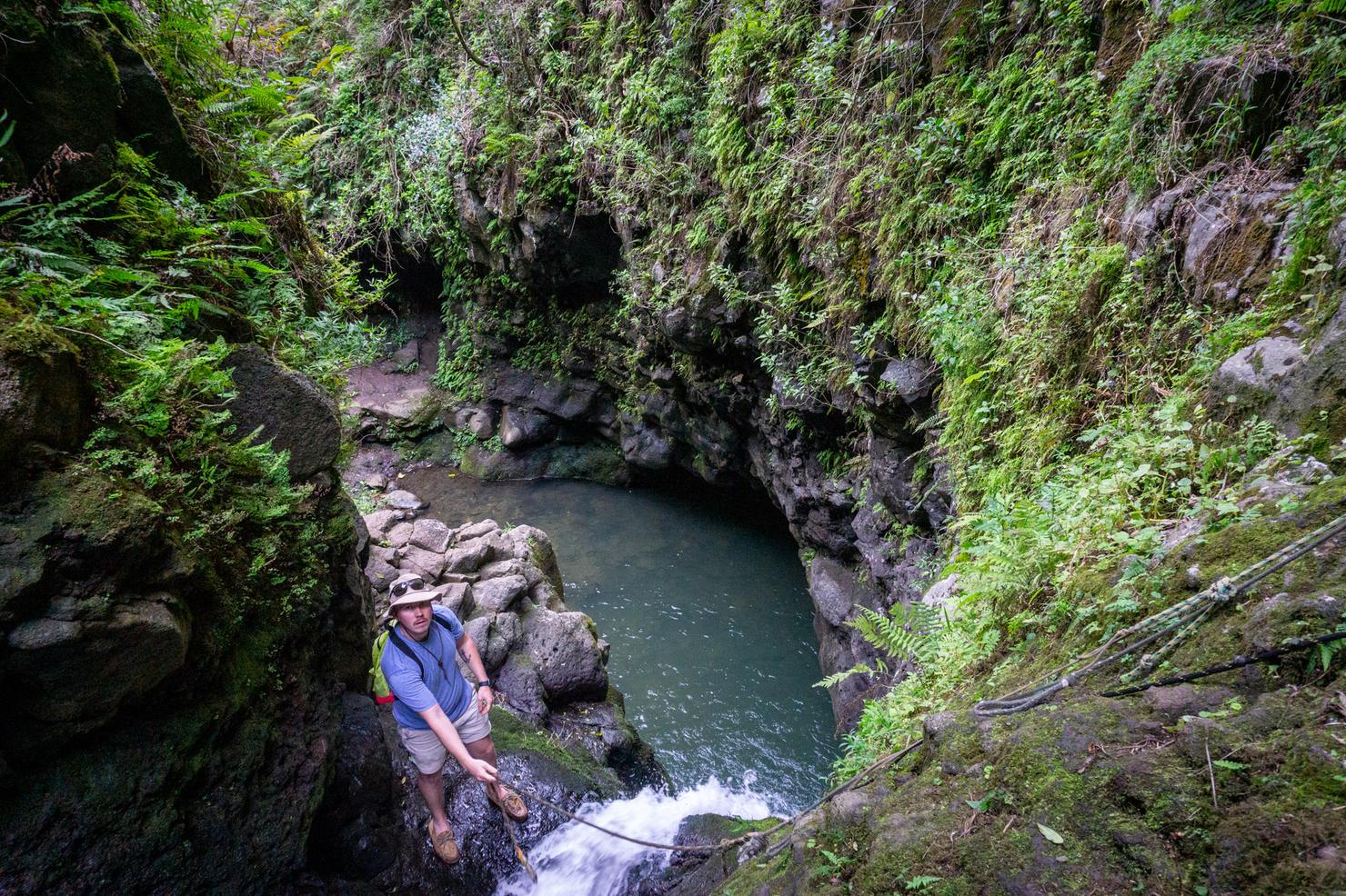
But if you're feeling adventurous, there's more! You can actually climb up the right side of that first waterfall to get to the next level. I should caution anyone who considers doing this that waterfall climbing is inherently dangerous. You're climbing up wet and slippery rocks and heavily relying on a prefastened rope. That caution out of that way, you'll note that this dude was climbing it in sperries... so I mean...
After a nice little scramble, we've reached level 2! This was a nice double flow fall. After snapping a few more pics, it was on to level 3.
The level 3 climb...
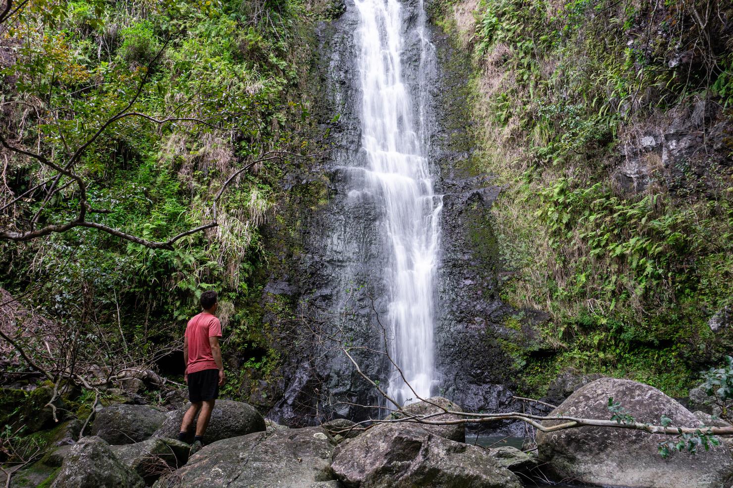
We've reached level 3-- an even taller, more impressive fall. You could theoretically keep going. The official Makamaka'ole Falls has multiple tiers (totaling 260 feet) in height and begins even farther back in the valley. But with one more hike planned and a flight to catch in the evening, I made this my turnaround point.
But not before a few more pics and a rinse under that refreshing flow. Now it's on to the final hike of the trip--Waihe'e Ridge!