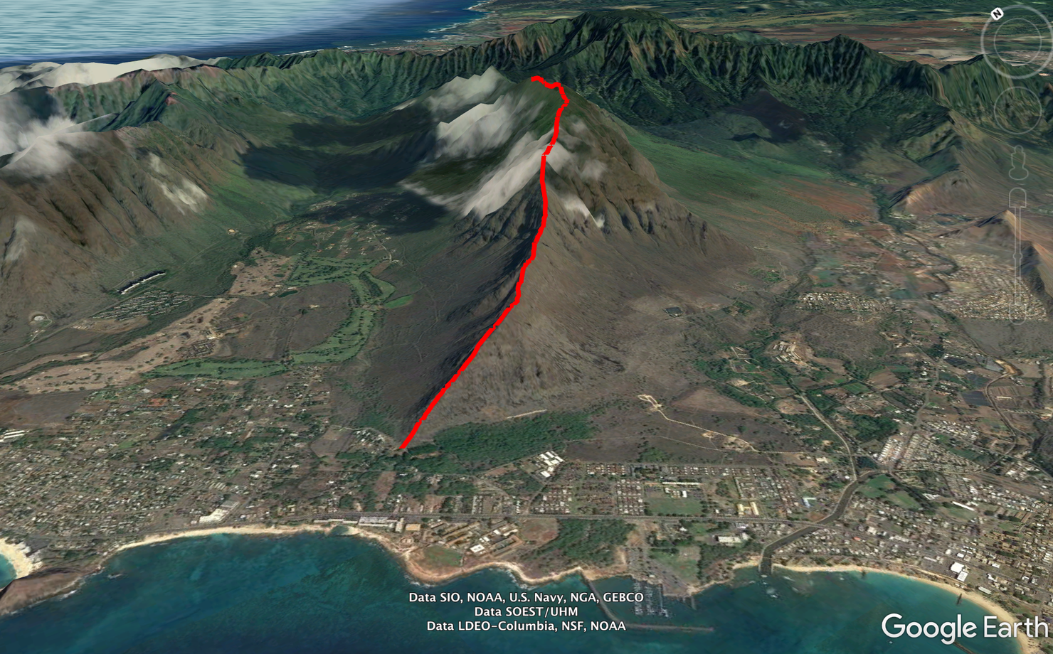
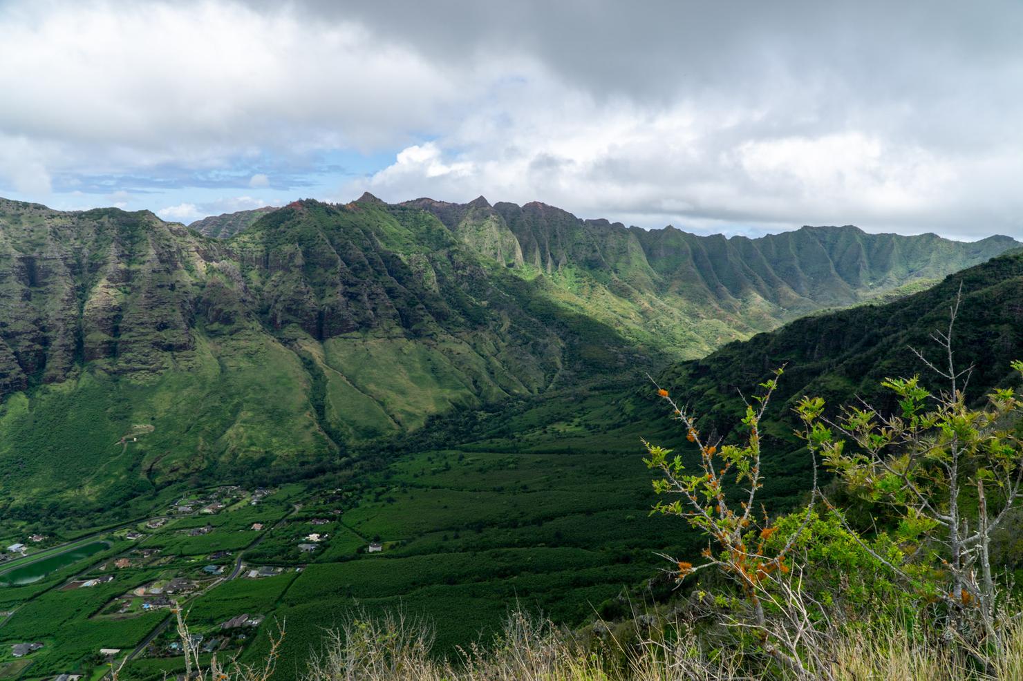
Located on the west side of Oahu, this relatively unknown ridge in the Waianae Range leads you to the third highest peak on the island. The ridge is a tough one--it is largely shadeless, with steep and crumbly scrambles, it requires traversing narrow ridges and even a bit of bush-wacking. But the satisfaction of completing the challenge, and those epic summit views staring at the beautiful Makaha Valley and towering Mount Ka'ala make it worth it.
Well, I think it's apparent that this COVID-19 thing is not going to "magically disappear." Similar to the rest of the United States, Hawaii instituted elements of a lockdown to contain the spread. While we have kept our case numbers low, many of us are adapting to this new way of life, including teleworking, takeout only orders, and massive toilet paper shortages. The good news is hiking is still allowed (at least for now). So a few of my friends and I decided to take a break from the unrelenting coverage of this crisis and make our way to West Oahu, to tackle a new ridge--Kamaile'unu.
The hike starts near the coast as you make your way up this long and steep ridge deep into Makaha Valley. That's pretty much it. Hot, shadeless and over 3,000 feet of elevation gain.
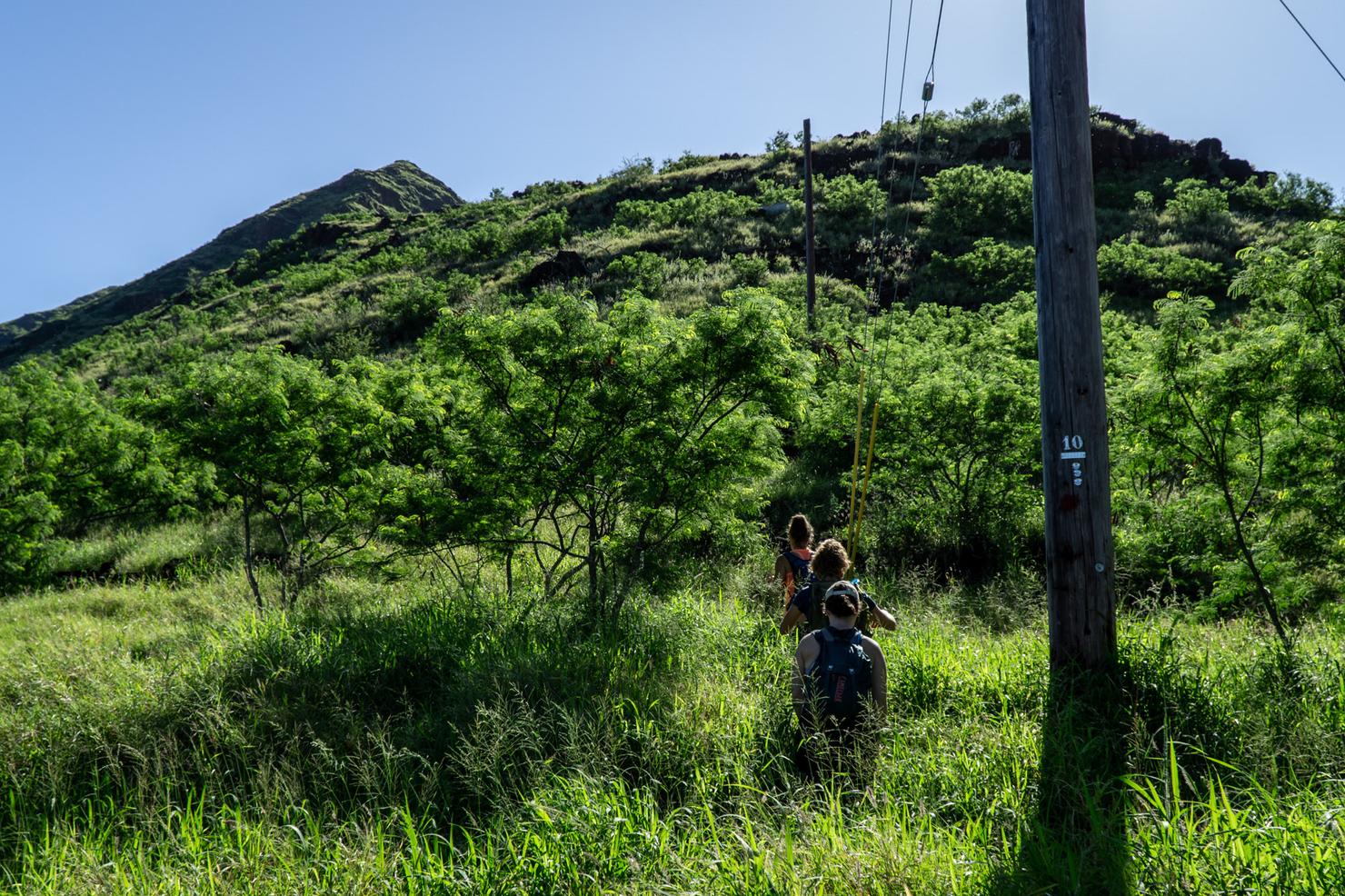
The entrance to the ridge is located at the end of Maiuu Street as it curves to become Kaulawaha. There's a bit of parking off the side of the road at the turn. Walk through the opening in the brush and take the obvious path towards the ridge.
And so begins the climb. Even with our early(ish) 9am start, the sun was beating down on us pretty hard. There's very little shade on this hike so you either have to shoot for a cloudy day or bring lots of water (and sunscreen).
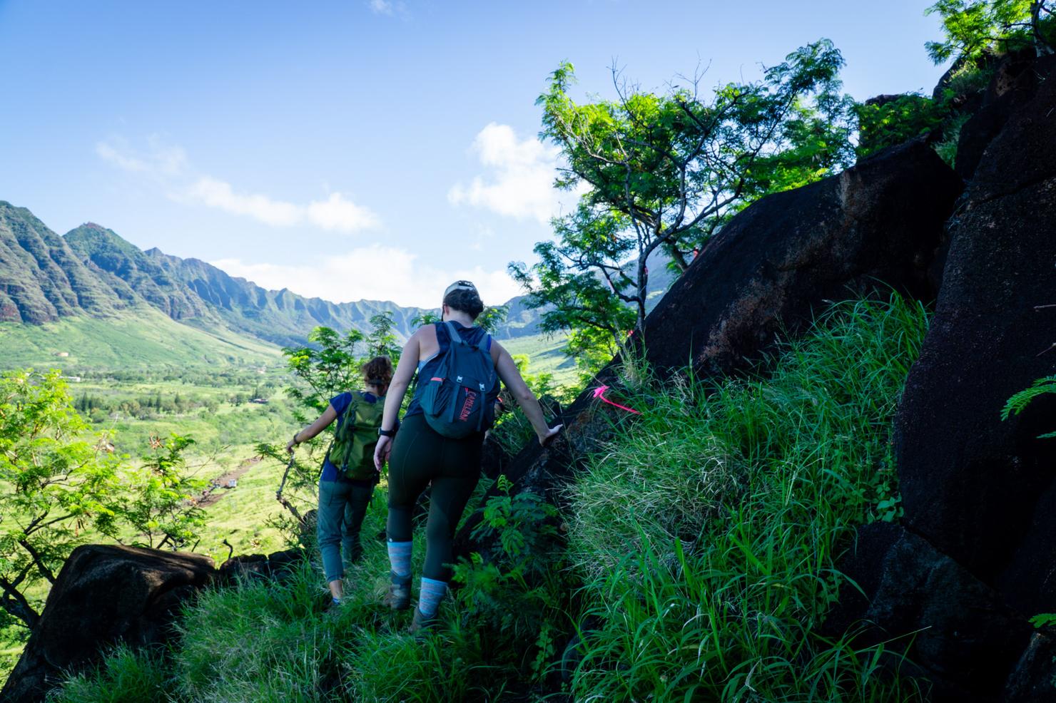
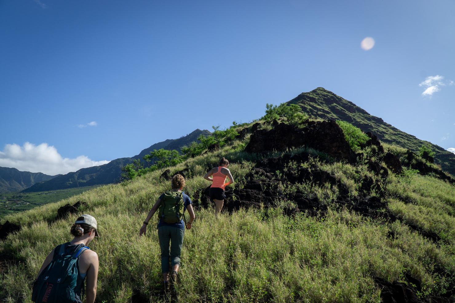
Even for a low trafficked ridge, we quickly noticed it was well marked with pink ribbons and paint. These marking would prove useful for finding the easiest path to scramble up the ridge.
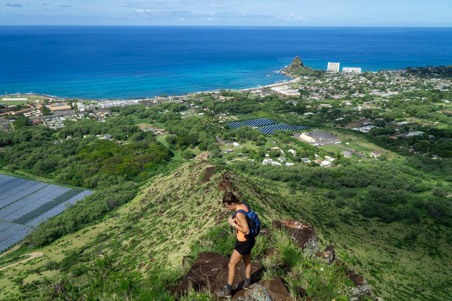
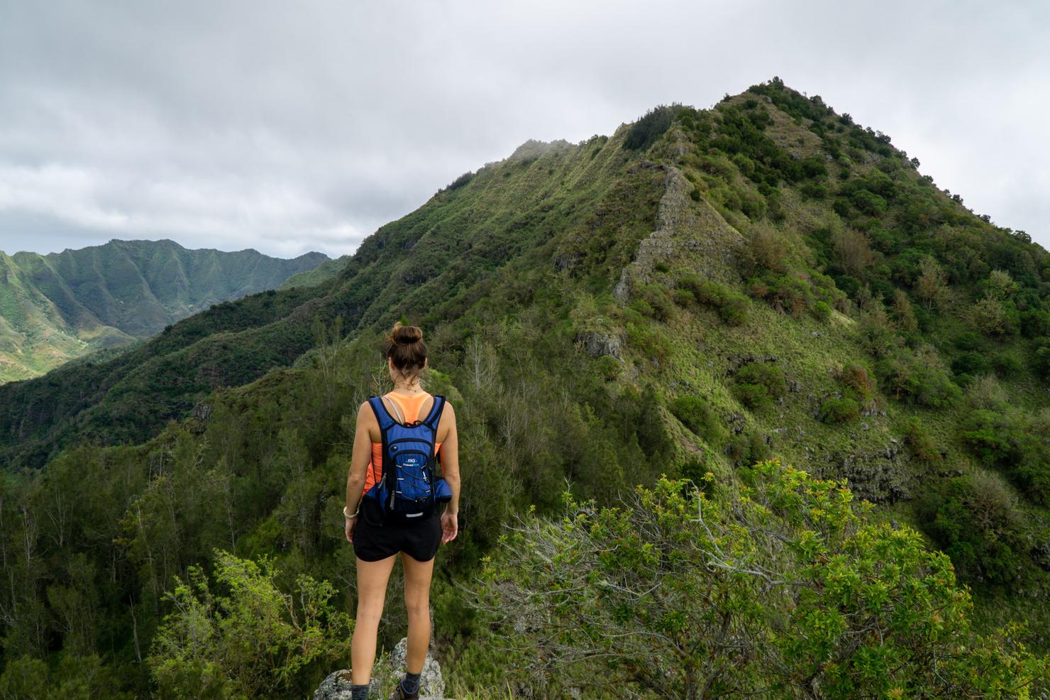
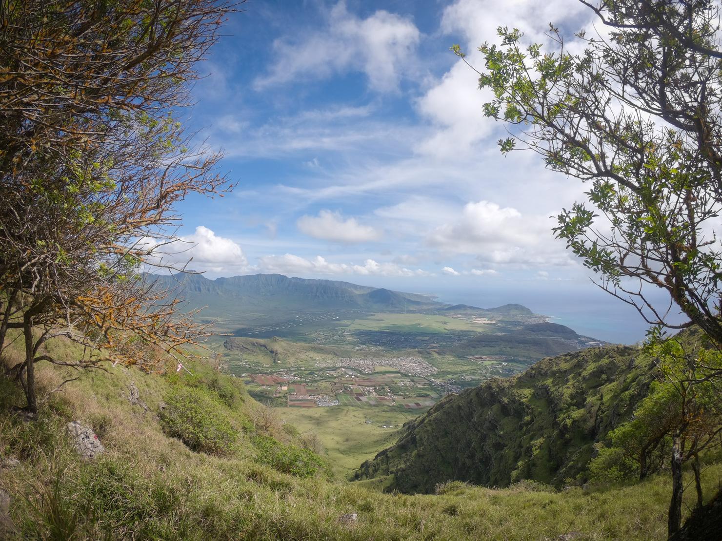
We've reached the spine! Time for a little view break. Those views can help distract you from all the heavy breathing and sweating you are about to do.
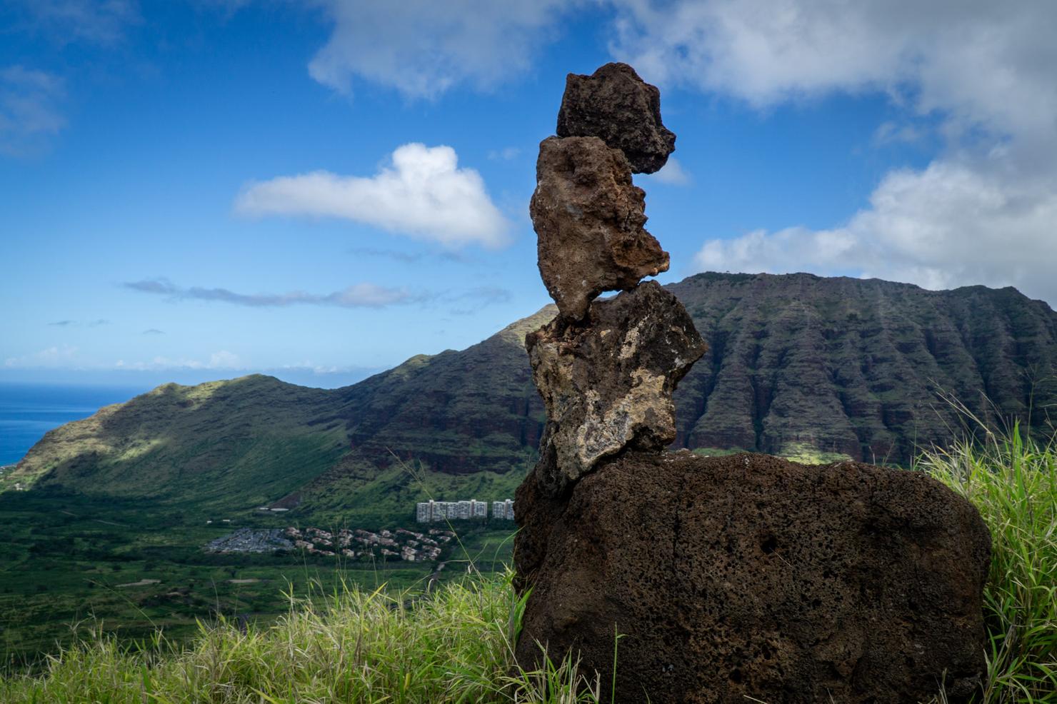
One of those unique finds along the trail, these perfectly balanced rocks that seem to be defying physics. I'm guessing this was done intentionally by someone, but it was pretty neat. Felt like a sign of good luck.
Which we might just need, because with rain off in the distance and a grueling climb ahead, a little luck might be needed to finish this hike.
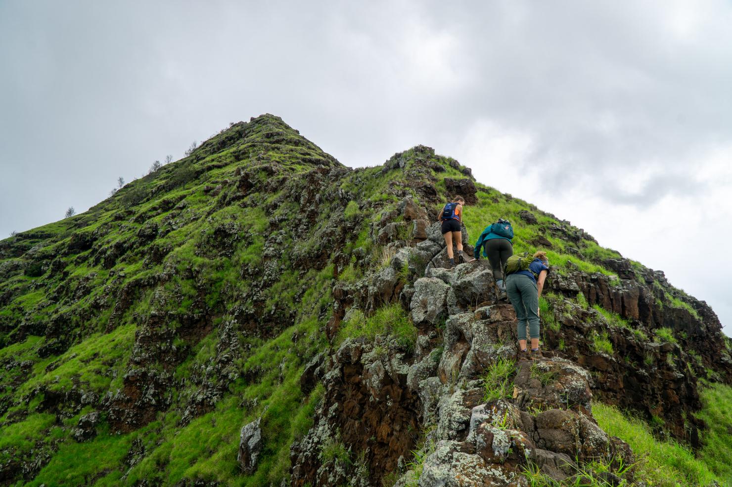
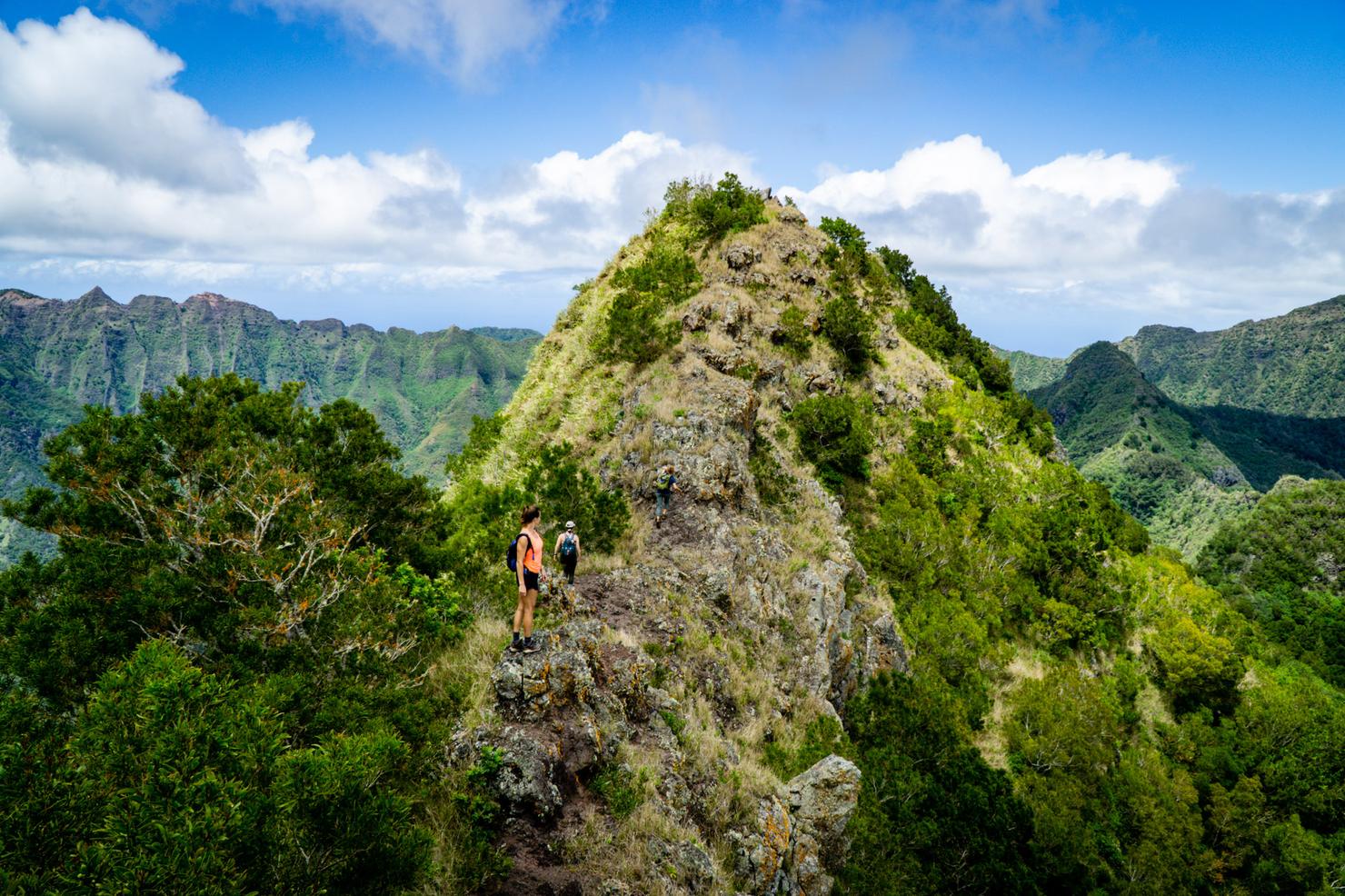
1.5 hours in, the hike ramped up a bit in intensity. A bit of rock scrambling on a narrow ridge is always a great way to heighten that sense of focus.
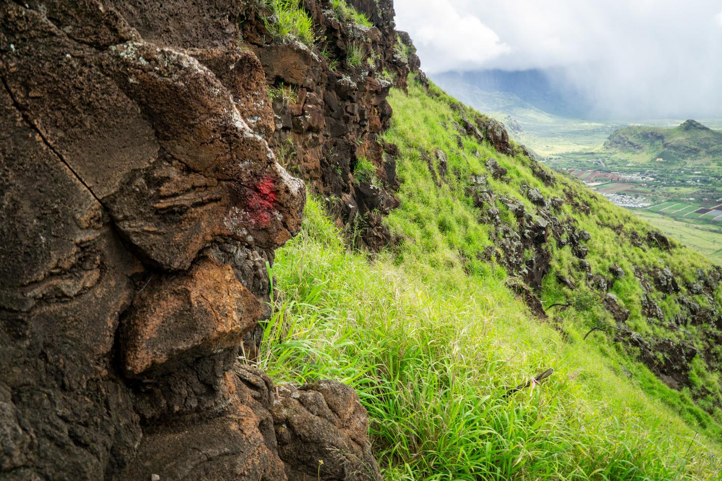
There's really only one way to go on this hike... up. However, choosing the best path isn't always obvious. We continued to follow these painted rocks to help guide our ascent
Did I mention some of these scrambles were steep?
While the ridges do get narrow, they aren't hair raising narrow. That being said, Waianae Ridges are notoriously crumbly, so always be paying attention to your step.
Damn, that view though.
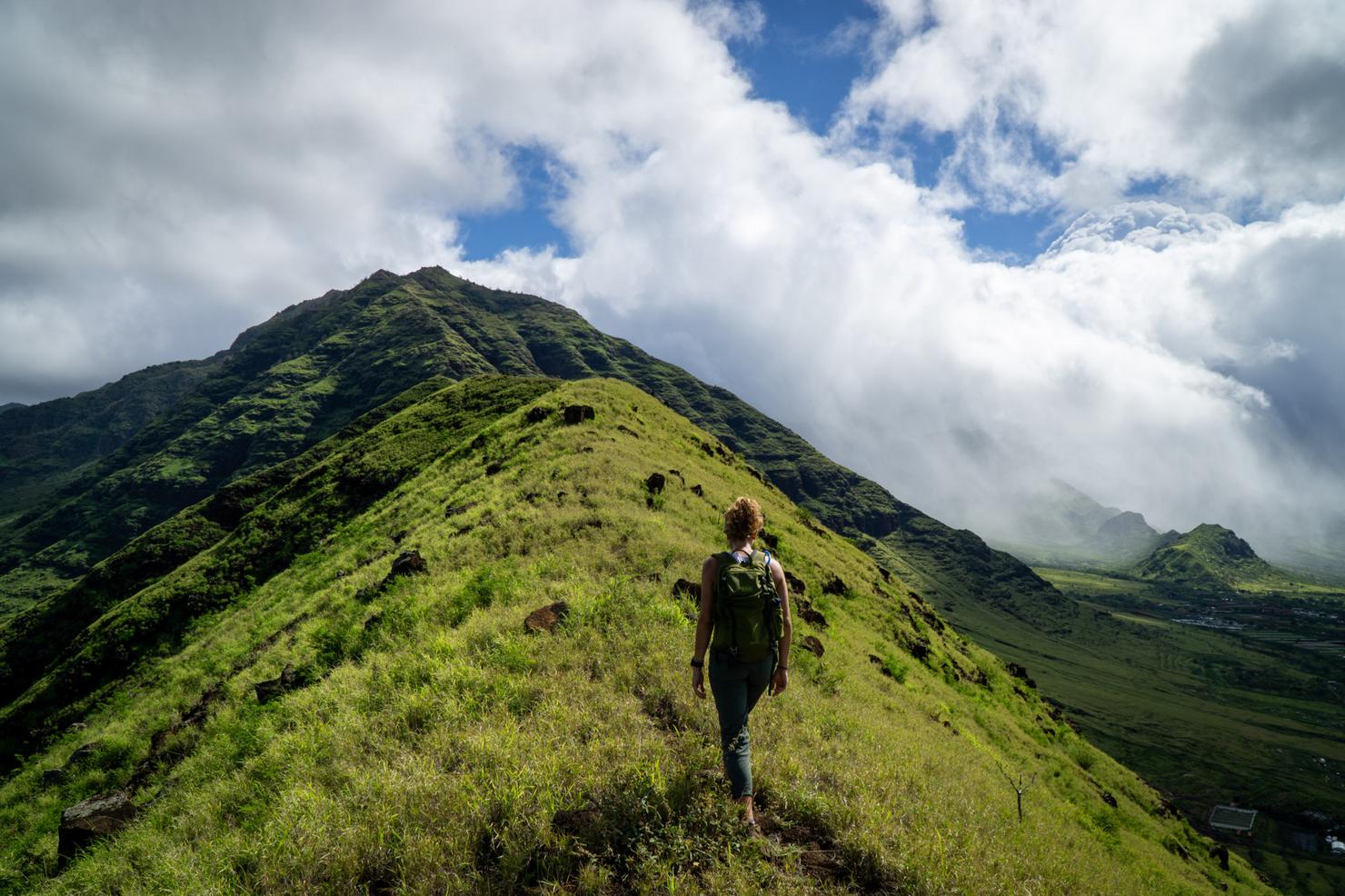
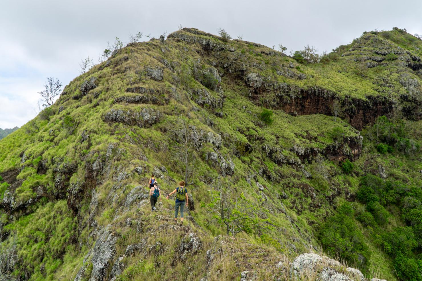
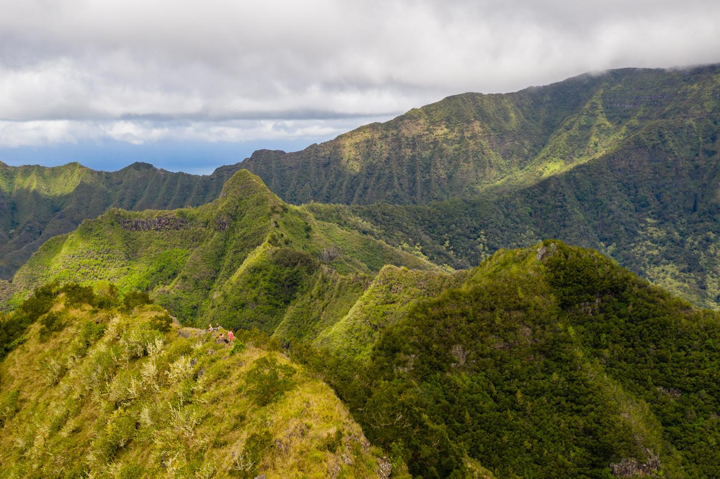
The most disheartening aspect of this hike were the numerous false peaks. You got the sense you were almost there, just to see another peak appear out of the clouds. While it felt like we were getting close, we had nearly two hours to go. This was also the section where the ridge abruptly ended.
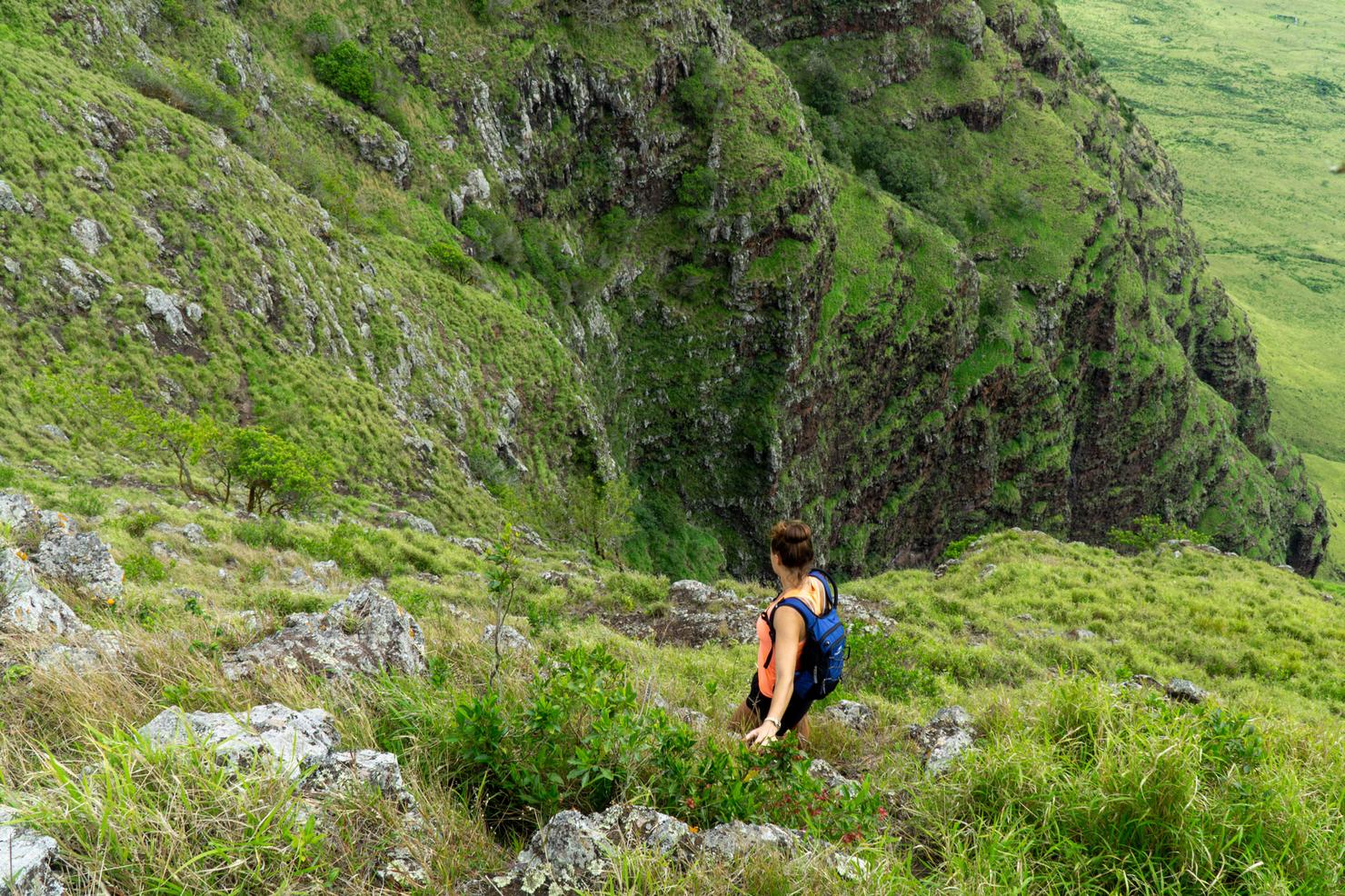
After looking around, we saw a path leading down our right side. There were plenty of holds and a nice sized ledge to walk along. But all you have to do is look at this perspective to realize this ridge is no joke.
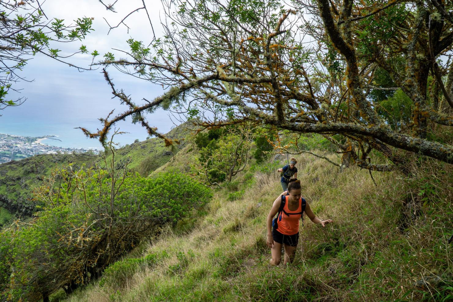
Eventually, the ribbons will lead you off the crest of the ridge into tall grass. This is probably one of the most annoying sections of the hike. Not only is the grass scratchy, but you are walking on a very awkward and angled slope.
Luckily there's a few good viewpoints to take the edge off.
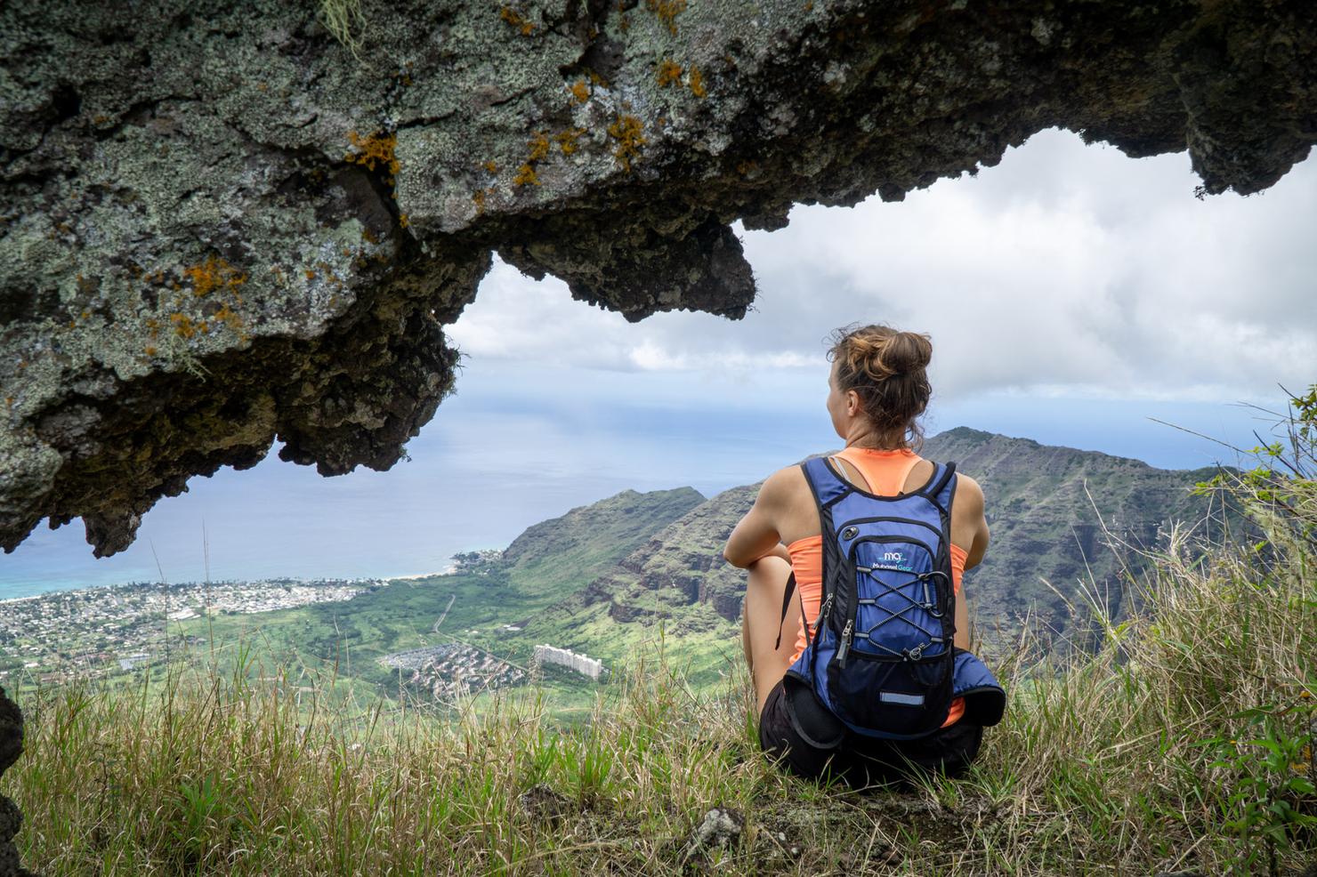
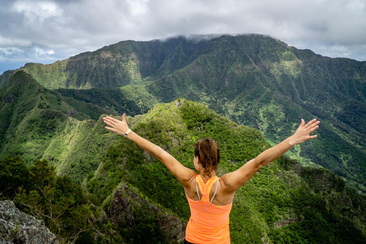
Eventually, the ribbons led us back up to the crest and we found another gem-- a puka! It was a perfect little window into that west side beauty.
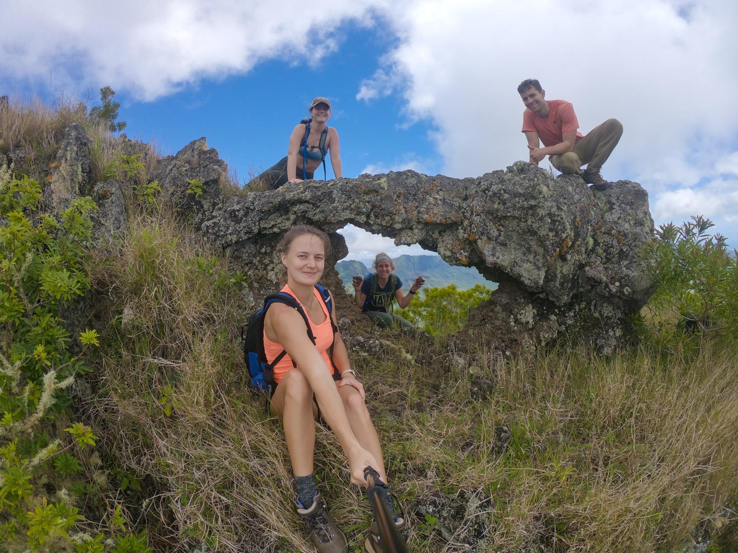
And a perfect spot for a selfie shot (adhering to proper social distancing of course).
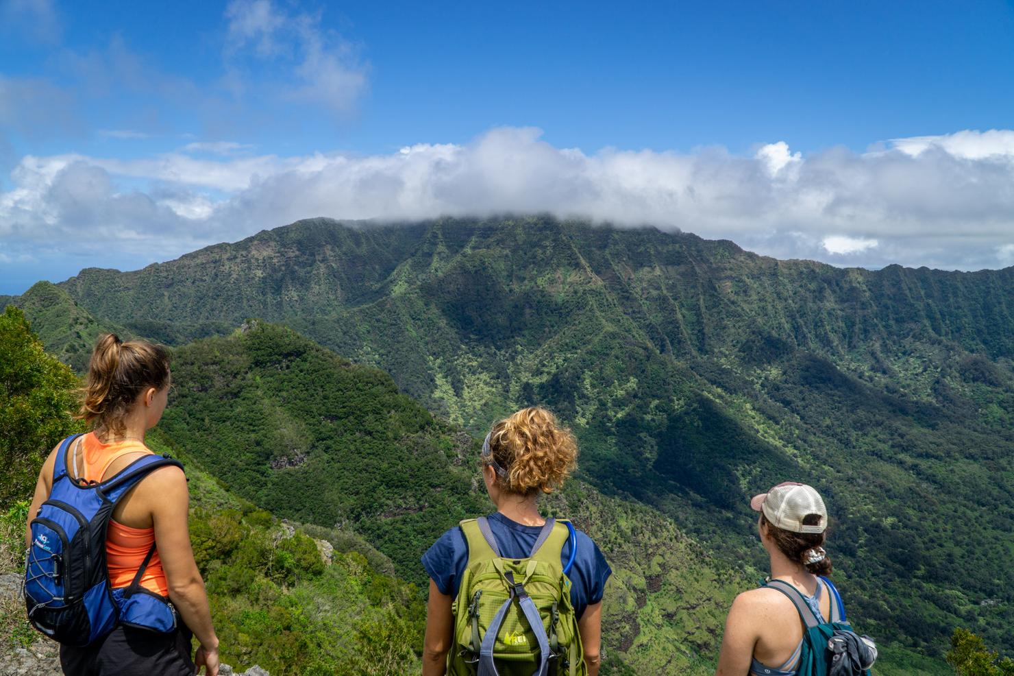
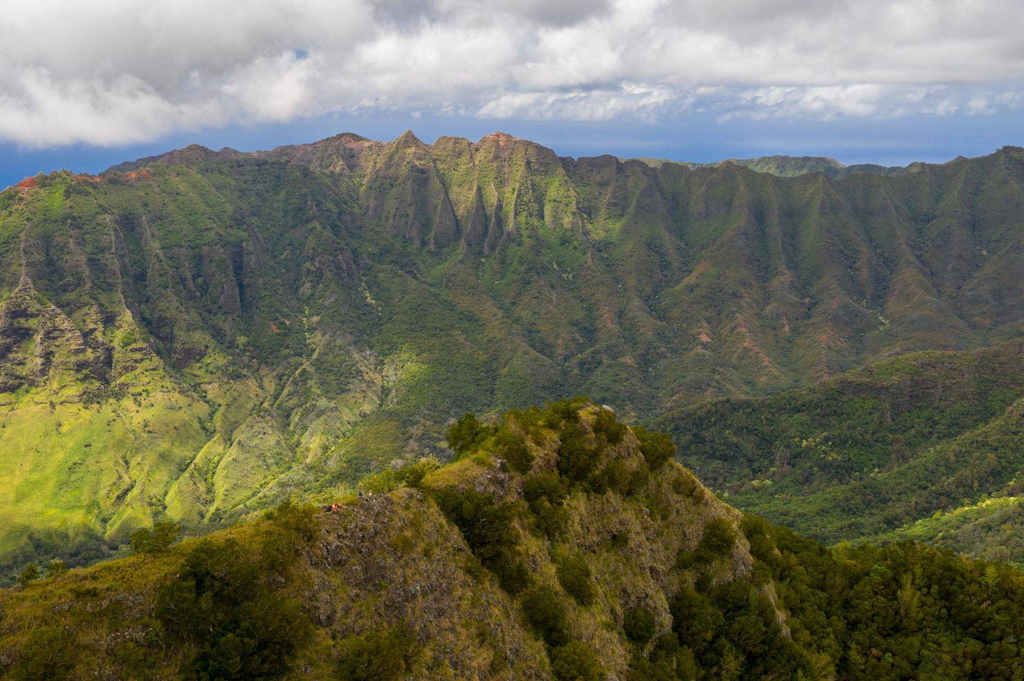
Are we there yet? After 3.5 hours, we were definitely ready to reach the terminus, but hadn't quite made it. Luckily, the views continue to impress. That cloud covered peak in front of us is Mount Ka'ala, the highest peak on Oahu.
Just a bit more. The peak itself isn't necessarily obvious. It's basically that little hump that rises slightly higher then the rest of the ridge. The final push actually had some of the most crumbly sections of ridge on the entire hike so don't let your guard down just yet!
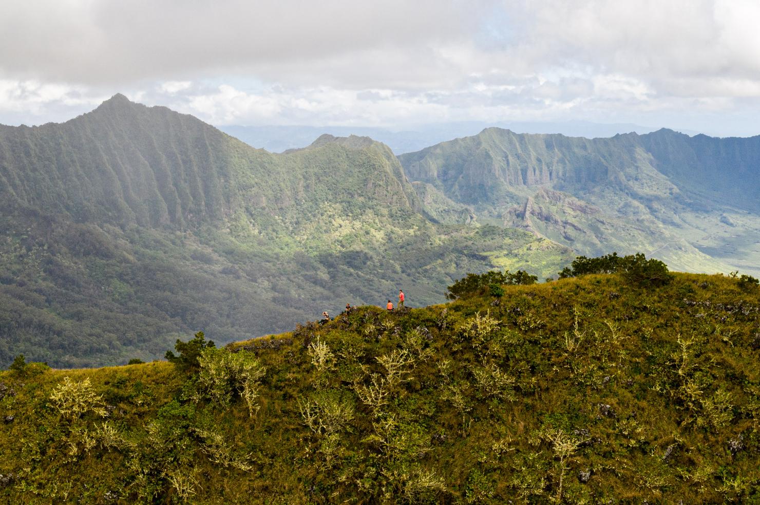
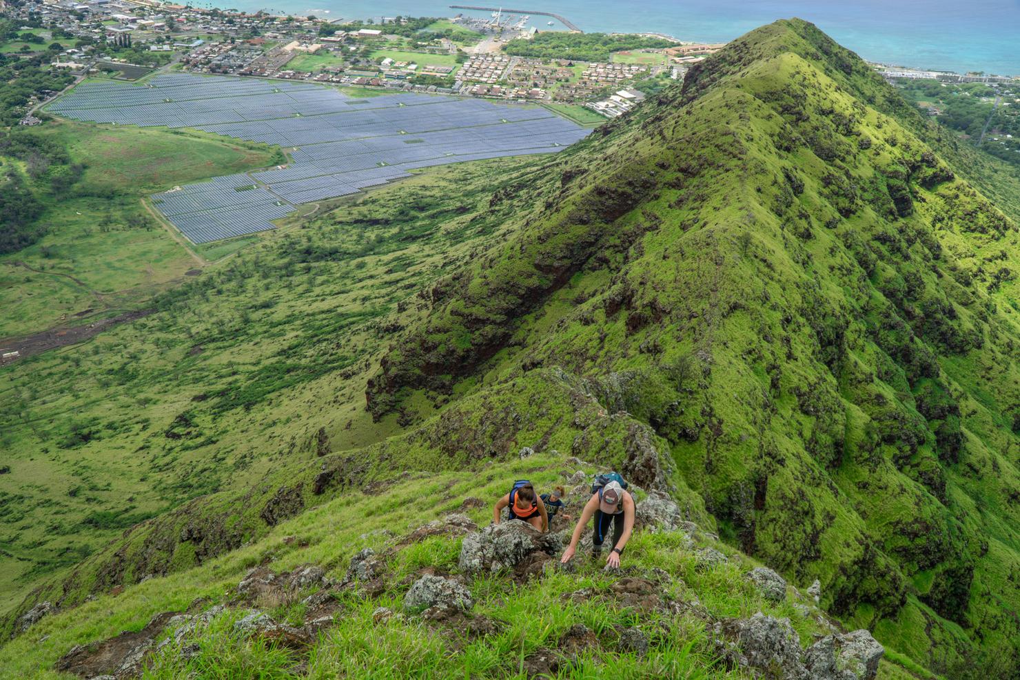
Aloha, Kamaile'unu! At 3270 feet, this is actually the third highest peak. After 4 hours of hiking, I think we all deserve to raise our arms in victory. The views up here are seriously unreal. You get a 360 view of some of the most beautiful and lesser seen ridges on Oahu.
And it looks even better from the air. This shot looks towards Makaha Valley. Often, these ridges are brown since this side of the island sees a lot less rain. But luckily wet winter really brought out some of those colors
The drone also shows all the connecting neighbor ridges. 3 years ago I actually summited this peak once before via a different ridge, Kawiwi. That is still, to this day, one of the scariest hikes I've done on island.
Nature fix complete. Now we had our long 4 hour journey back the way we came but we got to see the beautiful awe of these incredible mountains.