Difficulty: INTERMEDIATE
Time: 2-4 HOURS
Distance: ~4 MILES
Elevation Gain: 700 Feet
Foot Traffic: LOW
Challenges: Very Slippery, Muddy, Finding path into valley, River Crossings,
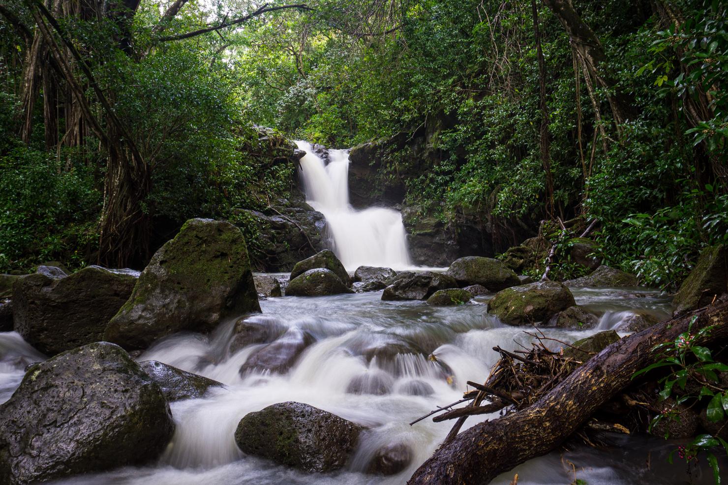
Sights: Kalauao Falls, Waianae Range
What to Bring: Shoes to get muddy, Water, Snack
Only visible after a heavy rain, this waterfall can be reached with a muddy and slippery hike that stems from the popular Aiea Loop Trail. It is not an easy journey, as you will be required to descend a steep slope to get to the base of Kalauao Valley before crossing the Kalauao Stream multiple times. But all that slipping and scrambling will lead you to this pleasant and secluded little waterfall.
Ah winter in Hawaii. While I do love that cool weather (I think it almost got under 70 last night ;)), the other thing this season brings is rain. And recently, a lot of it! For me, it meant I'd have to postpone some of those ridge hikes and start searching for waterfalls. Kalauao Falls had been on my revisit list for some time. After an unsuccessful trek to these falls (it was basically dry), I decided to return, hoping for some good flow. This time, I was not disappointed.
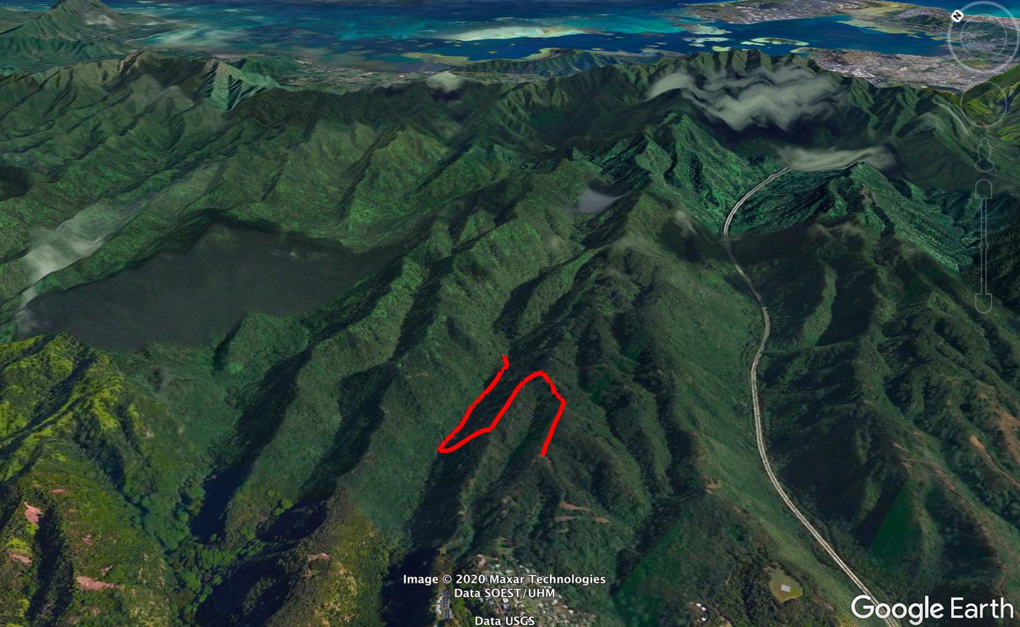
The hike begins on the Aiea loop trail for a short time before cutting onto an adjacent ridge. From here, you will look for the "Purple Tree" landmark that indicates your descent into the valley. Once you reach the valley floor, you will cross the Kalauao Stream multiple times until you run into the falls. Note, if you follow the AllTrails track, it will show this as a loop hike. I would advise against that, for reasons to be discussed later.
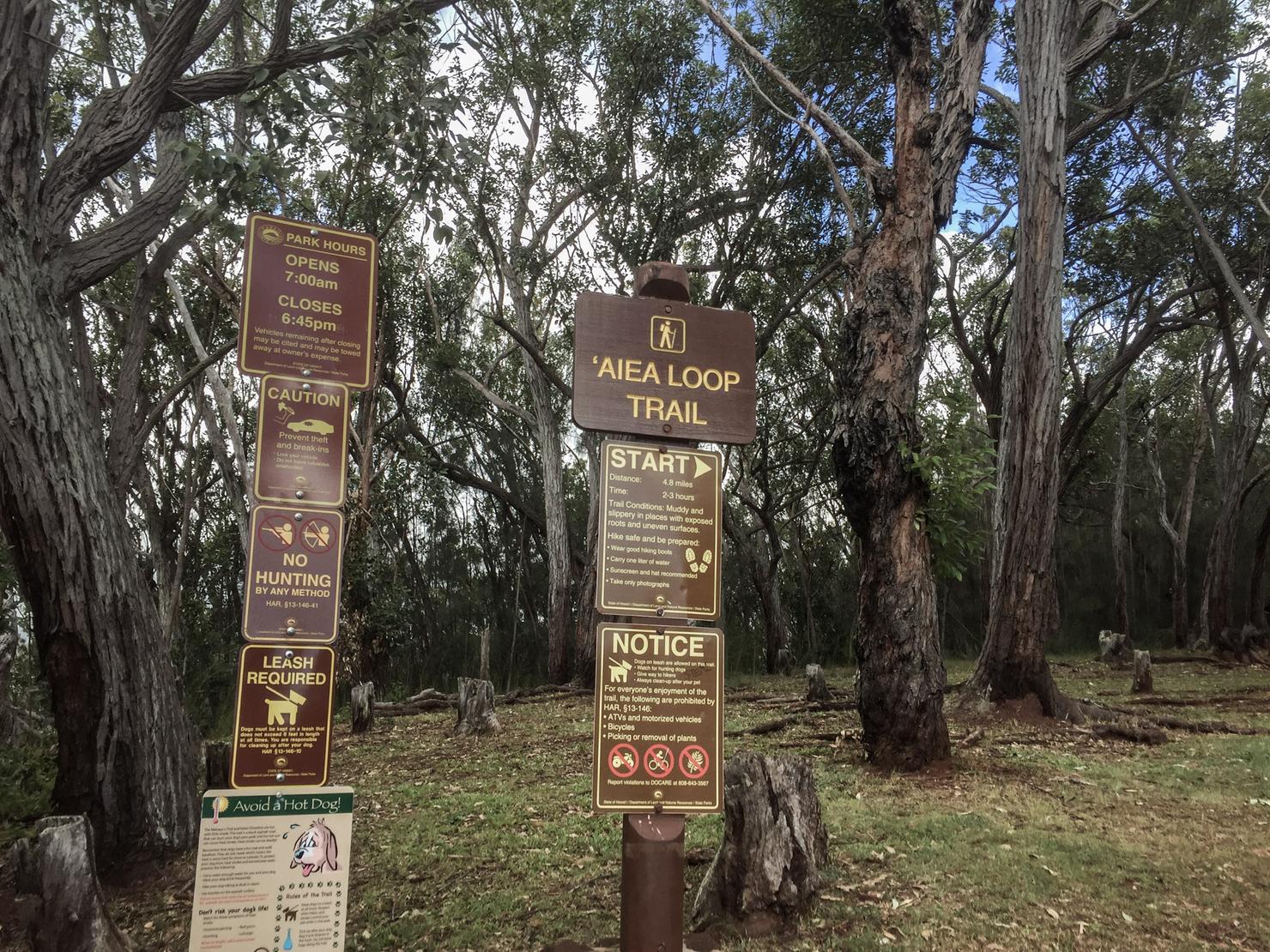
The start of the Aiea Loop Trail is located at the top of a hill in the Keaiwa State Recreation Area. Something to note is the gates to the park close at 6:45 pm, so plan accordingly. Let's hike!
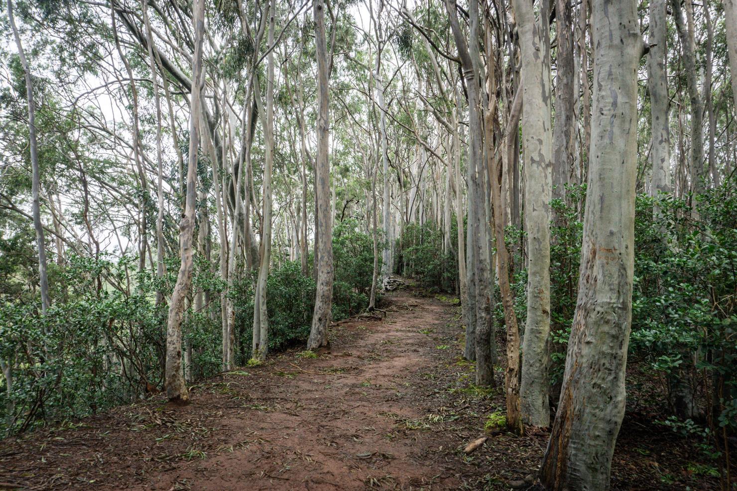
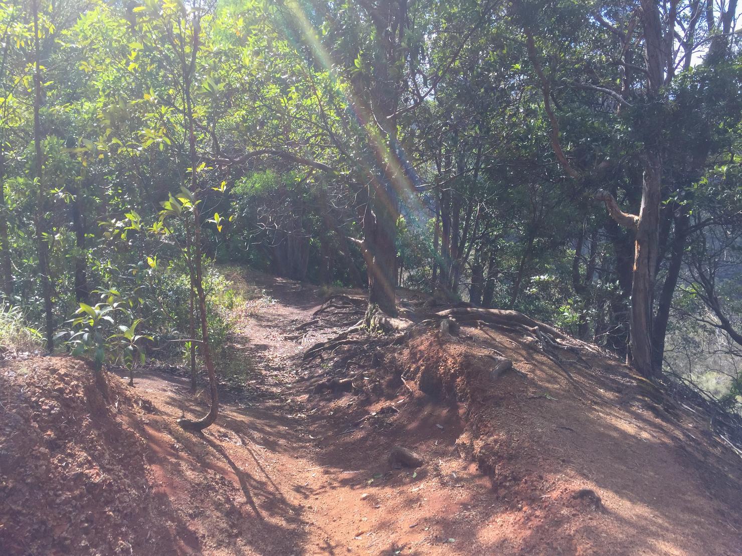
Aloha Aiea Loop! Something about this trail just smells like nature. Maybe it's the dense foliage or the muddy ground that creates this aroma, but every time I come here, I just feel cleansed. Like I'm truly breathing fresh air.
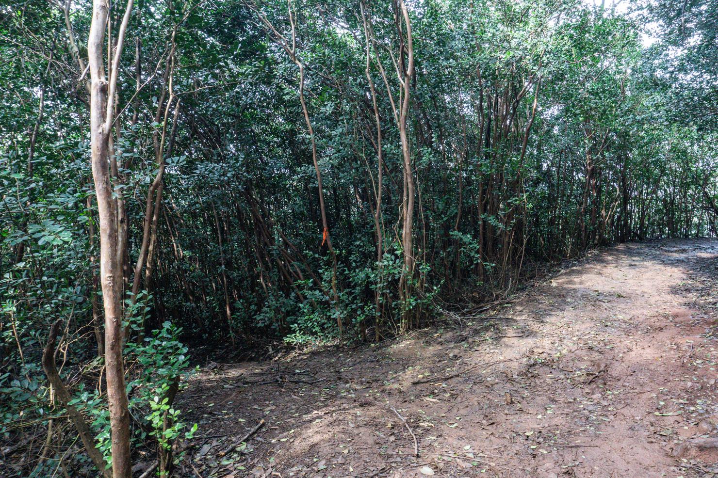
But we won't be on the loop trail for long. Less than 10 minutes into the hike, you will come to an opening in the trees on the left side of the trail. This is the fork to get to the valley. I'd say this fork is pretty easy to spot, but I missed it my first time hiking to the falls...
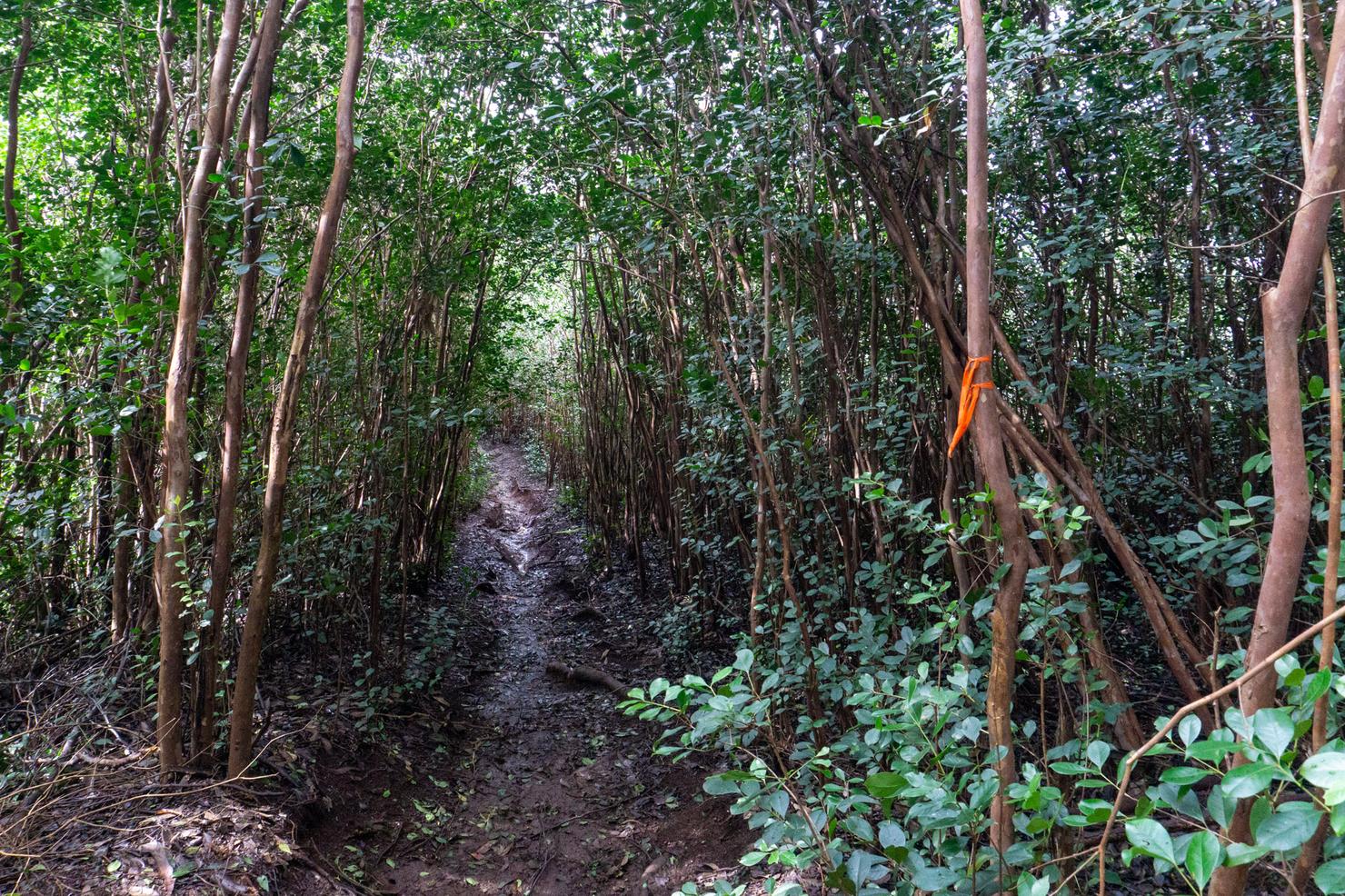
After the fork you will walk through the trees for a short bit.
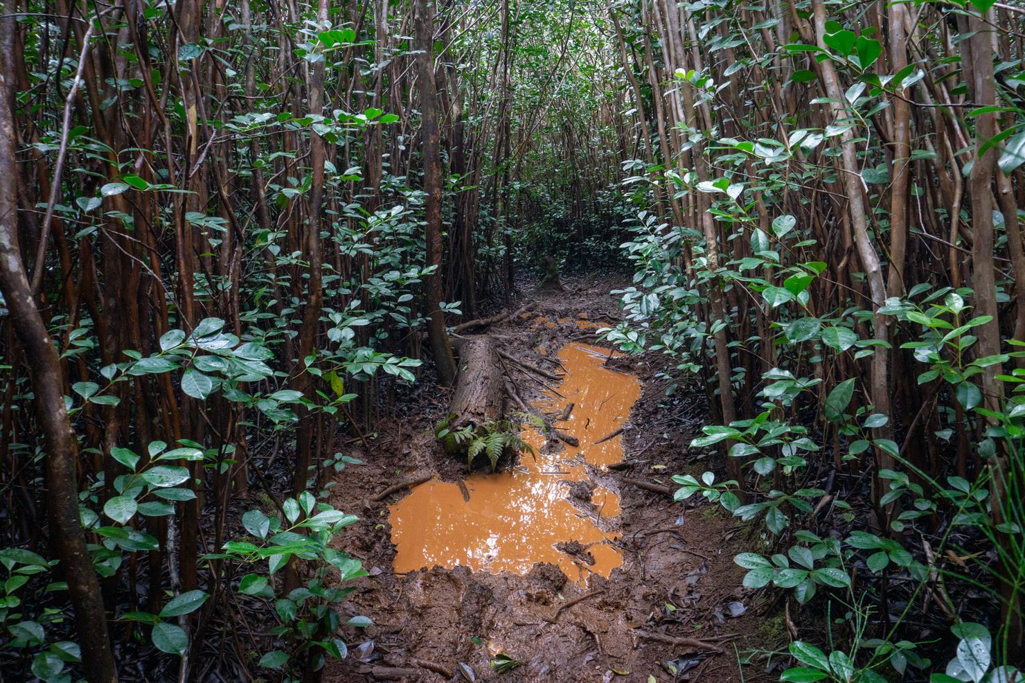
And (hopefully) avoiding a bit of mud.
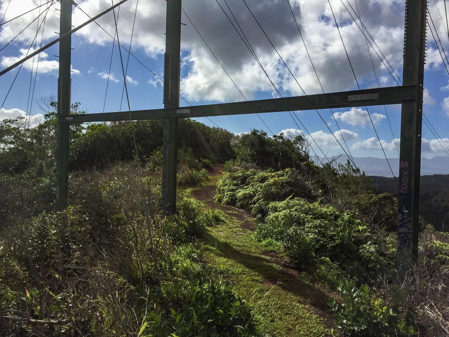
Then you will pop back out on this ridge underneath this powerline structure. Take in these ridge views while you can, because there won't be many views once we get into the valley.
The trail will open up again. This is when you really need to start paying attention, because the fork to the valley is coming up. There are two spots where it looks like the trail might split off into the valley to the right.
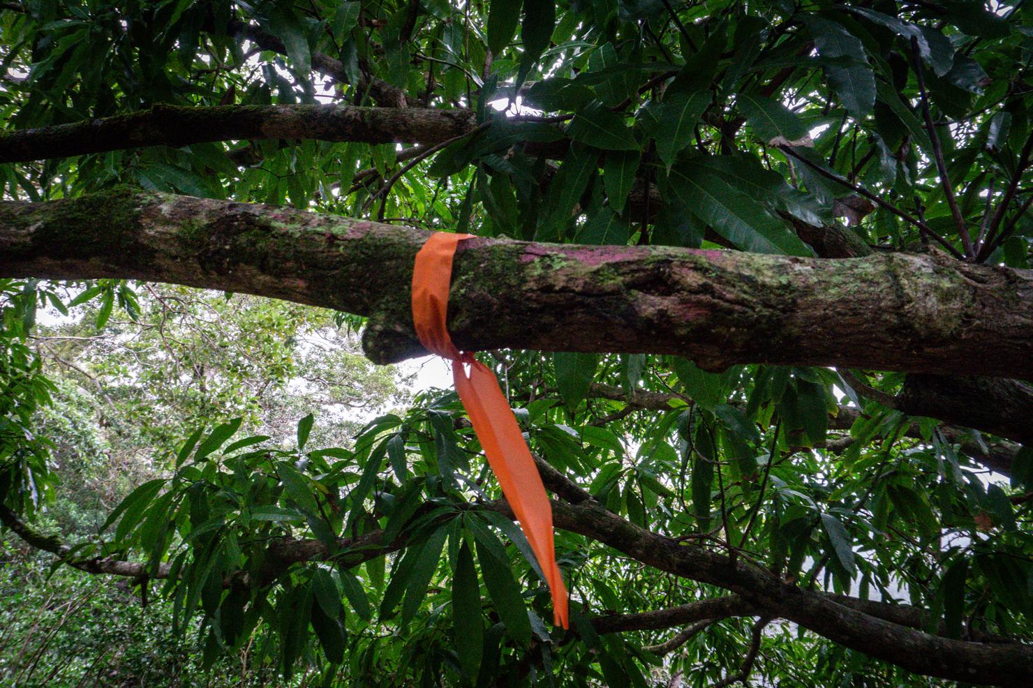
Wait until the SECOND junction and look for this tree branch painted in purple. This signifies the path down. I reached this junction roughly 15 minutes after departing from the Aiea Loop.
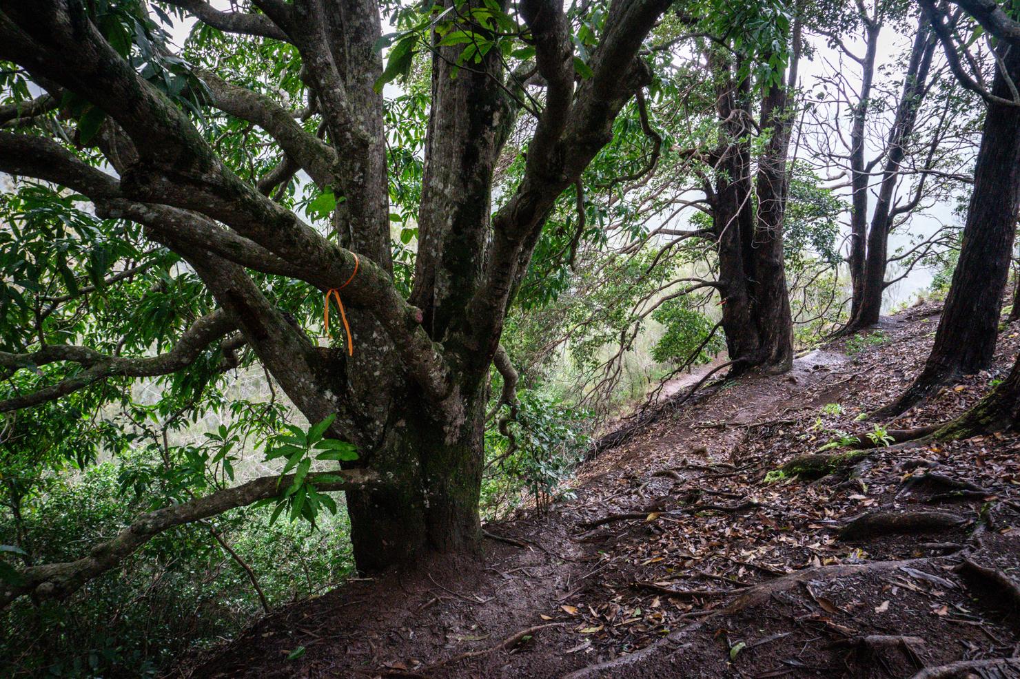
To the right of the Purple tree, the path looks like this. Follow this to get to the valley floor.
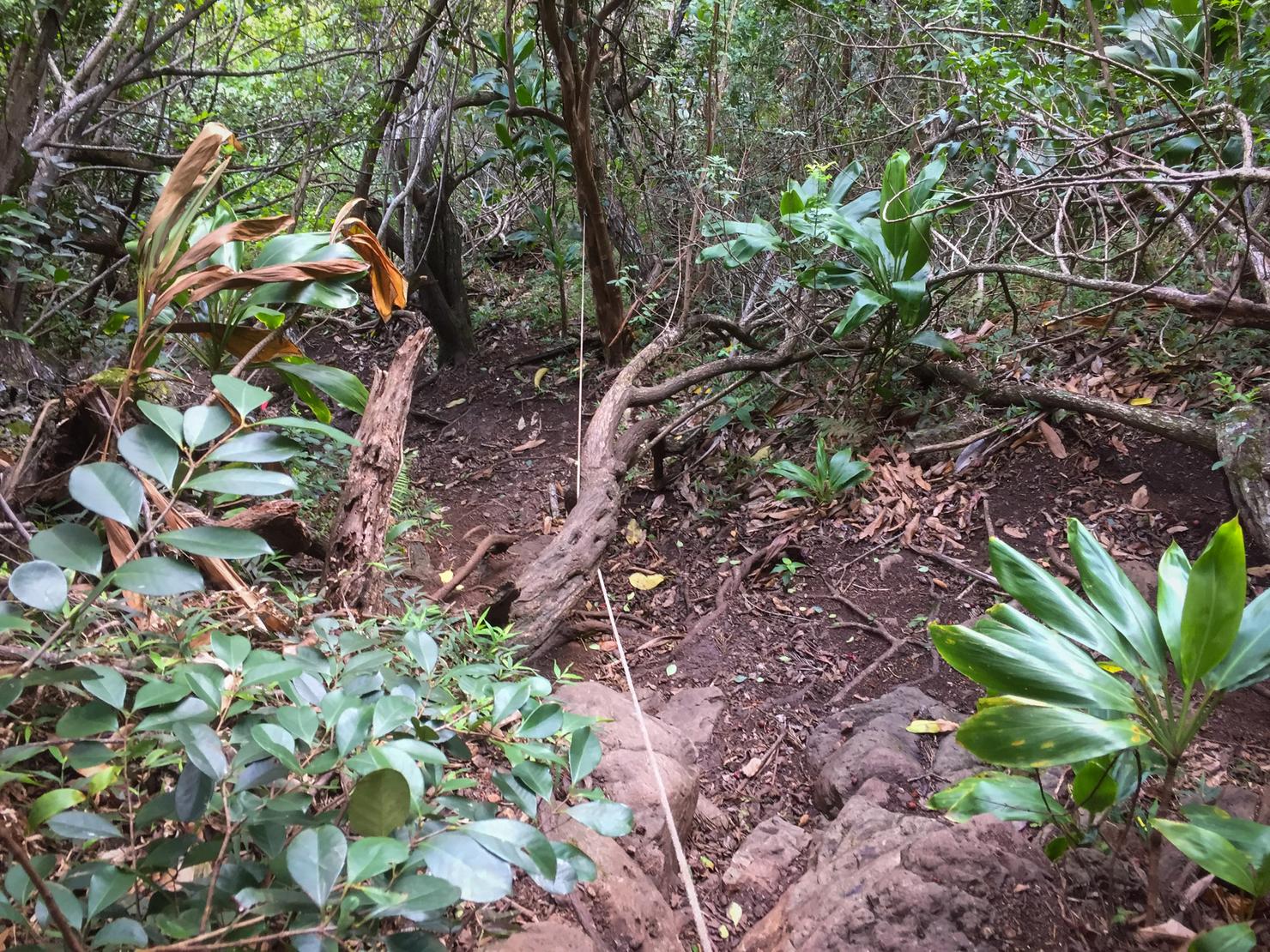
The trail down to the valley is well marked. But it is pretty steep and if you're lucky, slippery. I say lucky because it really needs to be wet for the flow to be good. There are a few ropes to help you out on the descent.
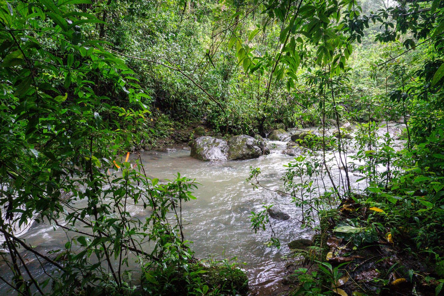
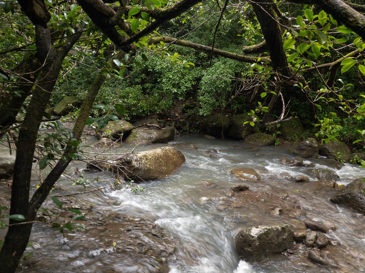
We've reached the bottom! From here, we are going to follow the river right and upstream to reach Kalauao Falls. Unlike the last time I was here, there was actually water in the stream. And it was moving! You could literally hear the water rushing over the rocks. (Quick safety note, flash flood are a risk anytime you are hiking in a valley. So be careful). This was one of the quicker flowing streams I've crossed, but I managed to get across without too much trouble.
And then I had to cross the stream another 7 or so times. That really is the challenge/fun of this hike, either rock hopping or fording the river without falling over. I DO recommend following these markers and crossing the stream where they indicate. It may seem like zig zagging, but you are taking the path of least resistance.
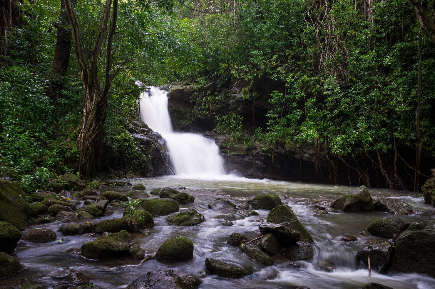
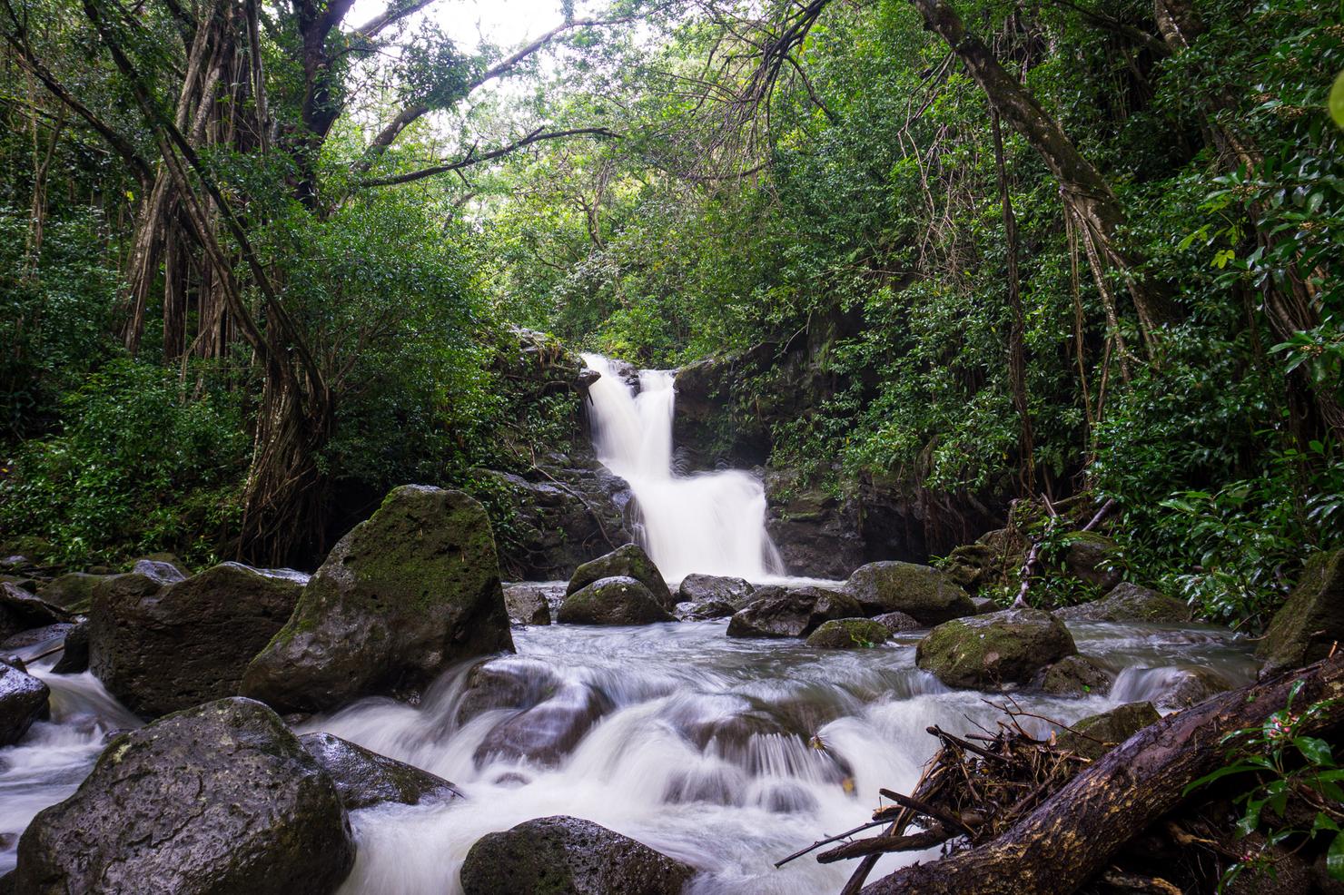
After about 30 minutes, we reached the falls! A massive upgrade from the last journey here--it was raging! Wasn't really feeling a swim today, so I decided to take few pics.
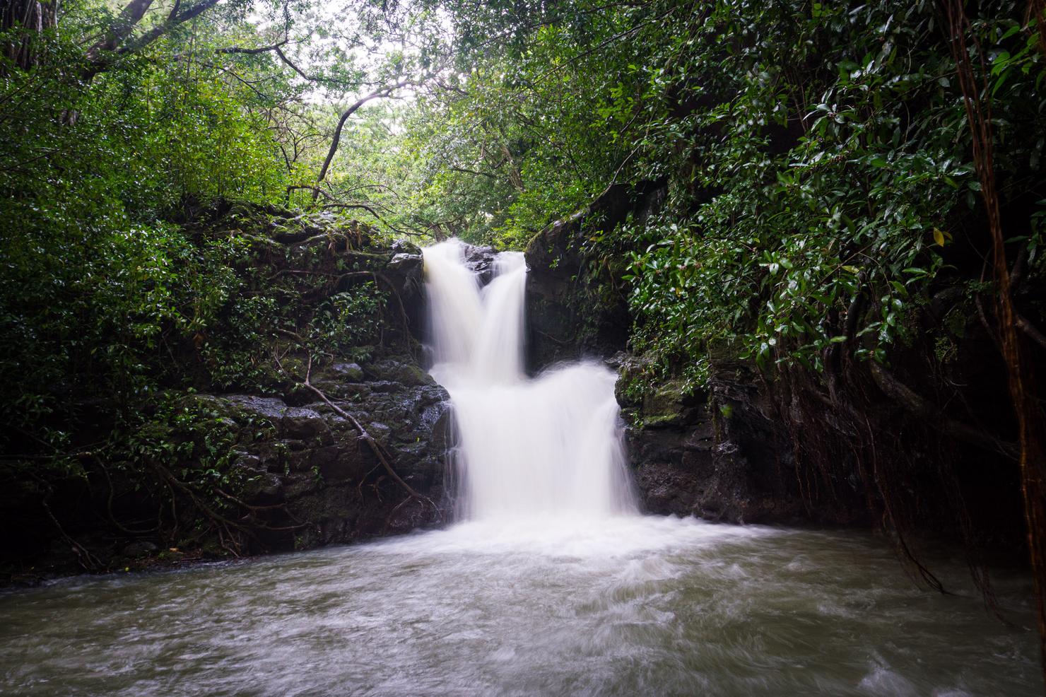
The flow was so strong, I don't know that you could even swim without being pushed back towards the rocks.
So I'll just soak in this moment metaphorically. Sitting on a rock and listening to the roar of the falls. I guess rainy season ain't too bad.
Once I had gotten my fill, it was time to make my way back to the car. Feeling adventurous, I decided to follow the AllTrails track to attempt to make this a loop. I continued up a path to the left of the falls.
Initially, the trail was pretty easy to follow. There were ribbons and river crossings, just like my trek to the falls.

But soon it changed. I ran out of ribbons, and was basically just paralleling the stream deeper and deeper into the valley. Checking the track, I backtracked and managed to find a pink ribbon on the right side of the stream that look like it coincided with a big turn in the track. I then hooked a right and started heading in the downstream direction. Now, however, I was higher up on a graded ridge.
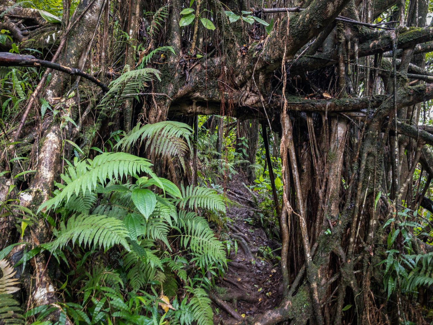
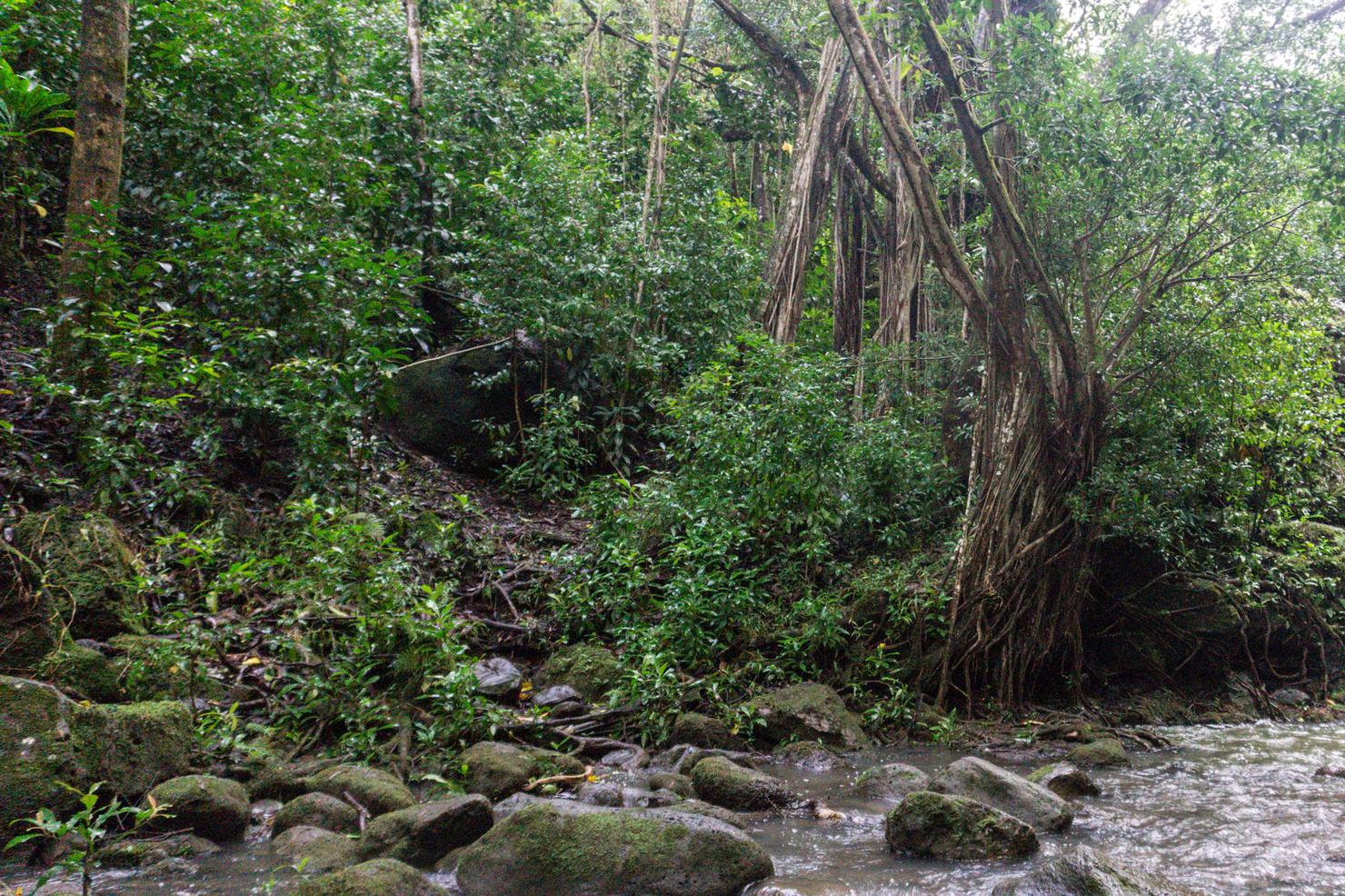
I continued to see trail markers and, given that the Alltrails track showed a higher elevation, I figured I was on the right path. This little tree doorway was the most noticeable landmark I saw on that path, so I made a mental note of it if I do ever decide to return on this route.
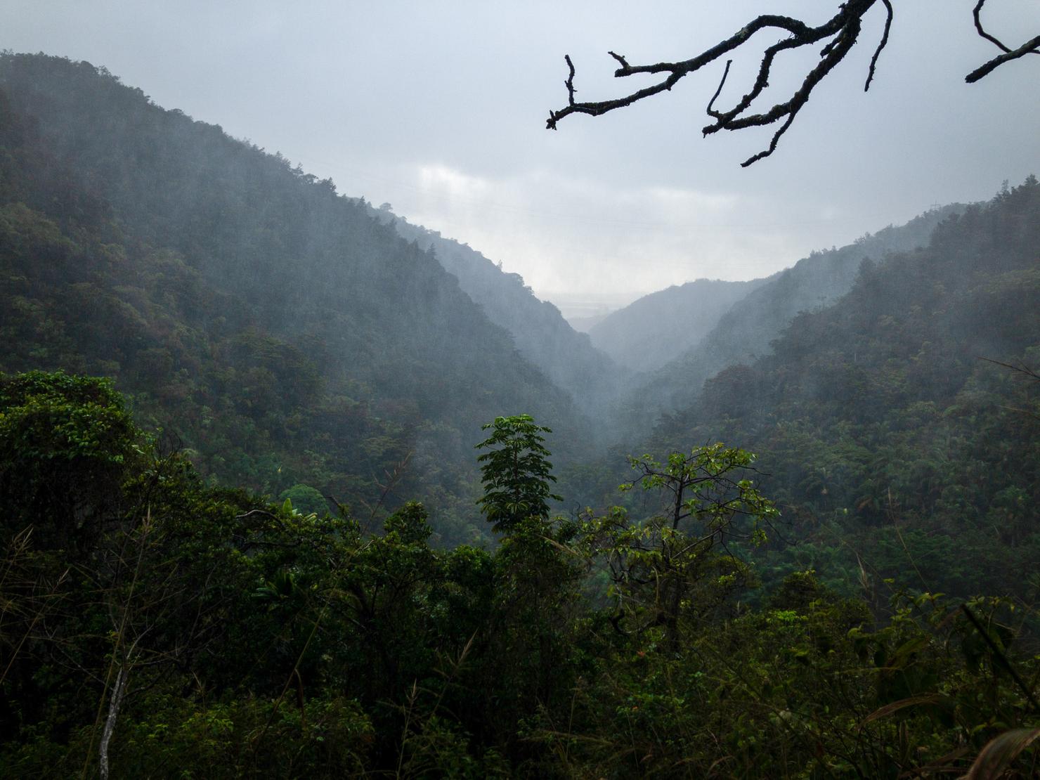
The pleasant surprise to this portion of the trail was when it opened up with a gorgeous view of the valley. Yes, that is rain. A strong downpour had started. But, I was already pretty wet muddy, so it didn't make much of a difference in my mood. In fact, I enjoyed it. Something about that rainy haze coupled with the green valley was just beautiful.

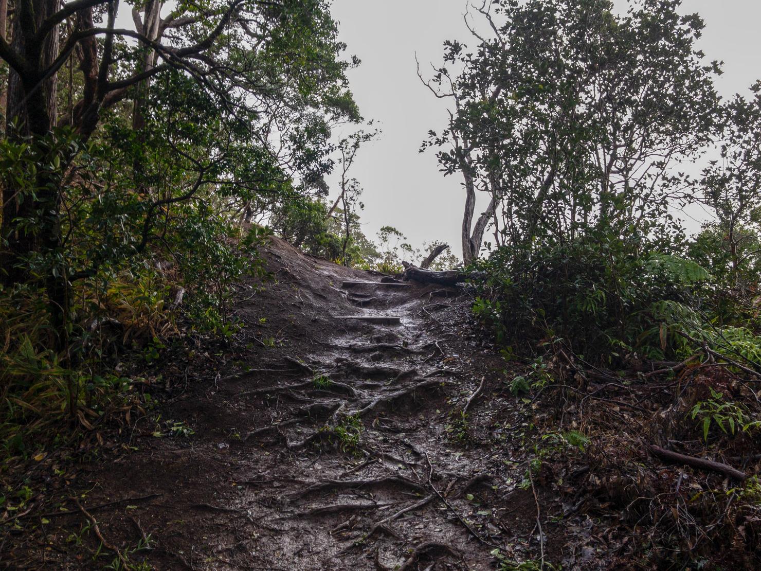
However, the ascent back to Aiea Loop did dampen my mood. It was overgrown with ulehe ferns, and leaving my pants at home, gave me plenty of micro cuts as I forced my way through. Because of this section and the fact that it seems pretty easy to get lost., I recommend taking skipping this part of the loop and making it an out and back. But that is just me.
But I did manage to find my way back to Aiea Loop. I was surprise to find that the trail ended up linking back up with the loop trail at the fork to Aiea Ridge Trail. I guess all that bushwacking and rain had me a little turned around. But luckily, I knew the way home from here. I think I earned myself some hot takeout. Udon anyone?
While it wasn't all sunshine and rainbows, I was very happy I returned to these falls and even more happy that I got to see some good flow. It was like mother nature gave me an early Christmas gift. I suppose I was a good boy this year :