Difficulty: EXTREME
Time: VARIABLE Based on Route (Our Journey ~5 Hours)
Distance: VARIABLE
Elevation Gain: 1500 FEET
Foot Traffic: LOW
Challenges: Hot/exposed/steep climb, Free Climbing, Narrow Ridges With Steep Dropoffs, Crumbling Rock, Overgrown
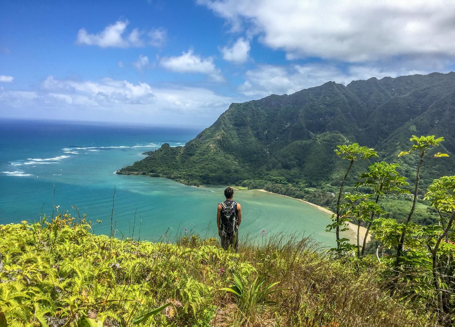
Sights: Windward Coast, Kahana Valley, Ko'olau Range
What to Bring: Lots of Water, Snack, Good Hiking Shoes, Sunscreen, Rope?
One of the more extreme Oahu hikes, this ridge is located on the Windward side of the island, near Ka'a'awa. You start by ascending a steep and exposed trail to reach the ridgeline. From here, you can either take the Mauka (toward the mountain/summit) route or the Makai (toward the sea) route. The most exciting part of this hike is traversing several notches and the "teeth"-- steep rocky free climbs and scrambles where one misstep could be fatal. This is an adventure for experienced hikers only.
Finally, a hike/climb other than Kawiwi to Kamaile'unu Ridge that I can label Extreme. Pu'u Piei's physically brutal ascent, narrow ridges, and tricky free climbs surrounded by steep dropoffs make this hike a tough one. There were a few instances traversing those notches where a fatal fall was a real possibility and relying on the ropes was necessary. While it still didn't quite match Kawiwi's overall physical and technical difficulty (it did only take 5 hours), I think it's safe to say this is an Extreme Hike.
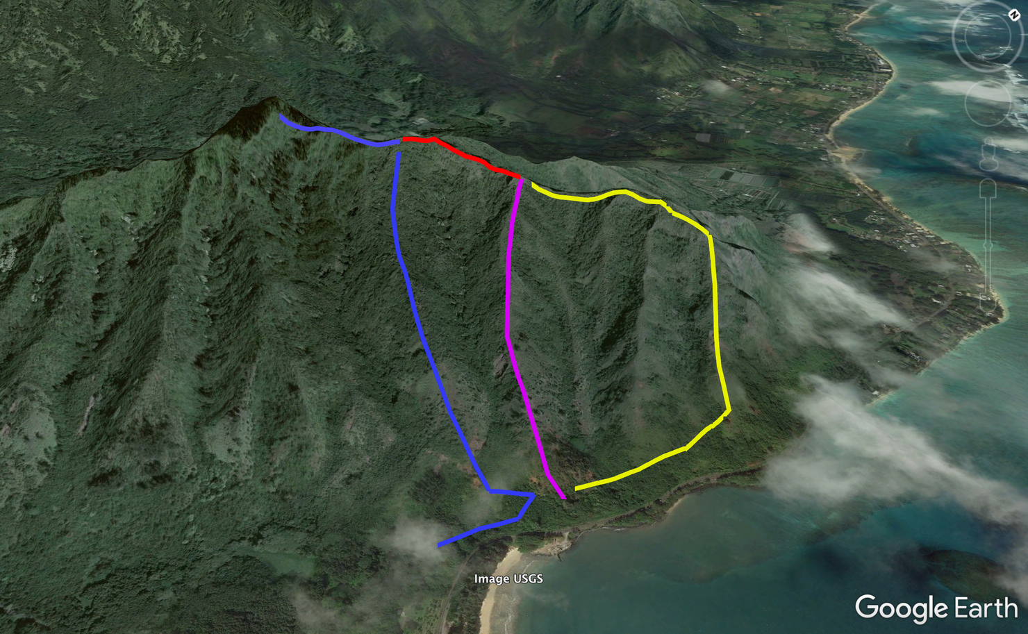
When my hiking buddy Peter and I looked for information on this hike, we couldn't find much. I decided to draw this Google Earth Image to attempt to clarify. From the looks of it, there are three paths that will get you to the ridge. Peter and my path was up the center (purple) path, across the red path (where the dangerous notches and "teeth" are located), up to the summit (blue), and then back down the left path (also blue). Many people call the hike to the peak the Mauka (towards the mountains) path and it can be done without doing the notches.
The yellow path would be the Makai (toward the sea) path and was not one Peter and I did. This is a create your own hikes kind of place. The distance and time will vary based on which ridge you take. This is a VERY ROUGH illustration of this ridge, so don't take it as gospel, but hopefully it gives you an idea of the possibilities it has to offer.
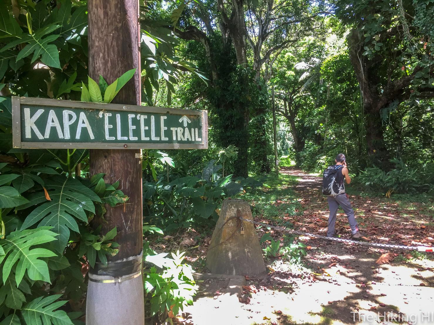
This is the best place to start the hike. It's located right by the Visitor Center for the Ahupua'a 'O Kahana State Park, which has its own parking lot. There's also a lot located closer to the beach.
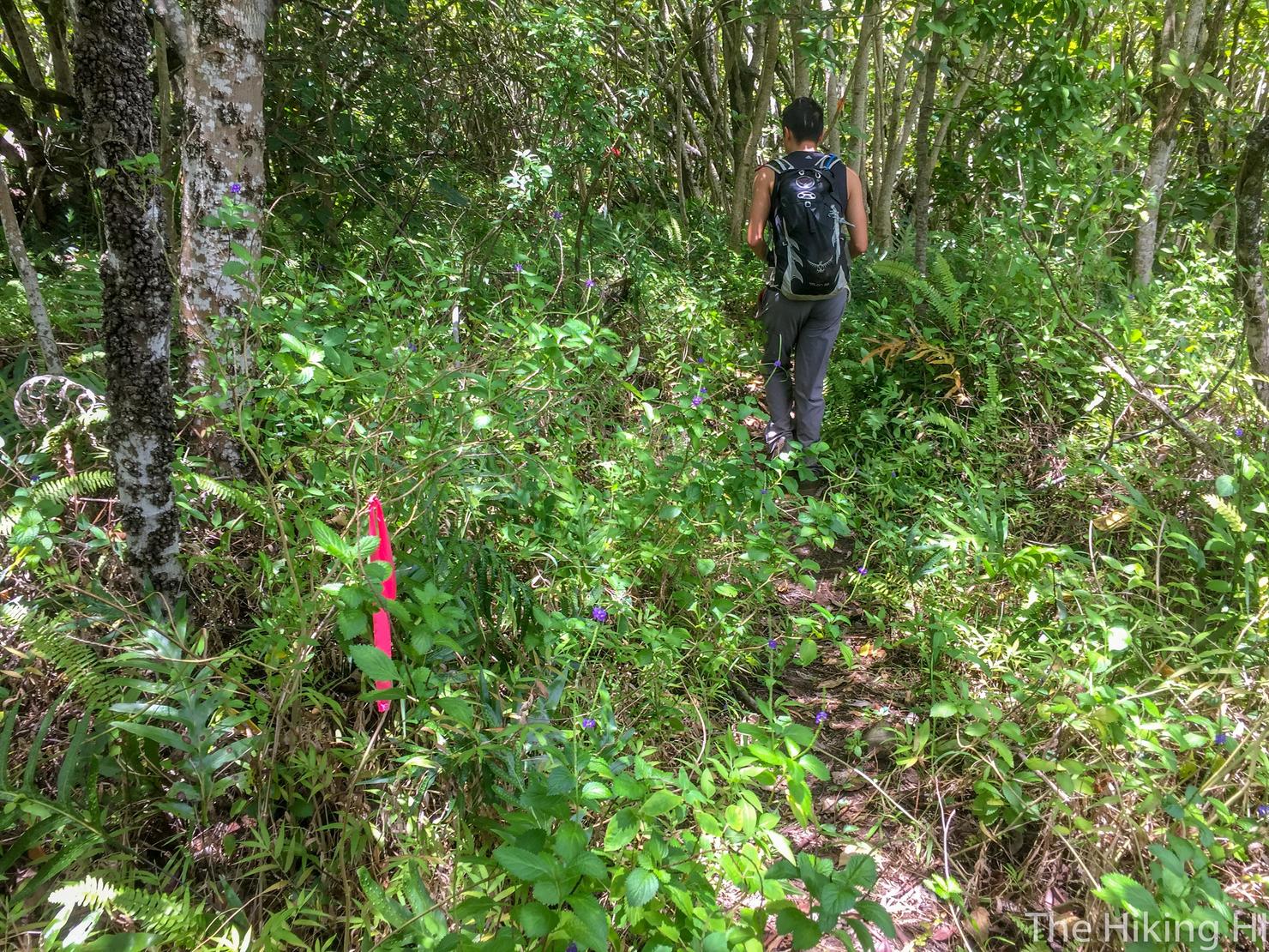
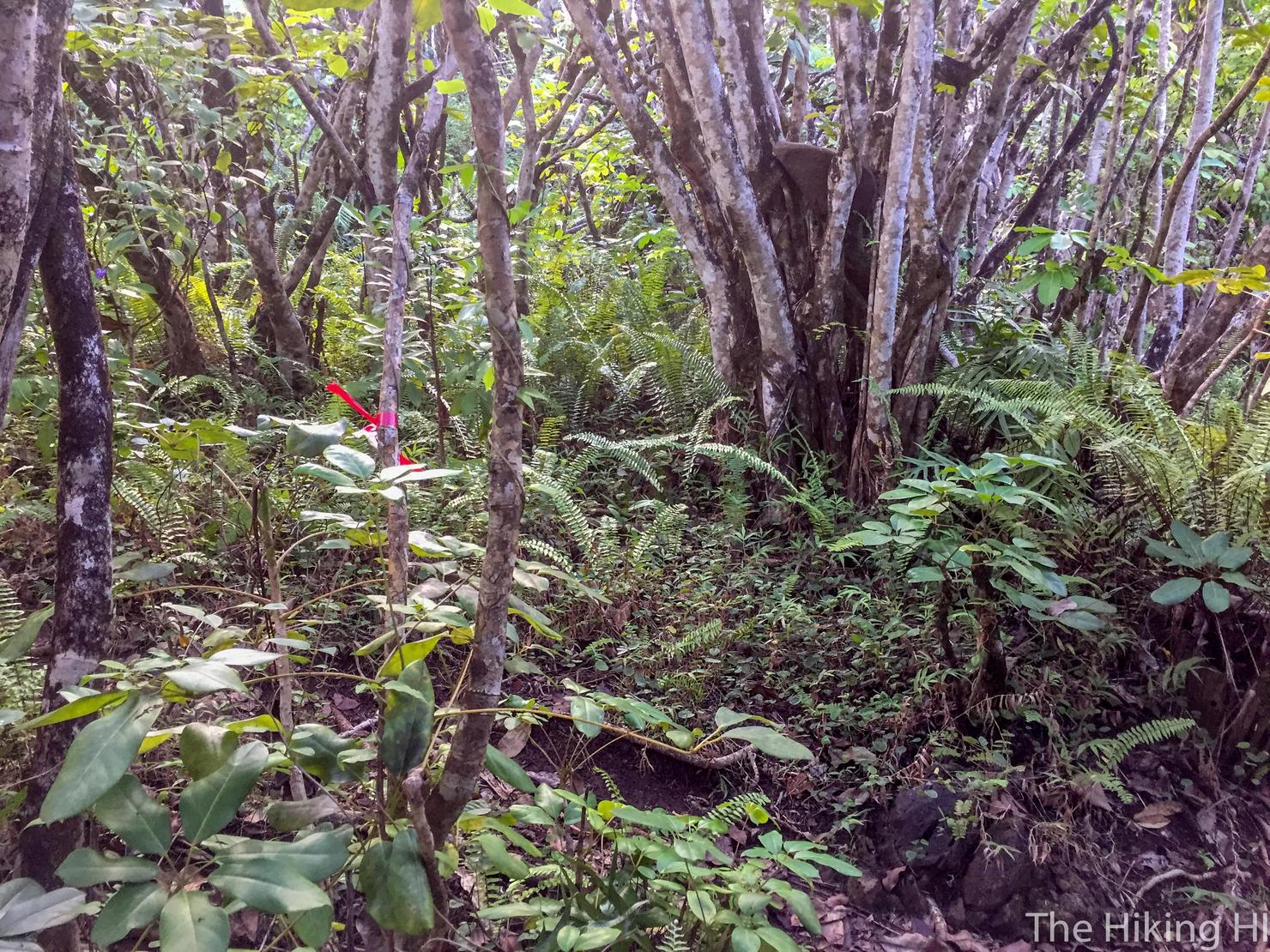
You will follow this obvious path with markers for a bit. Some of the older information we found on this said to take a left at Power Pole #3 to find the path to the ridge. This may have been the case several years ago, but from our experience, following these markers will get you to the right place... or at the very least to a path that will get you to the ridge.
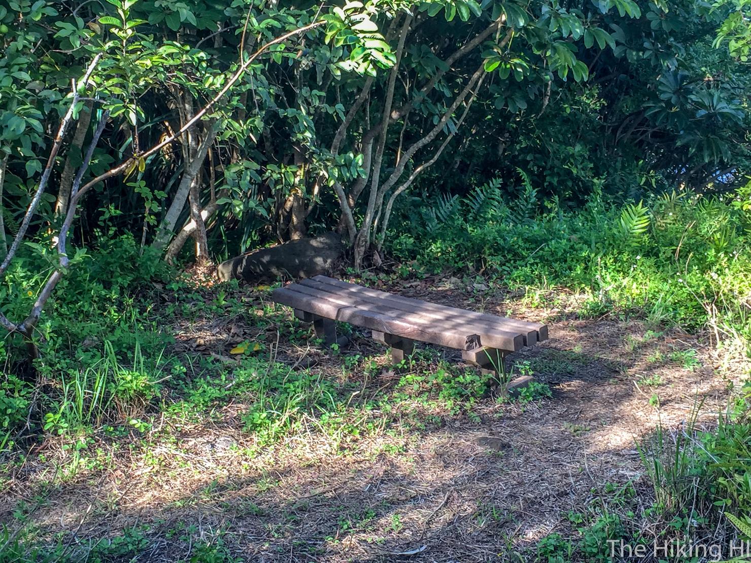
Continue following that path which will sort of parallel the road. Eventually you reach this bench.
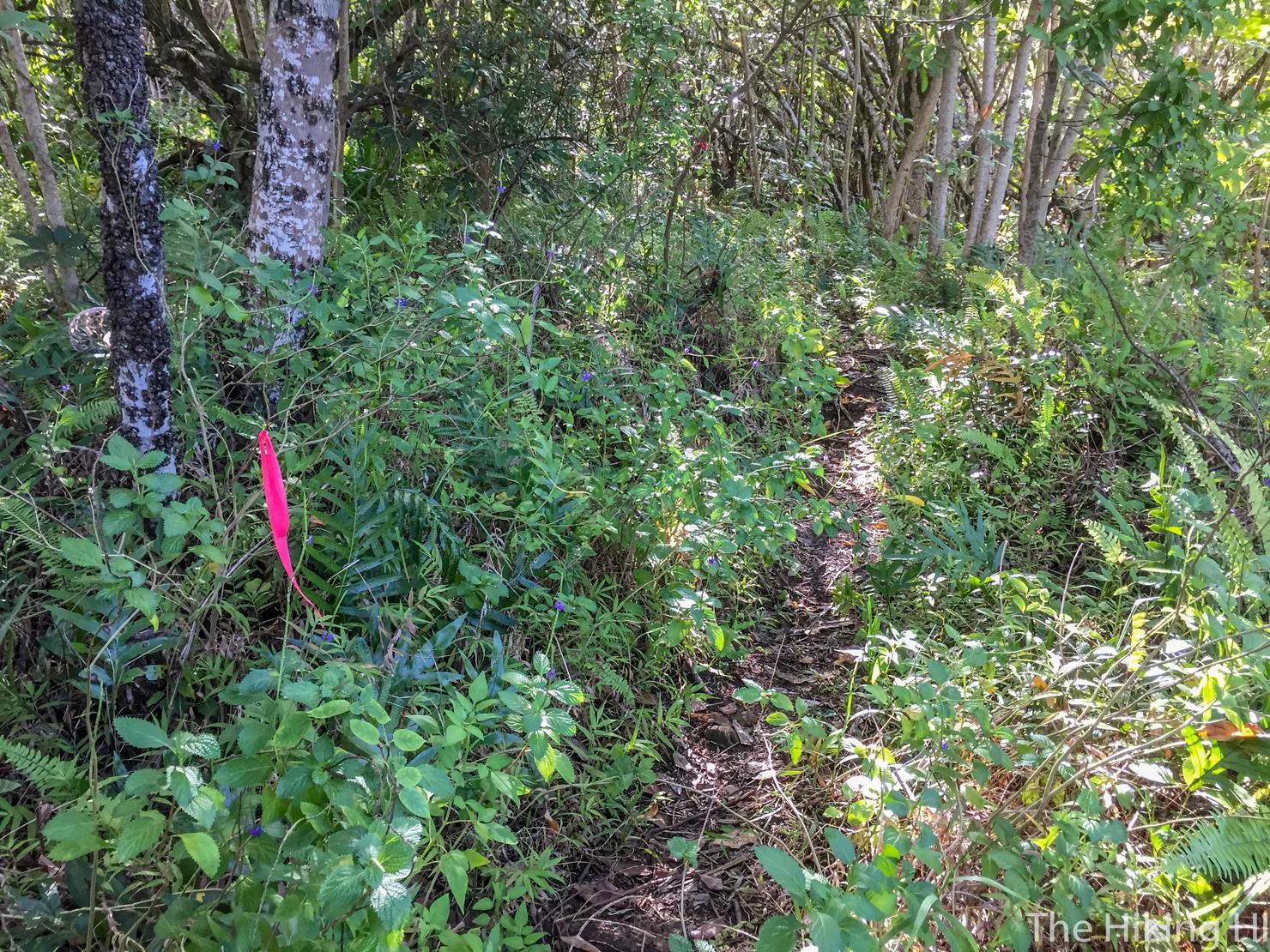
Just behind you should see an opening with this marker. Walk this way.
And shortly after you will come to a fork. If you head left, the path will follow you all the way up to the left most ridge (Blue Ridge), the ridge farthest inland and closest to the summit. I know this because this is the ridge we came down during our descent. Our original plan was to take this path during the ascent. Unfortunately, not knowing our way, Peter and I decided to go right.
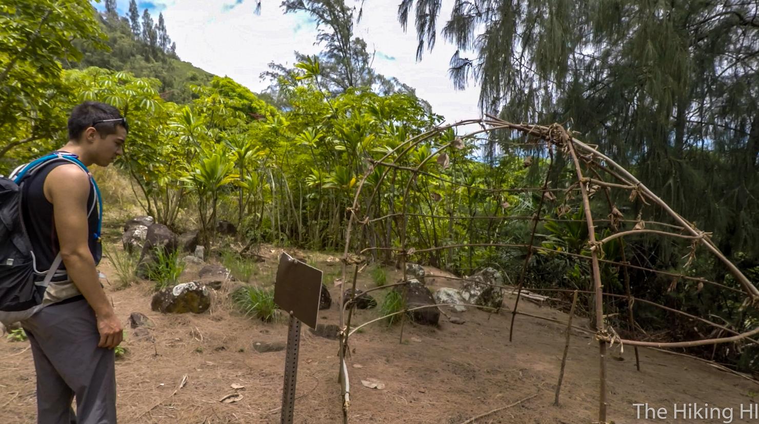
And going right put us back on that original trail that parallels the road and eventually led to this exotic structure. Shortly after this structure, we saw another fork that led inland to the center (purple) ridge. However, this trail that was paralleling the road did continue. Although I don't have proof, I'm pretty sure if you kept following it, it would lead you to the right most (yellow) ridge. I'm sure these directions completely confused you. Anyway we took the fork inland and headed up purple ridge.
The ascent begins.
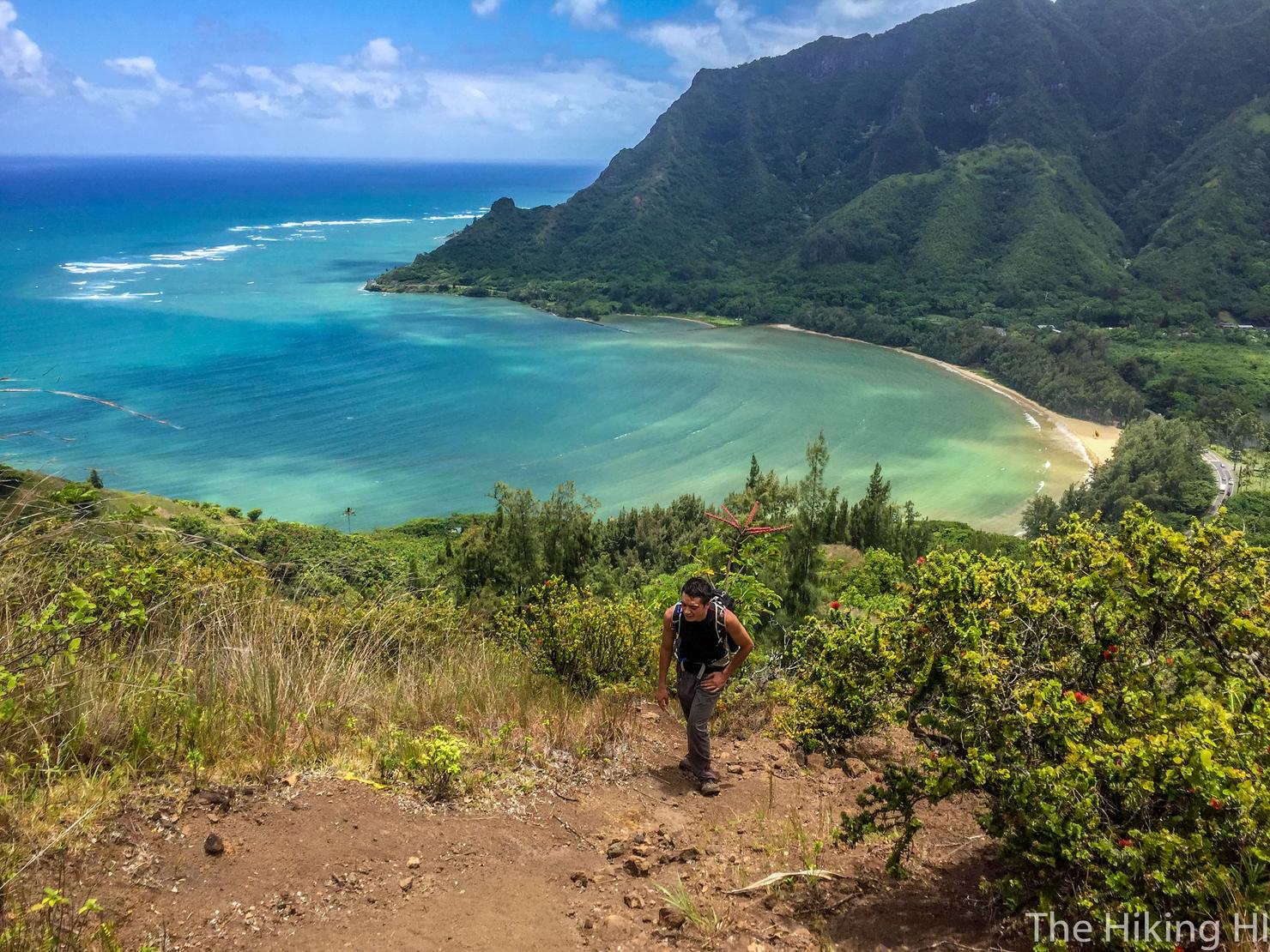
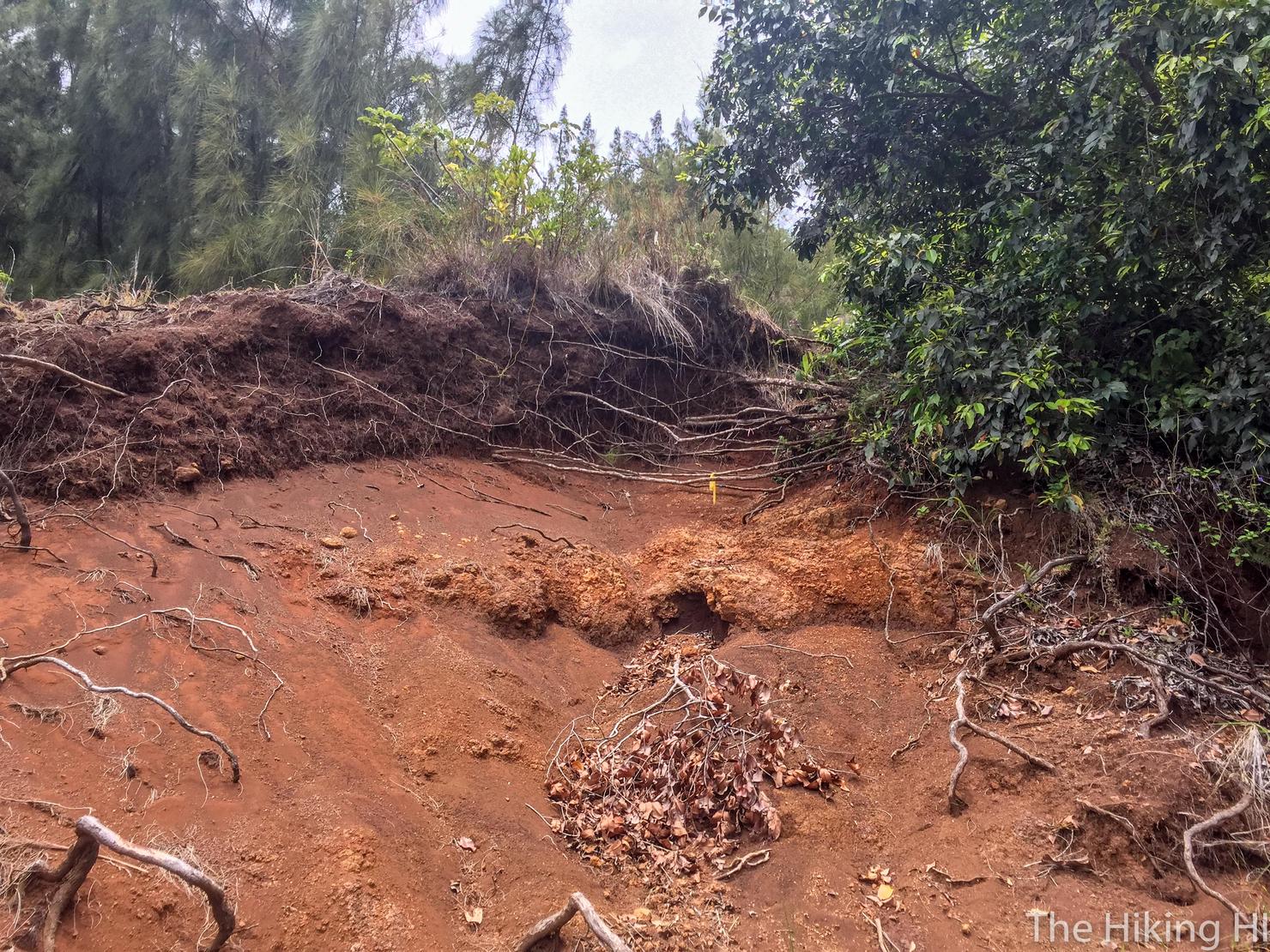
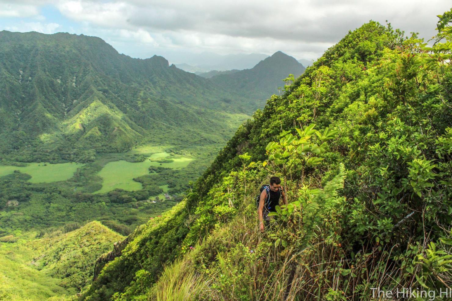
And the ascent SUCKS. It is very exposed and plenty steep. We started our hike right around noon, so we had that midday sun beating down on us. We had to take numerous breaks. Despite being a smaller elevation gain, I felt like this initial ascent was much tougher than that of Pu'u Manamana, the ridge behind Peter in this picture.
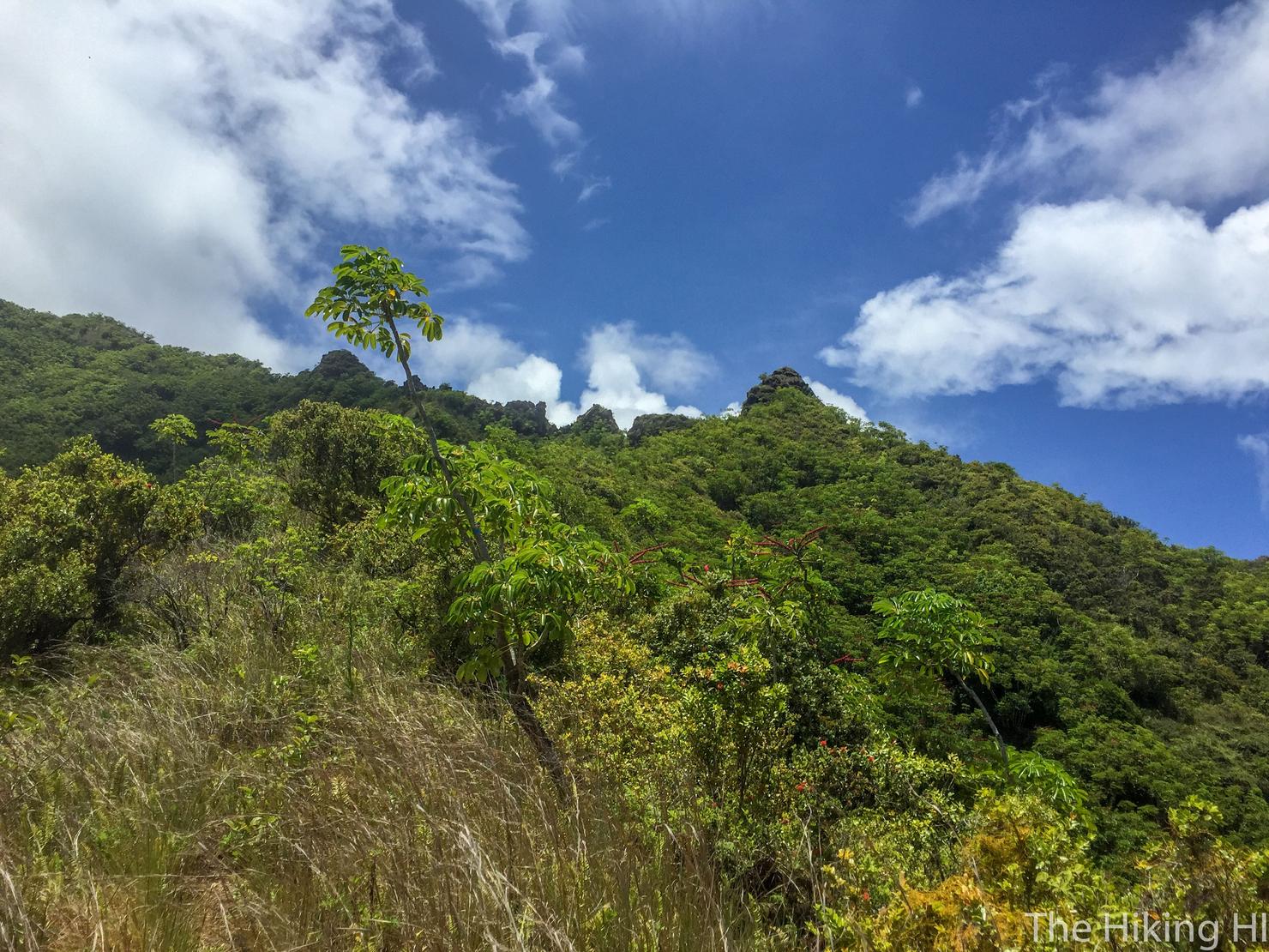
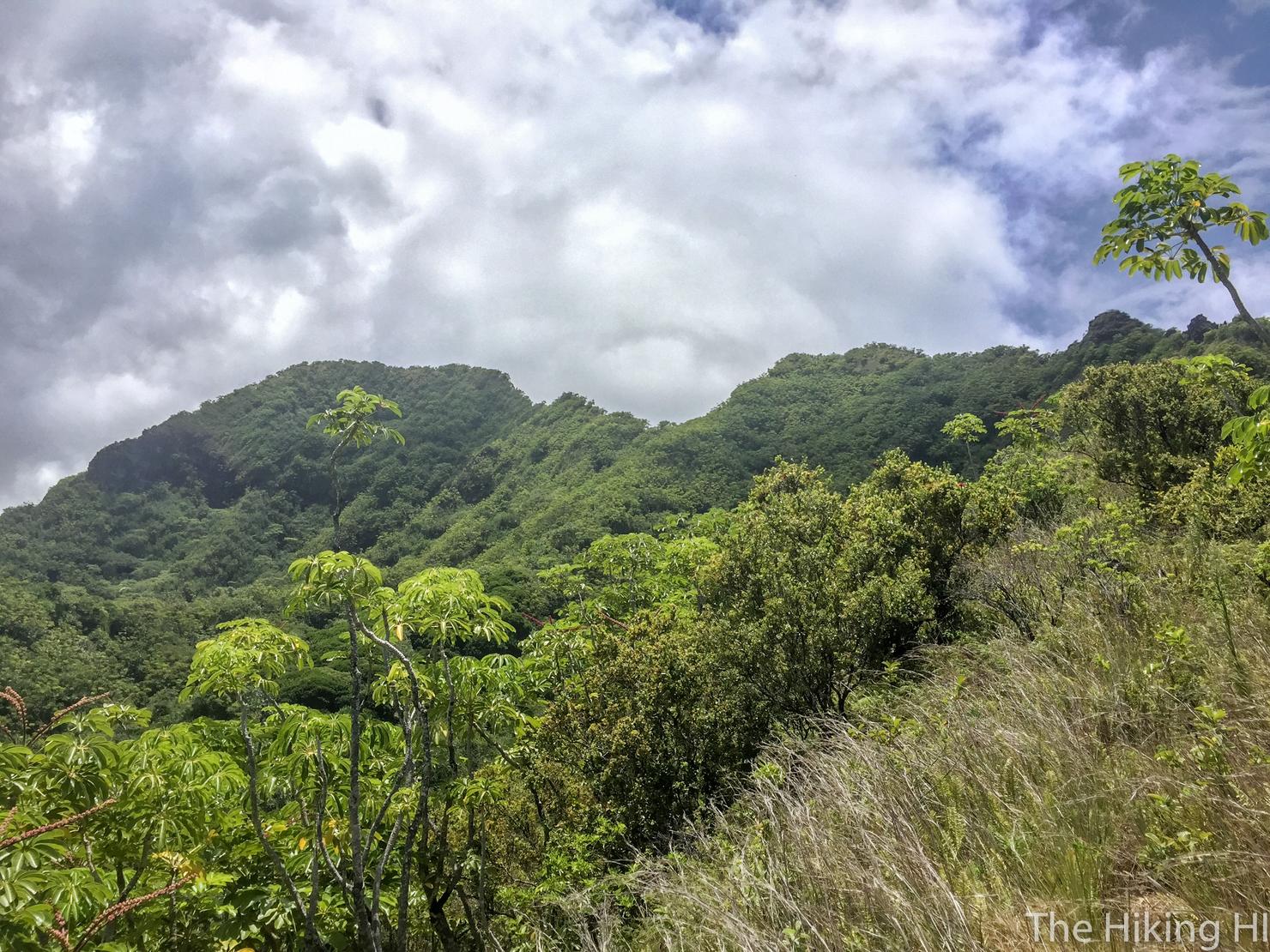
But we pushed on towards the ridge. You can see some of the notches and teeth coming into view.
And there's the summit all the way to the left. But let's not get ahead of ourselves, we need to get to the ridge first.
I found this ascent a great opportunity to take some photos, if only just to take a quick break. This area really is quite scenic.
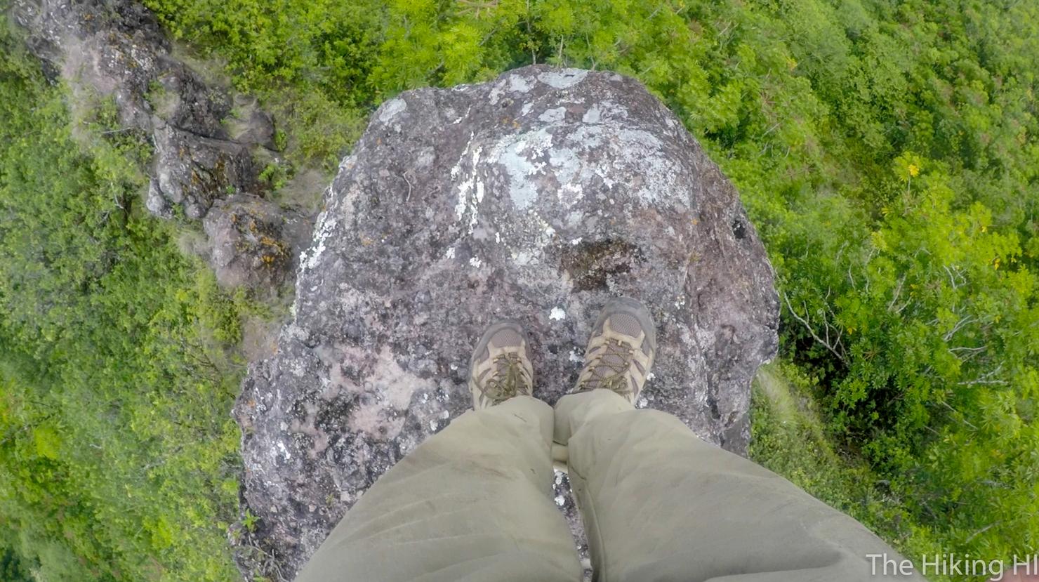
Almost there, that mound is the top of the ridge.
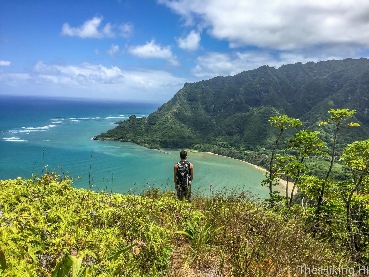
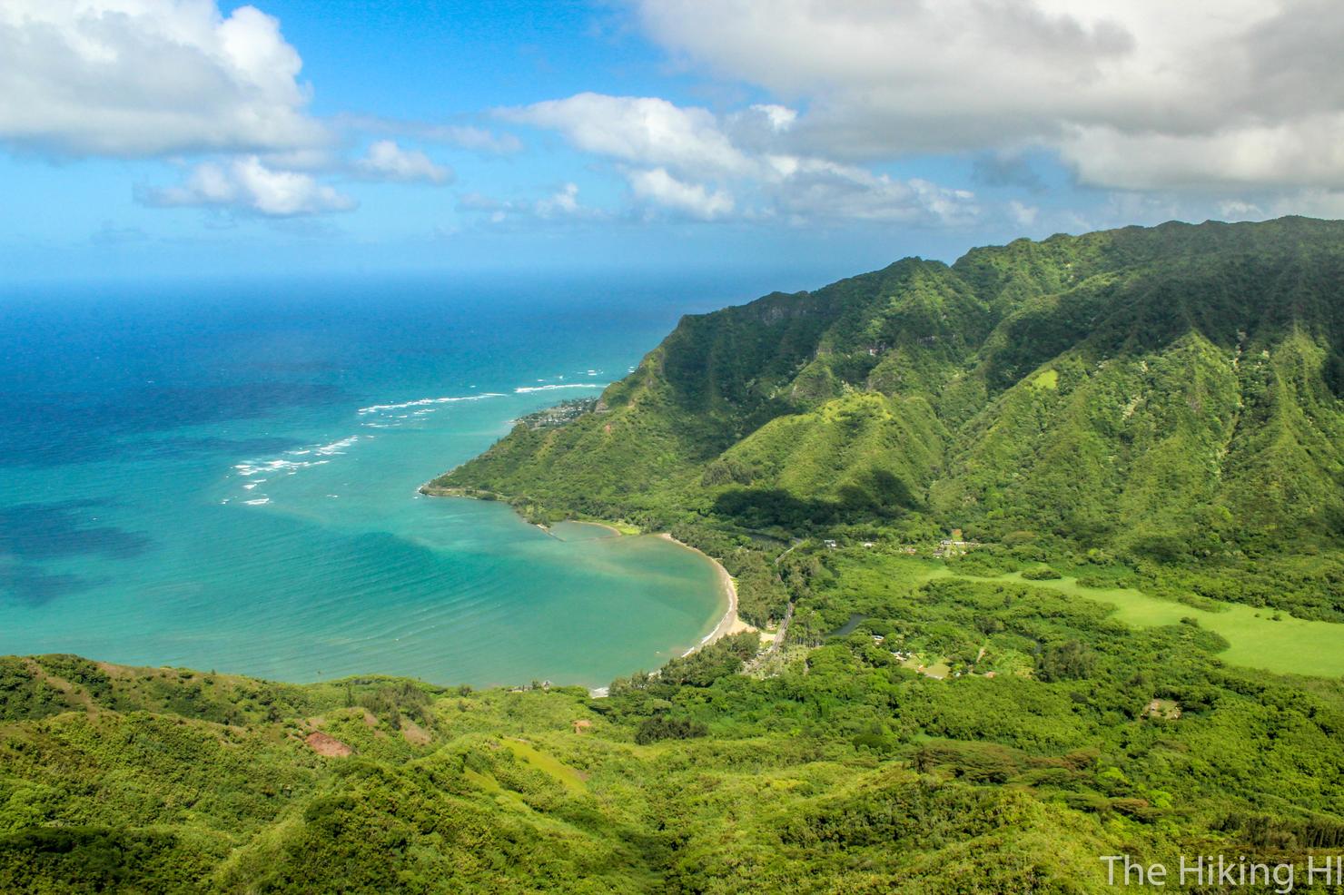
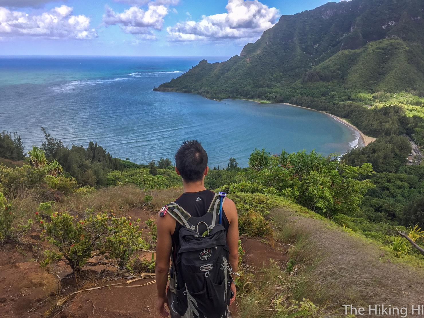
We made it! The views along the windward coast were spectacular.
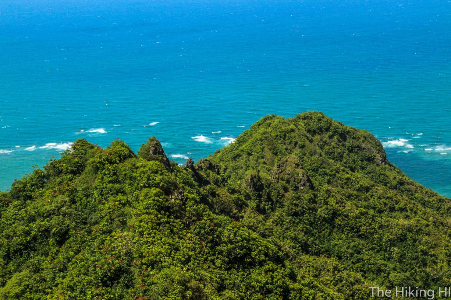
And if you look towards the ocean, you can see the Makai (yellow) path. It definitely looks like a beautiful and scenic hike.
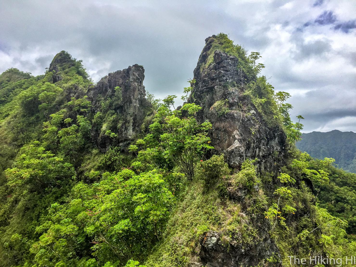
But this is why we're here, the Notches and Teeth of Pu'u Piei. We were warned by a pair of hikers on our ascent that the ropes attached to these notches were a bit questionable. I guess we'll have to see for ourselves.
Let's do this!
Peter and I were able to ascend the first notch without too much difficulty. It definitely wasn't easy, but we've done our share of hikes like this, so I think it's safe to say we have some experience.
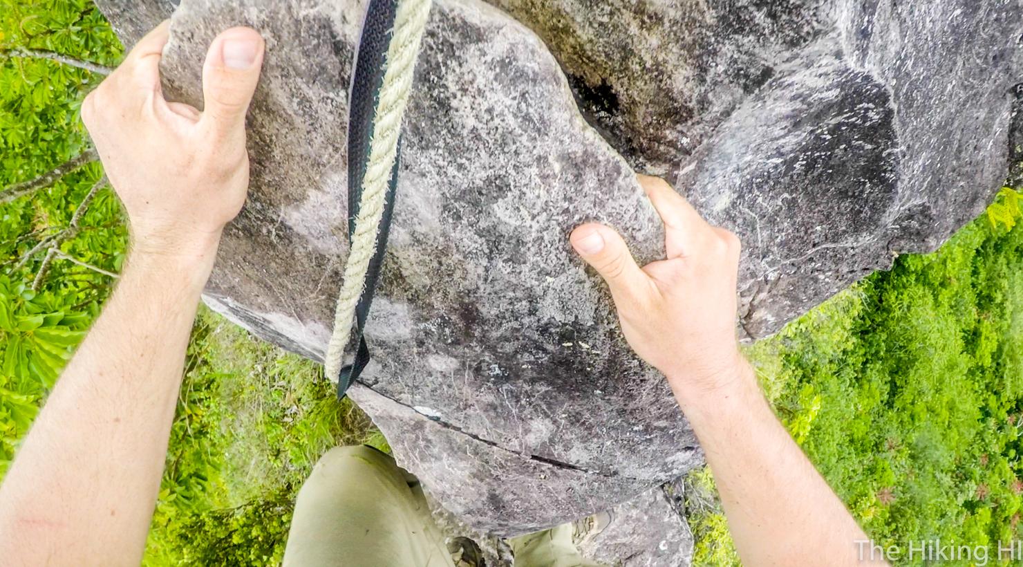
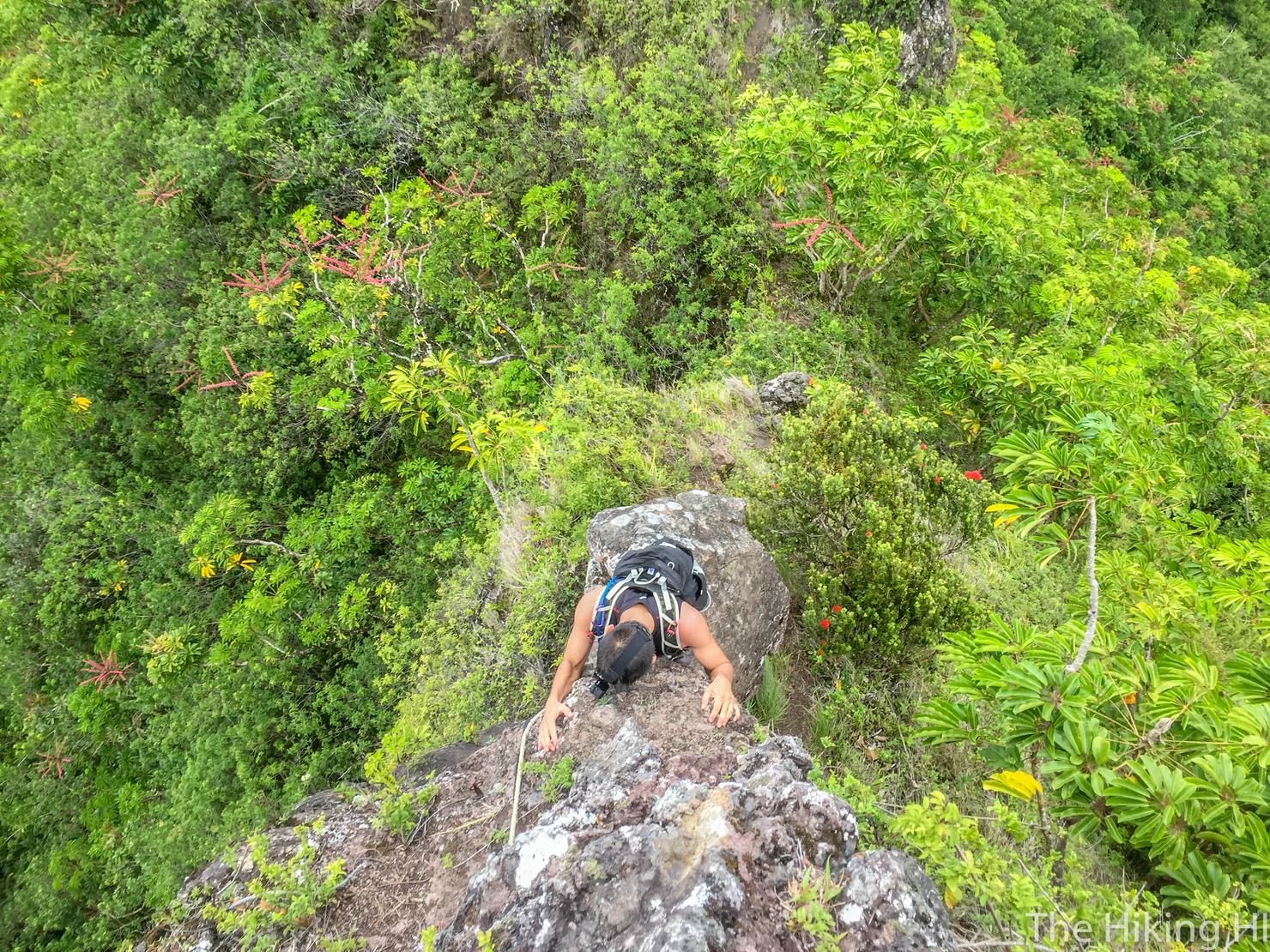
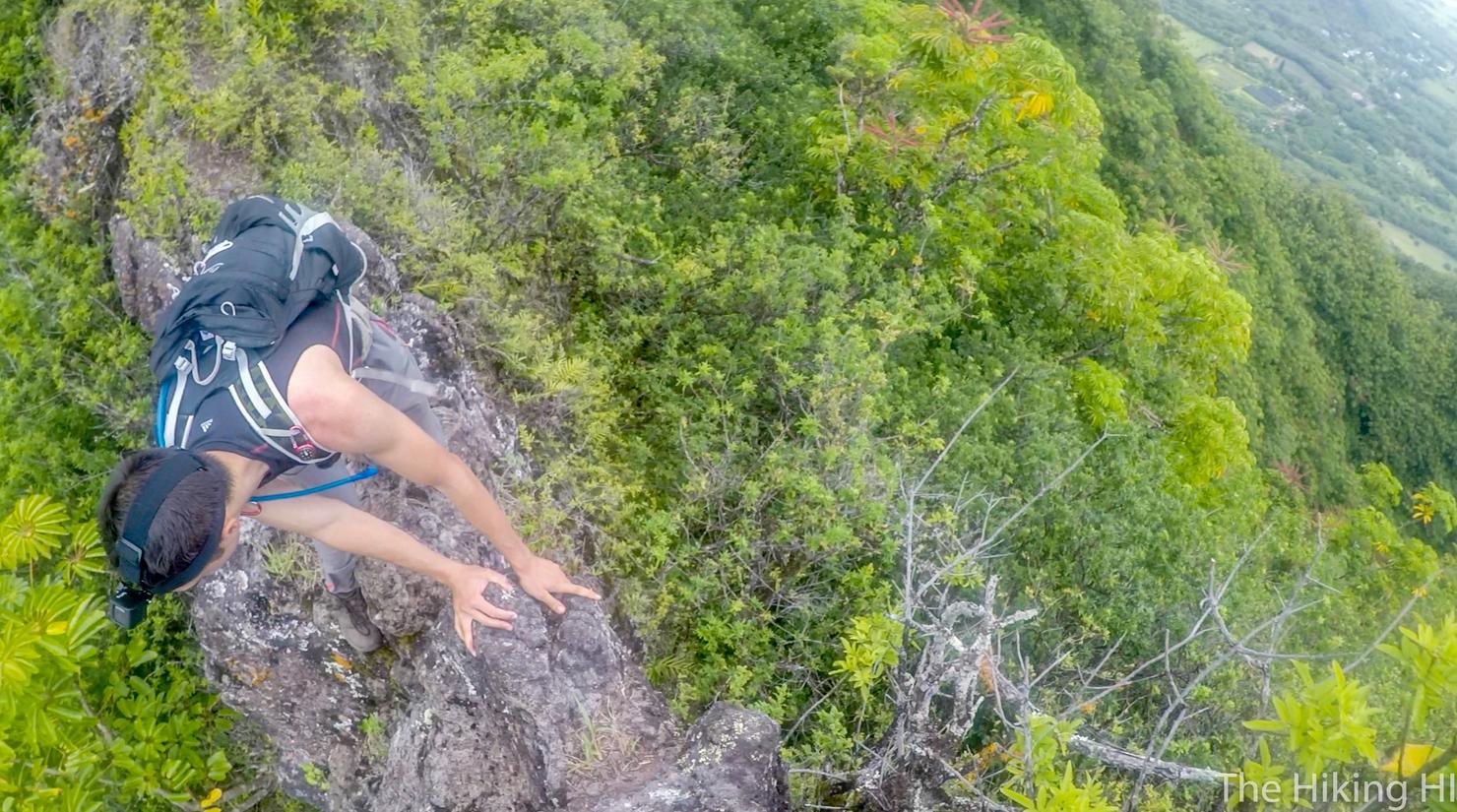
Notch 2 on the other hand, was significantly more challenging. It's a pretty flat rock face at the beginning with very few holds. You pretty much have to use the rope that is there to continue the ascent.
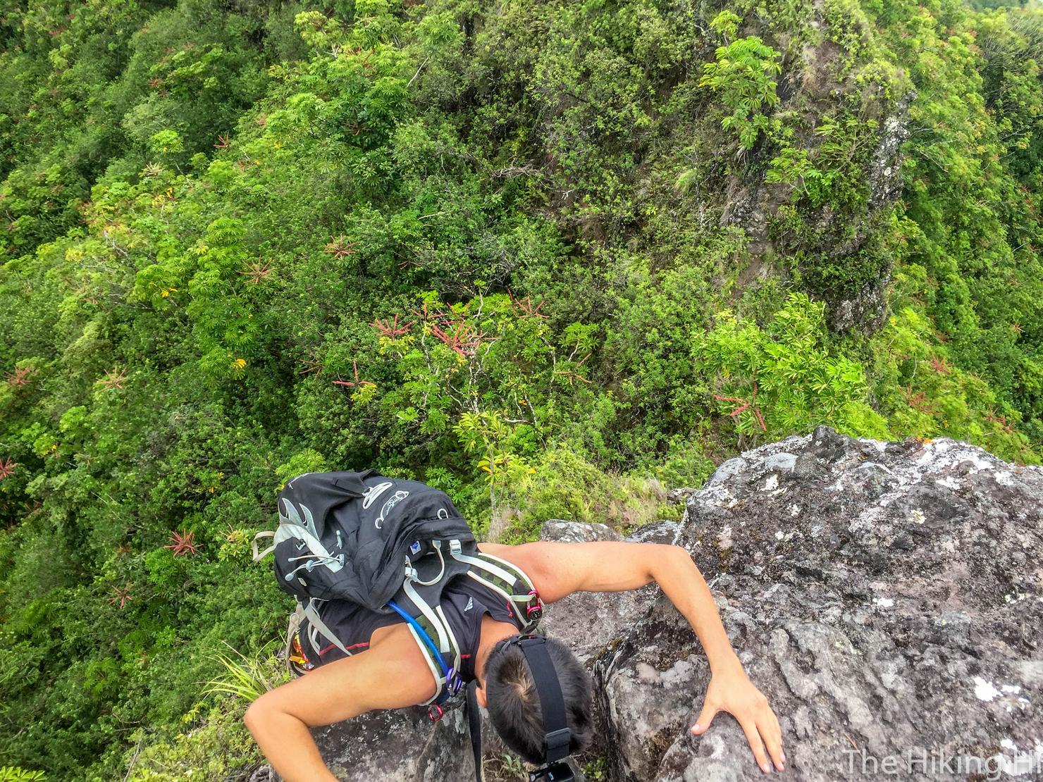
But with care and effort, Peter and I were able to get past this obstacle.
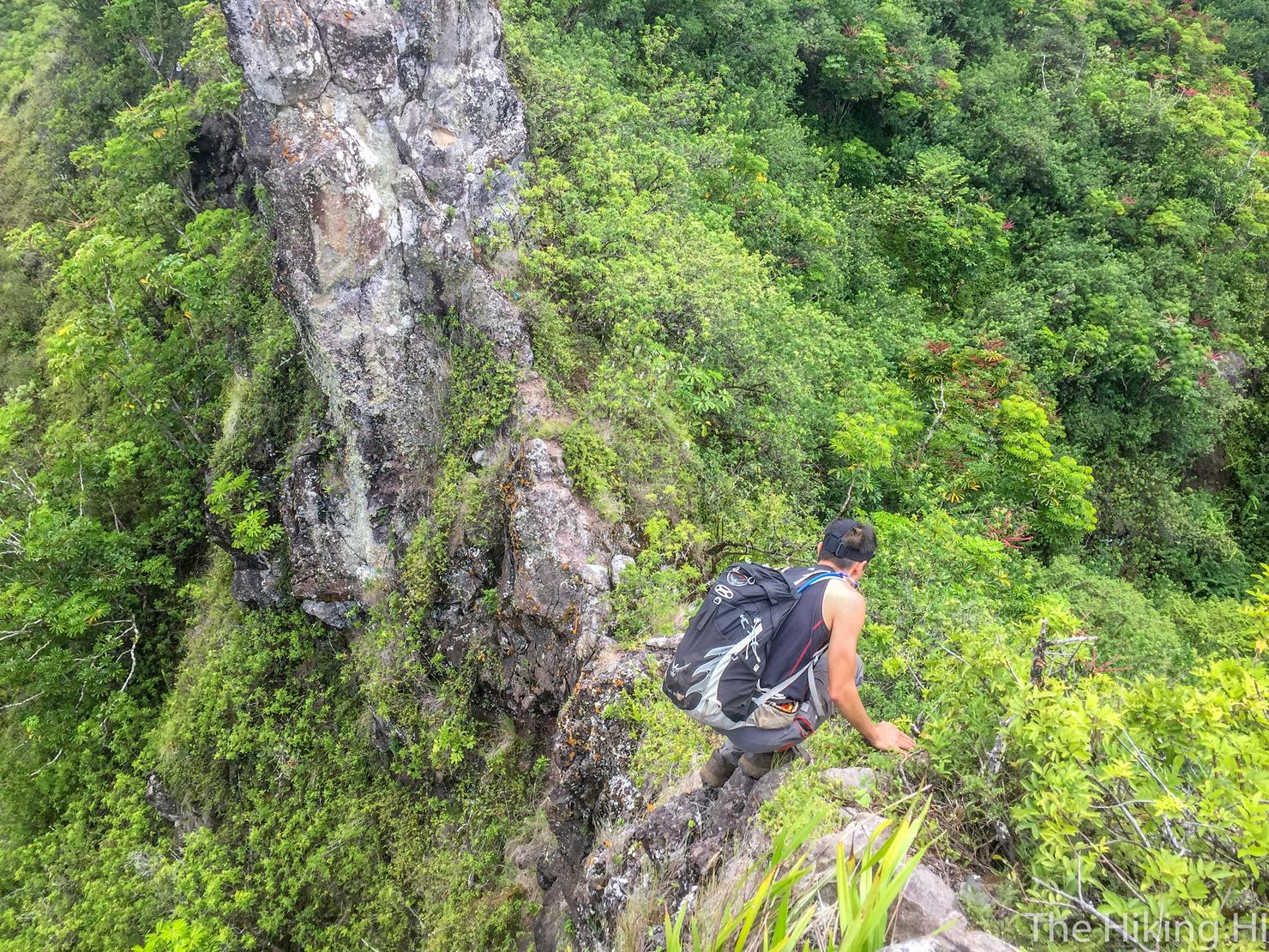
Onward to Notch 3! The trail definitely narrowed at this point, merely a few feet in width. The dropoffs weren't nearly as drastic as some I'd seen (check out sexy ridge of Pu'u Kalena), but a fall probably wouldn't feel too good.
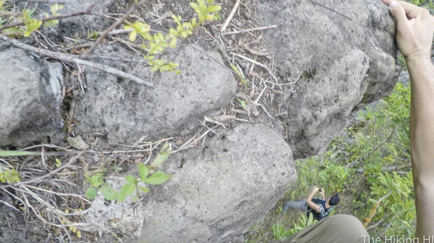
We didn't think it feasible to climb up the frontside of the notch. There weren't any holds and some of the rock was pretty lose. We saw a path around the side of the notch that led to this roped section. Clearly this was the "correct" path.
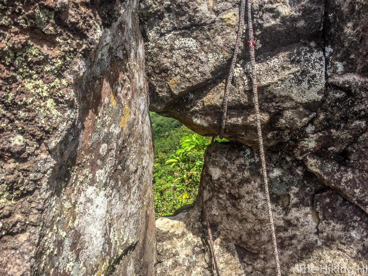
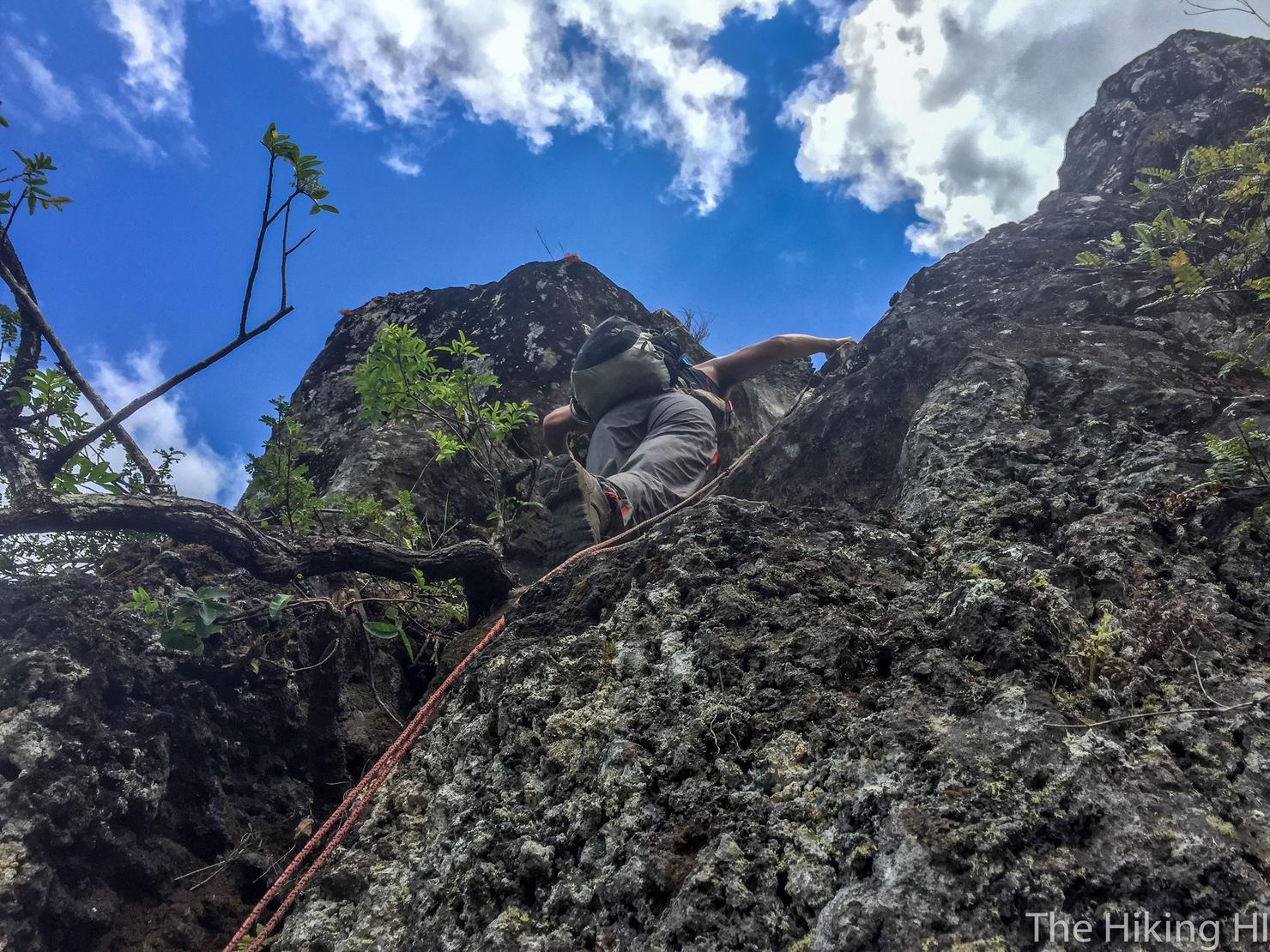
Of course correct didn't mean it wasn't sketchy. It was steep and I was forced to rely on the rope pretty heavily. That rope by the way, is secured to that rock above that tiny puka. Makes you feel safe doesn't it? Guess we better hurry up and get on the ridge before it gives.
Well ok, maybe the ridge isn't that much better. This shot definitely puts in perspective the potential danger of this hike.
But those views are worth it.
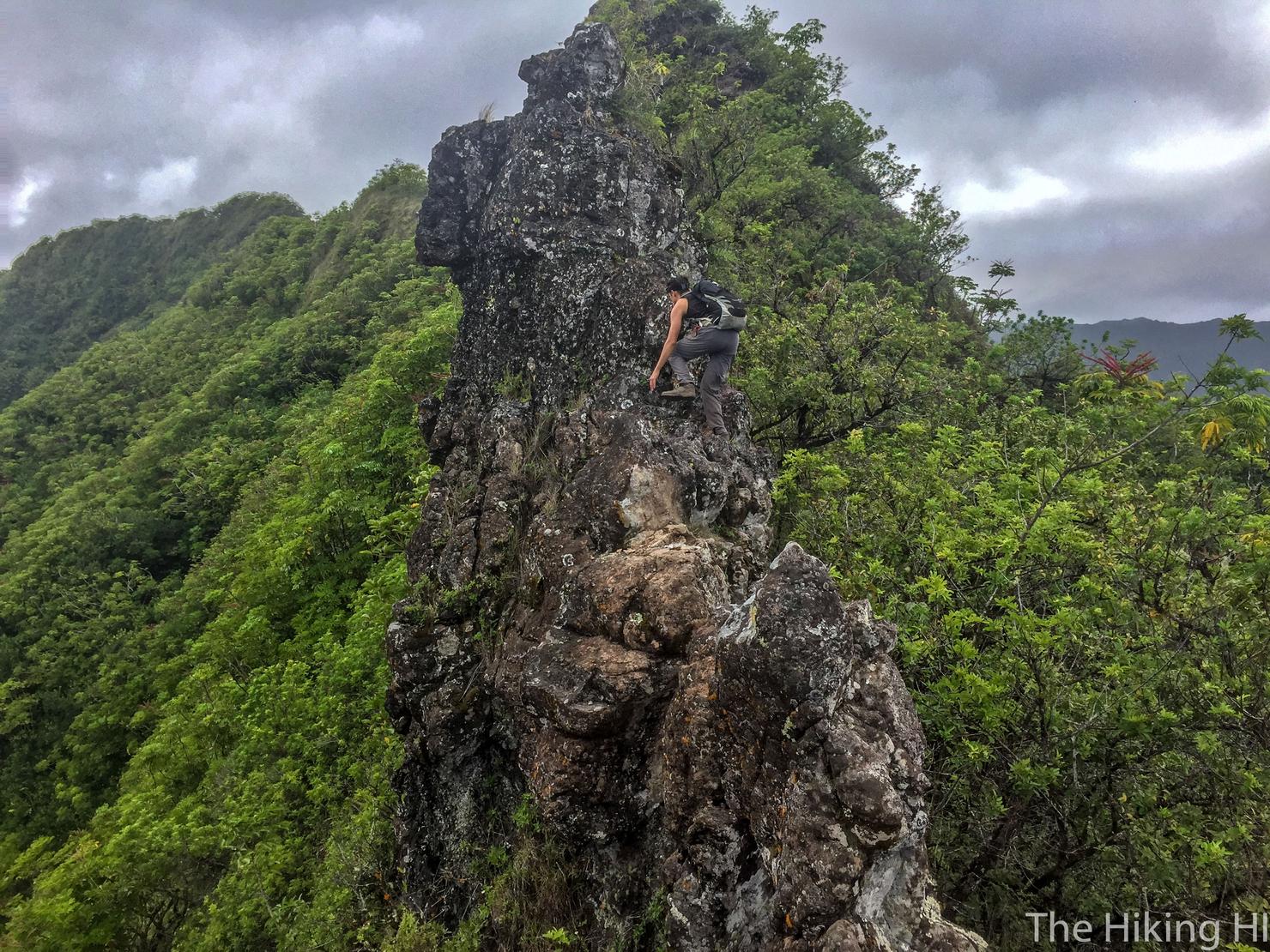
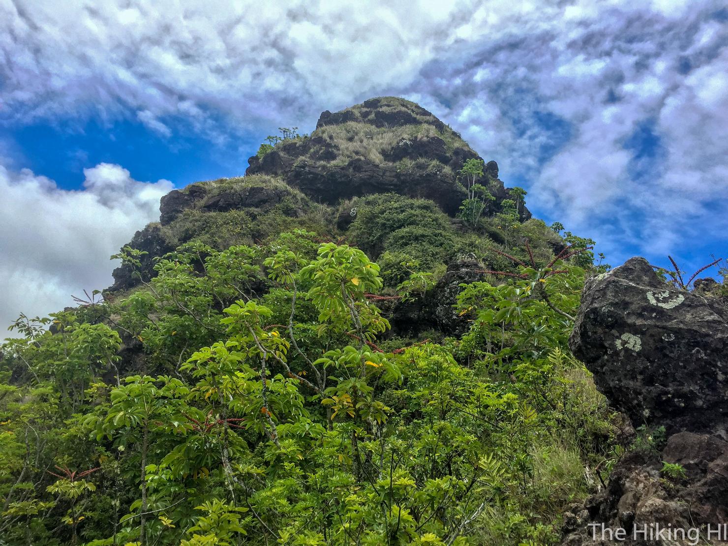
After the notches, you will continue on to what I assume is the teeth, smaller rock formations on the ridge line you are required to climb over. It wasn't as tough as the notches...
But they were still plenty dangerous.
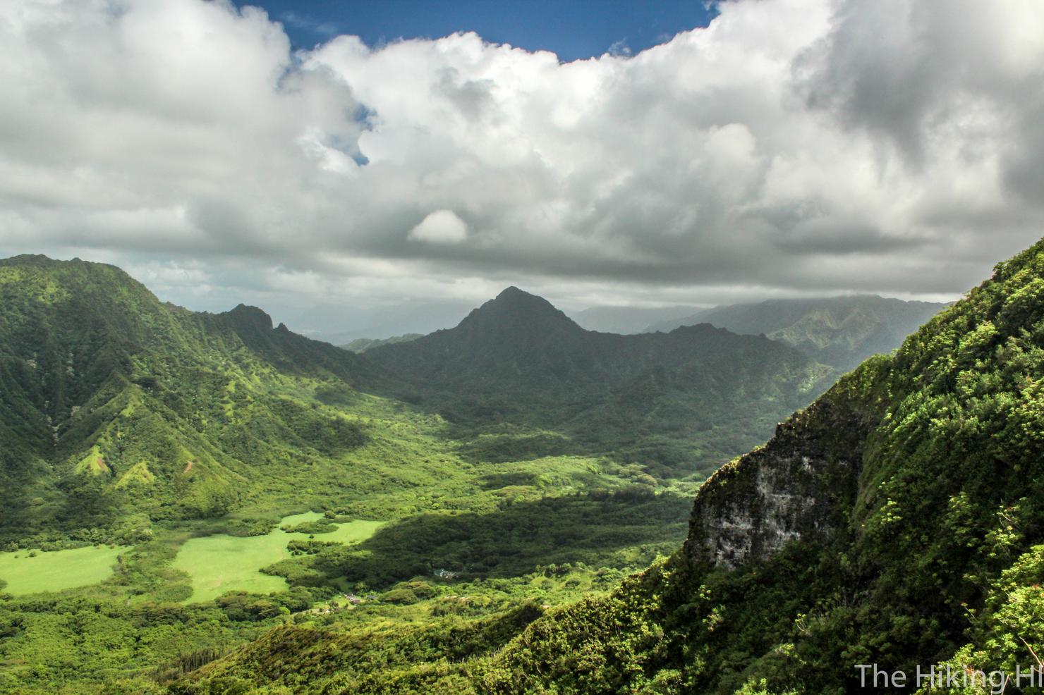
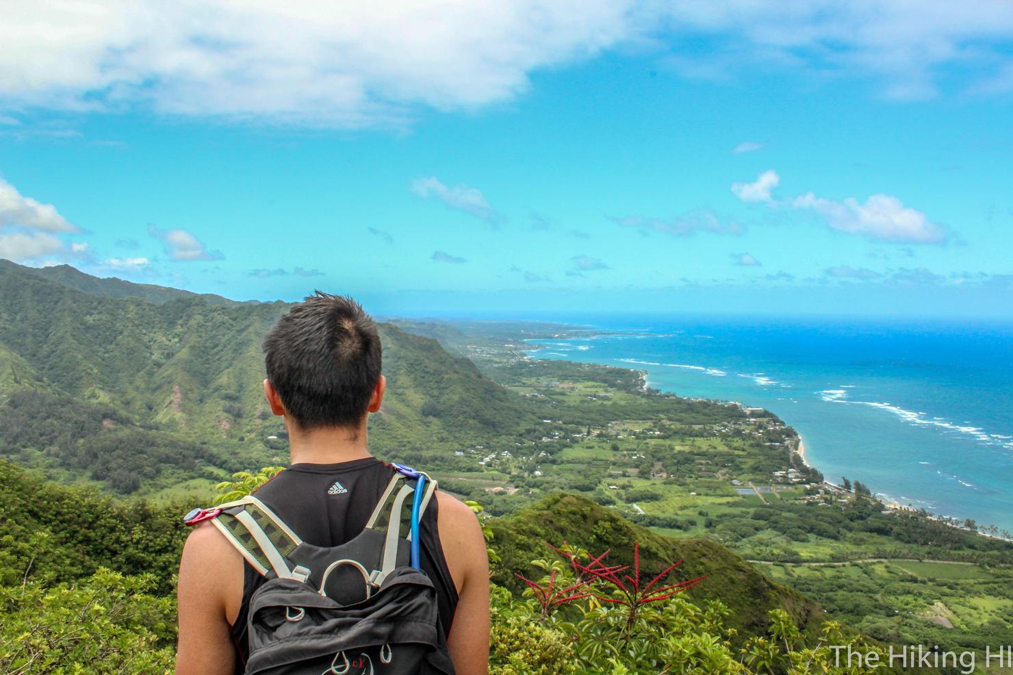
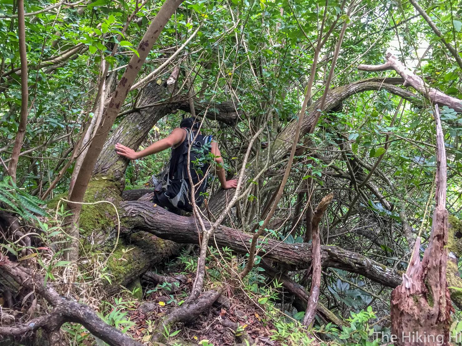
We decided to continue on to the peak. This is the part where the hike becomes a lot more overgrown. This is Kahana Valley. That left flat(ish) peak is the summit of Pu'u Manamana Turnover Trail. That sharp drop in the ridge to the right is (I'm fairly certain) the infamous True Manamana. That peak in the center of the photo is Pu'u Ohulehule.
We made it to the summit... well almost. The ridge got so overgrown up here, Peter and I decided to stop on this grassy ridgeline for our turnaround point. I'm fairly certain the actual peak is just a few minutes farther. Oh well, these views were just fine.
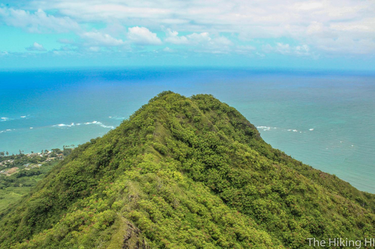
Here you can make out the teeth and the notches. Such a beautiful beast.
Alas, it was time to head home. We saw this marker on our way to the summit which signified the path down. This is the Blue ridge in the Google Earth Image above.
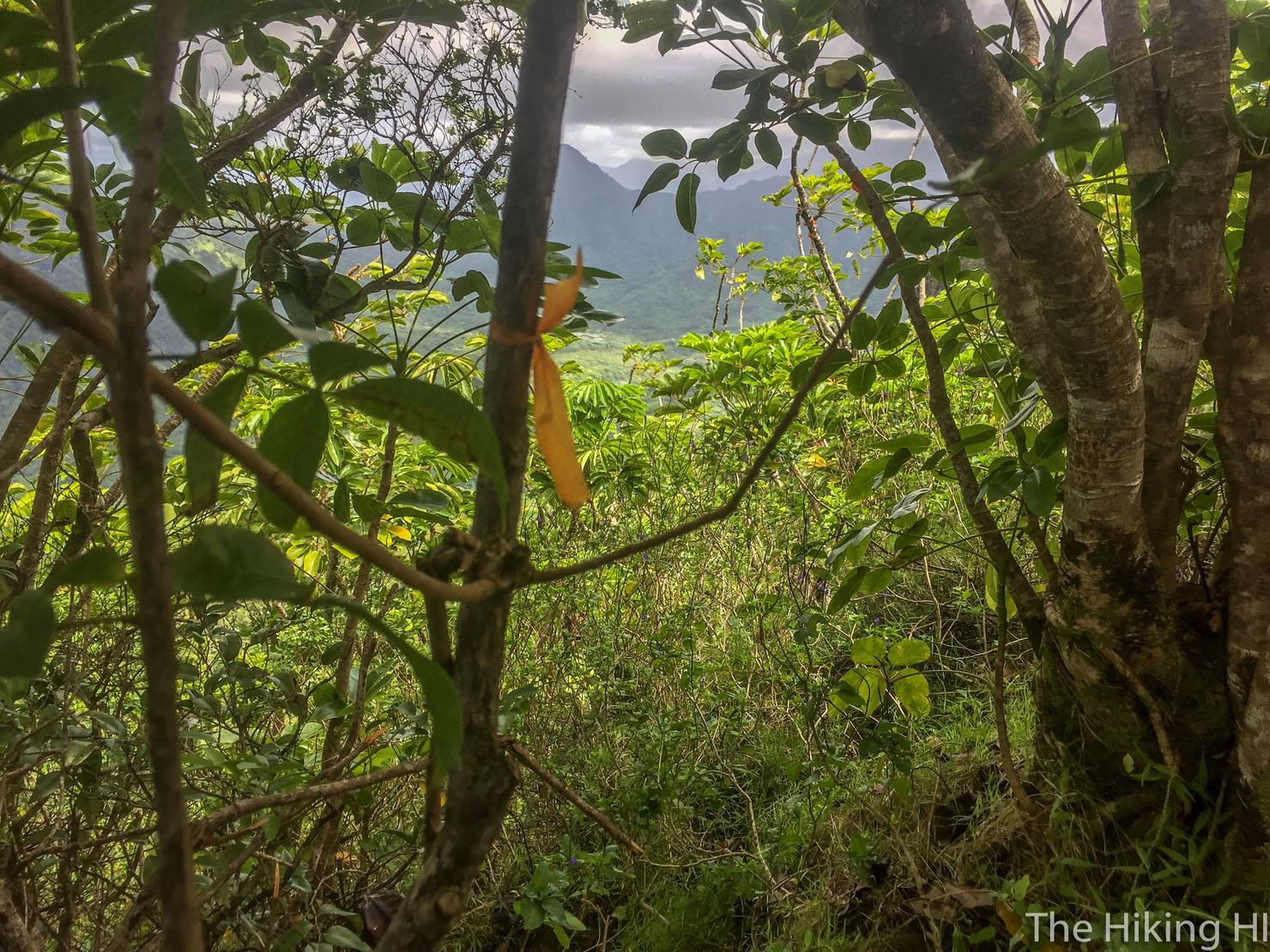
The descent was pretty straightforward, but it did get a little steep and overgrown at times.
But it eventually opened up for more amazing views of Kahana Bay. From here we continued back down the ridge, ready for some much needed food. What an adrenaline filled and beautiful experience on the Pu'u Piei Hike and Notches. It is definitely one of the more dangerous hikes I've done on Oahu, but it was definitely worth the risk.
Check out my video of this intense hike!