Difficulty: BEGINNER (INTERMEDIATE w/Pillbox)
Time: 3-4 HOURS
Distance: 5-6 MILES
Elevation Gain: 300 FEET with Pillbox
Foot Traffic: MODERATE
Challenges: Shadeless, Steep and rocky climb to pillbox
Sights: Rock Arch, Bird Sanctuary, Blowhole, Pillbox, Whales? Monk Seals?
What to Bring: Sunscreen, Water, Snack
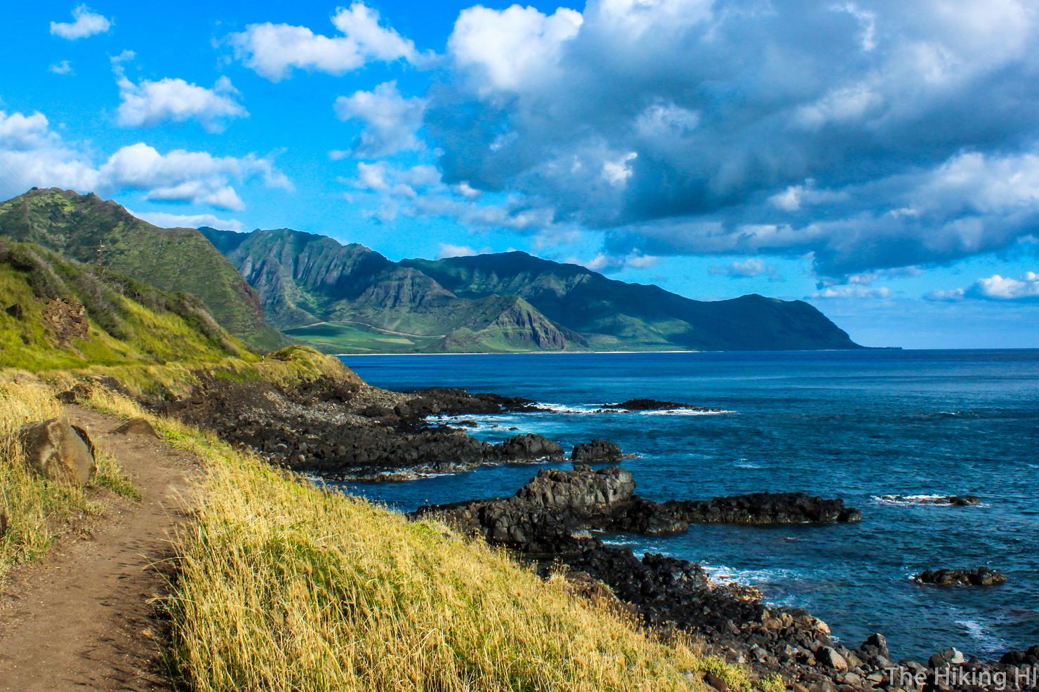
Sometimes it feels more like a scenic stroll than a hike, but what Kaena Point lacks in difficulty it makes up for in beauty. There's a lot to see on this hike, including a rock arch, a blowhole, a bird sanctuary, and of course the beautiful coastline. For those looking for something a little extra, you can even hike up the ridge to find a secret pillbox. It's a little bit of a drive to get to this place, but it's worth it every time.
I found myself with a half day of work, so I knew I had to take advantage of the opportunity and hike. After a quick weather search and a scan of the island, I saw that the northern part of the island looked pretty sunny. I decided I would revisit the coastal trail Kaena Point, a trail I'd only been on once as a trail run when I was training for the Honolulu Marathon last year. I knew there was a lot more to explore there than just the trail itself so this time I was prepared to unlock all its secrets.
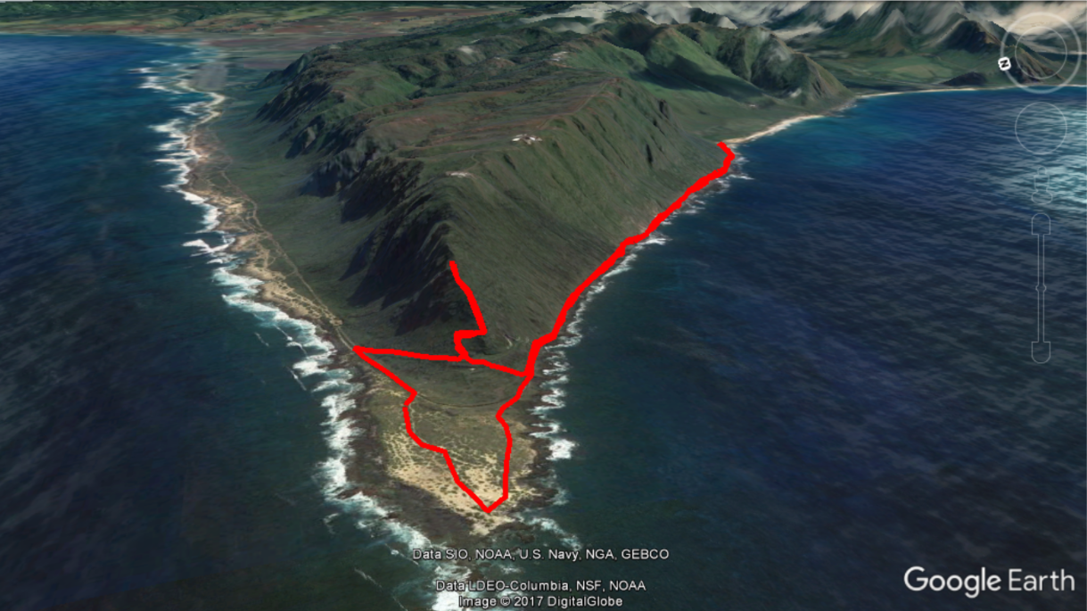
There are 2 different ways to do this hike, you can come from the North Shore, or from the West Side of the island. Personally, I think coming from the West Side is better. You are walking along a lovely trail right on the coast whereas from the North Shore, you are walking along a hilly dirt road made for 4WD vehicles. You will notice my path also lead me up the ridge. This is because I decided to check out the "secret" pillbox. More on how to get to that later.
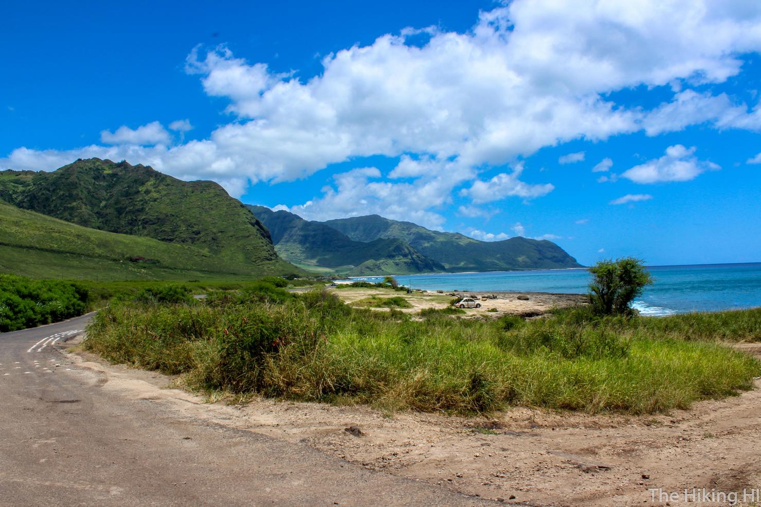
This trail is easy to find, just go along Farrington Highway until it ends. There's a small dirt area on the right side of the road (behind me in this photo) where most people park.
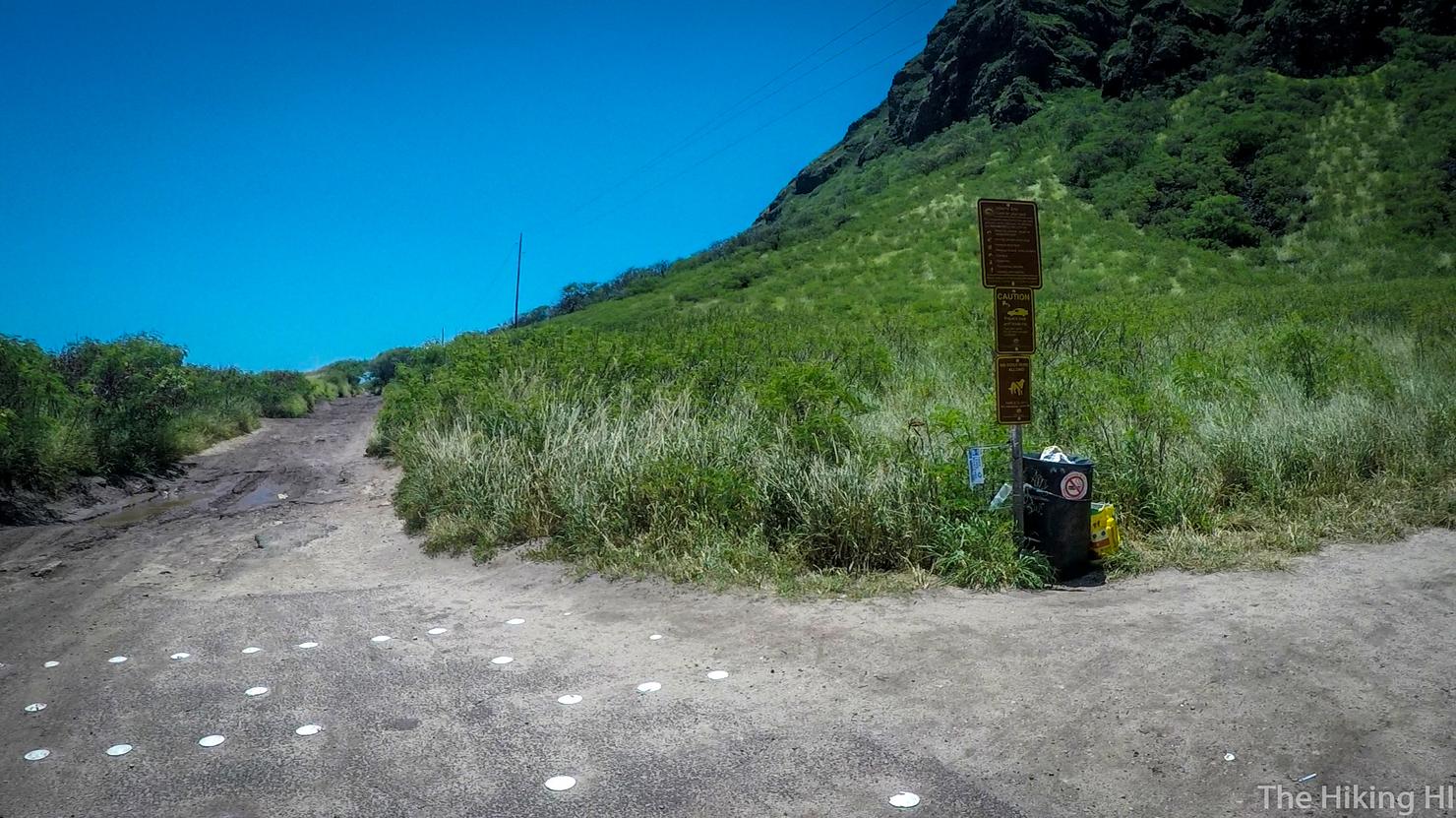
Let the hike begin!
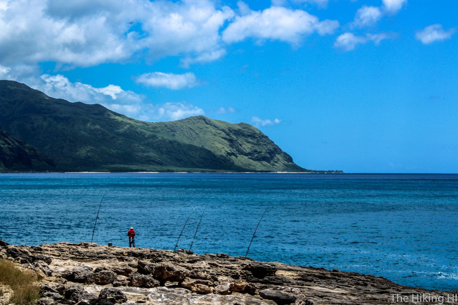
I had to include this photo I took at the beginning of the trail. Couldn't have picked a better spot to fish my man!
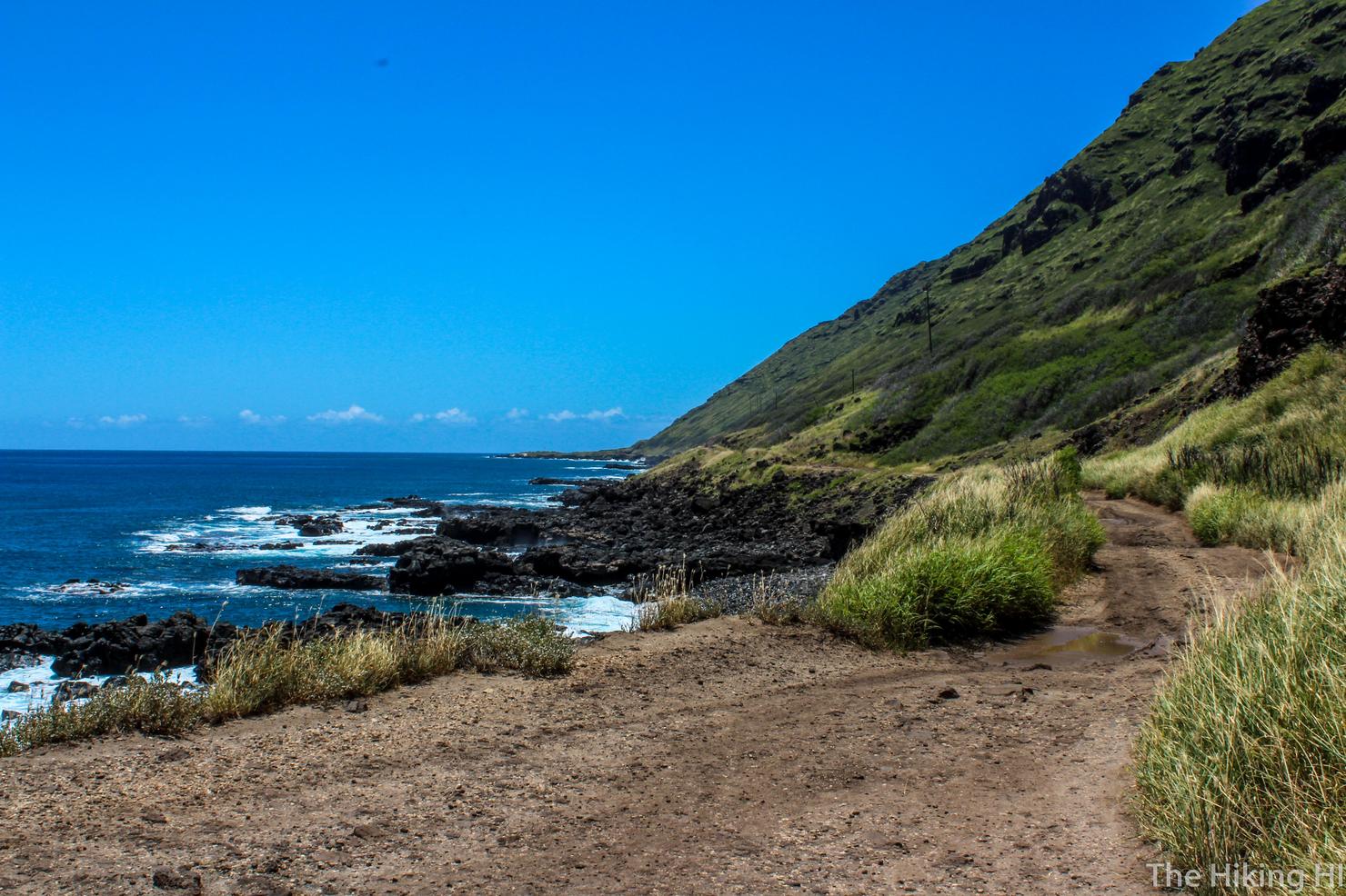
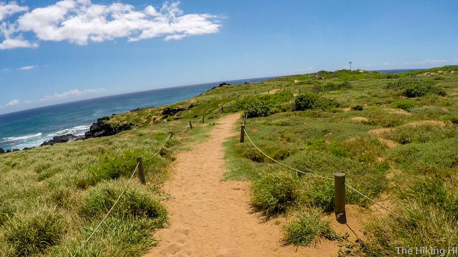
This is what the trail looks like all the way until you get to the bird sanctuary, the fenced in portion right on the tip of the island. There's no elevation gain, but that's what makes me like this trail, it's unique. A trail next to the ocean right at sea level is pretty hard to beat.
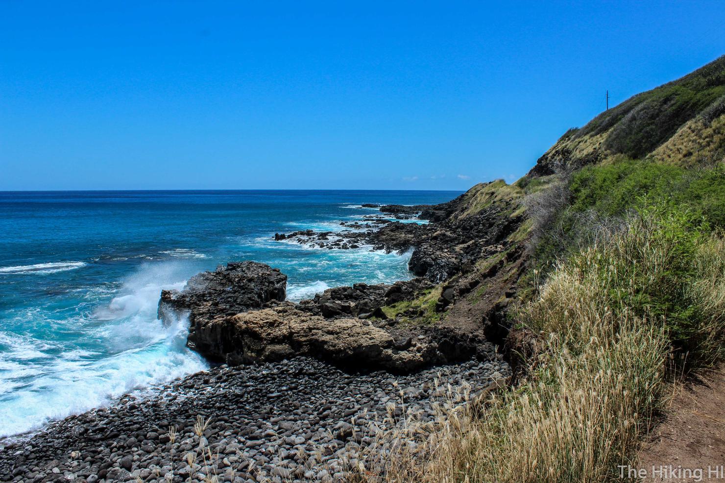
I love the sounds and sights of waves crashing against the nearby rocks. Great for photos too!
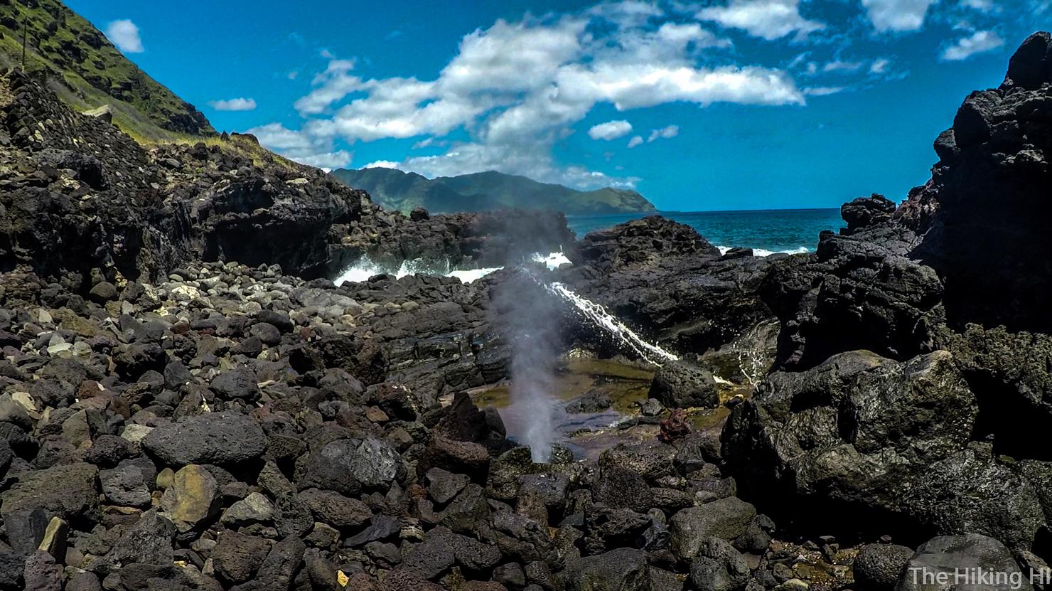
I found the blowhole! This was the first of the hidden gems along this hike. Well they're not really hidden, you just have to pay attention and not get lost in the beauty that surrounds you.
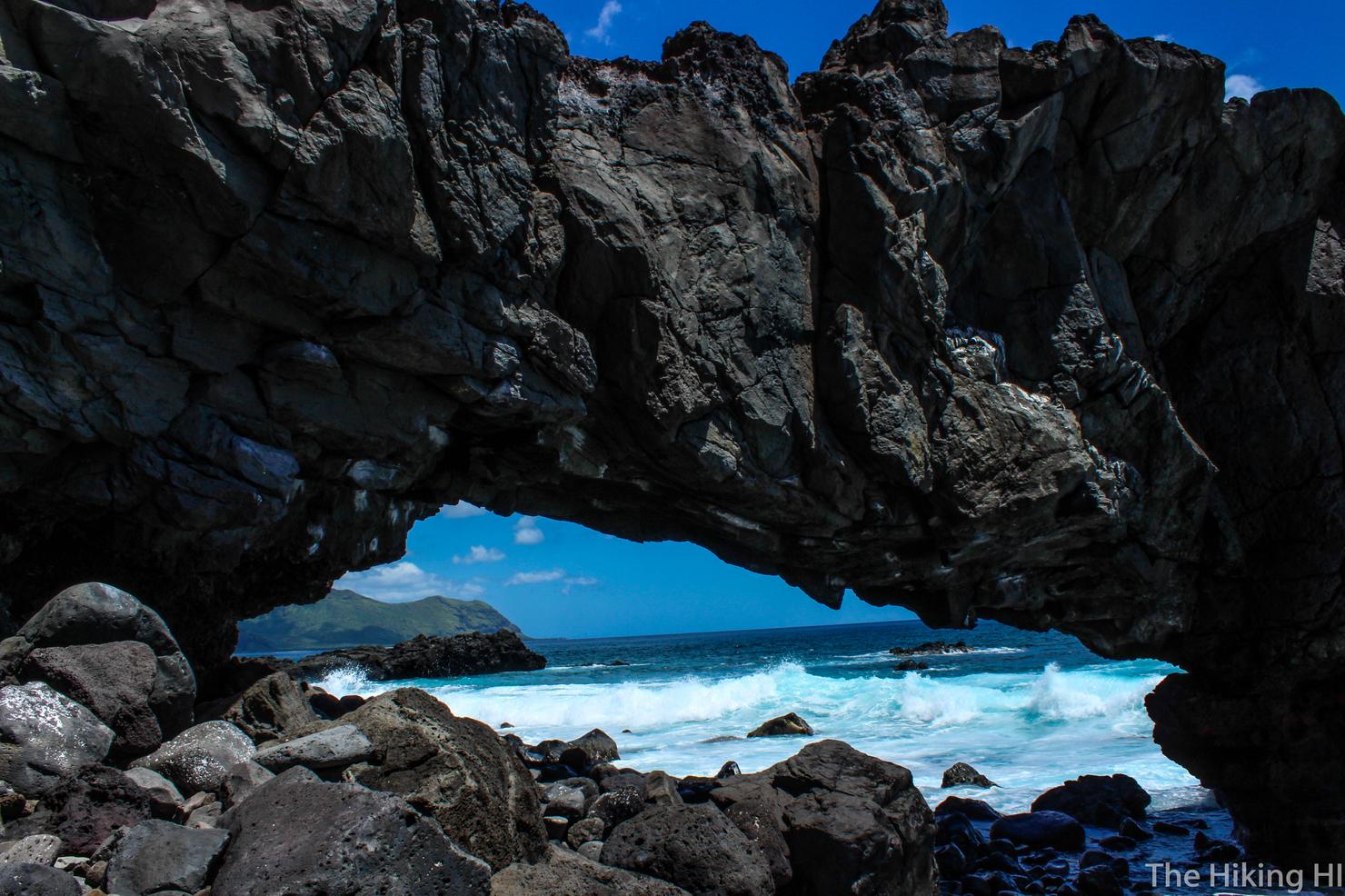
And next , we have this beautiful rock arch.
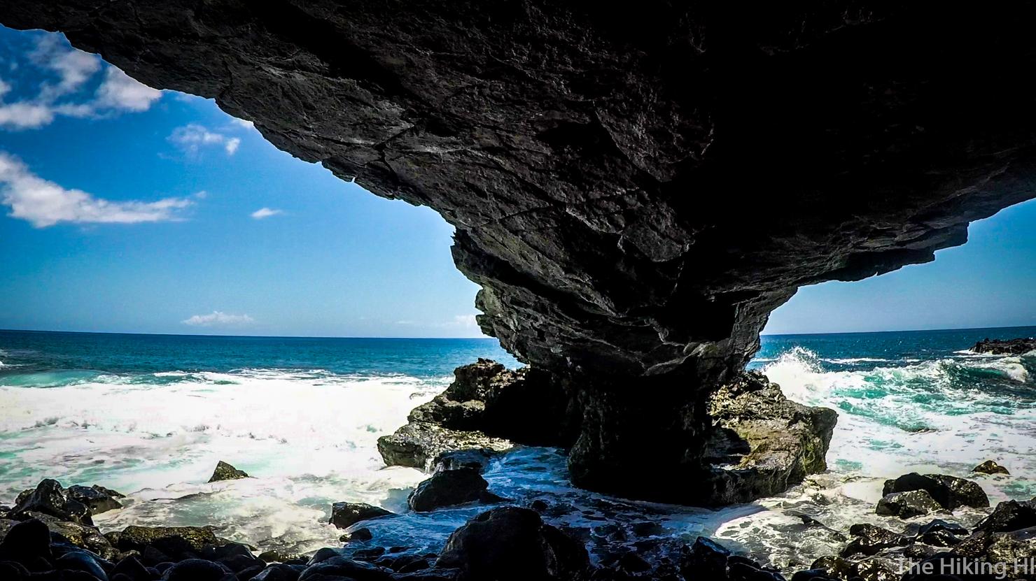
I had to get in for an underneath shot. I'm not sure what the tide was like the day I was there, but I was very close to getting wet while taking this photo.
It is a 2 mile walk to get to the bird sanctuary and it can be pretty hot if it's a sunny day like mine. Luckily you can turn around and distract yourself with these views.
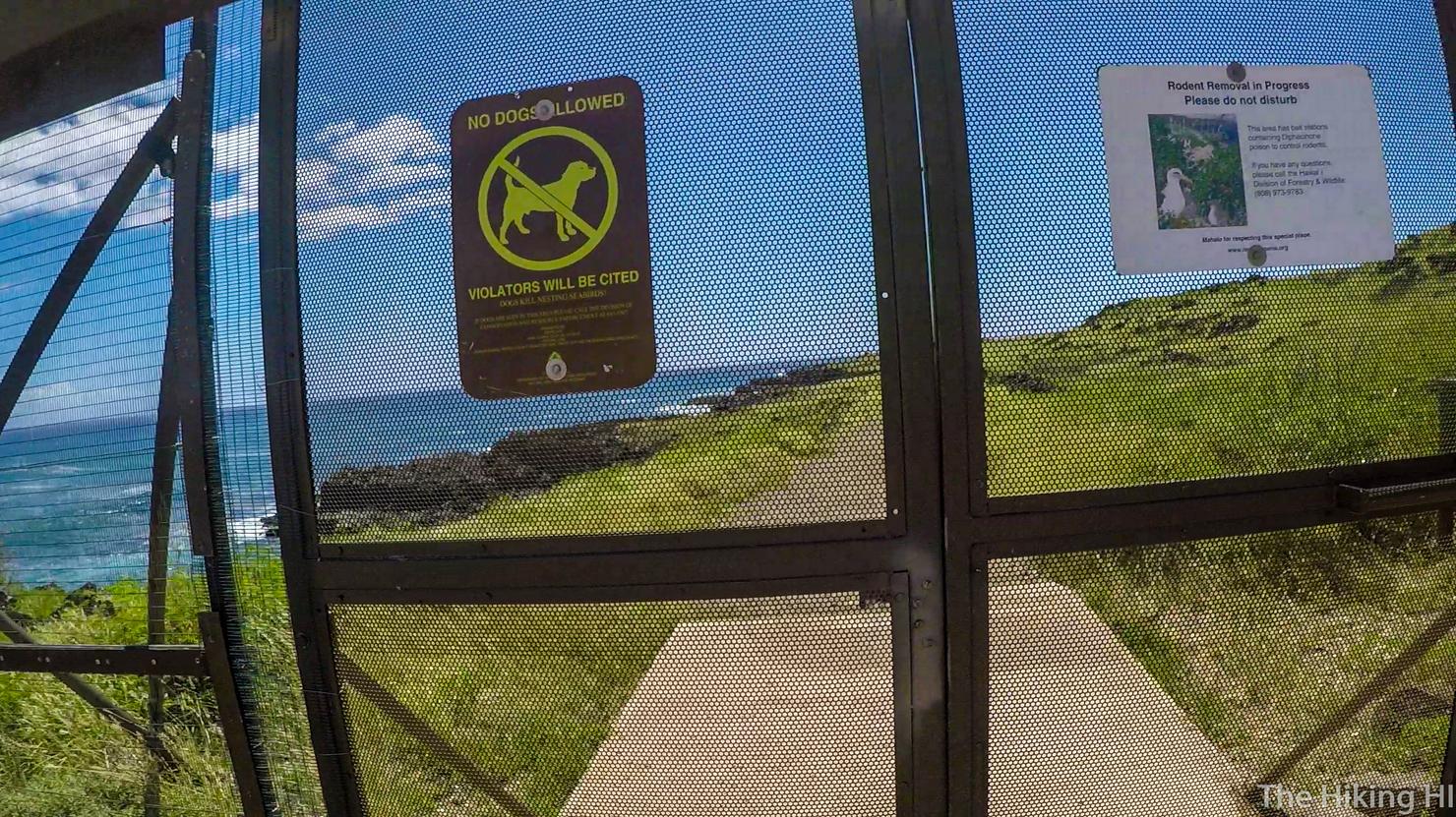
But before long, you will reach the sanctuary. Let's go in shall we?
It's about another 0.5 mile walk to get to the very tip, but it's a beautiful walk along a dirt/sand path. If you go between November and May, you have a good chance to see the Laysan Albatross, a massive bird that is protected in this sanctuary. Unfortunately, it was June when I did this, so I didn't see any. Oh well, just another reason to come back!
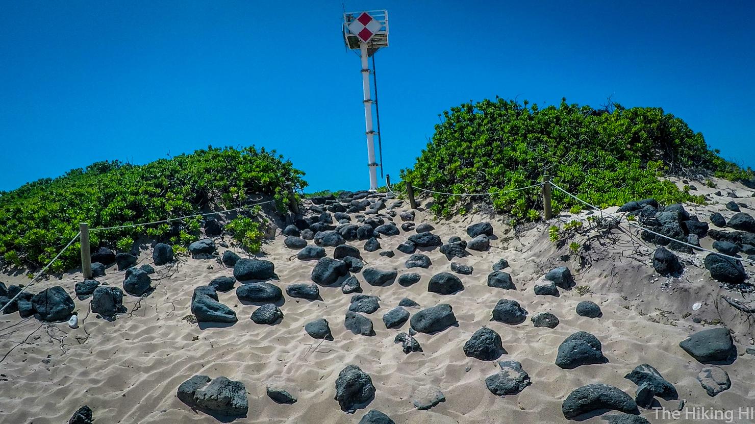
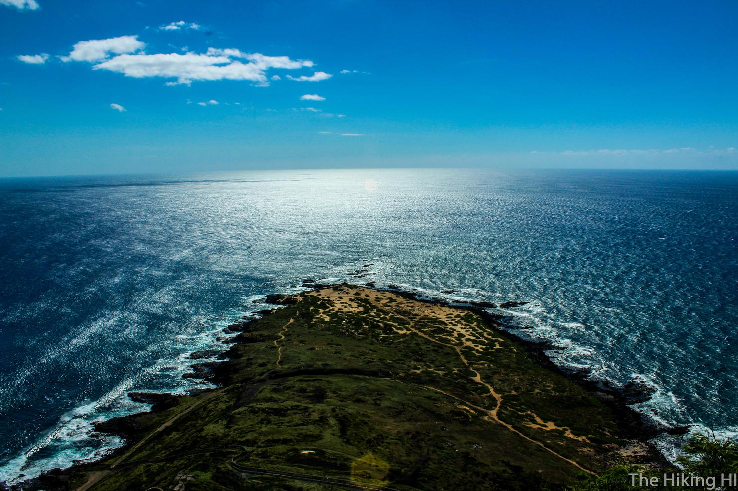
With a little bit of effort and possibly some sand in your shoes you will reach this beacon, signaling the westernmost tip of the island.
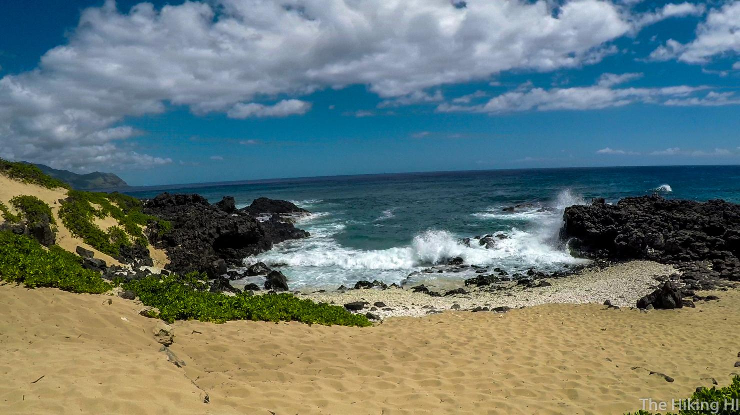
What a beautiful view, staring out into the seemingly endless blue ocean. Monk seals often frequent this location, so if you get lucky you might see some (I did not). I've also heard this is a good spot to see humpback whales breaching. But again, it's the wrong season. I guess the moral of the story is, do this trail in the winter!
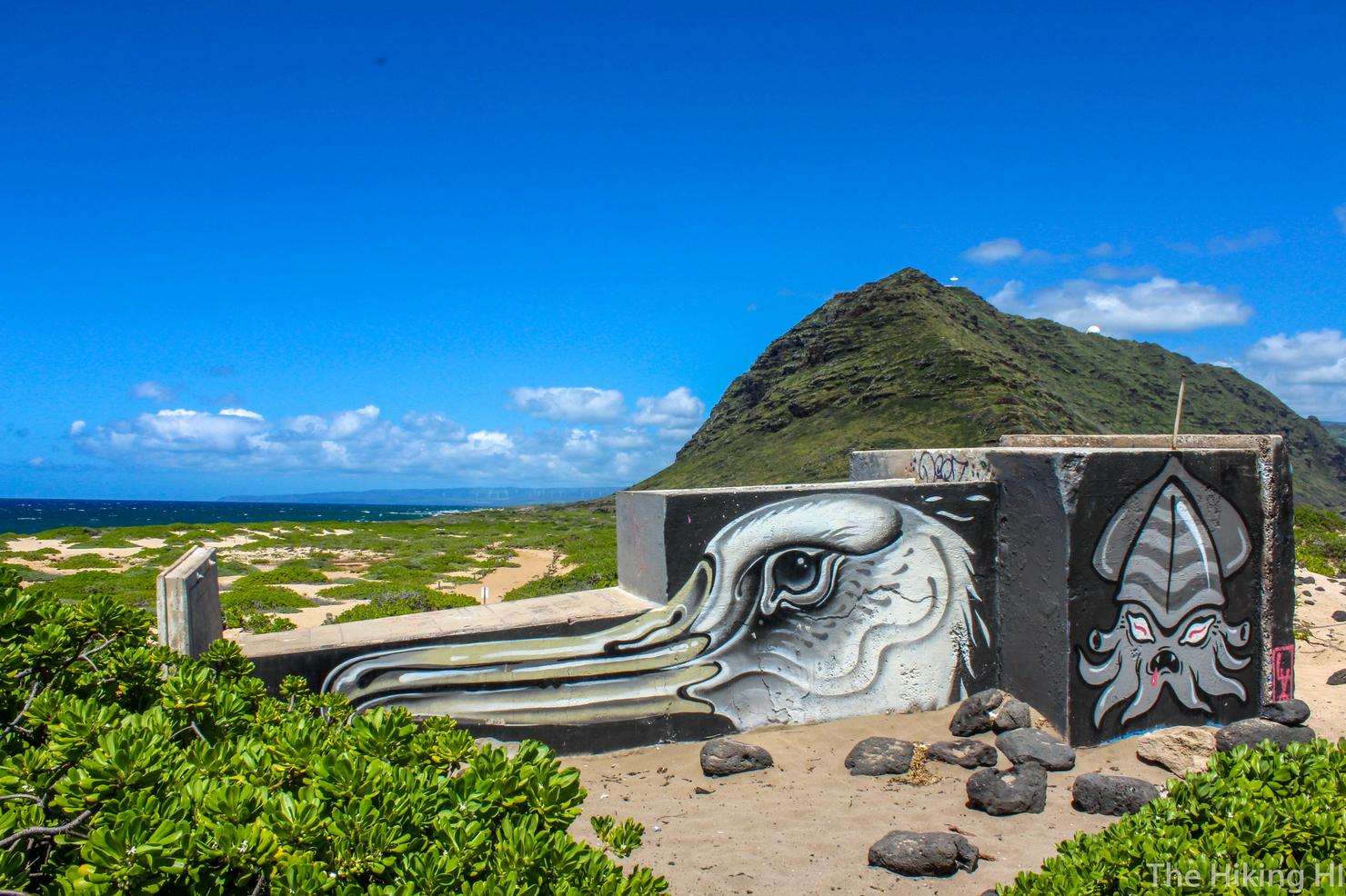
Since I didn't get to see an albatross, I suppose this mural of one will have to suffice.
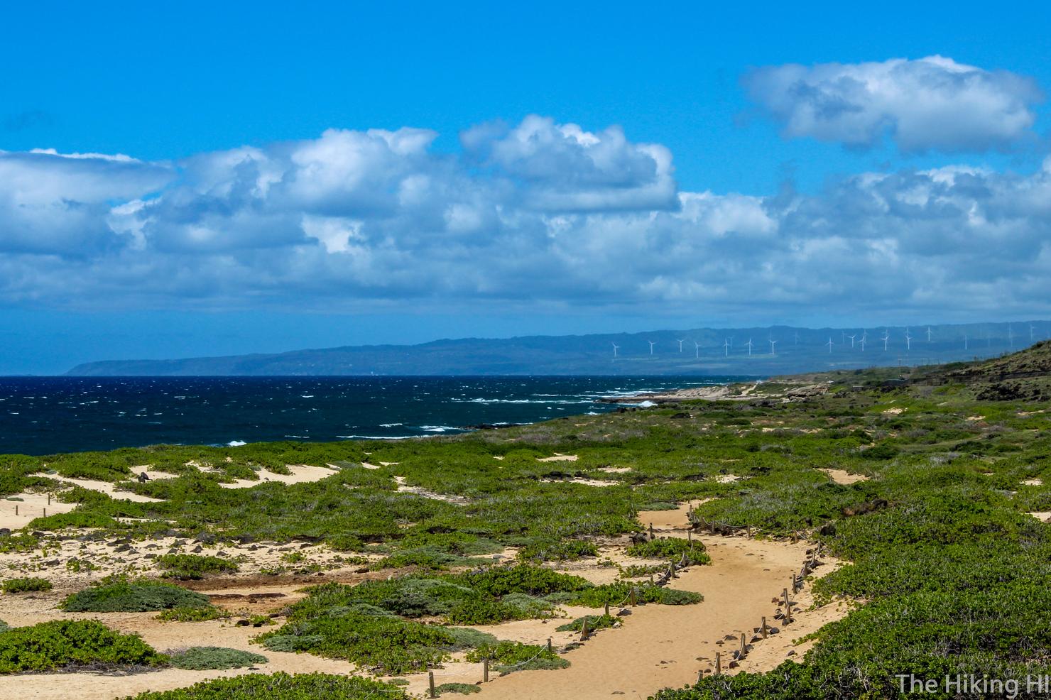
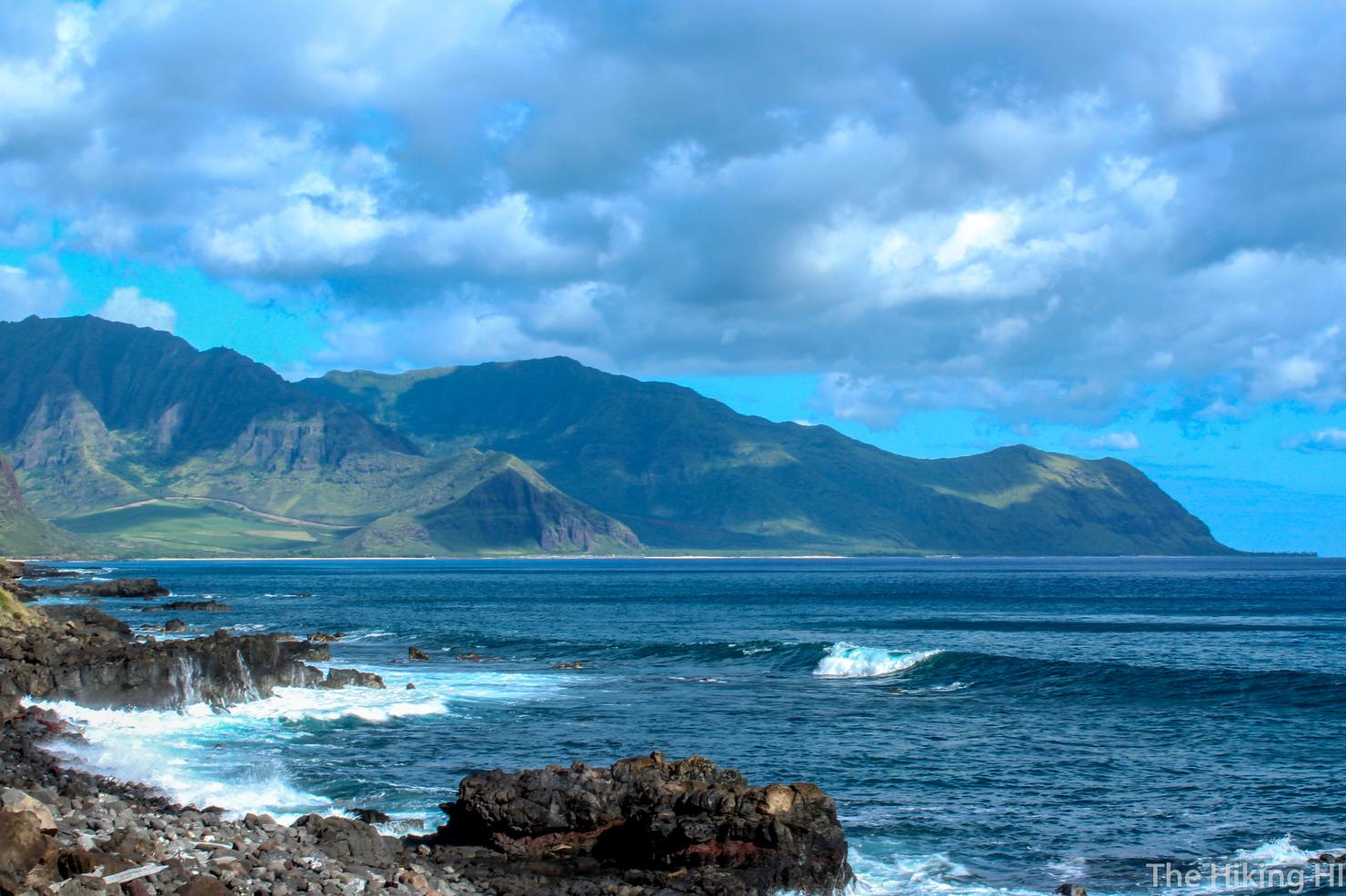
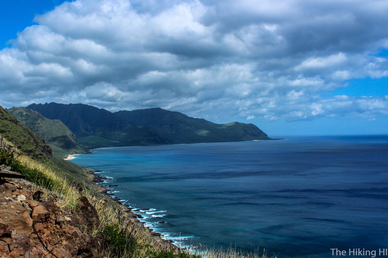
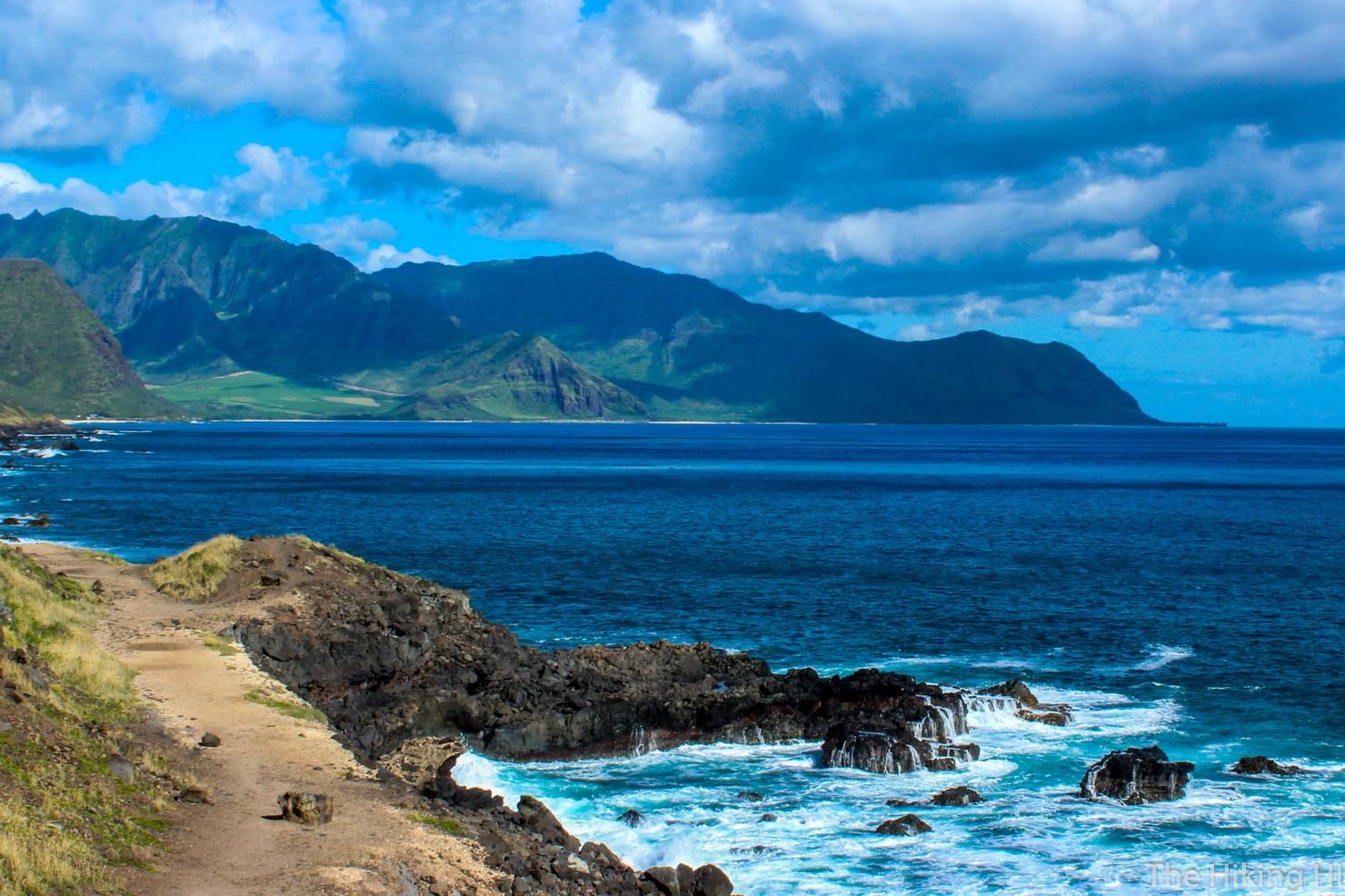
A shot looking along the northern coast. You can tell from the white caps that it was a pretty windy day. But this is nothing compared to what the waves will be like during the winter months.
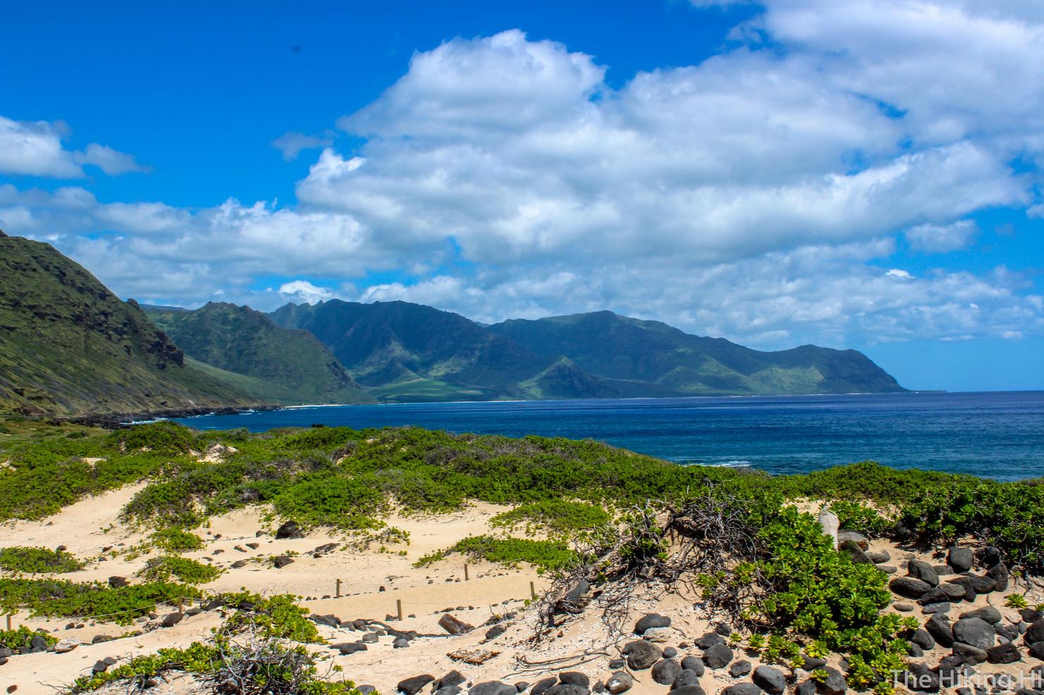
And a shot looking at where we came from. This would be a reasonable time to begin the return trip back. You really aren't missing much except a little bit of the northern coast. But my adventure wasn't over yet, I wanted to find another secret spot of Kaena Point--the Pillbox.
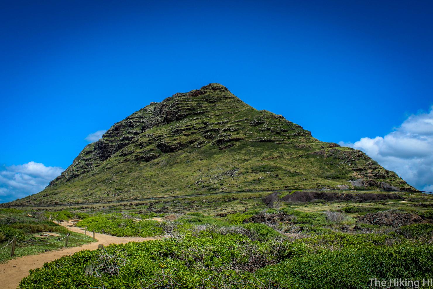
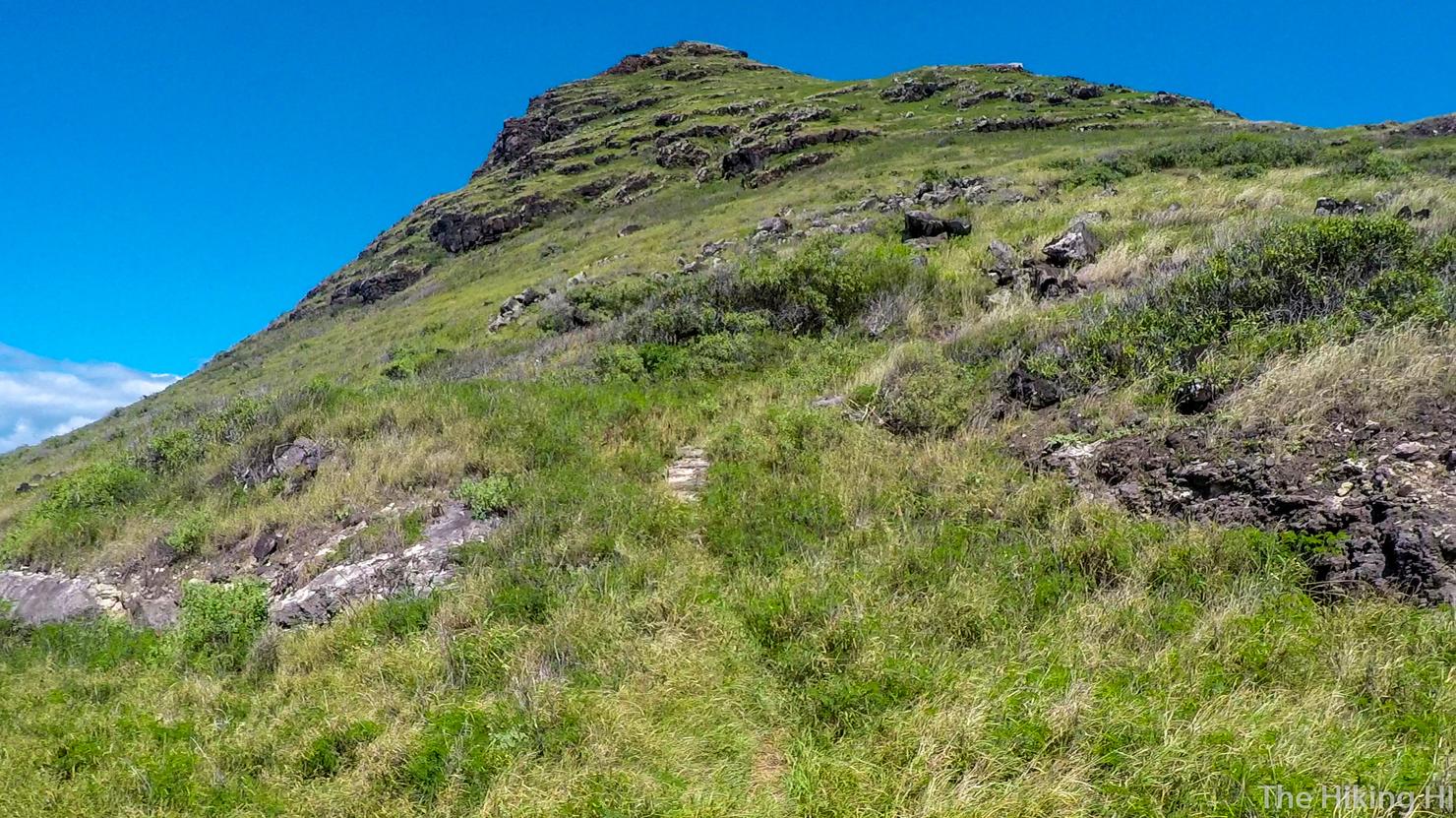
That is where we are going, straight up that ridge. The pillbox is located in that flat(ish) area slightly below and to the right of the peak. It's not the most challenging of climbs, but it will still make you sweat.
To get there, you need to get back outside the fence. This is the entrance if you were to come from the northern side, from the road which, go figure, is also called Farrington Highway. Who named these roads?
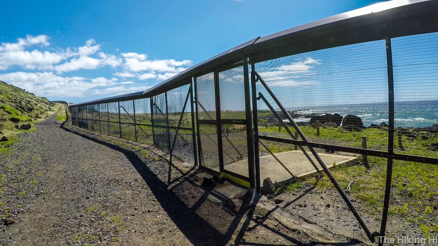
Follow the perimeter of the fence to the left. You will see another entrance into the bird sanctuary.
About a hundred yards past that entrance, is a very faint trail. It is not marked, it's basically just a path created by the hikers who have beaten it down before you, but it is the best spot to begin the climb.
The first part of the climb is relatively tame as you follow the winding trail until you get to this platform. Kaena Point looks so beautiful in that afternoon light.
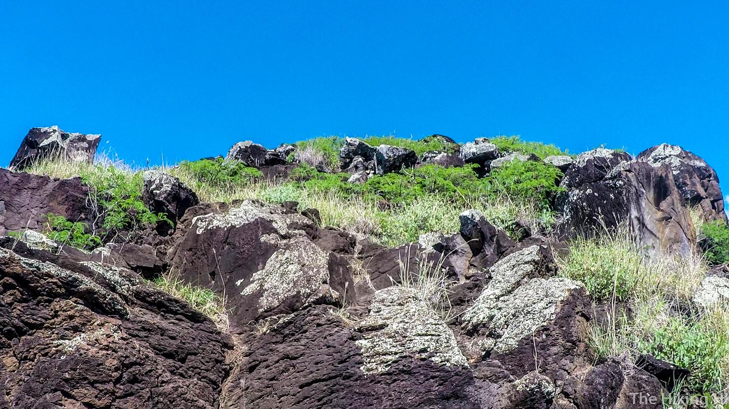
But then the hike gets a bit more challenging and requires a minor amount of climbing. I saw a few markers on my way up, but there's really no set path. Just keep going up!
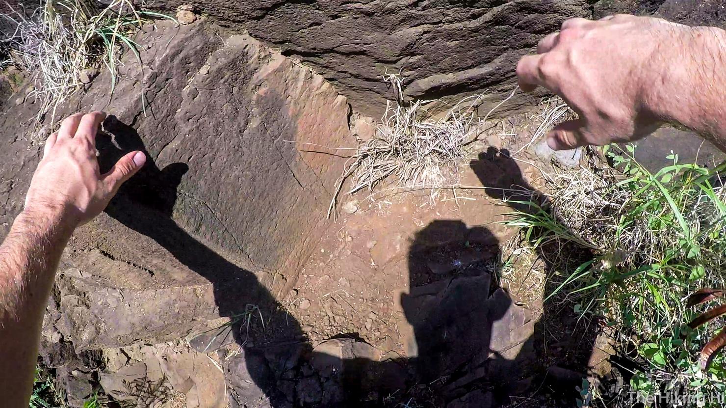
I think my shadow looks like a zombie here... That or one of the wacky inflatable tube men you see at a car dealership. What do you think?
Alright I guess the climb looks a little steep from here, but I swear it's really not that bad!
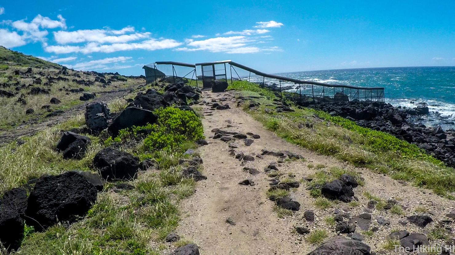
Just before reaching the pillbox, I saw this structure. Naturally I had to investigate.
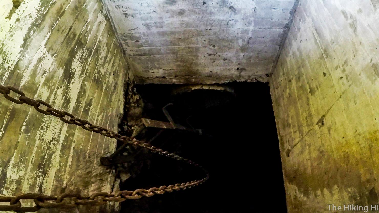
It was some long shaft down to one of the tunnel complexes, just another one of the many WWII relics on this island. I wanted to go further, but the ladder was busted. Apparently there is an entrance to this thing a little down the ridge, but I missed it. However, this post will give you some information about what that entrance might look like.
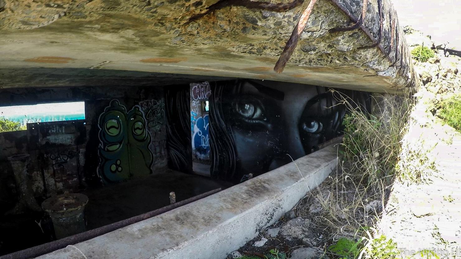
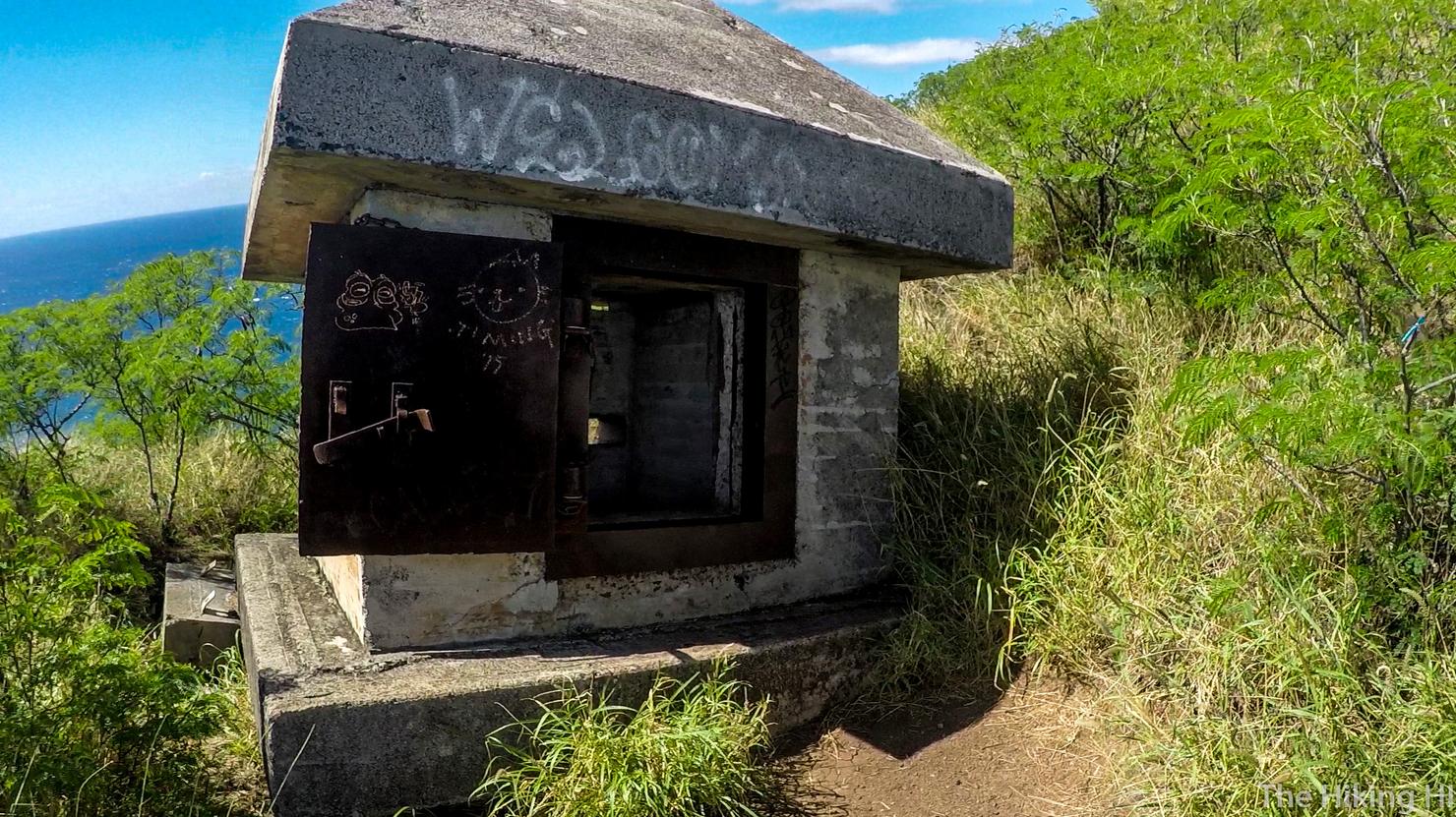
We've reached the pillbox!
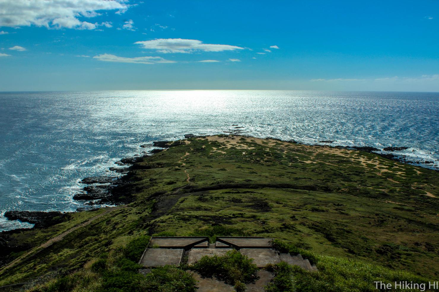
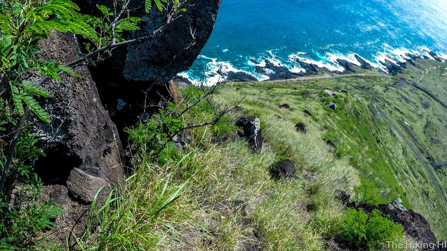
What a view from up here! I love how you can make out all the different trails leading to the point. It's definitely a choose your own adventure kind of place. My choices led me up here.
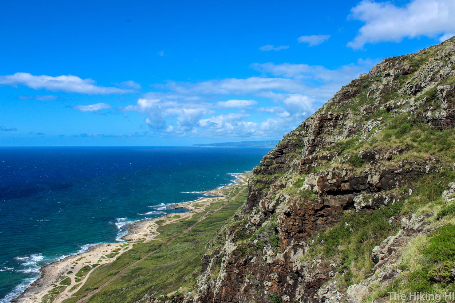
Here's a shot looking along the northern coast.
And a shot looking down the west side. We really have come quite some distance. But I'm a little hot, let's go get some shade in the pillbox!
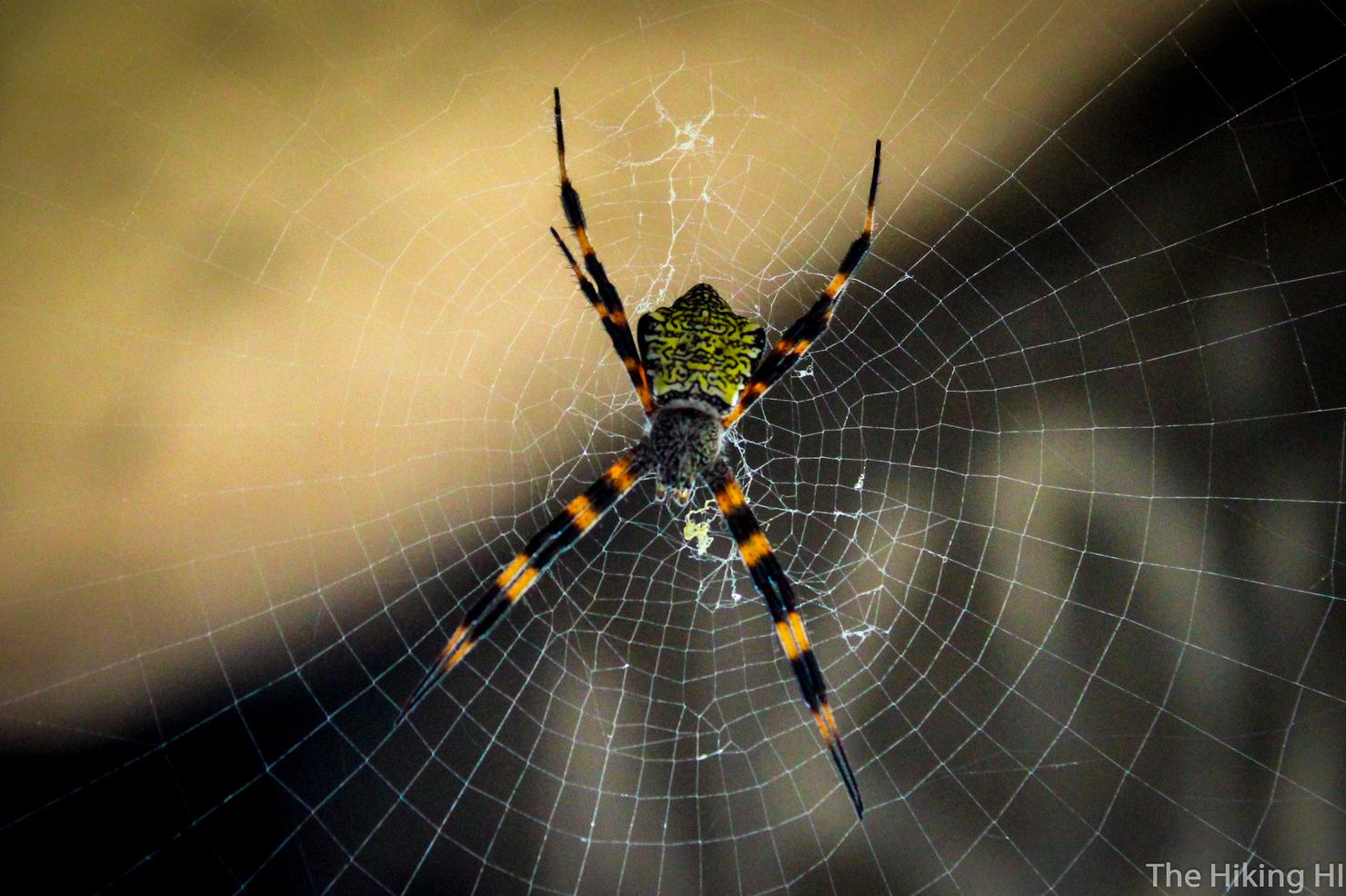
And this is what I found inside. Yikes! There were about a dozen of these guys in the pillbox. I think that's evidence that people don't venture up here very much. Luckily, I'm not Ron Weasley, so I had no problem getting close to capture a picture of this one's beautiful design. Now snakes, on the other hand... let's just say I'm glad there's no snakes in Hawaii.
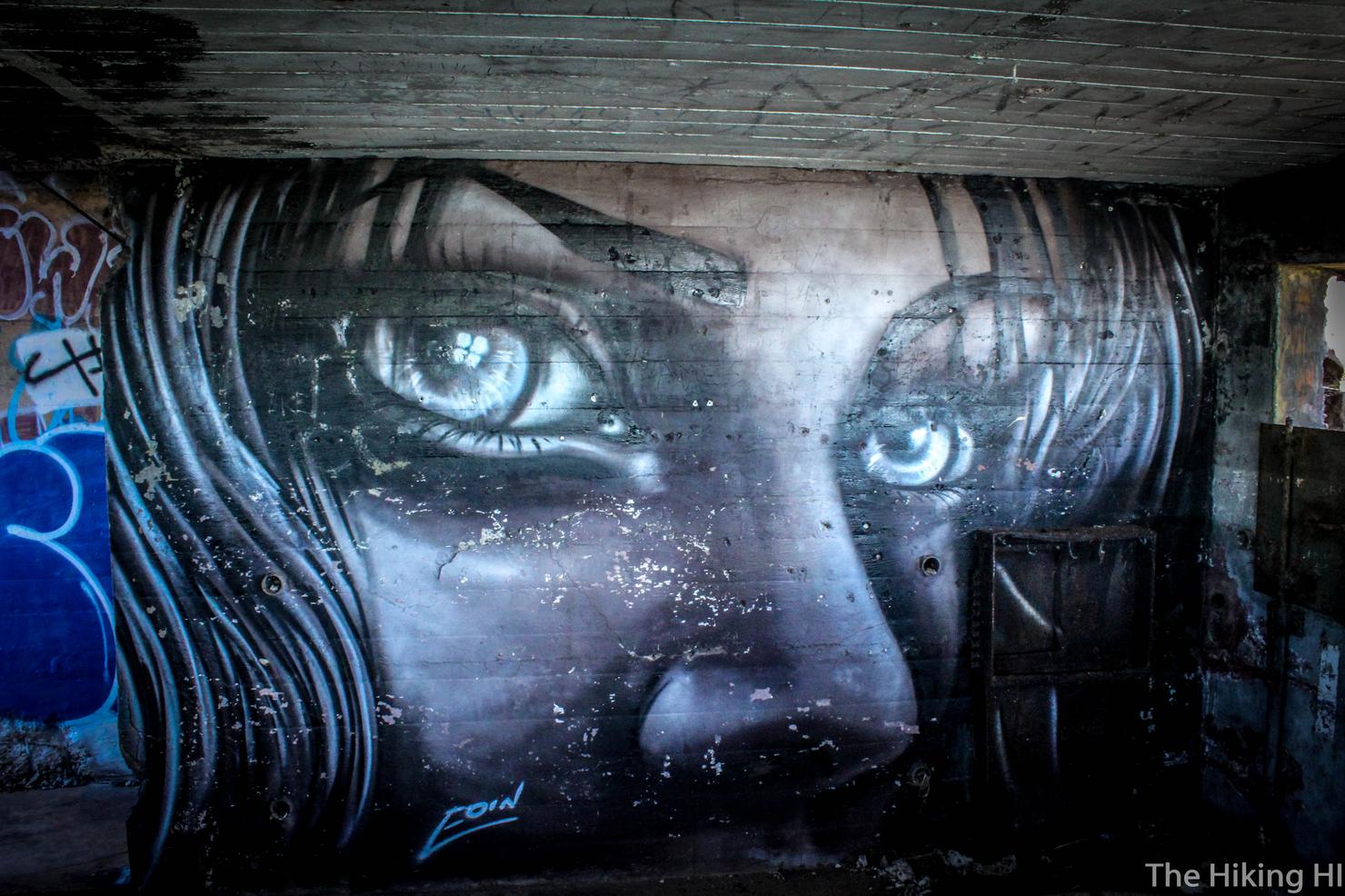
There was also this beautiful mural on one of the pillbox walls. Such a mysterious look about her eyes.
But alas, it was time to head home. I now had to descend the ridge and make the several mile trek back to my car. What a great day exploring Kaena Point! This place is a great example of how many historic and hidden spots there are scattered around this island. You simply have to venture out and find them!
Check out my video of this lovely hike!
Have you ventured to beautiful Kaena Point? Share your story below!