Difficulty: INTERMEDIATE-ADVANCED
Time: 7-9 HOURS
Distance: 12 MILES
Elevation Gain: 1700 FEET
Foot Traffic: LOW
Challenges: Endurance Challenge, Muddy and Slippery, Overgrown
Sights: Pearl Harbor, Waianae Range, Windward Side (weather permitting)
What to Bring: Water (>2), Lunch, Sunscreen, Pants, Microspikes (nice to have)
This lengthy ridge hike located near Pearl City takes you deep into the Ko'olau Mountain Range, all the way to the Ko'olau Summit Trail. While the elevation gain is gradual, you will have to contend with a muddy and overgrown ridge as well as traverse a cumulative 12 miles in order to reach this summit. If you finish this hike, you will have tackled one of the lengthiest day hikes on Oahu and for the lucky ones, you will be rewarded with stellar views of both sides of the island.
I learned about this trail when I hiked to the Waimano Pools, a popular waterfall hike in the area. I recall seeing a sign that indicated there was a ridge that could take you all the way to the KST. For me, there is something so satisfying about standing on the KST, having conquered a challenging ridge, and being able to see both sides of Oahu from one spot. I make it my mission to get to the KST in any way possible, on any trail I can find. While I wouldn't be treated with those beautiful views, my trek up Manana Ridge was still a fulfilling journey.
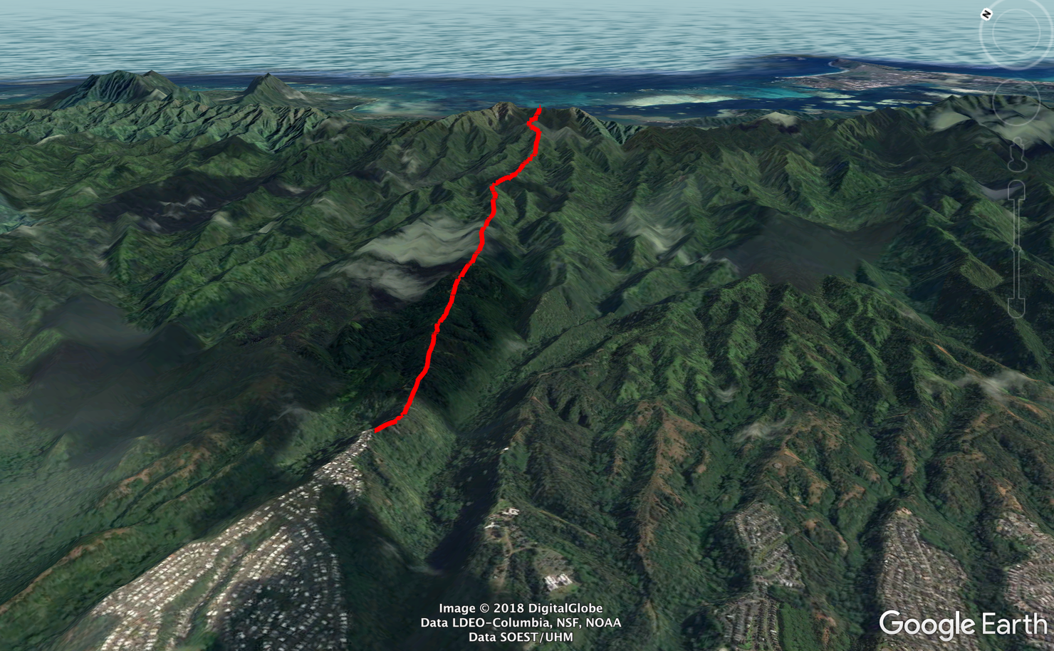
This hike is your typical Ko'olau finger ridge, a long gradual ascent to the KST.
The trailhead is located at the end of Komo Mai Drive. You cannot park in the cul-de-sac, but you can park anywhere else along the road (well not in front of someone's driveway...). This area can get busy given the relative popularity of Waimano Falls, but if you get here early you should be able to park close to the trailhead. And if you plan on hiking the entire 12 miles to reach this peak, I definitely recommend getting here early!
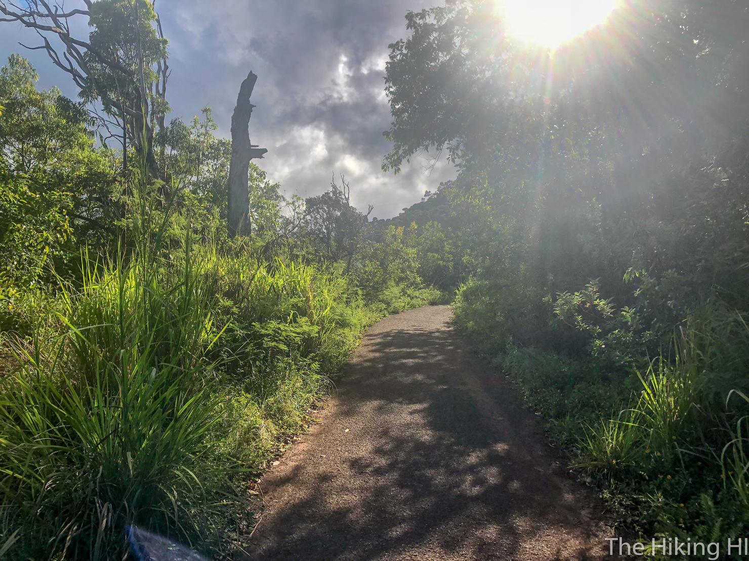
I love the way the morning sun bursts through the trees. There's no better way to greet the morning than with a little stroll outdoors. Well maybe this hike is a bit more than a "little stroll"...
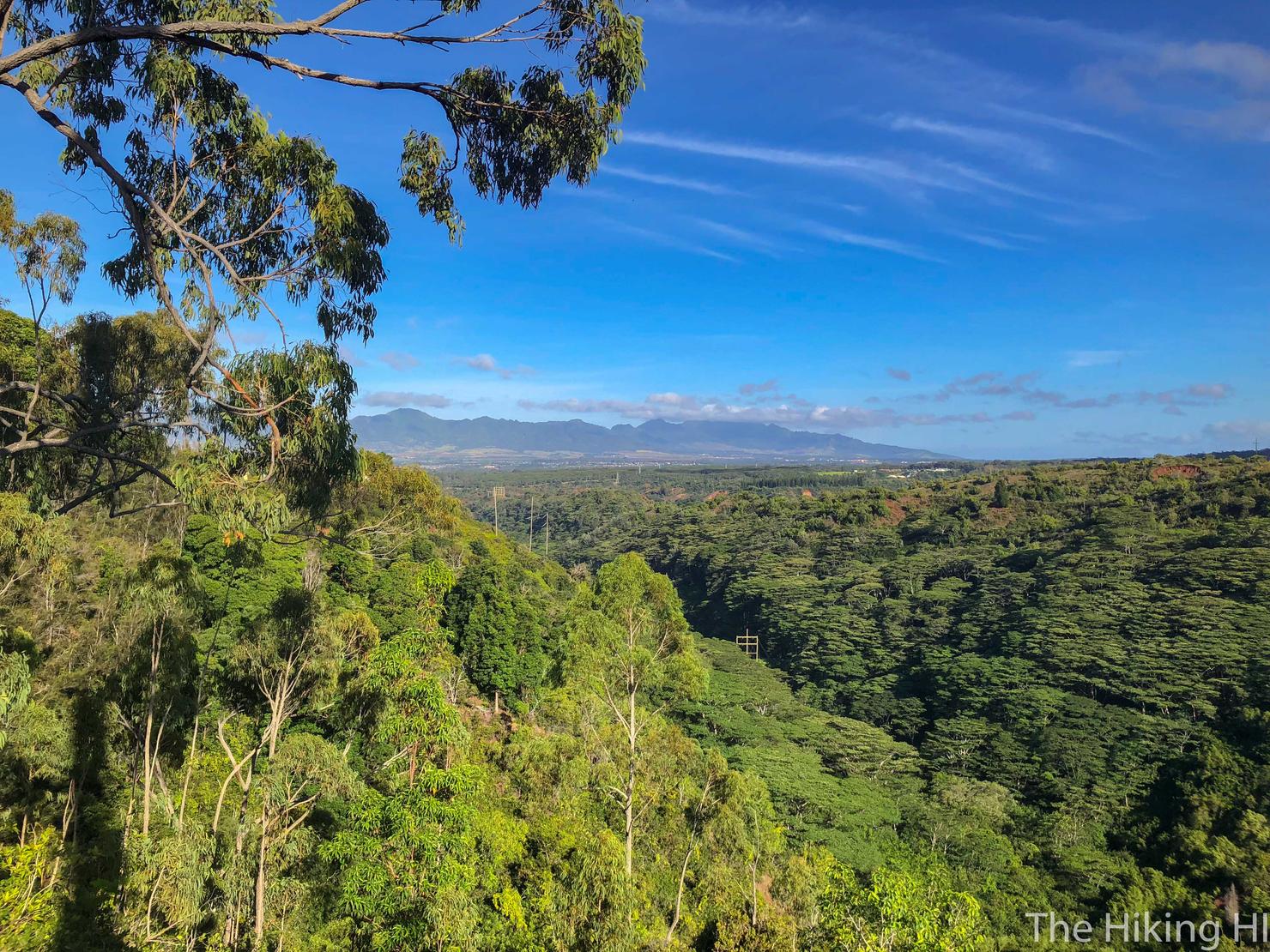
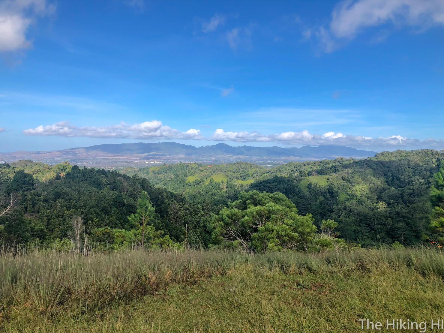
That morning glow also gives a nice soft color to the surrounding landscape. Here, you can see the neighboring valley as well as the Waianae Range, the other mountain range on Oahu.
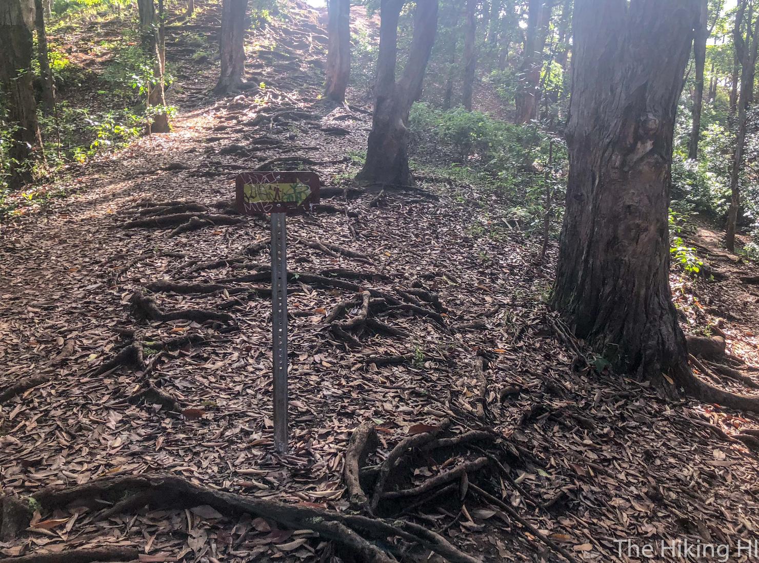
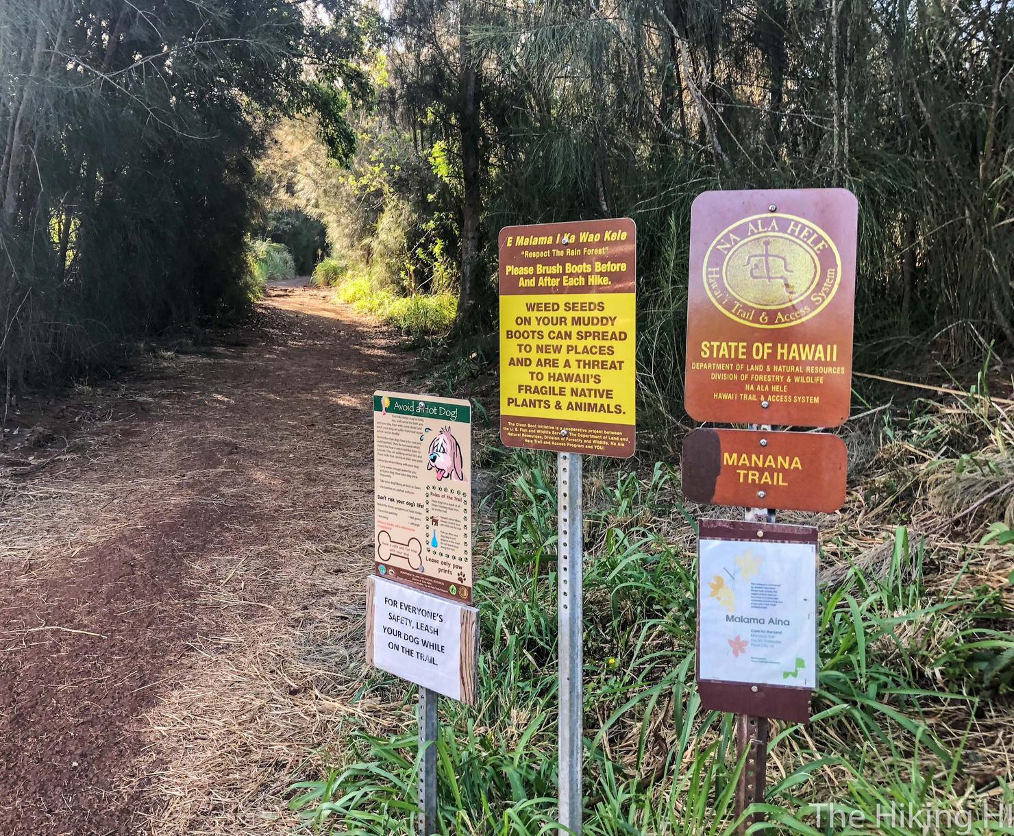
After about 20 minutes, you will reach this sign which indicates you go right.
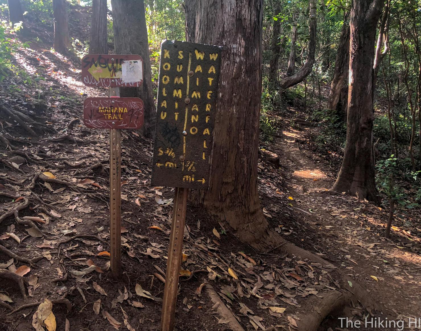
And a few moments later you will reach the fork, splitting the waterfall and ridge trail. 1.75 miles to the waterfall or 5.75 miles to the KST? Not too late to make this a short waterfall hike...
Nah it's a ridge hike kind of a day! It's hard to see from this photo, but just over these adjacent ridges is the famous Pearl Harbor, still home to an active Naval and Air Force Base.
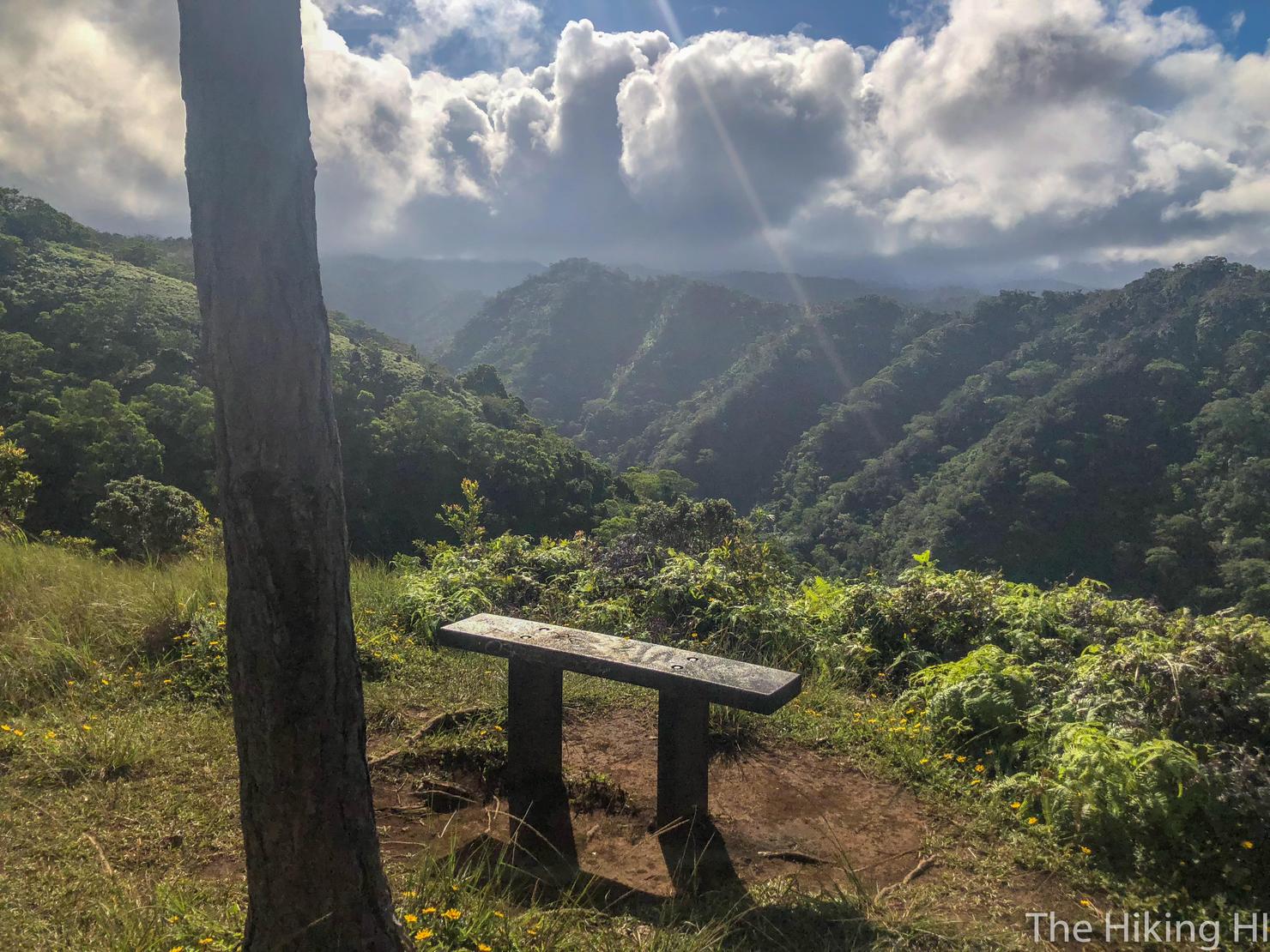
A scenic bench if you need a little breather. I hope not though, we have at least another six and a half hours to go...
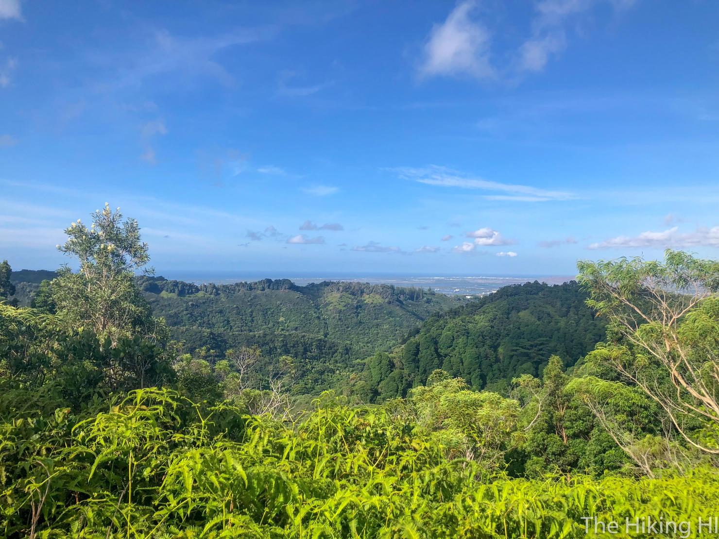
During the long ascent, you will get a few clearings that give you great 360 degree views. Here's another shot of the Waianae Range. I can't help but notice how cloudless that range looks.
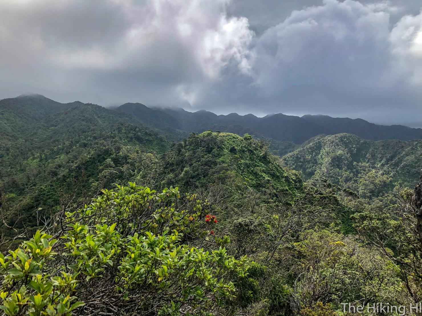
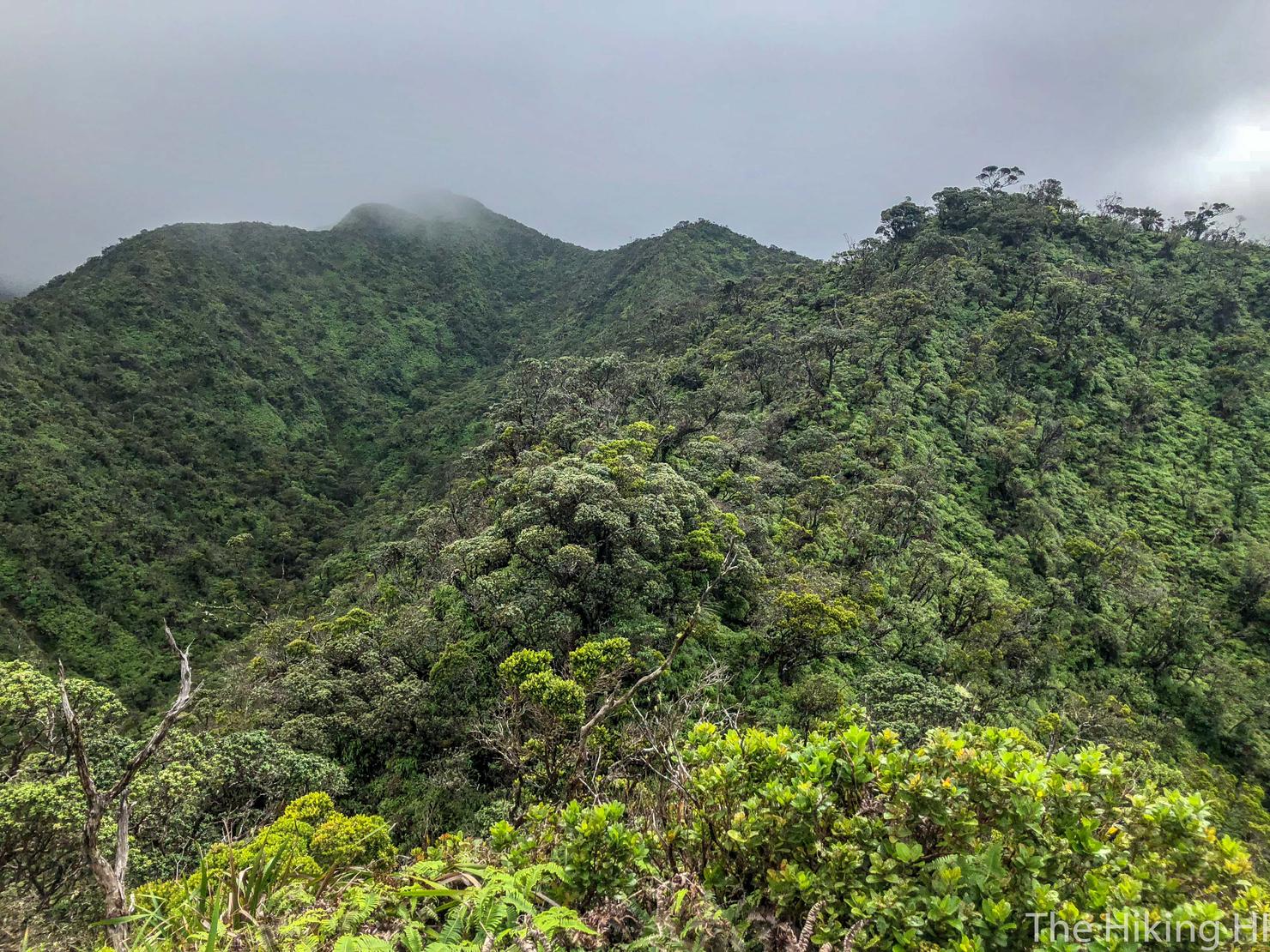
Which is a stark contrast to these cloudy Ko'olaus. The unfortunate reality is that getting a KST summit view is not guaranteed. Even if it looks like this right now, the clouds can clear by the time you reach the summit. Or they can stay... or it can rain. You just really never know with the Ko'olaus. Best thing to do now is to keep hiking. We will continue towards that flat portion in the center, one of the numerous false peaks you will experience on the trail.
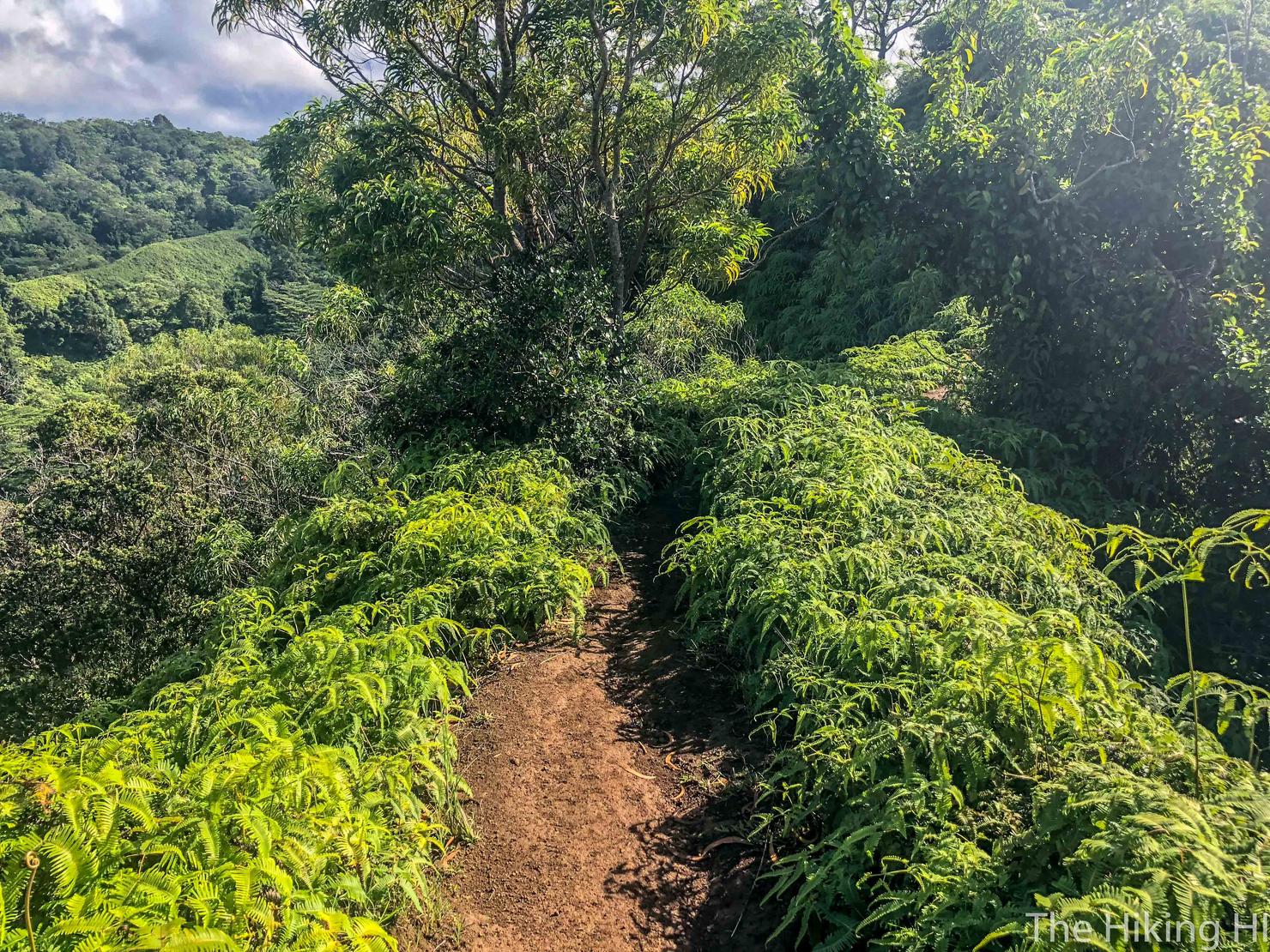
This trail gets progressively more challenging the farther you go. Early on it's well cleared and not very wet.
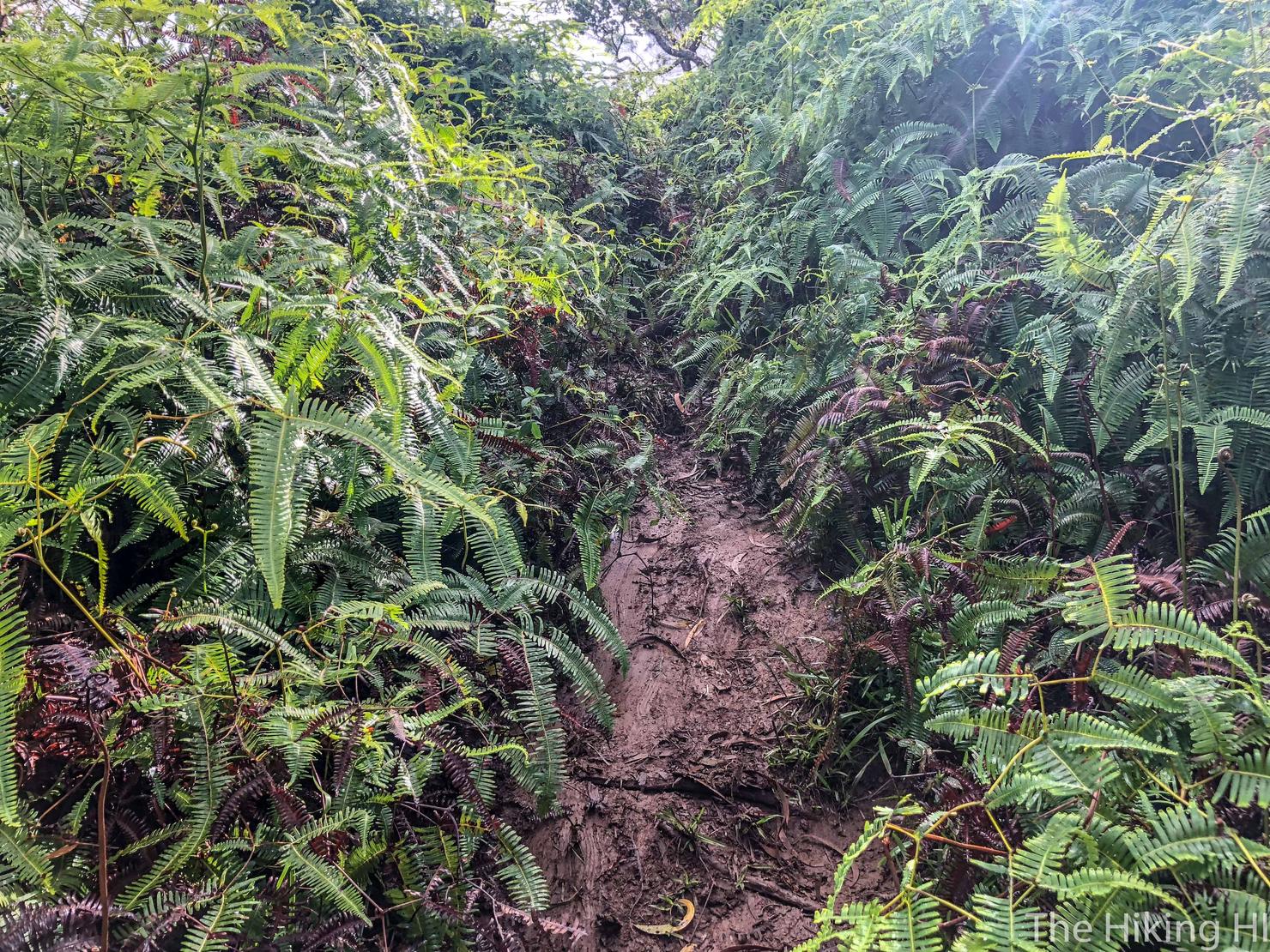
But the deeper you get, the muddier and more overgrown it becomes. I highly recommend pants for this hike. The brush is low, but you will feel it on exposed legs. I didn't realize how cut up I was until my post hike shower. Let's just say that shower was less than enjoyable.
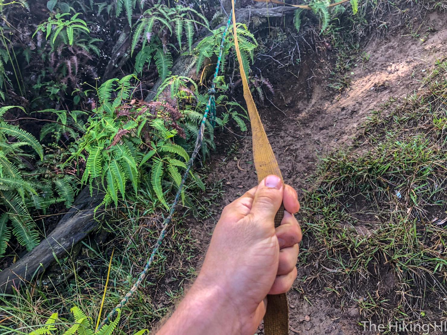
The good news is there aren't really any crazy ascents on this trail. There's a few sections where it gets steeper, but most of them have ropes to assist you. These are much more helpful on the way back so you don't fall on your face (as much).
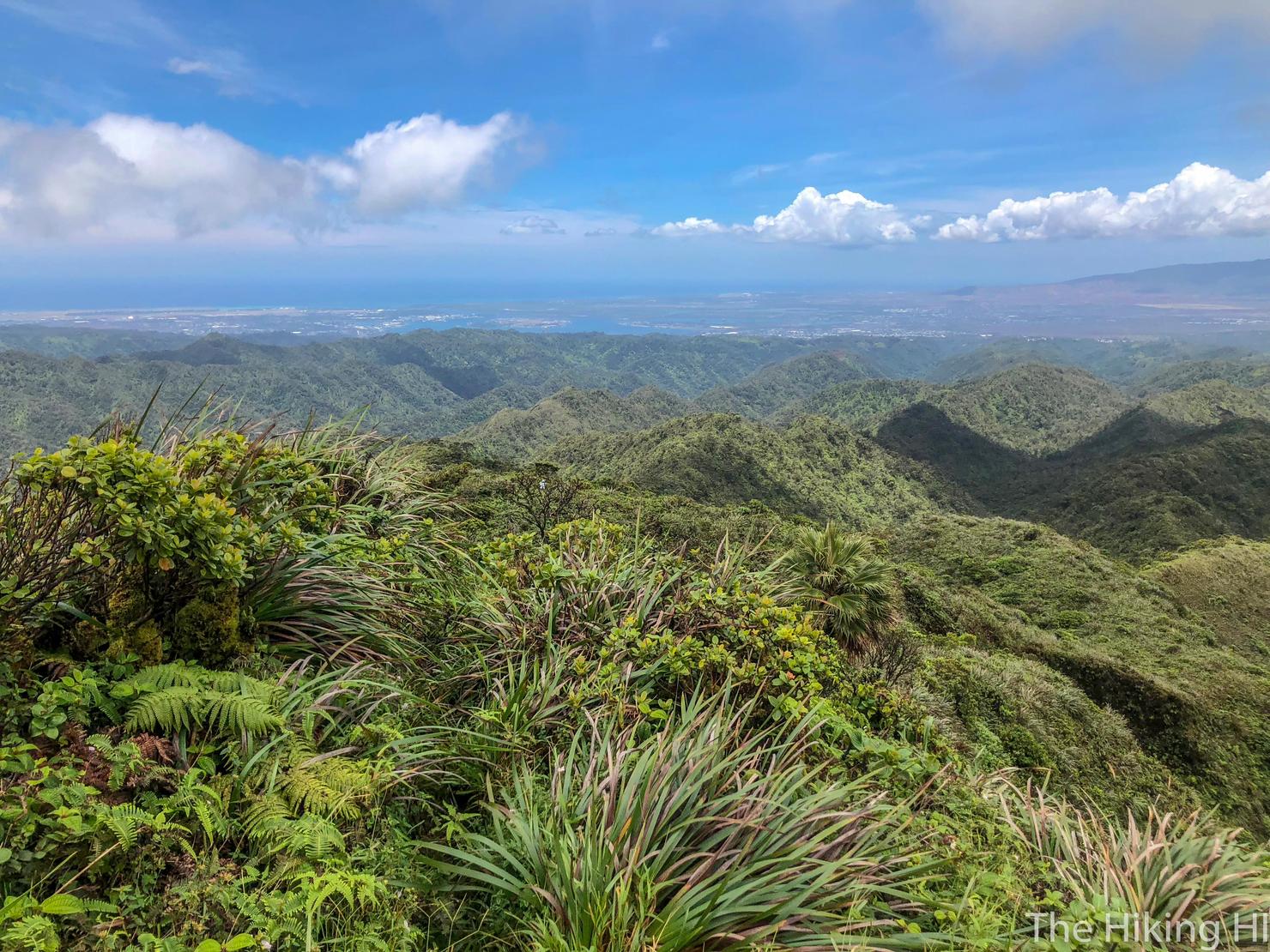
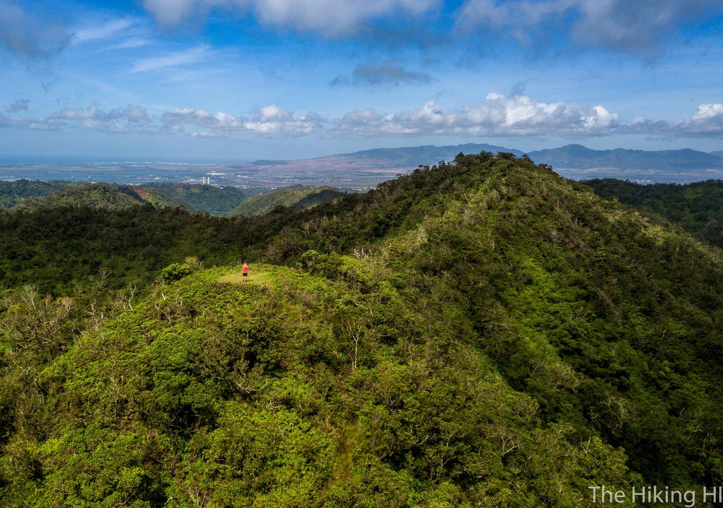
A view on top of the flat portion we saw earlier. This was a great perspective allowing you to see all the way to Pearl Harbor and beyond, as well us many of the neighboring ridges. If you wanted to make this a shorter hike, this would make for a great turnaround point. It took me about 2 hours to reach this spot.
This also makes for a great spot to fly a drone! Unfortunately the wind was gusting pretty good, so I couldn't keep my Mavic Pro up in the air for too long. This photo will have to do for today.
Because from the looks of those clouds, we probably aren't going to have much luck at the summit either. Oh well, onward!
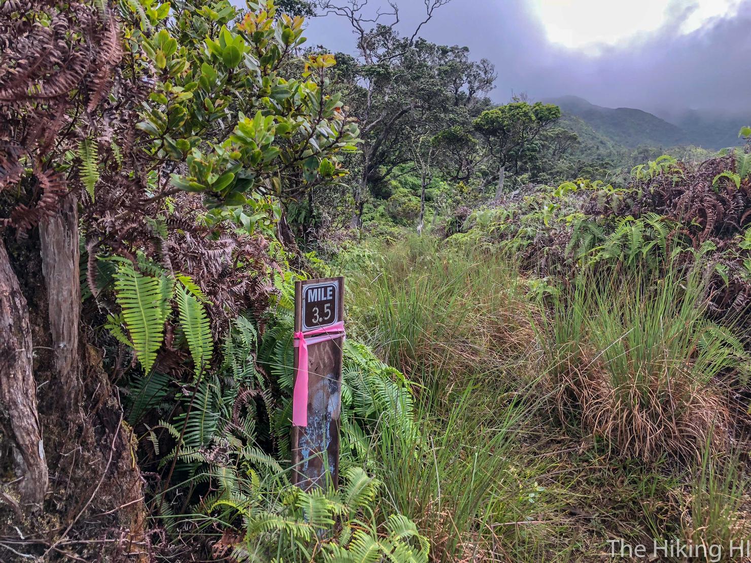
A mile marker! I hardly see these on Oahu and I never saw another one the rest of the hike. But hey it feels like we are making progress right?
As I continued on, the clouds began to close in behind me.
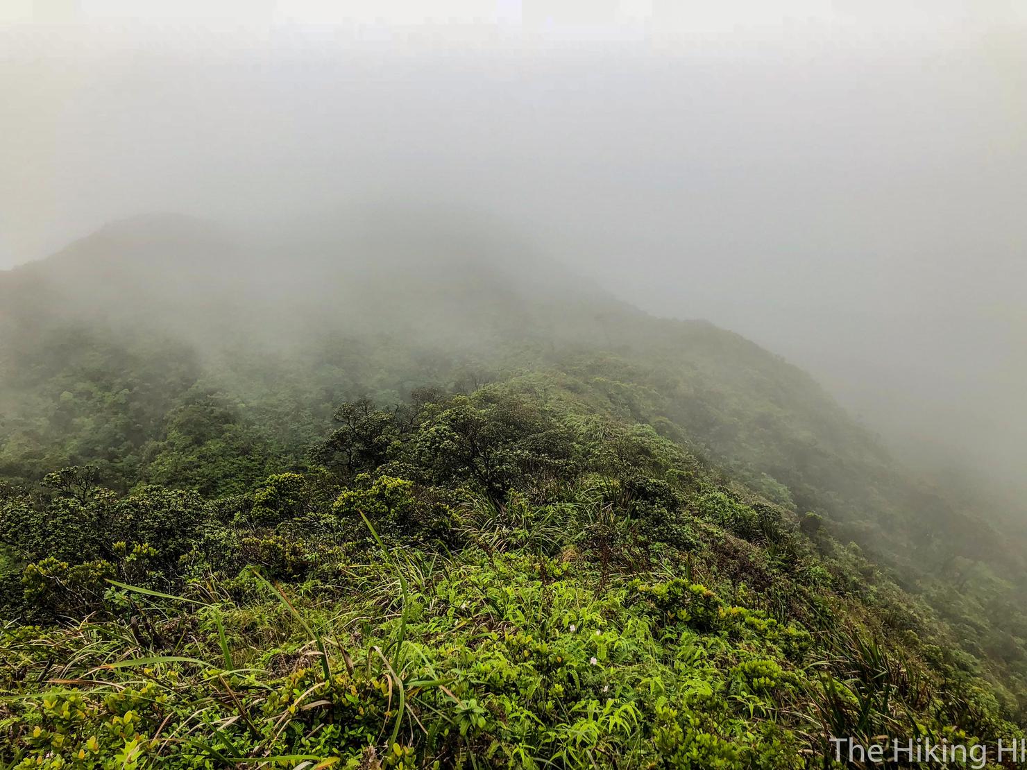
And soon I was completely engulfed, and then... a downpour. The clouds opened up and unleashed their watery fury on me. I thought about calling it and heading home, but I've been up here enough to know these showers can be short lived. I continued onward.
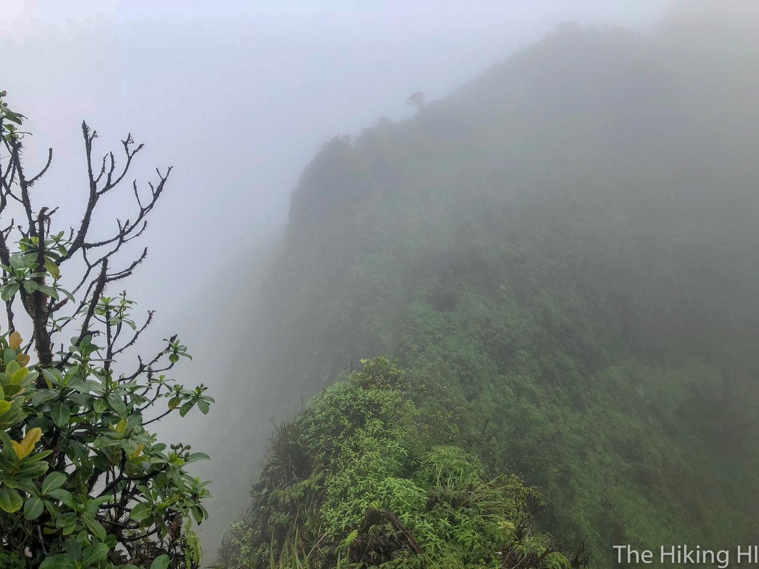
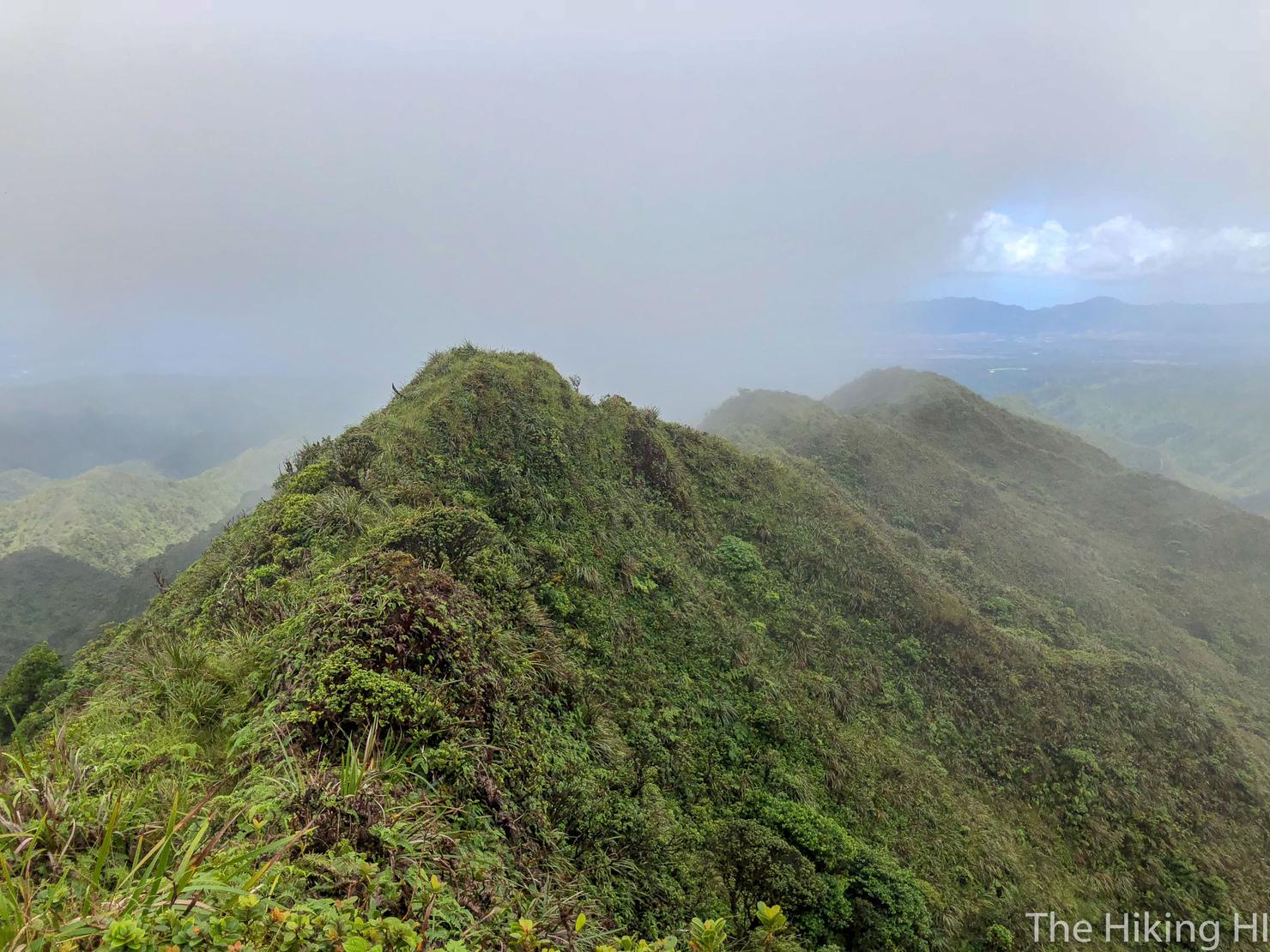
And after about 10 minutes the rain subsided. The clouds, however, were still very much present, partially covering this section, probably the skinniest portion of the ridge. It was this moment that made me instantly happy I continued with this hike. Crossing a narrow ridge, surrounded by clouds, the wind whistling all around you, just you and the elements together--It is a great feeling.
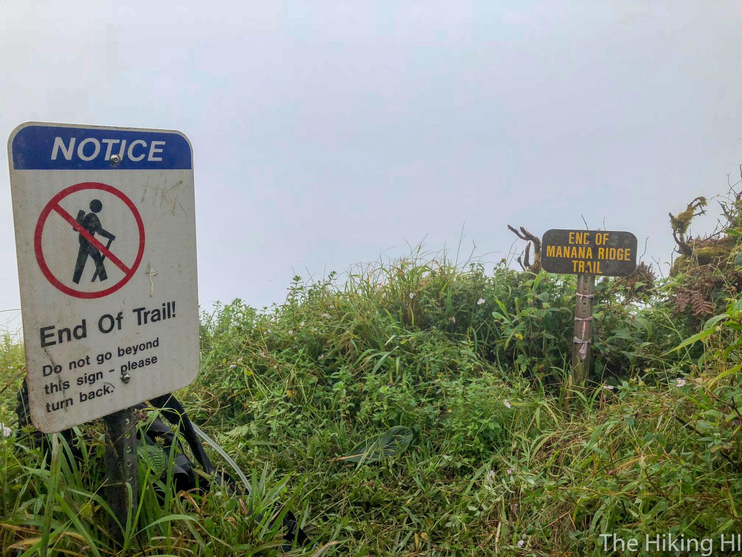
And as I finally made my way to the summit, the views were as expected- nonexistent. But my enjoyment didn't fade. Instead, I sat down, ate a snack, and prepared myself for the 6 mile trek back to civilization which would make this, my longest hike on the island of Oahu. Views or no views, I think I can be satisfied with that accomplishment.